Items Similar to Antique Map of both sides of the Central Rhine River, Germany


Want more images or videos?
Request additional images or videos from the seller
1 of 6
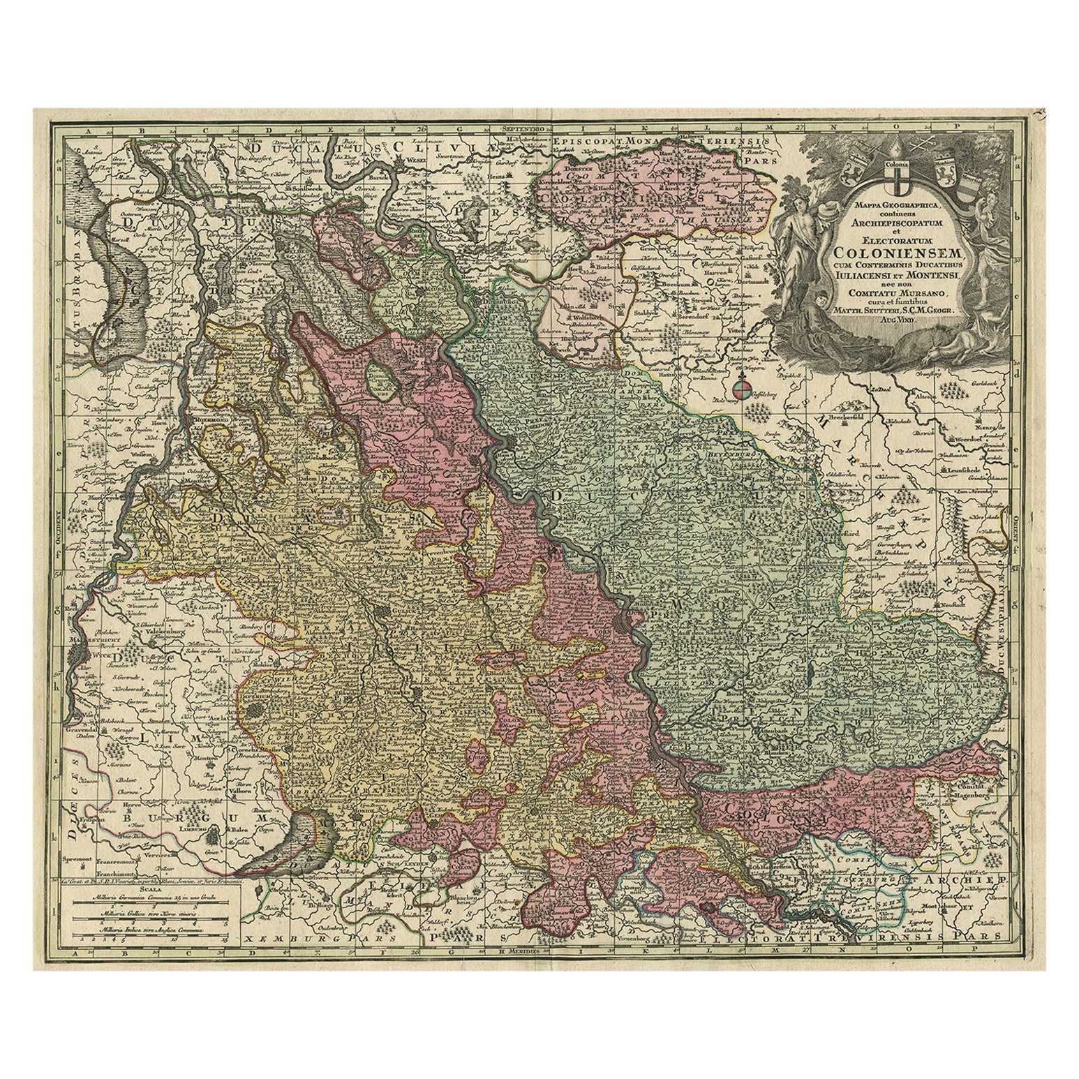
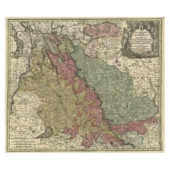
Antique Map of both sides of the Central Rhine River, Germany
$510.27
$637.8320% Off
£383.39
£479.2420% Off
€432
€54020% Off
CA$702.64
CA$878.3020% Off
A$786.39
A$982.9820% Off
CHF 411.65
CHF 514.5620% Off
MX$9,553.18
MX$11,941.4720% Off
NOK 5,226.85
NOK 6,533.5720% Off
SEK 4,932.43
SEK 6,165.5420% Off
DKK 3,287.95
DKK 4,109.9420% Off
About the Item
Antique map titled 'Mappa Geographica continens Archiepiscopatum et Electoratum Coloniensem (..)'. Decorative map of region on either side of the Central Rhine River, showing Dusseldorf, Cologne, Bonn, etc. Decorative cartouche. Published by M. Seutter, circa 1730.
George Matthaus Seutter, a German publisher, cartographer and engraver from Augsburg, was born 1678 as the son of a goldsmith. After an apprenticeship at J. B. Homann in Nuremberg, he returned to his native city of Augsburg and worked in the publishing firm of Jeremiah Wolf. In 1707 he founded his own successful publishing company and produced maps, atlases and globes. Seutter died in 1757. The company went over to his son Albrecht Carl and his stepsons G. B. Probst and T. C. Lotter in after his death in 1757.
- Dimensions:Height: 20.99 in (53.3 cm)Width: 24.41 in (62 cm)Depth: 0.02 in (0.5 mm)
- Materials and Techniques:
- Period:
- Date of Manufacture:c.1730
- Condition:Repaired: Large vertical repair left part of the map, well executed, nearly invisible. Original/contemporary hand coloring. Large vertical repair left part of the map, well executed, nearly invisible. Original folding line. Shows some wear and soiling. Blank verso. Please study image carefully.
- Seller Location:Langweer, NL
- Reference Number:Seller: BG-13442-141stDibs: LU3054335046022
About the Seller
5.0
Recognized Seller
These prestigious sellers are industry leaders and represent the highest echelon for item quality and design.
Platinum Seller
Premium sellers with a 4.7+ rating and 24-hour response times
Established in 2009
1stDibs seller since 2017
2,534 sales on 1stDibs
Typical response time: <1 hour
- ShippingRetrieving quote...Shipping from: Langweer, Netherlands
- Return Policy
Authenticity Guarantee
In the unlikely event there’s an issue with an item’s authenticity, contact us within 1 year for a full refund. DetailsMoney-Back Guarantee
If your item is not as described, is damaged in transit, or does not arrive, contact us within 7 days for a full refund. Details24-Hour Cancellation
You have a 24-hour grace period in which to reconsider your purchase, with no questions asked.Vetted Professional Sellers
Our world-class sellers must adhere to strict standards for service and quality, maintaining the integrity of our listings.Price-Match Guarantee
If you find that a seller listed the same item for a lower price elsewhere, we’ll match it.Trusted Global Delivery
Our best-in-class carrier network provides specialized shipping options worldwide, including custom delivery.More From This Seller
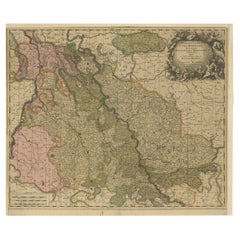
View AllOld Map of the Rhine & German Cities Incl Düsseldorf, Bonn, Köln, Etc., c.1730
Located in Langweer, NL
Antique map Germany titled 'Mappa Geographica continens Archiepiscopatum et Electoratum Coloniensem (..)'.
This antique map depicts the Rhine r...
Category
Antique 1730s Maps
Materials
Paper
$926 Sale Price
20% Off
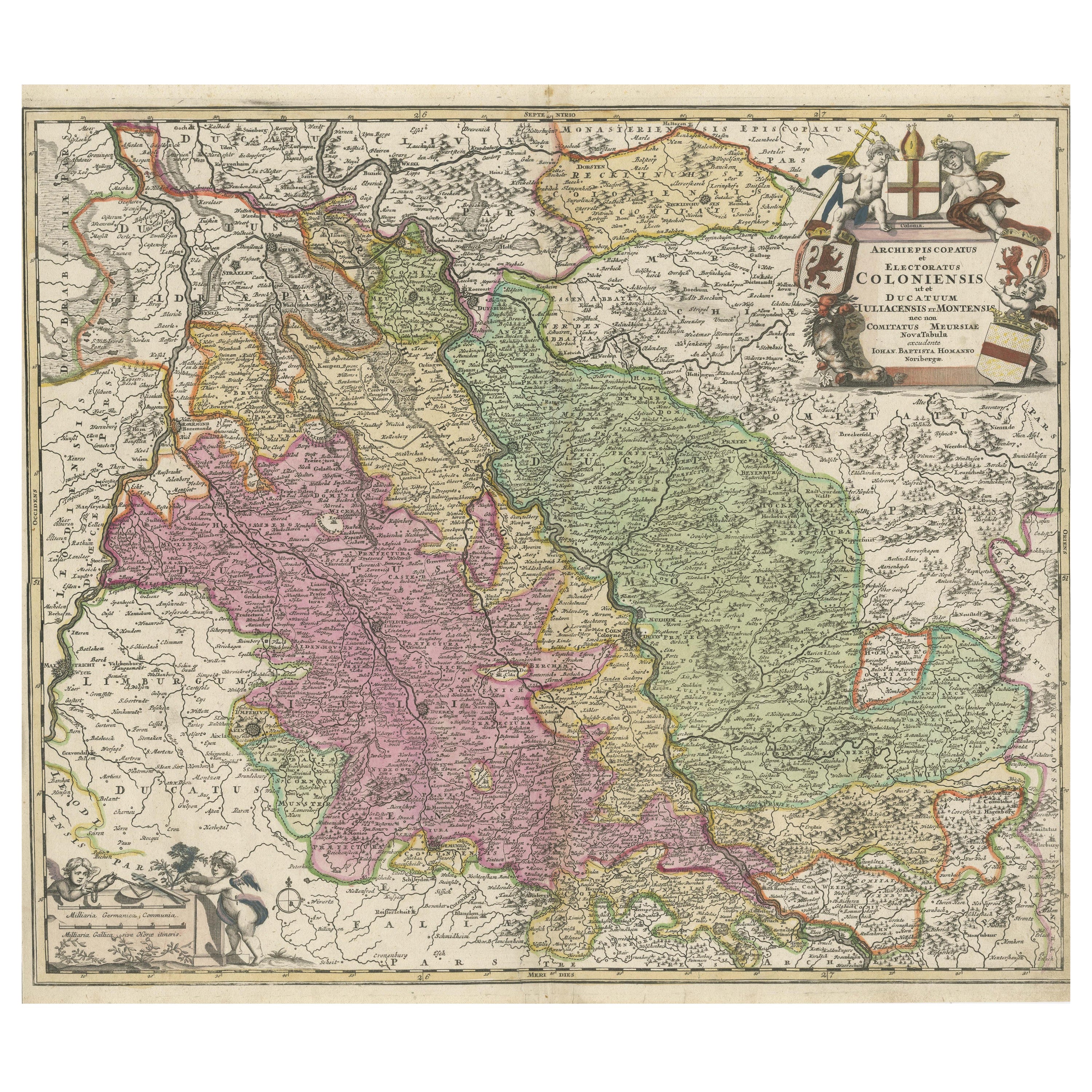
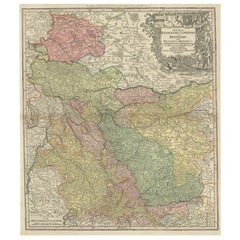
Antique Map of Cologne with the duchies of Jülich and Berg, Germany
Located in Langweer, NL
Antique map title 'Archiepiscopatus Coloniensis ducatibus Iuliacensi et Montensi (..)'. Original map of Cologne with the duchies of Jülich and Berg, Spa...
Category
Antique Late 17th Century Maps
Materials
Paper
$444 Sale Price
20% Off
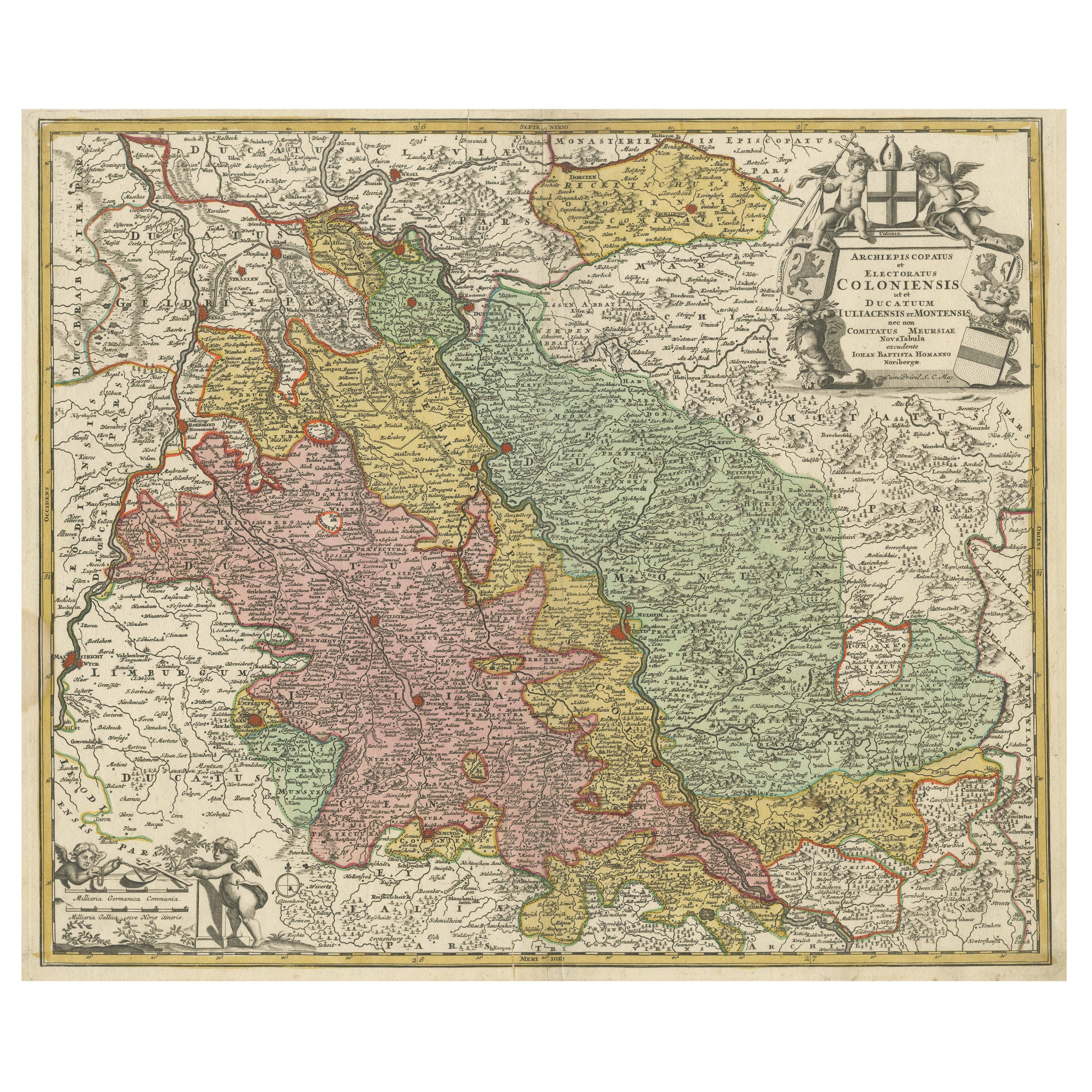
Antique Map of the Rhine centered on Cologne, Germany
Located in Langweer, NL
Antique map titled 'Archiepsiscopatus et Electoratus Coloniensis (..)'. Original antique map of the Rhine river, centered on Cologne, Germany. The Rhine River cuts across this map fr...
Category
Antique Early 18th Century Maps
Materials
Paper

$519 Sale Price
20% Off
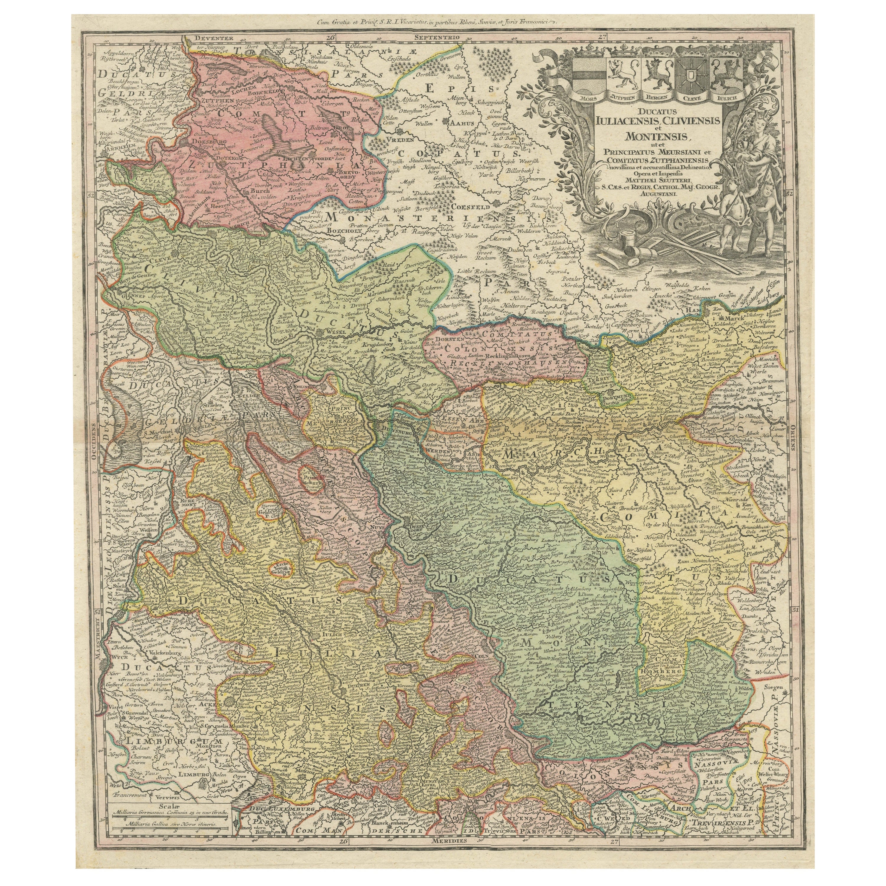
Antique Map of Western Germany with part of the Netherlands
Located in Langweer, NL
Antique map titled 'Ducatus Iuliacensis Cliviensis et Montensis (..)'. Original old map of Western Germany with part of the Netherlands. Published by M. Seutter, circa 1750.
George...
Category
Antique Mid-18th Century Maps
Materials
Paper
$425 Sale Price
20% Off
Detailed Antique Map of the Lower Rhine region, Germany
Located in Langweer, NL
Antique map titled 'S.R.I. Circulus Rhanus Inferior sive Electorum Rheni (..)'. Detailed map of the Lower Rhine region, Germany. The title cartouche in the upper left quadrant featur...
Category
Antique Mid-18th Century Maps
Materials
Paper

$425 Sale Price
20% Off
Antique Map of the Rhine centered on Cologne, Germany, with original coloring
Located in Langweer, NL
Antique map titled 'Archiepsiscopatus et Electoratus Coloniensis (..)'. Original antique map of the Rhine river, centered on Cologne, Germany. The Rhine River cuts across this map fr...
Category
Antique Early 18th Century Maps
Materials
Paper

$510 Sale Price
20% Off
You May Also Like
Original Antique Map of Switzerland, Engraved By Barlow, Dated 1807
Located in St Annes, Lancashire
Great map of Switzerland
Copper-plate engraving by Barlow
Published by Brightly & Kinnersly, Bungay, Suffolk.
Dated 1807
Unframed.
Category
Antique Early 1800s English Maps
Materials
Paper

17th Century Nicolas Visscher Map of Southeastern Europe
Located in Hamilton, Ontario
A beautiful, highly detailed map of southeastern Europe by Nicolas Visscher. Includes regions of Northern Italy (showing the cities Bologna, Padua, and Venice), Bohemia, Austria (sho...
Category
Antique 17th Century Dutch Maps
Materials
Paper

$1,350 Sale Price
38% Off
1752 Vaugoundy Map of Flanders : Belgium, France, and the Netherlands, Ric.a002
Located in Norton, MA
Large Vaugoundy Map of Flanders:
Belgium, France, and the Netherlands
Colored -1752
Ric.a002
Description: This is a 1752 Didier Robert de Vaugondy map of Flanders. The map de...
Category
Antique 17th Century Unknown Maps
Materials
Paper

1790 Thomas Stackhouse Map, Entitled "Russia in Europe, " , Ric.a004
Located in Norton, MA
1790 Thomas Stackhouse map, entitled
"Russia in Europe"
Ric.a004
Stackhouse, Thomas
Russia in Europe [map]
London: T. Stackhouse, 1783. Map. Matted hand-colored copper engraving. Image size: 14.5 x 15.25 inches. Mat size: 22.75 x 23.75 inches. A beautiful example of this map of Eastern Europe...
Category
Antique 17th Century Unknown Maps
Materials
Paper

Antique Colored Belgium Map Flandria Gallica Flanders Henricus Hondius
Located in Dayton, OH
Antique hand colored map of Flanders, Belgium, engraved by Henricus Hondius.
Sans frame - 21.25” x 18”.
Category
Antique 19th Century Renaissance Maps
Materials
Paper

$280 Sale Price
20% Off
West Germany: Original Hand Colored 17th Century Map by Johannes Janssonius
By Johannes Janssonius
Located in Alamo, CA
An original hand colored copperplate engraved map entitled in Latin "Archiepiscopatus Maghdeburgensis et Anhaltinus Ducatus cum terris adjacentibus", published in Amsterdam in 1640 i...
Category
Mid-17th Century Old Masters More Prints
Materials
Engraving

More Ways To Browse
Antique Wolf
1681 Moses Pitt
Antique Maps Washington Dc
Ithaca Antique Map
J Thayer
Rust Red Rug
Vintage Studio Chair
1890s French Posters
Casa Finland
Mobelfabrik Danish
Playful Chair
Giacometti Chairs
Antique Rug Wool Navy Blue Red
Bauhaus Flower Stand
French Table With Drawers
North Carolina Furniture
Antique Silver Platter
Boat Blueprint