Items Similar to Antique Map of Buru Island, Indonesia, c.1725


Want more images or videos?
Request additional images or videos from the seller
1 of 6
Antique Map of Buru Island, Indonesia, c.1725
$527.18
$658.9820% Off
£392.45
£490.5720% Off
€440
€55020% Off
CA$722.11
CA$902.6420% Off
A$803.14
A$1,003.9320% Off
CHF 419.38
CHF 524.2220% Off
MX$9,773.40
MX$12,216.7520% Off
NOK 5,356.08
NOK 6,695.0920% Off
SEK 5,023.05
SEK 6,278.8220% Off
DKK 3,349.57
DKK 4,186.9620% Off
Shipping
Retrieving quote...The 1stDibs Promise:
Authenticity Guarantee,
Money-Back Guarantee,
24-Hour Cancellation
About the Item
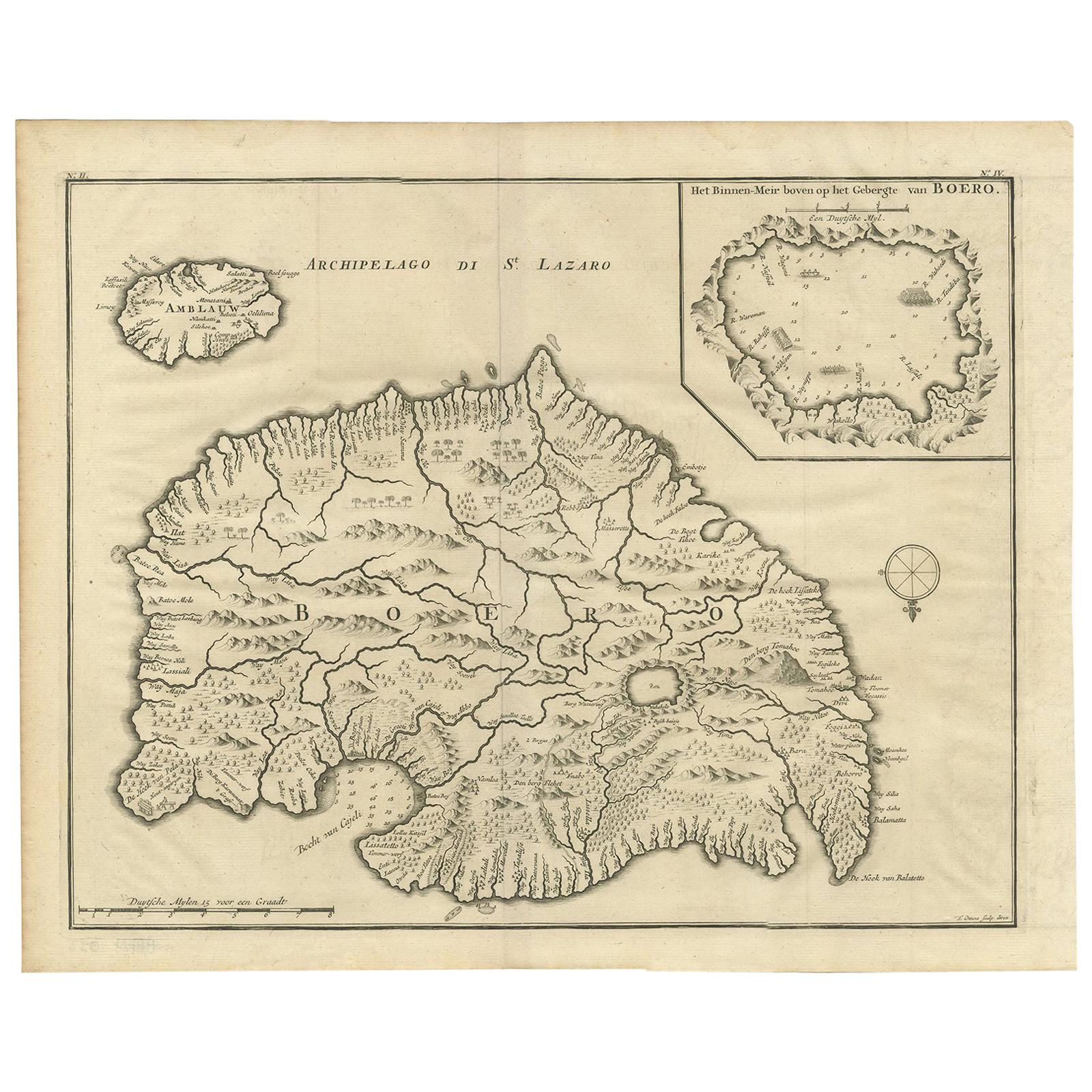
Antique map titled 'Boero'. Original antique map of Buru island. With an inset of the lake on top of the inland mountain. This map originates from Valentyn's 'Oud en Nieuw Oost Indien', ca. 1725.
Buru (formerly spelled Boeroe, Boro, or Bouru) is the third largest island within Maluku Islands of Indonesia. It lies between the Banda Sea to the south and Seram Sea to the north, west of Ambon and Seram islands. During former president Suharto's New Order administration in the 1960s–1970s, Buru was the site of a prison used to hold thousands of political prisoners. While held at Buru, writer Pramoedya Ananta Toer wrote most of his novels, including Buru Quartet.
Artists and Engravers: Published by Joannes van Braam and Gerard onder de Linden (Dordrecht and Amsterdam).
We sell original antique maps to collectors, historians, educators and interior decorators all over the world. Our collection includes a wide range of authentic antique maps from the 16th to the 20th centuries. Buying and collecting antique maps is a tradition that goes back hundreds of years. Antique maps have proved a richly rewarding investment over the past decade, thanks to a growing appreciation of their unique historical appeal. Today the decorative qualities of antique maps are widely recognized by interior designers who appreciate their beauty and design flexibility. Depending on the individual map, presentation, and context, a rare or antique map can be modern, traditional, abstract, figurative, serious or whimsical. We offer a wide range of authentic antique maps for any budget.
- Dimensions:Height: 12.6 in (32 cm)Width: 15.75 in (40 cm)Depth: 0 in (0.01 mm)
- Materials and Techniques:
- Period:
- Date of Manufacture:circa 1725
- Condition:Condition: Very good, given age. Left and right margin edges reinforced on rear. Small tear in left side of the print. General age-related toning and/or occasional minor defects from handling. Please study image carefully.
- Seller Location:Langweer, NL
- Reference Number:Seller: PCT-463531stDibs: LU3054326081802
About the Seller
5.0
Recognized Seller
These prestigious sellers are industry leaders and represent the highest echelon for item quality and design.
Platinum Seller
Premium sellers with a 4.7+ rating and 24-hour response times
Established in 2009
1stDibs seller since 2017
2,508 sales on 1stDibs
Typical response time: <1 hour
- ShippingRetrieving quote...Shipping from: Langweer, Netherlands
- Return Policy
Authenticity Guarantee
In the unlikely event there’s an issue with an item’s authenticity, contact us within 1 year for a full refund. DetailsMoney-Back Guarantee
If your item is not as described, is damaged in transit, or does not arrive, contact us within 7 days for a full refund. Details24-Hour Cancellation
You have a 24-hour grace period in which to reconsider your purchase, with no questions asked.Vetted Professional Sellers
Our world-class sellers must adhere to strict standards for service and quality, maintaining the integrity of our listings.Price-Match Guarantee
If you find that a seller listed the same item for a lower price elsewhere, we’ll match it.Trusted Global Delivery
Our best-in-class carrier network provides specialized shipping options worldwide, including custom delivery.More From This Seller
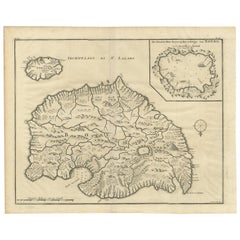
View AllAntique Map of Boero in Indonesia by Valentijn, 1726
By F. Valentijn
Located in Langweer, NL
Antique map titled 'Boero-Amblauw'. Detailed map of the Island Ambelau and Buru, Maluku Islands, Indonesia. With an inset of the lake on the Buru mountains. This print originates fro...
Category
Antique Early 18th Century Dutch Maps
Materials
Paper
$479 Sale Price
20% Off
Antique Map of Ambelau and Buru Island, Maluku or Moluccas in Indonesia, 1726
Located in Langweer, NL
Antique map titled 'Boero - Amblauw (..).' Detailed map of the Island Ambelau and Buru, Maluku Islands, Indonesia, by Francois Valentyn. With an inset of the lake on the Buru mountai...
Category
Antique 18th Century Maps
Materials
Paper

$354 Sale Price
20% Off
Antique Map of Java and Madura Island, Indonesia, c.1760
Located in Langweer, NL
Antique map titled 'Idee de l'Isle de Java.'
Well engraved and attractive chart of the island shows all principal harbors and coastal details, plus rivers, mountains and volcanoe...
Category
Antique 18th Century Maps
Materials
Paper

$431 Sale Price
20% Off
Antique Map of Ambon Island in the Moluccas, Indonesia, c.1760
Located in Langweer, NL
Antique map Ambon titled 'Carte Particuliere de l 'Isle Amboine'. Old map showing Ambon, in the Moluccas Islands, better known as the Spice Islands. Ambon was the headquarters of the...
Category
Antique 18th Century Maps
Materials
Paper

$230 Sale Price
20% Off
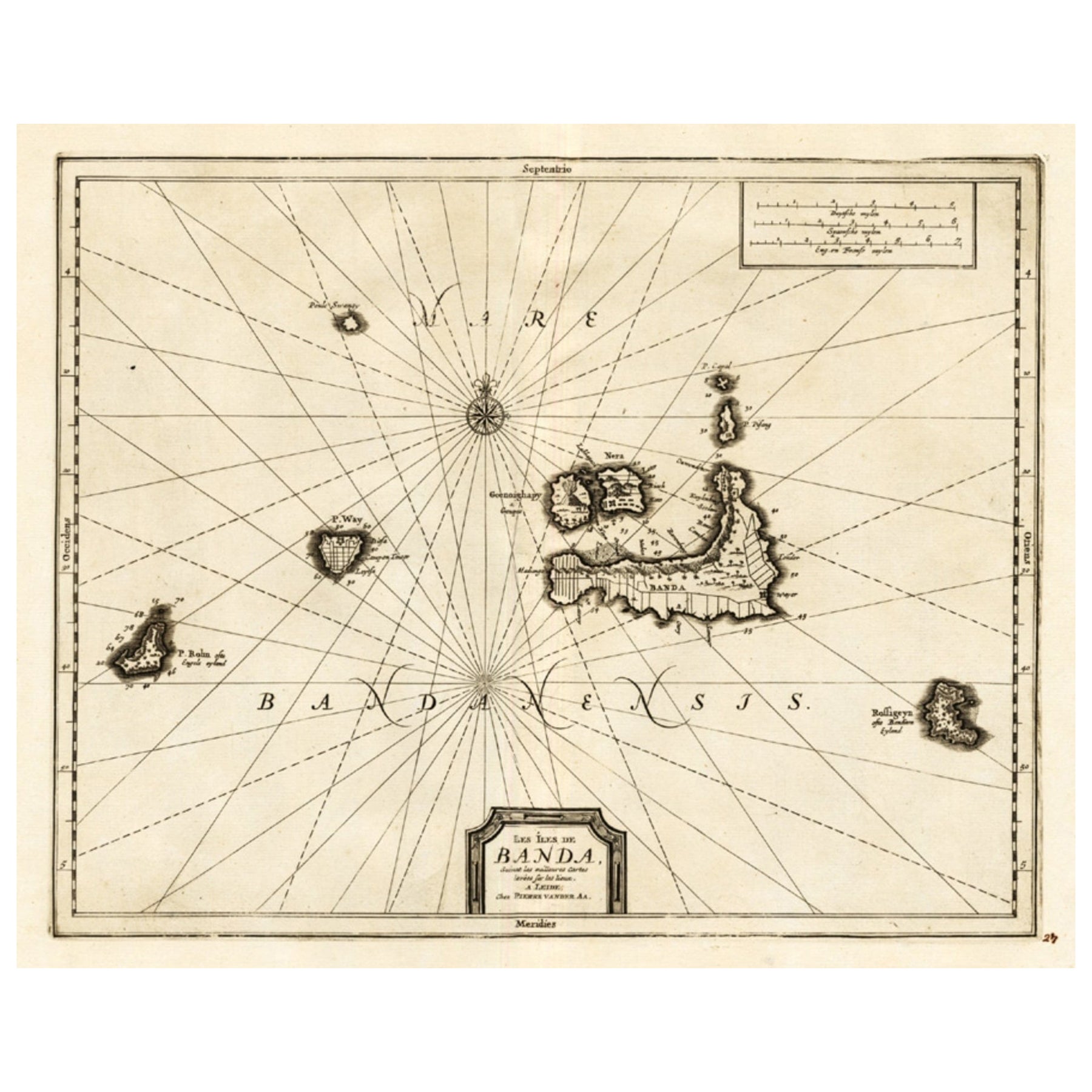
Antique Map of the Islands of Banda, Indonesia from a Very Rare Edition, 1725
Located in Langweer, NL
Antique map titled 'Les Iles de Banda (..).' (The islands of Banda, Indonesia.)
Extremely rare in this edition. This plate originates from the very scarse: 'La galerie agreable d...
Category
Antique 1720s Maps
Materials
Paper

$853 Sale Price
20% Off
Antique Map of the Island of Borneo in Asia (Indonesia), 1726
Located in Langweer, NL
Antique map titled 'Kaart van het Eyland Borneo'. Early map of the island of Borneo. This map originates from 'Oud en Nieuw Oost-Indiën' by F. Valentijn.
Artists and Engravers: Fran...
Category
Antique 18th Century Maps
Materials
Paper

$3,696 Sale Price
20% Off
You May Also Like
St. Christophe 'St. Kitts' Island: An 18th Century Hand-colored Map by Bellin
By Jacques-Nicolas Bellin
Located in Alamo, CA
Jacques Bellin's copper-plate map of the Caribbean island of Saint Kitts entitled "Carte De De l'Isle St. Christophe Pour servir á l'Histoire Genle. des V...
Category
Antique Mid-18th Century French Maps
Materials
Paper

West Coast of Africa, Guinea & Sierra Leone: An 18th Century Map by Bellin
By Jacques-Nicolas Bellin
Located in Alamo, CA
Jacques Bellin's copper-plate map entitled "Partie de la Coste de Guinee Dupuis la Riviere de Sierra Leona Jusquau Cap das Palmas", depicting the coast of Guinea and Sierra Leone in ...
Category
Antique Mid-18th Century French Maps
Materials
Paper

Captain Cook's Exploration of Tahiti 18th C. Hand-Colored Map by Bellin
By Jacques-Nicolas Bellin
Located in Alamo, CA
This beautiful 18th century hand-colored copper plate engraved map is entitled "Carte de l'Isle de Taiti, par le Lieutenant J. Cook" was created by Jacques Nicolas Bellin and publish...
Category
Antique Mid-18th Century French Maps
Materials
Paper

Ancient Map - Zeilan - Etching by Johannes Janssonius - 1650s
By Johannes Janssonius
Located in Roma, IT
Ancient Map - Zeilan is an ancient map realized in 1650 by Johannes Janssonius (1588-1664).
The Map is Hand-colored etching, with coeval watercoloring.
...
Category
1650s Modern Figurative Prints
Materials
Etching

Antique French Map of Asia Including China Indoneseia India, 1783
Located in Amsterdam, Noord Holland
Very nice map of Asia. 1783 Dedie au Roy.
Additional information:
Country of Manufacturing: Europe
Period: 18th century Qing (1661 - 1912)
Condition: Overall Condition B (Good Used)...
Category
Antique 18th Century European Maps
Materials
Paper

$648 Sale Price
20% Off
Original Antique Map of Switzerland, Engraved By Barlow, Dated 1807
Located in St Annes, Lancashire
Great map of Switzerland
Copper-plate engraving by Barlow
Published by Brightly & Kinnersly, Bungay, Suffolk.
Dated 1807
Unframed.
Category
Antique Early 1800s English Maps
Materials
Paper
