Items Similar to Antique Map of Choromandel, Golconda and Orixa, Malabar, India, 1744


Want more images or videos?
Request additional images or videos from the seller
1 of 6
Antique Map of Choromandel, Golconda and Orixa, Malabar, India, 1744
$1,103.24
$1,379.0620% Off
£820.70
£1,025.8820% Off
€920
€1,15020% Off
CA$1,510.72
CA$1,888.4020% Off
A$1,679.71
A$2,099.6420% Off
CHF 877.05
CHF 1,096.3220% Off
MX$20,446.21
MX$25,557.7620% Off
NOK 11,190.83
NOK 13,988.5320% Off
SEK 10,485.27
SEK 13,106.5920% Off
DKK 7,003.45
DKK 8,754.3120% Off
Shipping
Retrieving quote...The 1stDibs Promise:
Authenticity Guarantee,
Money-Back Guarantee,
24-Hour Cancellation
About the Item
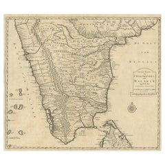
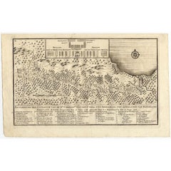
Antique map titled 'Regionum Choromandel, Golconda (..).' Handsome map of Choromandel, Golconda and Orixa, published in 'The True and Exact Description of the Most Celebrated East - India Coast of Malabar and Coromandel as also of the Island of Ceylon' by Philip Baldaeus (first printed in 1672), part of 'A Collection of Voyages and Travels, some now first printed from original manuscripts others now first printed in English', printed in 1744 for Henry Lintot and John Osborn. This map originates from Churchill's 'A Collection of Voyages and Travels, some now first printed from original manuscripts others now first printed in English', printed in 1744 for Henry Lintot and John Osborn.
Artists and Engravers: Made by 'Philip Baldaeus' after an anonymous artist.
We sell original antique maps to collectors, historians, educators and interior decorators all over the world. Our collection includes a wide range of authentic antique maps from the 16th to the 20th centuries. Buying and collecting antique maps is a tradition that goes back hundreds of years. Antique maps have proved a richly rewarding investment over the past decade, thanks to a growing appreciation of their unique historical appeal. Today the decorative qualities of antique maps are widely recognized by interior designers who appreciate their beauty and design flexibility. Depending on the individual map, presentation, and context, a rare or antique map can be modern, traditional, abstract, figurative, serious or whimsical. We offer a wide range of authentic antique maps for any budget.
- Creator:Philip Baldaeus (Artist)
- Dimensions:Height: 13.51 in (34.3 cm)Width: 17.13 in (43.5 cm)Depth: 0 in (0.01 mm)
- Materials and Techniques:
- Period:
- Date of Manufacture:1744
- Condition:Condition: Good, given age. A few minor creases. One small dark spot in the cartouche, hardly visible. Original folds as issued. General age-related toning and/or occasional minor defects from handling. Please study image carefully.
- Seller Location:Langweer, NL
- Reference Number:Seller: PCT-591911stDibs: LU3054326145122
About the Seller
5.0
Recognized Seller
These prestigious sellers are industry leaders and represent the highest echelon for item quality and design.
Platinum Seller
Premium sellers with a 4.7+ rating and 24-hour response times
Established in 2009
1stDibs seller since 2017
2,510 sales on 1stDibs
Typical response time: <1 hour
- ShippingRetrieving quote...Shipping from: Langweer, Netherlands
- Return Policy
Authenticity Guarantee
In the unlikely event there’s an issue with an item’s authenticity, contact us within 1 year for a full refund. DetailsMoney-Back Guarantee
If your item is not as described, is damaged in transit, or does not arrive, contact us within 7 days for a full refund. Details24-Hour Cancellation
You have a 24-hour grace period in which to reconsider your purchase, with no questions asked.Vetted Professional Sellers
Our world-class sellers must adhere to strict standards for service and quality, maintaining the integrity of our listings.Price-Match Guarantee
If you find that a seller listed the same item for a lower price elsewhere, we’ll match it.Trusted Global Delivery
Our best-in-class carrier network provides specialized shipping options worldwide, including custom delivery.More From This Seller
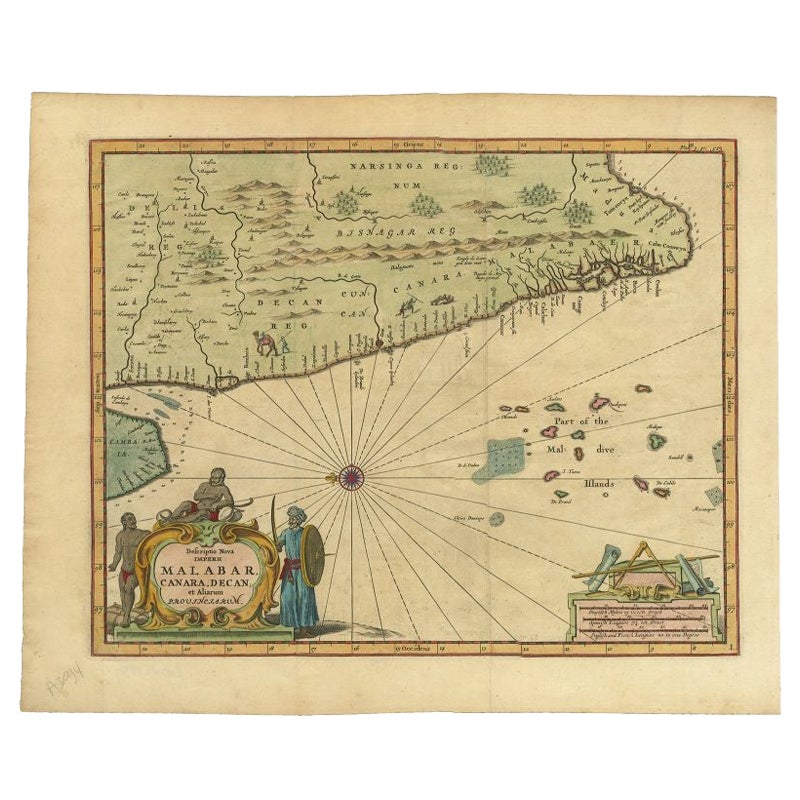
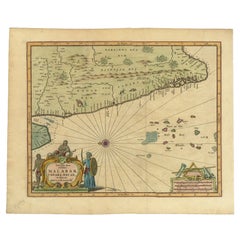
View AllAntique Map of the Malabar Coast by Baldaeus, 1744
By Philip Baldaeus
Located in Langweer, NL
Antique map titled 'Descriptio Nova Imperii Malabar (..).' Nice map of the Malabar Coast. This map was published in 'The True and Exact Description of th...
Category
Antique 18th Century Maps
Materials
Paper
$333 Sale Price
20% Off
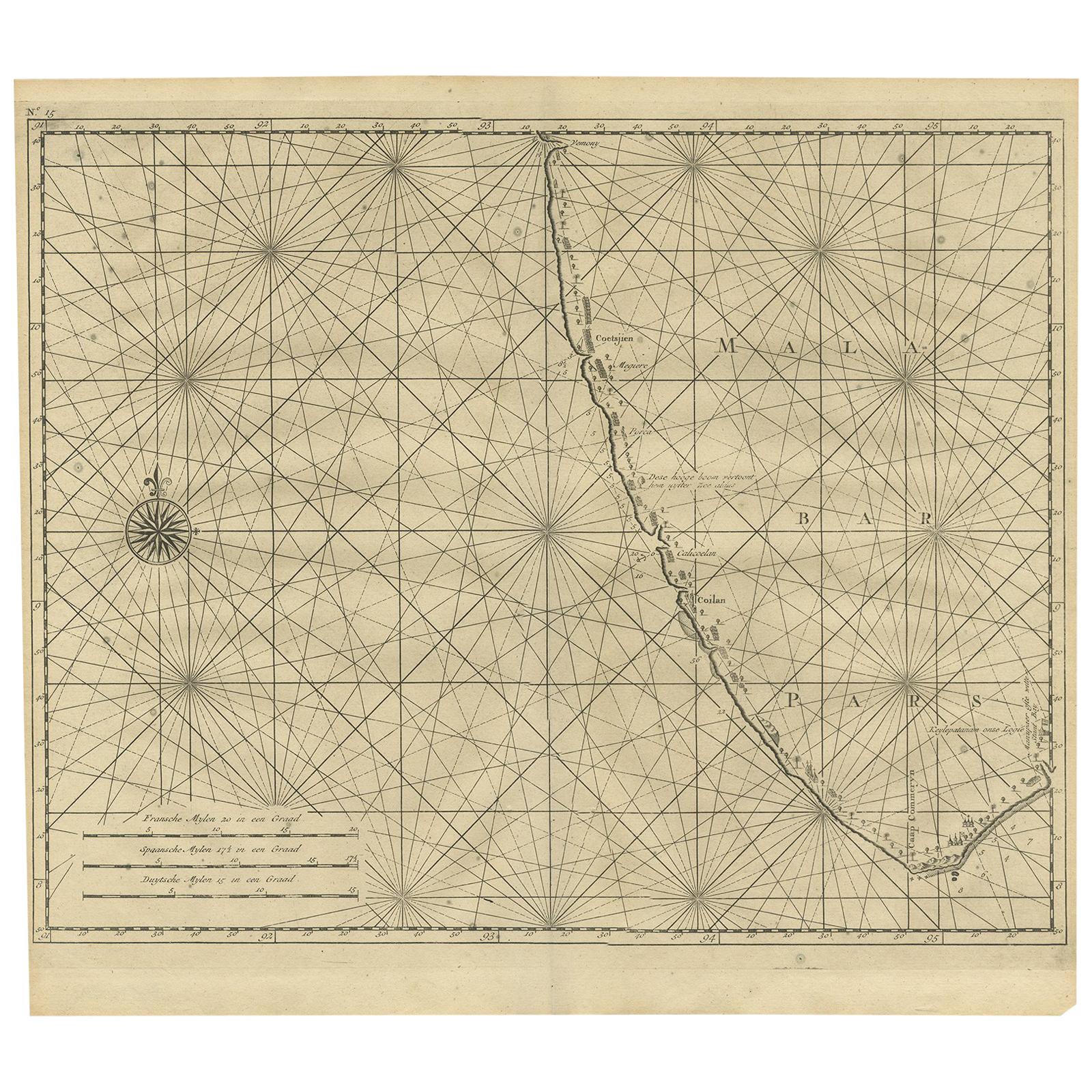
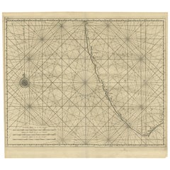
Antique Map of Malabar Coast by Valentijn, 1726
By F. Valentijn
Located in Langweer, NL
Untitled sea chart of the coast of Malabar, India. This print originates from 'Oud en Nieuw Oost-Indiën' by F. Valentijn.
Category
Antique Early 18th Century Dutch Maps
Materials
Paper
$431 Sale Price
20% Off
1705 Sanson Map of Southern India and Malabar with an Inset Map
Located in Langweer, NL
Title: 1705 Sanson Map of Southern India and Malabar with an Inset Map
Description: This finely engraved and beautifully hand-colored antique map, published in 1705, depicts south...
Category
Antique Early 1700s Maps
Materials
Paper

$738 Sale Price
20% Off
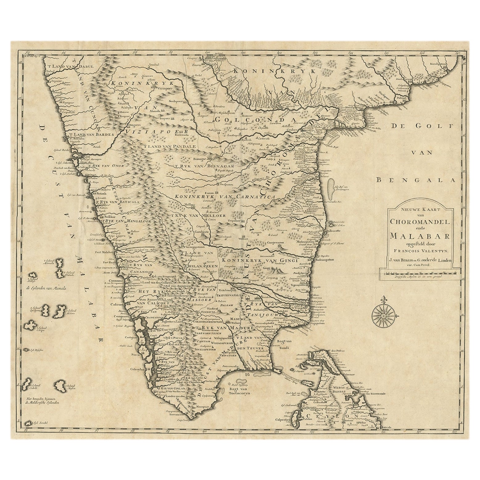
Old Original Map of Chormandel & Malabar, India & Ceylon, Now Sri Lanka, 1726
Located in Langweer, NL
Antique map titled 'Nieuwe Kaart van Choromandel ende Malabar'.
Antique map depicting the southern part of India and the northern tip of Ceylon, Sri Lanka. This map originates from...
Category
Antique 1720s Maps
Materials
Paper
$527 Sale Price
20% Off
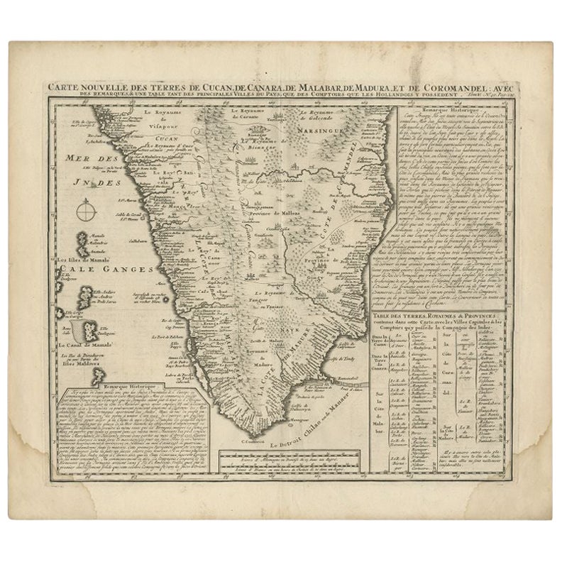
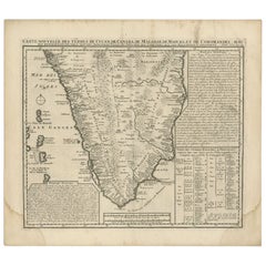
Antique Map of Southern India by Chatelain, c.1720
Located in Langweer, NL
"Antique map titled 'Carte Nouvelle des Terres de Cucan, de Canara, de Malabar, de Madura, et de Coromandel'. Map of the southern portion of India, originating from Chatelain's 'Atla...
Category
Antique 18th Century Maps
Materials
Paper
$297 Sale Price
20% Off
Antique Map of the Expedition of Govert Knol by Valentijn, 1726
Located in Langweer, NL
Antique map titled 'Aftekening der Expeditie van de Hr. Commissaris Govert Cnoll uyt Soerabaja, tot afhalinge van Pangerang Adepati Anom'. Map showing the expedition...
Category
Antique 18th Century Maps
Materials
Paper
$103 Sale Price
20% Off
You May Also Like
West Coast of Africa, Guinea & Sierra Leone: An 18th Century Map by Bellin
By Jacques-Nicolas Bellin
Located in Alamo, CA
Jacques Bellin's copper-plate map entitled "Partie de la Coste de Guinee Dupuis la Riviere de Sierra Leona Jusquau Cap das Palmas", depicting the coast of Guinea and Sierra Leone in ...
Category
Antique Mid-18th Century French Maps
Materials
Paper

1640 Willem Blaeu Map Entitled "Contado di molise et principato vltra, " Ric.a003
By Willem Blaeu
Located in Norton, MA
1640 Willem Blaeu map entitled
"Contado di molise et principato vltra,"
Colored
Ric. a003
Measures: 38 x 49.6 cm and wide margins
DBLAEU.
Cou...
Category
Antique 17th Century Dutch Maps
Materials
Paper

1627 Hendrik Hondius Map Entitled "Vltoniae Orientalis Pars, " Ric.a009
Located in Norton, MA
1627 Hendrik Hondius map entitled
"Vltoniae orientalis pars,"
Ric.a009
Title:
Vltoniae orientalis : pars
Title (alt.) :
Ultoniae orientalis pars
Creator:
Mercator, Gerh...
Category
Antique 17th Century Dutch Maps
Materials
Paper

Antique French Map of Asia Including China Indoneseia India, 1783
Located in Amsterdam, Noord Holland
Very nice map of Asia. 1783 Dedie au Roy.
Additional information:
Country of Manufacturing: Europe
Period: 18th century Qing (1661 - 1912)
Condition: Overall Condition B (Good Used)...
Category
Antique 18th Century European Maps
Materials
Paper

$648 Sale Price
20% Off
Southern Greece: A Large 17th C. Hand-colored Map by Sanson and Jaillot
By Nicolas Sanson
Located in Alamo, CA
This large original hand-colored copperplate engraved map of southern Greece and the Pelopponese Peninsula entitled "La Moree Et Les Isles De Zante, Cefalonie, Ste. Marie, Cerigo & C...
Category
Antique 1690s French Maps
Materials
Paper

1571-1638 Willem Blaeu map entitled, "Ilcadorino, " Hand Colored Ric0009
Located in Norton, MA
Willem Blaeu map entitled,
"Ilcadorino,".
Hand colored.
Description: large, unusual, and nice antique copper engraved map of Ilcadorino, by Willem BL...
Category
Antique 16th Century Dutch Maps
Materials
Paper

More Ways To Browse
Malabar Furniture
Antique Print Ceylon
Churchill Antiques
Antique Map Ceylon
Malabar Map
Joan Blaeu
Antique Nautical Maps
Antique Portuguese Plates
New Zealand Map
Antique Railroad Collectibles
Blaeu World Map
Roman Empire Map
Antique Map Of Middle East
Caribbean Map
Antique Map Of Egypt
Antique Map Ortelius
Antique Farm Antiques Collectibles
Antique Galleon