Items Similar to Antique Map of the Djati 'teak wood' Forest Near Rembang, Java by Stemler, 1875


Want more images or videos?
Request additional images or videos from the seller
1 of 5
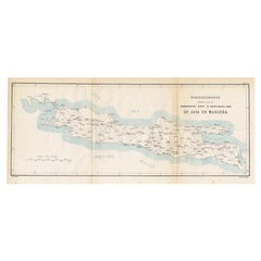
Antique Map of the Djati 'teak wood' Forest Near Rembang, Java by Stemler, 1875
$258.80
$323.5020% Off
£192.62
£240.7820% Off
€216
€27020% Off
CA$354.49
CA$443.1120% Off
A$394.27
A$492.8420% Off
CHF 205.88
CHF 257.3420% Off
MX$4,797.85
MX$5,997.3120% Off
NOK 2,629.35
NOK 3,286.6820% Off
SEK 2,465.86
SEK 3,082.3320% Off
DKK 1,644.33
DKK 2,055.4220% Off
Shipping
Retrieving quote...The 1stDibs Promise:
Authenticity Guarantee,
Money-Back Guarantee,
24-Hour Cancellation
About the Item
Antique map titled 'Overzichtskaart van de Djatibosschen in de Residentie Rembang, Java.' This scarce map shows the Djati (teak) Forest on the indonesian island of Java. Originates from 'Tijdschrift Aardrijkskundig Genootschap', published by C. F. Stemler in Amsterdam, 1874.
Artists and Engravers: Published by C. F. Stemler.
Condition: Good, general age related toning; some light staining from handling. Please study image carefully.
Date: c.1875
Overall size: 40 x 34.5 cm.
Image size: 0.001 x 32.5 x 28 cm.
We sell original antique maps to collectors, historians, educators and interior decorators all over the world. Our collection includes a wide range of authentic antique maps from the 16th to the 20th centuries. Buying and collecting antique maps is a tradition that goes back hundreds of years. Antique maps have proved a richly rewarding investment over the past decade, thanks to a growing appreciation of their unique historical appeal. Today the decorative qualities of antique maps are widely recognized by interior designers who appreciate their beauty and design flexibility. Depending on the individual map, presentation, and context, a rare or antique map can be modern, traditional, abstract, figurative, serious or whimsical. We offer a wide range of authentic antique maps for any budget.
- Creator:Stemler (Artist)
- Dimensions:Height: 13.59 in (34.5 cm)Width: 15.75 in (40 cm)Depth: 0 in (0.01 mm)
- Materials and Techniques:
- Period:
- Date of Manufacture:circa 1875
- Condition:
- Seller Location:Langweer, NL
- Reference Number:Seller: PCT-145401stDibs: LU3054325639312
About the Seller
5.0
Recognized Seller
These prestigious sellers are industry leaders and represent the highest echelon for item quality and design.
Platinum Seller
Premium sellers with a 4.7+ rating and 24-hour response times
Established in 2009
1stDibs seller since 2017
2,502 sales on 1stDibs
Typical response time: <1 hour
- ShippingRetrieving quote...Shipping from: Langweer, Netherlands
- Return Policy
Authenticity Guarantee
In the unlikely event there’s an issue with an item’s authenticity, contact us within 1 year for a full refund. DetailsMoney-Back Guarantee
If your item is not as described, is damaged in transit, or does not arrive, contact us within 7 days for a full refund. Details24-Hour Cancellation
You have a 24-hour grace period in which to reconsider your purchase, with no questions asked.Vetted Professional Sellers
Our world-class sellers must adhere to strict standards for service and quality, maintaining the integrity of our listings.Price-Match Guarantee
If you find that a seller listed the same item for a lower price elsewhere, we’ll match it.Trusted Global Delivery
Our best-in-class carrier network provides specialized shipping options worldwide, including custom delivery.More From This Seller
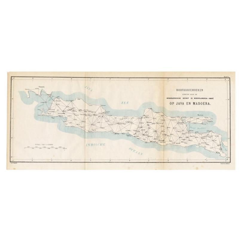
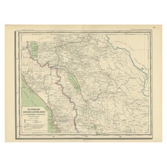
View AllOld Map of Java, Indonesia by Stemler, 1875
By Stemler
Located in Langweer, NL
Antique map titled 'Hoofddriehoeken - Java en madoera.' (Main triangles measured by the Geographical Service in the Dutch-Indies on Java and Madoera.) This scarce map shows the Indon...
Category
Antique 19th Century Maps
Materials
Paper
$67 Sale Price
20% Off
Antique Map of the East Coast of Sumatra , Indonesia, 1900
Located in Langweer, NL
Antique map of the East Coast of Sumatra. Also depicting the Strait of Malacca. This map originates from 'Atlas van Nederlandsch Oost- en West-Indië' by I. Dornseiffen.
Artists and...
Category
20th Century Maps
Materials
Paper

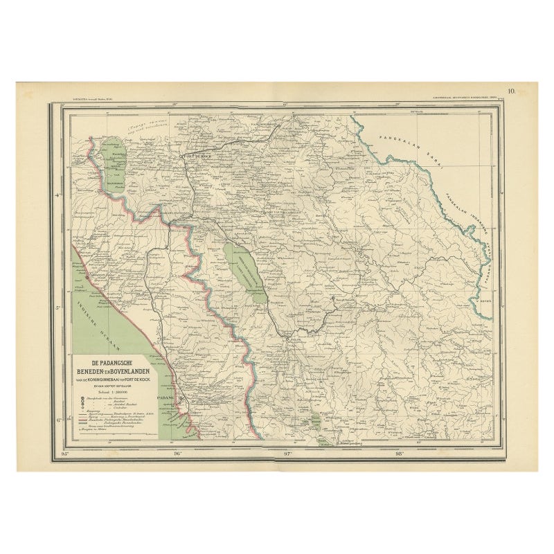
Antique Map of Padang, Sumatra, Indonesia, 1900
Located in Langweer, NL
Antique map titled 'De Padangsche Beneden-en Bovenlanden van de Koninginnedbaai tot Fort de Kock'. Old map of Padang, Sumatra. This map originates from 'Atlas van Nederlandsch Oost- ...
Category
20th Century Maps
Materials
Paper
Antique Map of the Region of Lampung, Sumatra, Indonesia, 1900
Located in Langweer, NL
Antique map of the region of Lampung, Sumatra. Also depicting part of Palembang and Java. This map originates from 'Atlas van Nederlandsch Oost- en West-Indië' by I. Dornseiffen.
A...
Category
20th Century Maps
Materials
Paper

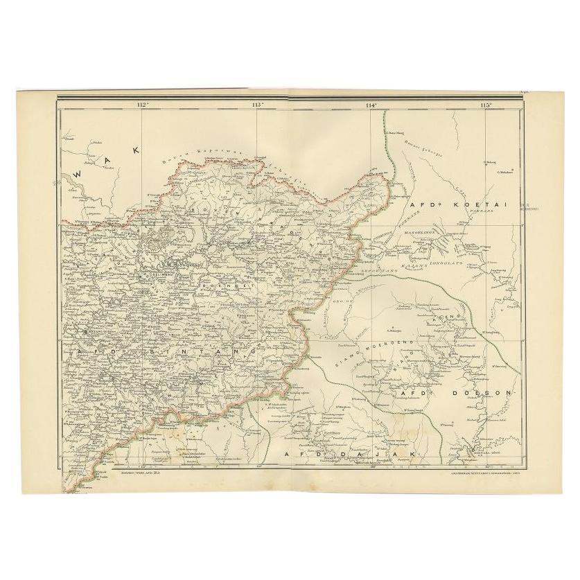
Antique Map of West Kalimantan (Schwaner Mountains), Borneo, Indonesia, 1900
Located in Langweer, NL
Antique map of West Kalimantan, Borneo. It shows the region of the Schwaner Mountains. This map originates from 'Atlas van Nederlandsch Oost- en West-Indië' by I. Dornseiffen.
Arti...
Category
20th Century Maps
Materials
Paper
$316 Sale Price
20% Off
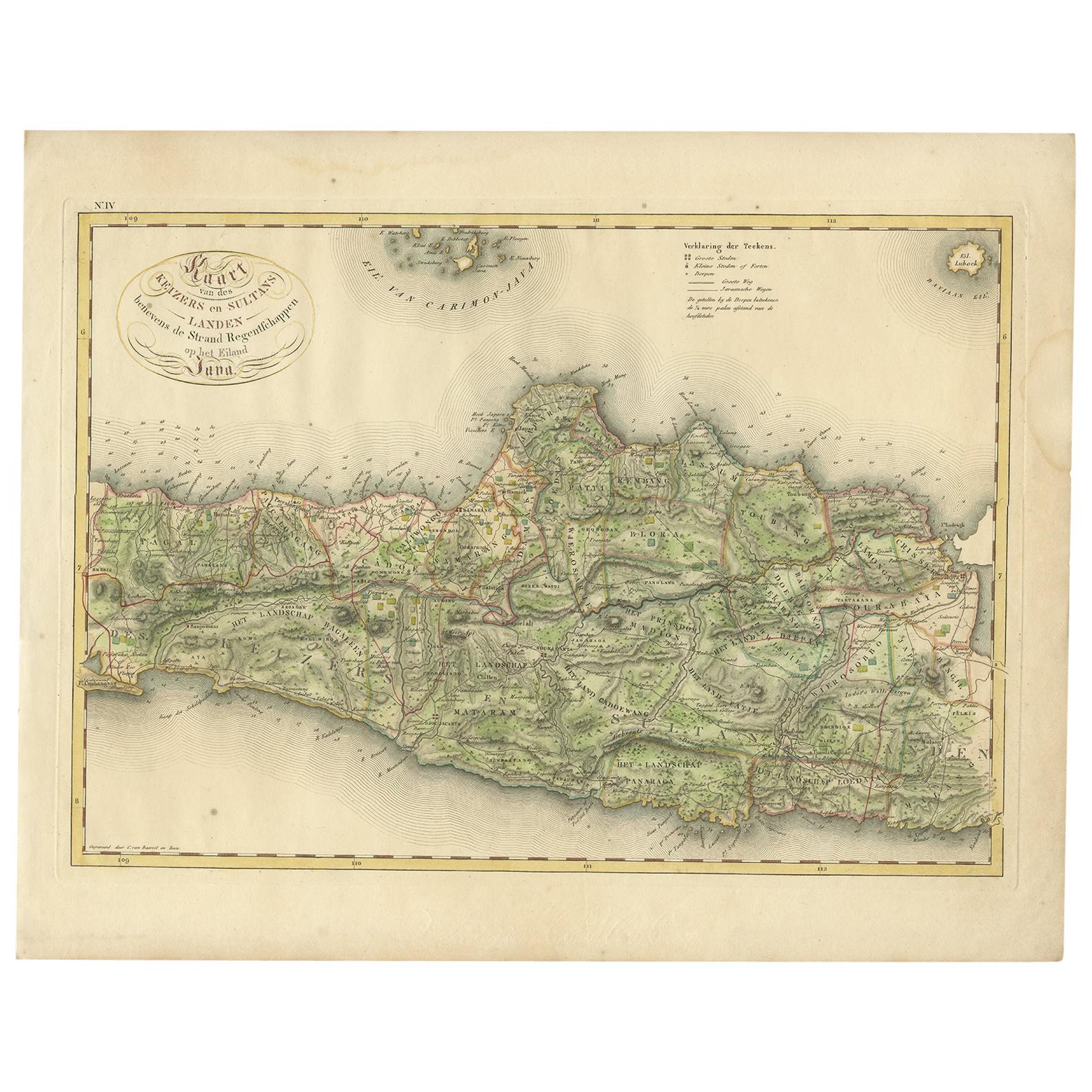
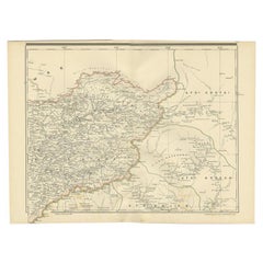
Antique Map of Central and East Java by Van den Bosch, 1818
Located in Langweer, NL
Antique map titled 'Kaart van de Keizers en Sultans Landen benevens de Strand Regentschappen op het Eiland Java'. Map of three central and easterly provinces of the island of Java. O...
Category
Antique Early 19th Century Maps
Materials
Paper

$1,150 Sale Price
20% Off
You May Also Like
Original Antique English County Map, Nottinghamshire, J & C Walker, 1851
Located in St Annes, Lancashire
Great map of Nottinghamshire
Original colour
By J & C Walker
Published by Longman, Rees, Orme, Brown & Co. 1851
Unframed.
Category
Antique 1850s English Other Maps
Materials
Paper

Large Original Antique Map of Java and Borneo, Fullarton, C.1870
Located in St Annes, Lancashire
Great map of Java and Borneo
Wonderful figurative borders
From the celebrated Royal Illustrated Atlas
Lithograph. Original color.
Published by Fullarton, Edinburgh. C.1870
Unfr...
Category
Antique 1870s Scottish Maps
Materials
Paper

Original Antique English County Map, Huntingdonshire, J & C Walker, 1851
Located in St Annes, Lancashire
Great map of Huntingdonshire
Original colour
By J & C Walker
Published by Longman, Rees, Orme, Brown & Co. 1851
Unframed.
Category
Antique 1850s English Other Maps
Materials
Paper

Original Antique English County Map - Monmouthshire. J & C Walker. 1851
Located in St Annes, Lancashire
Great map of Monmouthshire
Original colour
By J & C Walker
Published by Longman, Rees, Orme, Brown & Co. 1851
Unframed.
Category
Antique 1850s English Other Maps
Materials
Paper

1849 Map of "Europaische Russland", 'Meyer Map of European Russia', Ric. R017
Located in Norton, MA
1849 Map of
"Europaische Russland"
( Meyer Map of European Russia)
Ric.r017
A lovely map of European Russia dating to 1849 by Joseph Meyer. It covers the European portions of...
Category
Antique 19th Century Unknown Maps
Materials
Paper

Original Antique English County Map, Cambridgeshire, J & C Walker, 1851
Located in St Annes, Lancashire
Great map of Cambridgeshire
Original colour
By J & C Walker
Published by Longman, Rees, Orme, Brown & Co. 1851
Unframed.
Category
Antique 1850s English Other Maps
Materials
Paper

More Ways To Browse
Antique Teak Wood Furniture
Java Teak
Antique Maps Of Long Island
James Cook Map
Pirate Furniture
Railroad Collectibles
Antique Map Mexico
Framed Map Of Paris
Antique Map Of Rome
Used Nautical Charts
Antique Navigator
Map Of Middle East
Antique Map Of Switzerland
World Map Copper
British Empire Map
Malaysian Antique Furniture
Birds Eye View Map
Map Of Arabia