Items Similar to Antique Map of Central and East Java by Van den Bosch, 1818
Want more images or videos?
Request additional images or videos from the seller
1 of 5
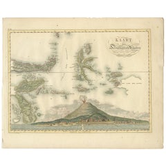
Antique Map of Central and East Java by Van den Bosch, 1818
About the Item
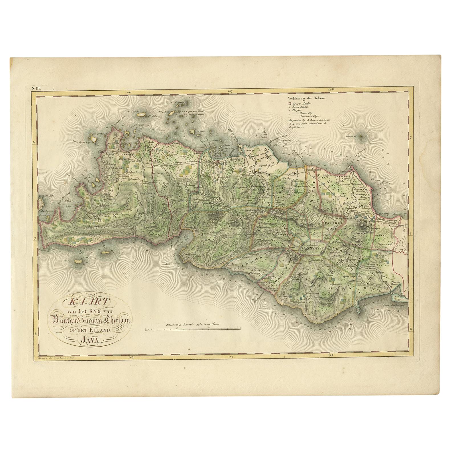
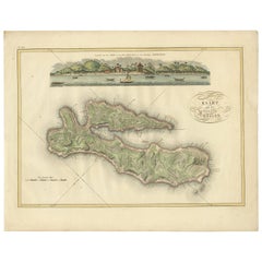
Antique map titled 'Kaart van de Keizers en Sultans Landen benevens de Strand Regentschappen op het Eiland Java'. Map of three central and easterly provinces of the island of Java. One of 12 maps from 'Atlas van Overzeesche bezittingen' (Atlas of Oversea Possessions) by J.S. van den Bosch. J.S. van den Bosch (1780-1844), Major General, Knight of the 3rd Class of the Military William Order.
- Dimensions:Height: 18.12 in (46 cm)Width: 22.84 in (58 cm)Depth: 0.02 in (0.5 mm)
- Materials and Techniques:
- Period:
- Date of Manufacture:1818
- Condition:Wear consistent with age and use. General age-related toning. Some wear and marginal tears. Please study images carefully.
- Seller Location:Langweer, NL
- Reference Number:
About the Seller
5.0
Platinum Seller
These expertly vetted sellers are 1stDibs' most experienced sellers and are rated highest by our customers.
Established in 2009
1stDibs seller since 2017
1,933 sales on 1stDibs
Typical response time: <1 hour
- ShippingRetrieving quote...Ships From: Langweer, Netherlands
- Return PolicyA return for this item may be initiated within 14 days of delivery.
More From This SellerView All
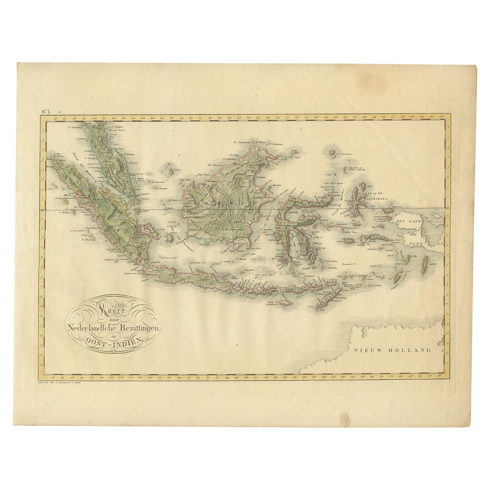
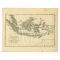
- Antique Map of the Dutch East Indies by Van den Bosch '1818'Located in Langweer, NLAntique map titled 'Kaart der Nederlandsche Bezittingen in Oost-Indiën'. Rare and attractive map of the Dutch East Indies, it shows the Dutch possessions in the 19th century. This ...Category
Antique Early 19th Century Maps
MaterialsPaper
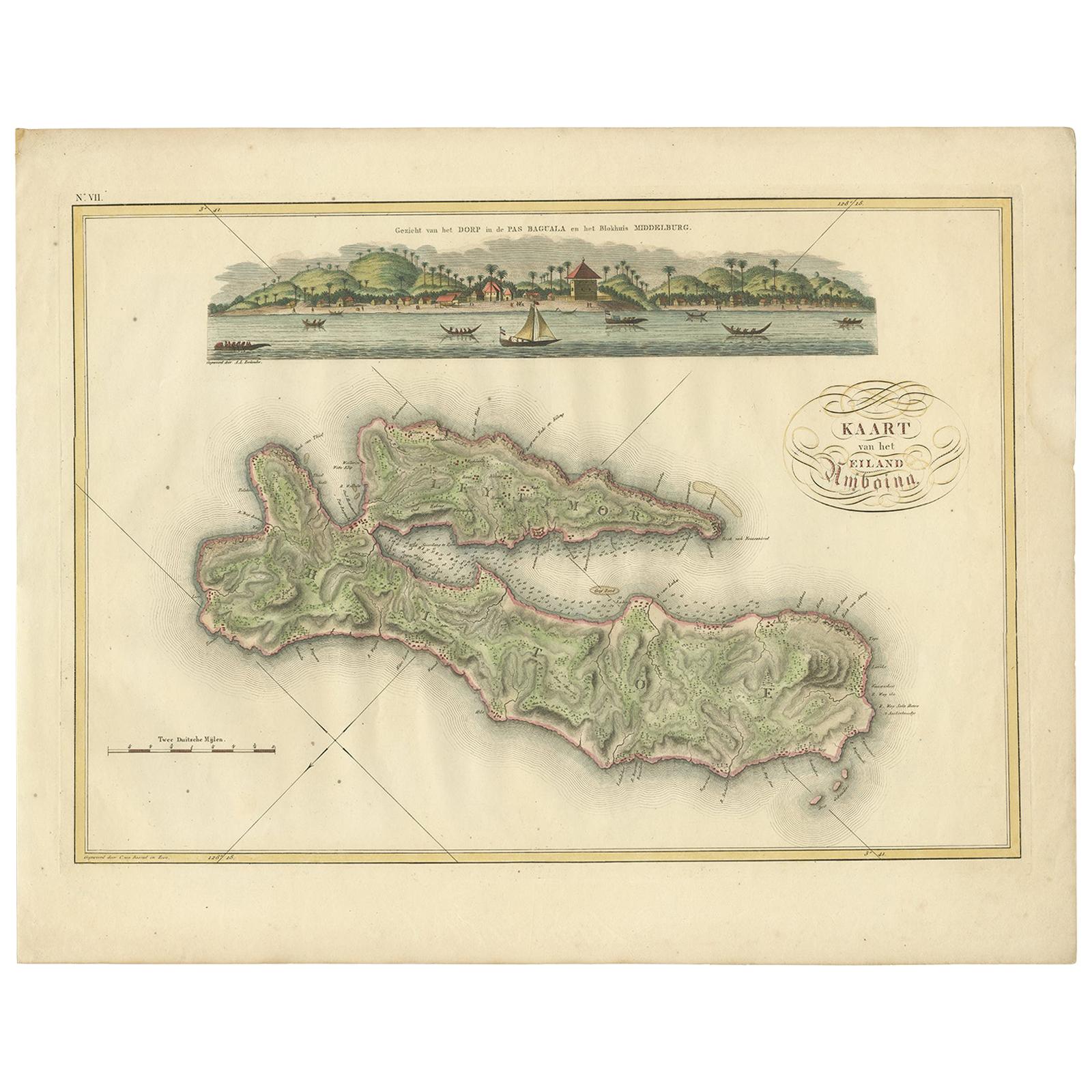
- Antique Map of Ambon Island by Van den Bosch, '1818'Located in Langweer, NLAntique map titled 'Kaart van het Eiland Amboina'. Rare and attractive map of Ambon Island. One of 12 maps from 'Atlas van Overzeesche bezittingen' (Atlas of Oversea Possessions) by ...Category
Antique Early 19th Century Maps
MaterialsPaper
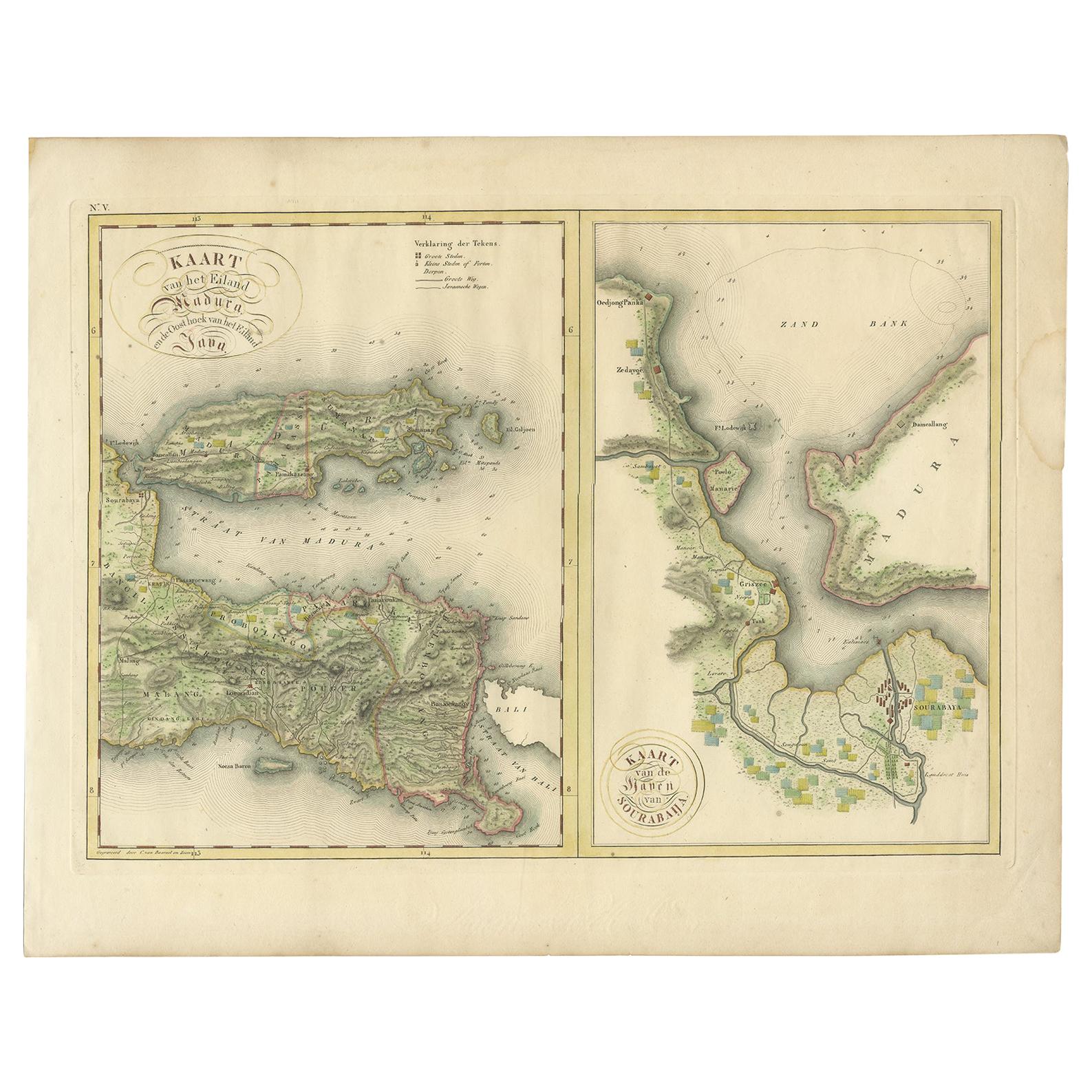
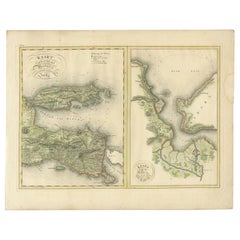
- Antique Map of Madura and Surabaya by Van den Bosch, '1818'Located in Langweer, NLTwo maps on one sheet titled 'Kaart van het Eiland Madura en de Oost hoek van het Eiland Java' and 'Kaart van de Haven van Sourabaija'. The left map shows East Java with the Island o...Category
Antique Early 19th Century Maps
MaterialsPaper
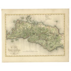
- Antique Map of Bantam, Jakarta and Cirebon by Van den Bosch '1818'Located in Langweer, NLAntique map titled 'Kaart van het Ryk van Bantam, Jacatra, Cheribon op het Eiland Java'. Rare and attractive map of the three most easterly provinces of Java (Bantam, Jakarta and Cir...Category
Antique Early 19th Century Maps
MaterialsPaper
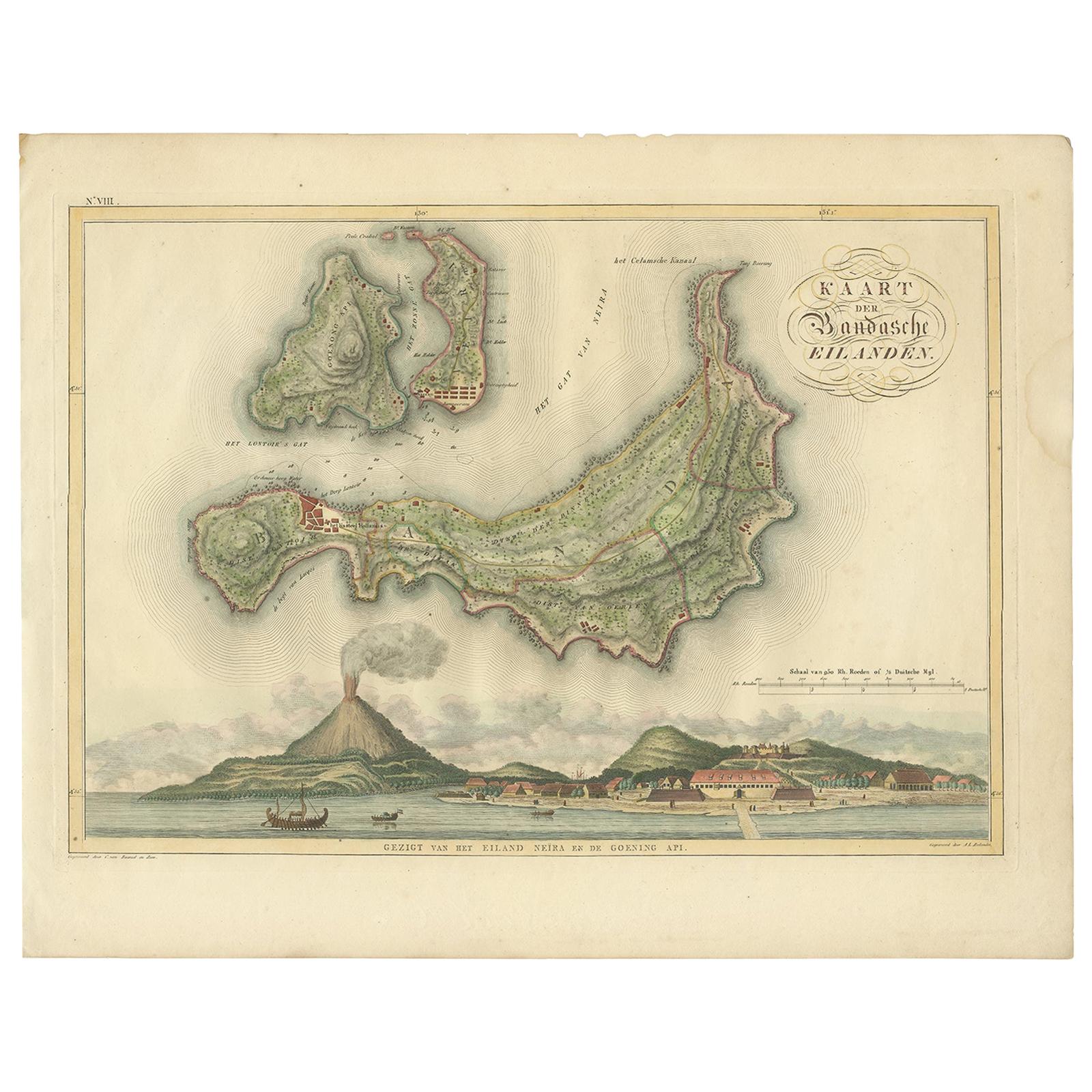
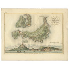
- Antique Map of the Banda Islands by Van den Bosch '1818'Located in Langweer, NLAntique map titled 'Kaart der Bandasche Eilanden'. Rare and attractive map of the Banda Islands with a large view of Banda Neira and Gunung Api. One of 12 maps from 'Atlas van Overze...Category
Antique Early 19th Century Maps
MaterialsPaper
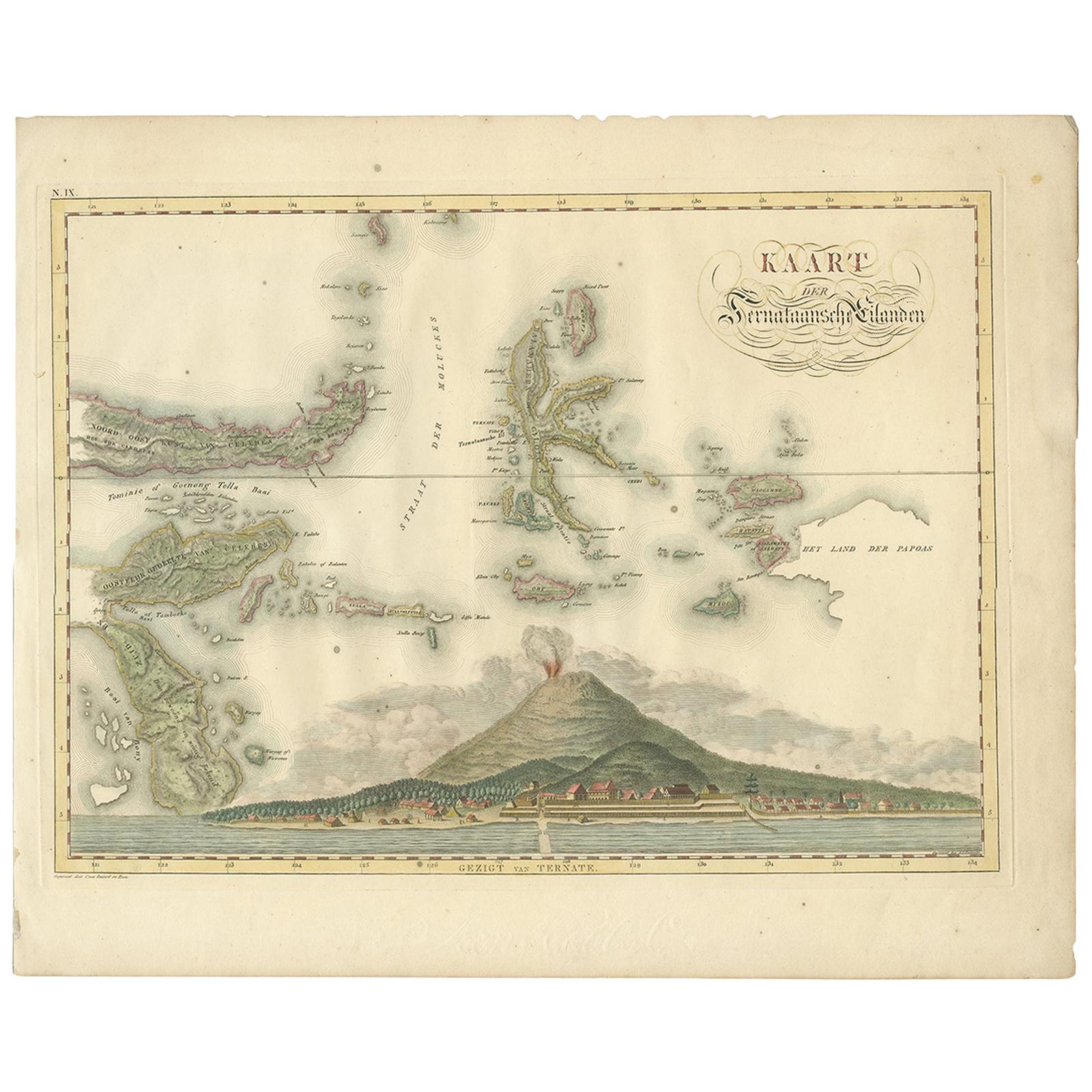
- Antique Map of the Ternate Islands by Van den Bosch '1818'Located in Langweer, NLAntique map titled 'Kaart der Ternataansche Eilanden'. Rare and attractive map of the Ternate Islands with a large view of Ternate Island. One of 12 maps from 'Atlas van Overzeesche ...Category
Antique Early 19th Century Maps
MaterialsPaper
You May Also Like
- Arts and Crafts Children's or Miniature Chair Attributed to Jac van den BoschBy Jac van den BoschLocated in Lisse, NLUnique tiger oak chair from the Dutch Arts & Crafts era. Arts & Crafts children's chairs are a rare find and to have found an original Dutch one in th...Category
Early 20th Century Dutch Arts and Crafts Models and Miniatures
MaterialsOak, Upholstery
- Large Original Antique Map of Java and Borneo, Fullarton, C.1870Located in St Annes, LancashireGreat map of Java and Borneo Wonderful figurative borders From the celebrated Royal Illustrated Atlas Lithograph. Original color. Published by Fullarton, Edinburgh. C.1870 Unfr...Category
Antique 1870s Scottish Maps
MaterialsPaper
- East German MapBy VEB Hermann HaackLocated in Baltimore, MDA brilliantly colourful map of the Leipzig, Karl Marx Stadt and Dresden area in the former German Democratic Republic by VEB Hermann Haack of Gotha.Category
Vintage 1970s German Maps
- Original Antique Map of South East Asia by Becker, circa 1840Located in St Annes, LancashireGreat map of South East Asia Steel engraving with original color outline Engraved by Becker Published by Virtue, circa 1840. Unframed.Category
Antique 1840s English Other Maps
MaterialsPaper
- Original Antique Map of South East Asia by Thomas Clerk, 1817Located in St Annes, LancashireGreat map of South East Asia Copper-plate engraving Drawn and engraved by Thomas Clerk, Edinburgh. Published by Mackenzie And Dent, 1817 Unframed.Category
Antique 1810s English Maps
MaterialsPaper
- Original Antique Map of Central America / Florida, Arrowsmith, 1820Located in St Annes, LancashireGreat map of Central America. Drawn under the direction of Arrowsmith. Copper-plate engraving. Published by Longman, Hurst, Rees, Orme and Brown, 1820 Unframed.Category
Antique 1820s English Maps
MaterialsPaper