Items Similar to Antique Map of The Dutch West-Stellingwerf Township by Behrns, 1861

Want more images or videos?
Request additional images or videos from the seller
1 of 5
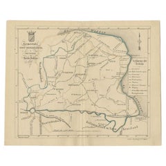
Antique Map of The Dutch West-Stellingwerf Township by Behrns, 1861
$115.29
$144.1220% Off
£84.91
£106.1420% Off
€96
€12020% Off
CA$156.85
CA$196.0620% Off
A$174.29
A$217.8720% Off
CHF 91.33
CHF 114.1720% Off
MX$2,137.41
MX$2,671.7620% Off
NOK 1,164.89
NOK 1,456.1120% Off
SEK 1,095.88
SEK 1,369.8520% Off
DKK 730.83
DKK 913.5420% Off
Shipping
Retrieving quote...The 1stDibs Promise:
Authenticity Guarantee,
Money-Back Guarantee,
24-Hour Cancellation
About the Item
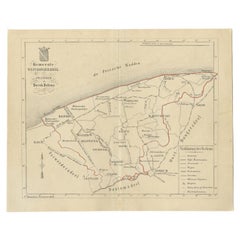
Antique map titled 'Gemeente West-Stellingwerf'. Old map depicting the West-Stellingwerf township including cities and villages like Noordwolde, Oldeholtwolde and Wolvega. This map orginates from 'Zak-Atlas van Friesland in 36 Kaarten'.
Artists and Engravers: Published by B. Behrns, Franeker.
Condition: Good, general age-related toning. Please study image carefully.
Date: 1861
Overall size: 21.1 x 17.2 cm.
Image size: 0.001 x 18.6 x 15.1 cm.
- Dimensions:Height: 6.78 in (17.2 cm)Width: 8.31 in (21.1 cm)Depth: 0 in (0.01 mm)
- Materials and Techniques:
- Period:
- Date of Manufacture:1861
- Condition:
- Seller Location:Langweer, NL
- Reference Number:Seller: BG-05105-341stDibs: LU3054325639932
About the Seller
5.0
Recognized Seller
These prestigious sellers are industry leaders and represent the highest echelon for item quality and design.
Platinum Seller
Premium sellers with a 4.7+ rating and 24-hour response times
Established in 2009
1stDibs seller since 2017
2,494 sales on 1stDibs
Typical response time: 1 hour
- ShippingRetrieving quote...Shipping from: Langweer, Netherlands
- Return Policy
Authenticity Guarantee
In the unlikely event there’s an issue with an item’s authenticity, contact us within 1 year for a full refund. DetailsMoney-Back Guarantee
If your item is not as described, is damaged in transit, or does not arrive, contact us within 7 days for a full refund. Details24-Hour Cancellation
You have a 24-hour grace period in which to reconsider your purchase, with no questions asked.Vetted Professional Sellers
Our world-class sellers must adhere to strict standards for service and quality, maintaining the integrity of our listings.Price-Match Guarantee
If you find that a seller listed the same item for a lower price elsewhere, we’ll match it.Trusted Global Delivery
Our best-in-class carrier network provides specialized shipping options worldwide, including custom delivery.More From This Seller
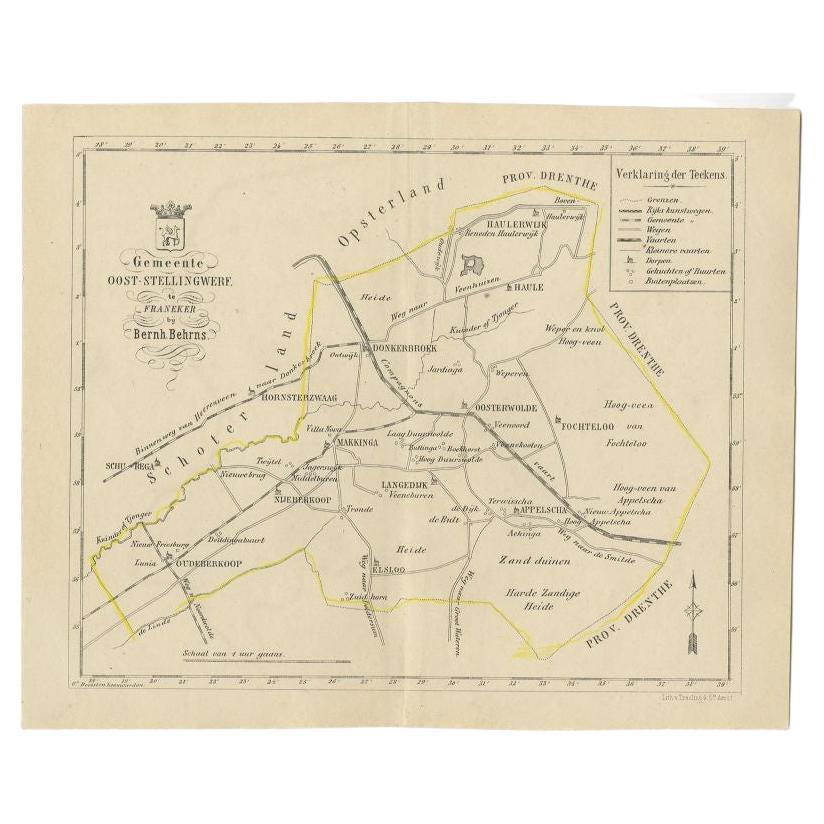
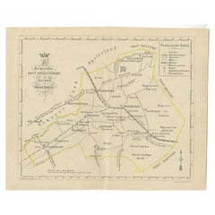
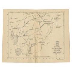
View AllAntique Map of the Oost-Stellingwerf Township by Behrns, 1861
Located in Langweer, NL
Antique map titled 'Gemeente Oost-Stellingwerf'. Old map depicting the Oost-Stellingwerf township including cities and villages like Oldeberkoop, Makkinga, Langedijk, Elsloo, Donkerb...
Category
Antique 19th Century Maps
Materials
Paper
$85 Sale Price
20% Off
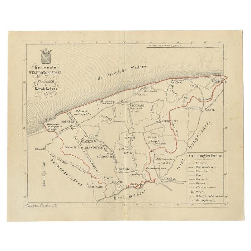
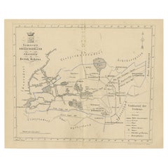
Antique Map of The Dutch West-Dongeradeel Township by Behrns, 1861
Located in Langweer, NL
Antique map titled 'Gemeente West-Dongeradeel'. Old map depicting the West-Dongeradeel township including cities and villages like Holwerd, Ternaard, Hanrum and Raard. This map orgin...
Category
Antique 19th Century Maps
Materials
Paper
$115 Sale Price
20% Off
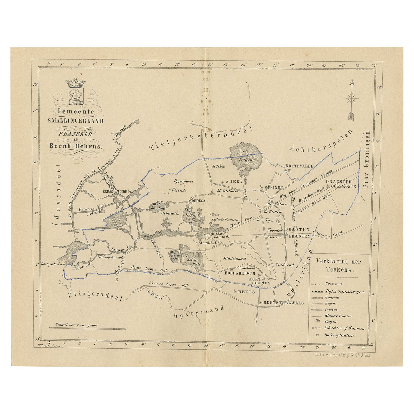
Antique Map of The Dutch Smallingerland Township, 1861
Located in Langweer, NL
Antique map titled 'Gemeente Smallingerland'. Old map depicting the Smallingerland township including cities and villages like Eernewoude, Oudega, Boornbergum, Opeinde and Drachten. ...
Category
Antique 19th Century Maps
Materials
Paper
$96 Sale Price
20% Off
Antique Map of The Dutch Township Rauwerderhem, 1861
Located in Langweer, NL
Antique map titled 'Gemeente Rauwerderhem'. Old map depicting the Rauwerderhem township including cities and villages like Deersum, Poppingawier, Rauwerd and Irnsum. This map orginat...
Category
Antique 19th Century Maps
Materials
Paper

$115 Sale Price
20% Off
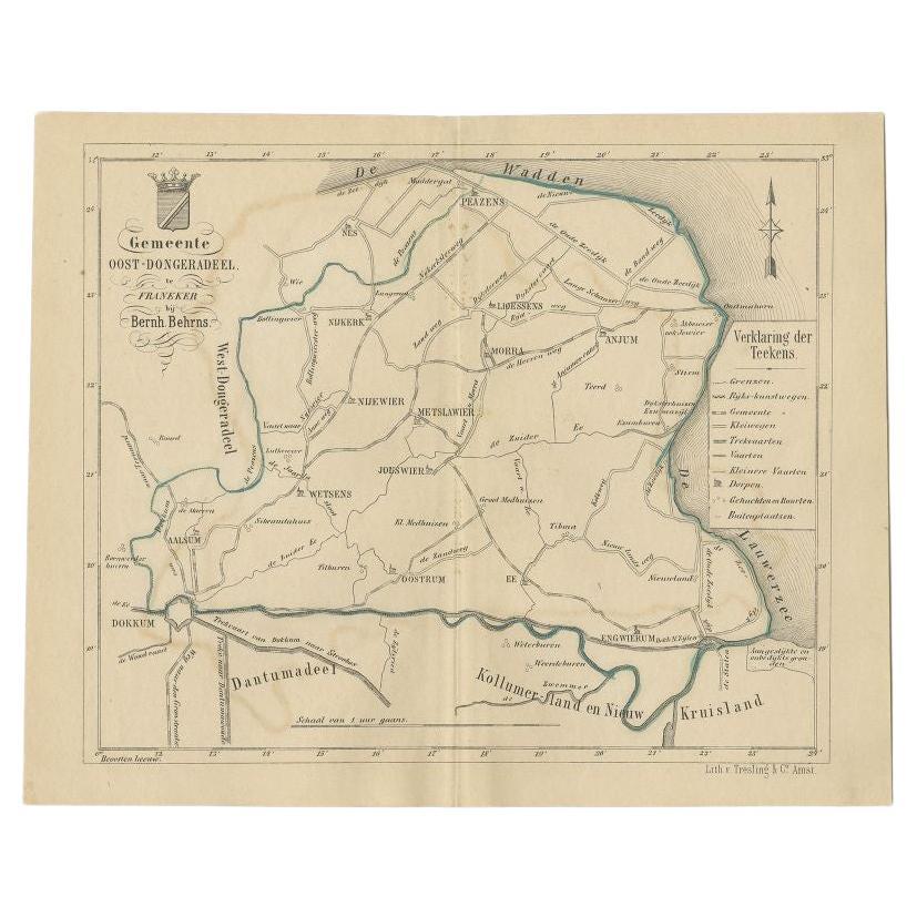
Antique Map of the Oost-Dongeradeel Township by Behrns, 1861
Located in Langweer, NL
Antique map titled 'Gemeente Oost-Dongeradeel'. Old map depicting the Oost-Dongeradeel township including cities and villages like Nijkerk, Morra, Anjum, Metslawier, Aalsum and Engwi...
Category
Antique 19th Century Maps
Materials
Paper
$85 Sale Price
20% Off
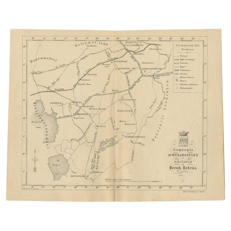
Antique Map of The Dutch Achtkarspelen Township by Behrns, 1861
Located in Langweer, NL
Antique map titled 'Gemeente Achtkarspelen'. Old map depicting the Achtkarspelen township including cities and villages like Buitenpost, Twijzel, Drogeham and Surhuisterveen. This ma...
Category
Antique 19th Century Maps
Materials
Paper
$115 Sale Price
20% Off
You May Also Like
Original Antique English County Map, Huntingdonshire, J & C Walker, 1851
Located in St Annes, Lancashire
Great map of Huntingdonshire
Original colour
By J & C Walker
Published by Longman, Rees, Orme, Brown & Co. 1851
Unframed.
Category
Antique 1850s English Other Maps
Materials
Paper

Original Antique English County Map, Buckinghamshire, J & C Walker, 1851
Located in St Annes, Lancashire
Great map of Buckinghamshire
Original colour
By J & C Walker
Published by Longman, Rees, Orme, Brown & Co. 1851
Unframed.
Category
Antique 1850s English Other Maps
Materials
Paper

Original Antique English County Map, Cambridgeshire, J & C Walker, 1851
Located in St Annes, Lancashire
Great map of Cambridgeshire
Original colour
By J & C Walker
Published by Longman, Rees, Orme, Brown & Co. 1851
Unframed.
Category
Antique 1850s English Other Maps
Materials
Paper

Original Antique English County Map, Nottinghamshire, J & C Walker, 1851
Located in St Annes, Lancashire
Great map of Nottinghamshire
Original colour
By J & C Walker
Published by Longman, Rees, Orme, Brown & Co. 1851
Unframed.
Category
Antique 1850s English Other Maps
Materials
Paper

Original Antique English County Map, Leicestershire, J & C Walker, 1851
Located in St Annes, Lancashire
Great map of Leicestershire
Original colour
By J & C Walker
Published by Longman, Rees, Orme, Brown & Co. 1851
Unframed.
Category
Antique 1850s English Other Maps
Materials
Paper

Original Antique English County Map - Monmouthshire. J & C Walker. 1851
Located in St Annes, Lancashire
Great map of Monmouthshire
Original colour
By J & C Walker
Published by Longman, Rees, Orme, Brown & Co. 1851
Unframed.
Category
Antique 1850s English Other Maps
Materials
Paper

More Ways To Browse
Antique Maps Of Long Island
James Cook Map
Pirate Furniture
Railroad Collectibles
Antique Map Mexico
Framed Map Of Paris
Antique Map Of Rome
Used Nautical Charts
Antique Navigator
Map Of Middle East
Antique Map Of Switzerland
World Map Copper
British Empire Map
Malaysian Antique Furniture
Birds Eye View Map
Map Of Arabia
Map Of Vienna
Old School Maps