Items Similar to Antique Map of France by A & C. Black, 1870


Want more images or videos?
Request additional images or videos from the seller
1 of 6
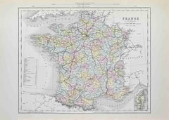
Antique Map of France by A & C. Black, 1870
$263.82
$329.7720% Off
£196.25
£245.3220% Off
€220
€27520% Off
CA$361.26
CA$451.5720% Off
A$401.67
A$502.0920% Off
CHF 209.73
CHF 262.1620% Off
MX$4,889.31
MX$6,111.6420% Off
NOK 2,676.07
NOK 3,345.0820% Off
SEK 2,507.35
SEK 3,134.1820% Off
DKK 1,674.74
DKK 2,093.4220% Off
Shipping
Retrieving quote...The 1stDibs Promise:
Authenticity Guarantee,
Money-Back Guarantee,
24-Hour Cancellation
About the Item
Antique map titled 'France'. Original antique map of France with inset map of France as divided into provinces, before the revolution of 1789 and map of Corsica. This map originates from ‘Black's General Atlas of The World’. Published by A & C. Black, 1870.
- Dimensions:Height: 23.63 in (60 cm)Width: 17.52 in (44.5 cm)Depth: 0.02 in (0.5 mm)
- Materials and Techniques:
- Period:
- Date of Manufacture:1870
- Condition:Wear consistent with age and use. General age-related toning. some foxing, small tears on the folding line page border, Please study image carefully.
- Seller Location:Langweer, NL
- Reference Number:Seller: BG-12784-141stDibs: LU3054325445842
About the Seller
5.0
Recognized Seller
These prestigious sellers are industry leaders and represent the highest echelon for item quality and design.
Platinum Seller
Premium sellers with a 4.7+ rating and 24-hour response times
Established in 2009
1stDibs seller since 2017
2,510 sales on 1stDibs
Typical response time: <1 hour
- ShippingRetrieving quote...Shipping from: Langweer, Netherlands
- Return Policy
Authenticity Guarantee
In the unlikely event there’s an issue with an item’s authenticity, contact us within 1 year for a full refund. DetailsMoney-Back Guarantee
If your item is not as described, is damaged in transit, or does not arrive, contact us within 7 days for a full refund. Details24-Hour Cancellation
You have a 24-hour grace period in which to reconsider your purchase, with no questions asked.Vetted Professional Sellers
Our world-class sellers must adhere to strict standards for service and quality, maintaining the integrity of our listings.Price-Match Guarantee
If you find that a seller listed the same item for a lower price elsewhere, we’ll match it.Trusted Global Delivery
Our best-in-class carrier network provides specialized shipping options worldwide, including custom delivery.More From This Seller
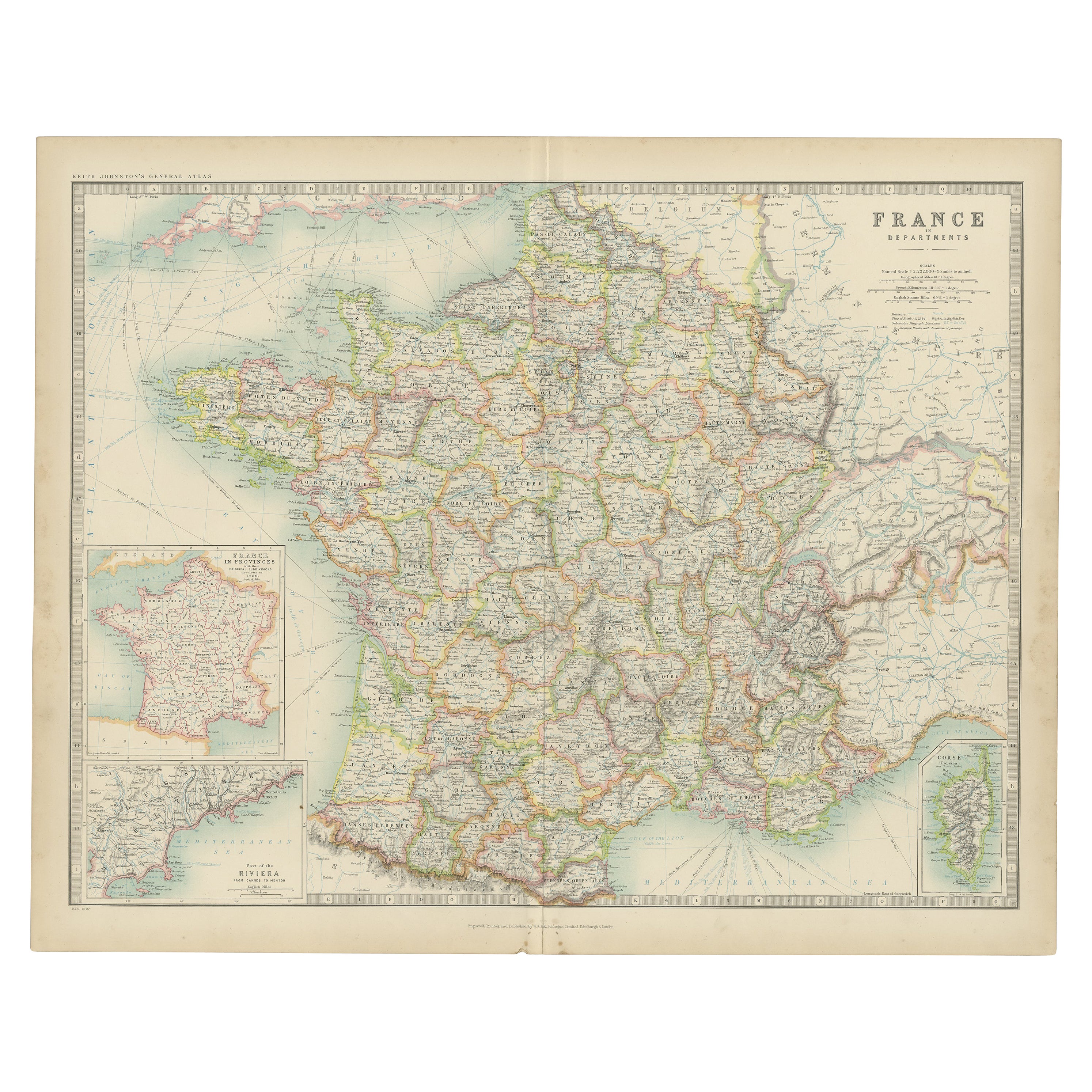
View AllAntique Map of France by Johnston (1909)
Located in Langweer, NL
Antique map titled 'France'. Original antique map of France. With inset maps of France in provinces, part of the Riviera and Corsica. This map or...
Category
Early 20th Century Maps
Materials
Paper

$239 Sale Price
20% Off
Antique Map of France by Lapie, 1842
Located in Langweer, NL
Antique map titled 'Carte des Gaules'. Map of France. This map originates from 'Atlas universel de géographie ancienne et moderne (..)' by Pierre M. Lapie and Alexandre E. Lapie. Pie...
Category
Antique Mid-19th Century Maps
Materials
Paper

$479 Sale Price
20% Off
Antique Map of France by Lapie, 1842
Located in Langweer, NL
Antique map titled 'Carte de France'. Map of France. This map originates from 'Atlas universel de géographie ancienne et moderne (..)' by Pierre M. Lapie and Alexandre E. Lapie. Pier...
Category
Antique Mid-19th Century Maps
Materials
Paper

$527 Sale Price
20% Off
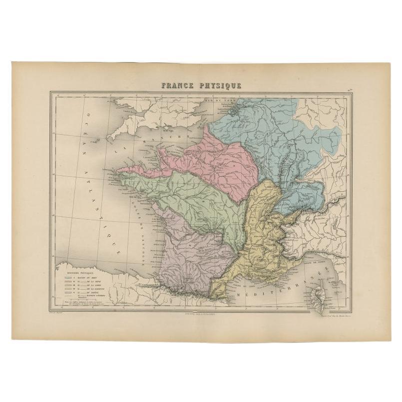
Antique Map of France by Migeon, 1880
Located in Langweer, NL
Antique map titled 'France Physique'. Old map of France. This map originates from 'Géographie Universelle Atlas-Migeon' by J. Migeon.
Artists and Engravers: Published by J. Migeon...
Category
Antique 19th Century Maps
Materials
Paper

$124 Sale Price
20% Off
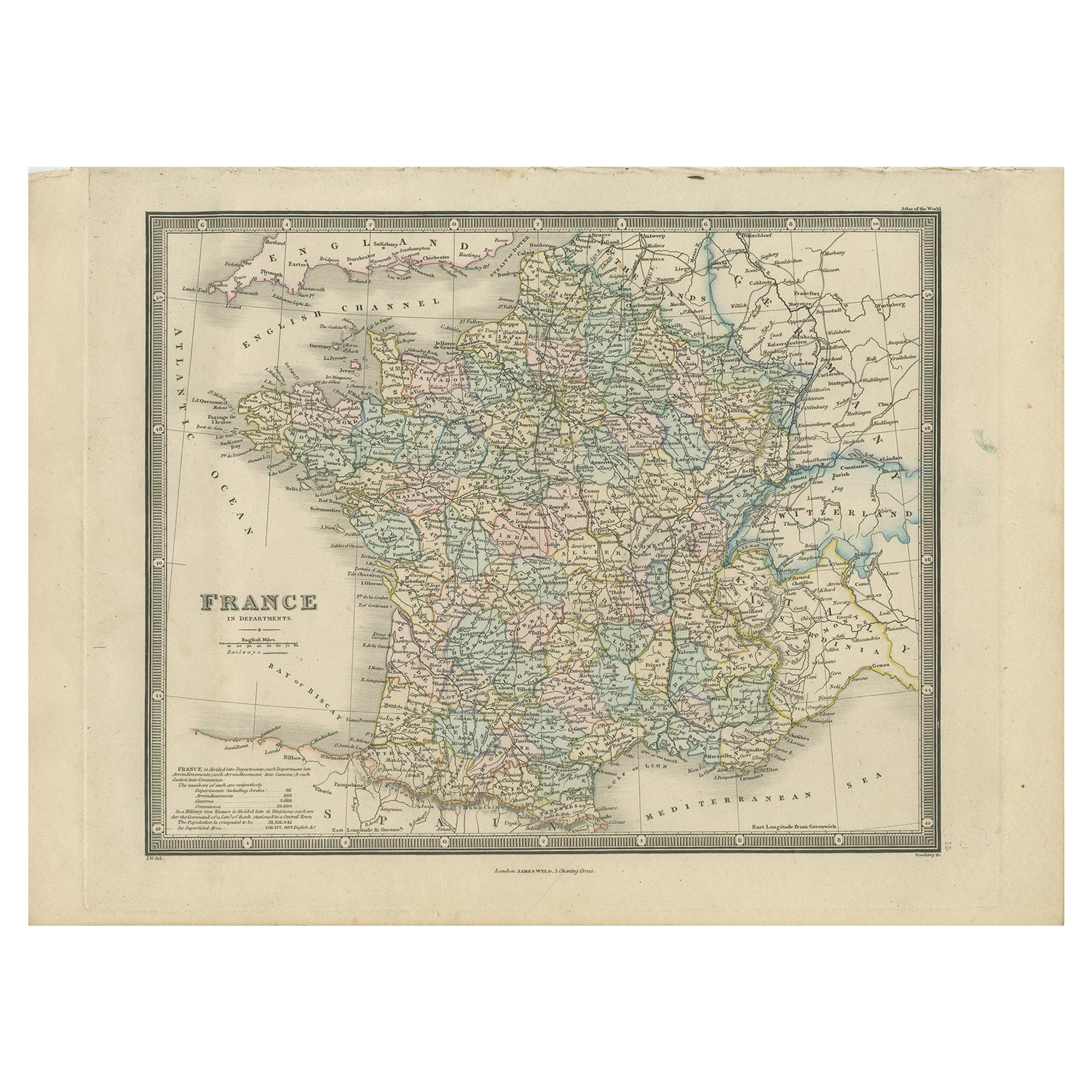
1859 Classic Map of France: Blackie's Imperial Geographic Masterpiece
Located in Langweer, NL
The "Antique Map of France" from 'The Imperial Atlas of Modern Geography', published in 1859 by W. G. Blackie, is a historically valuable cartographic work that offers a comprehensiv...
Category
Antique Mid-19th Century Maps
Materials
Paper

$224 Sale Price
25% Off
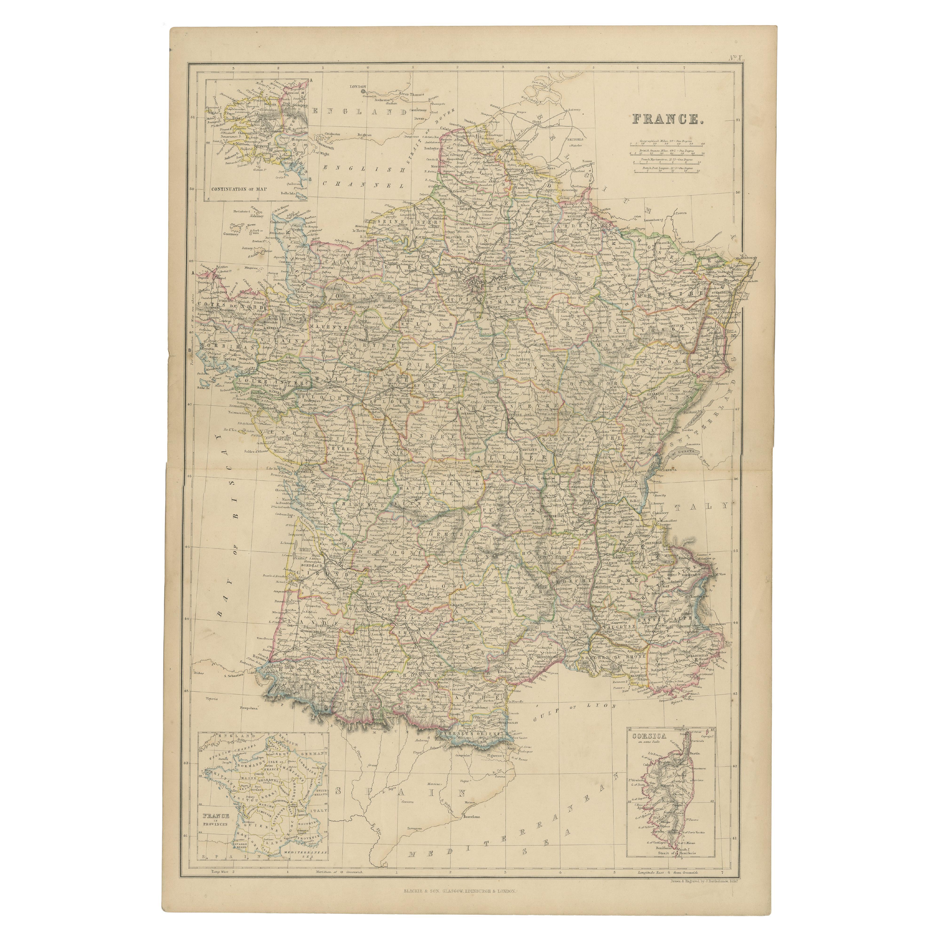
Antique Map of France in Departments by Wyld '1845'
Located in Langweer, NL
Antique map titled 'France in Departments'. Original antique map of France. This map originates from 'An Atlas of the World, Comprehending Separate Maps of its...
Category
Antique Mid-19th Century Maps
Materials
Paper

$191 Sale Price
20% Off
You May Also Like
Large 19th Century Map of France
Located in Pease pottage, West Sussex
Large 19th Century Map of France.
Remarkable condition, with a pleasing age worn patina.
Recently framed.
France Circa 1874.
Category
Antique Late 19th Century French Maps
Materials
Linen, Paper

France, Northern Part. Century Atlas antique map
Located in Melbourne, Victoria
'The Century Atlas. France, Northern Part.'
Original antique map, 1903.
Inset maps of 'France in Provinces' and 'Paris and Vicinity'.
Central fold as issued. Map name and number pr...
Category
Early 20th Century Victorian More Prints
Materials
Lithograph

Map of France - Etching - 1820
Located in Roma, IT
Map of France is an Original Etching realized by an unknown artist of 19th century in 1820.
Very good condition on two sheets of white paper joined at t...
Category
1820s Modern Figurative Prints
Materials
Etching

France in Departments - Lithograph - 1872
Located in Roma, IT
France in Departments is a map realized by an artist of the 19th century.
Lithograph, printed in 1872 by Milliam Mackenzie, London.
Category
1870s Modern Figurative Prints
Materials
Lithograph
France in Departments - Lithograph - 1872
Located in Roma, IT
France in Departments is an artwork realized by an artist of the 19th century.
Lithograph, printed in 1872 by Milliam Mackenzie, London.
Good condition.
Category
1870s Modern Figurative Prints
Materials
Lithograph

Antique Map of France
Located in Dallas, TX
Nice antique map of France in wood frame. This would make a great gift for a collector. A wonderful accessory!
Category
Early 20th Century Decorative Art
Materials
Glass, Wood, Paper

$1,760
More Ways To Browse
Caribbean Antiques
Antique Map Of Ireland
Ships Log
Map Of Egypt
Nautical Maps
Antique Maps Of Long Island
James Cook Map
Antique Doctors Office Furniture
Pirate Furniture
Railroad Collectibles
Antique Map Mexico
Framed Map Of Paris
Antique Map Of Rome
Used Nautical Charts
Antique Navigator
Map Of Middle East
Antique Map Of Switzerland
World Map Copper