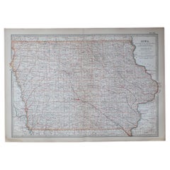
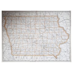
Items Similar to Antique Map of Iowa and Nebraska by Johnson, '1872'
Want more images or videos?
Request additional images or videos from the seller
1 of 5
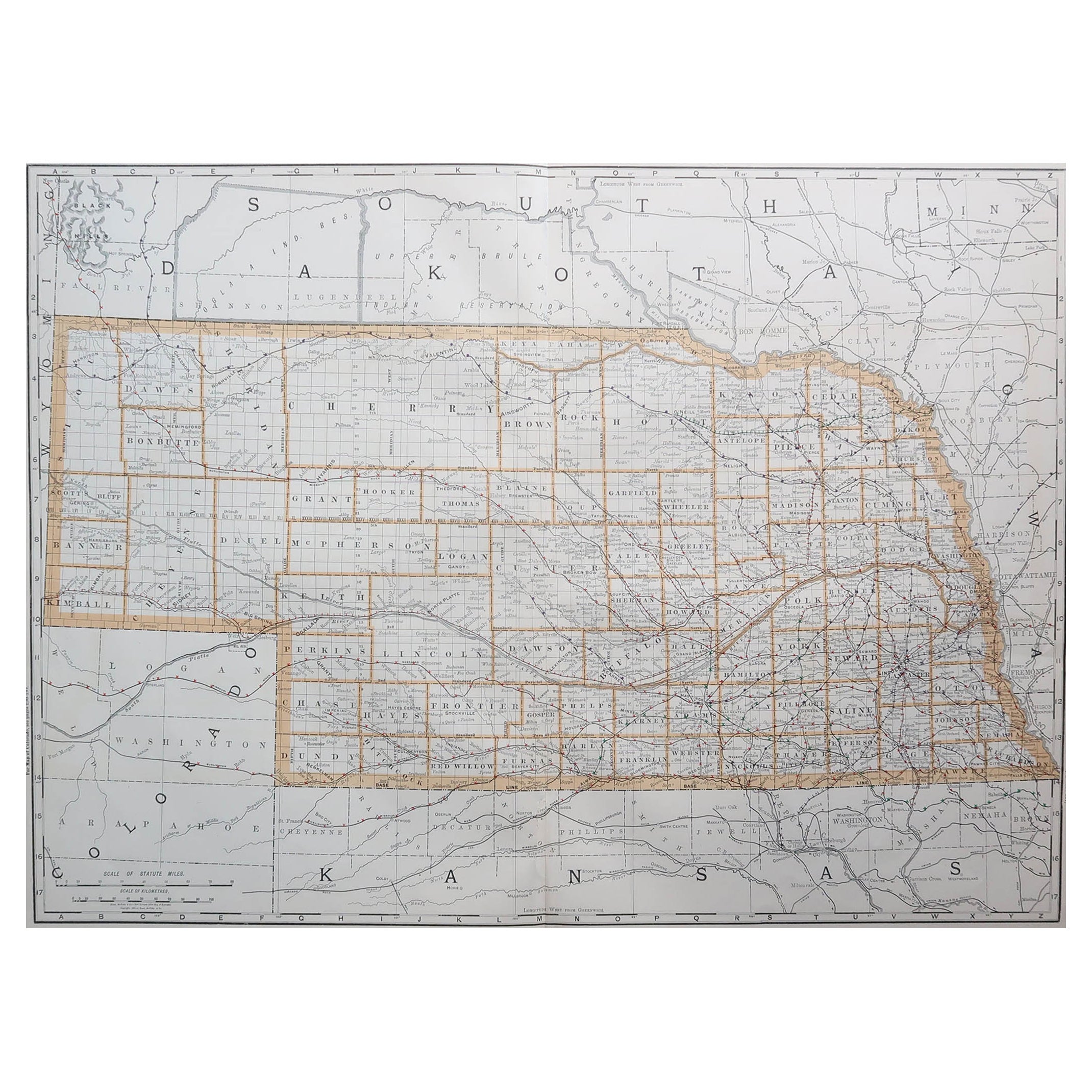
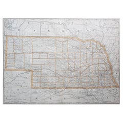
Antique Map of Iowa and Nebraska by Johnson, '1872'
$239.63
$299.5420% Off
£178.35
£222.9420% Off
€200
€25020% Off
CA$328.23
CA$410.2920% Off
A$365.07
A$456.3320% Off
CHF 190.63
CHF 238.2820% Off
MX$4,442.45
MX$5,553.0720% Off
NOK 2,434.58
NOK 3,043.2220% Off
SEK 2,283.21
SEK 2,854.0120% Off
DKK 1,522.53
DKK 1,903.1620% Off
Shipping
Retrieving quote...The 1stDibs Promise:
Authenticity Guarantee,
Money-Back Guarantee,
24-Hour Cancellation
About the Item
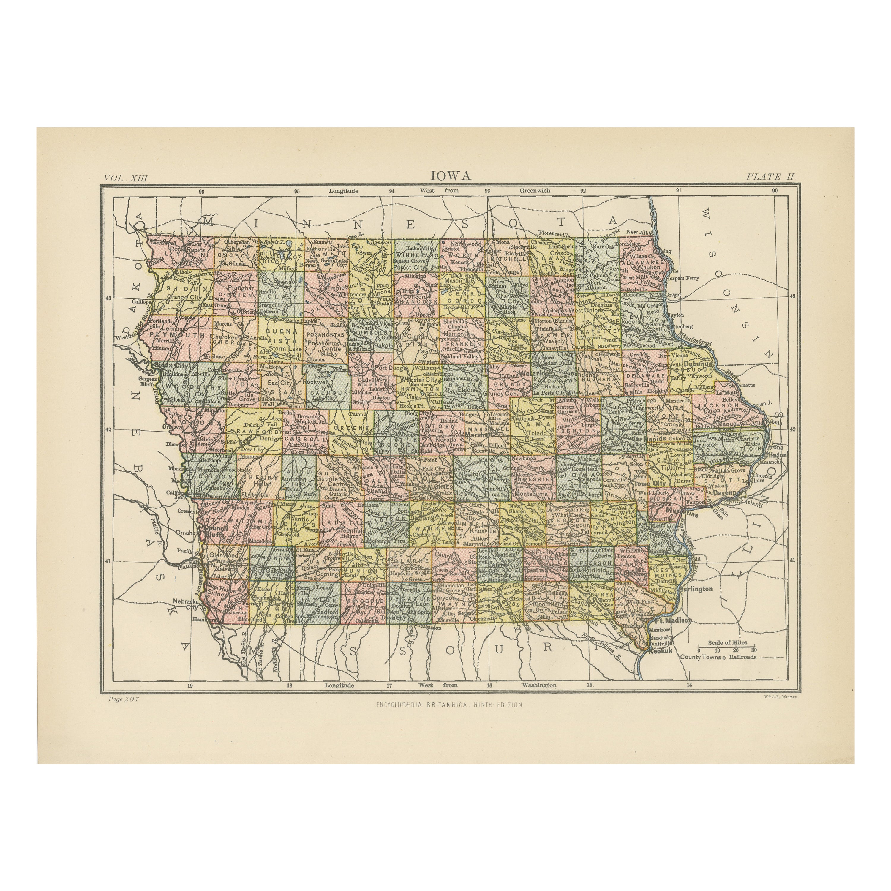
Antique map titled 'Johnson's Iowa and Nebraska'. Original map of Iowa and Nebraska. This map originates from 'Johnson's New Illustrated Family Atlas of the World' by A.J. Johnson. Published 1872.
- Dimensions:Height: 17.92 in (45.5 cm)Width: 26.38 in (67 cm)Depth: 0.02 in (0.5 mm)
- Materials and Techniques:
- Period:
- Date of Manufacture:1872
- Condition:General age-related toning, shows minor wear and creasing. Some soiling. Original folding line. English text on verso. Please study images carefully.
- Seller Location:Langweer, NL
- Reference Number:Seller: BG-12592-531stDibs: LU3054321468442
About the Seller
5.0
Recognized Seller
These prestigious sellers are industry leaders and represent the highest echelon for item quality and design.
Platinum Seller
Premium sellers with a 4.7+ rating and 24-hour response times
Established in 2009
1stDibs seller since 2017
2,508 sales on 1stDibs
Typical response time: <1 hour
- ShippingRetrieving quote...Shipping from: Langweer, Netherlands
- Return Policy
Authenticity Guarantee
In the unlikely event there’s an issue with an item’s authenticity, contact us within 1 year for a full refund. DetailsMoney-Back Guarantee
If your item is not as described, is damaged in transit, or does not arrive, contact us within 7 days for a full refund. Details24-Hour Cancellation
You have a 24-hour grace period in which to reconsider your purchase, with no questions asked.Vetted Professional Sellers
Our world-class sellers must adhere to strict standards for service and quality, maintaining the integrity of our listings.Price-Match Guarantee
If you find that a seller listed the same item for a lower price elsewhere, we’ll match it.Trusted Global Delivery
Our best-in-class carrier network provides specialized shipping options worldwide, including custom delivery.More From This Seller
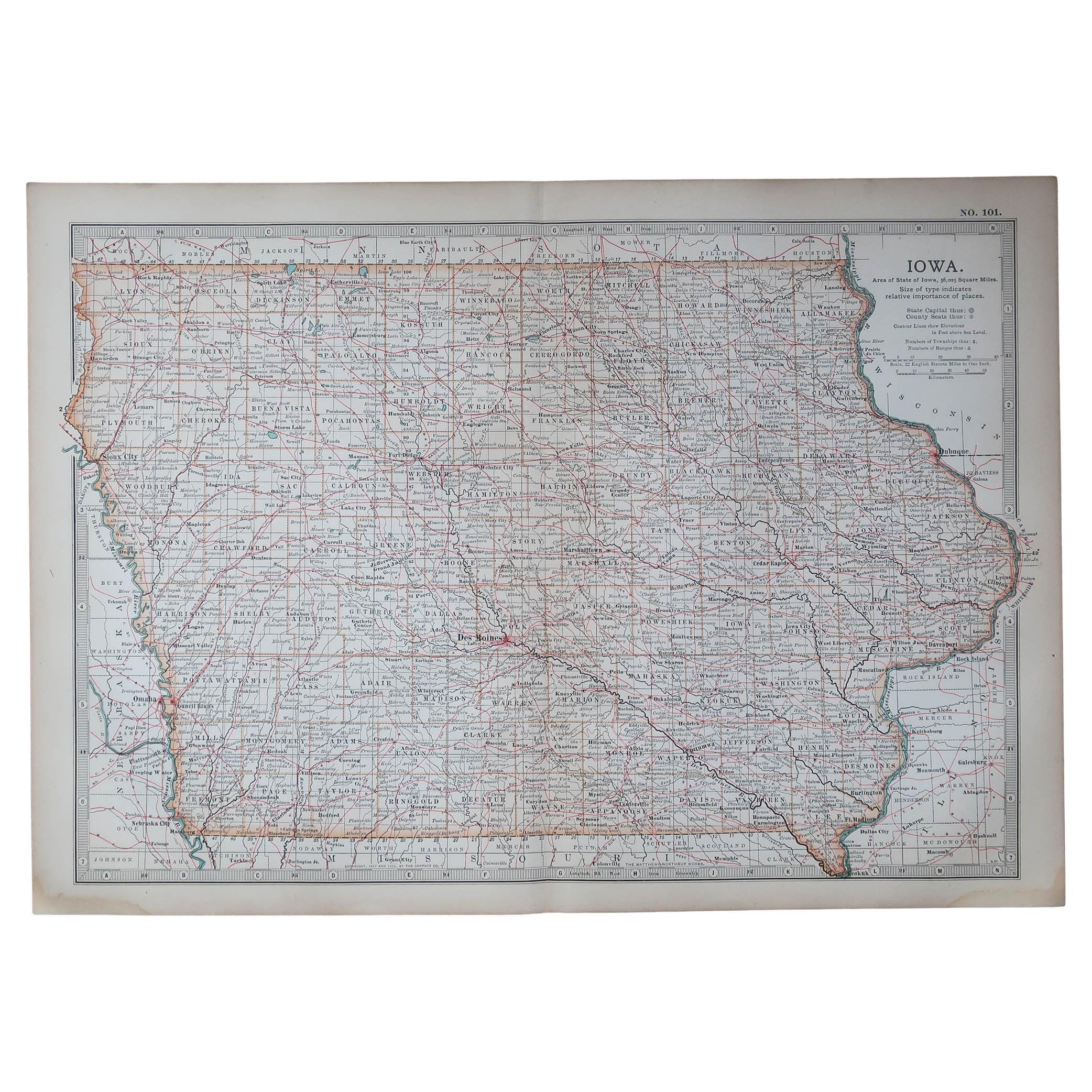
View AllAntique Map of Iowa
Located in Langweer, NL
Antique map titled 'Iowa'. Original antique map of Iowa, United States. This print originates from 'Encyclopaedia Britannica', Ninth Edition. Published 188...
Category
Antique Late 19th Century Maps
Materials
Paper
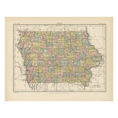
$277 Sale Price
20% Off
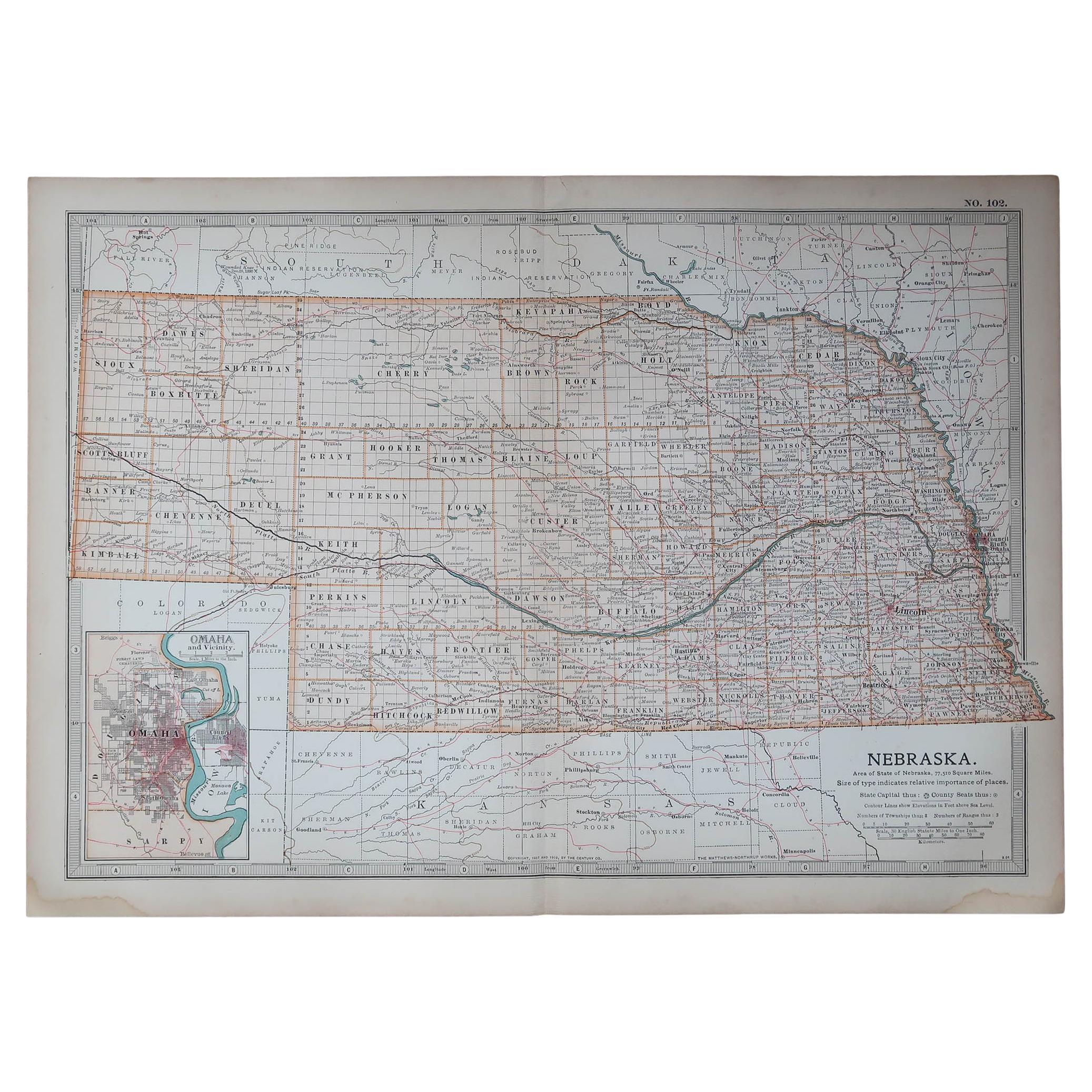
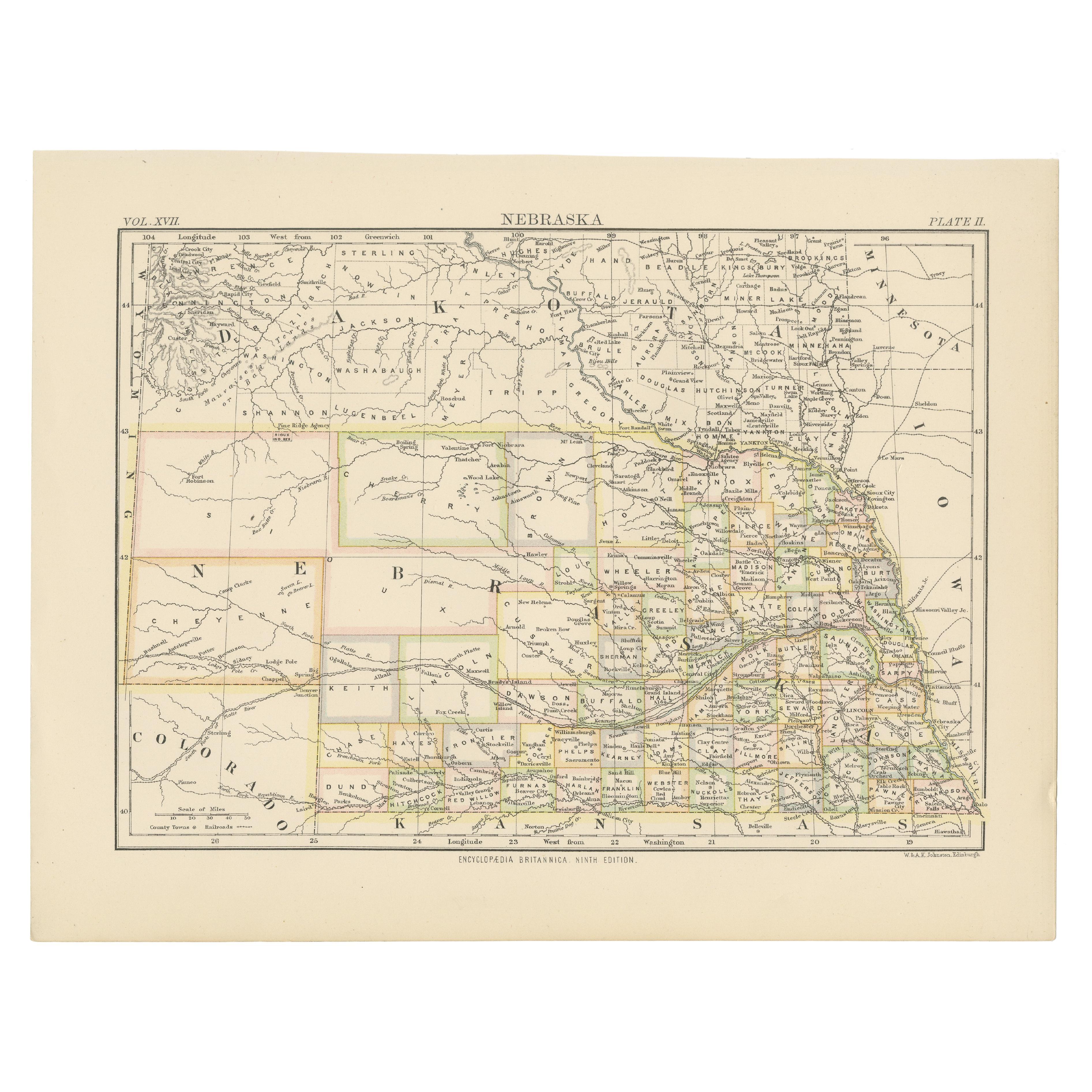
Antique Map of Nebraska
Located in Langweer, NL
Antique map titled 'Nebraska'. Original antique map of Nebraska, United States. This print originates from 'Encyclopaedia Britannica', Ninth Edition. Pu...
Category
Antique Late 19th Century Maps
Materials
Paper

$277 Sale Price
20% Off
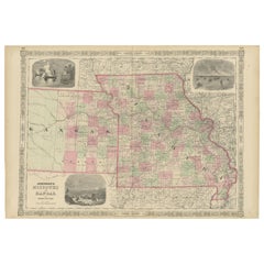
Historic Map of Missouri and Kansas Showing Railroads and Frontier Trails, 1864
Located in Langweer, NL
Antique 1864 Map of Missouri and Kansas by Johnson and Ward
Description:
This finely detailed and vibrantly hand-colored map of Missouri and Kansas, publ...
Category
Antique 1860s Maps
Materials
Paper
Antique Map of Western States, Michigan, Wisconsin, Iowa by A & C. Black, 1870
Located in Langweer, NL
Antique map titled 'Western States, Michigan, Wisconsin, Minnesota, Iowa with portions of Illinois & Indiana'. Original antique map of Western States, Michigan, Wisconsin, Minnesota,...
Category
Antique Late 19th Century Maps
Materials
Paper
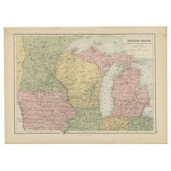
$167 Sale Price
20% Off
Antique Map of Indiana by Johnson, 1872
Located in Langweer, NL
Antique map titled 'Johnson's Indiana'. Original map of Indiana. This map originates from 'Johnson's New Illustrated Family Atlas of the World' by A.J. ...
Category
Antique Late 19th Century Maps
Materials
Paper

$179 Sale Price
40% Off
Antique Map of Illinois by Johnson, 1872
Located in Langweer, NL
Antique map titled 'Johnson's Illinois'. Original map of Illinois. This map originates from 'Johnson's New Illustrated Family Atlas of the World' by A....
Category
Antique Late 19th Century Maps
Materials
Paper
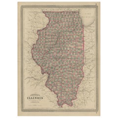
$239 Sale Price
20% Off
You May Also Like
Original Antique Map of the American State of Iowa, 1903
Located in St Annes, Lancashire
Antique map of Iowa
Published By A & C Black. 1903
Original colour
Good condition
Unframed.
Free shipping
Category
Antique Early 1900s English Maps
Materials
Paper
Large Original Antique Map of Iowa, USA, 1894
By Rand McNally & Co.
Located in St Annes, Lancashire
Fabulous map of Iowa.
Original color.
By Rand, McNally & Co.
Published, 1894.
Unframed.
Free shipping.
Category
Antique 1890s American Maps
Materials
Paper
Original Antique Map of the American State of Nebraska, 1903
Located in St Annes, Lancashire
Antique map of Nebraska
Published By A & C Black. 1903
Original colour
Good condition
Unframed.
Free shipping
Category
Antique Early 1900s English Maps
Materials
Paper

Large Original Antique Map of Nebraska, USA, 1894
By Rand McNally & Co.
Located in St Annes, Lancashire
Fabulous map of Nebraska
Original color
By Rand, McNally & Co.
Published, 1894
Unframed
Some slight restoration to the Gosper / Furnas area. Seen in the last image
Free shipping.
Category
Antique 1890s American Maps
Materials
Paper
Original Antique Map of the American State of Missouri ( Northern part ), 1903
Located in St Annes, Lancashire
Antique map of Missouri ( Northern Part )
Published By A & C Black. 1903
Original colour
Good condition
Unframed.
Free shipping
Category
Antique Early 1900s English Maps
Materials
Paper

Original Antique Map of the American State of Kansas, 1903
Located in St Annes, Lancashire
Antique map of Kansas
Published By A & C Black. 1903
Original colour
Good condition
Unframed.
Free shipping
Category
Antique Early 1900s English Maps
Materials
Paper
More Ways To Browse
Map Greece
Roman Map
Antique Maps Of Russia
Antique Roman Map
Maps Of Mediterranean
Mercator Map
Antique Railroad Furniture
Atlas Globe
Antique Mississippi Furniture
Framed World Map
Hand Drawn Map
Rare Compass
Antique Furniture Rollers
16th Century Scotland
Antique Wood Coat Of Arms
Antique Maps Australia
Antique Quadrant
Caribbean Antique Furniture