Items Similar to Antique Map of Italy by Keizer & de Lat, 1788

Want more images or videos?
Request additional images or videos from the seller
1 of 5
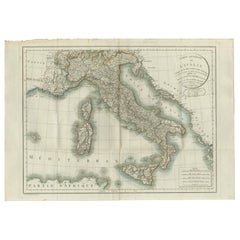
Antique Map of Italy by Keizer & de Lat, 1788
$314.18
$419.7125% Off
£233.72
£312.2225% Off
€262
€35025% Off
CA$430.23
CA$574.7325% Off
A$478.35
A$639.0225% Off
CHF 249.77
CHF 333.6625% Off
MX$5,822.73
MX$7,778.4525% Off
NOK 3,186.95
NOK 4,257.3825% Off
SEK 2,986.02
SEK 3,988.9625% Off
DKK 1,994.46
DKK 2,664.3625% Off
Shipping
Retrieving quote...The 1stDibs Promise:
Authenticity Guarantee,
Money-Back Guarantee,
24-Hour Cancellation
About the Item
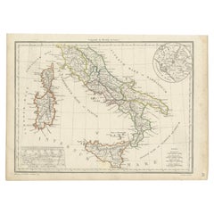
Antique map titled 'Kaart van Italie (..)'. Uncommon original antique map of Italy. This map originates from 'Nieuwe Natuur- Geschied- en Handelkundige Zak- en Reisatlas' by Gerrit Brender à Brandis. Published by J. Keizer and I. de Lat, 1788.
- Dimensions:Height: 8.08 in (20.5 cm)Width: 10.83 in (27.5 cm)Depth: 0.02 in (0.5 mm)
- Materials and Techniques:
- Period:
- Date of Manufacture:1788
- Condition:General age-related toning. Original folding lines. Original/contemporary hand coloring, blank verso. Minor wear, please study image carefully.
- Seller Location:Langweer, NL
- Reference Number:Seller: BG-12854-451stDibs: LU3054321978902
About the Seller
5.0
Recognized Seller
These prestigious sellers are industry leaders and represent the highest echelon for item quality and design.
Platinum Seller
Premium sellers with a 4.7+ rating and 24-hour response times
Established in 2009
1stDibs seller since 2017
2,510 sales on 1stDibs
Typical response time: <1 hour
- ShippingRetrieving quote...Shipping from: Langweer, Netherlands
- Return Policy
Authenticity Guarantee
In the unlikely event there’s an issue with an item’s authenticity, contact us within 1 year for a full refund. DetailsMoney-Back Guarantee
If your item is not as described, is damaged in transit, or does not arrive, contact us within 7 days for a full refund. Details24-Hour Cancellation
You have a 24-hour grace period in which to reconsider your purchase, with no questions asked.Vetted Professional Sellers
Our world-class sellers must adhere to strict standards for service and quality, maintaining the integrity of our listings.Price-Match Guarantee
If you find that a seller listed the same item for a lower price elsewhere, we’ll match it.Trusted Global Delivery
Our best-in-class carrier network provides specialized shipping options worldwide, including custom delivery.More From This Seller
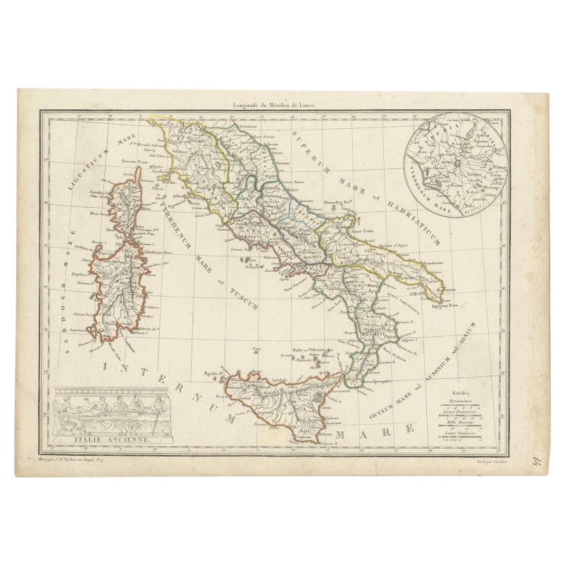
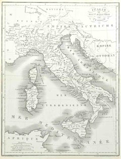
View AllAntique Map of Italy with an Inset of Rome, 1812
Located in Langweer, NL
Antique map titled 'Italie Ancienne'.
Old map of ancient Italy, with an inset map of the region of Rome. This map originates from 'Atlas Supplementaire du Precis de la Geographie...
Category
Antique 19th Century Maps
Materials
Paper
$153 Sale Price
20% Off
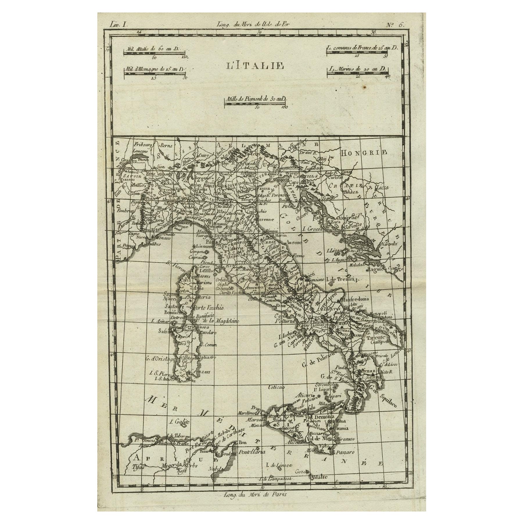
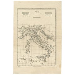
Antique Map of Italy, Corsica, Sardinia and Sicily, ca.1780
Located in Langweer, NL
Description: Antique map titled 'L'Italie.'
Map of Italy, Corsica, Sardinia and Sicily. Highly detailed, showing towns, rivers, some topographical features and political boundari...
Category
Antique 1780s Maps
Materials
Paper

$306 Sale Price
20% Off
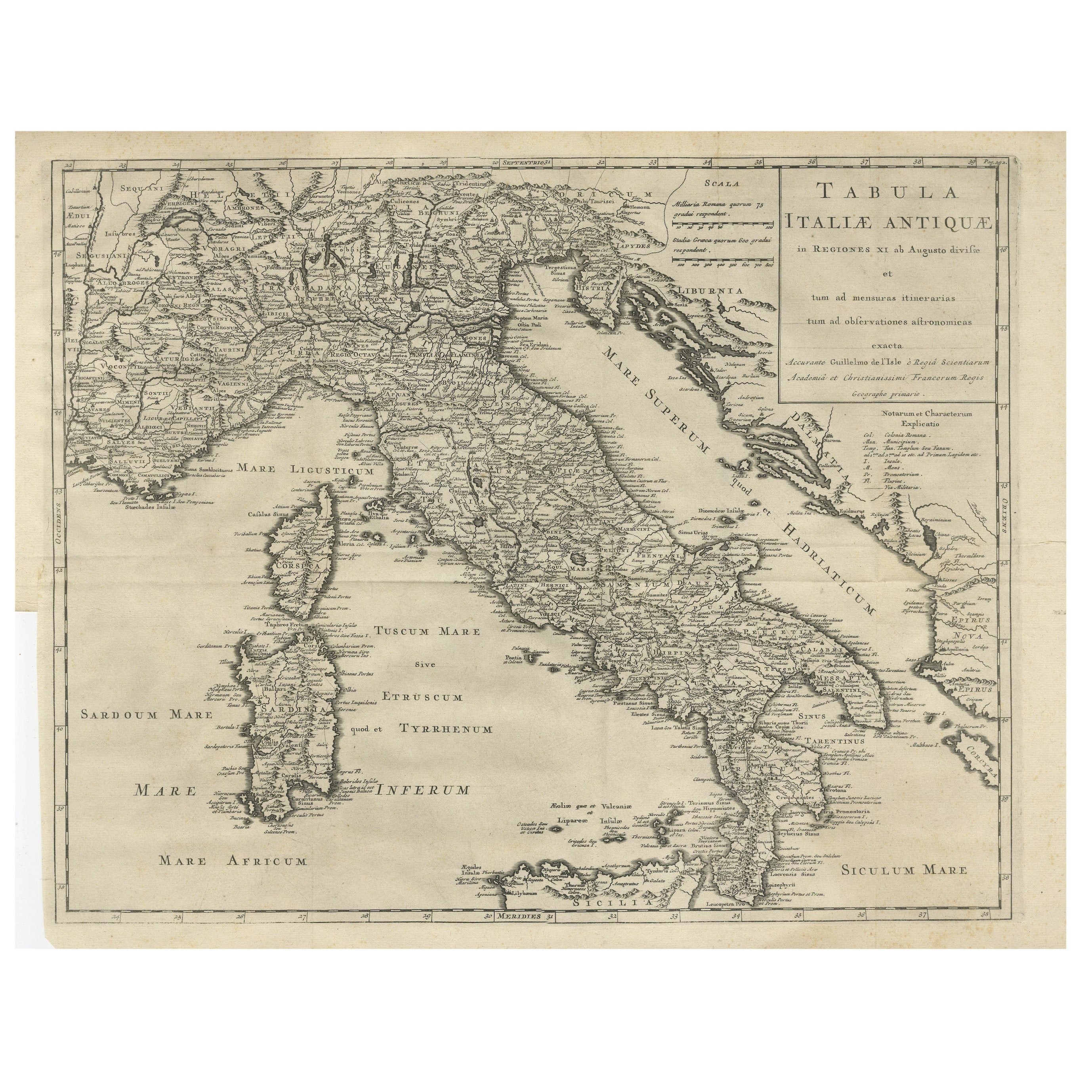
Antique Engraved Map of Italy in Roman Times, ca.1730
Located in Langweer, NL
Plain engr. map of Italy according to the division of Emperor Augustus by G. Delisle.
Title: "Tabula Italiae Antiquae In Regiones XI Ab Augusto Divisae Et Tum Ad Mensuras Itinerari...
Category
Antique 1730s Maps
Materials
Paper
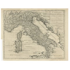
$652 Sale Price
20% Off
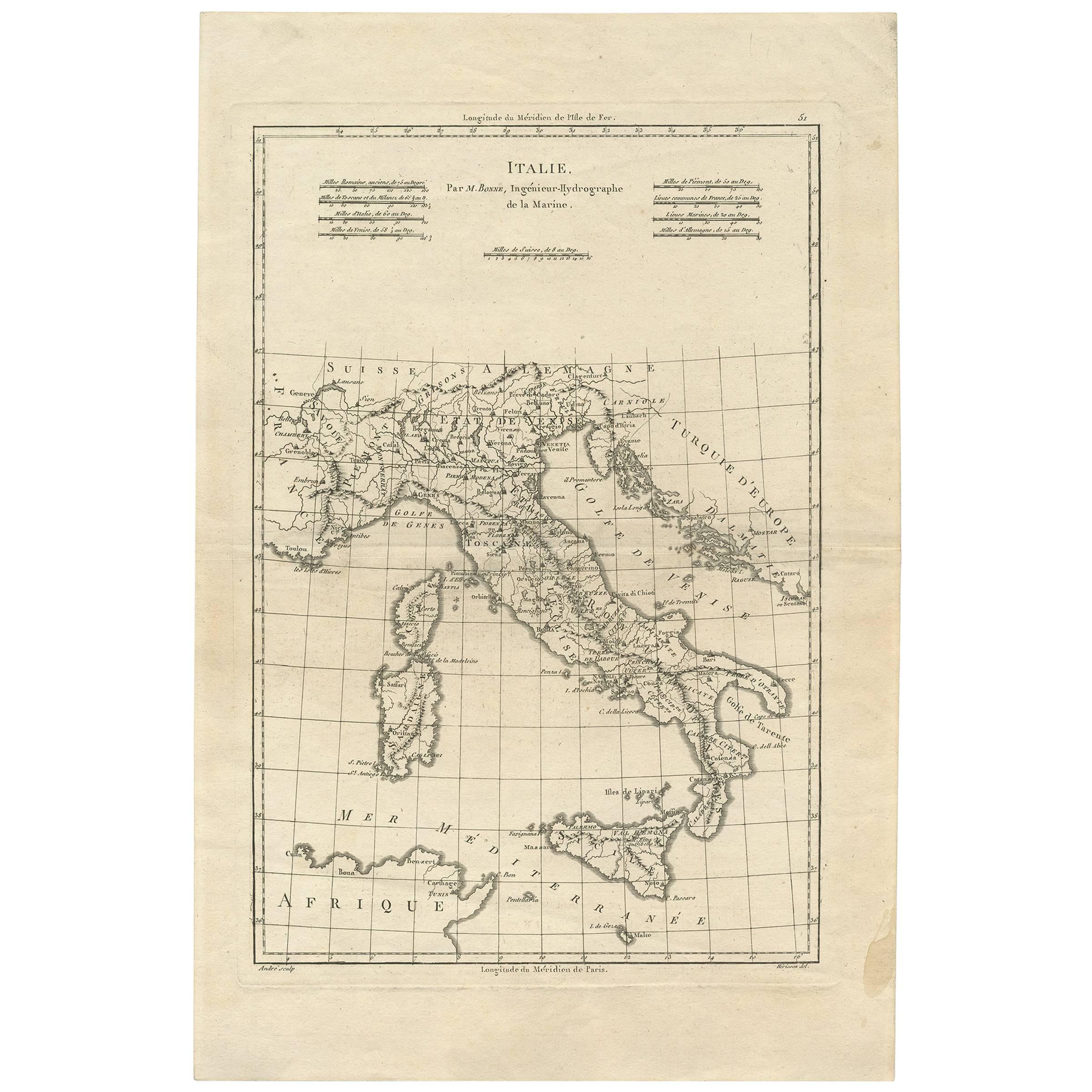
Antique Map of Italy by R. Bonne, circa 1780
Located in Langweer, NL
Beautiful map of Italy, Corsica, Sardinia and Sicily. Highly detailed, showing towns, rivers, some topographical features and political boundaries. Published by R. Bonne, circa 1780.
Category
Antique Late 18th Century French Maps
Materials
Paper
$287 Sale Price
20% Off
Antique Map of Italy, Showing Corsica, Sardinia, Croatia, Malta and More, C.1740
Located in Langweer, NL
Antique map titled 'Nieuwe Kaart van Italie na de Nieuwste waarnemingen van de l'Isle en andere.'
Attractive detailed map showing Italy as well as Corsica, Sardinia, Minorca, Croat...
Category
Antique 18th Century Maps
Materials
Paper

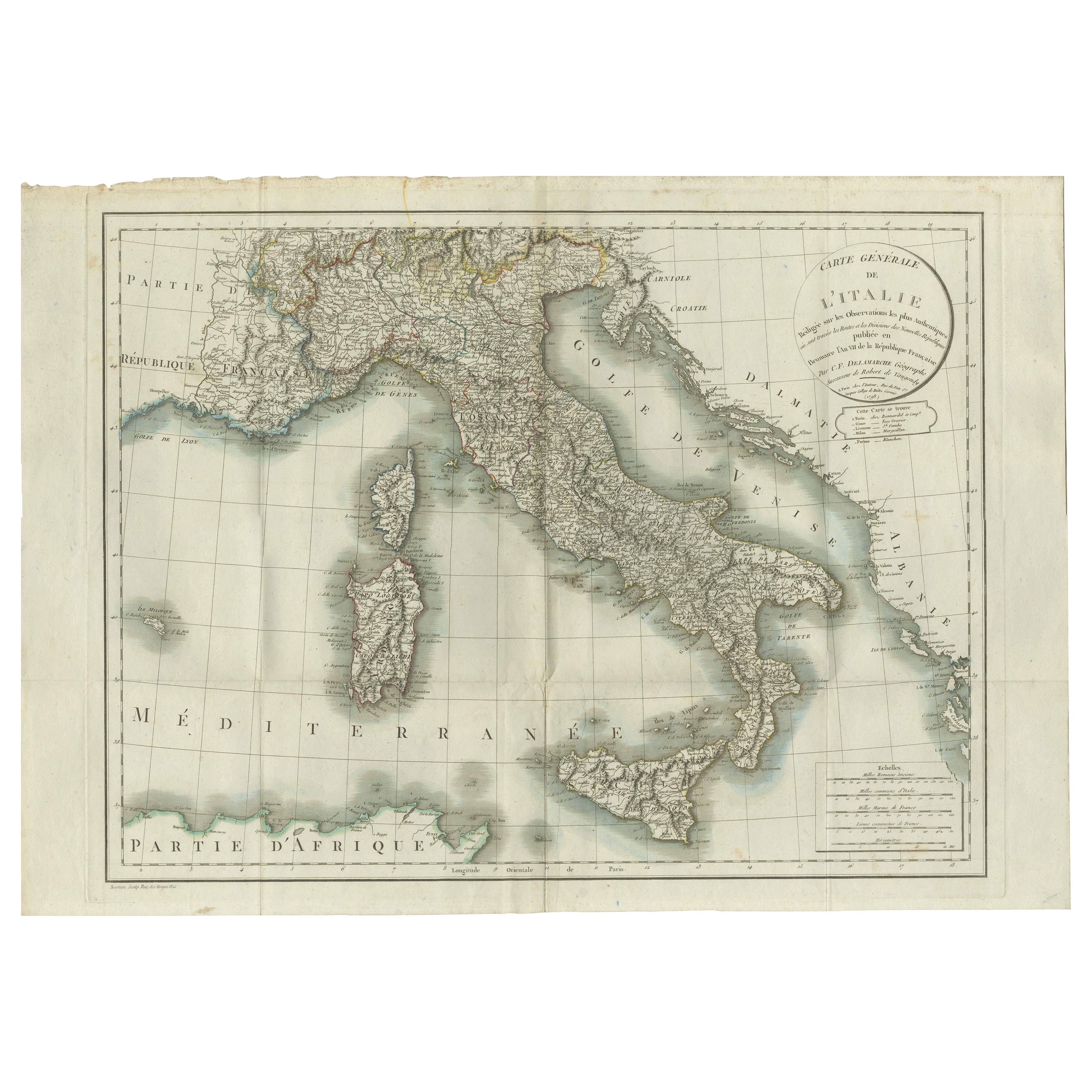
Map of Italy and Neighboring Regions by Delamarche – Antique Map, c.1800
Located in Langweer, NL
Antique Map of Italy and Surrounding Regions by Delamarche, circa 1800
This elegant and detailed antique map titled Carte Générale de l’Italie was drawn and engraved by the French g...
Category
Antique Early 1800s French Maps
Materials
Paper
You May Also Like
Large Original Antique Map of Italy. John Dower, 1861
Located in St Annes, Lancashire
Great map of Italy
Lithograph engraving by John Dower
Original colour
Published, 1861
Unframed
Good condition / repair to top right corner seen in last image
Category
Antique 1860s English Victorian Maps
Materials
Paper

The Kingdom of Naples and Southern Italy: A Hand-Colored 18th Century Homann Map
By Johann Baptist Homann
Located in Alamo, CA
"Novissima & exactissimus Totius Regni Neapolis Tabula Presentis Belli Satui Accommo Data" is a hand colored map of southern Italy and the ancient Kingdom of Naples created by Johann...
Category
Antique Early 18th Century German Maps
Materials
Paper

Antique Map of Italy Drawn & Engraved by R. Scott for Thomsons, Edinburgh 1814
Located in London, GB
This is a magnificent museum quality antique hand-coloured map of Italy, dating from 1814.
This historic and very rare antique map was drawn and engraved by R. Scott for Thomsons, New General Atlas, Edinburgh.
The map is very detailed and the various colours - yellow, grey and green - beautifully highlight the different natural and political divisions of Italy as it was before the Italian Unification...
Category
Antique 1810s Scottish Prints
Materials
Other

Large Original Antique Map of The South of Italy. John Dower, 1861
Located in St Annes, Lancashire
Great map of the South of Italy
Lithograph engraving by John Dower
Original colour
Published, 1861
Unframed
Good condition
Free shipping
Category
Antique 1860s English Victorian Maps
Materials
Paper

Map of Italy - Etching by Pierre François Tardieu - 1837
Located in Roma, IT
Map of Italy is an Etching realized in 1837.
Good conditions.
The artwork is realized in a well-balanced composition. the artwork and belongs to the suite suite "AtlasBatt" realize...
Category
1830s Modern Figurative Prints
Materials
Lithograph
Italy, Central and Southern Part. Century Atlas antique map
Located in Melbourne, Victoria
'The Century Atlas. Italy, Central and Southern Part.'
Original antique map, 1903.
Inset maps of Sicily and Naples.
Central fold as issued. Map name an...
Category
Early 20th Century Victorian More Prints
Materials
Lithograph

More Ways To Browse
Framed World Map
Rare Compass
16th Century Scotland
Antique Wood Coat Of Arms
Antique Maps Australia
Antique Quadrant
Caribbean Antique Furniture
Antique Native American Collectibles
Turkey Map
Map Of Austria
Antique Mediterranean Map
Antique Furniture Building Plans
Map Of Ireland
18th Century Compass
18th Century Maps America
Map Of Great Britain
Miniature Maps
Antique Map New York