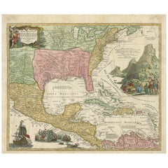
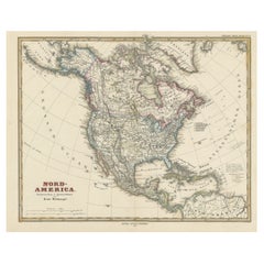
Antique Map of North America and the West Indies by Homann, circa 1720
View Similar Items


Want more images or videos?
Request additional images or videos from the seller
1 of 5
Antique Map of North America and the West Indies by Homann, circa 1720
Price:$2,000
$3,092.21List Price
About the Item
- Dimensions:Height: 21.07 in (53.5 cm)Width: 24.61 in (62.5 cm)Depth: 0.02 in (0.5 mm)
- Materials and Techniques:
- Period:
- Date of Manufacture:circa 1720
- Condition:Good, given age. Edges with several small tears, not affecting image. Some staining and light soiling in the margins. Some minor crinkles and creases. Original middle fold as issued. General age-related toning, please study images carefully.
- Seller Location:Langweer, NL
- Reference Number:Seller: PCT-598191stDibs: LU3054321362042
About the Seller
5.0
Recognized Seller
These prestigious sellers are industry leaders and represent the highest echelon for item quality and design.
Platinum Seller
Premium sellers with a 4.7+ rating and 24-hour response times
Established in 2009
1stDibs seller since 2017
2,565 sales on 1stDibs
Authenticity Guarantee
In the unlikely event there’s an issue with an item’s authenticity, contact us within 1 year for a full refund. DetailsMoney-Back Guarantee
If your item is not as described, is damaged in transit, or does not arrive, contact us within 7 days for a full refund. Details24-Hour Cancellation
You have a 24-hour grace period in which to reconsider your purchase, with no questions asked.Vetted Professional Sellers
Our world-class sellers must adhere to strict standards for service and quality, maintaining the integrity of our listings.Price-Match Guarantee
If you find that a seller listed the same item for a lower price elsewhere, we’ll match it.Trusted Global Delivery
Our best-in-class carrier network provides specialized shipping options worldwide, including custom delivery.More From This Seller
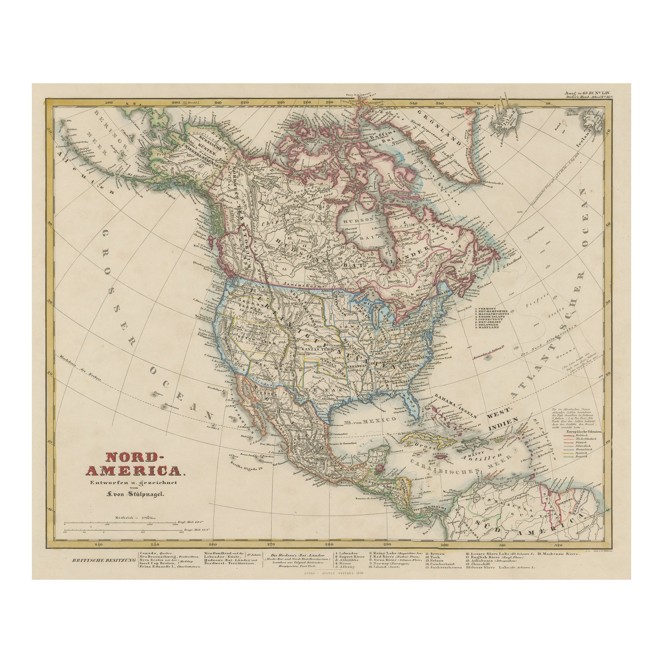
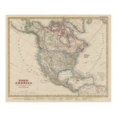
View AllAntique Map of North America Including the West Indies
Located in Langweer, NL
Original antique map titled 'Nord-America'. Old map of North America and the West Indies. Also showing British Overseas Territories and Hudson Bay.
This map originates from Stiel...
Category
Antique Mid-19th Century Maps
Materials
Paper
$551 Sale Price
20% Off
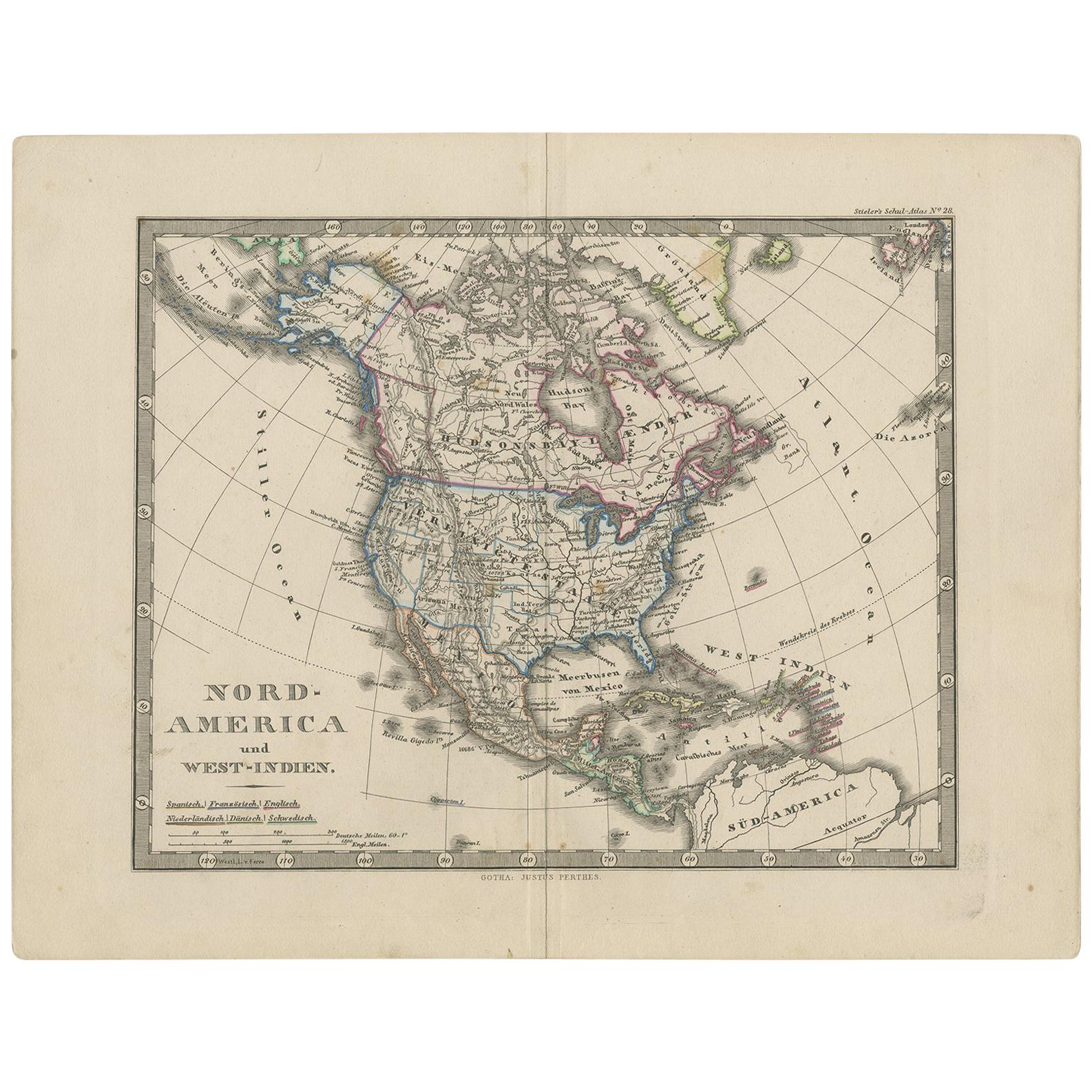
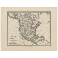
Antique Map of North America and the West Indies by Stieler, circa 1865
Located in Langweer, NL
Antique map titled 'Nord-America und West-Indien'. Old map of North America and the West Indies. This map originates from Stieler's 'Schul-Atlas'.
Category
Antique Mid-19th Century Maps
Materials
Paper
$114 Sale Price
20% Off
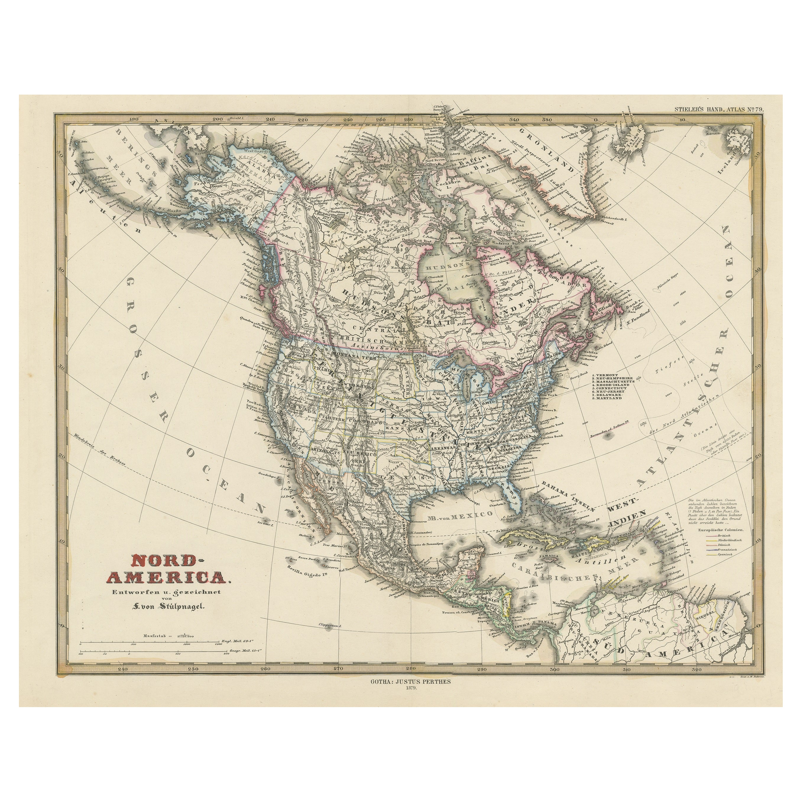
Antique Map with Hand Coloring of North America and the West Indies
Located in Langweer, NL
Original antique map titled 'Nord-America'. Old map of North America and the West Indies.
This map originates from Stielers Handatlas, published circa 1879. Stielers Handatlas (a...
Category
Antique Late 19th Century Maps
Materials
Paper
$553 Sale Price
25% Off
Free Shipping
Antique Map of the West Indies and Central America by W. G. Blackie, 1859
Located in Langweer, NL
Antique map titled 'The West India Island & Central America'. Original antique map of the West Indies and Central America, with inset map of Jamaica. Th...
Category
Antique Mid-19th Century Maps
Materials
Paper

$237 Sale Price
20% Off
Antique Map of the West Indies and Central America by Lowry '1852'
Located in Langweer, NL
Antique map titled 'West Indies and Central America'. Original map of the West Indies and Central America. This map originates from 'Lowry's Table Atlas constructed and engraved from...
Category
Antique Mid-19th Century Maps
Materials
Paper

$95 Sale Price
20% Off
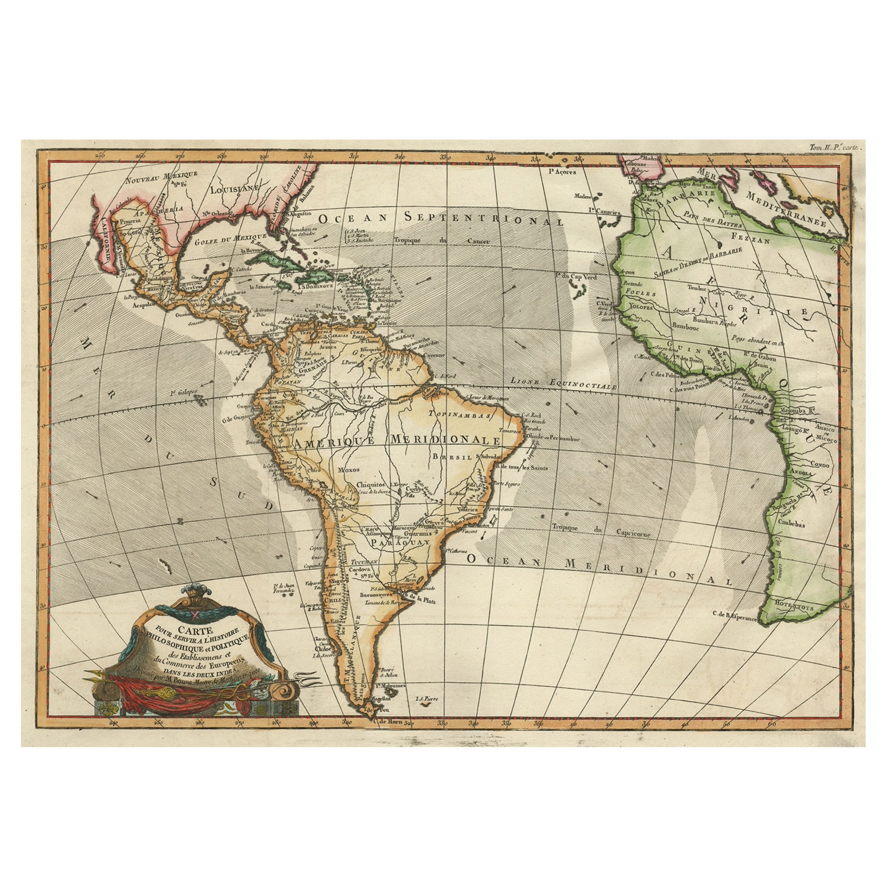
Antique Map of the Americas and West Indies by Robert de Vaugondy, 1778
Located in Langweer, NL
Antique Map of the Americas and West Indies by Robert de Vaugondy, 1778
This detailed antique map titled "Amérique ou Indes Occidentales" was published in 1778 by the renowned Frenc...
Category
Antique Late 18th Century French Maps
Materials
Paper

$1,338 Sale Price
25% Off
You May Also Like
New Map of North America from the Latest Discoveries, 1763
Located in Philadelphia, PA
A fine antique 18th century map of the North American seaboard.
Entitled "A New Map of North America from the Latest Discoveries 1763".
By the Cartographer/Engraver - John Spil...
Category
Antique Mid-18th Century English Georgian Maps
Materials
Paper

West Africa Entitled "Guinea Propria": An 18th Century Hand Colored Homann Map
By Johann Baptist Homann
Located in Alamo, CA
This is a scarce richly hand colored copper plate engraved map of Africa entitled "Guinea Propria, nec non Nigritiae vel Terrae Nigrorum Maxima Pars" by Johann Baptist Homann (1664-1...
Category
Antique Mid-18th Century German Maps
Materials
Paper

The Kingdom of Naples and Southern Italy: A Hand-Colored 18th Century Homann Map
By Johann Baptist Homann
Located in Alamo, CA
"Novissima & exactissimus Totius Regni Neapolis Tabula Presentis Belli Satui Accommo Data" is a hand colored map of southern Italy and the ancient Kingdom of Naples created by Johann...
Category
Antique Early 18th Century German Maps
Materials
Paper

Hand Colored 18th Century Homann Map of Austria Including Vienna and the Danube
By Johann Baptist Homann
Located in Alamo, CA
"Archiducatus Austriae inferioris" is a hand colored map of Austria created by Johann Baptist Homann (1663-1724) and published in Nuremberg, Germany in 1728 shortly after his death. ...
Category
Antique Early 18th Century German Maps
Materials
Paper

Cricket Print, England v. West Indies at the Oval, by Arthur Weaver
By Arthur Weaver
Located in Oxfordshire, GB
1990's Arthur Weaver Oval Cricket Ground Print, England v West Indies.
A colourful cricket lithograph signed by the artist, Arthur Weaver, of the 'Final Test' at The Oval Cricket Gr...
Category
1990s English Sporting Art Sports Equipment and Memorabilia
Materials
Paper

Hand-Colored 18th Century Homann Map of the Black Sea, Turkey and Asia Minor
By Johann Baptist Homann
Located in Alamo, CA
An attractive original early 18th century hand-colored map of the Black Sea and Turkey entitled "Carte de L'Asie Minevre ou de la Natolie et du Pont Evxin Tiree des Voyages et des Ob...
Category
Antique Early 18th Century German Maps
Materials
Paper

Recently Viewed
View AllMore Ways To Browse
Antique Maps West Indies
Antique Great Lakes Map
British East Indies
Antique Maps Of Texas
Used Furniture Corpus Christi
Nova Scotia Antique Furniture
Antique Mexican Blanket
Antique Indian Blanket Chest
Antique Furniture Santa Cruz
Used Furniture St Augustine
Antique Map Nova Scotia
West Indies Chest
Map Of Native American Tribes
Indian Trade Blanket
Antique Spanish Treasure Chest
Antique Map Chest
Map Chest
Antique Maps Scotland