Items Similar to Antique Map of Northern India by Johnston, 1867
Want more images or videos?
Request additional images or videos from the seller
1 of 5
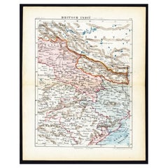
Antique Map of Northern India by Johnston, 1867
$110.38
$137.9820% Off
£82.62
£103.2820% Off
€93.60
€11720% Off
CA$151.92
CA$189.9020% Off
A$169.33
A$211.6620% Off
CHF 88.84
CHF 111.0520% Off
MX$2,067.79
MX$2,584.7320% Off
NOK 1,124.92
NOK 1,406.1520% Off
SEK 1,063.22
SEK 1,329.0320% Off
DKK 712.55
DKK 890.6920% Off
About the Item
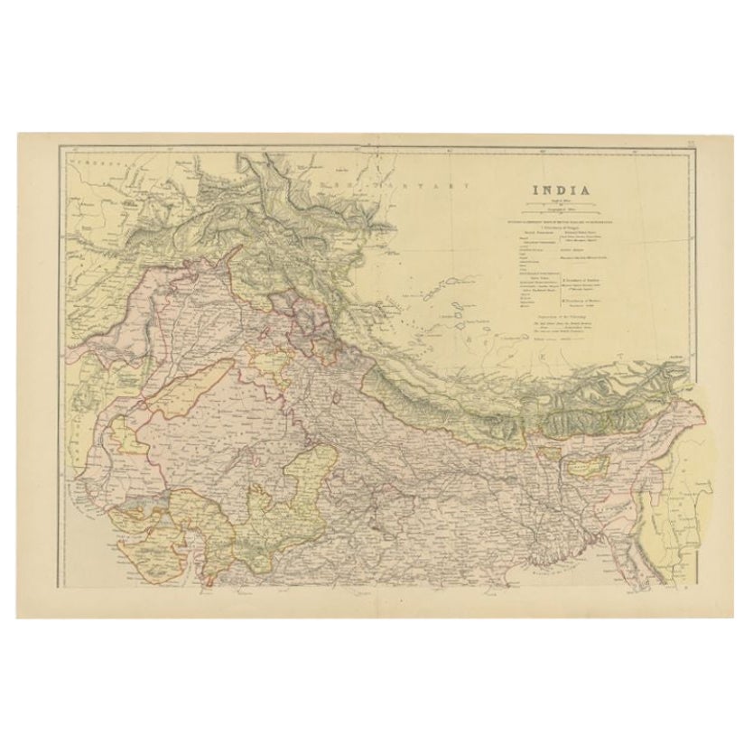
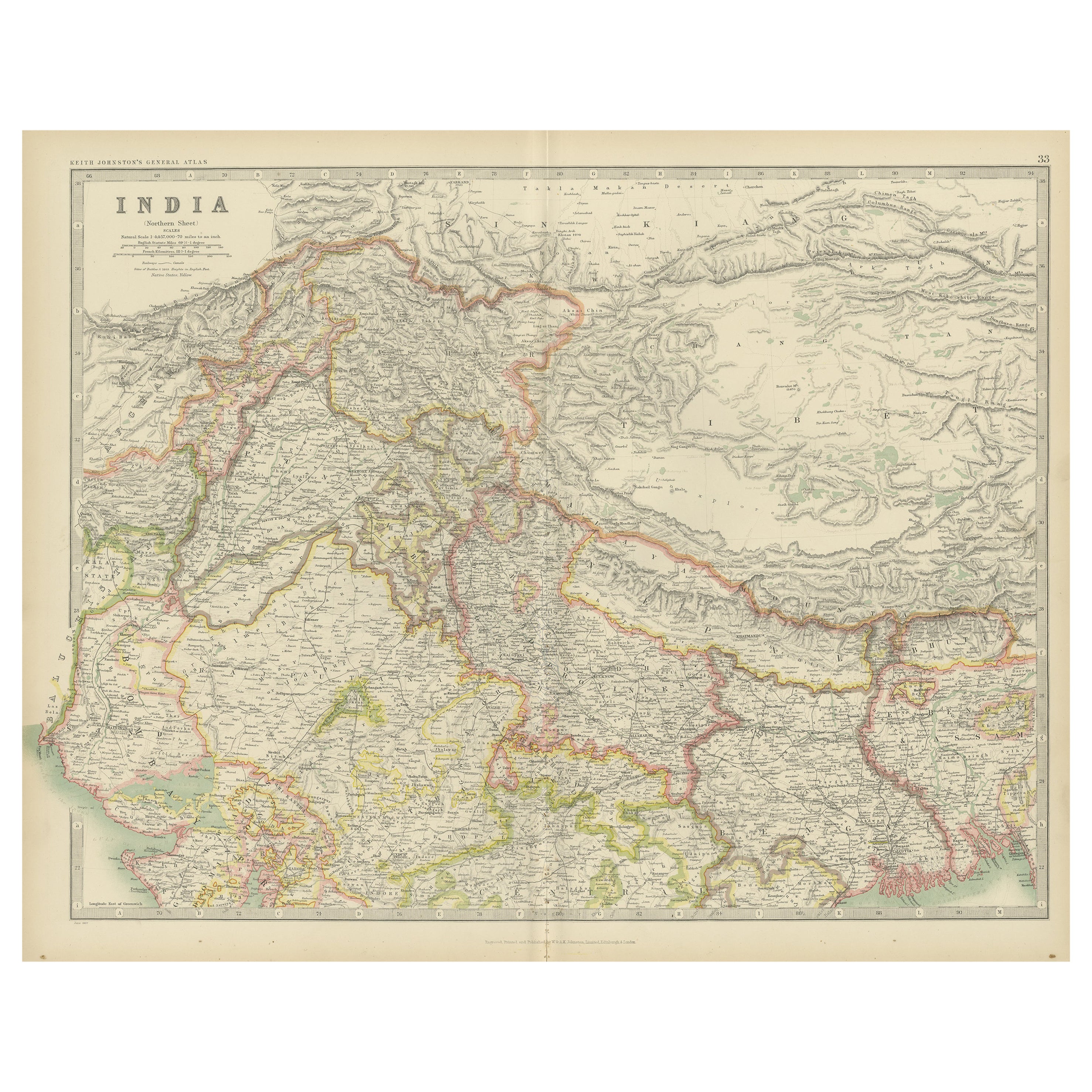
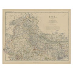
Antique map titled 'India (Northern Sheet)'. Depicting Rajputana, Bombay, Nepal and more. Originates from the 'Handy Royal Atlas of Modern Geography' by Alex Keith Johnston. Artists and Engravers: Published by W. & K. Johnston, Edinburgh and London, 1867.
Artist: Published by W. & K. Johnston, Edinburgh and London, 1867.
Condition: Very good, general age-related toning. Please study image carefully.
Date: 1867
Overall size: 47.5 x 37 cm.
Image size: 0.001 x 43.5 x 32 cm.
Antique prints have long been appreciated for both their aesthetic and investment value. They were the product of engraved, etched or lithographed plates. These plates were handmade out of wood or metal, which required an incredible level of skill, patience and craftsmanship. Whether you have a house with Victorian furniture or more contemporary decor an old engraving can enhance your living space.
- Dimensions:Height: 14.57 in (37 cm)Width: 18.71 in (47.5 cm)Depth: 0 in (0.01 mm)
- Materials and Techniques:
- Period:
- Date of Manufacture:1867
- Condition:
- Seller Location:Langweer, NL
- Reference Number:Seller: BGJC-002571stDibs: LU3054327622432
About the Seller
5.0
Recognized Seller
These prestigious sellers are industry leaders and represent the highest echelon for item quality and design.
Platinum Seller
Premium sellers with a 4.7+ rating and 24-hour response times
Established in 2009
1stDibs seller since 2017
2,513 sales on 1stDibs
Typical response time: <1 hour
- ShippingRetrieving quote...Shipping from: Langweer, Netherlands
- Return Policy
Authenticity Guarantee
In the unlikely event there’s an issue with an item’s authenticity, contact us within 1 year for a full refund. DetailsMoney-Back Guarantee
If your item is not as described, is damaged in transit, or does not arrive, contact us within 7 days for a full refund. Details24-Hour Cancellation
You have a 24-hour grace period in which to reconsider your purchase, with no questions asked.Vetted Professional Sellers
Our world-class sellers must adhere to strict standards for service and quality, maintaining the integrity of our listings.Price-Match Guarantee
If you find that a seller listed the same item for a lower price elsewhere, we’ll match it.Trusted Global Delivery
Our best-in-class carrier network provides specialized shipping options worldwide, including custom delivery.More From This Seller
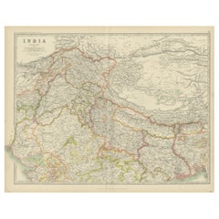
View AllAntique Map of Northern India by Blackie & Son, 1860
Located in Langweer, NL
Antique map titled 'India'. Old map depicting northern India. This map originates from 'The Comprehensive Atlas & Geography of the World, Compiled and Engraved from the most Authenti...
Category
Antique 19th Century Maps
Materials
Paper
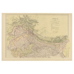
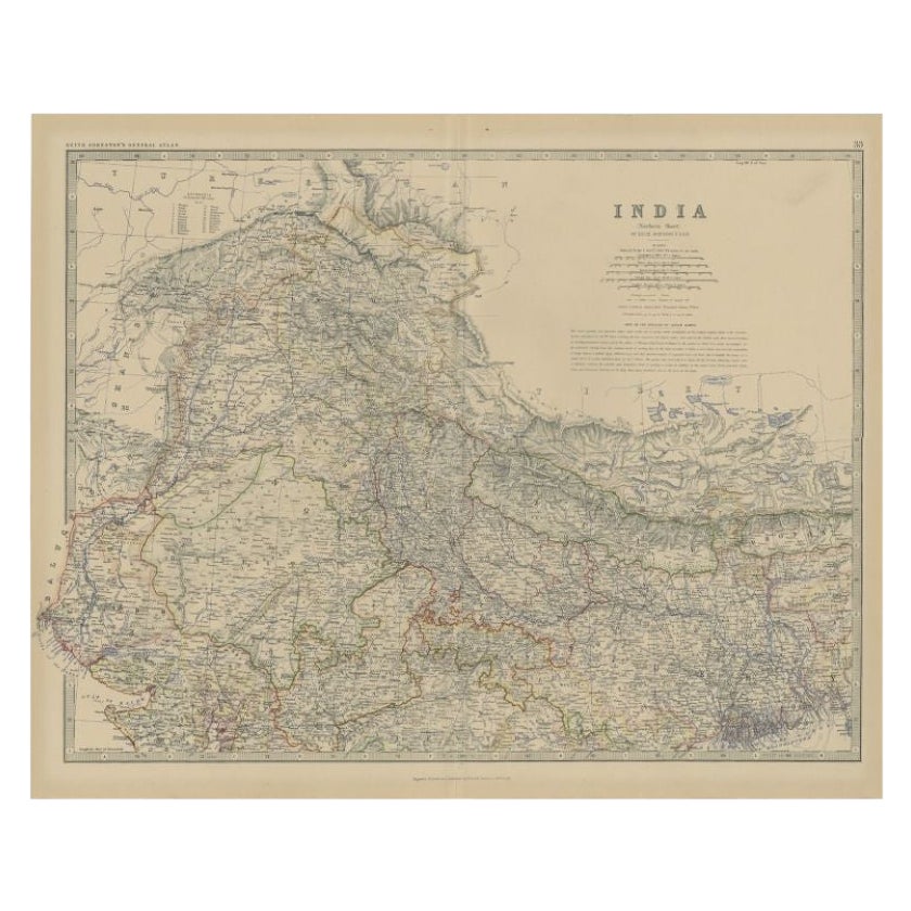
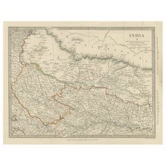
Antique Map of Northern India by Johnston, 1882
Located in Langweer, NL
Antique map titled 'India (Northern Sheet)'. Old map of Northern India. This map originates from 'The Royal Atlas of Modern Geography, Exhibiting, in a Series of Entirely Original an...
Category
Antique 19th Century Maps
Materials
Paper
$127 Sale Price
20% Off
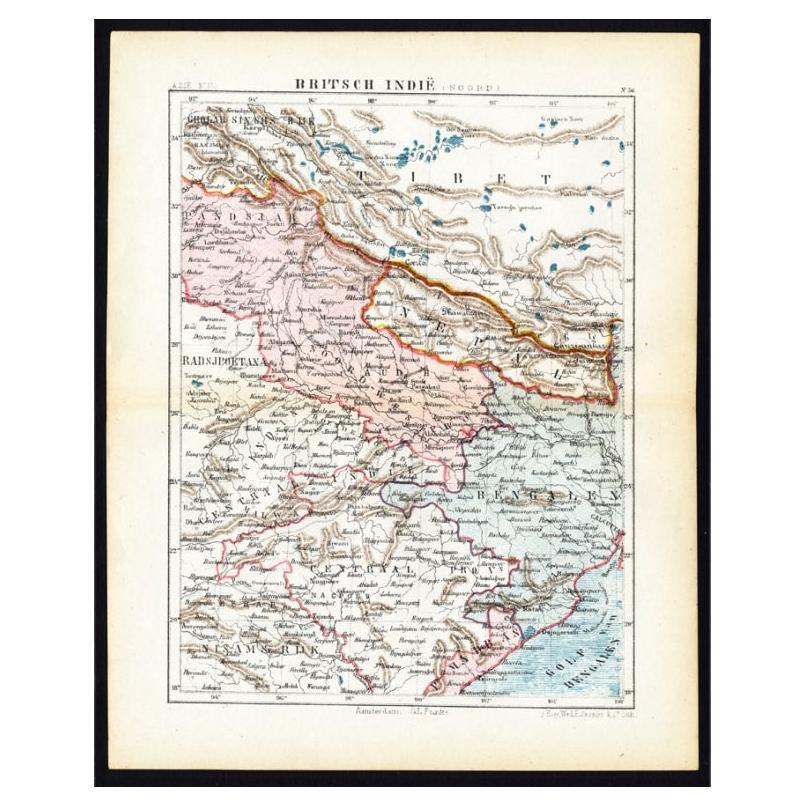
Antique Map of Northern India 'British Indies', C.1880
Located in Langweer, NL
Plate 56 : 'Britsch-Indie, Noord.' (British Indies, North). This lithographed map originates from: 'Wereld-atlas voor Kantoor en Huiskamer' (transl: World Atlas for the office and li...
Category
Antique 19th Century Maps
Materials
Paper
$61 Sale Price
20% Off
Antique Map of India 'Northern' by Johnston '1909'
Located in Langweer, NL
Antique map titled 'India'. Original antique map of India, Northern sheet. This map originates from the ‘Royal Atlas of Modern Geography’. Published by W. & A.K. Johnston, 1909.
Category
Early 20th Century Maps
Materials
Paper
$235 Sale Price
20% Off
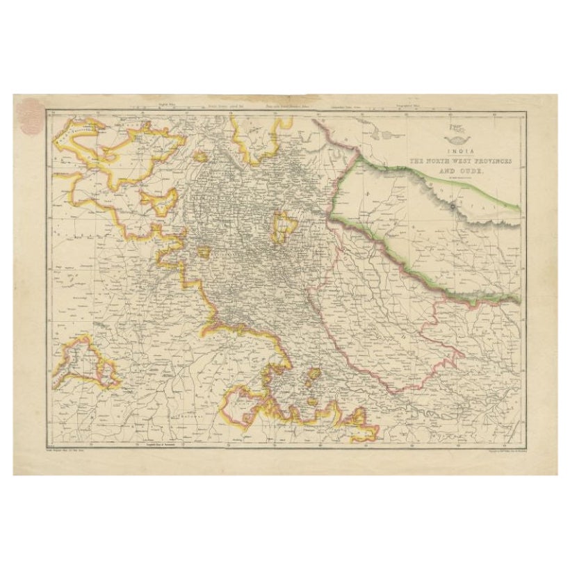
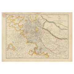
Antique Map of Northwestern India by Weller, 1857
Located in Langweer, NL
Antique map titled 'India, The North West Provinces and Oude'.Detailed map of the northwestern part of India, extending to the Himalaya Mountains. Shows part of Nepal including Dharm...
Category
Antique 19th Century Maps
Materials
Paper
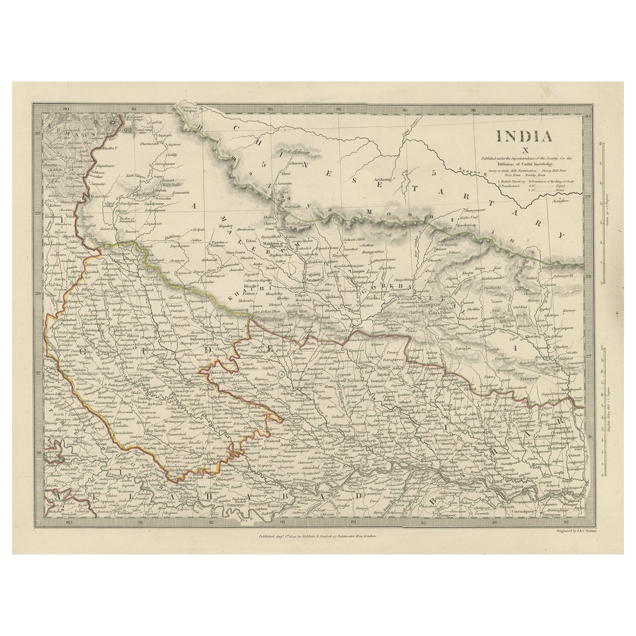
Original Antique Map of Part of the Bahar Region (India), 1834
Located in Langweer, NL
Antique map titled 'India X'. Old steel engraved map of part of the Bahar region, it also shows part of Nepal.
Artists and Engravers: Engraved by J. & C. Walker. Published under th...
Category
Antique 19th Century Maps
Materials
Paper
$273 Sale Price
20% Off
You May Also Like
Original Antique Map of India by Dower, circa 1835
Located in St Annes, Lancashire
Nice map of India
Drawn and engraved by J.Dower
Published by Orr & Smith. C.1835
Unframed.
Free shipping
Category
Antique 1830s English Maps
Materials
Paper

Large Original Vintage Map of India, circa 1920
Located in St Annes, Lancashire
Great map of India
Original color.
Good condition / repair to some minor damage just above Sri Lanka. Shown in the last image.
Published by Alexander Gross
Unframed.
Category
Vintage 1920s English Maps
Materials
Paper

India (Southern Sheet), English antique map by Alexander Keith Johnston, 1901
Located in Melbourne, Victoria
'India (Southern Sheet)', antique lithographic map by Keith Johnston.
Inset maps of 'Bombay Island & Town', 'Madras & Environs', and 'South-Eastern Provinces of India'.
Central vertical fold as issued.
495mm by 625mm (sheet)
Alexander Keith...
Category
Early 20th Century Victorian More Prints
Materials
Lithograph

1851 Map of "Independent Tartary", Ric. R018
Located in Norton, MA
1851 Map of
Independent Tartary
"Russia"
Ric.r018
A highly decorative 1851 map of Independent Tartary by John Tallis and John Rapkin. Covers the regions between the Caspian Sea and Lake Bakquash and between Russia and Afghanistan. These include the ancient Silk Route kingdoms of Khiva, Tartaria, Kokand, and Bokhara. Today this region roughly includes Kazakhstan, Uzbekistan, Turkmenistan, Kyrgyzstan, and Tajikistan. This wonderful map offers a wealth of detail for anyone with an interest in the Central Asian portion of the ancient Silk Road. Identifies various caravan routes, deserts, wells, and stopping points, including the cities of Bokhara and Samarkand. Three vignettes by W. Bragg decorate the map, these including an image of Tartars on a Journey, a horseback Bride Chase, and a tartar camp site. Surrounded by a vine motif border. Engraved by J. Rapkin for John Tallis's 1851 Illustrated Atlas .
Tartary Antique Map...
Category
Antique 19th Century Unknown Maps
Materials
Paper

Large Original Antique Map of Asia by Sidney Hall, 1847
Located in St Annes, Lancashire
Great map of Asia
Drawn and engraved by Sidney Hall
Steel engraving
Original colour outline
Published by A & C Black. 1847
Unframed
Free shipping
Category
Antique 1840s Scottish Maps
Materials
Paper

Antique 1803 Italian Map of Asia Including China Indoneseia India
Located in Amsterdam, Noord Holland
Antique 1803 Italian Map of Asia Including China Indoneseia India
Very nice map of Asia. 1803.
Additional information:
Type: Map
Country of Manufacturing: Europe
Period: 19th centu...
Category
Antique 19th Century European Maps
Materials
Paper

$584 Sale Price
20% Off
More Ways To Browse
India Engraving
Antiques Nepal
John Speed Antique Maps
Malaysia Map
Sebastian Munster
Antique Map Chile
Antique Map Of Boston
Ipswich Antique Furniture
Maps Balkans
Missouri Map
Antique Maps Of Texas
Antique Maps Virginia
Antique Railroad Scale
Jamaican Antique
Hindeloopen Furniture
Romania Map
Stanford Antique Furniture
Sardinia Map