Items Similar to Antique Map of the Rauwerderhem Township, Friesland by Halma, 1718
Want more images or videos?
Request additional images or videos from the seller
1 of 5
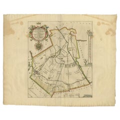
Antique Map of the Rauwerderhem Township, Friesland by Halma, 1718
$317.06
$396.3320% Off
£233.51
£291.8920% Off
€264
€33020% Off
CA$431.34
CA$539.1720% Off
A$479.31
A$599.1420% Off
CHF 251.16
CHF 313.9520% Off
MX$5,877.87
MX$7,347.3420% Off
NOK 3,203.44
NOK 4,004.3020% Off
SEK 3,013.68
SEK 3,767.1020% Off
DKK 2,009.79
DKK 2,512.2420% Off
Shipping
Retrieving quote...The 1stDibs Promise:
Authenticity Guarantee,
Money-Back Guarantee,
24-Hour Cancellation
About the Item
Antique map Friesland titled 'Rauwerderhem de Elfde Grietenije van Ooster Goo (..)'. Old map of Friesland, the Netherlands. This map depicts the region of Rauwerderhem and includes cities and villages like Sijbrandaburen, Raard, Deersum and more. With coat of arms of the Van Nijsten family. Originates from 'Uitbeelding van de Heerlijkheid van Friesland' by Bernardus Schotanus à Sterringa. This atlas is considered the best atlas of Friesland, the Netherlands.
Artists and Engravers: Published by F. Halma, Leeuwarden.
Condition: Good, general age-related toning. Minor defects and repair on folding line, please study image carefully.
Date: 1718
Overall size: 65.5 x 55 cm.
Image size: 36 x 42 cm.
We sell original antique maps to collectors, historians, educators and interior decorators all over the world. Our collection includes a wide range of authentic antique maps from the 16th to the 20th centuries. Buying and collecting antique maps is a tradition that goes back hundreds of years. Antique maps have proved a richly rewarding investment over the past decade, thanks to a growing appreciation of their unique historical appeal. Today the decorative qualities of antique maps are widely recognized by interior designers who appreciate their beauty and design flexibility. Depending on the individual map, presentation, and context, a rare or antique map can be modern, traditional, abstract, figurative, serious or whimsical. We offer a wide range of authentic antique maps for any budget.
- Dimensions:Height: 21.66 in (55 cm)Width: 25.79 in (65.5 cm)Depth: 0 in (0.01 mm)
- Materials and Techniques:
- Period:
- Date of Manufacture:1718
- Condition:
- Seller Location:Langweer, NL
- Reference Number:Seller: BG-05322-211stDibs: LU3054327829262
About the Seller
5.0
Recognized Seller
These prestigious sellers are industry leaders and represent the highest echelon for item quality and design.
Platinum Seller
Premium sellers with a 4.7+ rating and 24-hour response times
Established in 2009
1stDibs seller since 2017
2,494 sales on 1stDibs
Typical response time: 1 hour
- ShippingRetrieving quote...Shipping from: Langweer, Netherlands
- Return Policy
Authenticity Guarantee
In the unlikely event there’s an issue with an item’s authenticity, contact us within 1 year for a full refund. DetailsMoney-Back Guarantee
If your item is not as described, is damaged in transit, or does not arrive, contact us within 7 days for a full refund. Details24-Hour Cancellation
You have a 24-hour grace period in which to reconsider your purchase, with no questions asked.Vetted Professional Sellers
Our world-class sellers must adhere to strict standards for service and quality, maintaining the integrity of our listings.Price-Match Guarantee
If you find that a seller listed the same item for a lower price elsewhere, we’ll match it.Trusted Global Delivery
Our best-in-class carrier network provides specialized shipping options worldwide, including custom delivery.More From This Seller
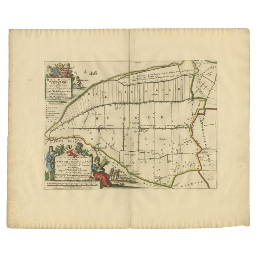
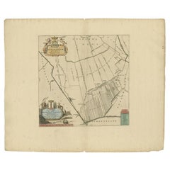
View AllAntique Map of the Bildt Township 'Friesland' by Halma, 1718
Located in Langweer, NL
The map depicts the historical region of 't Bildt in Friesland, with notable places such as St. Jacobiparochie, St. Annaparochie, and Vrouwenparochie. These are still existing towns ...
Category
Antique 18th Century Maps
Materials
Paper
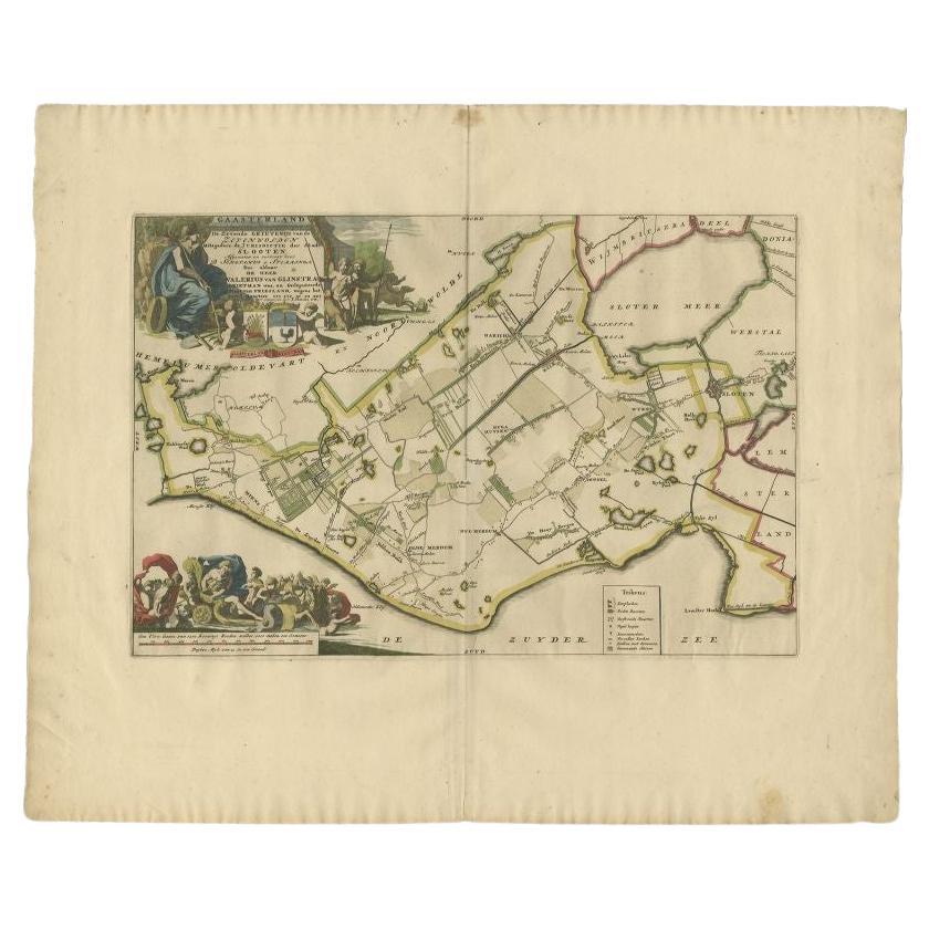
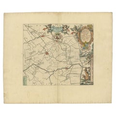
Antique Map of the Gaasterland Township 'Friesland' by Halma, 1718
Located in Langweer, NL
Antique map Friesland titled 'Gaasterland de Zevende Grietenije van de Zevenwolden (..)'. Old map of Friesland, the Netherlands. This map depicts the region of Gaasterland and includ...
Category
Antique 18th Century Maps
Materials
Paper
$383 Sale Price
20% Off
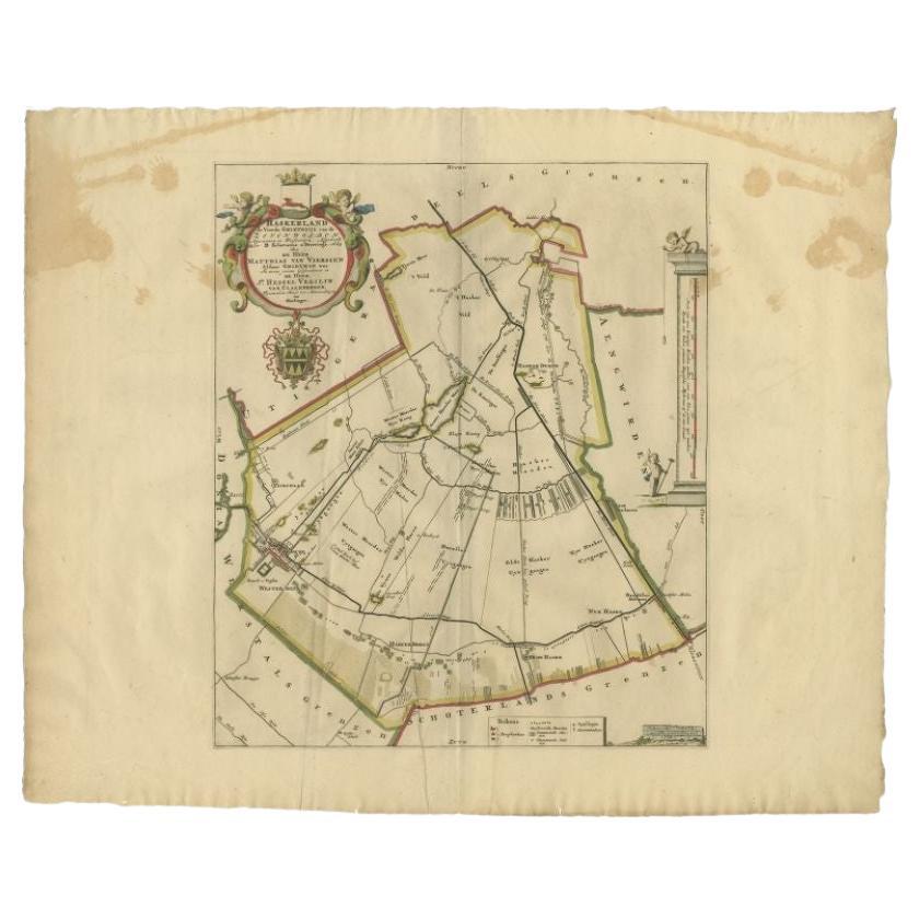
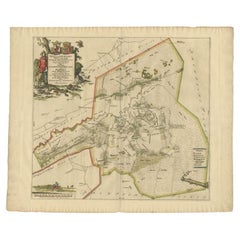
Antique Map of the Haskerland Township 'Friesland' by Halma, 1718
Located in Langweer, NL
Antique map Friesland titled 'Haskerland, de vierde Grietenije van de Zevenwolden (..)'. Old map of Friesland, the Netherlands. This map depicts the region of Haskerland and includes...
Category
Antique 18th Century Maps
Materials
Paper
$266 Sale Price
20% Off
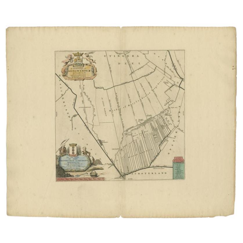
Antique Map of the Aengwirden Township 'Friesland' by Halma, 1718
Located in Langweer, NL
Antique map titled 'De Grietenije van Aengwerden, de Tweede van de Zevenwolden (..)'. Old map of Friesland, the Netherlands. This map depicts the region of Aengwirden and includes ci...
Category
Antique 18th Century Maps
Materials
Paper
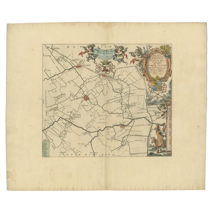
Antique Map of the Menaldumadeel Township 'Friesland' by Halma, 1718
Located in Langweer, NL
Antique map Friesland titled 'Menalduma Deel Wesentlyk vertoont (..)'. Old map of Friesland, the Netherlands. This map depicts the region of Menaldumadeel and includes cities and vil...
Category
Antique 18th Century Maps
Materials
Paper
$317 Sale Price
20% Off
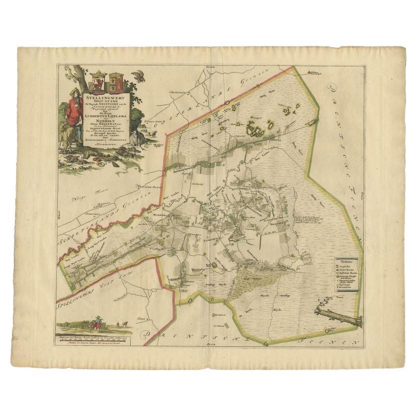
Antique Map of the Ooststellingwerf Township Friesland by Halma, 1718
Located in Langweer, NL
Antique map titled 'Stellingwerf Oost-Eynde, de negende Grietenije van de Sevenwolden'. This regional map of the Oost Stellingwerf Grietenij, part of the Province of Friesland, The N...
Category
Antique 18th Century Maps
Materials
Paper
$373 Sale Price
20% Off
You May Also Like
1752 Vaugoundy Map of Flanders : Belgium, France, and the Netherlands, Ric.a002
Located in Norton, MA
Large Vaugoundy Map of Flanders:
Belgium, France, and the Netherlands
Colored -1752
Ric.a002
Description: This is a 1752 Didier Robert de Vaugondy map of Flanders. The map de...
Category
Antique 17th Century Unknown Maps
Materials
Paper

1620 Map of Artois Entitled "Artesia Comitatvs Artois, " by Bleau, Ric.a012
Located in Norton, MA
1640 map of Artois entitled
"Artesia Comitatvs Artois,"
by Bleau
Colored
A-012.
Detailed map of the northern province of Artois, France on the border with Belgium. Feature...
Category
Antique 17th Century Dutch Maps
Materials
Paper

1635 Willem Blaeu Map of Northern France"Comitatvs Bellovacvm" Ric.a08
Located in Norton, MA
1635 Willem Blaeu map of northern France, entitled.
"Comitatvs Bellovacvm Vernacule Beavvais,"
Colored
Ric.a008
“COMITATVS BELLOVACVM…” Amsterdam: W...
Category
Antique 17th Century Unknown Maps
Materials
Paper

Framed 1731 Color Engraving, Map of Rotterdam by Matthaus Seutter, "Roterodami"
Located in Bridgeport, CT
"Roterodami". Seutter (1678-1757) was an important German 18th century map maker. Bird's eye view of the city above with full details, neoclassi...
Category
Antique 18th Century European Renaissance Maps
Materials
Glass, Wood, Paper

1640 Joan Bleau Map Entitled"Diocecese de rheims et le pais de rethel, " Eic.a011
Located in Norton, MA
1640 Joan Bleau map entitled
"Diocecese de rheims et le pais de rethel,"
Ric.a011
OAN BLAEU
Diocecese de Rheims, et le pais de Rethel.
Handcolored engraving, c.1640.
...
Category
Antique 17th Century Dutch Maps
Materials
Paper

Antique Map Of Brabantia Ducantus By Bleau Circa 1640
Located in Brussels, Brussels
map of theBrabantia Ducantus (Belgium) circa 1640 by Bléau. Bléau was well known for antique atlas that he draw during the 17 century
beautiful map, double page folded in the middle,...
Category
Antique 17th Century French Renaissance Maps
Materials
Paper

More Ways To Browse
Antique Map Burgundy
Antique Map By Coronelli
Antique Maps Singapore
Constantinople Map
Iraq Map
Mughal Map
Map Of Palestine
Victorian Portico
Antique Furniture Dundee
Antique Map Iceland
Antique Maps Of Malta
Antique Saudi Arabia
Otto Petri
Serbia Antique Map
Taiwan Map
Antique Maps Colorado
Antique Wooden Roller
Hemisphere Antiques