Items Similar to Antique Map of Southern Asia, the East Indies and the Indian Ocean, ca.1840


Want more images or videos?
Request additional images or videos from the seller
1 of 5
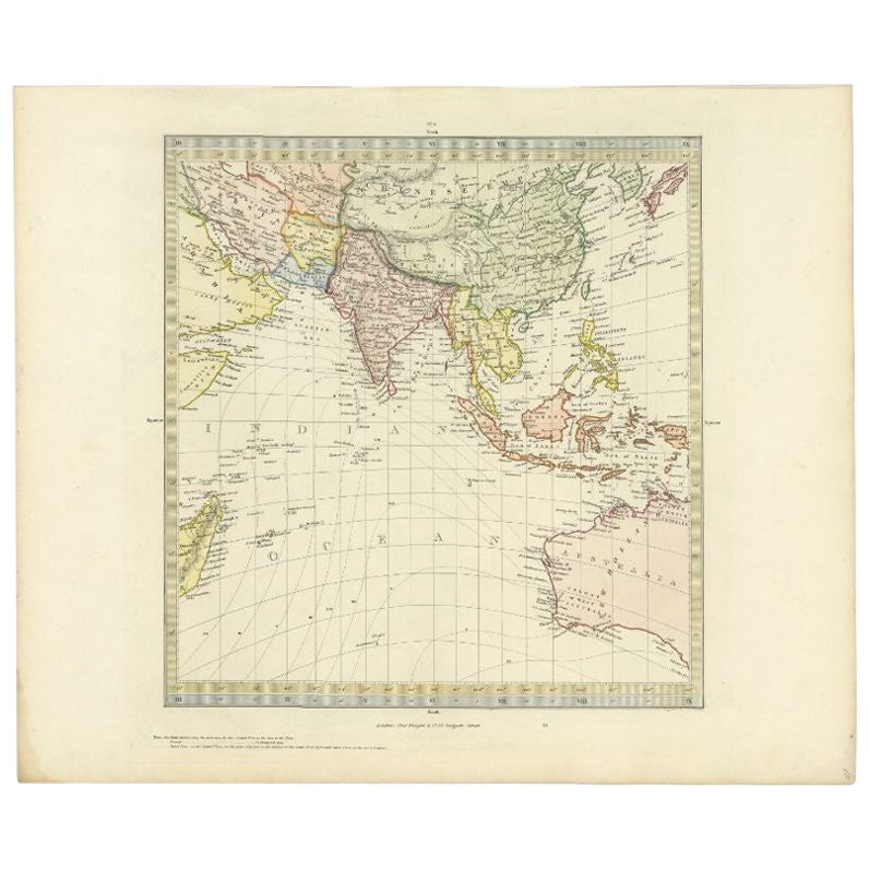
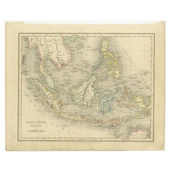
Antique Map of Southern Asia, the East Indies and the Indian Ocean, ca.1840
$306.53
$383.1720% Off
£226.60
£283.2420% Off
€256
€32020% Off
CA$416.91
CA$521.1320% Off
A$467.14
A$583.9320% Off
CHF 243.17
CHF 303.9620% Off
MX$5,714.76
MX$7,143.4520% Off
NOK 3,086.53
NOK 3,858.1620% Off
SEK 2,915.19
SEK 3,643.9920% Off
DKK 1,949.31
DKK 2,436.6420% Off
Shipping
Retrieving quote...The 1stDibs Promise:
Authenticity Guarantee,
Money-Back Guarantee,
24-Hour Cancellation
About the Item
Original antique map of Southern Asia, the East Indies and the Indian Ocean. Also shows part of Australia. Published circa 1840.
Artists and Engravers: Engraved by J. & C. Walker.
Condition: Good, general age-related toning. Minor wear, blank verso. Please study image carefully.
- Dimensions:Height: 13.39 in (34 cm)Width: 16.15 in (41 cm)Depth: 0 in (0.02 mm)
- Materials and Techniques:
- Period:
- Date of Manufacture:circa 1840
- Condition:Condition: Good, general age-related toning. Minor wear, blank verso. Please study image carefully.
- Seller Location:Langweer, NL
- Reference Number:Seller: BG-12993-3 1stDibs: LU3054326741292
About the Seller
5.0
Recognized Seller
These prestigious sellers are industry leaders and represent the highest echelon for item quality and design.
Platinum Seller
Premium sellers with a 4.7+ rating and 24-hour response times
Established in 2009
1stDibs seller since 2017
2,494 sales on 1stDibs
Typical response time: 1 hour
- ShippingRetrieving quote...Shipping from: Langweer, Netherlands
- Return Policy
Authenticity Guarantee
In the unlikely event there’s an issue with an item’s authenticity, contact us within 1 year for a full refund. DetailsMoney-Back Guarantee
If your item is not as described, is damaged in transit, or does not arrive, contact us within 7 days for a full refund. Details24-Hour Cancellation
You have a 24-hour grace period in which to reconsider your purchase, with no questions asked.Vetted Professional Sellers
Our world-class sellers must adhere to strict standards for service and quality, maintaining the integrity of our listings.Price-Match Guarantee
If you find that a seller listed the same item for a lower price elsewhere, we’ll match it.Trusted Global Delivery
Our best-in-class carrier network provides specialized shipping options worldwide, including custom delivery.More From This Seller
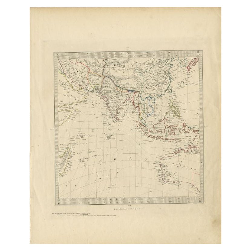
View AllAntique Map of Southern Asia by Walker, c.1840
Located in Langweer, NL
"Original antique map of Southern Asia, the East Indies and the Indian Ocean. Also shows part of Australia. Published circa 1840. Artists and Engravers: ...
Category
Antique 19th Century Maps
Materials
Paper

$100 Sale Price
20% Off
Antique Map of Southeast Asia by Walker, c.1845
Located in Langweer, NL
"Untitled map of southeast Asia. This map depicts India, Indonesia, Australia and surrounding regions. Also depicts a large part of the Indian Ocean. Artists and Engravers: Engraved ...
Category
Antique 19th Century Maps
Materials
Paper
$69 Sale Price
20% Off
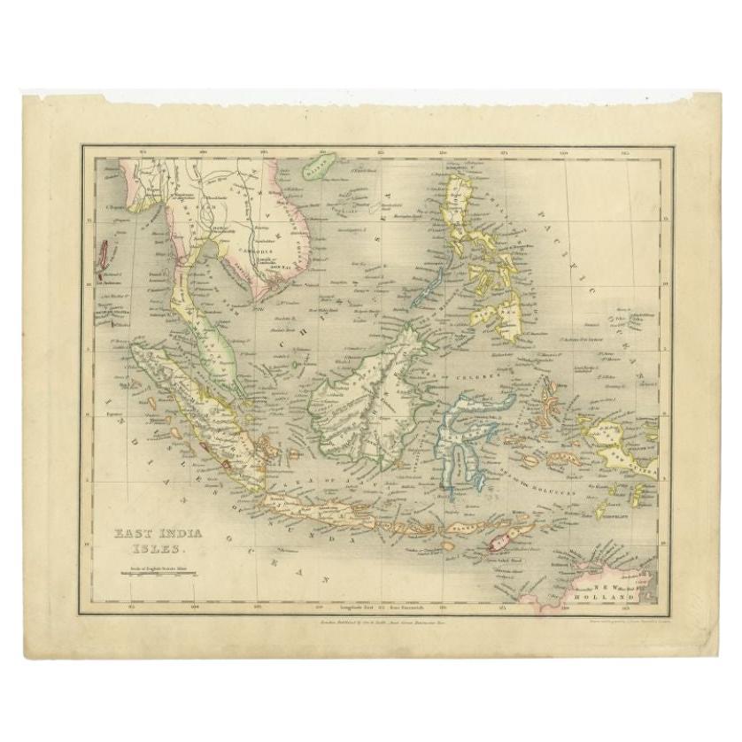
Antique Map of the East Indies by Dower, 1832
Located in Langweer, NL
Antique map titled 'East India Isles'. Old map of the East Indies. This map originates from 'A General Descriptive Atlas Of The Earth (..)' by J. Dower.
Artists and Engravers: Dr...
Category
Antique 19th Century Maps
Materials
Paper
$158 Sale Price
20% Off
Antique Map of India and Southeast Asia by Balbi '1847'
Located in Langweer, NL
Antique map titled 'India en deçà et au delà du Gange'. Original antique map of India and Souteast Asia. This map originates from 'Abrégé de Géographie (..)' by Adrien Balbi. Publish...
Category
Antique Mid-19th Century Maps
Materials
Paper

$143 Sale Price
20% Off
Original Antique Map of Southern Asia, Published in 1833
Located in Langweer, NL
Antique map titled 'Carte de l'Inde'. Detailed map extending from India in the west to Vietnam and the Malay Peninsula in the east. This map originates from 'Atlas universel de geogr...
Category
Antique Mid-19th Century Maps
Materials
Paper

$718 Sale Price
20% Off
Antique Map of the East Indies by Wyld '1845'
Located in Langweer, NL
Antique map titled 'Archipelago of the Indian Ocean'. Original antique map of the East Indies. This map originates from 'An Atlas of the World, Comprehending Separate Maps of its Var...
Category
Antique Mid-19th Century Maps
Materials
Paper

$335 Sale Price
20% Off
You May Also Like
Antique 1803 Italian Map of Asia Including China Indoneseia India
Located in Amsterdam, Noord Holland
Antique 1803 Italian Map of Asia Including China Indoneseia India
Very nice map of Asia. 1803.
Additional information:
Type: Map
Country of Manufacturing: Europe
Period: 19th centu...
Category
Antique 19th Century European Maps
Materials
Paper

$584 Sale Price
20% Off
Original Antique Map of The Eastern Hemisphere by Dower, circa 1835
Located in St Annes, Lancashire
Nice map of the Eastern Hemisphere
Drawn and engraved by J.Dower
Published by Orr & Smith. C.1835
Unframed.
Free shipping
Category
Antique 1830s English Maps
Materials
Paper

Original Antique Map of India by Dower, circa 1835
Located in St Annes, Lancashire
Nice map of India
Drawn and engraved by J.Dower
Published by Orr & Smith. C.1835
Unframed.
Free shipping
Category
Antique 1830s English Maps
Materials
Paper

Original Antique Map of South East Asia by Thomas Clerk, 1817
Located in St Annes, Lancashire
Great map of South East Asia
Copper-plate engraving
Drawn and engraved by Thomas Clerk, Edinburgh.
Published by Mackenzie And Dent, 1817
Unframed.
Category
Antique 1810s English Maps
Materials
Paper

Large Original Antique Map of Asia by Sidney Hall, 1847
Located in St Annes, Lancashire
Great map of Asia
Drawn and engraved by Sidney Hall
Steel engraving
Original colour outline
Published by A & C Black. 1847
Unframed
Free shipping
Category
Antique 1840s Scottish Maps
Materials
Paper

Original Antique Map of The World by Dower, circa 1835
Located in St Annes, Lancashire
Nice map of the World
Drawn and engraved by J.Dower
Published by Orr & Smith. C.1835
Unframed.
Free shipping
Category
Antique 1830s English Maps
Materials
Paper

More Ways To Browse
J C Walker Map
Thailand Map
Antique Maps Of Russian Empire
Antique Navigational Tools
Australian Colonial
Antique German Compass
Key Trade Sign
Spanish Galleon
World Map Of Trade Routes
Antique Puerto Rico
Albanian Antique
Antique Furniture Wiltshire
Antique Maps Of Israel
Framed Africa Maps
Antique Furniture Goa
Croatian Antiques
Map Of Israel
Teak Sphere