Items Similar to Antique Map of Syria by Wyld '1845'

Want more images or videos?
Request additional images or videos from the seller
1 of 8
Antique Map of Syria by Wyld '1845'
$239.63
$299.5420% Off
£178.39
£222.9920% Off
€200
€25020% Off
CA$328.23
CA$410.2920% Off
A$365.07
A$456.3320% Off
CHF 190.63
CHF 238.2820% Off
MX$4,442.45
MX$5,553.0720% Off
NOK 2,434.58
NOK 3,043.2220% Off
SEK 2,283.21
SEK 2,854.0120% Off
DKK 1,522.53
DKK 1,903.1620% Off
Shipping
Retrieving quote...The 1stDibs Promise:
Authenticity Guarantee,
Money-Back Guarantee,
24-Hour Cancellation
About the Item
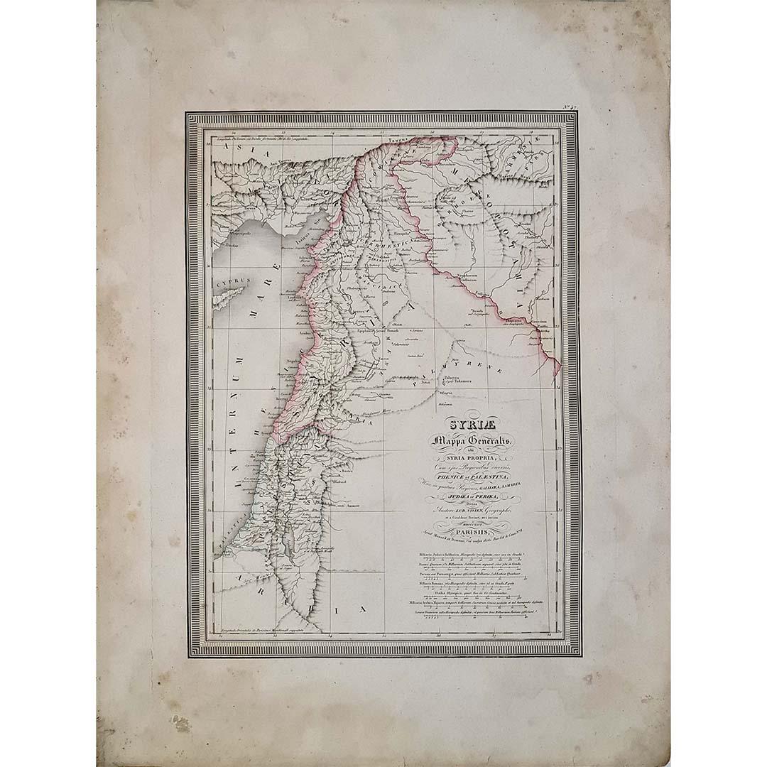
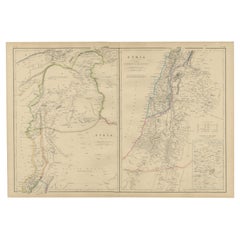
Antique map titled 'Map of Syria'. Original antique map of Syria. This map originates from 'An Atlas of the World, Comprehending Separate Maps of its
Various Countries, constructed and drawn from the latest Astronomical and Geographical Observations' by J. Wyld. Published 1845.
- Dimensions:Height: 14.18 in (36 cm)Width: 10.24 in (26 cm)Depth: 0.02 in (0.5 mm)
- Materials and Techniques:
- Period:
- Date of Manufacture:1845
- Condition:General age-related toning. Minor wear, light staining. Blank verso, please study image carefully.
- Seller Location:Langweer, NL
- Reference Number:Seller: BG-12894-441stDibs: LU3054323140122
About the Seller
5.0
Recognized Seller
These prestigious sellers are industry leaders and represent the highest echelon for item quality and design.
Platinum Seller
Premium sellers with a 4.7+ rating and 24-hour response times
Established in 2009
1stDibs seller since 2017
2,510 sales on 1stDibs
Typical response time: <1 hour
- ShippingRetrieving quote...Shipping from: Langweer, Netherlands
- Return Policy
Authenticity Guarantee
In the unlikely event there’s an issue with an item’s authenticity, contact us within 1 year for a full refund. DetailsMoney-Back Guarantee
If your item is not as described, is damaged in transit, or does not arrive, contact us within 7 days for a full refund. Details24-Hour Cancellation
You have a 24-hour grace period in which to reconsider your purchase, with no questions asked.Vetted Professional Sellers
Our world-class sellers must adhere to strict standards for service and quality, maintaining the integrity of our listings.Price-Match Guarantee
If you find that a seller listed the same item for a lower price elsewhere, we’ll match it.Trusted Global Delivery
Our best-in-class carrier network provides specialized shipping options worldwide, including custom delivery.More From This Seller
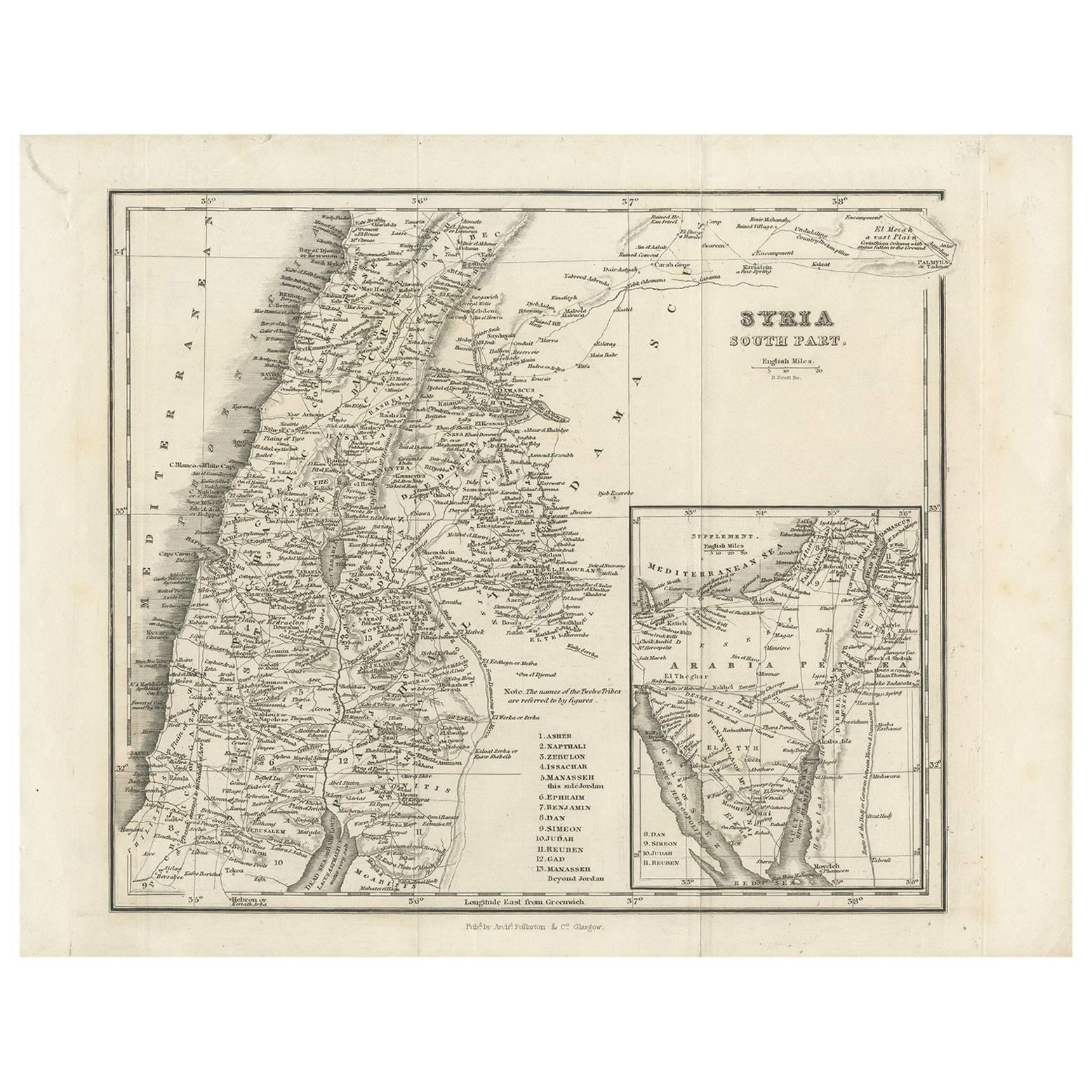
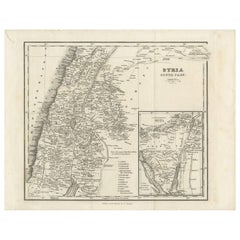
View AllAntique Map of Southern Syria by Fullarton & Co, circa 1860
Located in Langweer, NL
Antique map titled 'Syria south part'. Published by Fullarton & Co, Glasgow, circa 1860.
- Title: Syria South Part
- Publisher: Fullarton & Co, Glasgow
- Date of Publication: Circa ...
Category
Antique Mid-19th Century English Maps
Materials
Paper
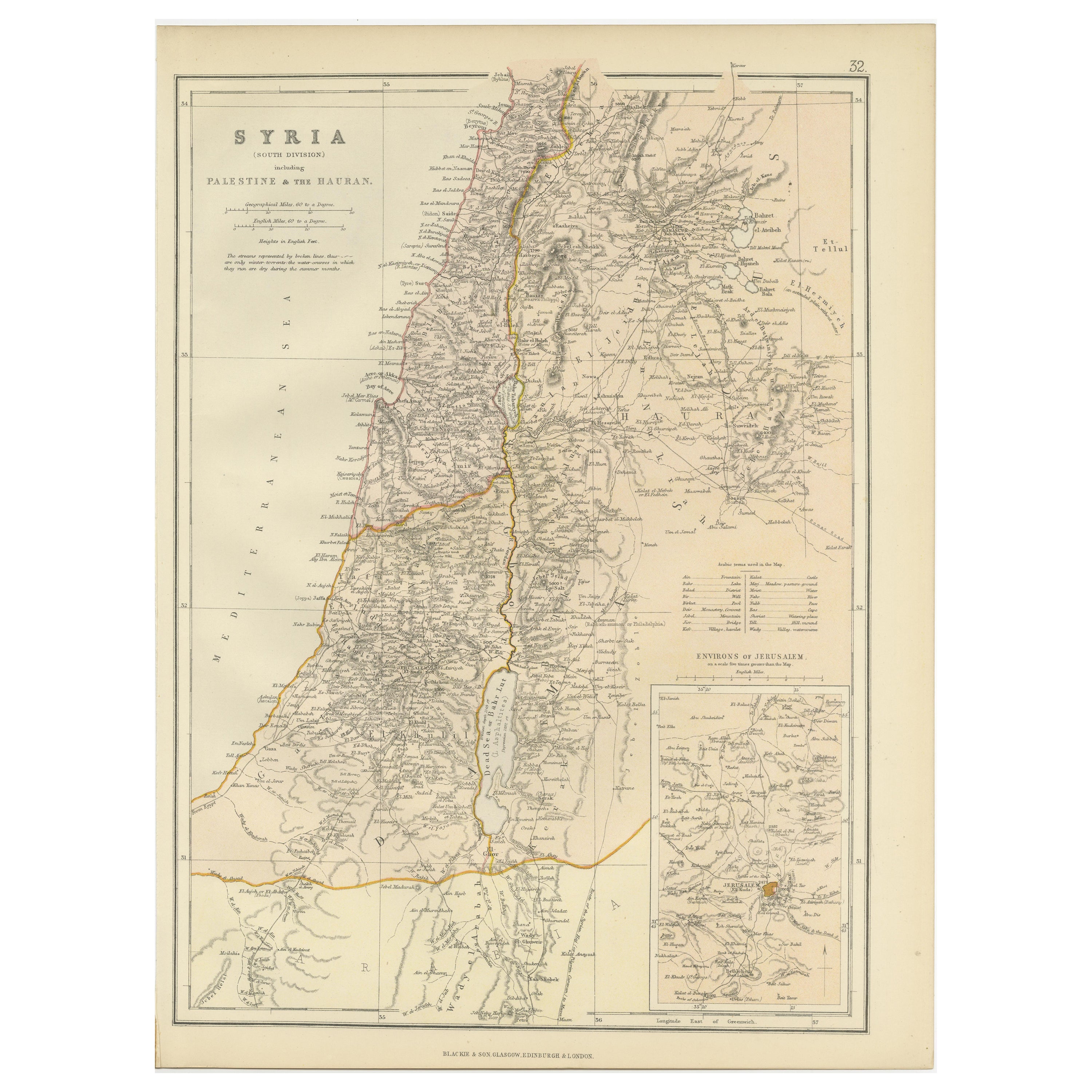
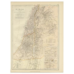
An Insightful 19th Century Map of Syria and the Surrounding Regions, 1882
Located in Langweer, NL
This map, titled "SYRIA (SOUTH DIVISION) including PALESTINE & THE HAUARAN," is a historical cartographic work from the late 19th century, specifically from the 1882 atlas by Blackie...
Category
Antique 1880s Maps
Materials
Paper
$268 Sale Price
20% Off
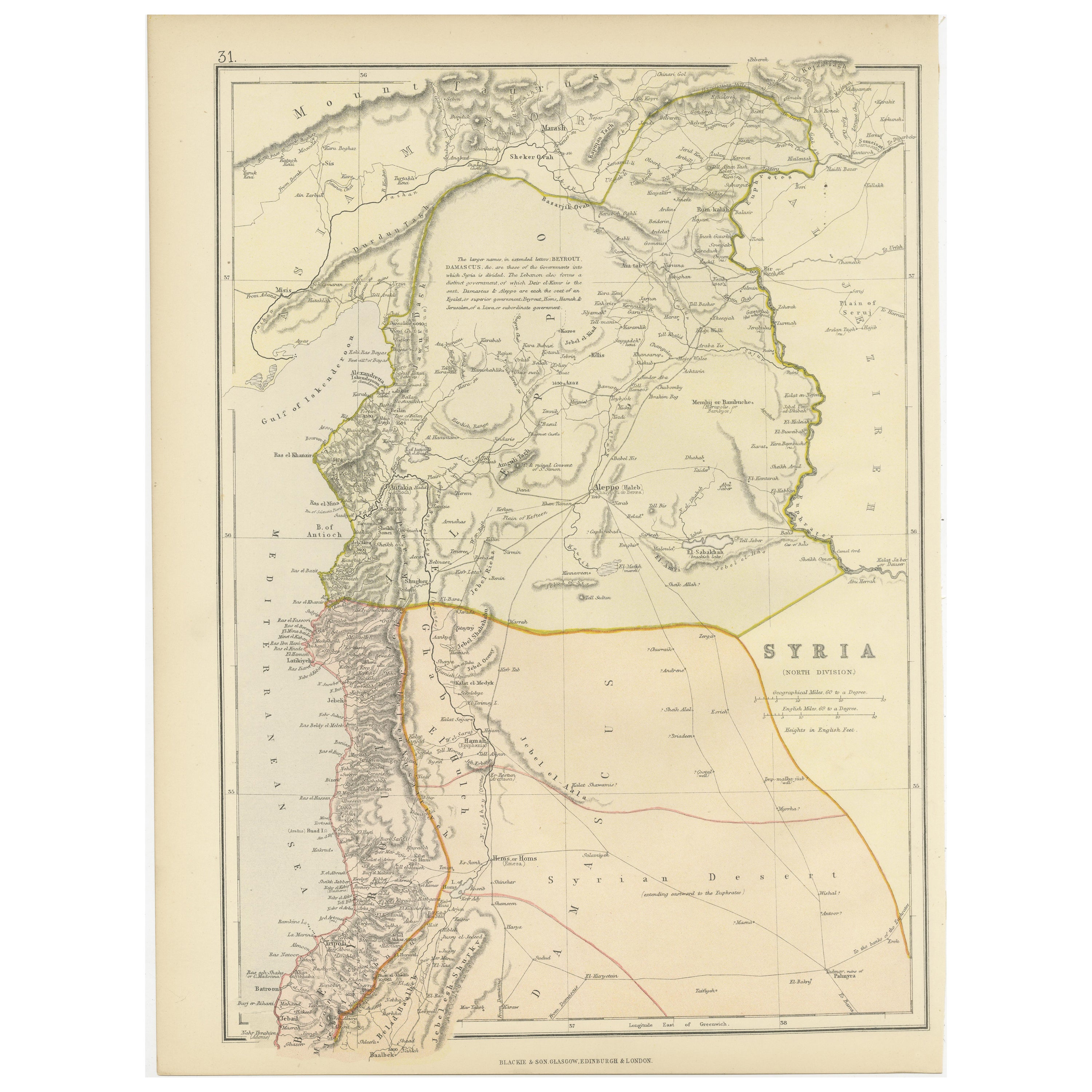
Territories of Antiquity: The Northern Division of Syria, A Detailed 1882 Map
Located in Langweer, NL
This 19th-century map from the atlas published by Blackie and Son in 1882 is titled "SYRIA (NORTH DIVISION)" and covers the northern part of Syria, capturing its geographical and adm...
Category
Antique 1880s Maps
Materials
Paper

$268 Sale Price
20% Off
Antique Map of Turkey in Asia by Wyld '1845'
Located in Langweer, NL
Antique map titled 'Map of Turkey in Asia'. Original antique map of Turkey in Asia. This map originates from 'An Atlas of the World, Comprehendin...
Category
Antique Mid-19th Century Maps
Materials
Paper

$191 Sale Price
20% Off
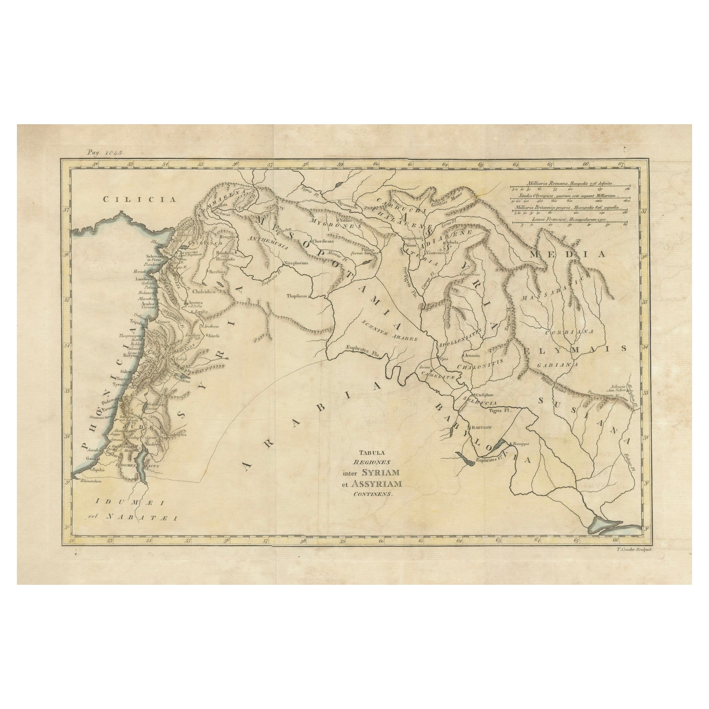
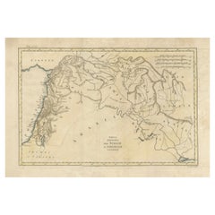
Antique 19th Century Map of Ancient Syria & Assyria - Historical Regions, c.1802
Located in Langweer, NL
19th Century Map of Ancient Syria and Assyria: 'Tabula Regiones inter Syriam et Assyriam continens'"*
This beautifully detailed 18th-century map, titled...
Category
Antique Early 1800s Maps
Materials
Paper
$297 Sale Price
20% Off
The Divided Realms of Syria - North and South as Seen in 1859 by W. G. Blackie
Located in Langweer, NL
The "Antique Map of Syria, North and South Division" by W. G. Blackie, dated 1859, is a significant historical cartographic work. This map, originating fr...
Category
Antique Mid-19th Century Maps
Materials
Paper
$239 Sale Price
20% Off
You May Also Like
Circa 1825 original engraving of the map of Syria by Giraldon Bovinet
Located in PARIS, FR
The circa 1825 original engraving of "Syrie" by Giraldon Bovinet, based on the work of L. Vivien, is a historically significant map that reflects early 19th-century cartographic tech...
Category
1820s Prints and Multiples
Materials
Engraving, Paper

Map of the Holy Land "Carte de la Syrie et de l'Egypte" by Pierre M. Lapie
By Pierre M. Lapie
Located in Alamo, CA
An early 19th century map of ancient Syria and Egypt entitled "Carte de la Syrie et de l'Egypte anciennes/dressée par M. Lapie, Colonel d'Etat Major, et...
Category
Antique Early 19th Century French Maps
Materials
Paper

Map of the Holy Land "Carte de la Syrie et de l'Egypte" by Pierre Lapie
By Pierre M. Lapie
Located in Alamo, CA
This is an early 19th century map of ancient Syria and Egypt entitled "Carte de la Syrie et de l'Egypte anciennes/dressée par M. Lapie, Colonel d'Etat M...
Category
1830s Landscape Prints
Materials
Engraving

Large Original Antique Map of Cyprus. 1894
Located in St Annes, Lancashire
Superb Antique map of Cyprus
Published Edward Stanford, Charing Cross, London 1894
Original colour
Good condition
Unframed.
Free shipping
Category
Antique 1890s English Maps
Materials
Paper

Original Antique Map of Ancient Greece, Achaia, Corinth, 1786
Located in St Annes, Lancashire
Great map of Ancient Greece. Showing the region of Thessaly, including Mount Olympus
Drawn by J.D. Barbie Du Bocage
Copper plate engraving by P.F Tardieu
Original hand color...
Category
Antique 1780s French Other Maps
Materials
Paper

Large Original Vintage Map of Israel, circa 1920
Located in St Annes, Lancashire
Great map of Israel
Original color.
Good condition
Published by Alexander Gross
Unframed.
Category
Vintage 1920s English Edwardian Maps
Materials
Paper

More Ways To Browse
Antique Syrian
Antique Syrian Furniture
Map Of Syria
Turkey Map
Map Of Austria
Antique Mediterranean Map
Antique Furniture Building Plans
Map Of Ireland
18th Century Compass
18th Century Maps America
Map Of Great Britain
Miniature Maps
Antique Map New York
Antique Wine Maps
Antique Map Of The South Of France
Antique Maps Of Greece
Large Framed Maps
Java Map