Items Similar to Antique Map of the West Coast of Africa, 1771

Want more images or videos?
Request additional images or videos from the seller
1 of 6
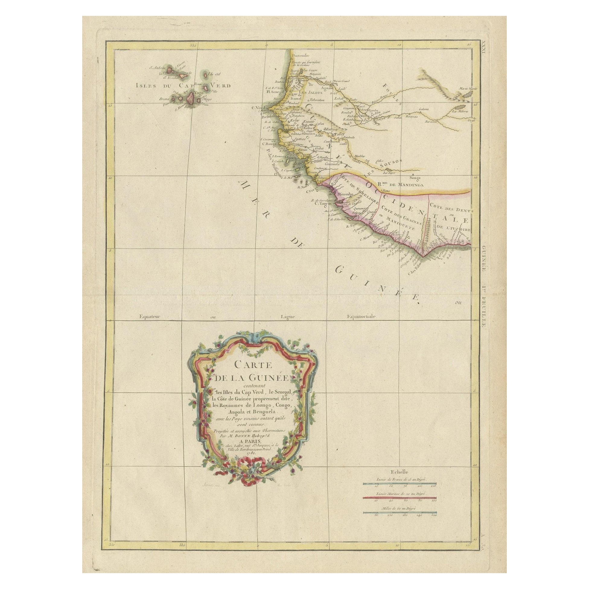
Antique Map of the West Coast of Africa, 1771
$335.77
$419.7120% Off
£249.78
£312.2220% Off
€280
€35020% Off
CA$459.78
CA$574.7320% Off
A$511.22
A$639.0220% Off
CHF 266.93
CHF 333.6620% Off
MX$6,222.76
MX$7,778.4520% Off
NOK 3,405.90
NOK 4,257.3820% Off
SEK 3,191.17
SEK 3,988.9620% Off
DKK 2,131.49
DKK 2,664.3620% Off
Shipping
Retrieving quote...The 1stDibs Promise:
Authenticity Guarantee,
Money-Back Guarantee,
24-Hour Cancellation
About the Item
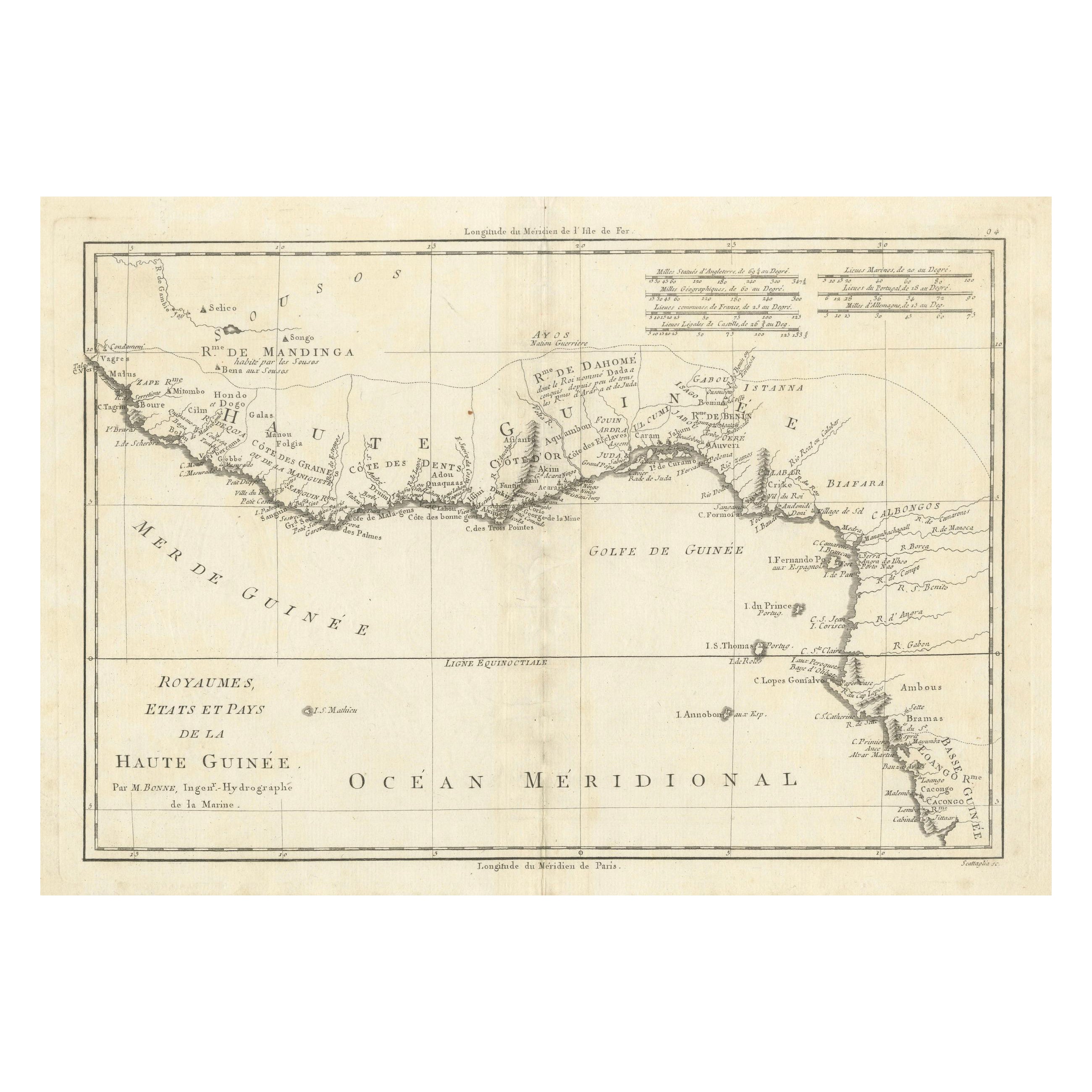
Antique map titled 'Carte de la Guinee contenant les Isles du Cap Verd, le Senegal, la Cote de Guinee proprement dite, les Royaumes de Loango, Congo, Angola, et Benguela avec les Pays voisins autant qu'ils sont connus'. Map of the West Coast of Africa. Covers from the Cape Verde Islands eastward to the coasts of Africa and the western mouth of the Niger River. Includes the modern day nations of Mauritania, Senegal, Gambia, Guinea-Bissau, Guinea, Sierra Leone, Liberia and Cote d'Ivoire.
Artists and Engravers: Rigobert Bonne (1727 - 1794) was one of the most important French cartographers of the late 18th century.
Condition: Good, age-related toning. Some stains, please study image carefully.
Date: 1771
Overall size: 38 x 54 cm.
Image size: 31 x 42 cm.
We sell original antique maps to collectors, historians, educators and interior decorators all over the world. Our collection includes a wide range of authentic antique maps from the 16th to the 20th centuries. Buying and collecting antique maps is a tradition that goes back hundreds of years. Antique maps have proved a richly rewarding investment over the past decade, thanks to a growing appreciation of their unique historical appeal. Today the decorative qualities of antique maps are widely recognized by interior designers who appreciate their beauty and design flexibility. Depending on the individual map, presentation, and context, a rare or antique map can be modern, traditional, abstract, figurative, serious or whimsical. We offer a wide range of authentic antique maps for any budget.
- Creator:Rigobert Bonne (Artist)
- Dimensions:Height: 21.26 in (54 cm)Width: 14.97 in (38 cm)Depth: 0 in (0.01 mm)
- Materials and Techniques:
- Period:
- Date of Manufacture:1771
- Condition:Condition: Good, age-related toning. Some stains, please study image carefully.
- Seller Location:Langweer, NL
- Reference Number:Seller: BG-008021stDibs: LU3054329304172
About the Seller
5.0
Recognized Seller
These prestigious sellers are industry leaders and represent the highest echelon for item quality and design.
Platinum Seller
Premium sellers with a 4.7+ rating and 24-hour response times
Established in 2009
1stDibs seller since 2017
2,511 sales on 1stDibs
Typical response time: <1 hour
- ShippingRetrieving quote...Shipping from: Langweer, Netherlands
- Return Policy
Authenticity Guarantee
In the unlikely event there’s an issue with an item’s authenticity, contact us within 1 year for a full refund. DetailsMoney-Back Guarantee
If your item is not as described, is damaged in transit, or does not arrive, contact us within 7 days for a full refund. Details24-Hour Cancellation
You have a 24-hour grace period in which to reconsider your purchase, with no questions asked.Vetted Professional Sellers
Our world-class sellers must adhere to strict standards for service and quality, maintaining the integrity of our listings.Price-Match Guarantee
If you find that a seller listed the same item for a lower price elsewhere, we’ll match it.Trusted Global Delivery
Our best-in-class carrier network provides specialized shipping options worldwide, including custom delivery.More From This Seller
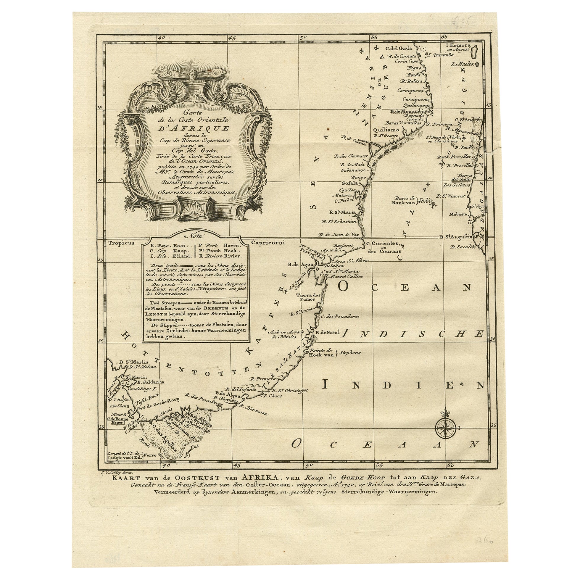
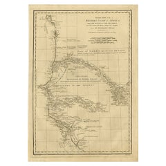
View AllOriginal Detailed Antique Map of the East Coast of Africa, 1747
Located in Langweer, NL
Antique map titled 'Carte de la coste Orientale d'Afrique - Kaart van de Oostkust van Afrika'.
Original antique map of the east coast of Africa. Reaches from Cape of Good Hope an...
Category
Antique 1740s Maps
Materials
Paper

$179 Sale Price
20% Off
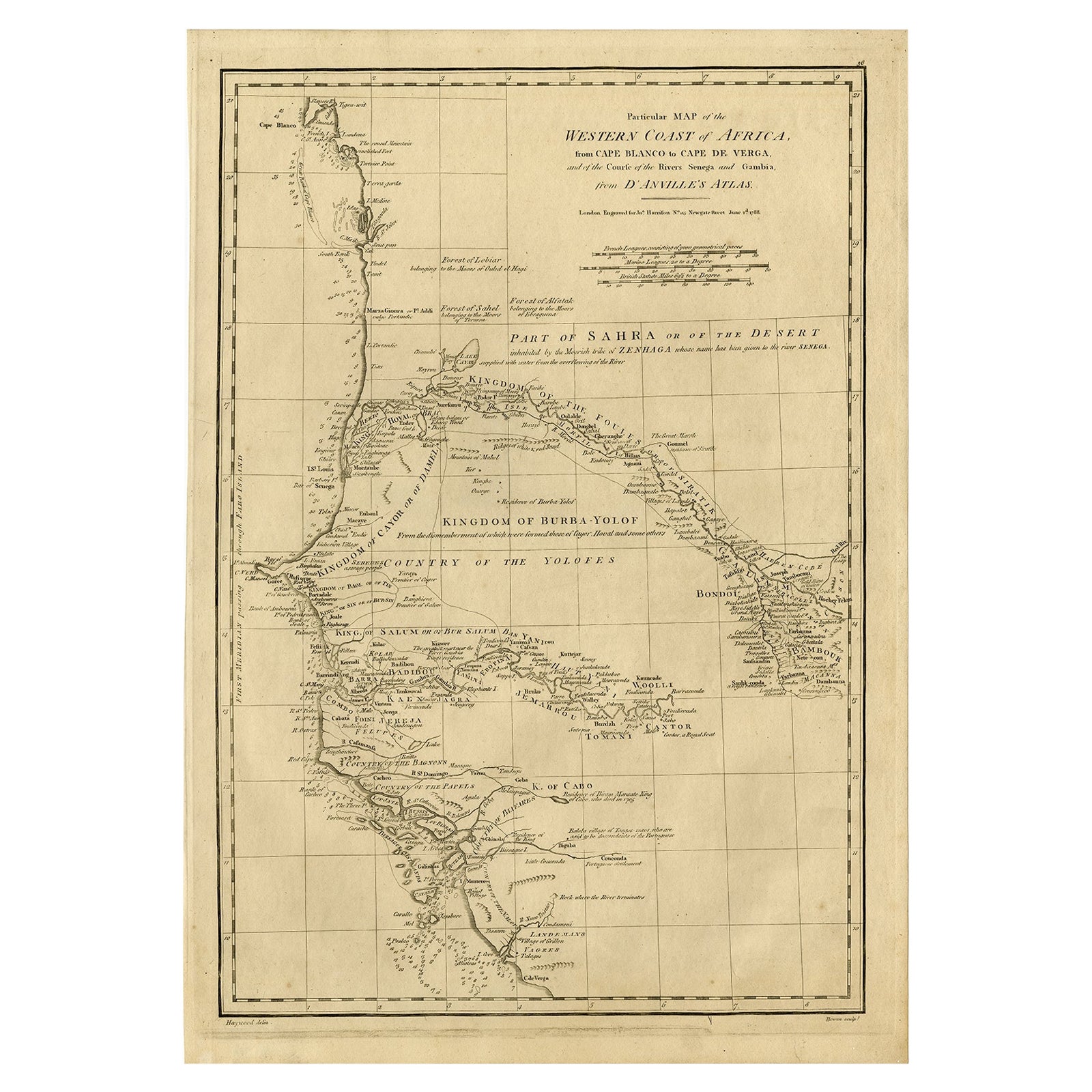
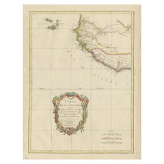
Map of the West African coast from the North of Mauretania to Guinee, 1788
Located in Langweer, NL
Antique map titled 'Particular Map of the Western Coast of Africa, from Cape Blanco to Cape de Verga, and of the Course of the Rivers Senega and Gambia.'
Map of the African coast...
Category
Antique 1780s English Maps
Materials
Paper
$359 Sale Price
20% Off
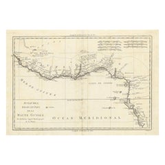
Antique Map of the Coast of Guinea, Africa, c.1780
Located in Langweer, NL
Antique map Africa titled 'Carte de la Haute et de la Basse Guinée'. Map of the Coast of Guinea, Africa. Represents modern day Liberia, Ivory Coast, Ghana, Nigeria, Cameroon, Gabon, Congo, and Equatorial Guinea...
Category
Antique 18th Century Maps
Materials
Paper

$150 Sale Price
20% Off
Antique Map of the Coast of Guinea and the Cape Verde Islands
Located in Langweer, NL
Antique map titled 'Carte de la Guinée (..)'. This map was originally part of a 2 sheet larger map of Eastern Africa, showing the Cape Verde Islands and Senegal. This map originates ...
Category
Antique Late 18th Century Maps
Materials
Paper
$453 Sale Price
40% Off
18th Century Map of Upper Guinea: Kingdoms and Coastal Regions of West Africa
Located in Langweer, NL
This is an antique map depicting the coastal regions of West Africa, specifically the Gulf of Guinea and surrounding areas, including parts of what is now Senegal, Guinea, Sierra Leo...
Category
Antique 1780s Maps
Materials
Paper
$230 Sale Price
20% Off
Antique Map of the Cape Verde Islands and Part of Senegal, West Africa, 1690
Located in Langweer, NL
Antique map titled 'Bocche del Fivme Negro et Isole di Capo Verde'. Beautiful double-page map of the Cape Verde Islands and part of the coast of Senegal, with large decorative cartou...
Category
Antique 17th Century Italian Maps
Materials
Paper

You May Also Like
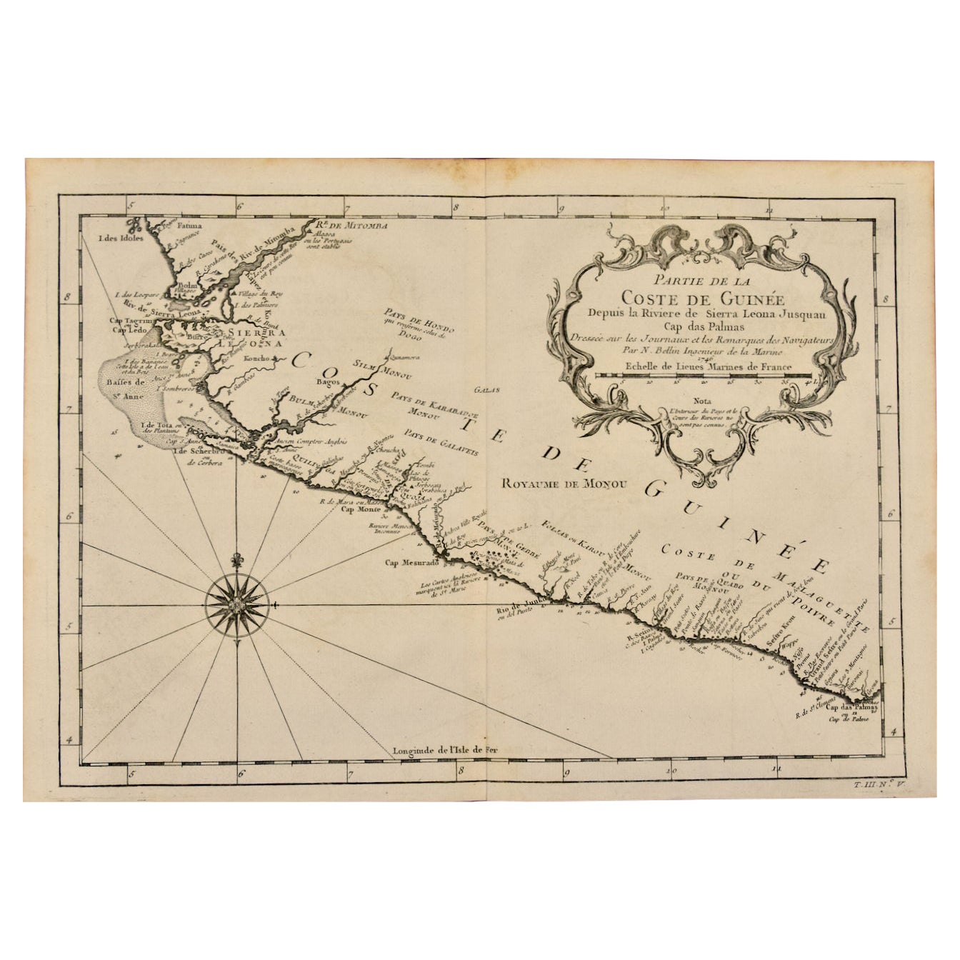
West Coast of Africa, Guinea & Sierra Leone: An 18th Century Map by Bellin
By Jacques-Nicolas Bellin
Located in Alamo, CA
Jacques Bellin's copper-plate map entitled "Partie de la Coste de Guinee Dupuis la Riviere de Sierra Leona Jusquau Cap das Palmas", depicting the coast of Guinea and Sierra Leone in ...
Category
Antique Mid-18th Century French Maps
Materials
Paper

West Coast of Africa; Guinea & Sierra Leone: Bellin 18th Century Map
Located in Alamo, CA
This is a Jacques Bellin copper-plate map entitled "Partie de la Coste de Guinee Dupuis la Riviere de Sierra Leona Jusquau Cap das Palmas", depicting the coast of Guinea and Sierra L...
Category
1740s Old Masters Landscape Prints
Materials
Engraving

California, Alaska and Mexico: 18th Century Hand-Colored Map by de Vaugondy
By Didier Robert de Vaugondy
Located in Alamo, CA
This is an 18th century hand-colored map of the western portions of North America entitled "Carte de la Californie et des Pays Nord-Ouest separés de l'Asie par le détroit d'Anian, ex...
Category
Antique 1770s French Maps
Materials
Paper

West Africa Entitled "Guinea Propria": An 18th Century Hand Colored Homann Map
By Johann Baptist Homann
Located in Alamo, CA
This is a scarce richly hand colored copper plate engraved map of Africa entitled "Guinea Propria, nec non Nigritiae vel Terrae Nigrorum Maxima Pars" by Johann Baptist Homann (1664-1...
Category
Antique Mid-18th Century German Maps
Materials
Paper

Antique Map of California as an Island "The 5 Californias" by Robert de Vaugondy
Located in San Diego, CA
A very nice and rare antique map entitled "Carte de la Californie Suivant" (The 5 Californias), by Didier Robert de Vaugondy of Paris, circa 1772. The map itself measures 15.5" x 13...
Category
Antique Mid-19th Century American Maps
Materials
Paper

Africa: A Large 17th Century Hand-Colored Map by Sanson and Jaillot
By Nicolas Sanson
Located in Alamo, CA
This large original hand-colored copperplate engraved map of Africa entitled "L'Afrique divisee suivant l'estendue de ses principales parties ou sont distingues les uns des autres, L...
Category
Antique 1690s French Maps
Materials
Paper

More Ways To Browse
West African Furniture
Gambia Antique Map
Guinea Bissau
Antique Maps Massachusetts
Guyana Antique Map
Peninsular War
Santa Cruz Island
Ukraine Antique Map
Antique Life Buoy
Antique Map Nova Scotia
Antique Map Of Argentina
Antique Maps Of Kansas
Cambodia Antique Map
Magellan Map
Map Ukraine
Mariners Chart
Papua New Guinea Antique Map
Bermuda Map