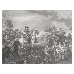
Items Similar to Antique Print of the Battle of Camaret in the Nine Years War, Near Brest, France

Want more images or videos?
Request additional images or videos from the seller
1 of 7
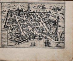
Antique Print of the Battle of Camaret in the Nine Years War, Near Brest, France
$622.82
$778.5320% Off
£461.55
£576.9320% Off
€520
€65020% Off
CA$850.27
CA$1,062.8420% Off
A$945.90
A$1,182.3720% Off
CHF 495.85
CHF 619.8120% Off
MX$11,558.61
MX$14,448.2620% Off
NOK 6,314.03
NOK 7,892.5420% Off
SEK 5,943.79
SEK 7,429.7320% Off
DKK 3,959.23
DKK 4,949.0420% Off
Shipping
Retrieving quote...The 1stDibs Promise:
Authenticity Guarantee,
Money-Back Guarantee,
24-Hour Cancellation
About the Item
Antique print titled 'Plan of the Attack of Camaret Bay, on the Coast of Bretagne, thro which lies the Harbour of Brest'. Striking plan showing the details of the battle at the mouth of Cameret Bay. Includes a battle plan, numerous ships, and two massive cartouches. This print originates from Tindal's Continuation of Rapin's History. Published 1746.
- Dimensions:Height: 15.75 in (40 cm)Width: 19.69 in (50 cm)Depth: 0.02 in (0.5 mm)
- Materials and Techniques:
- Period:
- Date of Manufacture:1746
- Condition:Wear consistent with age and use. General age-related toning, shows some wear. Original folding lines. Few small tears, only slightly affecting image. Some water stains in lower margin, blank verso. Please study images carefully.
- Seller Location:Langweer, NL
- Reference Number:Seller: BG-13216-831stDibs: LU3054331002022
About the Seller
5.0
Recognized Seller
These prestigious sellers are industry leaders and represent the highest echelon for item quality and design.
Platinum Seller
Premium sellers with a 4.7+ rating and 24-hour response times
Established in 2009
1stDibs seller since 2017
2,502 sales on 1stDibs
Typical response time: <1 hour
- ShippingRetrieving quote...Shipping from: Langweer, Netherlands
- Return Policy
Authenticity Guarantee
In the unlikely event there’s an issue with an item’s authenticity, contact us within 1 year for a full refund. DetailsMoney-Back Guarantee
If your item is not as described, is damaged in transit, or does not arrive, contact us within 7 days for a full refund. Details24-Hour Cancellation
You have a 24-hour grace period in which to reconsider your purchase, with no questions asked.Vetted Professional Sellers
Our world-class sellers must adhere to strict standards for service and quality, maintaining the integrity of our listings.Price-Match Guarantee
If you find that a seller listed the same item for a lower price elsewhere, we’ll match it.Trusted Global Delivery
Our best-in-class carrier network provides specialized shipping options worldwide, including custom delivery.More From This Seller
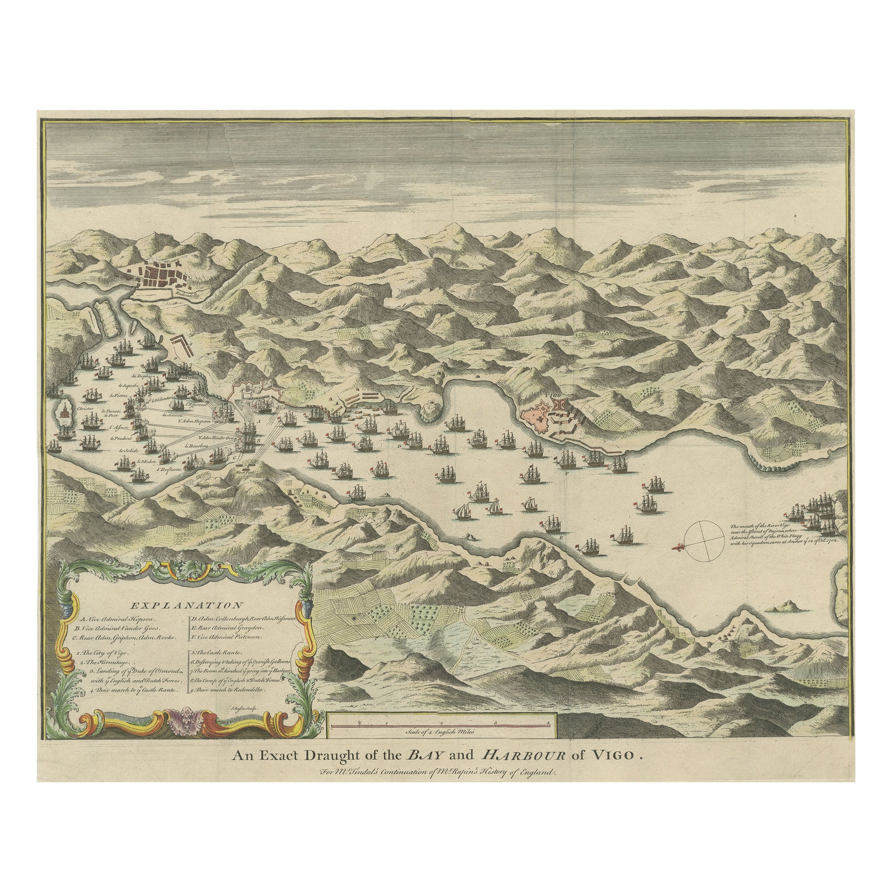
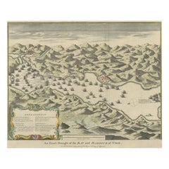
View AllAntique Print of the Battle in 1702 of Vigo Bay or Rande, Galicia, Spain
Located in Langweer, NL
Antique print titled 'An Exact Draught of the Bay and Harbour of Vigo'. The Battle of Vigo Bay was an engagement that saw a combined Dutch/English naval force successfully capture on...
Category
Antique Mid-18th Century Prints
Materials
Paper
$843 Sale Price
20% Off
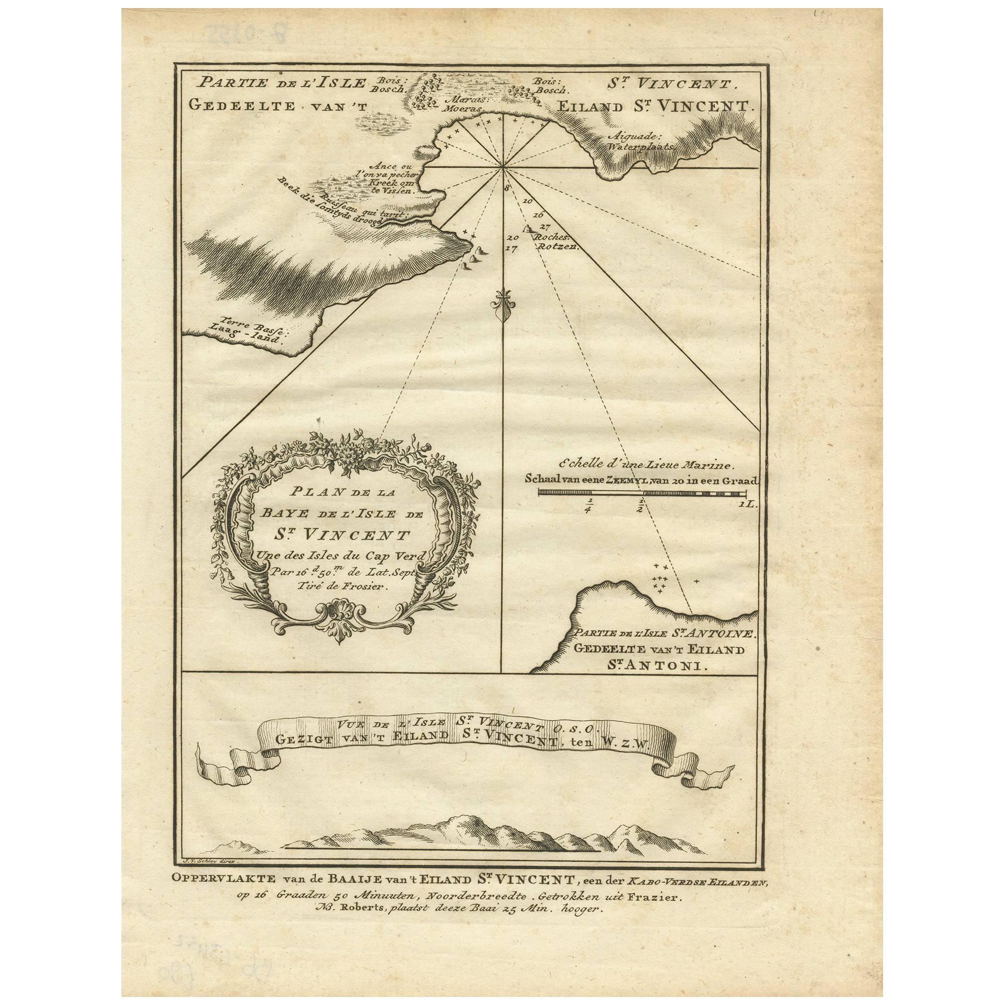
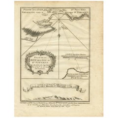
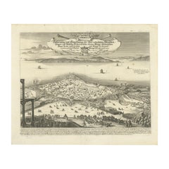
Antique Print of the Bay of the Island of St. Vincent by Van Schley (1747)
Located in Langweer, NL
Antique print titled 'Oppervlakte van de Baaije van 't Eiland St. Vincent (..)'. View of the Bay of the Island of St. Vincent, one of the Capeverdian Islands. Originates from a Dutch...
Category
Antique Mid-18th Century Maps
Materials
Paper
$105 Sale Price
20% Off
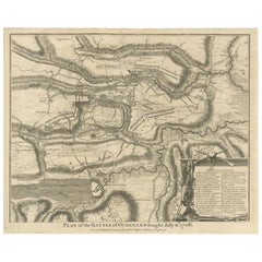
Antique Print of the Battle of Oudenard by I. Basire, 1751
Located in Langweer, NL
Plan of the Battle of Oudenard, fought during the war of the Spanish Succession (1701-1714), in which the Allies, led by Marlborough and Prince Eugene of Savoy, beat the French under the leadership of Louis Joseph, duc de Vendôme, and Louis, duc de Bourgogne (later the Dauphin, but died of measles at 29). The French commanders had quarrelled, resulting in a divided force that was easily beaten. Nicholas Tindal (1687-1774), at one time Chaplain to Greenwich Hospital...
Category
Antique Mid-18th Century Prints
Materials
Paper
$229 Sale Price
20% Off
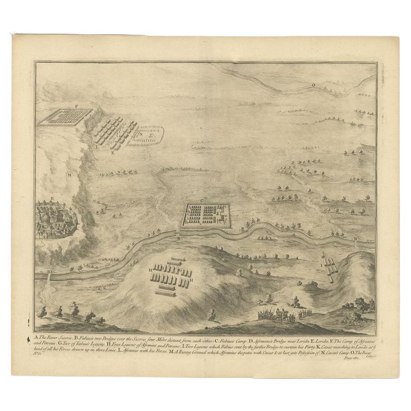
Antique Print of the Battle of Romans near the River Sicoris or Segre in France
Located in Langweer, NL
Antique battle map of the Segre river. With detailed legend explaining the various elements of the print. This print most likely originates from an edition of 'The Commentaries of Ca...
Category
Antique 18th Century Prints
Materials
Paper
$229 Sale Price
20% Off
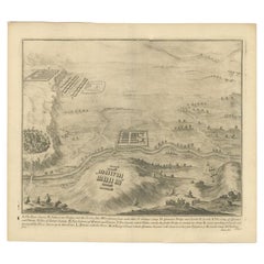
Prince Henry's Naval and Land Battle during the Seven Years' War Engraved, 1667
Located in Langweer, NL
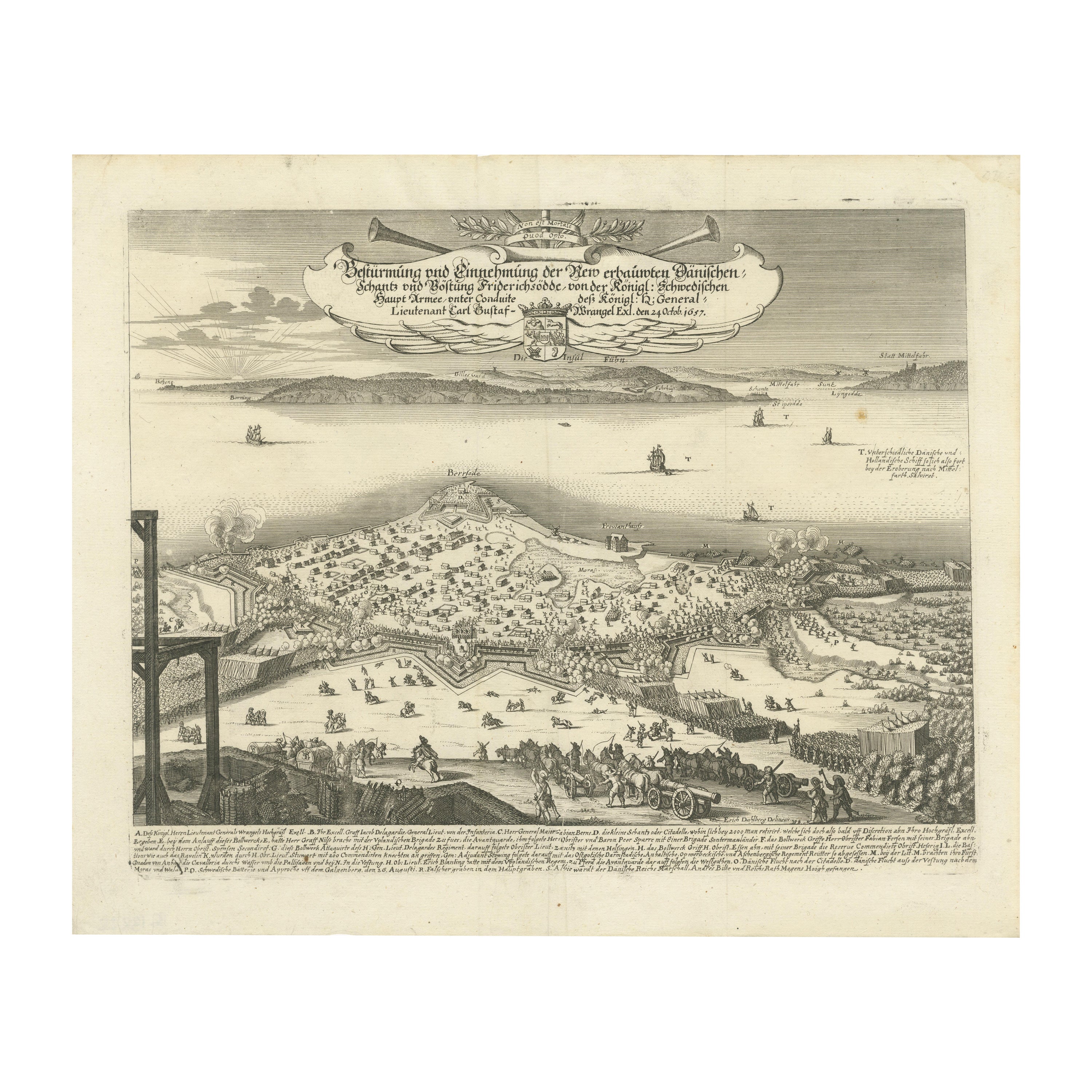
The engraving depicts the assault and capture of the Danish fortress Friderichsodde (now known as Fredericia) located on the island of Fyn. The scene, captured on October 24, 1657, vividly illustrates the Swedish main army's takeover under the command of General Carl Gustaf Wrangel. This historical event is meticulously documented in the artwork, which showcases not only the military action but also the strategic landscape and fortifications characteristic of the time.
Erik Jönsson Graf von Dahlberg, the artist behind this work, was a prominent Swedish field marshal, architect, and fortress builder. Born in 1625 and passing in 1703, Dahlberg's contributions to military and architectural fields were significant. He was renowned for his detailed and artistically valuable drawings which served as the basis for large-scale copperplate engravings. These engravings are of substantial topographical and architectural historical importance as they provide a detailed visual account of Swedish territories during the era.
In 1661, Dahlberg began work on his magnum opus—a comprehensive geographical and historical depiction of Swedish territories, which received royal privileges. His journey in 1667-1668 to Paris for the engraving of the initial plates reflects the international scope and ambition of his project. However, the work was intermittently paused when Dahlberg was tasked in 1674 with overseeing all Swedish fortress constructions, a role that significantly impacted his career and works. The project resumed and was published in 1684, highlighting a significant period of Swedish history and military achievements under his visual documentation.
MORE ABOUT THE BATTLE:
The image is an intricate engraving depicting a battle scene. Based on the details and the text in the cartouche, the scene illustrates a significant historical battle involving Prussian forces. The presence of multiple ships and extensive fortifications suggests a combined land and naval engagement.
Key Features in the Engraving:
1. Land Battle: The forefront of the image shows numerous troops, artillery pieces, and cavalry in action, depicting the intensity and scale of the land combat.
2. Naval Elements: Ships in the background indicate that this battle had a naval component, which would have been crucial for controlling trade routes or strategic waterways.
3. Fortifications: Extensive fortifications, including bastions and protective walls, suggest a well-defended location, possibly a city or a significant stronghold.
Historical Context:
From the text, it appears the battle involves "Prinz Heinrich," referring to Prince Henry of Prussia, who was an influential military leader during the reign of his brother, Frederick the Great. Under Frederick’s rule, Prussia engaged in several key conflicts, including the Seven Years' War (1756-1763), which saw major battles across Europe and involved complex alliances.
Given the level of detail and the era suggested by the style of ships and fortifications, the battle was of the significant engagements during the Seven Years' War, where Prince Henry played a critical role. His campaigns often involved maneuvering to protect Prussia from multiple fronts, including naval engagements in the Baltic.
Interpretation:
This engraving serves not only as a historical document but also as a piece of propaganda, likely glorifying the prowess and strategic capabilities of the Prussian military...
Category
Antique 1670s Prints
Materials
Paper
$440 Sale Price
20% Off
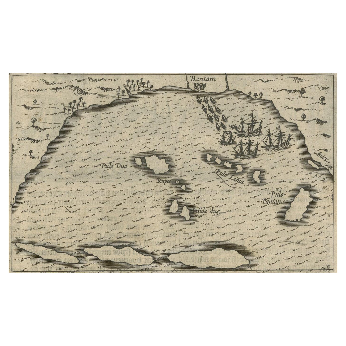
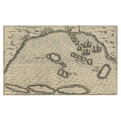
Small Map of Bantam with Dutch Ships and an Engraving of Portugese, 1614
Located in Langweer, NL
Two rare old miniature copper-engravings one one leaf. One showing the first arrival of the first Dutch in Indonesia, the so-called 'Houtman expedition' and on the reverse Portugese welcoming them with gifts.
The First Dutch Expedition to Indonesia was an expedition that took place from 1595 to 1597. It was instrumental in the opening up of the Indonesian spice trade...
Category
Antique Early 17th Century Maps
Materials
Paper
$718 Sale Price
20% Off
You May Also Like
Map of Burdegalen - Original Etching by George Braun - 1575 ca.
Located in Roma, IT
This Burdegalen is an original etching realized in about 1575 by George Braun (1541 – 1622)
The state of preservation of the artwork is good and aged on the edges of the sheet with...
Category
16th Century More Prints
Materials
Etching
1646 Jansson Map Entitled "Procinvia Connactiae, " Ric.a006
Located in Norton, MA
1646 Jansson map entitled
"Procinvia connactiae,"
Ric.a006
Description: The PROVINCE of CONNAVGT 490 x 380From vol 4 of Jansson's Atlas Novus 1646, published in Amsterdam with...
Category
Antique 17th Century Unknown Maps
Materials
Paper

Antique Map - Gallia - Etching by Johannes Janssonius - 1650s
By Johannes Janssonius
Located in Roma, IT
Antique Map - Gallia is an antique map realized in 1650 by Johannes Janssonius (1588-1664).
The Map is Hand-colored etching, with coeval watercoloring.
Good conditions with slight ...
Category
1650s Modern Figurative Prints
Materials
Etching

Rugen Island, Germany: An Early 17th Century Map by Mercator and Hondius
By Gerard Mercator
Located in Alamo, CA
This is an early 17th century map entitled "Nova Famigerabilis Insulae Ac Ducatus Rugiae Desciptio" (Map of Rugen Island, Germany) by Gerard Mercator and Henricus and Joducus Hondiu...
Category
Early 17th Century Old Masters Landscape Prints
Materials
Engraving

Original Antique Map of Switzerland, Engraved By Barlow, Dated 1807
Located in St Annes, Lancashire
Great map of Switzerland
Copper-plate engraving by Barlow
Published by Brightly & Kinnersly, Bungay, Suffolk.
Dated 1807
Unframed.
Category
Antique Early 1800s English Maps
Materials
Paper

Original Antique Print of The Battle of The Boyne, Ireland. C.1850
Located in St Annes, Lancashire
Great image of The Battle of The Boyne
Fine steel engraving after Benjamin West
With a highly decorative figural border
Published by London prin...
Category
Antique 1850s English Prints
Materials
Paper