Items Similar to California, Alaska and Mexico: 18th Century Hand-Colored Map by de Vaugondy

Want more images or videos?
Request additional images or videos from the seller
1 of 9
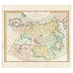
California, Alaska and Mexico: 18th Century Hand-Colored Map by de Vaugondy
$975
£739.81
€845.90
CA$1,361.81
A$1,514.15
CHF 790.60
MX$18,430.87
NOK 10,087.77
SEK 9,451.76
DKK 6,313.14
Shipping
Retrieving quote...The 1stDibs Promise:
Authenticity Guarantee,
Money-Back Guarantee,
24-Hour Cancellation
About the Item
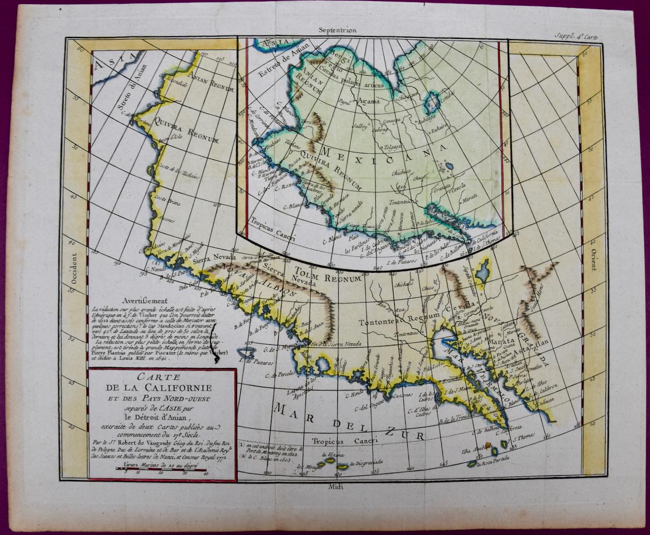
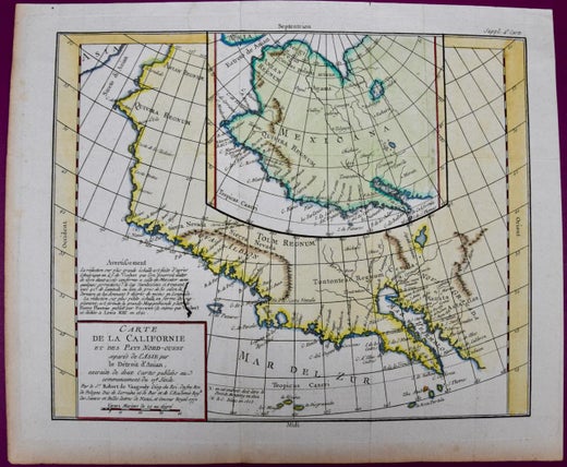
This is an 18th century hand-colored map of the western portions of North America entitled "Carte de la Californie et des Pays Nord-Ouest separés de l'Asie par le détroit d'Anian, extraite de deux cartes publiees au commencement de 17e Siecle" (Map of California and the Northwestern Countries separated from Asia by the Anian Strait, from two maps published at the beginning of the 17th century), created by Didier Robert De Vaugondy and published in Paris in 1772 in Diderot's Encyclopedie. The map and its inset are based on earlier maps from 1612 by and 1641 by the Dutch cartographers Petrus Plancius (1552-1622) and Nicolaes Visscher I (1618- 1679) relying on information included on maps by Gerardus Mercator (1512-1594).
The main portions of the map depicts the west coast of North America from present day Alaska in the north to Baja California in the south. The map includes the Strait of Anian in the region of Alaska, which refers to the legendary but nonexistent Northwest Passage, hoped to be a link between the Atlantic and Pacific oceans and a desirable trade route from Europe to North America. Captain James Cook eventually disproved its existence during his third and final voyage in 1778.
A large inset map of the same region curiously depicts the coastline differently than in the larger portion of the map. The larger map shows Mendocino in Northern California, the Bay of San Miguel (present day San Diego) and Cabo de California (Cabo San Lucas) at the southern tip of Baja California, while the smaller inset map includes C. de San Francisco and los Farilones (the Farallon Islands) and Isle De Paxaros, possibly representing Catalina Island. The larger map shows Nova Albion, the name given to Northern California by Sir Francis Drake when he claimed the area for England in 1579. His point of landfall is now called Drake's Cove, which is part of Point Reyes National Seashore. The smaller inset map identifies the entire region as "Mexicana".
These maps are based on maps by Vischer of 1612 and 1641, and appeared in the Supplement to Denis Diderot's Encyclopedie. Both maps showing the fictitious Strait of Anian at the top; it was part of the legendary Northwest Passage, the long hoped for link of the Pacific and Atlantic Oceans, whose existence many explorers attempted to prove, and which was later definitively disproved by Captain Cook in 1778. The smaller inset map shows much more of the Strait, along with an open sea, making a suggestion of a Northwest Passage. The coastlines and named locations depicted on these two maps vary greatly as they reflect was known at two different time periods.
The map is printed on watermarked laid, chain-linked paper with wide margins. The sheet measures 13.75" high x 16.63" wide. There are vertical and horizontal fold, as issued, with reinforcement of a left vertical fold on the verso. There is minimal discoloration of the edges of the left and lower margins and a few faint spots on the right, but the map is otherwise in excellent condition.
Didier Robert de Vaugondy (1723-1786) was the son of Gilles Robert de Vaugondy, who was a prominent French cartographer, printmaker and publisher. The two worked together in the family business, they publishing atlases. The best know publication was the Atlas Universel (1757). Didier followed his father as the royal cartographer/hydrographer to King Louis XV of France. He held a similar position in the court of the Duke of Lorraine and King of Poland. He later became the royal censor for information published in French geography texts, sea charts and publication describing travel and exploration.
- Creator:Didier Robert de Vaugondy (Artist)
- Dimensions:Height: 13.75 in (34.93 cm)Width: 16.63 in (42.25 cm)Depth: 0.13 in (3.31 mm)
- Materials and Techniques:Paper,Engraved
- Place of Origin:
- Period:1770-1779
- Date of Manufacture:1772
- Condition:Wear consistent with age and use.
- Seller Location:Alamo, CA
- Reference Number:Seller: # 3391stDibs: LU5206226628942
Didier Robert de Vaugondy
Didier Robert de Vaugondy (1723-1786) was the son of Gilles Robert de Vaugondy, who was a prominent French cartographer, printmaker and publisher. The two worked together in the family business, they publishing atlases. The best know publication was the Atlas Universel (1757). Didier followed his father as the royal cartographer/hydrographer to King Louis XV of France. He held a similar position in the court of the Duke of Lorraine and King of Poland. He later became the royal censor for information published in French geography texts, sea charts and publication describing travel and exploration.
About the Seller
5.0
Vetted Professional Seller
Every seller passes strict standards for authenticity and reliability
1stDibs seller since 2020
15 sales on 1stDibs
- ShippingRetrieving quote...Shipping from: Alamo, CA
- Return Policy
Authenticity Guarantee
In the unlikely event there’s an issue with an item’s authenticity, contact us within 1 year for a full refund. DetailsMoney-Back Guarantee
If your item is not as described, is damaged in transit, or does not arrive, contact us within 7 days for a full refund. Details24-Hour Cancellation
You have a 24-hour grace period in which to reconsider your purchase, with no questions asked.Vetted Professional Sellers
Our world-class sellers must adhere to strict standards for service and quality, maintaining the integrity of our listings.Price-Match Guarantee
If you find that a seller listed the same item for a lower price elsewhere, we’ll match it.Trusted Global Delivery
Our best-in-class carrier network provides specialized shipping options worldwide, including custom delivery.More From This Seller
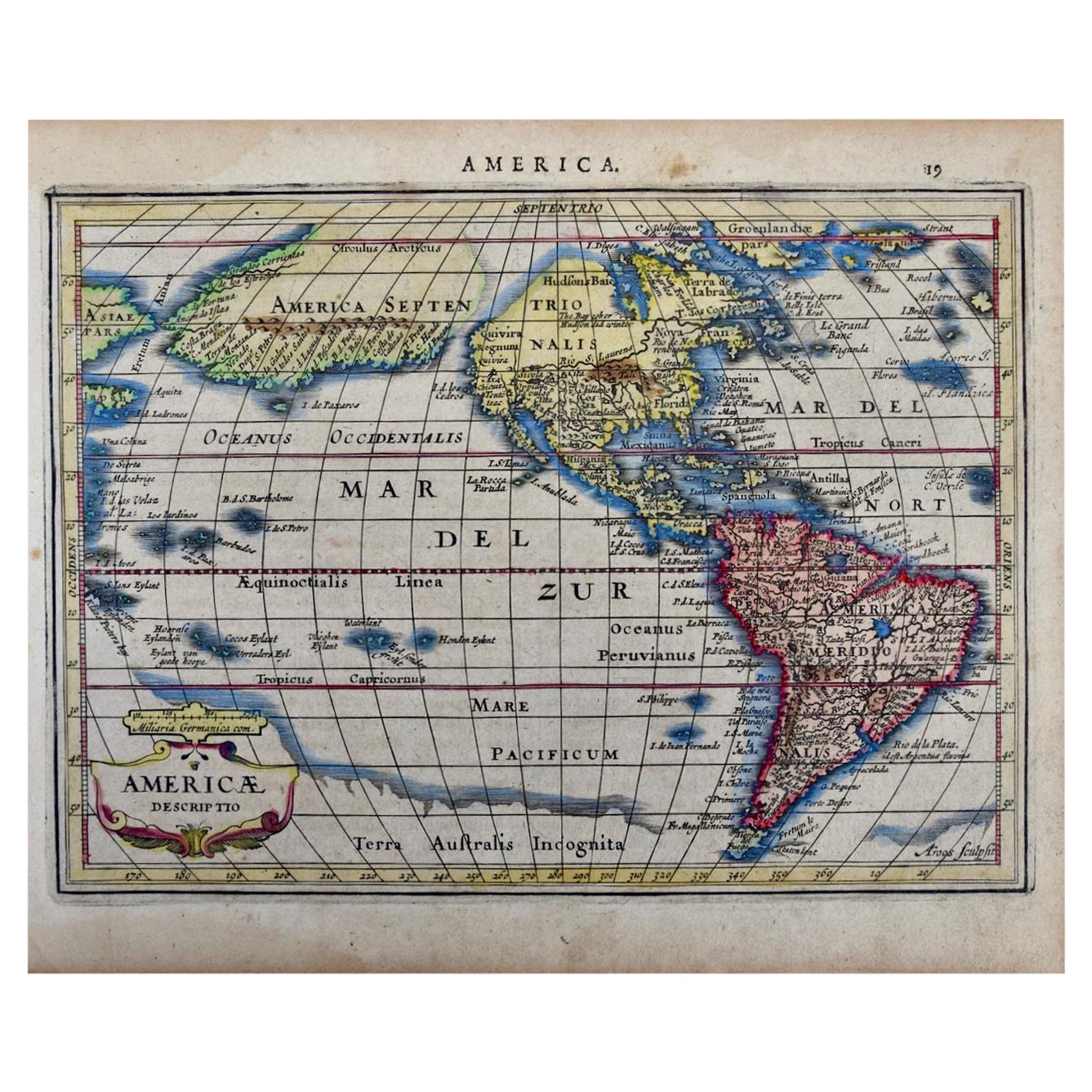
View AllNorth & South America: A 17th Century Hand-colored Map by Jansson & Goos
By Johannes Janssonius
Located in Alamo, CA
A 17th century hand-colored map of North & South America entitled "Americae Descriptio" by the cartographer Johannes Jansson, published in Jansson's Atlas Minor in Amsterdam in 1628....
Category
Antique 1620s Dutch Maps
Materials
Paper

Southern Greece: A Large 17th C. Hand-colored Map by Sanson and Jaillot
By Nicolas Sanson
Located in Alamo, CA
This large original hand-colored copperplate engraved map of southern Greece and the Pelopponese Peninsula entitled "La Moree Et Les Isles De Zante, Cefalonie, Ste. Marie, Cerigo & C...
Category
Antique 1690s French Maps
Materials
Paper

Africa: A Large 17th Century Hand-Colored Map by Sanson and Jaillot
By Nicolas Sanson
Located in Alamo, CA
This large original hand-colored copperplate engraved map of Africa entitled "L'Afrique divisee suivant l'estendue de ses principales parties ou sont distingues les uns des autres, L...
Category
Antique 1690s French Maps
Materials
Paper

America "Amérique Septentrionale": A 19th Century French Map by Delamarche
By Maison Delamarche 1
Located in Alamo, CA
This framed mid 19th century map of North America entitled "Amérique Septentrionale" by Felix Delamarche was published in Paris in 1854 by Quay de l'Horloge du Palais, avec les Carte...
Category
Antique Mid-19th Century American Other Maps
Materials
Paper

West Africa Entitled "Guinea Propria": An 18th Century Hand Colored Homann Map
By Johann Baptist Homann
Located in Alamo, CA
This is a scarce richly hand colored copper plate engraved map of Africa entitled "Guinea Propria, nec non Nigritiae vel Terrae Nigrorum Maxima Pars" by Johann Baptist Homann (1664-1...
Category
Antique Mid-18th Century German Maps
Materials
Paper

West Coast of Africa, Guinea & Sierra Leone: An 18th Century Map by Bellin
By Jacques-Nicolas Bellin
Located in Alamo, CA
Jacques Bellin's copper-plate map entitled "Partie de la Coste de Guinee Dupuis la Riviere de Sierra Leona Jusquau Cap das Palmas", depicting the coast of Guinea and Sierra Leone in ...
Category
Antique Mid-18th Century French Maps
Materials
Paper

You May Also Like
California: 18th Century Hand-colored Map by de Vaugondy
By Didier Robert de Vaugondy
Located in Alamo, CA
This is an 18th century hand-colored map of the western portions of North America entitled "Carte de la Californie et des Pays Nord-Ouest separés de l'Asie par le détroit d'Anian, ex...
Category
1770s Landscape Prints
Materials
Engraving

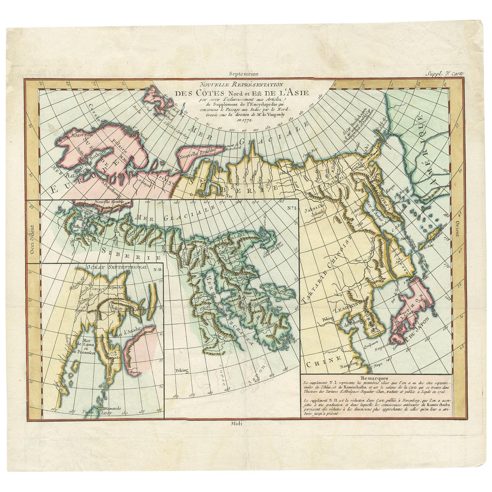
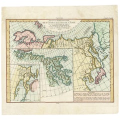
Antique Map of the North and East Coast of Asia by Vaugondy, circa 1750
Located in Langweer, NL
Antique map titled 'Nouvelle representation des Cotes Nord et Est de L'Asie.' Map the north and east coast of Asia, showing an oddly shaped Japan and inset maps of Kamchatka. Origina...
Category
Antique Mid-18th Century Maps
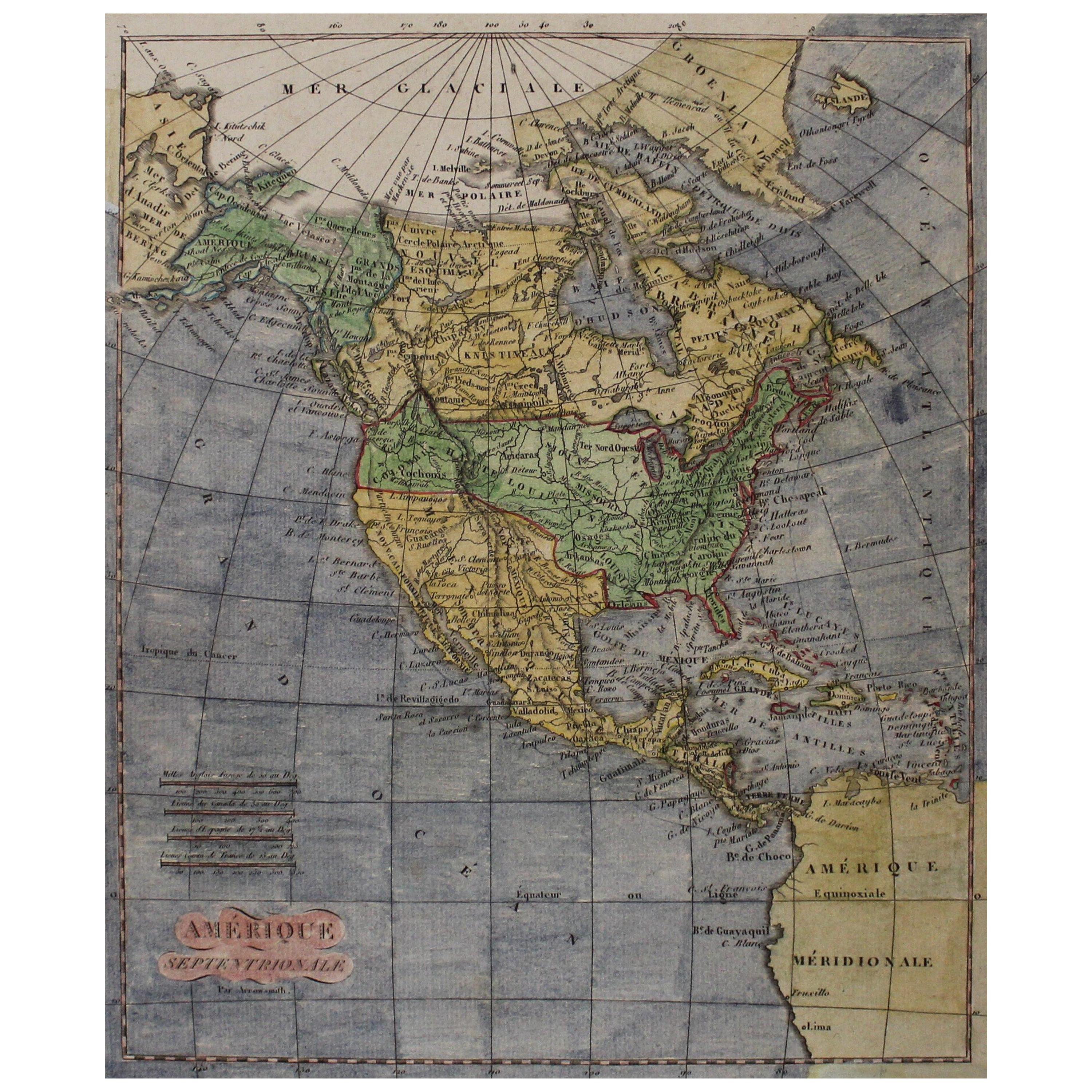
Early 19th Century Hand Coloured Map of North America by Aaron Arrowsmith
By Aaron Arrowsmith
Located in Hamilton, Ontario
Hand coloured map in French by English cartographer Aaron Arrowsmith (1750–1823) titled "Amerique Septentionale" (North America).
Map size: 9.5" x 8"
Mat size: 20.5" x 14.25".
Category
Antique Early 19th Century English Maps
Materials
Paper

$795 Sale Price
36% Off
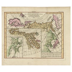
Map of North and East coast of Asia with Japan & inset maps of Kamchatka, c1750
Located in Langweer, NL
Antique map titled 'Nouvelle representation des Cotes Nord et Est de L'Asie.'
Map the north and east coast of Asia, showing an oddly shaped Japan and inset maps of Kamchatka. Thi...
Category
Antique 1750s Maps
Materials
Paper
$911 Sale Price
20% Off
Antique Map of the World with California as an Island, 1788
Located in Langweer, NL
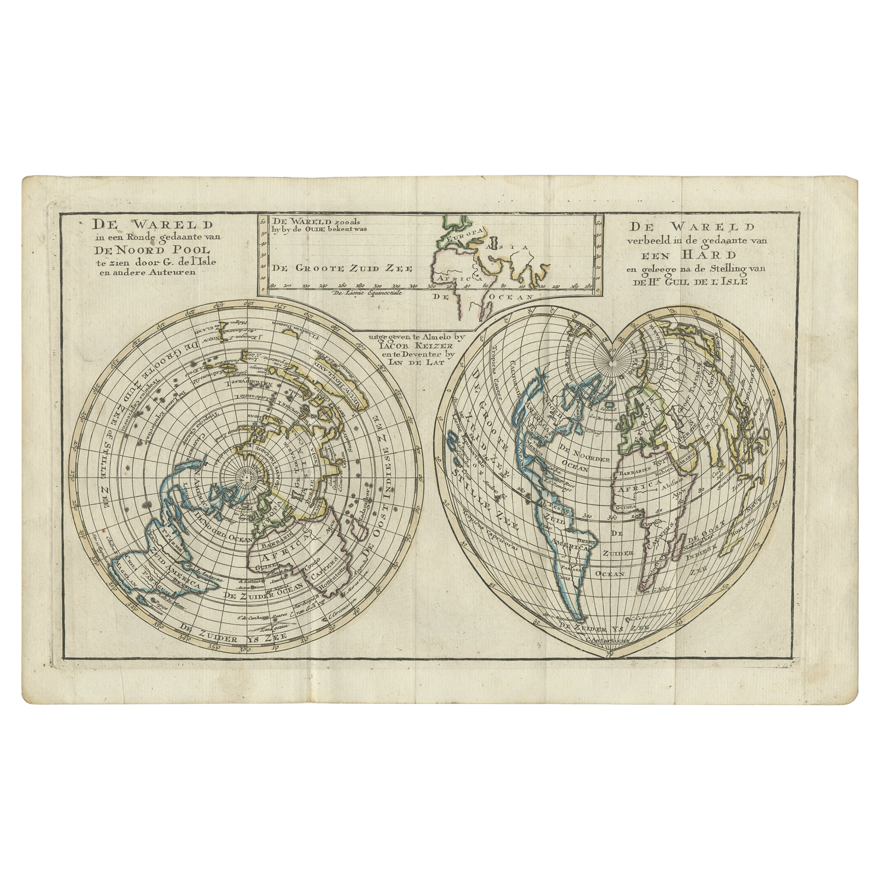
Description: Antique map titled 'De wareld in een ronde gedaante van de Noord Pool te zien - De Wareld verbeeld in de gedaante van een hard'. This interesting composition contains three world maps on the sheet. At left is a northern projection showing all the landmasses. At right is a cordiform projection (heart-shaped). At top is a map of the world as known to the ancients. Both the polar and cordiform projections show California as an island...
Category
Antique 1780s Maps
Materials
Paper

$623 Sale Price
20% Off
Antique Map of North Europe and East Asia by Vaugondy, circa 1750
Located in Langweer, NL
Antique map titled 'Carte des parties nord et est de L'Asie'. Map of the Northern parts and East Asia. Five maps on one sheet, showing California, Alaska and Syberia, Korea and Japan...
Category
Antique Mid-18th Century Maps
More Ways To Browse
Antique Furniture California
Antique Hand Carts
Antique Hand Trolley
Mexican 18th Century Furniture
Antique Furniture Detroit
Map Of Mexican California
Louis Xv Trolley
Textable Trolley
Sir Francis Drake
Trolley Drakes
Used Furniture Cabo San Lucas
James Francis Gill
Sri Lanka Map
Philippines Map
Antique Map Ceylon
Antique Sri Lanka Map
Persian Maps
Antique Civil War Maps