Items Similar to English Engraved Hand Colored Map of the North Eastern United States, circa 1817


Want more images or videos?
Request additional images or videos from the seller
1 of 8
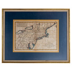
English Engraved Hand Colored Map of the North Eastern United States, circa 1817
$4,800
£3,642.13
€4,164.45
CA$6,704.30
A$7,454.27
CHF 3,892.21
MX$90,736.59
NOK 49,662.87
SEK 46,531.74
DKK 31,080.05
Shipping
Retrieving quote...The 1stDibs Promise:
Authenticity Guarantee,
Money-Back Guarantee,
24-Hour Cancellation
About the Item
English copper engraved hand colored map of the North Eastern United States matted under glass in a gilt frame, Early 19th Century. Drawn and Engraved for Thomson's New General Atlas, 1817.
- Dimensions:Height: 22 in (55.88 cm)Width: 25.75 in (65.41 cm)Depth: 1 in (2.54 cm)
- Style:George III (Of the Period)
- Materials and Techniques:
- Place of Origin:
- Period:
- Date of Manufacture:circa 1817
- Condition:Wear consistent with age and use.
- Seller Location:Charleston, SC
- Reference Number:Seller: # 51861stDibs: LU887228039762
About the Seller
4.7
Vetted Professional Seller
Every seller passes strict standards for authenticity and reliability
Established in 1970
1stDibs seller since 2010
431 sales on 1stDibs
Typical response time: 7 hours
- ShippingRetrieving quote...Shipping from: Charleston, SC
- Return Policy
Authenticity Guarantee
In the unlikely event there’s an issue with an item’s authenticity, contact us within 1 year for a full refund. DetailsMoney-Back Guarantee
If your item is not as described, is damaged in transit, or does not arrive, contact us within 7 days for a full refund. Details24-Hour Cancellation
You have a 24-hour grace period in which to reconsider your purchase, with no questions asked.Vetted Professional Sellers
Our world-class sellers must adhere to strict standards for service and quality, maintaining the integrity of our listings.Price-Match Guarantee
If you find that a seller listed the same item for a lower price elsewhere, we’ll match it.Trusted Global Delivery
Our best-in-class carrier network provides specialized shipping options worldwide, including custom delivery.More From This Seller
View AllFrench Framed Copper Engraved Hand Colored Map of Carolina & Georgia, Circa 1757
Located in Charleston, SC
French copper engraved hand colored map of Carolina & Georgia matted under glass with a painted frame, mid-18th century
Category
Antique 1750s French Louis XV Maps
Materials
Glass, Wood, Paint, Paper
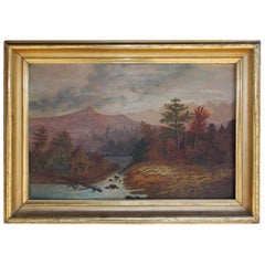
American Oil Framed Landscape on Academy Board, Hudson Valley, Circa 1820
Located in Charleston, SC
American school oil landscape on academy board in the original gold gilt molded frame. Landscape depicts Hudson Valley with mountains in the background, trees in the foreground and a...
Category
Antique 1820s American American Classical Paintings
Materials
Giltwood
American Steel Engraving of George Washington in Orig. Gilt Starred Frame C 1800
By John Trumbull
Located in Charleston, SC
American Steel Engraving of General George Washington "Before the Battle of Trenton" By John Trumbull Under Original Wavy Glass and Thirteen Starred Gilt Frame, Early 19th Century. T...
Category
Antique Early 1800s American American Colonial Drawings
Materials
Steel

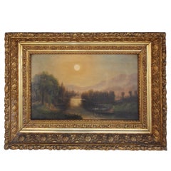
American Oil on Canvas Landscape in the Original Floral Gilt Frame. Circa 1850
Located in Charleston, SC
American oil on canvas landscape with a flowing stream, trees and mountains, watering cows in the foreground, sun in the background, encompassed on the origi...
Category
Antique 1850s American American Empire Paintings
Materials
Canvas, Giltwood, Paint
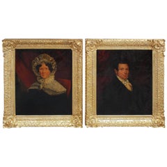
Pair of American Oil on Canvas Gilt Framed Portraits, S.C., Circa 1770
Located in Charleston, SC
Pair of American oil on canvas portraits in the original floral gilt frames and stretchers. South Carolina, Late 18th century. Signed Dr. Anthony Hemingway on re-verso.
Category
Antique 1770s American American Colonial Paintings
Materials
Gold Leaf
American Oil on Canvas Portrait of Seated Young Lady, NY, Circa 1850
Located in Charleston, SC
American oil on canvas portrait of seated young lady in the original gilt wood floral flame, New York, Mid-19th century.
Category
Antique 1850s American American Empire Paintings
Materials
Gesso, Canvas, Wood, Paint

You May Also Like
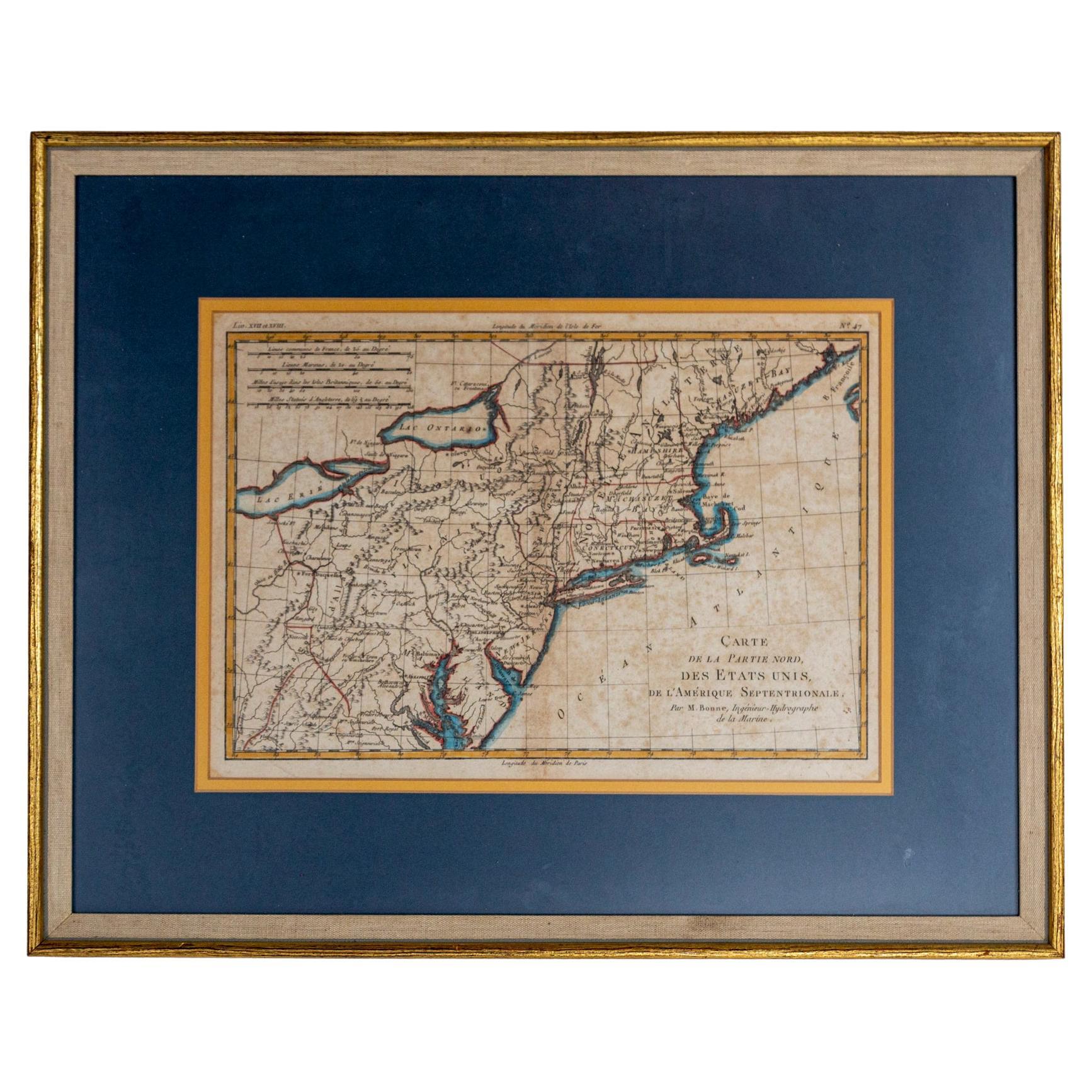
Hand-Colored French Map, Carte des Etats Unis, Par Bonne, Late 18th Century
By Rigobert Bonne
Located in Chappaqua, NY
Hand-colored French map, Carte de la Partie Nord, des Etats Unis, de l'Amérique Septentrionale, late 18th century. A French map of New England published at the end of the Revolutionary War...
Category
Antique Late 18th Century French Louis XVI Prints
Materials
Paper
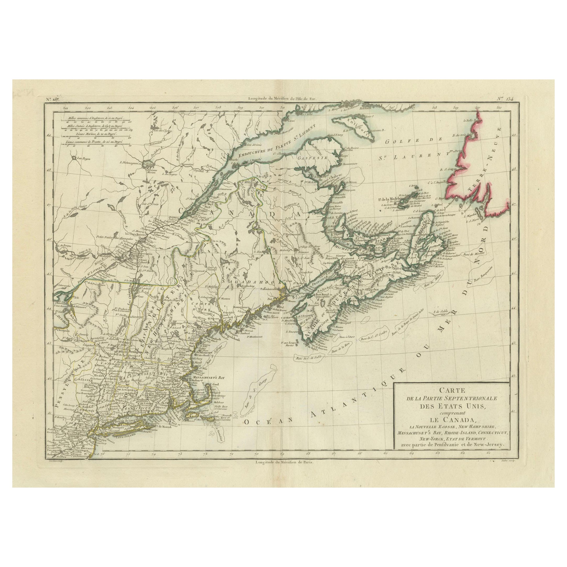
Antique Map of the Northeastern United States and Canada by Tardieu, 1802
Located in Langweer, NL
This antique map titled "Carte de la Partie Septentrionale des Etats Unis," created by Pierre Antoine Tardieu, depicts the northeastern part of the United States and parts of Canada....
Category
Antique Early 1800s Maps
Materials
Paper

$537 Sale Price
20% Off
1864 Map of North America, Antique Hand-Colored Map, by Adolphe Hippolyte Dufour
Located in Colorado Springs, CO
Offered is a map of North America entitled Amerique du Nord from 1864. This rare, separately published wall map was produced by Adolphe Hippolyte Dufour. This map includes vibrant an...
Category
Antique 1860s French Maps
Materials
Paper

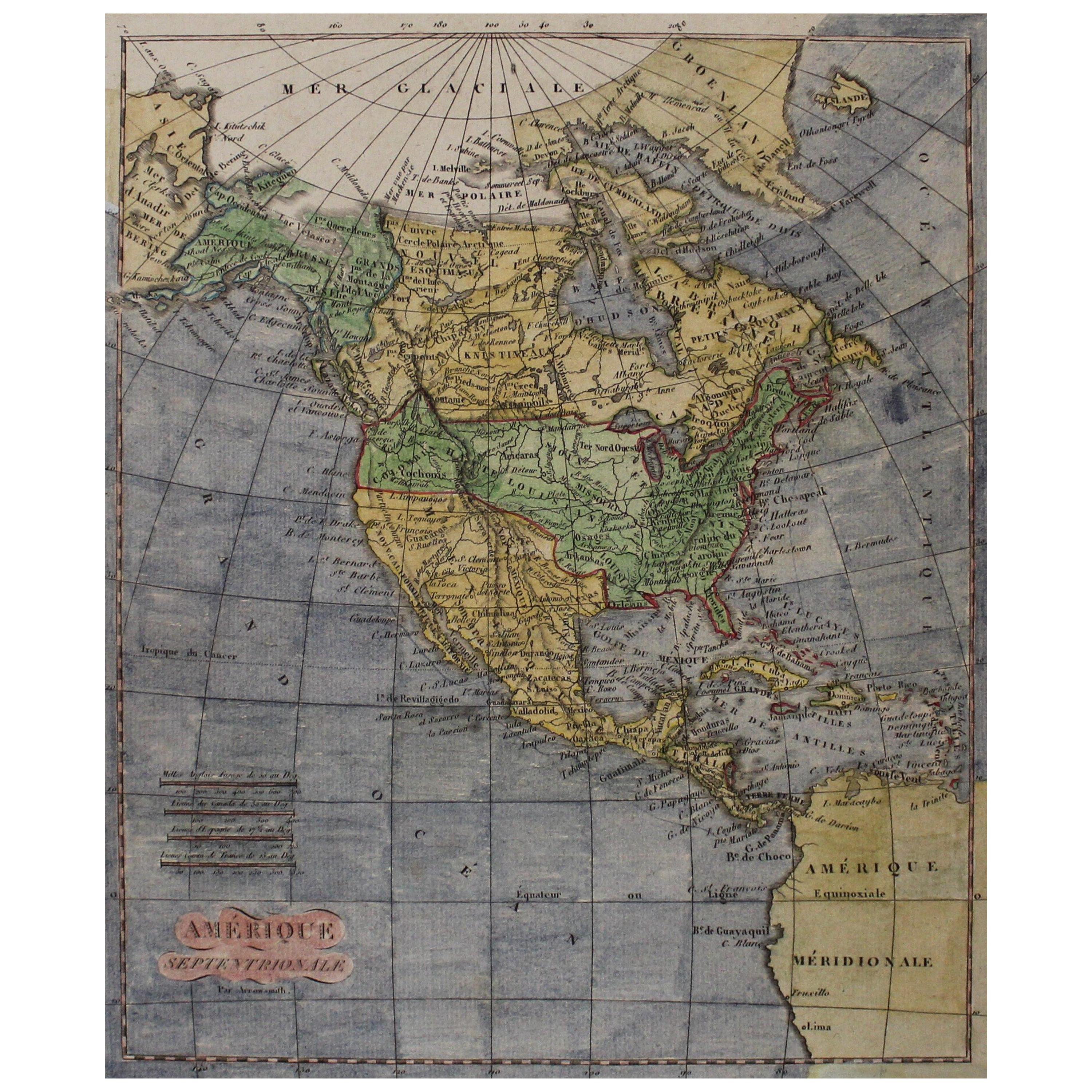
Early 19th Century Hand Coloured Map of North America by Aaron Arrowsmith
By Aaron Arrowsmith
Located in Hamilton, Ontario
Hand coloured map in French by English cartographer Aaron Arrowsmith (1750–1823) titled "Amerique Septentionale" (North America).
Map size: 9.5" x 8"
Mat size: 20.5" x 14.25".
Category
Antique Early 19th Century English Maps
Materials
Paper

$795 Sale Price
36% Off
Antique Map of the United States of North America by Wyld '1845'
Located in Langweer, NL
Antique map titled 'Map of The United States of North America'. Original antique map of the United States of North America. This map originates from 'An Atlas of the World, Comprehen...
Category
Antique Mid-19th Century Maps
Materials
Paper

$239 Sale Price
20% Off
Antique Map of New England and Part of Canada by Vaugondy 'circa 1755'
Located in Langweer, NL
Antique map titled 'Partie de l'Amérique septent qui comprend la nouvelle France ou le Canada'. Decorative and highly detailed map of New England an...
Category
Antique Mid-18th Century Maps
Materials
Paper

$1,574 Sale Price
24% Off
More Ways To Browse
English Copper
Caucasus Map
Map Of Puerto Rico
Nevada Antique Map
Shetland Map
Antique Chicago Maps
Kolkata Antique Furniture
Antique Bermuda Furniture
Antique Dairy Collectibles
Antique Map Of Cuba
Antique Map Of Yorkshire
Antique Map Vietnam
Antique Maps Massachusetts
Guyana Antique Map
Peninsular War
Santa Cruz Island
Ukraine Antique Map
Antique Life Buoy