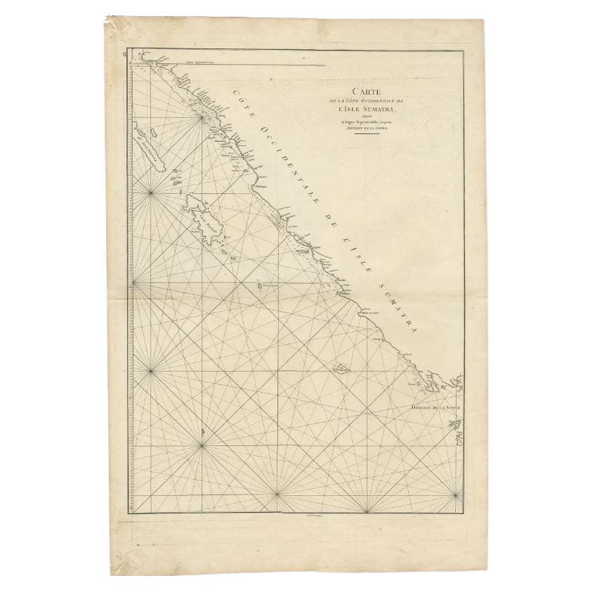
Items Similar to Large Antique Sea Chart of the South-Eastern Coast of Sumatra, Indonesia


Want more images or videos?
Request additional images or videos from the seller
1 of 6
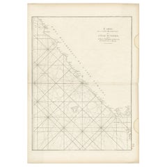
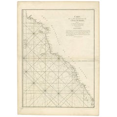
Large Antique Sea Chart of the South-Eastern Coast of Sumatra, Indonesia
$443.42
$554.2720% Off
£331.91
£414.8920% Off
€376
€47020% Off
CA$610.27
CA$762.8420% Off
A$680.21
A$850.2620% Off
CHF 356.88
CHF 446.1020% Off
MX$8,306.49
MX$10,383.1220% Off
NOK 4,518.92
NOK 5,648.6620% Off
SEK 4,271.07
SEK 5,338.8420% Off
DKK 2,862.38
DKK 3,577.9720% Off
About the Item
Antique map titled 'Carte pour aller du Détroit de la Sonde ou de Batavia, au Détroit de Banca'. This uncommon sea chart shows northern Java and eastern Sumatra along with an inset of the small islands in the Detroit Sound. The handsome chart provides detailed navigational information, including the route of Julien Crozet in April 1772, who led a French expedition to the South Pacific after the voyage's commander, Marion De Fresne, and 26 crew members were killed (and allegedly eaten) by a Maori tribe in the Bay of Islands off the coast of New Zealand. With title upper left corner and small inset map of the small isles nearby the south-eastern coast of Sumatra.
J. B. d'Apres de Mannevillette, from his atlas "Neptune orientale". French sailor and hydrographer, D' Après de Mannevillette (1707-1780) used new instruments to correct the latitudes measured by previous explorers. His atlas Le Neptune Oriental, first published in 1745, was considered a major achievement and an indispensable resource for navigators.
- Dimensions:Height: 30.2 in (76.7 cm)Width: 20.87 in (53 cm)Depth: 0.02 in (0.5 mm)
- Materials and Techniques:
- Period:
- Date of Manufacture:circa 1780
- Condition:Repaired: Professionally restored in several places (mainly on the coast line) and restoration on the folding line. Wear consistent with age and use. General age-related toning. Shows some wear and soiling. Blank verso. Please study images carefully.
- Seller Location:Langweer, NL
- Reference Number:Seller: BG-13369-11stDibs: LU3054331885302
About the Seller
5.0
Recognized Seller
These prestigious sellers are industry leaders and represent the highest echelon for item quality and design.
Platinum Seller
Premium sellers with a 4.7+ rating and 24-hour response times
Established in 2009
1stDibs seller since 2017
2,517 sales on 1stDibs
Typical response time: <1 hour
- ShippingRetrieving quote...Shipping from: Langweer, Netherlands
- Return Policy
Authenticity Guarantee
In the unlikely event there’s an issue with an item’s authenticity, contact us within 1 year for a full refund. DetailsMoney-Back Guarantee
If your item is not as described, is damaged in transit, or does not arrive, contact us within 7 days for a full refund. Details24-Hour Cancellation
You have a 24-hour grace period in which to reconsider your purchase, with no questions asked.Vetted Professional Sellers
Our world-class sellers must adhere to strict standards for service and quality, maintaining the integrity of our listings.Price-Match Guarantee
If you find that a seller listed the same item for a lower price elsewhere, we’ll match it.Trusted Global Delivery
Our best-in-class carrier network provides specialized shipping options worldwide, including custom delivery.More From This Seller
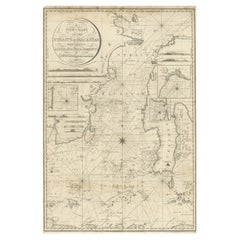
View AllAntique Sea Chart of the Coast of Sumatra, Indonesia, circa 1775
Located in Langweer, NL
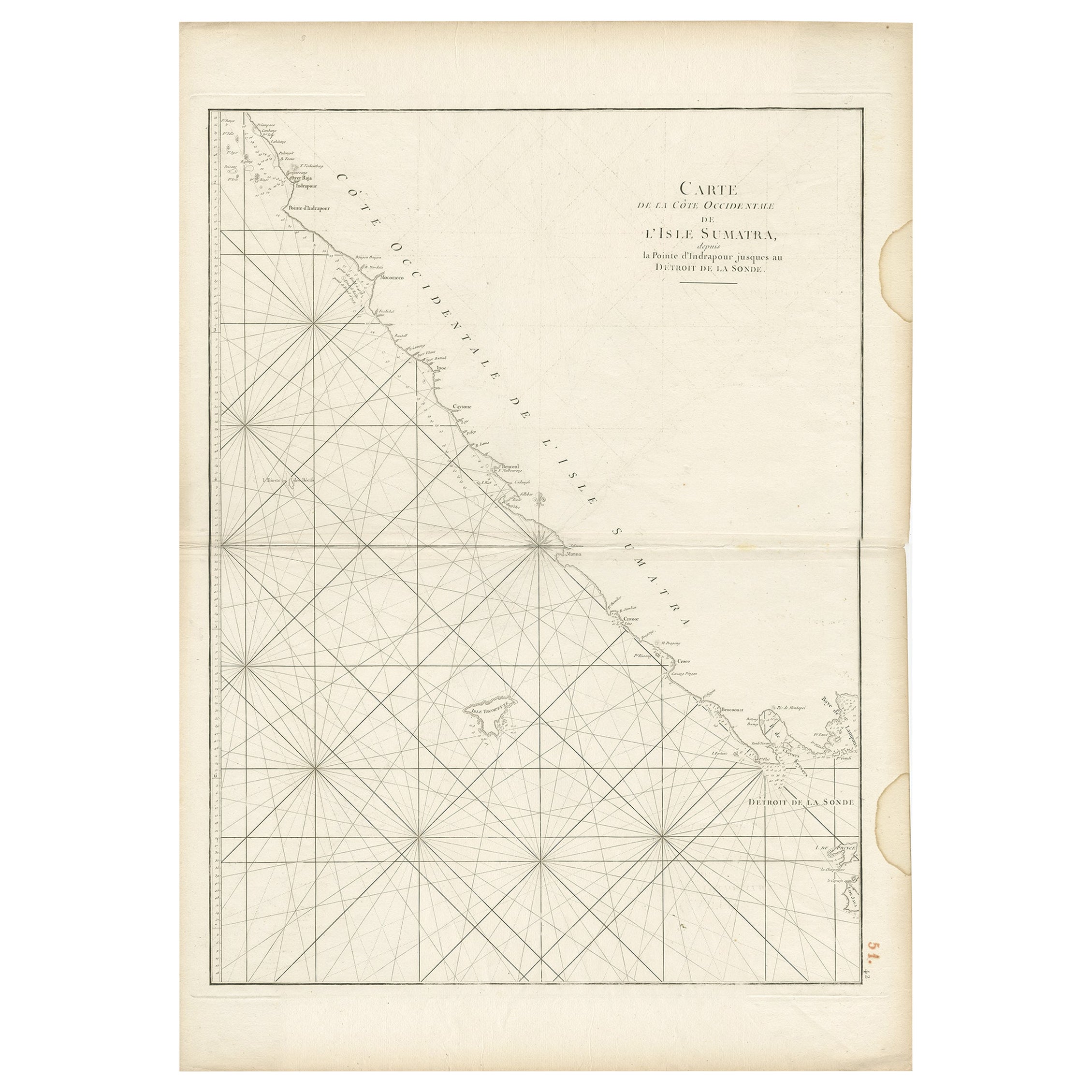
Antique map titled 'Carte de la Côte Occidentale de l'Isle Sumatra'. Sea chart of the part of the south-western coast of Sumatra with the Nassau (Nias) and Fortune isles.
Artists ...
Category
Antique 18th Century Maps
Materials
Paper
$509 Sale Price
20% Off
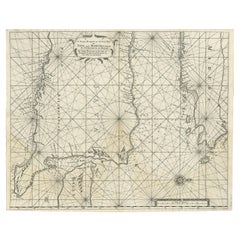
Sea Chart of Part of the Southwestern Coast of Sumatra & Nias, Indonesia, C1775
Located in Langweer, NL
Antique map titled 'Carte de la Côte Occidentale de l'Isle Sumatra'. Sea chart of the part of the south-western coast of Sumatra with the Nassau (Nias) and Fortune isles.
Artists ...
Category
Antique 1770s Maps
Materials
Paper

$477 Sale Price
25% Off
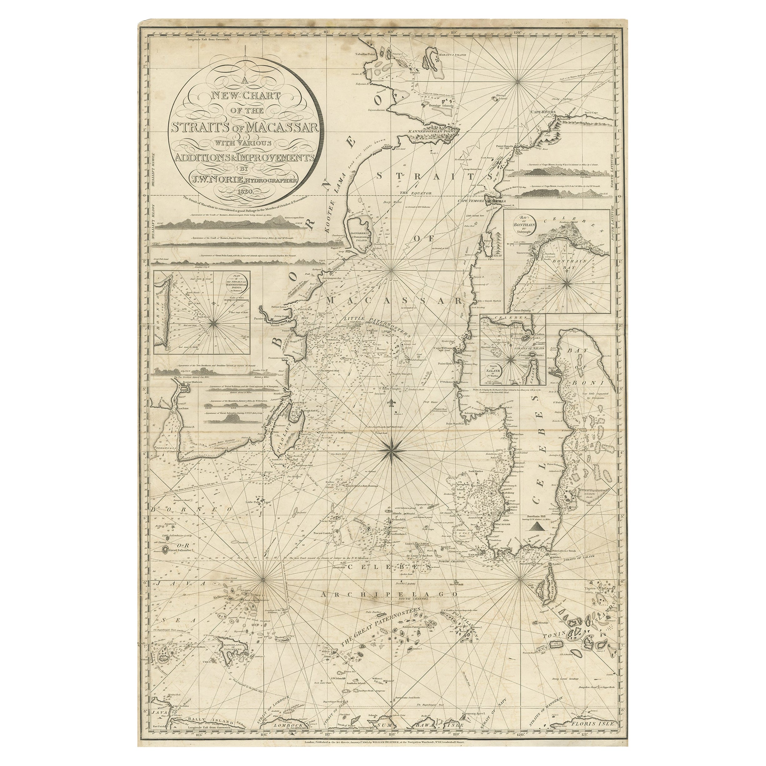
Antique Chart of the Straits of Makassar, Indonesia with Borneo and Celebes-1820
Located in Langweer, NL
Description: Antique map titled 'A New Chart of the Straits of Macassar with various additions & improvements by J.W. Norie'.
Rare and beautifully engraved chart of the Straits of Makassar showing Eastern Borneo and Celebes coast lines. With various smaller inset maps including a plan of the shoals off ragged and shoal points in Borneo, the Bay of Bonthain and the Straits of Salayr.
Artists and Engravers: John William Norie (1772-1843), acquired the chart publishing business of William Heather after he died in 1812. He went into partnership with George Wilson...
Category
Antique 1820s Maps
Materials
Paper
$2,594 Sale Price
20% Off
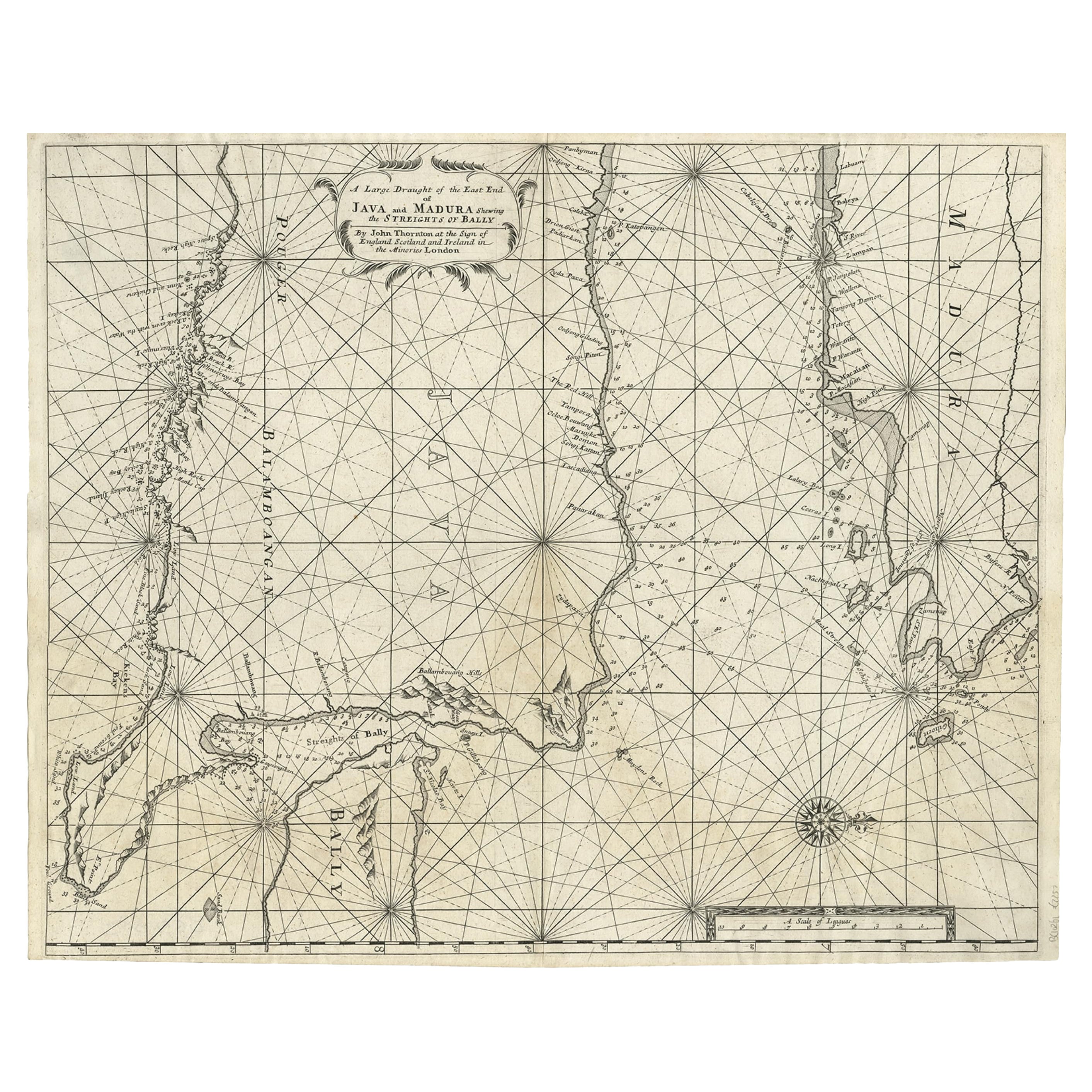
Rare Old English Sea Chart of Part of Indonesia with Java, Madura and Bali, 1711
Located in Langweer, NL
Antique map titled 'A Large Draught of the East End of Java and Madura shewing the Streights of Bally.'
Rare early example of this working English Sea Chart of part of Indonesia ...
Category
Antique 1710s Maps
Materials
Paper
$1,556 Sale Price
20% Off
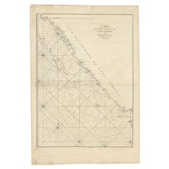
Antique Map of the South-Western Coast of Sumatra by De la Haye, c.1780
Located in Langweer, NL
Antique map titled 'Carte de la Côte Occidentale de l'Isle Sumatra'. Sea chart of the part of the south-western coast of Sumatra with the Nassau (Nias) and Fortune isles.
Artists ...
Category
Antique 18th Century Maps
Materials
Paper
$382 Sale Price
20% Off
Antique Coastal Map of West Sumatra 'Indonesia' by J. Mannevillette, 1745
Located in Langweer, NL
Antique map titled 'Carte de la côte occidentale de l'isle Sumatra depuis la ligne équinoctiale jusqu'au détroit de la Sonde'. Beautiful coastal map of We...
Category
Antique Mid-18th Century Maps
Materials
Paper
$467 Sale Price
20% Off
You May Also Like
Antique Maritime Chart of East Coast Virginia to Nova Scotia
Located in Norwell, MA
1920 nautical chart of the East Coast of the United States from Virginia to Maine, New Brunswick, and Nova Scotia. The chart shows Cape Cod, Long Island, the Connecticut coast, Jersey Shore, Maine, New Hampshire, etc. Very detailed, showing ports, lighthouses, shoals, depths, etc. The chart is by famous cartographer George W. Eldridge, compiled from surveys of the United States government, British Admiralty, George Eldridge, and others. First authorized by George Eldridge, published in 1916 by Wilfred O. White with a merchant's stamp of Charles Hutchinson...
Category
Vintage 1920s North American Maps
Materials
Paper

Large U.S. Coast and Geodetic Survey Chart A of the Atlantic Coast, 1877
Located in Nantucket, MA
Large U.S. Coast and Geodetic Survey Chart A of the Atlantic Coast, 1877, re-issued in February 1881, a printed paper laid down on linen navigational chart of the U.S. Atlantic coast...
Category
Antique 1880s American Other Maps
Materials
Linen

19th Century Nautical Chart of Martinique
Located in Norwell, MA
Original map of Martinique from 1887 with chartered waters around the island. Prepared from a French survey, completed in 1825, showing town, ports, rivers and tributaries. Published...
Category
Antique 19th Century Nautical Objects

Imray Ocean Chart of the Coast of Brazil 1876
Located in Norwell, MA
Imray & Son 1876 Nautical chart of the Coast of Brazil between Cape Frio and the River Plate. Nicely framed. Overall Dimensions: 46" H x 56" W.
Category
Antique 1870s Nautical Objects
Materials
Paper
Long Island Chart from 1828
Located in Norwell, MA
Rare original chart of Long Island Sound by E + G Blunt of New York, 179 Water St. "Surveyed in the years 1828, 29 & 30" Exceedingly rare and early chart, titled Long Island Sound fr...
Category
Antique 1830s Nautical Objects
Materials
Paper

Ocean Chart Of Massachusetts Bay
Located in Norwell, MA
Cape Cod Bay chart from 1907 by George W. Eldridge. This is chart "D" Massachusetts Bay and the coast from Chatham to Boston. Showing plotted courses, depths, lighthouses, ports, etc.. Excellent graphics. Ports include Barnstable, Sandwich, Duxbury, Plymouth, Cohasset, Hingham, Quincy, Boston, Marblehead, Lynn. Manchester by the Sea...
Category
Antique Early 1900s North American Prints
Materials
Paper
More Ways To Browse
Antique Furniture Detroit
New Zealand Maori
Navigation Instrument
Antique Maori
J And C Bavaria
Map Of Barbados
Montreal Map
Antique Furniture Toledo Ohio
Laos Antique Map
Orinoco Furniture
Johann Baptist Homann On Sale
Rand Mcnally Vintage Maps
Tipu Sultan
Antique Map Bermuda
Antique Map Holder
Lancashire Map
Maltese Falcon
Raised Relief Map