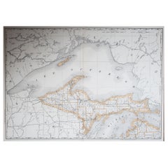
Large Original Antique Map of Michigan 'North', USA, 1894
View Similar Items
Want more images or videos?
Request additional images or videos from the seller
1 of 5
Large Original Antique Map of Michigan 'North', USA, 1894
Price:$79.49
$90List Price
About the Item
- Creator:Rand McNally & Co. (Maker)
- Dimensions:Height: 20.5 in (52.07 cm)Width: 27 in (68.58 cm)Depth: 0.07 in (1.78 mm)
- Materials and Techniques:Paper,Other
- Place of Origin:
- Period:
- Date of Manufacture:1894
- Condition:Wear consistent with age and use.
- Seller Location:St Annes, GB
- Reference Number:1stDibs: LU1836330118022
About the Seller
4.9
Platinum Seller
Premium sellers with a 4.7+ rating and 24-hour response times
1stDibs seller since 2016
3,116 sales on 1stDibs
Typical response time: 1 hour
Associations
International Confederation of Art and Antique Dealers' Associations
Authenticity Guarantee
In the unlikely event there’s an issue with an item’s authenticity, contact us within 1 year for a full refund. DetailsMoney-Back Guarantee
If your item is not as described, is damaged in transit, or does not arrive, contact us within 7 days for a full refund. Details24-Hour Cancellation
You have a 24-hour grace period in which to reconsider your purchase, with no questions asked.Vetted Professional Sellers
Our world-class sellers must adhere to strict standards for service and quality, maintaining the integrity of our listings.Price-Match Guarantee
If you find that a seller listed the same item for a lower price elsewhere, we’ll match it.Trusted Global Delivery
Our best-in-class carrier network provides specialized shipping options worldwide, including custom delivery.More From This Seller
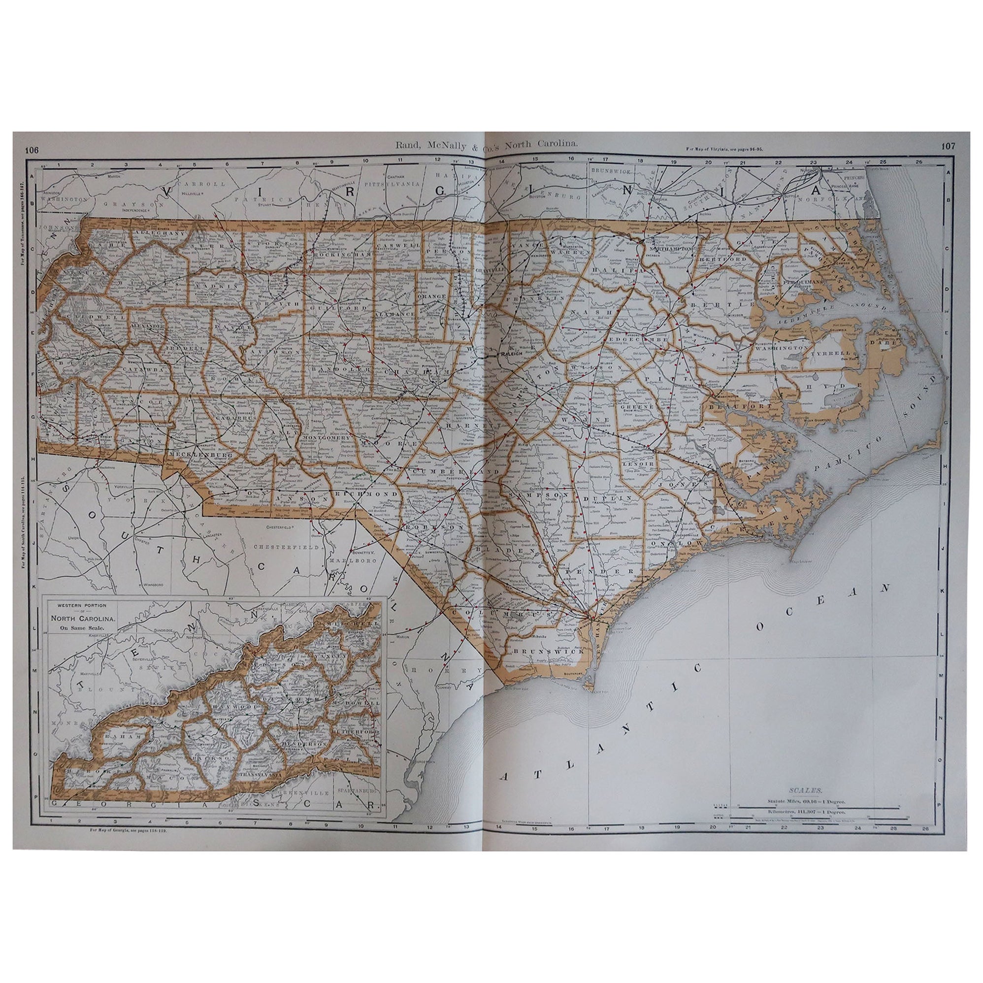
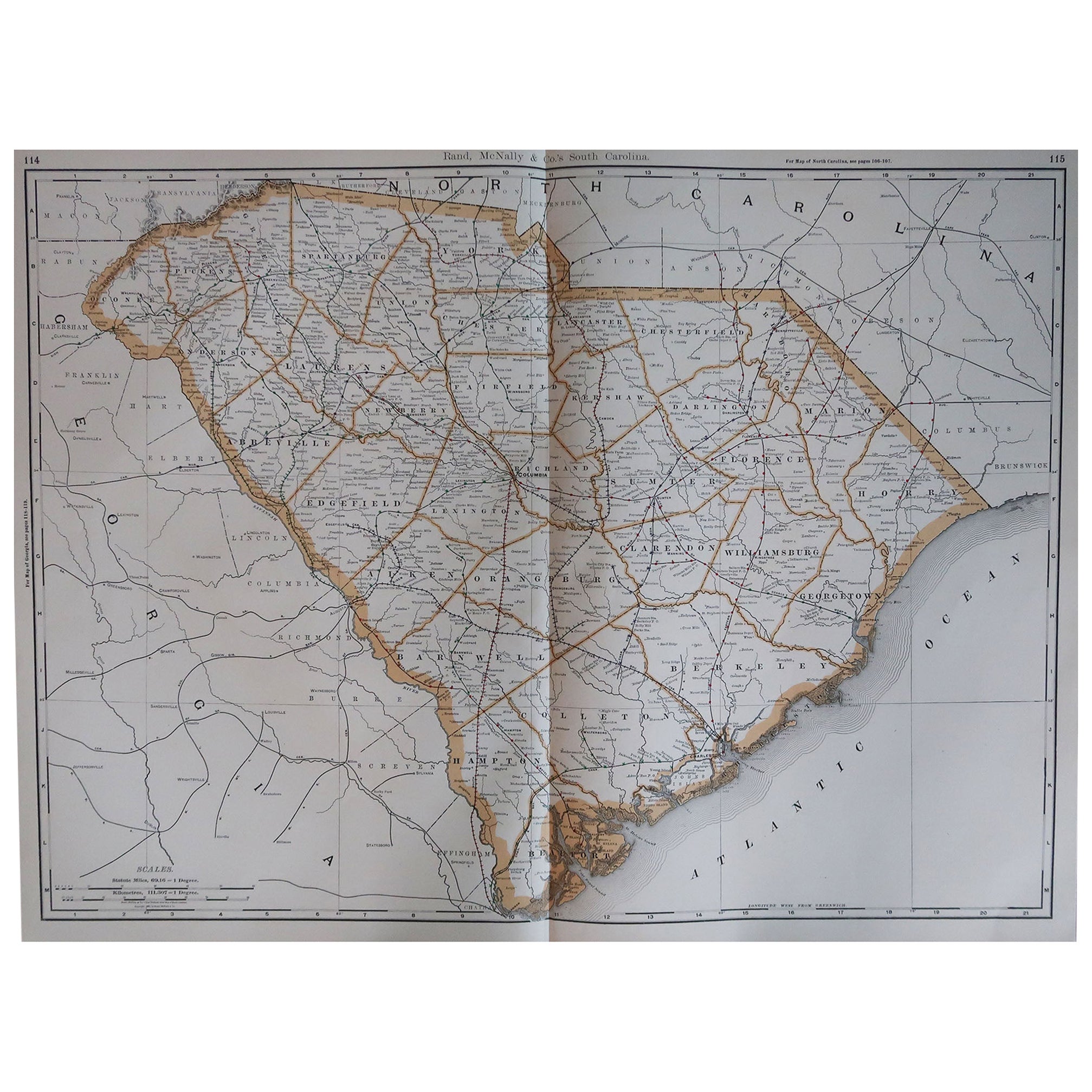
View AllLarge Original Antique Map of North Carolina, USA, 1894
By Rand McNally & Co.
Located in St Annes, Lancashire
Fabulous map of North Carolina
Original color
By Rand, McNally & Co.
Published, 1894
Unframed
Free shipping.
Category
Antique 1890s American Maps
Materials
Paper

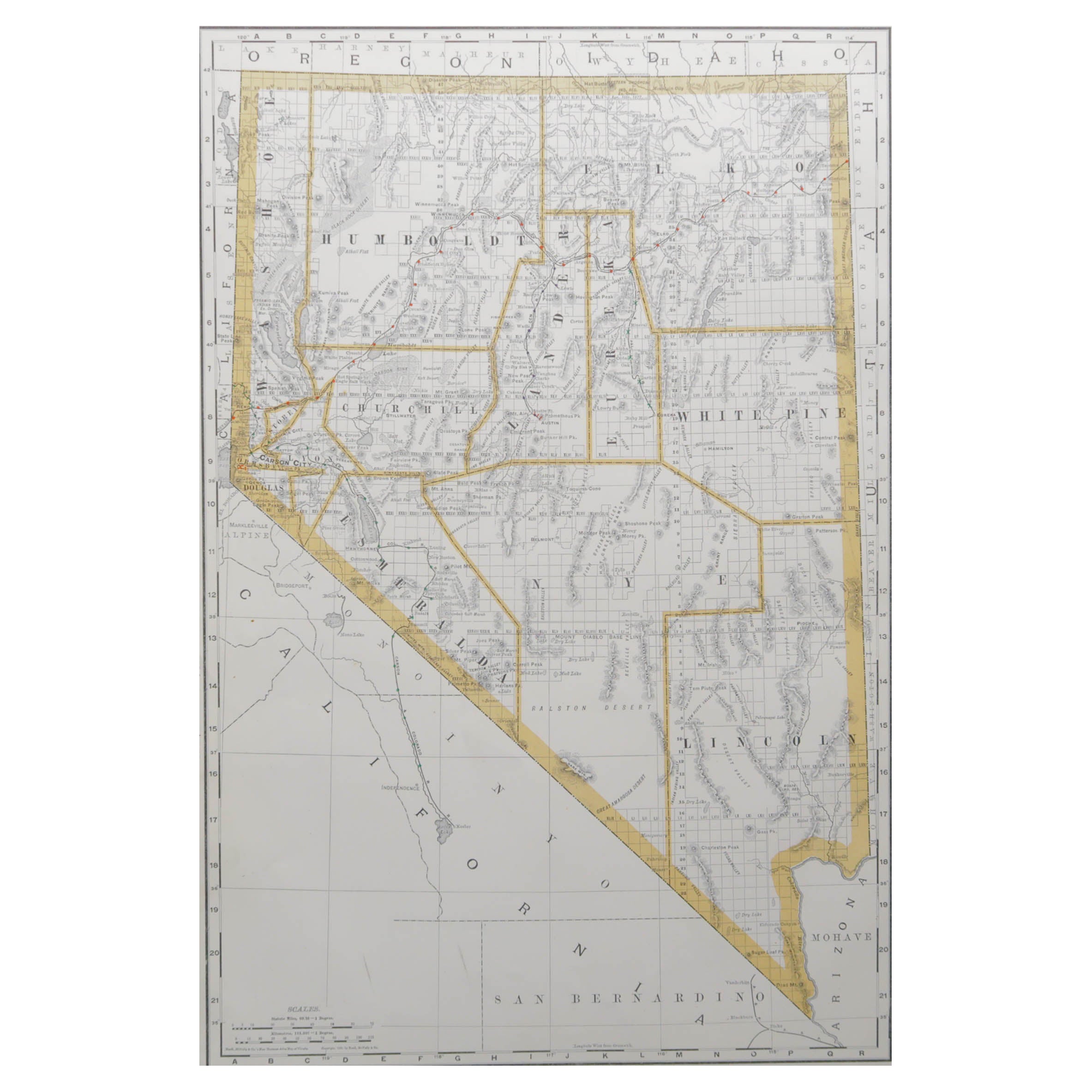
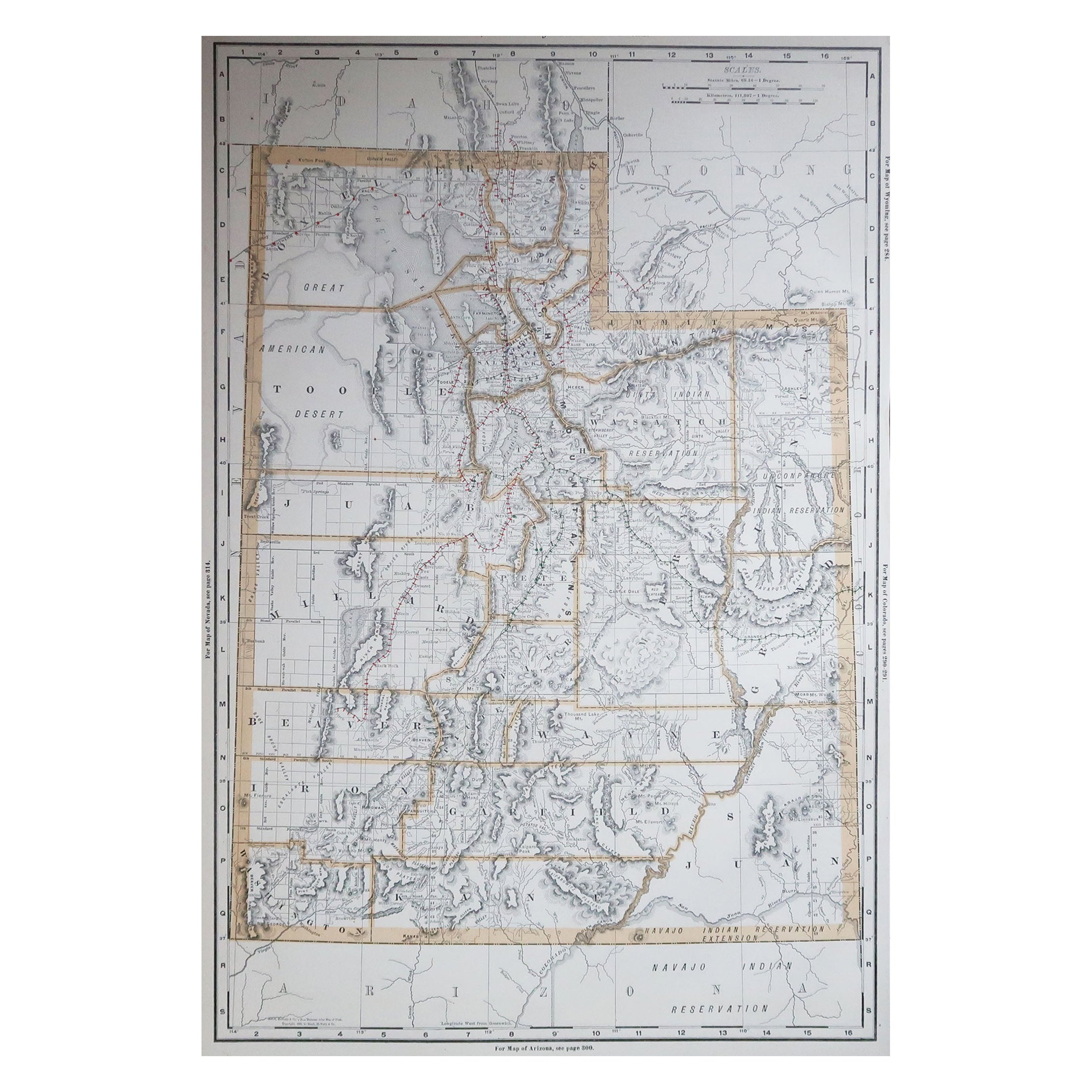
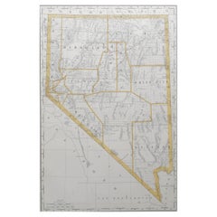
Large Original Antique Map of Nevada, USA, 1894
By Rand McNally & Co.
Located in St Annes, Lancashire
Fabulous map of Nevada
Original color
By Rand, McNally & Co.
Published, 1894
Unframed
Free shipping.
Category
Antique 1890s American Maps
Materials
Paper
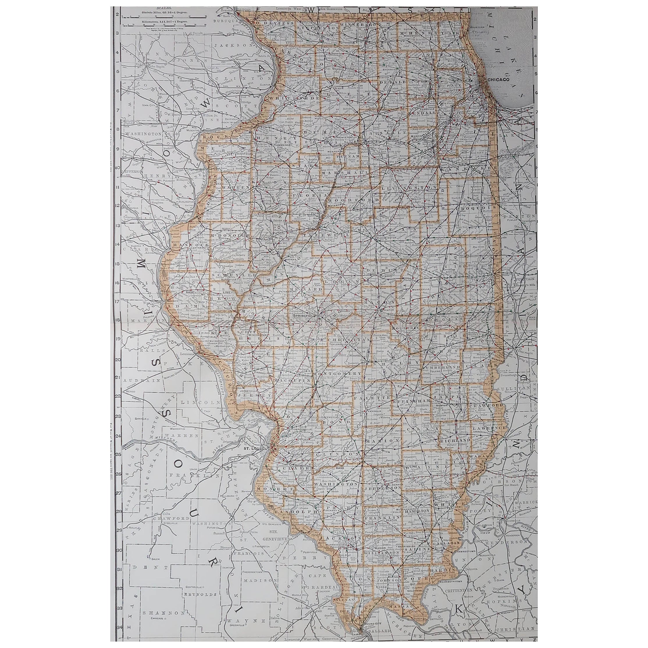
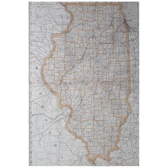
Large Original Antique Map of Illinois, USA, 1894
By Rand McNally & Co.
Located in St Annes, Lancashire
Fabulous map of Illinois
Original color
By Rand, McNally & Co.
Published, 1894
Unframed
Free shipping.
Category
Antique 1890s American Maps
Materials
Paper
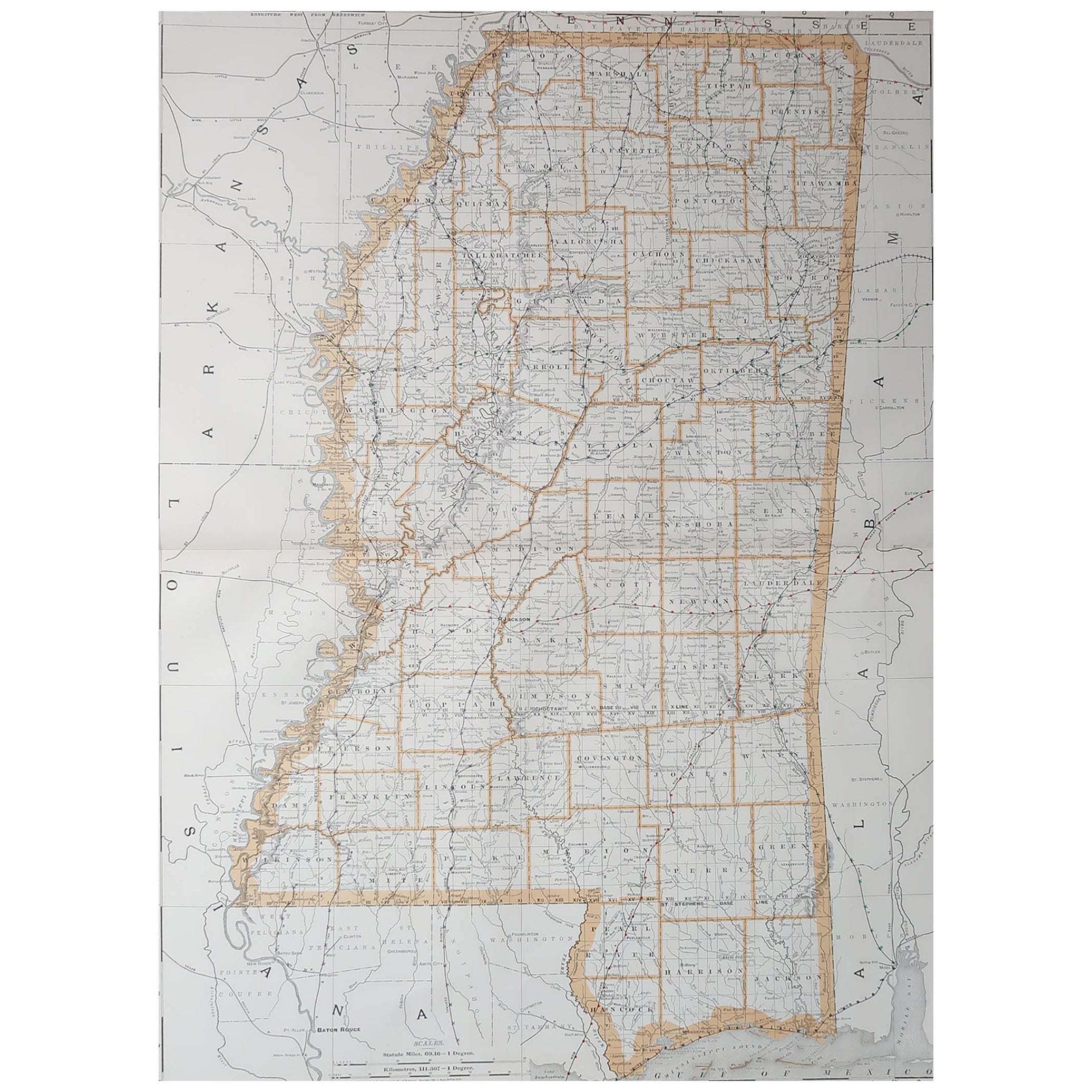
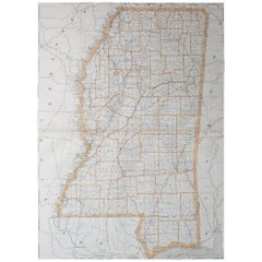
Large Original Antique Map of Mississippi, USA, 1894
By Rand McNally & Co.
Located in St Annes, Lancashire
Fabulous map of Mississippi
Original color
By Rand, McNally & Co.
Published, 1894
Unframed
Free shipping.
Category
Antique 1890s American Maps
Materials
Paper
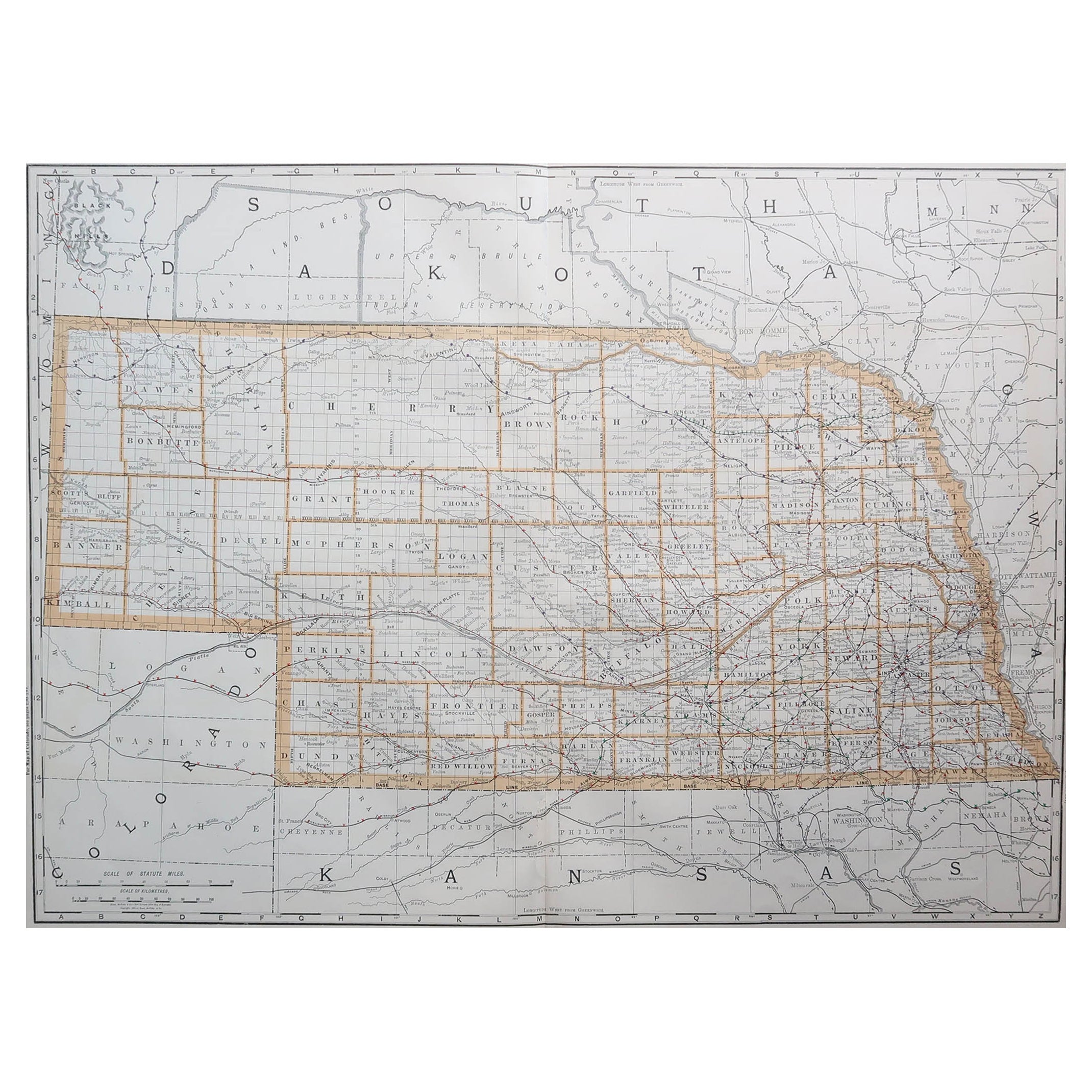
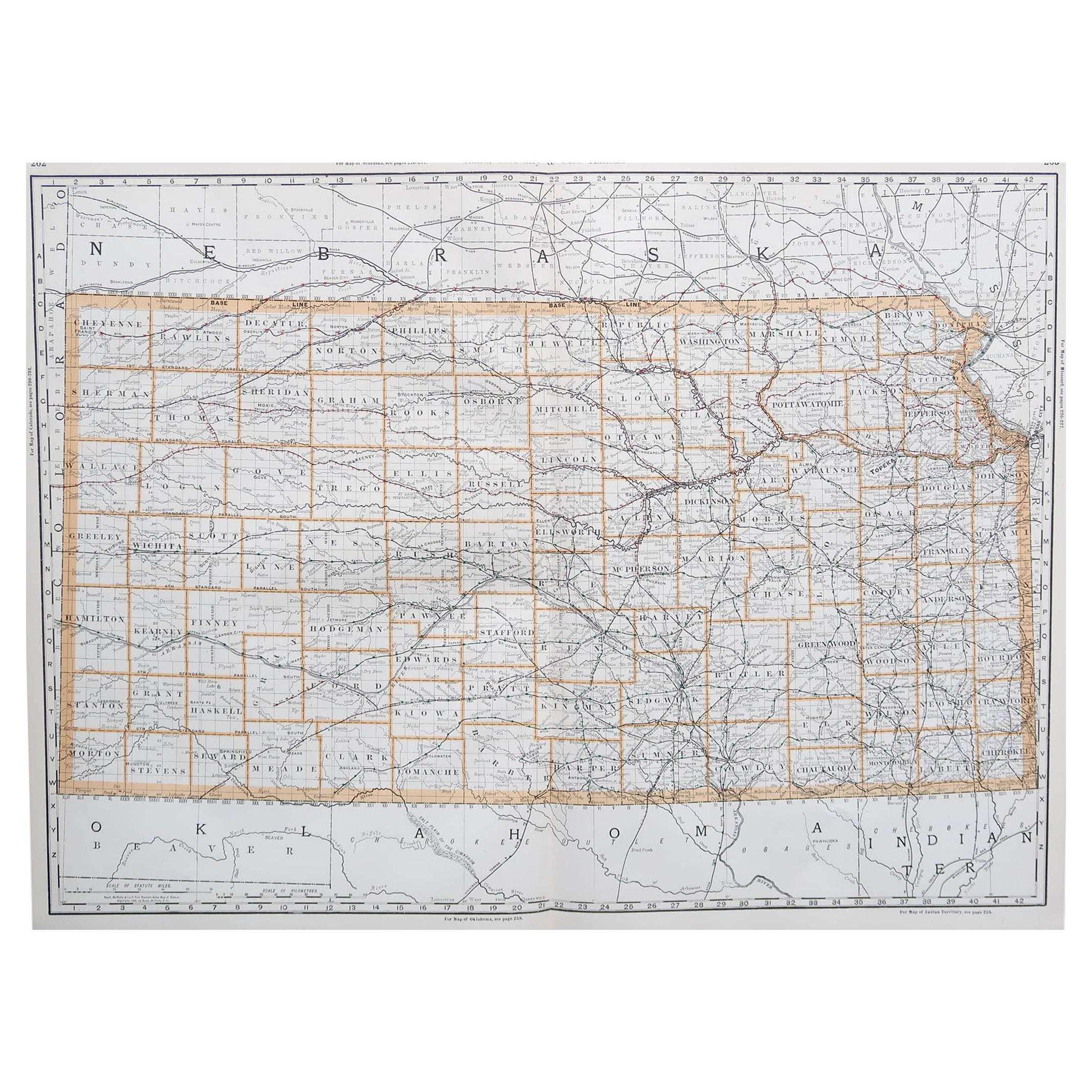
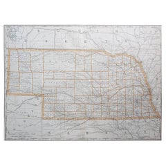
Large Original Antique Map of Nebraska, USA, 1894
By Rand McNally & Co.
Located in St Annes, Lancashire
Fabulous map of Nebraska
Original color
By Rand, McNally & Co.
Published, 1894
Unframed
Some slight restoration to the Gosper / Furnas area. Seen in the last image
Free shipping.
Category
Antique 1890s American Maps
Materials
Paper
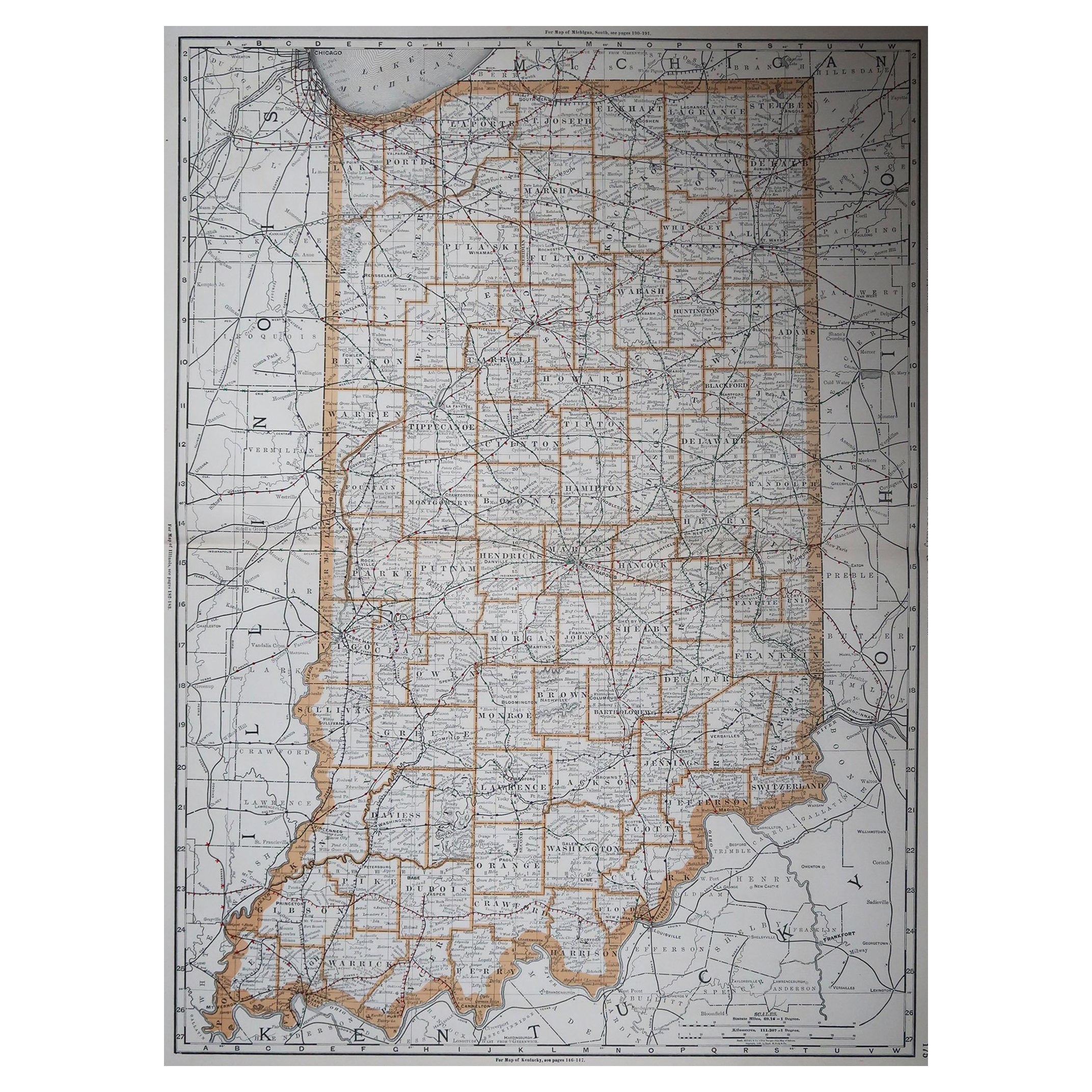
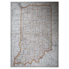
Large Original Antique Map of Indiana, USA, 1894
By Rand McNally & Co.
Located in St Annes, Lancashire
Fabulous map of Indiana.
Original color.
By Rand, McNally & Co.
Published, 1894.
Unframed.
Free shipping.
Category
Antique 1890s American Maps
Materials
Paper
You May Also Like
Antique Map of North East Borneo and North Sulawesi by P.M.G. Vandermaelen
Located in Langweer, NL
Contemporary colored lithographed map. Relief shown pictorially and by hachures. Covers North Eastern Borneo and part of Northern Sulawesi.
Category
Antique Early 19th Century Maps
Materials
Paper

$467 Sale Price
20% Off
Antique Map of North America by Dufour 'circa 1834'
Located in Langweer, NL
Antique map titled 'Amérique Septentrionale'. Uncommon map of North America. Published by or after A.H. Dufour, circa 1834. Source unknown, to be determined.
Category
Antique Mid-19th Century Maps
Materials
Paper

$188 Sale Price
20% Off
Original Engraved Antique Map of the World, Colorful and Decorative, C.1780
By Pierre François Tardieu
Located in Langweer, NL
Antique map titled 'Mappemonde en Deux Hemispheres ou l'on a Indique les Nouvelles Decouvertes' - This handsome double hemisphere map presents a ...
Category
Antique 18th Century Maps
Materials
Paper

$443 Sale Price
20% Off
Very Decorative Original Antique Map of the World, Published in France in c.1780
By Rigobert Bonne
Located in Langweer, NL
Antique map titled 'L'Ancien Monde Et Le Nouveau en Deux Hemispheres' - Double hemisphere map of the World, showing the contemporary geographical...
Category
Antique 18th Century Maps
Materials
Paper

$726 Sale Price
20% Off
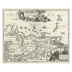
Antique Map of Venezuela by Montanus, 1671
By Arnoldus Montanus
Located in Langweer, NL
Antique map titled 'Venezuela cum parte Australi Novae Andalusiae'. The map extends from Coquibocoa to the Orinoque River, centered on Bariquicemento and Cape de Curiacao. Large cart...
Category
Antique Mid-17th Century English Maps
Materials
Paper
$566 Sale Price
20% Off
Antique Map of Korea by Kozaki, 1903
Located in Langweer, NL
Old map of Korea by S. Kozaki. Restored and mounted.
Category
20th Century Maps
Materials
Paper

$896 Sale Price
20% Off
Recently Viewed
View AllMore Ways To Browse
Antique Map Of Michigan
Antique Maps Of Maryland
Gambia Antique Map
Antique Manitoba
Antique Map Of Brooklyn
Antique Map Of Michigan
Cham Antiques
Map Of Native American Tribes
Antique Furniture Halifax Furniture
Antique Furniture Trinidad
Antique Kiel Furniture
Cornwall Map
Marie Galante
Patagonia Map
Shepherd And Hedger
Vignola Furniture
Washington Dc Map
Antique Map Of Cornwall