Items Similar to Map of India and Ceylon with Inset of Calcutta and the Ganges, by Bonne, 1780


Want more images or videos?
Request additional images or videos from the seller
1 of 7
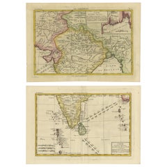
Map of India and Ceylon with Inset of Calcutta and the Ganges, by Bonne, 1780
$325.79
$407.2320% Off
£241.42
£301.7820% Off
€272
€34020% Off
CA$444.76
CA$555.9520% Off
A$494.78
A$618.4720% Off
CHF 259.37
CHF 324.2120% Off
MX$6,046.04
MX$7,557.5520% Off
NOK 3,302.72
NOK 4,128.4120% Off
SEK 3,109.06
SEK 3,886.3220% Off
DKK 2,070.98
DKK 2,588.7320% Off
Shipping
Retrieving quote...The 1stDibs Promise:
Authenticity Guarantee,
Money-Back Guarantee,
24-Hour Cancellation
About the Item
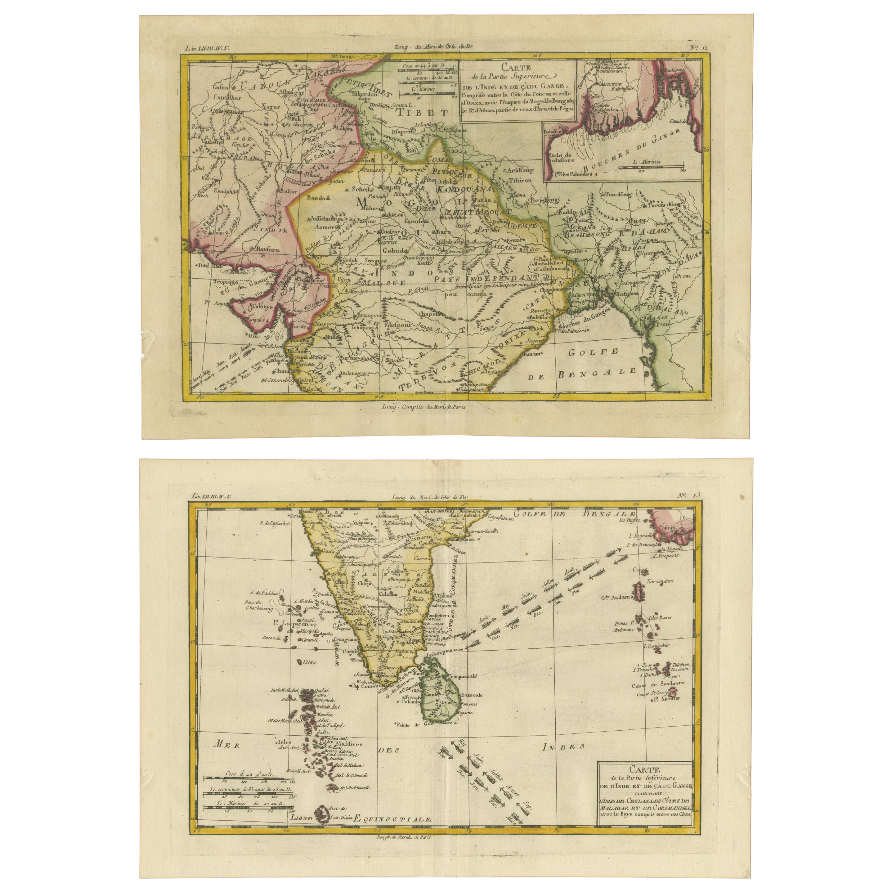
The map on offer is an antique copperplate engraving of India and Ceylon (Sri Lanka), created by Rigobert Bonne (1727-1794), a prominent French cartographer. Here is a breakdown of the map and its features:
1. Geographical Scope:
- The map covers the Indian subcontinent, including India, Ceylon (Sri Lanka), Tibet, Nepal, and the Maldives. It provides a detailed view of the regions as they were understood in the 18th century.
- The map also includes the Maldives and a portion of Southeast Asia, which reflects Bonne's attempts to capture the broader region surrounding the Indian Ocean.
2. Inset of Calcutta and the Ganges:
- In the upper right corner, there is an inset map focusing on Calcutta (modern-day Kolkata) and the Ganges River. This area was particularly important due to its role in British colonial trade and influence in India during the 18th century.
3. Map Title:
- The main title of the map in the cartouche (upper right) translates as "Map of the Upper Part of India beyond the Ganges." It refers to Northern India and its surrounding regions, covering significant historical areas such as Bengal and Tibet.
- The lower cartouche on the map provides a "Map of the Lower Part of India beyond the Ganges", including Ceylon and other coastal regions.
4. Cartographic Detail:
- The map showcases hand-applied color boundaries, which delineate regions and political entities, a common practice in high-quality maps of this era.
- Bonne’s maps are known for their clear depiction of geographical features, including mountain ranges, rivers, and islands. This map appears to label significant passes, cities, mountains, and bodies of water.
5. Condition and Production:
- Being a copperplate engraving, this map would have been meticulously engraved on a copper sheet before being inked and pressed onto paper, which often results in fine, precise lines and the possibility of a visible platemark.
- The map is well-preserved with a centerfold, typical for maps that were part of larger atlases or collections.
6. Historical and Cartographic Significance:
- Rigobert Bonne was one of the leading French cartographers during the late 18th century. He worked as the Hydrographer at the Dépôt de la Marine, and his maps were known for their accuracy and clarity, focusing more on geographical precision than on ornamental design, which was common in earlier maps.
- Maps like this one were crucial for European understanding of colonial territories and trade routes in the 18th century, especially for navigation and expansion during the age of European imperialism.
- Dimensions:Height: 17.72 in (45 cm)Width: 14.18 in (36 cm)Depth: 0 in (0.02 mm)
- Materials and Techniques:Paper,Engraved
- Period:1780-1789
- Date of Manufacture:1780
- Condition:Condition: good, given age. Light foxing, soilng and creasing. Original folding as issued with two engravings joined together. General age-related toning and/or occasional minor defects from handling. Please study scan carefully.
- Seller Location:Langweer, NL
- Reference Number:Seller: BG-137261stDibs: LU3054341476752
About the Seller
5.0
Recognized Seller
These prestigious sellers are industry leaders and represent the highest echelon for item quality and design.
Platinum Seller
Premium sellers with a 4.7+ rating and 24-hour response times
Established in 2009
1stDibs seller since 2017
2,494 sales on 1stDibs
Typical response time: 1 hour
- ShippingRetrieving quote...Shipping from: Langweer, Netherlands
- Return Policy
Authenticity Guarantee
In the unlikely event there’s an issue with an item’s authenticity, contact us within 1 year for a full refund. DetailsMoney-Back Guarantee
If your item is not as described, is damaged in transit, or does not arrive, contact us within 7 days for a full refund. Details24-Hour Cancellation
You have a 24-hour grace period in which to reconsider your purchase, with no questions asked.Vetted Professional Sellers
Our world-class sellers must adhere to strict standards for service and quality, maintaining the integrity of our listings.Price-Match Guarantee
If you find that a seller listed the same item for a lower price elsewhere, we’ll match it.Trusted Global Delivery
Our best-in-class carrier network provides specialized shipping options worldwide, including custom delivery.More From This Seller
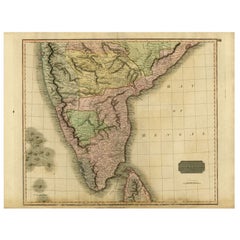
View All18th Century Cartographic Depiction of Upper India and Ceylon, 1835
Located in Langweer, NL
An exquisite set of two maps, 'Carte de la Partie Superieure De L'Inde en de Cadu Gange,' masterfully crafted by the renowned 18th-century French cartographer, Charles Marie Rigobert...
Category
Antique 1830s Maps
Materials
Paper
$421 Sale Price
20% Off
Free Shipping
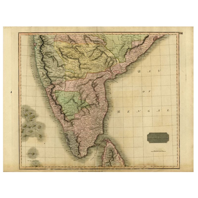
Antique Map of Southern India and Ceylon by Thomson, 1816
Located in Langweer, NL
"Antique map titled 'Southern Hindostan'. A map of Southern India and the North of Ceylon. From Thomson's 'New General Atlas', 1816. Artists and Engravers: Engraved by Neele.
Arti...
Category
Antique 19th Century Maps
Materials
Paper
$167 Sale Price
20% Off
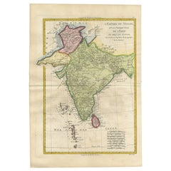
Old Map of The Mughal Empire and the Indian Peninsula South of the Ganges, 1787
Located in Langweer, NL
This is a historical map titled "L'Empire Du Mogol, Et La Presqu Isle De L'Inde En Deca Du Gange."
An original authentic map, created by Rigobert Bonne (1727-1794), an influential ...
Category
Antique 1780s Maps
Materials
Paper
$335 Sale Price
20% Off
Free Shipping
1705 Sanson Map of Southern India and Malabar with an Inset Map
Located in Langweer, NL
Title: 1705 Sanson Map of Southern India and Malabar with an Inset Map
Description: This finely engraved and beautifully hand-colored antique map, published in 1705, depicts south...
Category
Antique Early 1700s Maps
Materials
Paper

$737 Sale Price
20% Off
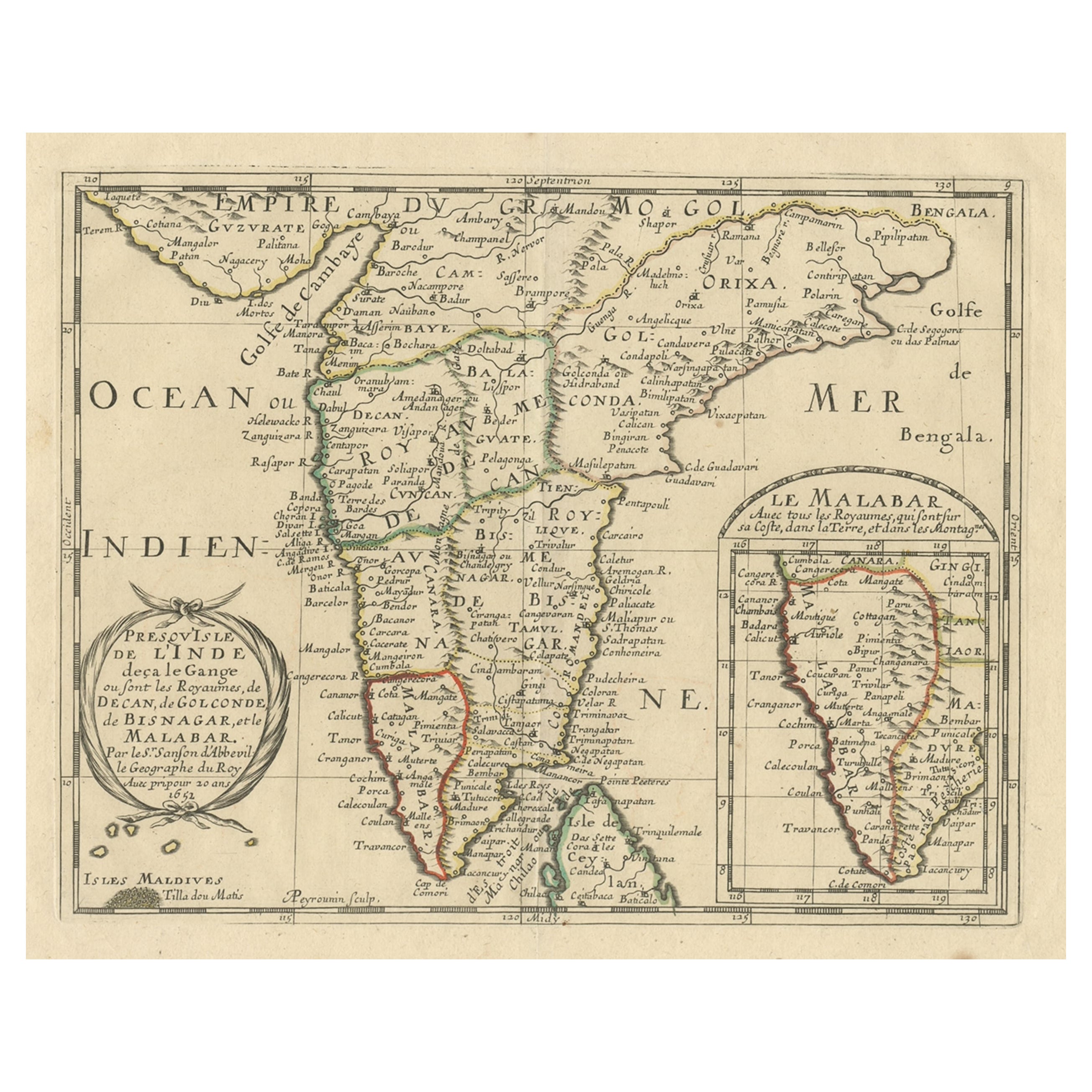
Original Antique Map showing Southern India, Northern Sri Lanka & Malabar, 1652
Located in Langweer, NL
Antique map titled 'Presqu'Isle de l'Inde deca le Gange (..)'.
Old map showing the southern part of India, including the northern part of Sri Lanka. With inset map of Southern India (Malabar). This map covers the subcontinent from the Bay of Bengal and the Gulf of Cambay to Ceylon. The Mogul Empire can be found in the north. Further south...
Category
Antique 1650s Maps
Materials
Paper

$632 Sale Price
20% Off
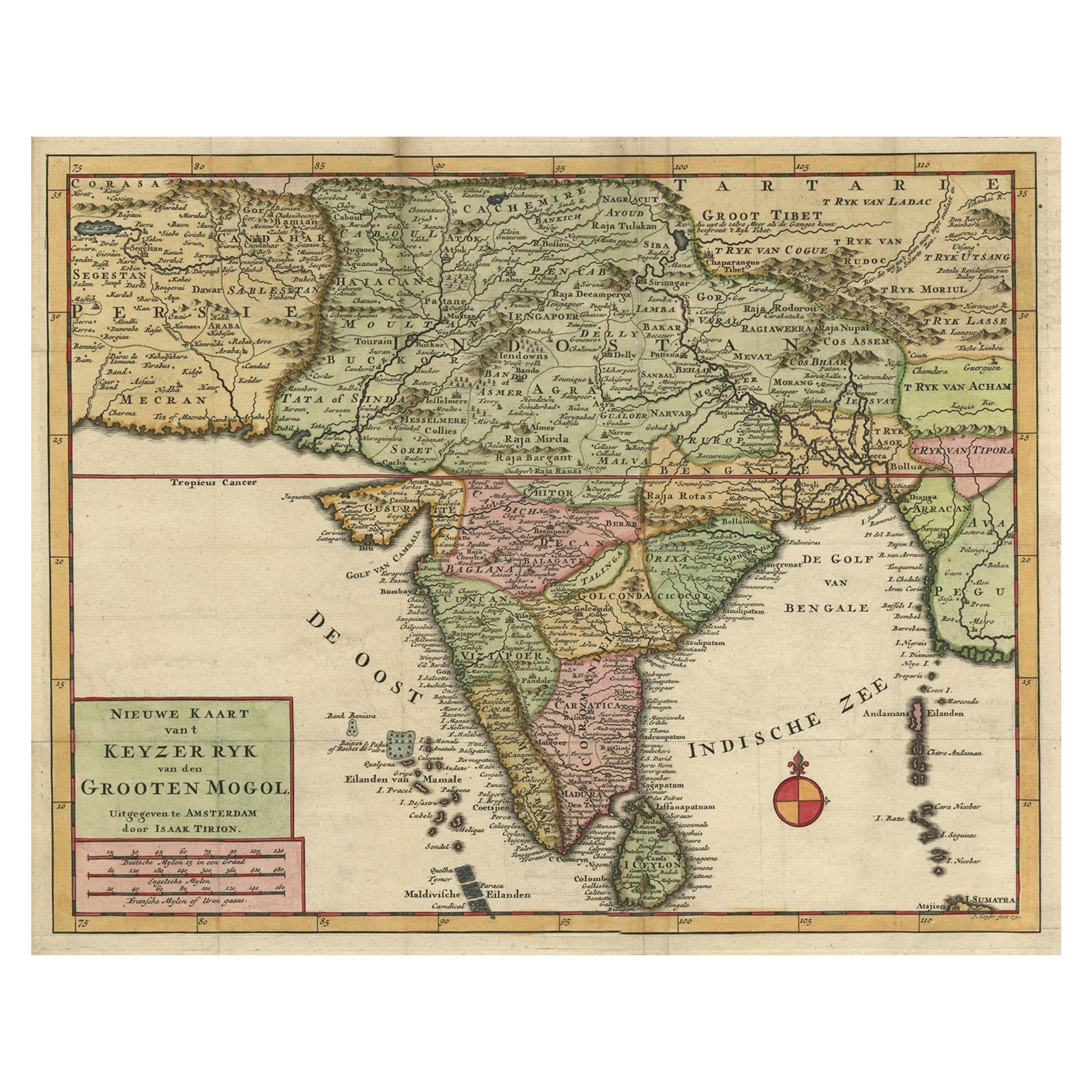
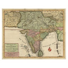
Attractive Detailed Map of the Empire of the Great Mogul, Incl India, 1731
Located in Langweer, NL
Antique map titled 'Nieuwe Kaart van t Keyzer Ryk Grooten Mogol.'
Attractive detailed map of the Empire of the Great Mogul, which included India, Sri Lanka, Pakistan and Banglade...
Category
Antique 1730s Maps
Materials
Paper
$900 Sale Price
20% Off
You May Also Like
Original Antique Map of India by Dower, circa 1835
Located in St Annes, Lancashire
Nice map of India
Drawn and engraved by J.Dower
Published by Orr & Smith. C.1835
Unframed.
Free shipping
Category
Antique 1830s English Maps
Materials
Paper

Antique French Map of Asia Including China Indoneseia India, 1783
Located in Amsterdam, Noord Holland
Very nice map of Asia. 1783 Dedie au Roy.
Additional information:
Country of Manufacturing: Europe
Period: 18th century Qing (1661 - 1912)
Condition: Overall Condition B (Good Used)...
Category
Antique 18th Century European Maps
Materials
Paper

$648 Sale Price
20% Off
India (Southern Sheet), English antique map by Alexander Keith Johnston, 1901
Located in Melbourne, Victoria
'India (Southern Sheet)', antique lithographic map by Keith Johnston.
Inset maps of 'Bombay Island & Town', 'Madras & Environs', and 'South-Eastern Provinces of India'.
Central vertical fold as issued.
495mm by 625mm (sheet)
Alexander Keith...
Category
Early 20th Century Victorian More Prints
Materials
Lithograph

Antique 1803 Italian Map of Asia Including China Indoneseia India
Located in Amsterdam, Noord Holland
Antique 1803 Italian Map of Asia Including China Indoneseia India
Very nice map of Asia. 1803.
Additional information:
Type: Map
Country of Manufacturing: Europe
Period: 19th centu...
Category
Antique 19th Century European Maps
Materials
Paper

$584 Sale Price
20% Off
Map of the East Indies: An Original 18th Century Hand-colored Map by E. Bowen
Located in Alamo, CA
This is an original 18th century hand-colored map entitled "An Accurate Map of the East Indies Exhibiting the Course of the European Trade both on the Continent and Islands" by Emanu...
Category
Mid-18th Century Old Masters Landscape Prints
Materials
Engraving

Map Of India - Original Lithograph - 19th Century
Located in Roma, IT
Map of India is an original lithograph artwork realized by an Anonymous engraver of the 19th Century.
Printed in the series of "France Pittoresque".
Titled "France Pittoresque".
...
Category
19th Century Modern Figurative Prints
Materials
Lithograph

More Ways To Browse
Ceylon Furniture
Colonial British India Furniture
India Ink Furniture
Colonial Sri Lankan
Tables With Inlaid Wood
World War Table
Antonio Jacobsen
Ariston Chairs
Coffee Tables Europe
Marble Top Dining Tables
Nordiska Argentina
Pink And Black Rug
Black Wooden Chair
Orrefors Embassy
Black Ebonized
Elios Chair
Panache Designs
Plata Lappas