Items Similar to Map of the Provence in Southern France, Original Old Engraving by De Wit c. 1688


Want more images or videos?
Request additional images or videos from the seller
1 of 6
Map of the Provence in Southern France, Original Old Engraving by De Wit c. 1688
$460.77
£345.37
€390
CA$633.01
A$706.70
CHF 370.30
MX$8,650.72
NOK 4,702.83
SEK 4,434.17
DKK 2,968.82
Shipping
Retrieving quote...The 1stDibs Promise:
Authenticity Guarantee,
Money-Back Guarantee,
24-Hour Cancellation
About the Item
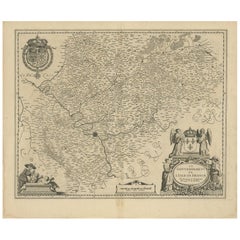
Title: Provence Map - Hand-Colored 17th-Century Engraving by Frederik De Wit c. 1688
Description: This captivating map, "Gouvernement de Provence," depicts the Provence region of southern France, including its beautiful coastline along the Mediterranean. Published by the esteemed cartographer Frederik De Wit around 1688, the map offers remarkable detail and artistry. It features original hand-coloring, showcasing towns, rivers, mountains, and coastal features, including Marseille and the Isles d’Hyères.
The map is adorned with two ornate cartouches. The lower-left cartouche includes playful cherubs and decorative elements, while the lower-right cartouche proudly displays the coat of arms of Provence, framed with classical motifs. These decorative features emphasize the region’s historical and cultural significance, adding elegance to its geographic precision.
Frederik De Wit was one of the most celebrated cartographers of the Dutch Golden Age, known for his ability to combine functional maps with artistic beauty. This map is a fine example of his craftsmanship and was part of his renowned composite atlases, which remain highly sought after by collectors today.
Condition Report: Fair to good condition with vibrant hand-coloring. Minor foxing and faint toning. Green color oxidation has weakened some areas, leaving one small hole in lower right cartouche.. See images for details or request more.
Framing and Matting Tips: To complement the historical significance and decorative details of this map, choose a classic gold-leaf or dark wood frame. Acid-free matting in a neutral cream tone will protect the map and enhance its presentation. For preservation, UV-protective glass is recommended to prevent fading of the hand-coloring. This map is ideal for a study, gallery, or living space, offering a timeless and sophisticated appeal.
- Dimensions:Height: 20.83 in (52.9 cm)Width: 24.41 in (62 cm)Depth: 0.01 in (0.2 mm)
- Materials and Techniques:Paper,Engraved
- Period:1680-1689
- Date of Manufacture:circa 1688
- Condition:Condition Report: Fair to good condition with vibrant hand-coloring. Minor foxing and faint toning. Green color oxidation has weakened some areas, leaving one small hole in right cartouche. See images for details or request more.
- Seller Location:Langweer, NL
- Reference Number:Seller: BG-14046-121stDibs: LU3054343439342
About the Seller
5.0
Recognized Seller
These prestigious sellers are industry leaders and represent the highest echelon for item quality and design.
Platinum Seller
Premium sellers with a 4.7+ rating and 24-hour response times
Established in 2009
1stDibs seller since 2017
2,511 sales on 1stDibs
Typical response time: <1 hour
- ShippingRetrieving quote...Shipping from: Langweer, Netherlands
- Return Policy
Authenticity Guarantee
In the unlikely event there’s an issue with an item’s authenticity, contact us within 1 year for a full refund. DetailsMoney-Back Guarantee
If your item is not as described, is damaged in transit, or does not arrive, contact us within 7 days for a full refund. Details24-Hour Cancellation
You have a 24-hour grace period in which to reconsider your purchase, with no questions asked.Vetted Professional Sellers
Our world-class sellers must adhere to strict standards for service and quality, maintaining the integrity of our listings.Price-Match Guarantee
If you find that a seller listed the same item for a lower price elsewhere, we’ll match it.Trusted Global Delivery
Our best-in-class carrier network provides specialized shipping options worldwide, including custom delivery.More From This Seller
View AllAntique Map of the Artois Region 'France' by F. de Wit, circa 1680
Located in Langweer, NL
Antique map titled 'Tabula Comitatus Artesiae emendata'. Large map of the Artois region, France. Published by F. de Wit, circa 1680.
Category
Antique Late 17th Century Maps
Materials
Paper

$509 Sale Price
25% Off
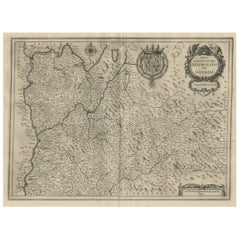
Antique Map of the Region of Lyon by Hondius, circa 1630
Located in Langweer, NL
Antique map titled 'Lionnois, Forest et Beauiolois'. Old map of the former region of Lyon, Vienne, Bresse, Rohan and the Rhône River. This map originates f...
Category
Antique Mid-17th Century Maps
Materials
Paper

$472 Sale Price
20% Off
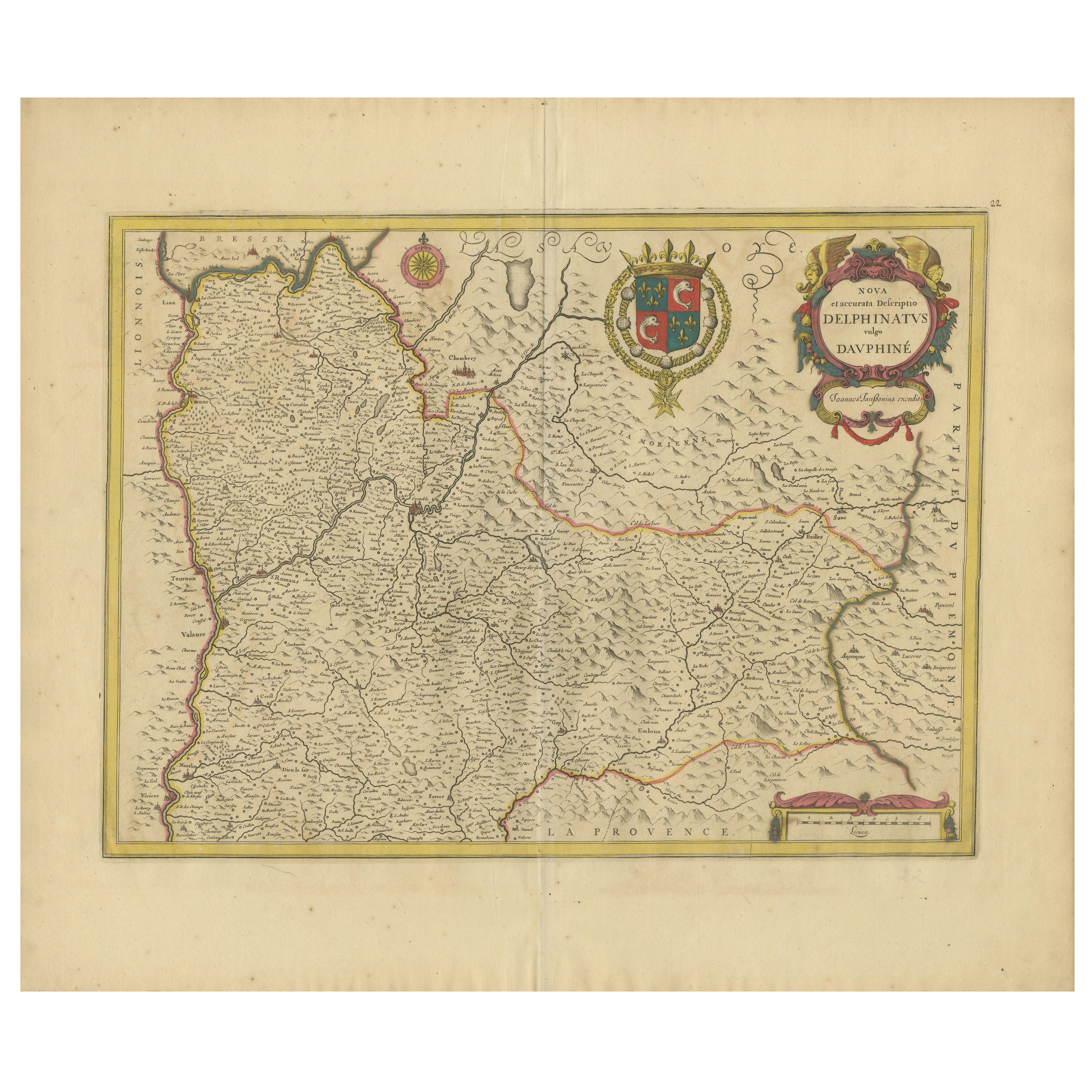
Antique Map of the Region of Dauphiné by Janssonius, 1657
Located in Langweer, NL
Antique map of France titled 'Nova et Accurata descriptio Delphinatus vulgo Dauphiné'. Decorative map of Dauphiné region in France. Originally a seperate province in southeastern Fra...
Category
Antique 17th Century Maps
Materials
Paper
$453 Sale Price
20% Off
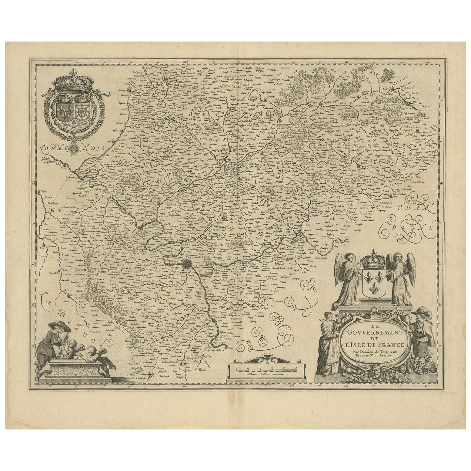
Antique Map of the Region of 'Île de France' by Janssonius, circa 1650
By Johannes Janssonius
Located in Langweer, NL
Antique map of France titled 'Le Gouvernement de L'Isle de France'. Paris is represented by a miniature plan of the city, making it distinct from the other towns of the region which ...
Category
Antique Mid-17th Century Maps
Materials
Paper
$425 Sale Price
20% Off
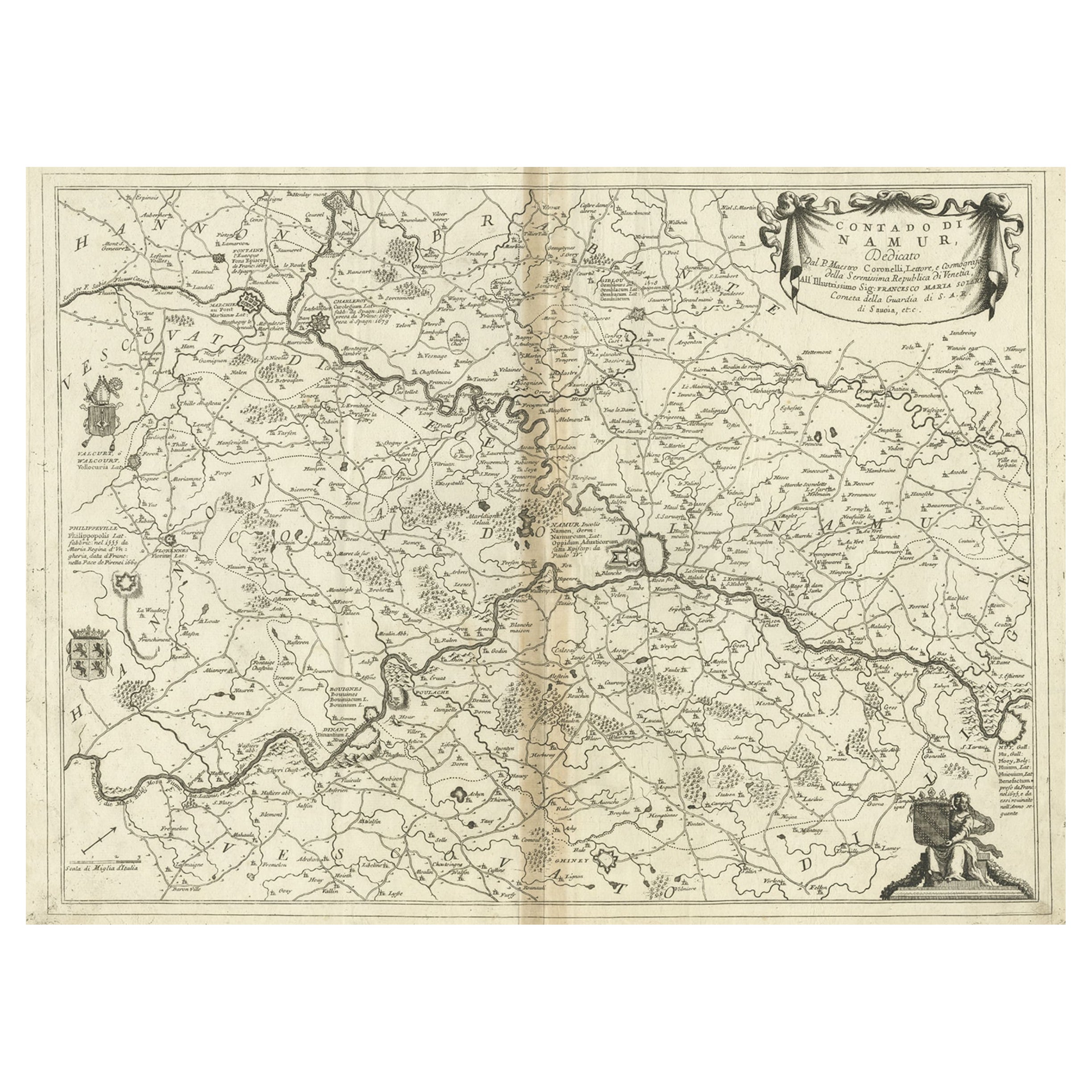
Antique Map of the Namur Region in France by Coronelli, c.1695
By Vincenzo Coronelli
Located in Langweer, NL
Antique map titled 'Contado di Namur (..)'. Old map of the Namur region in central Belgium. Includes several coats of arms.
Artists and Engravers: The remarkable Vincenzo Coronell...
Category
Antique 17th Century Maps
Materials
Paper
$444 Sale Price
20% Off
Rare 17th-Century Map of Dauphiné in Southeastern France by F. De Wit, ca.1688
Located in Langweer, NL
Title: Rare Hand-Colored 17th-Century Map of Dauphiné by Frederik De Wit c. 1688
Description: This captivating 17th-century map of Dauphiné, titled "Nova et Accurata Delphinatus Vul...
Category
Antique 1680s Maps
Materials
Paper

You May Also Like
1771 Bonne Map of Poitou, Touraine and Anjou, France, Ric.a015
Located in Norton, MA
1771 Bonne Map of Poitou,
Touraine and Anjou, France
Ric.a015
1771 Bonne map of Potiou, Touraine and Anjou entitled "Carte des Gouvernements D'Anjou et du Saumurois, de la Touraine, du Poitou,du Pays d'aunis, Saintonge?Angoumois,"
Carte des gouvernements d'Anjou et du Saumurois, de la Touraine, du Poitou, du Pays d'Aunis, Saintonge-Angoumois. Projettee et assujettie au ciel par M. Bonne, Hyd. du Roi. A Paris, Chez Lattre, rue St. Jacques a la Ville de Bord(ea)ux. Avec priv. du Roi. 1771. Arrivet inv. & sculp., Atlas moderne ou collection de cartes sur toutes...
Category
Antique 17th Century Unknown Maps
Materials
Paper

1640 Joan Bleau Map Entitled"Diocecese de rheims et le pais de rethel, " Eic.a011
Located in Norton, MA
1640 Joan Bleau map entitled
"Diocecese de rheims et le pais de rethel,"
Ric.a011
OAN BLAEU
Diocecese de Rheims, et le pais de Rethel.
Handcolored engraving, c.1640.
...
Category
Antique 17th Century Dutch Maps
Materials
Paper

17th Century Topographical Map of Cote D'azur, Avignon, Frejus by Iohan Peeters
Located in New York, NY
Fine topographical 17th century map by Iohan Peeters of the towns of Avignon and Frejus in the Cote d'Azur-Provence-Alpes Region of Southeastern France.
Beautifully suited decorativ...
Category
Antique 17th Century Dutch Maps
Materials
Paper

1640 Willem Blaeu Map Entitled "Contado di molise et principato vltra, " Ric.a003
By Willem Blaeu
Located in Norton, MA
1640 Willem Blaeu map entitled
"Contado di molise et principato vltra,"
Colored
Ric. a003
Measures: 38 x 49.6 cm and wide margins
DBLAEU.
Cou...
Category
Antique 17th Century Dutch Maps
Materials
Paper

1635 Willem Blaeu Map of Northern France"Comitatvs Bellovacvm" Ric.a08
Located in Norton, MA
1635 Willem Blaeu map of northern France, entitled.
"Comitatvs Bellovacvm Vernacule Beavvais,"
Colored
Ric.a008
“COMITATVS BELLOVACVM…” Amsterdam: W...
Category
Antique 17th Century Unknown Maps
Materials
Paper

Map Holy Land La Terre Sainte Engraved van Loon Published N de Fer 1703 French
Located in BUNGAY, SUFFOLK
La Terre Sainte, The Holy Land, Tiree Des Memoires De M.De.La Rue. Par N. de Fer. Geographe de Sa Majeste Catoliq et de Monseigneur le Dauphin. Avec Privil du Roi 1703
Detailed map of the Holy Land from Nicholas de Fer's L'Atlas Curieux ou le Monde. East is oriented at the top.
MAKER Nicolas de Fer 1646-1720
The French cartographer and engraver, Nicolas de Fer, was a master at creating maps that were works of art. The maps that he published were printed during the Baroque period when the decorative arts were characterized by ornate detail. De Fer’s detailed maps and atlases were valued more for their decorative content than their geographical accuracy.
Nicolas de Fer was born in 1646. His father, Antoine de Fer, owned a mapmaking firm. At the age of twelve, Nicolas was apprenticed to a Parisian engraver named Louis Spirinx. The family business was starting to decline when his father died in 1673. Nicolas de Fer’s mother, Genevieve, took over the business after the death of her husband. In 1687 the business was passed on to Nicolas and the profits increased after he took over the firm. Nicolas de Fer was a prolific cartographer who produced atlases and hundreds of single maps. He eventually became the official geographer to King Louis XIV of France and King Philip V...
Category
Antique Early 1700s French Louis XIV Maps
Materials
Paper

More Ways To Browse
17th Century Engravings
Coat Of Arms Engraving
French Matting
17th Century Dutch Wood Frames
Carlo Scarpa 1934 Chairs
Christofle Marly
1900 Antique Chairs
Glass Table Italian Round
Alvar Aalto Poster
Geometric Metal Table
Post Modern High Chairs
Vintage Vine Rug
Cancel An Order
Antique Framing Square
Silver Metal Chair
Swedish Kilim
Vintage Scandanavian Chairs
Vintage Tropical Furniture