Items Similar to Map of Tartary by Isaak Tirion: Detailed Cartography of Northern Asia, ca.1740

Want more images or videos?
Request additional images or videos from the seller
1 of 11
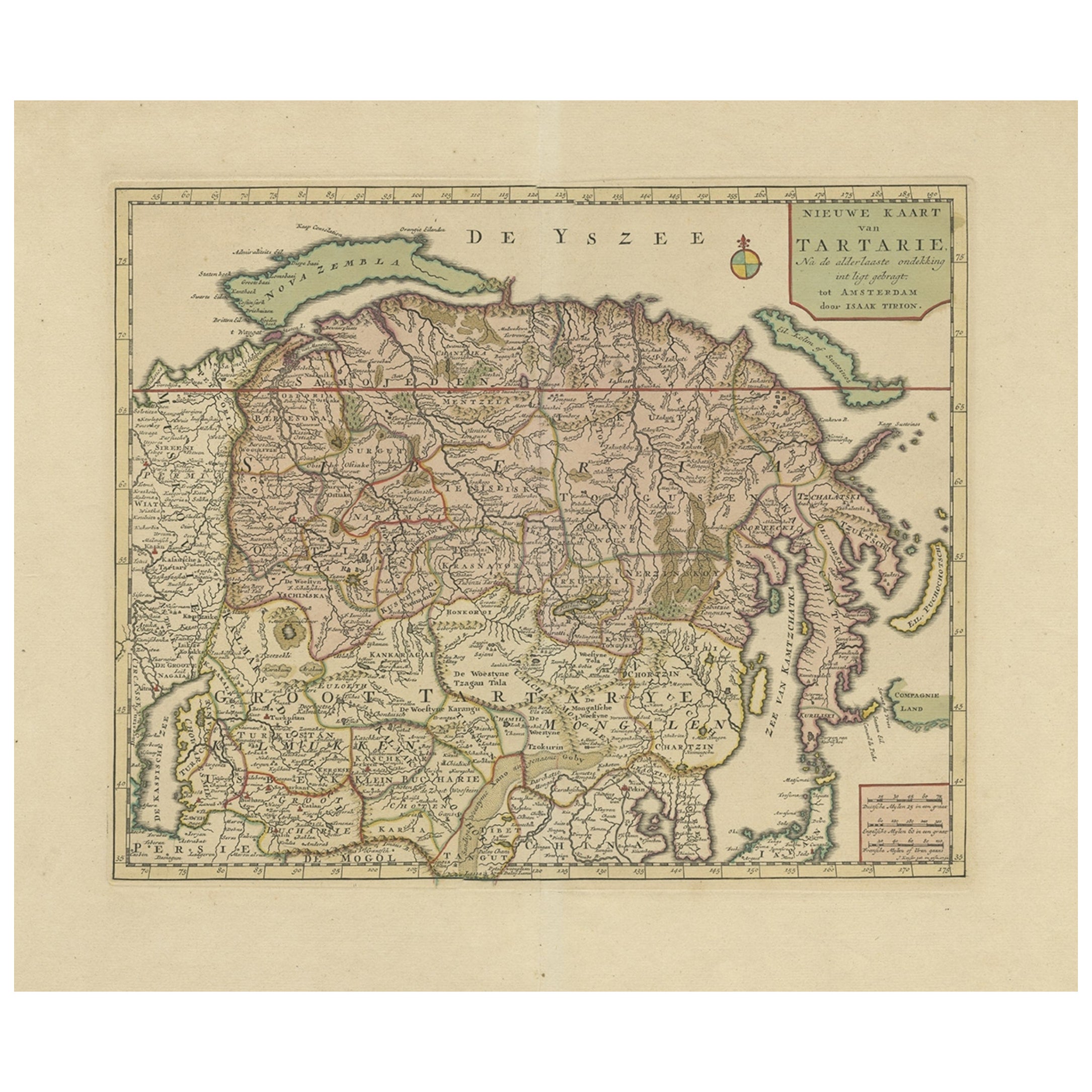
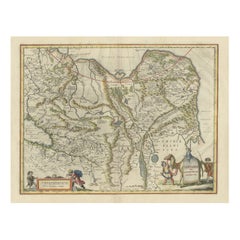
Map of Tartary by Isaak Tirion: Detailed Cartography of Northern Asia, ca.1740
$633.17
$791.4620% Off
£471.01
£588.7620% Off
€528
€66020% Off
CA$867.02
CA$1,083.7820% Off
A$964.01
A$1,205.0120% Off
CHF 503.35
CHF 629.1920% Off
MX$11,734.35
MX$14,667.9320% Off
NOK 6,422.56
NOK 8,028.2020% Off
SEK 6,017.63
SEK 7,522.0420% Off
DKK 4,019.37
DKK 5,024.2220% Off
Shipping
Retrieving quote...The 1stDibs Promise:
Authenticity Guarantee,
Money-Back Guarantee,
24-Hour Cancellation
About the Item
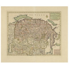
This is an antique map titled "Nieuwe Kaart van Tartarie," which translates to "New Map of Tartary." The map was created by Isaak Tirion, a prominent Dutch cartographer and publisher based in Amsterdam. Tartary refers to the vast region of Asia, primarily covering parts of what is now Russia, Central Asia, and parts of China and Mongolia. This map reflects European knowledge of the region during the 18th century.
Cartographer/Publisher: Isaak Tirion
Place of Publication: Amsterdam, Netherlands
Date of Publication: Isaak Tirion was active during the 18th century, particularly in the mid-1700s. This map was likely published around 1730-1750. Tirion's maps are known for their accuracy and attention to detail during this period.
Important Areas/Cities on the Map:
- Northern Asia: The map covers a vast area known as Tartary, including parts of Siberia, Mongolia, and Northern China.
- Great Wall of China: A significant feature on the map, marking the boundary between China and the northern regions.
- Lake Baikal: Known as "Lacum Baikal," this prominent lake in Siberia is detailed on the map.
- Major Cities: Several important cities and regions are highlighted, including:
- Moscow: Marked as "Moskovia," showing the influence of the Russian Empire in the region.
- Peking (Beijing): Represented in the map, reflecting its significance as the capital of China.
- Samarkand: A key city along the Silk Road, crucial in Central Asian history.
- Tobolsk: Important as a major administrative center in Siberia during the Russian Empire.
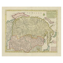
The map mentions the place of the Dalai Lama. It is located in the region corresponding to modern-day Tibet. The Dalai Lama's location is typically labeled as "Lassa" (Lhasa) on maps of this period, which is the capital of Tibet and the traditional seat of the Dalai Lama. Lassa (or its variant spelling) should be present in the area depicting the Tibetan plateau, within the broader region of Tartary as understood in the 18th century. This inclusion reflects the European awareness of Tibet as a significant cultural and religious center in Asia, associated with the Dalai Lama.
The Potala Palace is actually marked on the map and was the residence, or "woonplaats," of the Dalai Lama. The Potala Palace, located in Lhasa, Tibet, served as the winter palace of the Dalai Lamas from the 17th century until the 14th Dalai Lama fled to India in 1959 during the Tibetan uprising. The Potala Palace is an iconic structure and has been a spiritual and political center for Tibetan Buddhism.
The palace is situated on Marpo Ri, the "Red Hill," and is a UNESCO World Heritage Site today. It not only served as the residence of the Dalai Lama but also housed numerous chapels, shrines, and tombs of past Dalai Lamas, making it a significant religious site.
This feature further underscores the historical and cultural importance of the map, as it highlights regions and places of global significance during the 18th century.
The map provides a fascinating glimpse into the geographical understanding of Asia in the 18th century, particularly from a European perspective. The detailed depiction of mountain ranges, rivers, and territories demonstrates the cartographic skills of Isaak Tirion and his contribution to European knowledge of Asia during this era.
- Dimensions:Height: 16.15 in (41 cm)Width: 20.28 in (51.5 cm)Depth: 0 in (0.02 mm)
- Materials and Techniques:Paper,Engraved
- Period:1740-1749
- Date of Manufacture:circa 1740
- Condition:Very good, contemporary hand coloring. General age-related toning and vertical folding line as issued. Please study image carefully.
- Seller Location:Langweer, NL
- Reference Number:Seller: BG-13746-41stDibs: LU3054341031682
About the Seller
5.0
Recognized Seller
These prestigious sellers are industry leaders and represent the highest echelon for item quality and design.
Platinum Seller
Premium sellers with a 4.7+ rating and 24-hour response times
Established in 2009
1stDibs seller since 2017
2,510 sales on 1stDibs
Typical response time: <1 hour
- ShippingRetrieving quote...Shipping from: Langweer, Netherlands
- Return Policy
Authenticity Guarantee
In the unlikely event there’s an issue with an item’s authenticity, contact us within 1 year for a full refund. DetailsMoney-Back Guarantee
If your item is not as described, is damaged in transit, or does not arrive, contact us within 7 days for a full refund. Details24-Hour Cancellation
You have a 24-hour grace period in which to reconsider your purchase, with no questions asked.Vetted Professional Sellers
Our world-class sellers must adhere to strict standards for service and quality, maintaining the integrity of our listings.Price-Match Guarantee
If you find that a seller listed the same item for a lower price elsewhere, we’ll match it.Trusted Global Delivery
Our best-in-class carrier network provides specialized shipping options worldwide, including custom delivery.More From This Seller
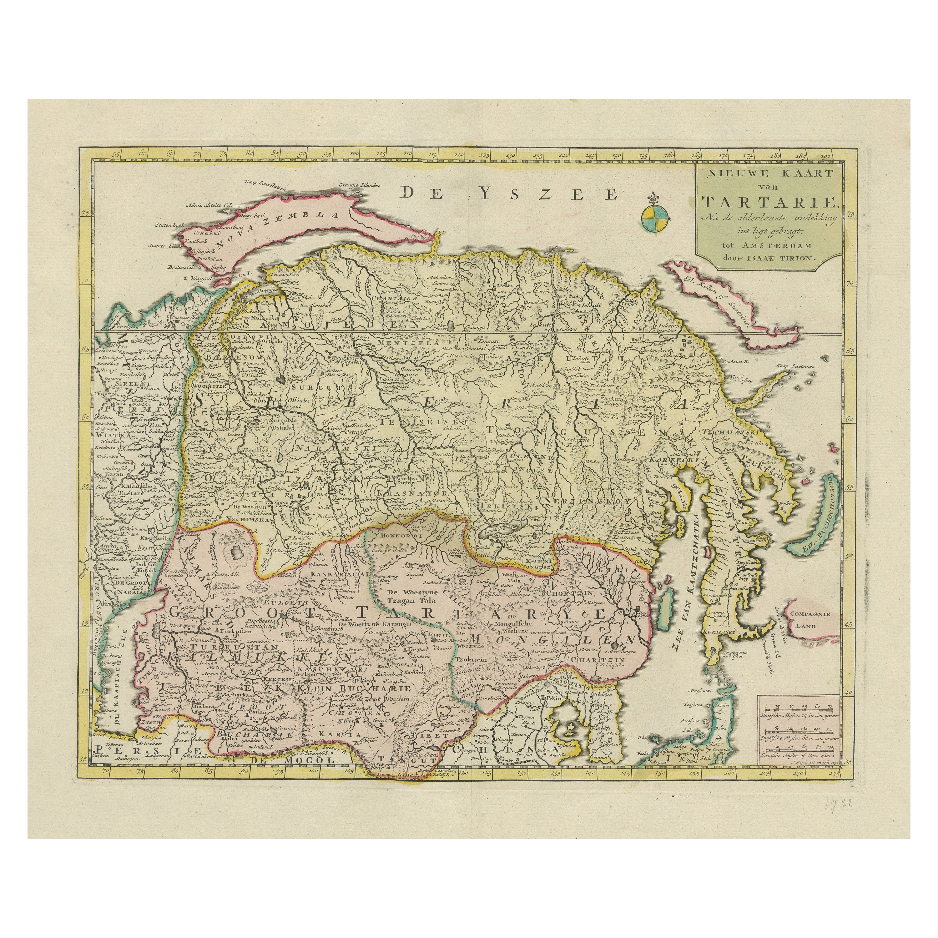
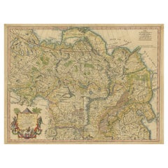
View AllAntique Map of Siberia and Chinese Tartary, Incl Nova Zembla, ca.1732
Located in Langweer, NL
Antique map of Tartary titled 'Nieuwe Kaart van Tartarie na de alderlaatste ondekking int ligt gebracht tot Amsterdam door Isaak Tirion'.
Map op Siberia and Chinese tartary. In t...
Category
Antique 1730s Maps
Materials
Paper
$825 Sale Price
20% Off
Free Shipping
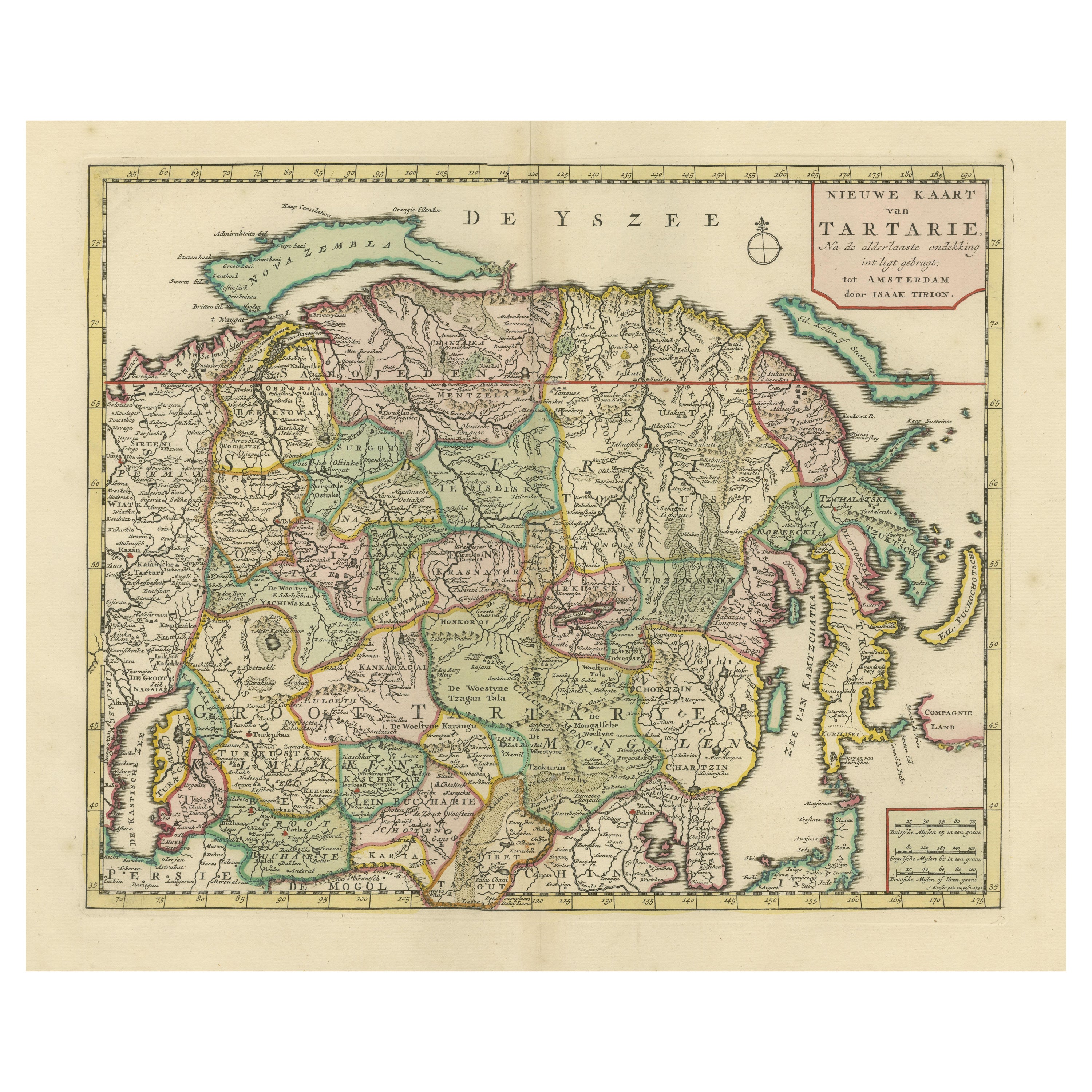
Antique Map op Siberia and Chinese Tartary with original hand coloring, 1732
Located in Langweer, NL
Antique map titled 'Nieuwe Kaart van Tartarie na de alderlaatste ontdekking int ligt gebragt'. Map op Siberia and Chinese tartary. In the north Novaya Zemlya curls back to attach its...
Category
Antique Mid-18th Century Maps
Materials
Paper
$767 Sale Price
20% Off
Antique Map of Northern Asia, with Russia, Korea and Northern Japan
Located in Langweer, NL
Antique map titled 'Nieuwe Kaart van Tartarie'. Map op Siberia and Chinese tartary. In the north Novaya Zemlya curls back to attach itself to the mainland by a narrow isthmus. In the...
Category
Antique Mid-18th Century Maps
Materials
Paper
$772 Sale Price
34% Off
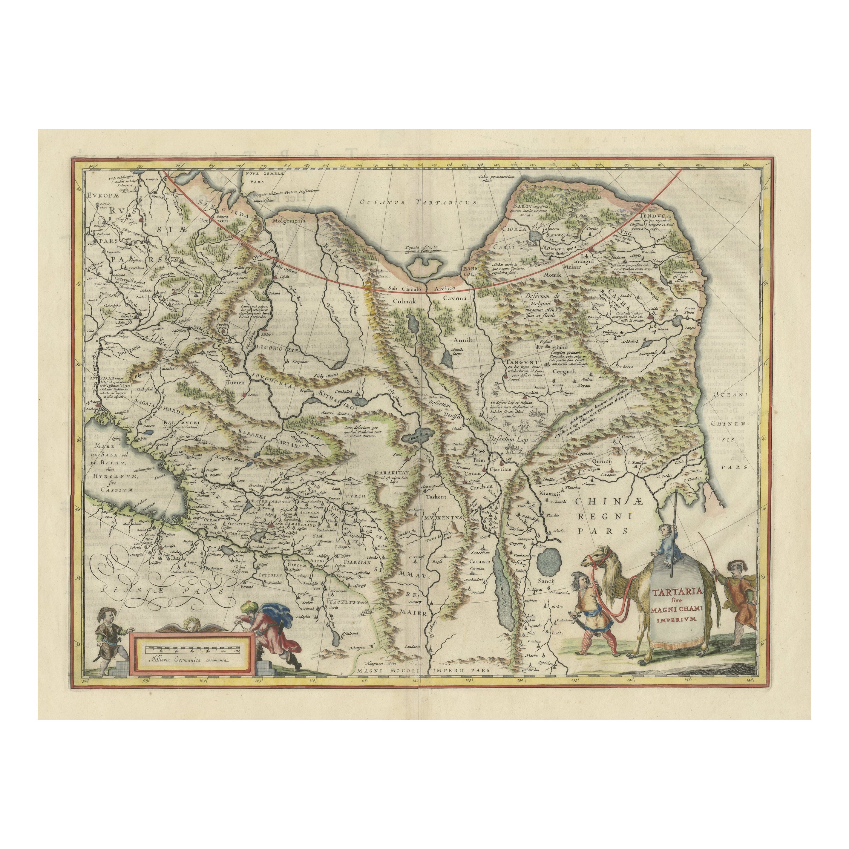
Old Genuine Antique Map of Tartary in the Russian Far East
Located in Langweer, NL
Original antique map titled 'Tartaria sive Magni Chami Imperium'. This great map of Tartary covers all of eastern Asia between the Caspian Sea and northern China and Manchuria. Being...
Category
Antique Mid-17th Century Maps
Materials
Paper
$1,343 Sale Price
20% Off
Antique Map of Tartary, Also Showing the Great Wall of China
Located in Langweer, NL
Antique map titled 'Carte de Tartarie'. Detailed map of Tartary, consisting of the Eastern part of Russia, Central Asia, China and Korea, first published by Guillaume De L'Isle in 1706. The map extends from the Peninsula of Korea in the east to the Caspian and Black Seas. The Great Wall of China...
Category
Antique Early 18th Century Maps
Materials
Paper
$1,055 Sale Price
20% Off
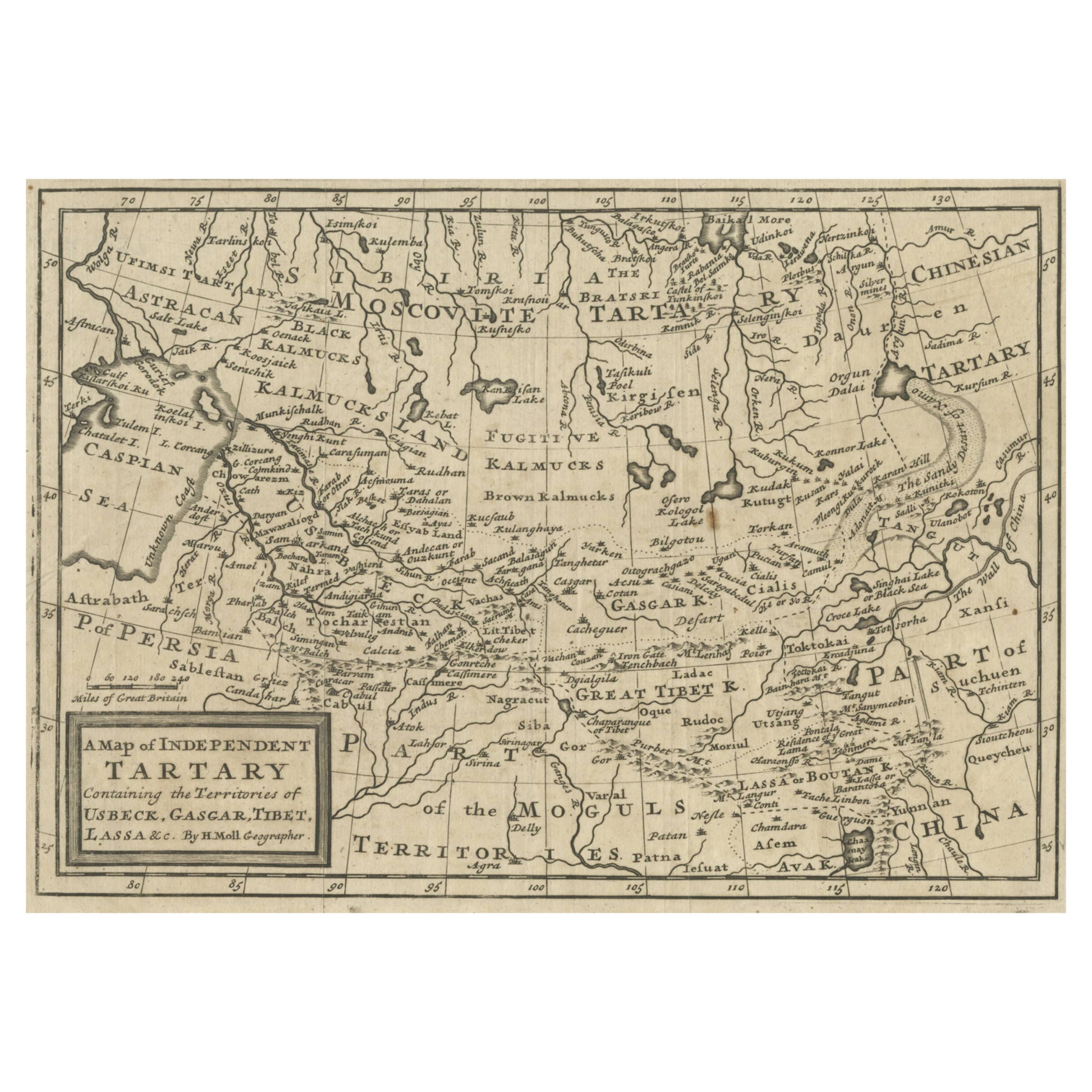
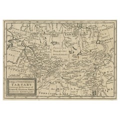
Old Map of Tartary with Persia, Siberia, the Mogul Territories & China, ca.1717
Located in Langweer, NL
Antique map titled 'A Map of Independent Tartary, containing the territories of Usbeck, Gasgar, Tibet, Lassa & c'.
Old map depicting east of the Caspian Sea with parts of Persia, Siberia, the Mogul territories and on to western China...
Category
Antique 1710s Maps
Materials
Paper
$335 Sale Price
20% Off
You May Also Like
Map of the Russian Empire: An Original 18th Century Hand-colored Map by E. Bowen
Located in Alamo, CA
This is an original 18th century hand-colored map entitled "A New & Accurate Map of The Whole Russian Empire, As Contain'd Both In Europe and Asia, Drawn from Authentic Journals, Sur...
Category
Mid-18th Century Old Masters Landscape Prints
Materials
Engraving

1646 Jansson Map Entitled "Procinvia Connactiae, " Ric.a006
Located in Norton, MA
1646 Jansson map entitled
"Procinvia connactiae,"
Ric.a006
Description: The PROVINCE of CONNAVGT 490 x 380From vol 4 of Jansson's Atlas Novus 1646, published in Amsterdam with...
Category
Antique 17th Century Unknown Maps
Materials
Paper

1851 Map of "Independent Tartary", Ric. R018
Located in Norton, MA
1851 Map of
Independent Tartary
"Russia"
Ric.r018
A highly decorative 1851 map of Independent Tartary by John Tallis and John Rapkin. Covers the regions between the Caspian Sea and Lake Bakquash and between Russia and Afghanistan. These include the ancient Silk Route kingdoms of Khiva, Tartaria, Kokand, and Bokhara. Today this region roughly includes Kazakhstan, Uzbekistan, Turkmenistan, Kyrgyzstan, and Tajikistan. This wonderful map offers a wealth of detail for anyone with an interest in the Central Asian portion of the ancient Silk Road. Identifies various caravan routes, deserts, wells, and stopping points, including the cities of Bokhara and Samarkand. Three vignettes by W. Bragg decorate the map, these including an image of Tartars on a Journey, a horseback Bride Chase, and a tartar camp site. Surrounded by a vine motif border. Engraved by J. Rapkin for John Tallis's 1851 Illustrated Atlas .
Tartary Antique Map...
Category
Antique 19th Century Unknown Maps
Materials
Paper

Scandinavia & Portions of Eastern Europe: 18th Century Hand-Colored Homann Map
By Johann Baptist Homann
Located in Alamo, CA
An early 18th century hand-colored copper-plate map entitled "Regni Sueciae in omnes suas Subjacentes Provincias accurate divisi Tabula Generalis" by Johann Baptist Homann (1663-1724...
Category
Antique Early 18th Century German Maps
Materials
Paper

Antique French Map of Asia Including China Indoneseia India, 1783
Located in Amsterdam, Noord Holland
Very nice map of Asia. 1783 Dedie au Roy.
Additional information:
Country of Manufacturing: Europe
Period: 18th century Qing (1661 - 1912)
Condition: Overall Condition B (Good Used)...
Category
Antique 18th Century European Maps
Materials
Paper

$648 Sale Price
20% Off
1790 Thomas Stackhouse Map, Entitled "Russia in Europe, " , Ric.a004
Located in Norton, MA
1790 Thomas Stackhouse map, entitled
"Russia in Europe"
Ric.a004
Stackhouse, Thomas
Russia in Europe [map]
London: T. Stackhouse, 1783. Map. Matted hand-colored copper engraving. Image size: 14.5 x 15.25 inches. Mat size: 22.75 x 23.75 inches. A beautiful example of this map of Eastern Europe...
Category
Antique 17th Century Unknown Maps
Materials
Paper

More Ways To Browse
Antique Mongolian Furniture
Wall Shrine
Mongolian Antique
Silk Map
Tibetan Key
Russian Icon Religious
Chinese Shrine
18th Century Russian Icon
Russia Winter Palace
Tibetan Shrine
Coffee Table Black Italian Modern
Christofle America
Iranian Silk Rug Carpet
Poul Moller
Tables With Inlaid Wood
World War Table
Antonio Jacobsen
Ariston Chairs