Items Similar to Northwest Coast and Isle of Man Map

Want more images or videos?
Request additional images or videos from the seller
1 of 5
Northwest Coast and Isle of Man Map
$523.04
$653.8020% Off
£380
£47520% Off
€445.42
€556.7820% Off
CA$714.05
CA$892.5620% Off
A$794.35
A$992.9320% Off
CHF 416.41
CHF 520.5120% Off
MX$9,706.73
MX$12,133.4120% Off
NOK 5,302.42
NOK 6,628.0320% Off
SEK 4,991.50
SEK 6,239.3720% Off
DKK 3,324.90
DKK 4,156.1320% Off
Shipping
Retrieving quote...The 1stDibs Promise:
Authenticity Guarantee,
Money-Back Guarantee,
24-Hour Cancellation
About the Item
Greenville Collins Northwest Coast and Isle of Man. hand coloured chart, encased in an ebonised frame.
Dimensions
Height 26.5 Inches
Width 30 Inches
Depth 1 Inches
- Dimensions:Height: 26.5 in (67.31 cm)Width: 30 in (76.2 cm)Depth: 1 in (2.54 cm)
- Materials and Techniques:
- Place of Origin:
- Period:
- Date of Manufacture:circa 1900
- Condition:Wear consistent with age and use.
- Seller Location:Cheshire, GB
- Reference Number:1stDibs: LU947636261632
About the Seller
5.0
Gold Seller
Premium sellers maintaining a 4.3+ rating and 24-hour response times
Established in 1980
1stDibs seller since 2012
434 sales on 1stDibs
Typical response time: 3 hours
Associations
LAPADA - The Association of Arts & Antiques DealersInternational Confederation of Art and Antique Dealers' Associations
- ShippingRetrieving quote...Shipping from: Cheshire, United Kingdom
- Return Policy
Authenticity Guarantee
In the unlikely event there’s an issue with an item’s authenticity, contact us within 1 year for a full refund. DetailsMoney-Back Guarantee
If your item is not as described, is damaged in transit, or does not arrive, contact us within 7 days for a full refund. Details24-Hour Cancellation
You have a 24-hour grace period in which to reconsider your purchase, with no questions asked.Vetted Professional Sellers
Our world-class sellers must adhere to strict standards for service and quality, maintaining the integrity of our listings.Price-Match Guarantee
If you find that a seller listed the same item for a lower price elsewhere, we’ll match it.Trusted Global Delivery
Our best-in-class carrier network provides specialized shipping options worldwide, including custom delivery.More From This Seller
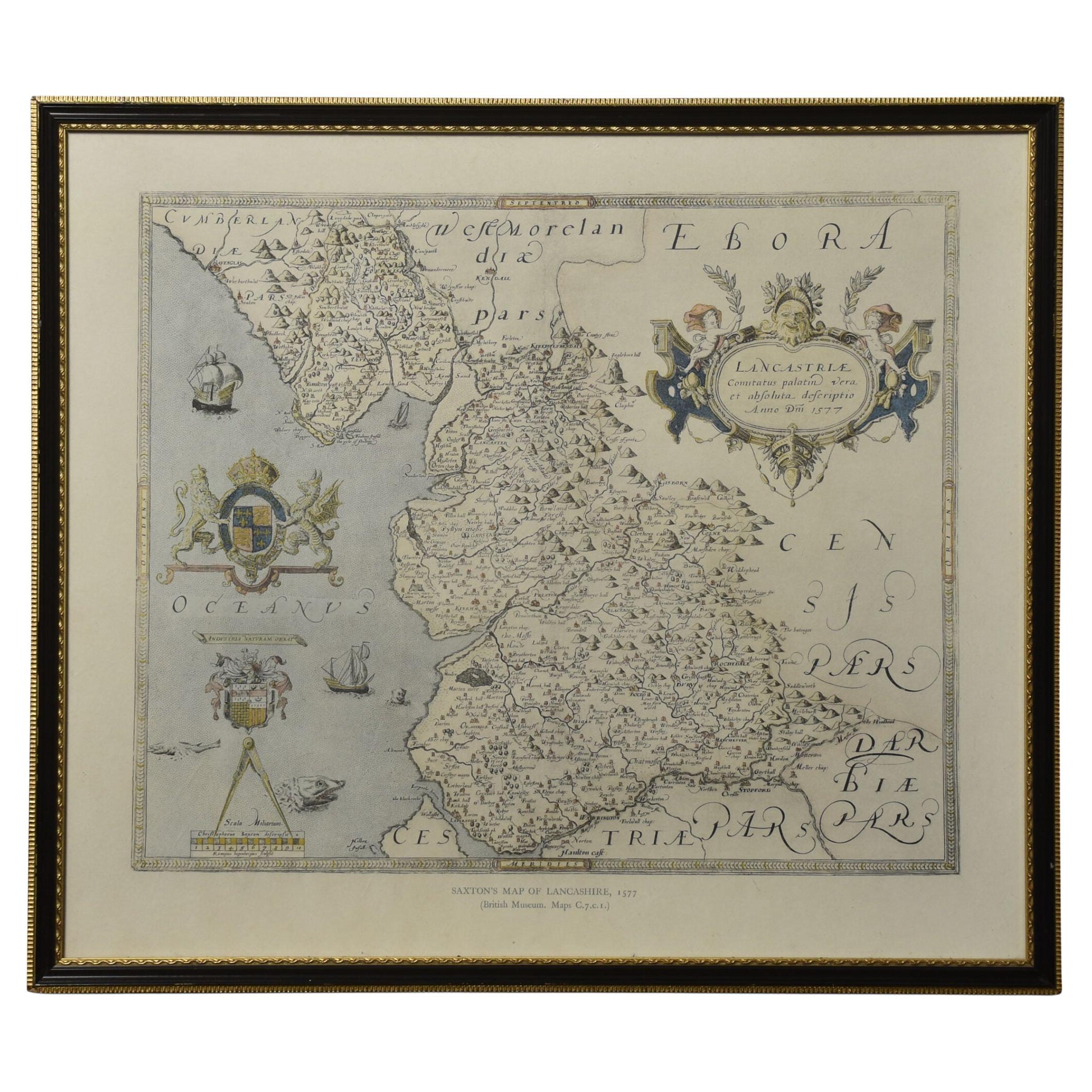
View AllMap of Lancashire
Located in Cheshire, GB
Saxton Map of Lancashire hand coloured. Encased in an ebonised frame.
Dimensions
Height 21 Inches
Width 24 Inches
Depth 1 Inches
Category
Early 20th Century British Maps
Materials
Paper

$765 Sale Price
20% Off
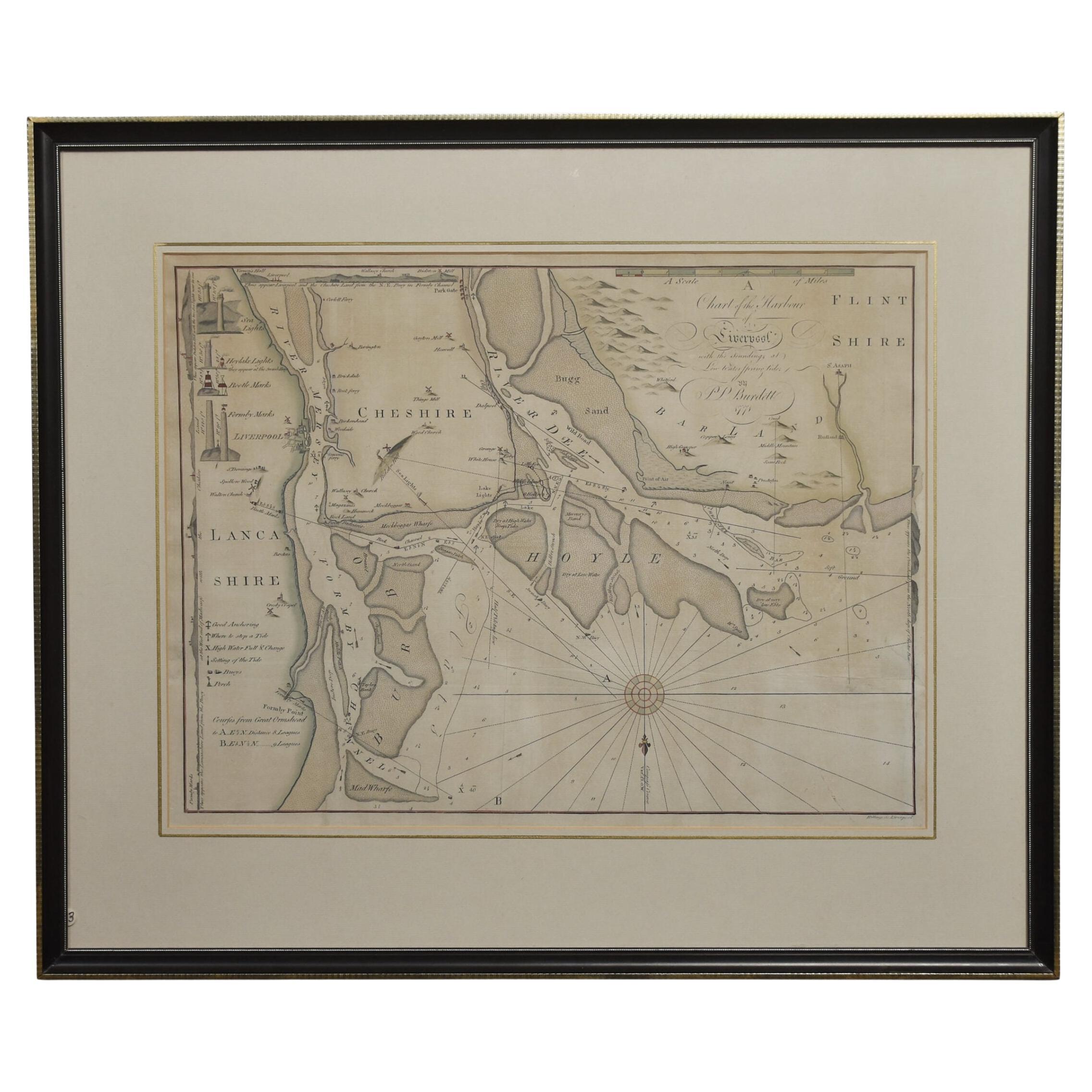
Chart of the Harbour of Liverpool
Located in Cheshire, GB
PL Burdett A Chart of the Harbour of Liverpool hand coloured. Encased in an ebonised frame.
Dimensions
Height 23.5 Inches
Width 28 Inches
Depth 1 Inches
Category
Early 20th Century British Maps
Materials
Paper

$633 Sale Price
20% Off
Map of Essex by Emanuel Bowen
Located in Cheshire, GB
Map of part of Essex and part of Kent, hand-coloured. Encased in an ebonized and gilded frame.
Dimensions
Height 25.5 Inches
Length 32.5 Inches
width 1 Inches.
Category
Antique Late 19th Century British Maps
Materials
Paper

$991 Sale Price
50% Off
Large 19th century Pond Yach
Located in Cheshire, GB
19th-century gaff rigged pond yacht, fully rigged over simulated plank deck with fittings, the hull varnished to the waterline and painted green beneath, with brass rudder and leaded...
Category
Antique Late 19th Century British Nautical Objects
Materials
Wood
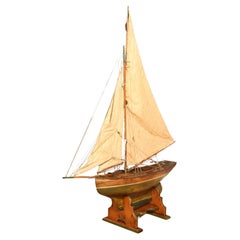
$4,536 Sale Price
20% Off
Paul-Louis Barruel Watercolour on Paper
Located in Cheshire, GB
Watercolour on paper of a Seagull Signed Paul-Louis Barruel encased in ebonies frame.
Dimensions
Height 27 Inches
Width 22 Inches
Depth 1.5 Inches.
Category
Early 20th Century French Paintings
Materials
Paint

$991 Sale Price
40% Off
Cased scale model of the Scottish two masted schooner
Located in Cheshire, GB
Cased scale model of the Scottish two-masted schooner ‘Scottish Maid’ by C Russell, standing rigged over a plank deck, with fittings and pinned hull. standin...
Category
Mid-20th Century British Nautical Objects
Materials
Wood
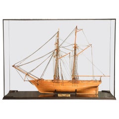
$2,070 Sale Price
20% Off
You May Also Like
Antique Maritime Chart of East Coast Virginia to Nova Scotia
Located in Norwell, MA
1920 nautical chart of the East Coast of the United States from Virginia to Maine, New Brunswick, and Nova Scotia. The chart shows Cape Cod, Long Island, the Connecticut coast, Jersey Shore, Maine, New Hampshire, etc. Very detailed, showing ports, lighthouses, shoals, depths, etc. The chart is by famous cartographer George W. Eldridge, compiled from surveys of the United States government, British Admiralty, George Eldridge, and others. First authorized by George Eldridge, published in 1916 by Wilfred O. White with a merchant's stamp of Charles Hutchinson...
Category
Vintage 1920s North American Maps
Materials
Paper

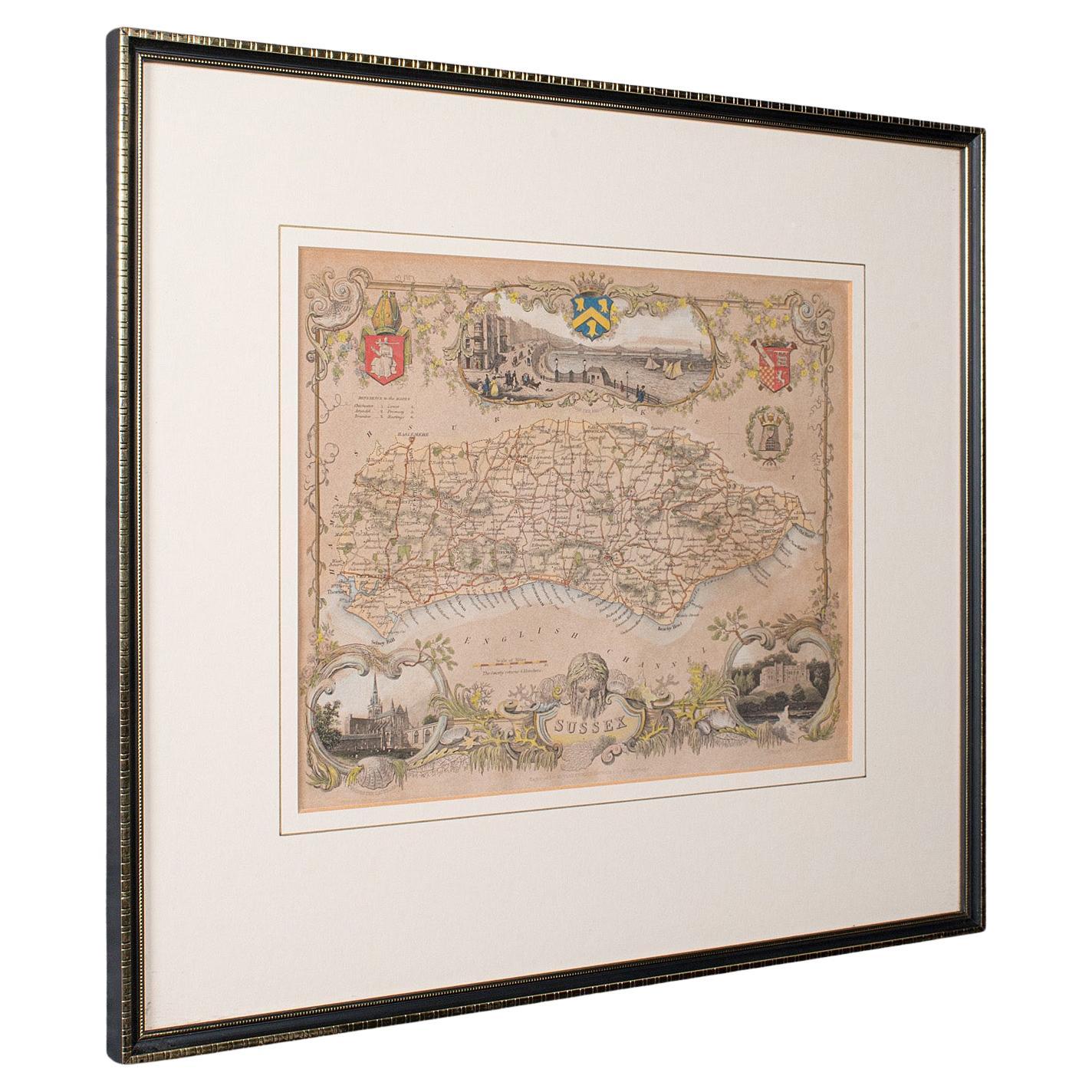
Antique County Map, Sussex, English, Framed Lithography, Cartography, Victorian
Located in Hele, Devon, GB
This is an antique lithography map of Sussex. An English, framed atlas engraving of cartographic interest, dating to the mid 19th century and later.
Superb lithography of Sussex an...
Category
Antique Mid-19th Century British Victorian Maps
Materials
Paper

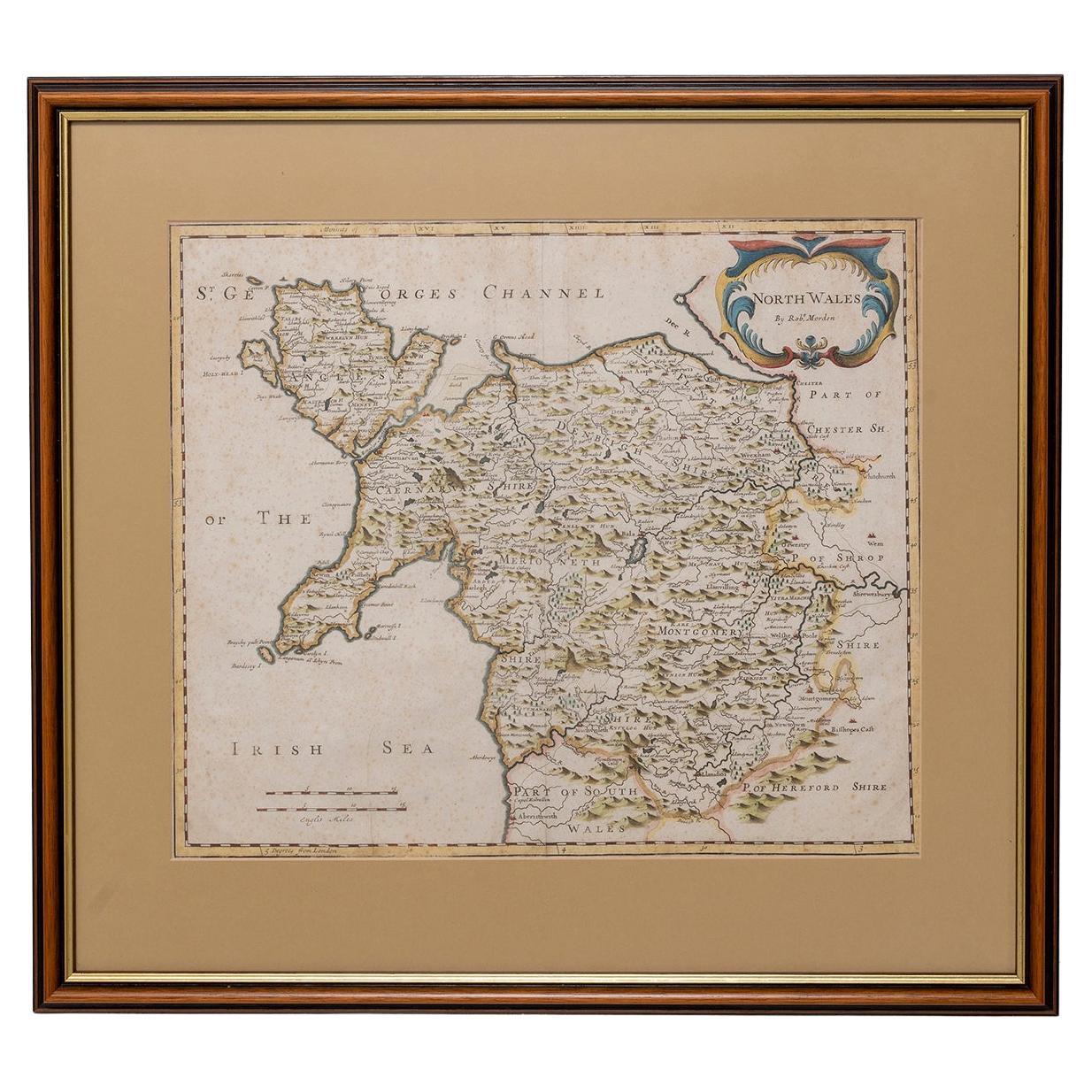
Map North Wales Robert Marsden Anglesey
Located in BUNGAY, SUFFOLK
Map of North Wales by Robert Marsden
Including Anglesey
Charming topography and detail and colouring
just purchased more information to follow.
Category
Antique 18th Century English Georgian Maps
Materials
Paper

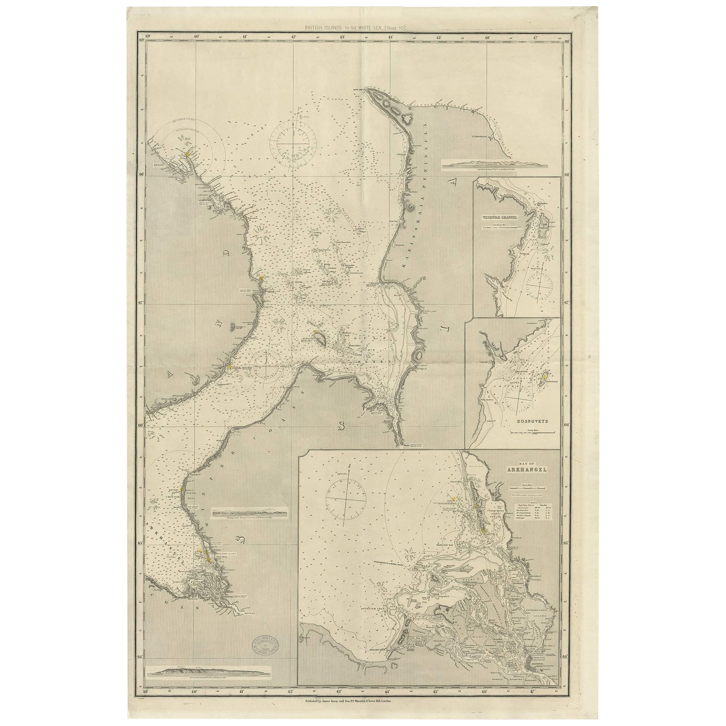
Antique Map of the British Islands to the White Sea by J. Imray
Located in Langweer, NL
Antique large nautical chart of the British Islands to the White Sea. With insets of Veshnyak Channel, Sosnovets and the Bay of Arkhangel. Published by James Irmay and Son, circa 1875.
Category
Antique Late 19th Century Maps
Materials
Paper
Antique Lithography Map, Northumberland, English, Framed, Engraving, Cartography
Located in Hele, Devon, GB
This is an antique lithography map of Northumberland. An English, framed atlas engraving of cartographic interest, dating to the mid 19th century a...
Category
Antique Mid-19th Century British Victorian Maps
Materials
Wood

Northern Scotland: A 17th Century Hand-colored Map by Mercator
By Gerard Mercator
Located in Alamo, CA
This is a framed hand-colored 17th century map of Northern Scotland by Gerard Mercator entitled "Scotiae pars Septentrionalis", published in Amsterdam in 1636. It is a highly detailed map of the northern part of Scotland, with the northwest Highlands and the cities Inverness and Aberdeen, as well as the Orkney Islands and the Hebrides. There is a decorative title cartouche in the upper left corner.
The map is presented in an antiqued brown wood...
Category
Antique 1630s Dutch Maps
Materials
Paper

More Ways To Browse
Antique Rug Wool Navy Blue Red
Antique Silver Platter
Boat Blueprint
Cream Plates
Vintage Art Deco Rugs
Vintage Serving Forks
Brewery Signs
Herati Rug
Gold Leaf Furniture Black
Italian Wood Console Tables
Maison Jansen Argentina
Antique Oushak
Mid Century Danish Directors Chairs
Moller 70
Wood Relief Art
Argentina Travel Poster
Century Furniture Faux Bamboo
Early American Chairs