Items Similar to Original Antique Map of the Duchy of Holstein


Want more images or videos?
Request additional images or videos from the seller
1 of 6
Original Antique Map of the Duchy of Holstein
$1,055.28
$1,319.1020% Off
£785.02
£981.2720% Off
€880
€1,10020% Off
CA$1,445.04
CA$1,806.2920% Off
A$1,606.68
A$2,008.3520% Off
CHF 838.92
CHF 1,048.6520% Off
MX$19,557.25
MX$24,446.5620% Off
NOK 10,704.27
NOK 13,380.3420% Off
SEK 10,029.39
SEK 12,536.7420% Off
DKK 6,698.95
DKK 8,373.6920% Off
Shipping
Retrieving quote...The 1stDibs Promise:
Authenticity Guarantee,
Money-Back Guarantee,
24-Hour Cancellation
About the Item
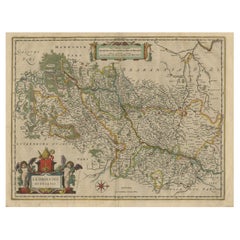
Antique map titled 'Ducatus Holsatiae Nova Tabula'. Original old map of the Duchy of Holstein, the northernmost territory of the Holy Roman Empire, from the mid-17th Century. To the north lies the Danish Duchy of Schleswig. In the south are Meklenburg and Lower Saxony. Fehmarn Island lies just off Holstein’s Baltic coastline. The strategically and commercially important great port cities of Hamburg, Kiel and Lubeck are all shown on the map. Holstein is crisscrossed with waterways: the Elbe river being the most prominent, and together with Trave, provided pathways for the region’s trade. The vessel depicted in the North Sea approaching the sandbars suggests the importance of trade to the region. Relief depicted pictorially.
Two inset box provide further detail of the specific locales. The inset box in the upper left shows the marshy coastal area around Dagebüll on the western coast. The depicted wierde/terp (artifical artificial dwelling mound) that were created in the marshy, low-lying reclaimed land to provide safe ground during storm surges, high tides and sea or river flooding. The inset box in the top right corner shows the area in and around Stapelholm. Cartouches in the lower corners contain bar-scales and provenance details. Annotative text in the North Sea. Two compass roses lie on either side of Holstein.
Willem Janszoon Blaeu (1571-1638) was a prominent Dutch geographer and publisher. Born the son of a herring merchant, Blaeu chose not fish but mathematics and astronomy for his focus. He studied with the famous Danish astronomer Tycho Brahe, with whom he honed his instrument and globe making skills. Blaeu set up shop in Amsterdam, where he sold instruments and globes, published maps, and edited the works of intellectuals like Descartes and Hugo Grotius. In 1635, he released his atlas, Theatrum Orbis Terrarum, sive, Atlas novus.
- Creator:Willem Blaeu (Artist)
- Dimensions:Height: 20.48 in (52 cm)Width: 24.53 in (62.3 cm)Depth: 0.02 in (0.5 mm)
- Materials and Techniques:
- Period:Mid-17th Century
- Date of Manufacture:c.1640
- Condition:Wear consistent with age and use. General age-related toning. Minor wear and soiling. Latin text on verso. Please study image carefully.
- Seller Location:Langweer, NL
- Reference Number:Seller: BG-13364-21stDibs: LU3054332471132
About the Seller
5.0
Recognized Seller
These prestigious sellers are industry leaders and represent the highest echelon for item quality and design.
Platinum Seller
Premium sellers with a 4.7+ rating and 24-hour response times
Established in 2009
1stDibs seller since 2017
2,511 sales on 1stDibs
Typical response time: <1 hour
- ShippingRetrieving quote...Shipping from: Langweer, Netherlands
- Return Policy
Authenticity Guarantee
In the unlikely event there’s an issue with an item’s authenticity, contact us within 1 year for a full refund. DetailsMoney-Back Guarantee
If your item is not as described, is damaged in transit, or does not arrive, contact us within 7 days for a full refund. Details24-Hour Cancellation
You have a 24-hour grace period in which to reconsider your purchase, with no questions asked.Vetted Professional Sellers
Our world-class sellers must adhere to strict standards for service and quality, maintaining the integrity of our listings.Price-Match Guarantee
If you find that a seller listed the same item for a lower price elsewhere, we’ll match it.Trusted Global Delivery
Our best-in-class carrier network provides specialized shipping options worldwide, including custom delivery.More From This Seller
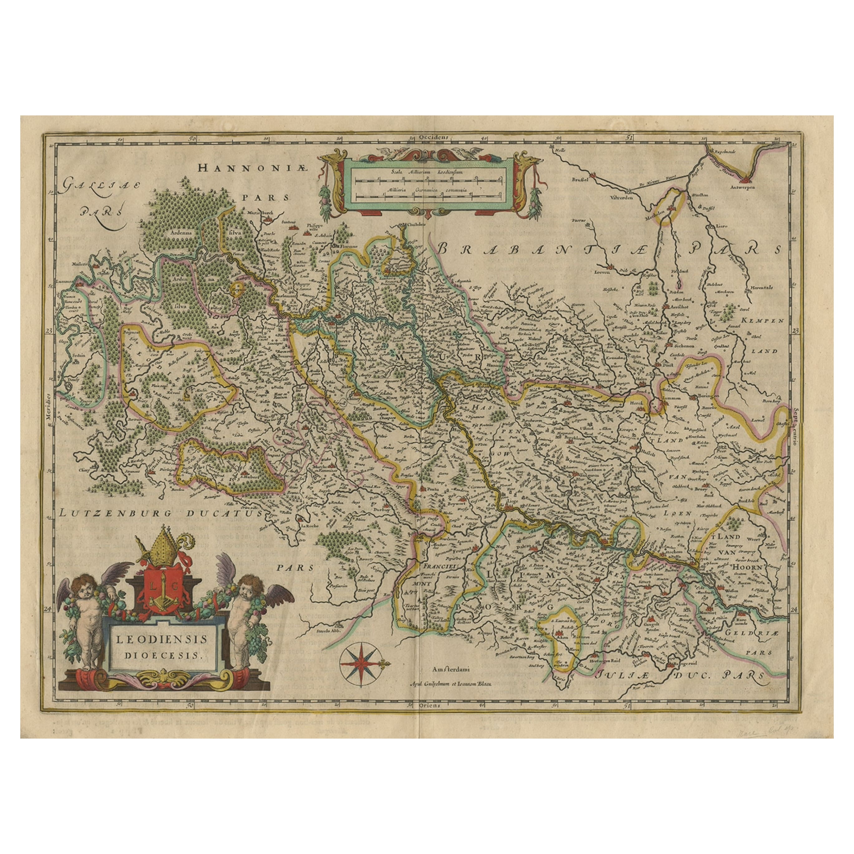
View AllAntique Map of Dutch & Belgium Provinces Limburg, Namen and Ardennes, ca.1635
Located in Langweer, NL
Antique print, titled: 'Leodiensis Dioecesis.'
Detailed map including the Dutch and Belgium provinces Limburg and the Belgium province of Namen and Ardennes. Exquisitely engraved...
Category
Antique 1630s Maps
Materials
Paper
$623 Sale Price
20% Off
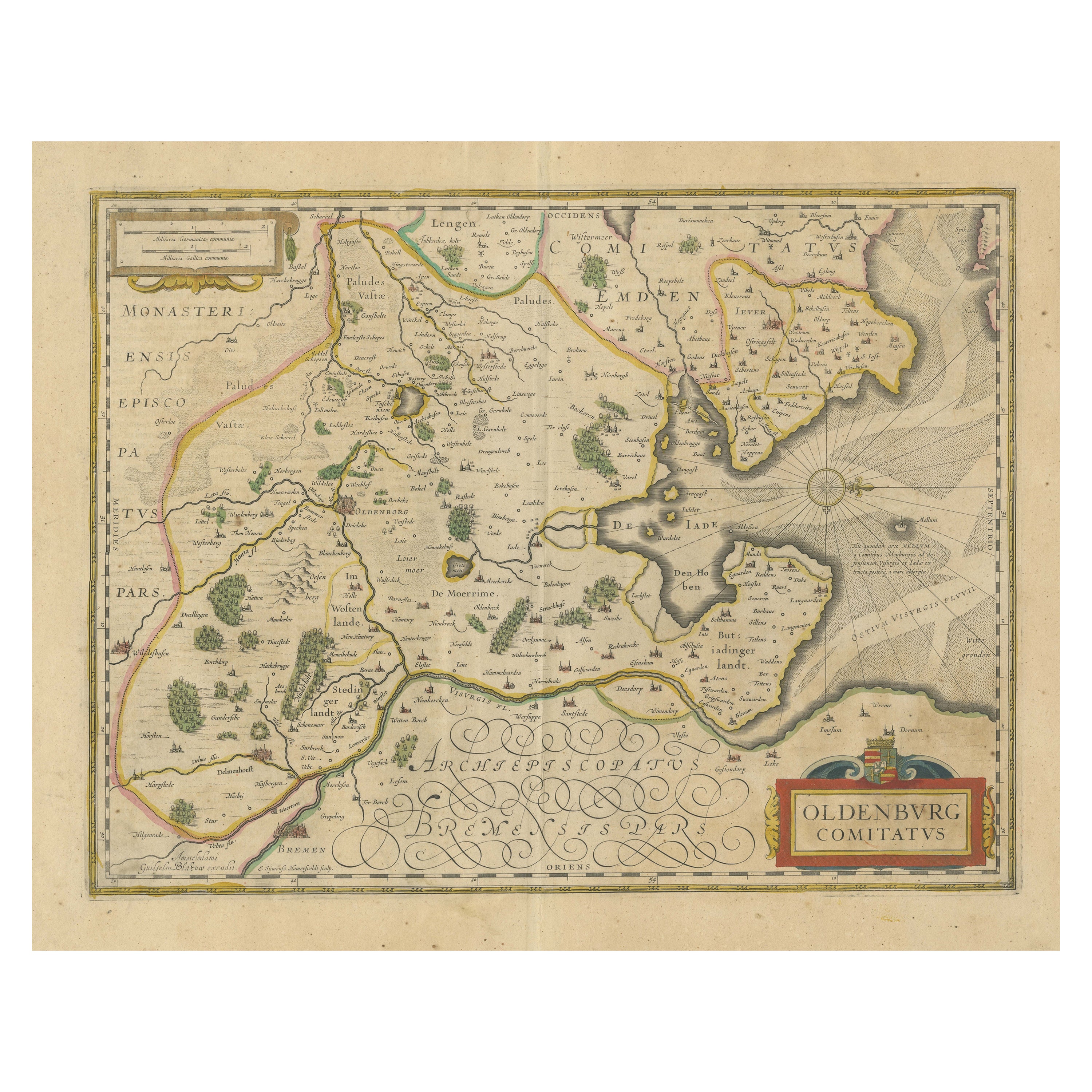
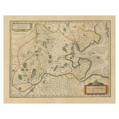
Antique Map of the Region of Oldenburg, Germany
By Willem Blaeu
Located in Langweer, NL
Antique map titled 'Oldenburg Comitatus'. Detailed old map of Oldenburg, Germany. The map also shows Bremen and the Jade Bight. Published by W. Blaeu, circa 1640. Willem Jansz. Blaeu...
Category
Antique Mid-17th Century Maps
Materials
Paper
$422 Sale Price
20% Off
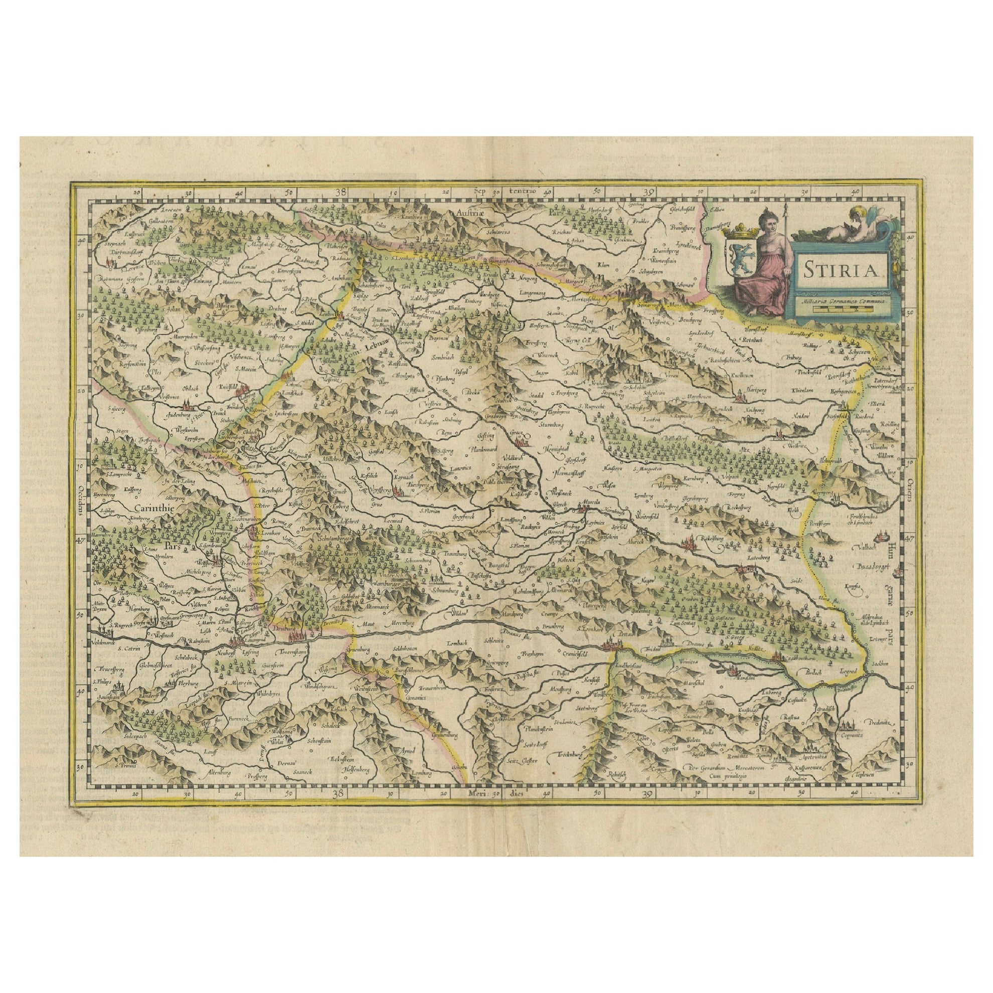
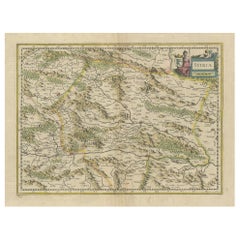
An Original Antique Mid-17th Century Blaeu Map of Styria in Southeastern Austria
Located in Langweer, NL
This is an antique map of Styria (referred to as “Stiria” or “Steyrmarck”), published by the renowned Dutch cartographer Willem Janszoon Blaeu (often simply “Blaeu”). The first editi...
Category
Antique 1640s Maps
Materials
Paper
Antique Map of the Nassau Region in Western Germany
Located in Langweer, NL
Antique map titled 'Nassovia Principatus (..)'. Detailed map of the Nassau region in western Germany between Koblenz, Hadamar, Giessen, Frankfurt and Mainz. The map is filled with in...
Category
Antique Early 18th Century Maps
Materials
Paper

$633 Sale Price
20% Off
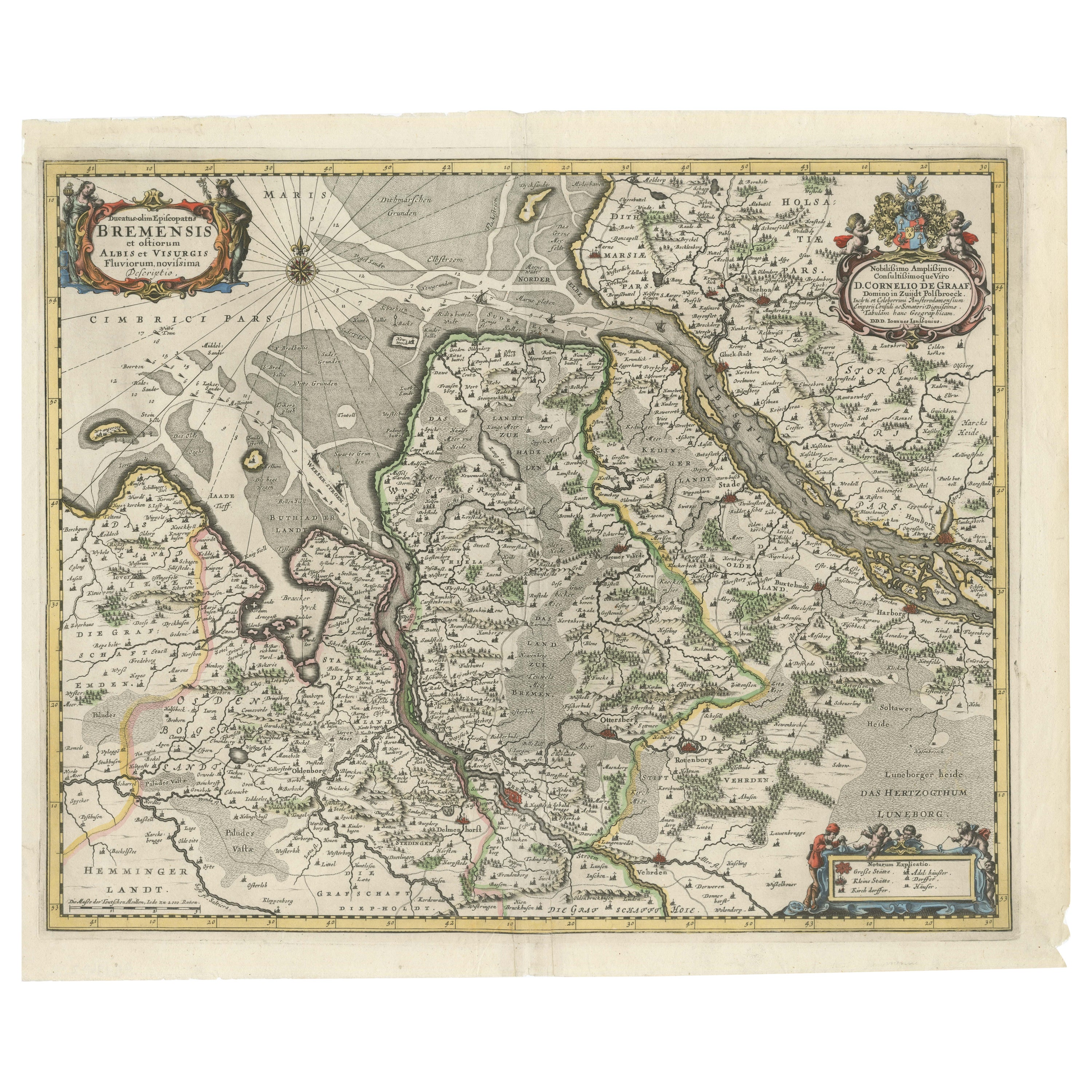
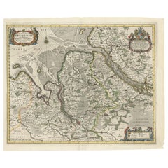
Johannes Janssonius' 17th-Century Map of the Duchy of Bremen in Germany
Located in Langweer, NL
The map titled "Ducatus olim Episcopatus Bremensis et ostiorum Albis et Visurgis Fluviorum novissima Descriptio" by Johannes Janssonius provides a rich historical and geographical il...
Category
Antique 1650s Maps
Materials
Paper
$738 Sale Price
20% Off
Original Antique Map of the Dutch Provinces of Overijssel and Drenthe, 1635
Located in Langweer, NL
Antique map titled 'Transiselania Dominium vernacule Over-Yssel.' - Map of the Dutch Provinces of Overijssel and Drenthe. Dedicated to Mr. Bartold Wich...
Category
Antique 1630s Maps
Materials
Paper

$460 Sale Price
20% Off
You May Also Like
1640 Willem Blaeu Map Entitled "Contado di molise et principato vltra, " Ric.a003
By Willem Blaeu
Located in Norton, MA
1640 Willem Blaeu map entitled
"Contado di molise et principato vltra,"
Colored
Ric. a003
Measures: 38 x 49.6 cm and wide margins
DBLAEU.
Cou...
Category
Antique 17th Century Dutch Maps
Materials
Paper

1643 Willem&Joan Blaeu Map NW Flanders "Flandriae Teutonicae Pars Prientalior
Located in Norton, MA
1643 Willem and Joan Blaeu map of northwest Flanders, entitled
"Flandriae Teutonicae Pars Prientalior,"
Ric0012
" Authentic" - Map of the northwest Fl...
Category
Antique 17th Century Dutch Maps
Materials
Paper

Antique Colored Belgium Map Flandria Gallica Flanders Henricus Hondius
Located in Dayton, OH
Antique hand colored map of Flanders, Belgium, engraved by Henricus Hondius.
Sans frame - 21.25” x 18”.
Category
Antique 19th Century Renaissance Maps
Materials
Paper

$280 Sale Price
20% Off
17th Century Hand-Colored Map of a Region in West Germany by Janssonius
By Johannes Janssonius
Located in Alamo, CA
This attractive highly detailed 17th century original hand-colored map is entitled "Archiepiscopatus Maghdeburgensis et Anhaltinus Ducatus cum terris adjacentibus". It was published ...
Category
Antique Mid-17th Century Dutch Maps
Materials
Paper

Prussia, Poland, N. Germany, Etc: A Hand-colored 17th Century Map by Janssonius
By Johannes Janssonius
Located in Alamo, CA
This is an attractive hand-colored copperplate engraved 17th century map of Prussia entitled "Prussia Accurate Descripta a Gasparo Henneberg Erlichensi", published in Amsterdam by Joannes Janssonius in 1664. This very detailed map from the golden age of Dutch cartography includes present-day Poland, Latvia, Lithuania, Estonia and portions of Germany. This highly detailed map is embellished by three ornate pink, red, mint green and gold...
Category
Antique Mid-17th Century Dutch Maps
Materials
Paper

1635 Willem Blaeu Map of Northern France"Comitatvs Bellovacvm" Ric.a08
Located in Norton, MA
1635 Willem Blaeu map of northern France, entitled.
"Comitatvs Bellovacvm Vernacule Beavvais,"
Colored
Ric.a008
“COMITATVS BELLOVACVM…” Amsterdam: W...
Category
Antique 17th Century Unknown Maps
Materials
Paper

More Ways To Browse
The Old Curiosity Shop
17th Century Danish
17th Century Safe
Schleswig Holstein
Compass In A Box
Antique Box Compass
Kiel Furniture
Safe Herring
J And C Bavaria
Map Of Barbados
Montreal Map
Antique Furniture Toledo Ohio
Laos Antique Map
Orinoco Furniture
Johann Baptist Homann On Sale
Rand Mcnally Vintage Maps
Tipu Sultan
Antique Map Bermuda