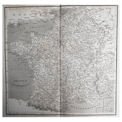
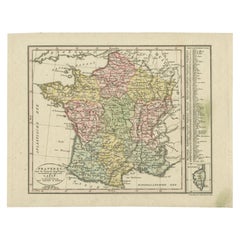
Original Antique Map of France, Arrowsmith, 1820
View Similar Items


Want more images or videos?
Request additional images or videos from the seller
1 of 5
Original Antique Map of France, Arrowsmith, 1820
$950List Price
About the Item
- Dimensions:Height: 10.5 in (26.67 cm)Width: 16 in (40.64 cm)Depth: 0.07 in (1.78 mm)
- Materials and Techniques:Paper,Other
- Place of Origin:
- Period:
- Date of Manufacture:1820
- Condition:Wear consistent with age and use.
- Seller Location:St Annes, GB
- Reference Number:1stDibs: LU1836331232972
About the Seller
4.9
Platinum Seller
Premium sellers with a 4.7+ rating and 24-hour response times
1stDibs seller since 2016
3,120 sales on 1stDibs
Typical response time: 1 hour
Associations
International Confederation of Art and Antique Dealers' Associations
Authenticity Guarantee
In the unlikely event there’s an issue with an item’s authenticity, contact us within 1 year for a full refund. DetailsMoney-Back Guarantee
If your item is not as described, is damaged in transit, or does not arrive, contact us within 7 days for a full refund. Details24-Hour Cancellation
You have a 24-hour grace period in which to reconsider your purchase, with no questions asked.Vetted Professional Sellers
Our world-class sellers must adhere to strict standards for service and quality, maintaining the integrity of our listings.Price-Match Guarantee
If you find that a seller listed the same item for a lower price elsewhere, we’ll match it.Trusted Global Delivery
Our best-in-class carrier network provides specialized shipping options worldwide, including custom delivery.More From This Seller
View AllOriginal Antique Map of China, Arrowsmith, 1820
Located in St Annes, Lancashire
Great map of China
Drawn under the direction of Arrowsmith
Copper-plate engraving
Published by Longman, Hurst, Rees, Orme and Brown, 1820
Unfr...
Category
Antique 1820s English Maps
Materials
Paper

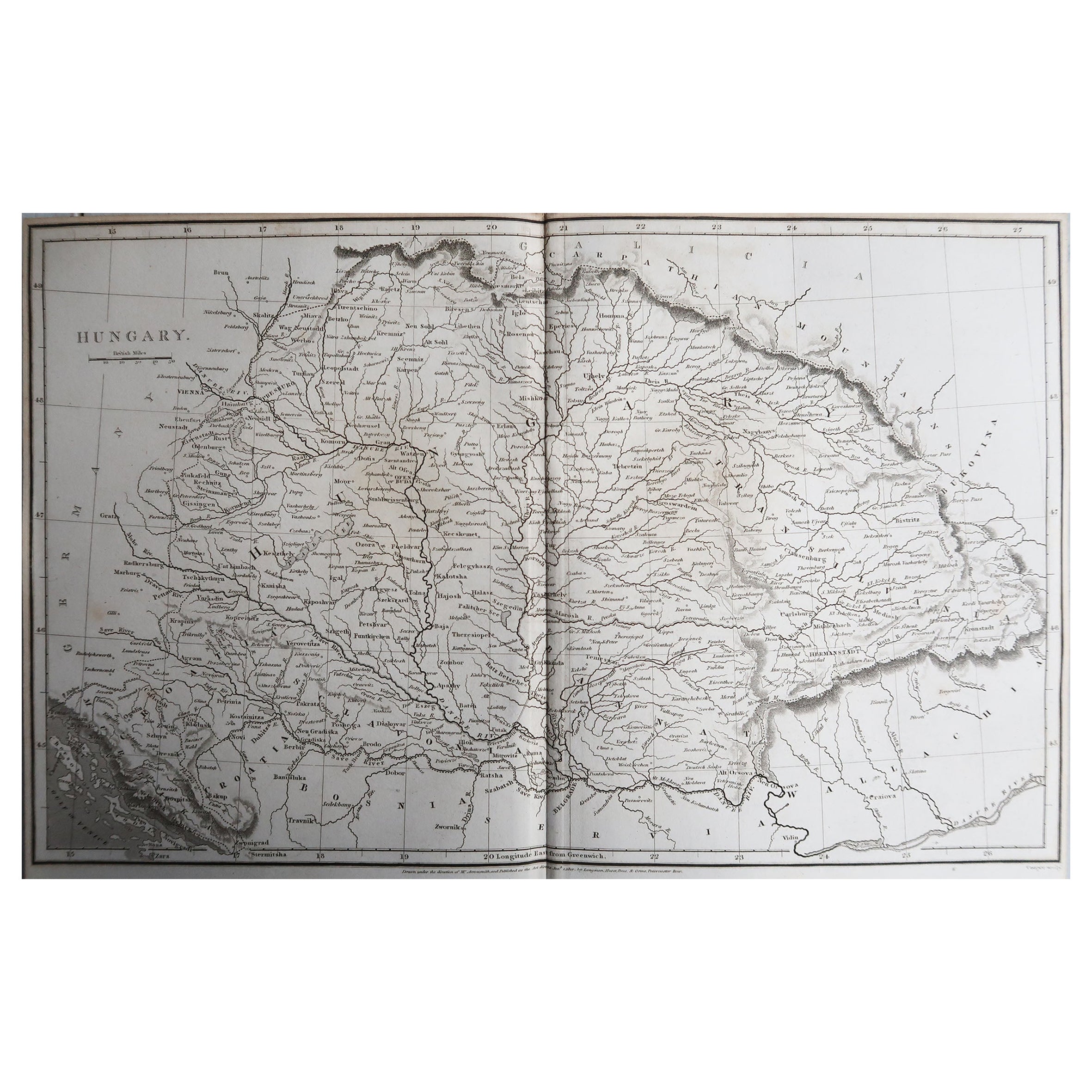
Original Antique Map of Hungary, Arrowsmith, 1820
Located in St Annes, Lancashire
Great map of Hungary
Drawn under the direction of Arrowsmith.
Copper-plate engraving.
Published by Longman, Hurst, Rees, Orme and Brown, 1820
Unframed.
Category
Antique 1820s English Maps
Materials
Paper

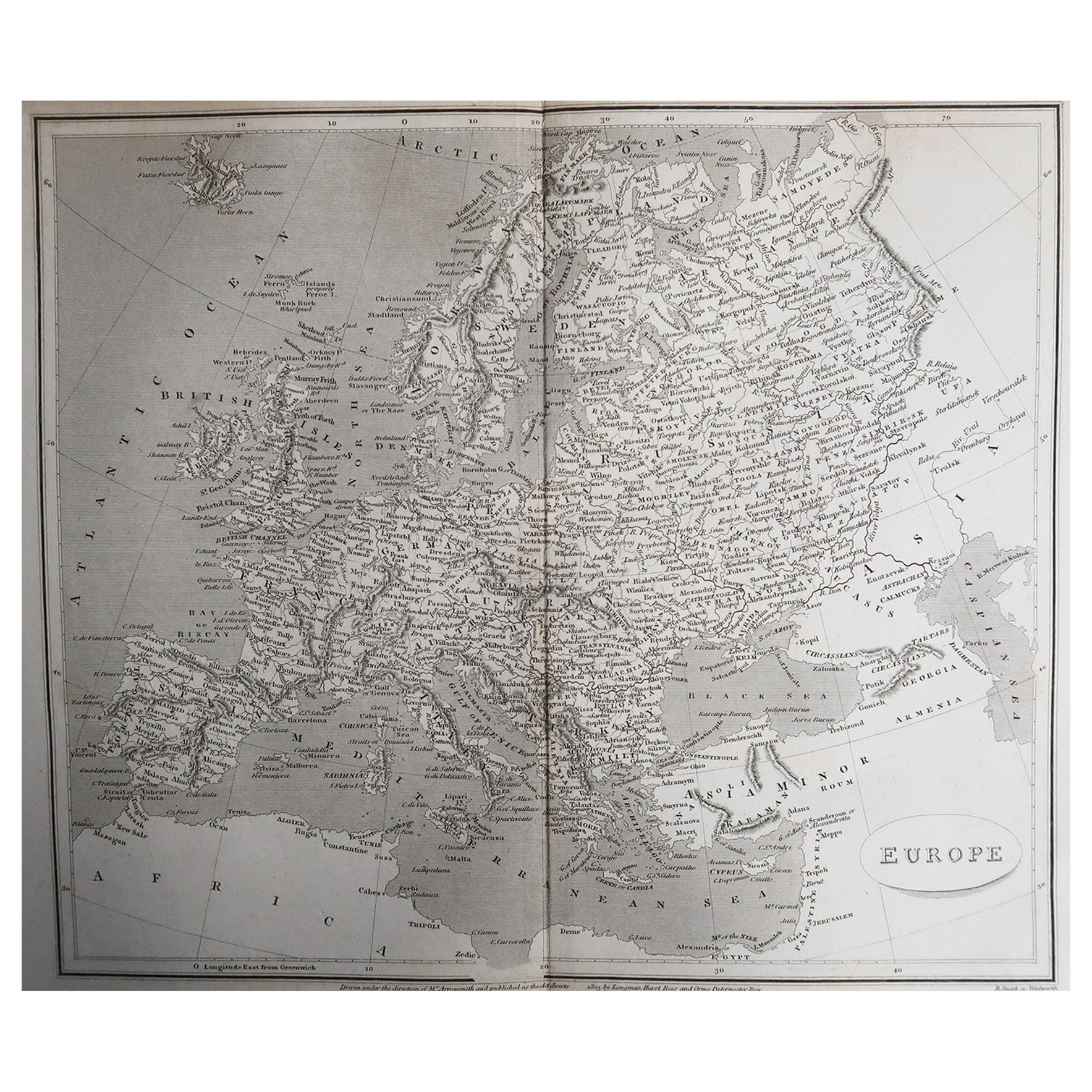
Original Antique Map of Europe, Arrowsmith, 1820
Located in St Annes, Lancashire
Great map of Europe
Drawn under the direction of Arrowsmith.
Copper-plate engraving.
Published by Longman, Hurst, Rees, Orme and Brown, 1820
...
Category
Antique 1820s English Maps
Materials
Paper

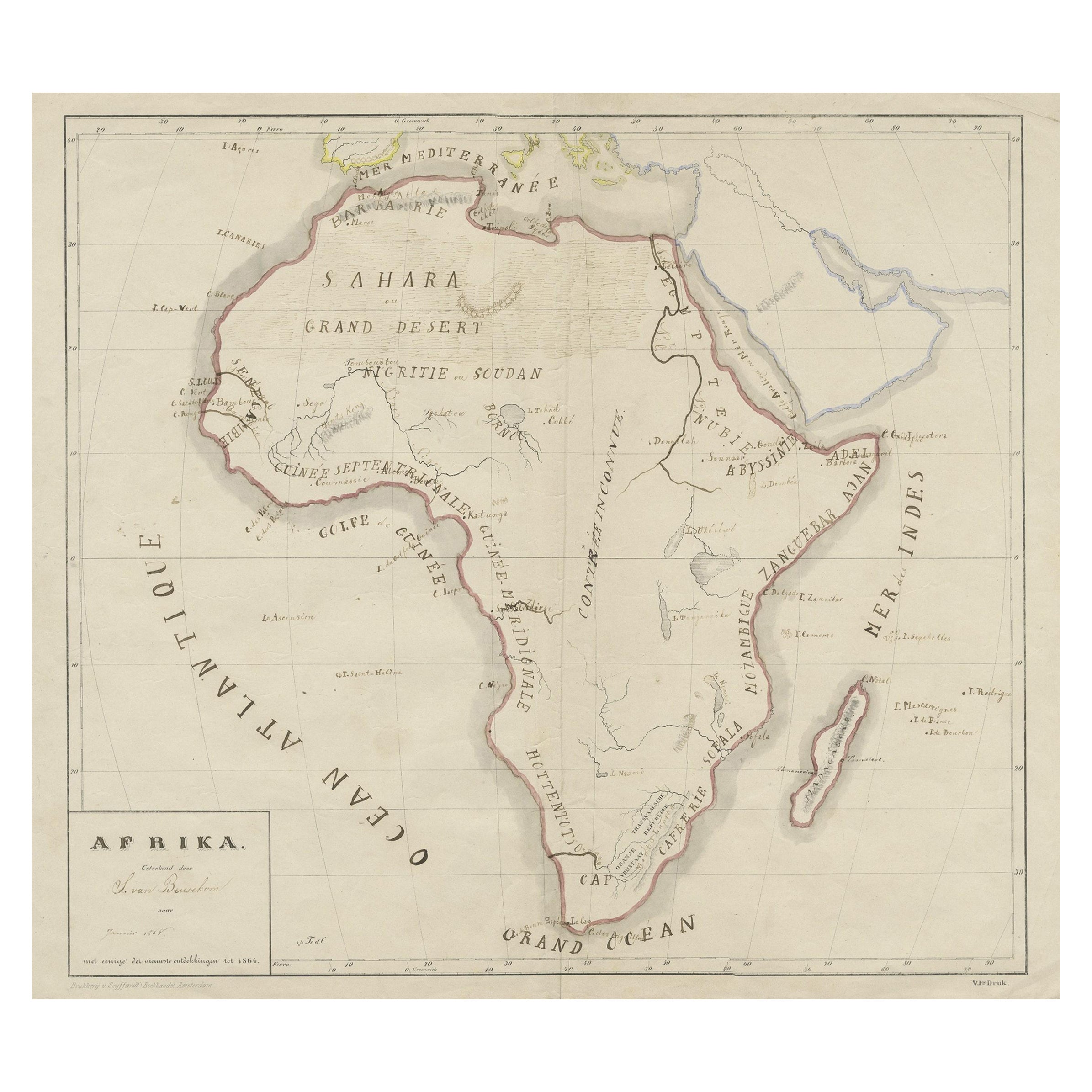
Original Antique Map of South Africa, Arrowsmith, 1820
Located in St Annes, Lancashire
Great map of South Africa.
Drawn under the direction of Arrowsmith.
Copper-plate engraving.
Published by Longman, Hurst, Rees, Orme and Br...
Category
Antique 1820s English Maps
Materials
Paper

Original Antique Map of Central America / Florida, Arrowsmith, 1820
Located in St Annes, Lancashire
Great map of Central America.
Drawn under the direction of Arrowsmith.
Copper-plate engraving.
Published by Longman, Hurst, Rees, Orme and Brown, 1820
Unframed.
Category
Antique 1820s English Maps
Materials
Paper

Original Antique Map of South America. C.1780
Located in St Annes, Lancashire
Great map of South America
Copper-plate engraving
Published C.1780
Two small worm holes to left side of map
Unframed.
Category
Antique Early 1800s English Georgian Maps
Materials
Paper

You May Also Like
Antique Map of New Zealand by Arrowsmith '1844'
Located in Langweer, NL
Antique map titled 'Map of the colony of New Zealand from official documents'. A scarce map of New Zealand. First issued in the 1830s, this state sh...
Category
Antique Mid-19th Century Maps
Materials
Paper

$1,547 Sale Price
24% Off
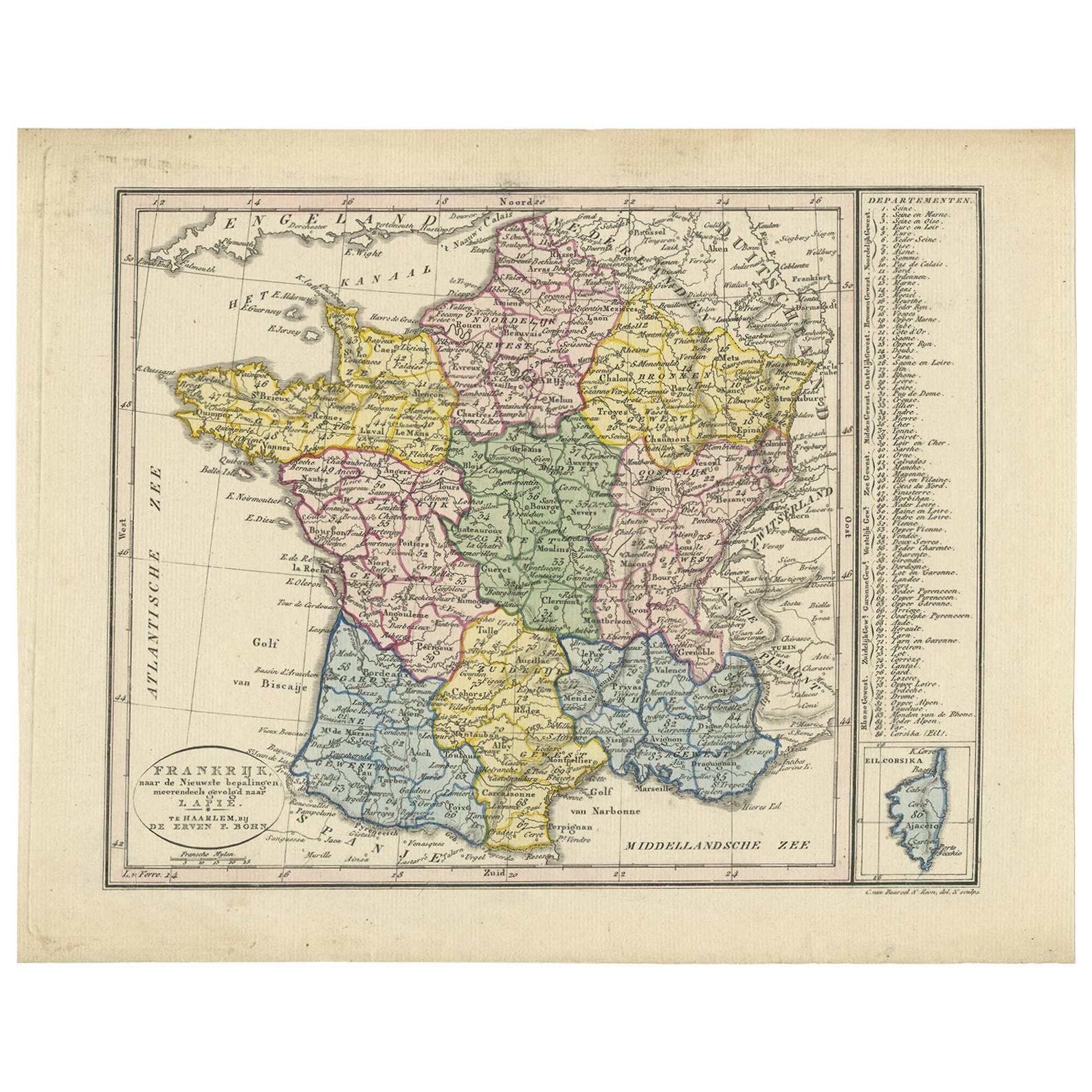
Antique Map of France by Van Baarsel (c.1820)
Located in Langweer, NL
'Frankrijk naar de nieuwste bepalingen meerendeels gevolgd naar Lapie'. Beautiful map of France with an inset map of the island of Corsica. Includes a table with reference to the dep...
Category
Antique Early 19th Century Dutch Maps
Materials
Paper

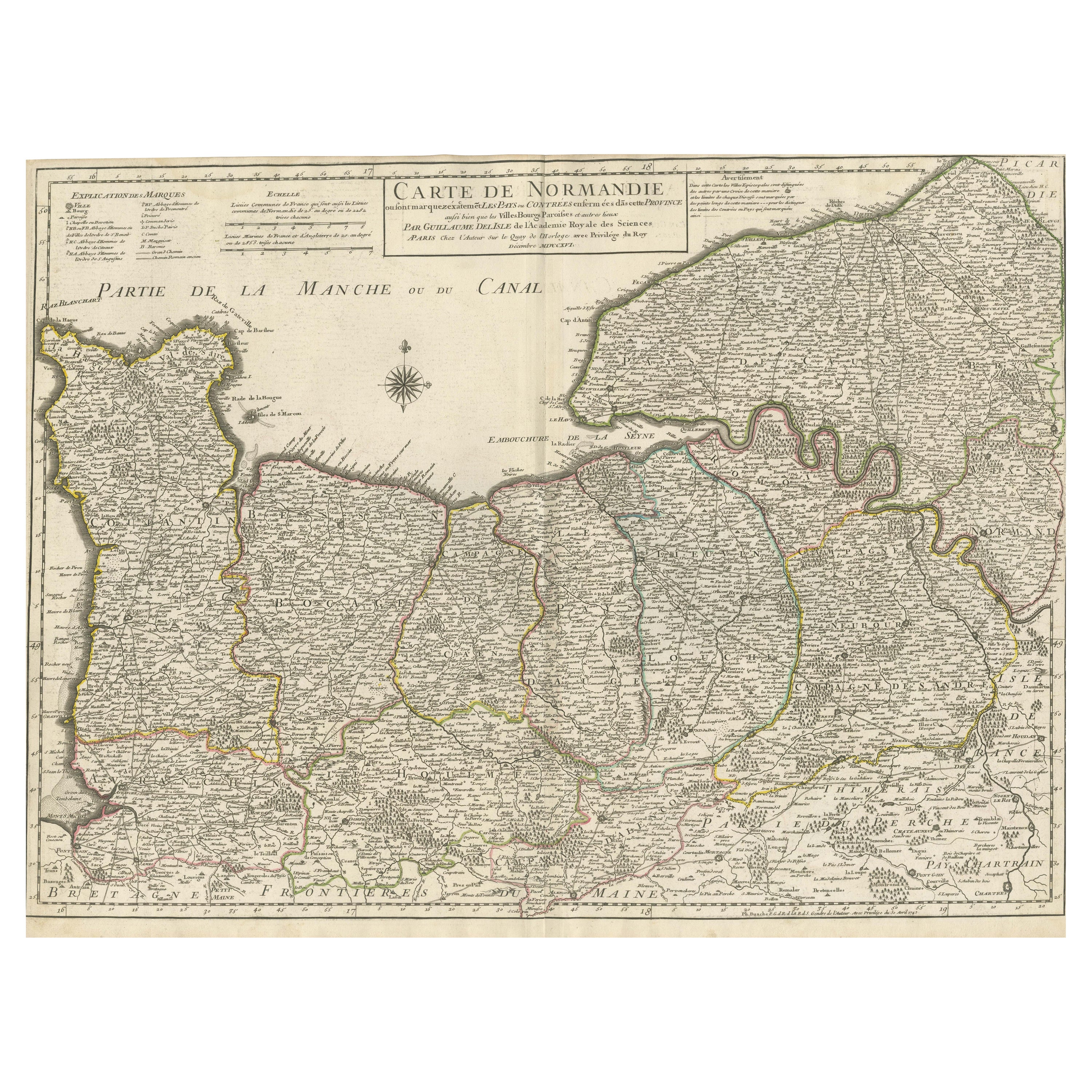
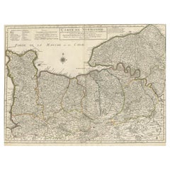
Original Antique Map of Normandy, France
Located in Langweer, NL
Antique map titled 'Carte de Normandie (..)'. Attractive map of Normandy, France. it depicts the former French Duchy of Normandy, covers the region fro...
Category
Antique Mid-18th Century Maps
Materials
Paper
$744 Sale Price
20% Off
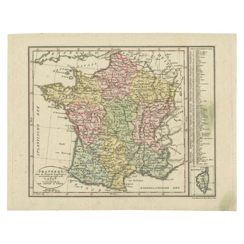
Antique Map of France with an Inset Map of the Island of Corsica, c.1820
Located in Langweer, NL
Antique map titled 'Frankrijk naar de nieuwste bepalingen meerendeels gevolgd naar Lapie'. Beautiful map of France with an inset map of the island of Corsica. Includes a table with r...
Category
Antique 19th Century Dutch Maps
Materials
Paper
$169 Sale Price
20% Off
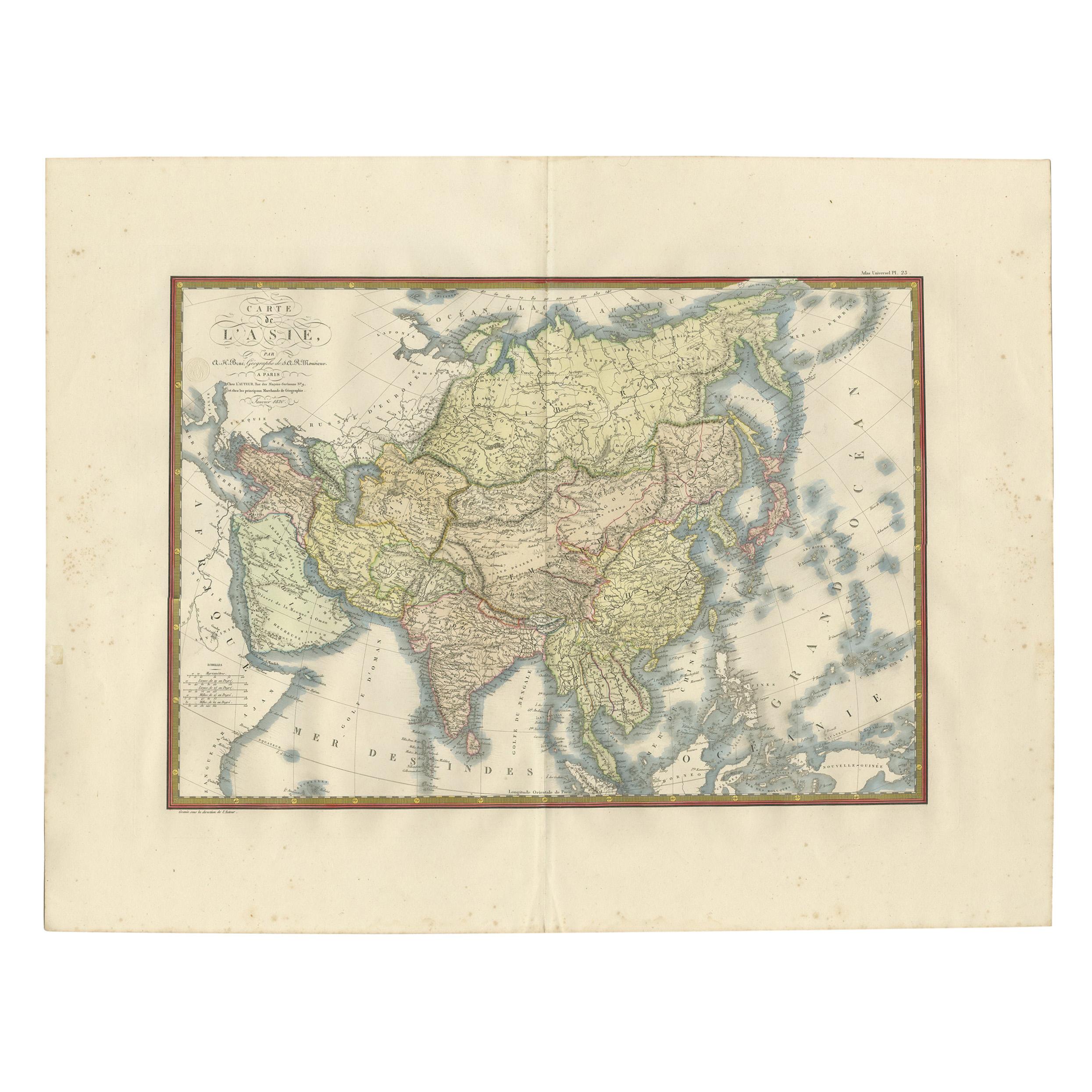
Antique Map of Asia by Brué '1820'
Located in Langweer, NL
Antique map titled 'Carte de l'Asie'. Original antique map of Asia. A blind stamp near the title reads 'Carte Encyprotipe'. This map originates fro...
Category
Antique Early 19th Century Maps
Materials
Paper

$612 Sale Price
20% Off
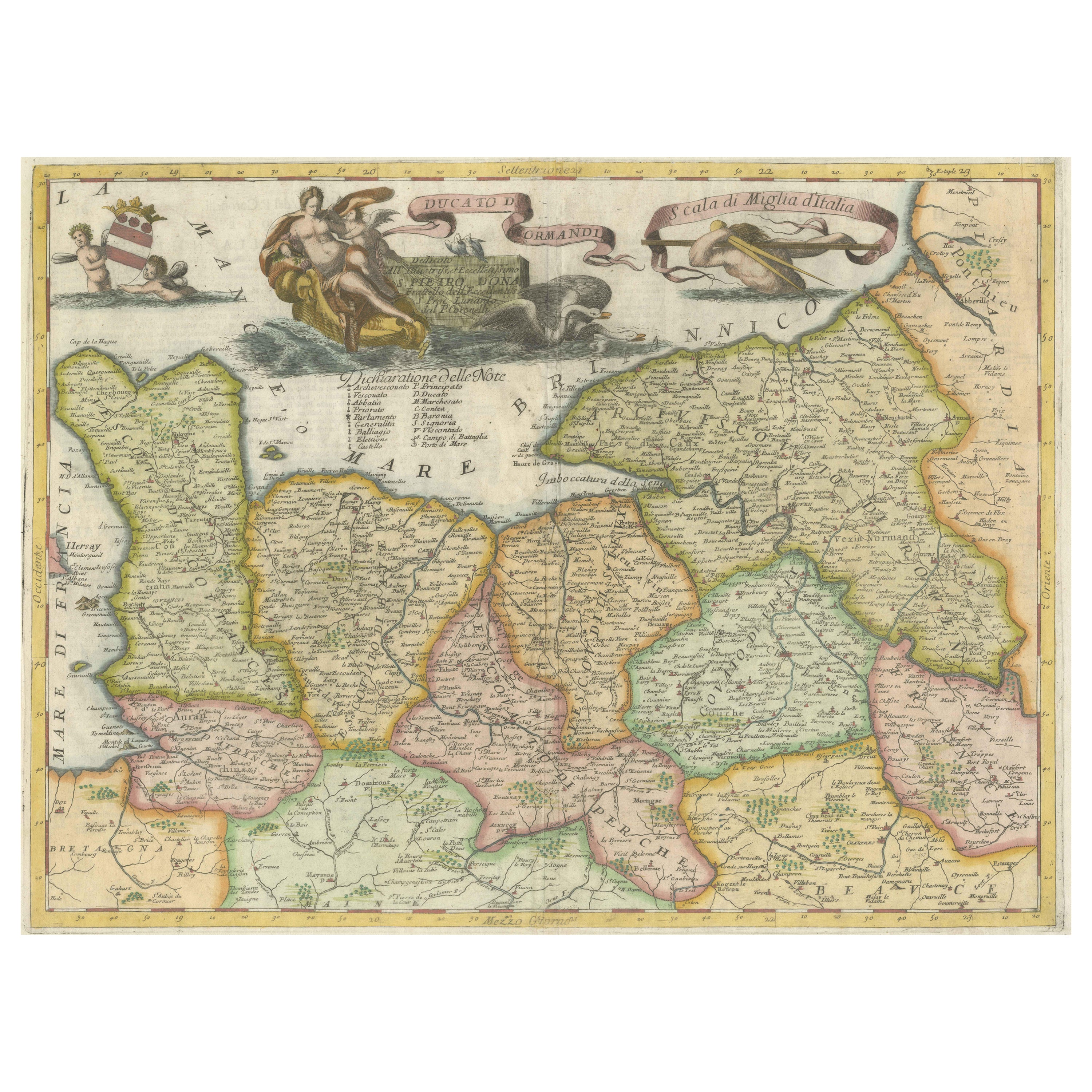
Decorative Original Antique Map of Normandy, France
Located in Langweer, NL
Original antique map titled 'Ducato D'Normandie Scala di Miglia d'Italia'. Very decorative map of Normandy, with a fine title cartouche featuring Leda ...
Category
Antique Late 17th Century Italian Maps
Materials
Paper

$886 Sale Price
20% Off
Recently Viewed
View AllMore Ways To Browse
Antique Map Of Cornwall
Coronelli Globe
Vintage Bartholomew Maps
Antique Alabama Map
Cape Cod Map
Goa France
Antique Planisphere
Charlotte Reine
Dutch Malacca
Gabon Antique Map
J And C Bavaria
Map Of Barbados
Montreal Map
Antique Furniture Toledo Ohio
Laos Antique Map
Orinoco Furniture
Johann Baptist Homann On Sale
Rand Mcnally Vintage Maps