Items Similar to Original Antique Map of Northern India


Want more images or videos?
Request additional images or videos from the seller
1 of 6
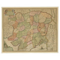
Original Antique Map of Northern India
$207.94
$259.9220% Off
£155.86
£194.8320% Off
€176
€22020% Off
CA$285.67
CA$357.0920% Off
A$318.92
A$398.6520% Off
CHF 167.11
CHF 208.8920% Off
MX$3,903.91
MX$4,879.8920% Off
NOK 2,122.30
NOK 2,652.8820% Off
SEK 2,001.06
SEK 2,501.3320% Off
DKK 1,339.78
DKK 1,674.7220% Off
Shipping
Retrieving quote...The 1stDibs Promise:
Authenticity Guarantee,
Money-Back Guarantee,
24-Hour Cancellation
About the Item
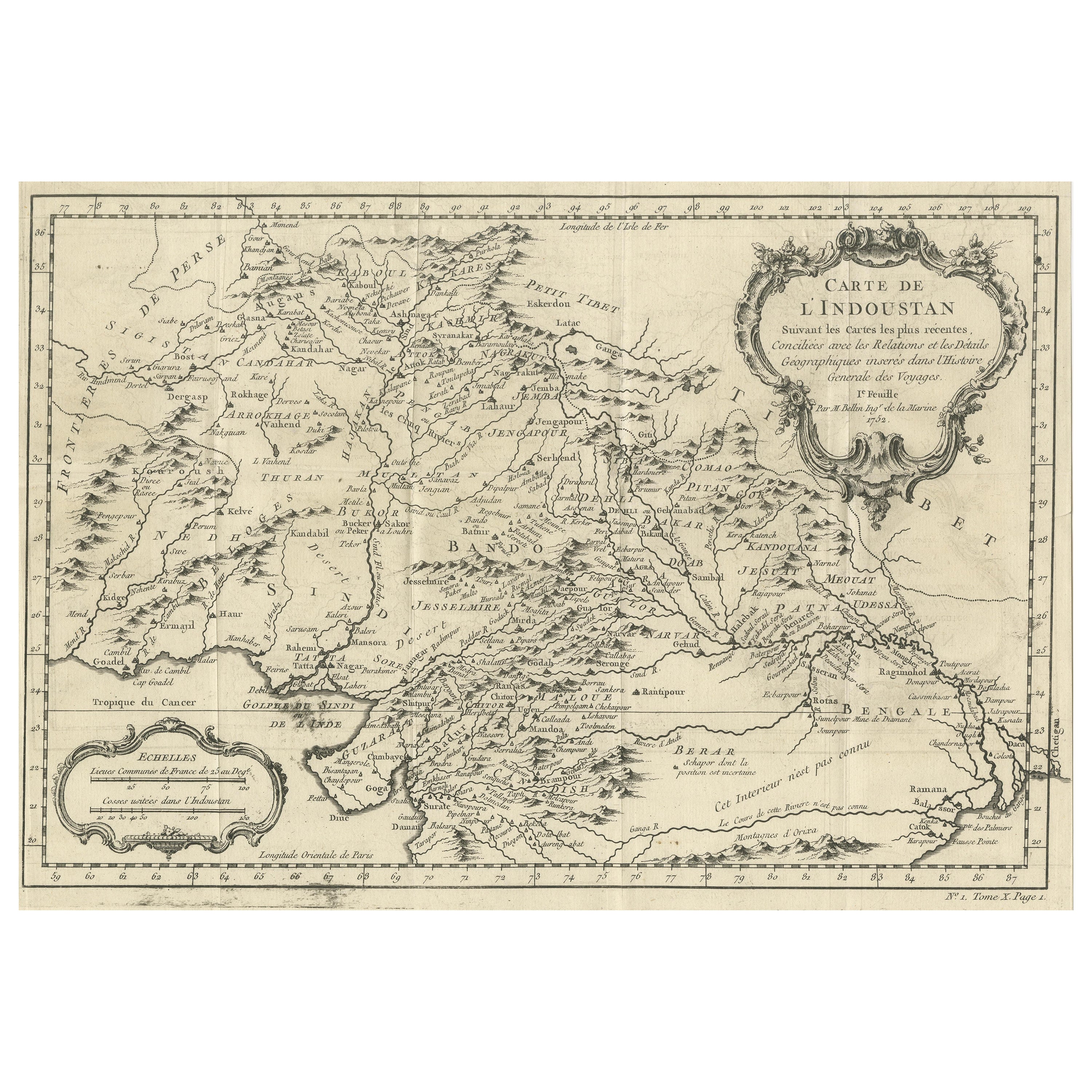
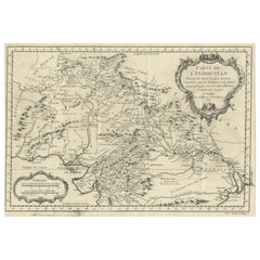
Antique map titled 'Carte de l'Indoustan (..) - Kaart van Hindoestan (..)'. Original antique map of northern India. This map originates from 'Historische beschryving der reizen, of Nieuwe en volkoome verzameling van de aller-waardigste en zeldsaamste zee- en landtogten (..)'. Engraved by J. van Schley. Published by P. de Hondt, 1757.
- Creator:Jakob van der Schley (Artist)
- Dimensions:Height: 9.85 in (25 cm)Width: 13 in (33 cm)Depth: 0.02 in (0.5 mm)
- Materials and Techniques:
- Period:
- Date of Manufacture:1757
- Condition:Wear consistent with age and use. Strong toning. Original folding lines. Shows some soiling and staining, blank verso. Please study images carefully.
- Seller Location:Langweer, NL
- Reference Number:Seller: BG-13301-11stDibs: LU3054331065622
About the Seller
5.0
Recognized Seller
These prestigious sellers are industry leaders and represent the highest echelon for item quality and design.
Platinum Seller
Premium sellers with a 4.7+ rating and 24-hour response times
Established in 2009
1stDibs seller since 2017
2,513 sales on 1stDibs
Typical response time: <1 hour
- ShippingRetrieving quote...Shipping from: Langweer, Netherlands
- Return Policy
Authenticity Guarantee
In the unlikely event there’s an issue with an item’s authenticity, contact us within 1 year for a full refund. DetailsMoney-Back Guarantee
If your item is not as described, is damaged in transit, or does not arrive, contact us within 7 days for a full refund. Details24-Hour Cancellation
You have a 24-hour grace period in which to reconsider your purchase, with no questions asked.Vetted Professional Sellers
Our world-class sellers must adhere to strict standards for service and quality, maintaining the integrity of our listings.Price-Match Guarantee
If you find that a seller listed the same item for a lower price elsewhere, we’ll match it.Trusted Global Delivery
Our best-in-class carrier network provides specialized shipping options worldwide, including custom delivery.More From This Seller
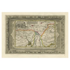
View AllAntique Map of part of India, the Ganges and Hindustan
Located in Langweer, NL
Antique map titled 'Carte de l'Indoustan'. Original antique map of part of India, the Ganges and Hindustan. This map originates from 'Histoire Generale Des Voyages' by Antoine Franco...
Category
Antique Mid-18th Century Maps
Materials
Paper
$311 Sale Price
20% Off
Antique Map of India as Described It Was before the 5th Century, 1744
Located in Langweer, NL
Antique map titled 'India, as described by all Authors before the fifth Century'. Detailed map of part of India, including Hyrcania, Parthia, Carmania, Gedorossii, Drangiana, Aria, M...
Category
Antique 18th Century Maps
Materials
Paper

$302 Sale Price
20% Off
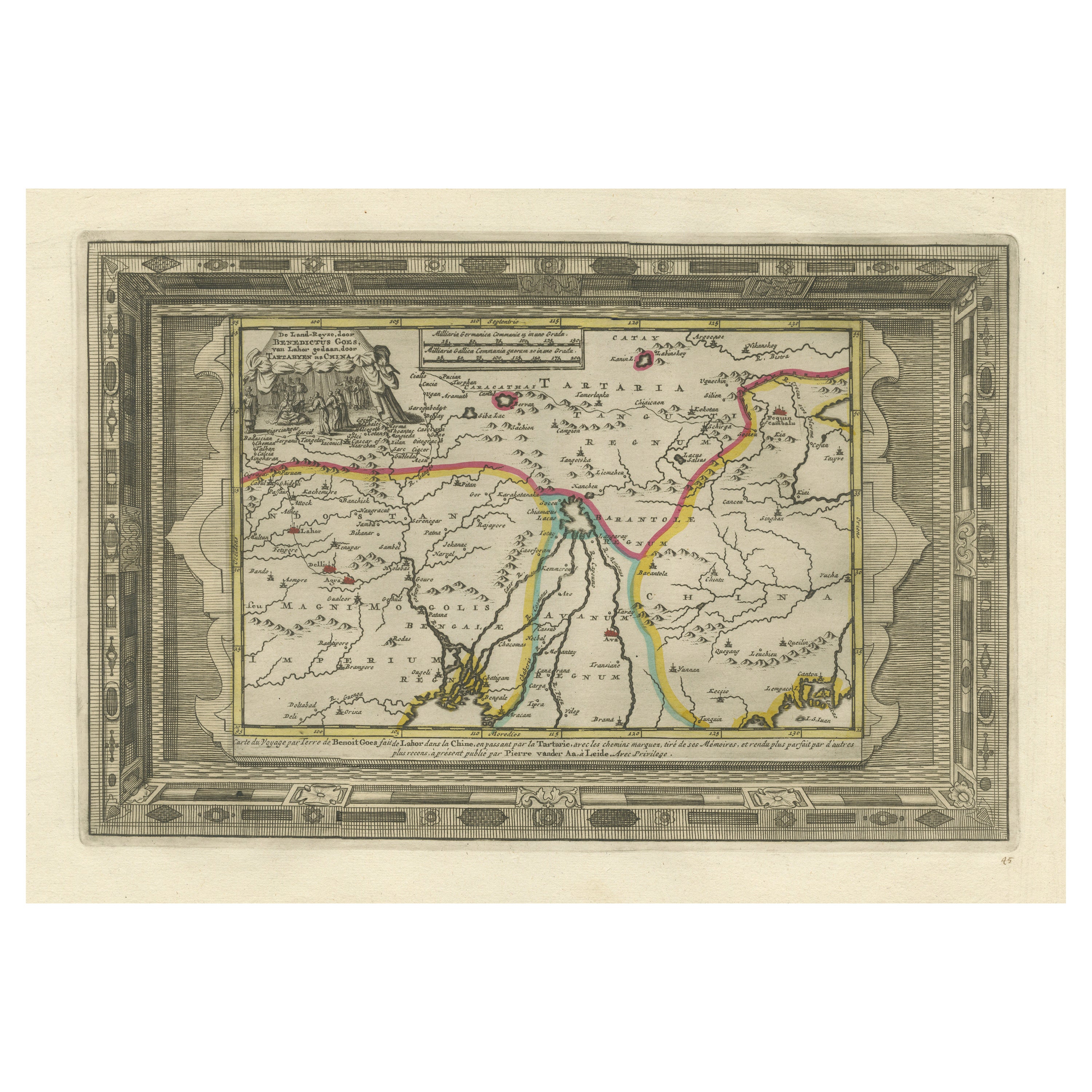
Benedictus Goes’ Route – Antique Map of Tartary to China by Van der Aa, 1714
Located in Langweer, NL
Benedictus Goes’ Route – Antique Map of Tartary to China by Van der Aa, 1714
This fascinating antique map titled De Land-Reyse door Benedictus Goes, van Lahor gedaan, door Tartaryen...
Category
Antique Early 18th Century Dutch Maps
Materials
Paper
$510 Sale Price
20% Off
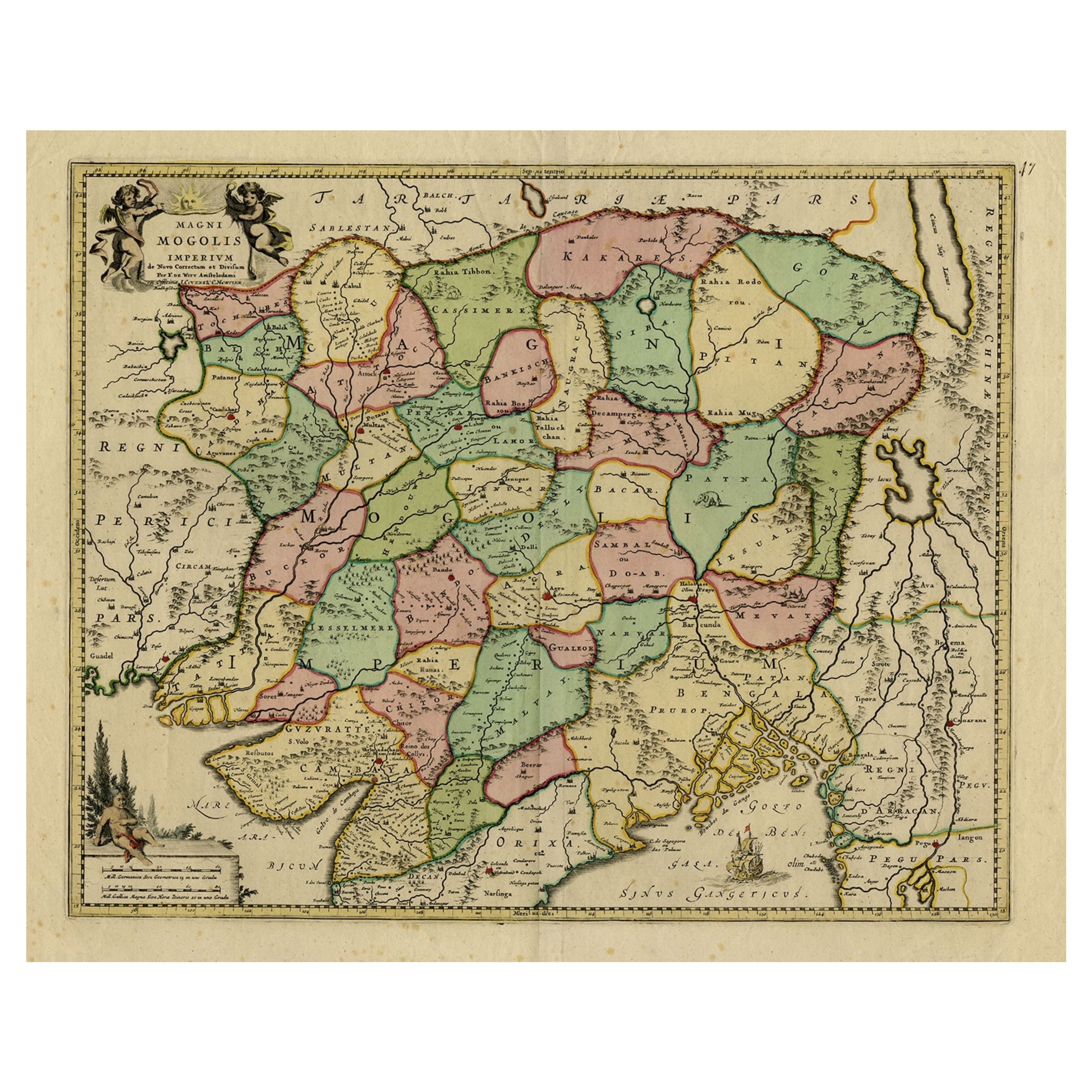
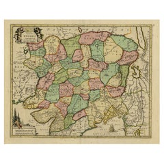
Map of Northern India & Surrounding Regions, incl Kabul, Candahar & Bhutan, 1710
Located in Langweer, NL
Antique map titled 'Magni Mogolis Imperium de Novo Correctum et Divisum Per F. de Witt Amstelodami.'
Map of Northern India and surrounding regions. This includes Kabul and Candah...
Category
Antique 1710s Maps
Materials
Paper
$1,153 Sale Price
20% Off
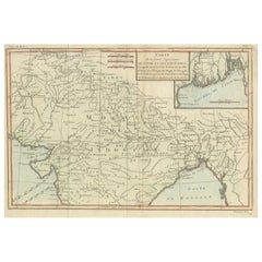
Antique Map of part of Central and Southern Asia
Located in Langweer, NL
Antique map titled 'Carte de la Partie Superieure de l'Inde en deca du Gange. Comprise entre la Cote du Concan et celle d'Orixa, avec l'Empire du Mogol, le Bengale, le R. d'Asham, pa...
Category
Antique Late 18th Century Maps
Materials
Paper
$368 Sale Price
20% Off
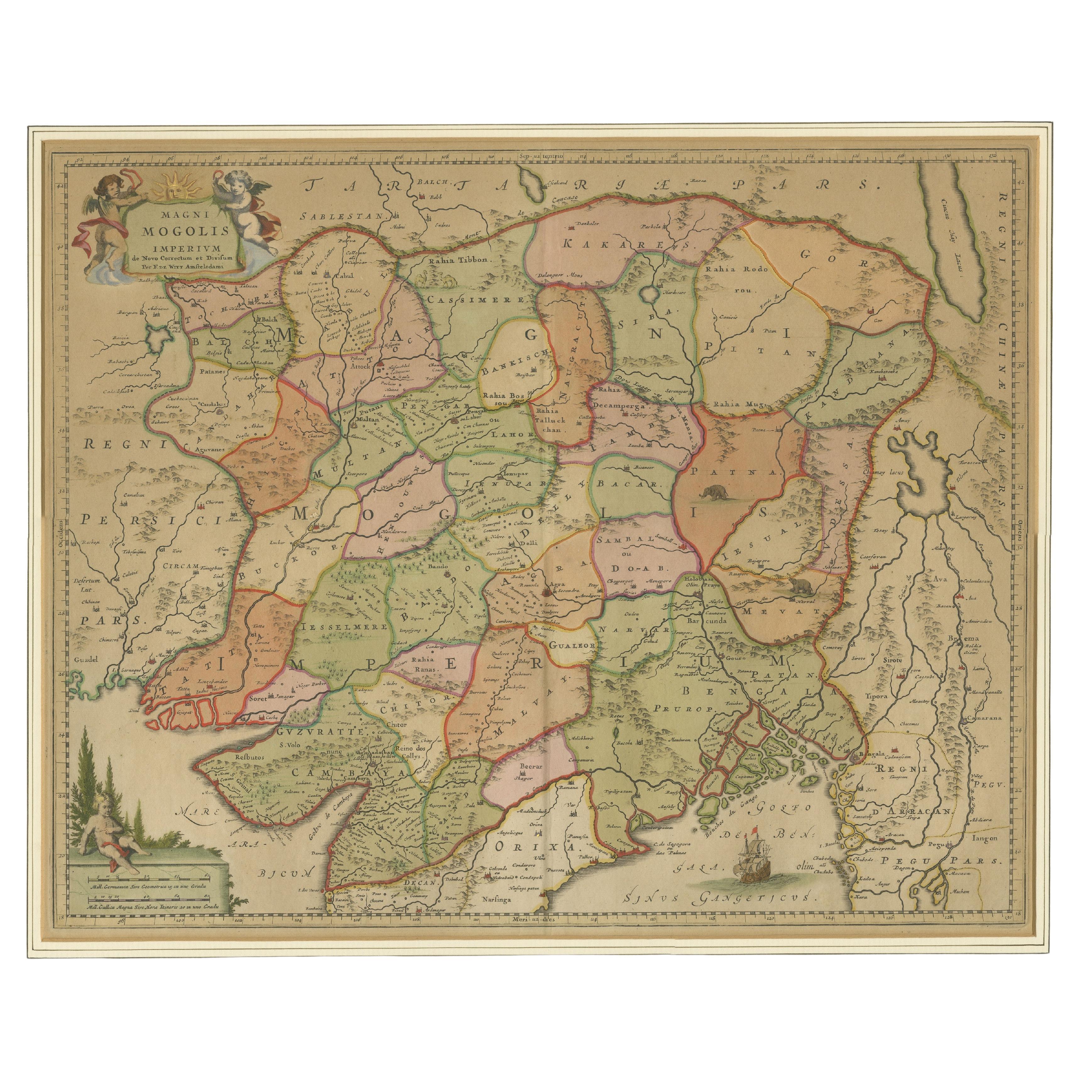
Antique Map of the Empire of the Great Mogul
Located in Langweer, NL
Antique map titled 'Magni Mogolis Imperium'. This map depicts the Empire of the Great Mogul in northern India including the region from Iran to Burma. The Indus and Ganges Rivers are...
Category
Antique Late 17th Century Maps
Materials
Paper
$907 Sale Price
20% Off
You May Also Like
Antique French Map of Asia Including China Indoneseia India, 1783
Located in Amsterdam, Noord Holland
Very nice map of Asia. 1783 Dedie au Roy.
Additional information:
Country of Manufacturing: Europe
Period: 18th century Qing (1661 - 1912)
Condition: Overall Condition B (Good Used)...
Category
Antique 18th Century European Maps
Materials
Paper

$648 Sale Price
20% Off
Ancient National Atlas of France with Marengo
Located in Alessandria, Piemonte
Ancient National Atlas of France with the department of Marengo: a rare French etching dated 1806.
ST/178.
Category
Antique Early 19th Century French Other Prints
Materials
Paper

Antique 1803 Italian Map of Asia Including China Indoneseia India
Located in Amsterdam, Noord Holland
Antique 1803 Italian Map of Asia Including China Indoneseia India
Very nice map of Asia. 1803.
Additional information:
Type: Map
Country of Manufacturing: Europe
Period: 19th centu...
Category
Antique 19th Century European Maps
Materials
Paper

$584 Sale Price
20% Off
"Nova Barbariae Descriptio", a 17th Century Hand-Colored Map of North Africa
By Johannes Janssonius
Located in Alamo, CA
This original attractive 17th century hand-colored map of North Africa entitled "Nova Barbariae Descriptio" by Johannes Janssonius was published in Paris in 1635. It includes the Med...
Category
Antique Mid-17th Century Dutch Maps
Materials
Paper

17th Century Nicolas Visscher Map of Southeastern Europe
Located in Hamilton, Ontario
A beautiful, highly detailed map of southeastern Europe by Nicolas Visscher. Includes regions of Northern Italy (showing the cities Bologna, Padua, and Venice), Bohemia, Austria (sho...
Category
Antique 17th Century Dutch Maps
Materials
Paper

$1,350 Sale Price
38% Off
Persia, Armenia & Adjacent Regions: A 17th Century Hand-colored Map by De Wit
By Frederick de Wit
Located in Alamo, CA
A large 17th century hand colored copperplate engraved map entitled "Novissima nec non Perfectissima Scandinaviae Tabula comprehendens Regnorum Sueciae, Daniae et Norvegiae distincte...
Category
Antique Late 17th Century Dutch Maps
Materials
Paper
