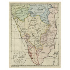
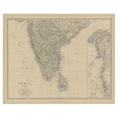
Original Map of Southern India with Kingdom Mysore, Ruled by Tipu Sultan, 1800
View Similar Items


Want more images or videos?
Request additional images or videos from the seller
1 of 5
Original Map of Southern India with Kingdom Mysore, Ruled by Tipu Sultan, 1800
$226.76List Price
About the Item
About the Seller
5.0
Recognized Seller
These prestigious sellers are industry leaders and represent the highest echelon for item quality and design.
Platinum Seller
Premium sellers with a 4.7+ rating and 24-hour response times
Established in 2009
1stDibs seller since 2017
2,531 sales on 1stDibs
Authenticity Guarantee
In the unlikely event there’s an issue with an item’s authenticity, contact us within 1 year for a full refund. DetailsMoney-Back Guarantee
If your item is not as described, is damaged in transit, or does not arrive, contact us within 7 days for a full refund. Details24-Hour Cancellation
You have a 24-hour grace period in which to reconsider your purchase, with no questions asked.Vetted Professional Sellers
Our world-class sellers must adhere to strict standards for service and quality, maintaining the integrity of our listings.Price-Match Guarantee
If you find that a seller listed the same item for a lower price elsewhere, we’ll match it.Trusted Global Delivery
Our best-in-class carrier network provides specialized shipping options worldwide, including custom delivery.More From This Seller
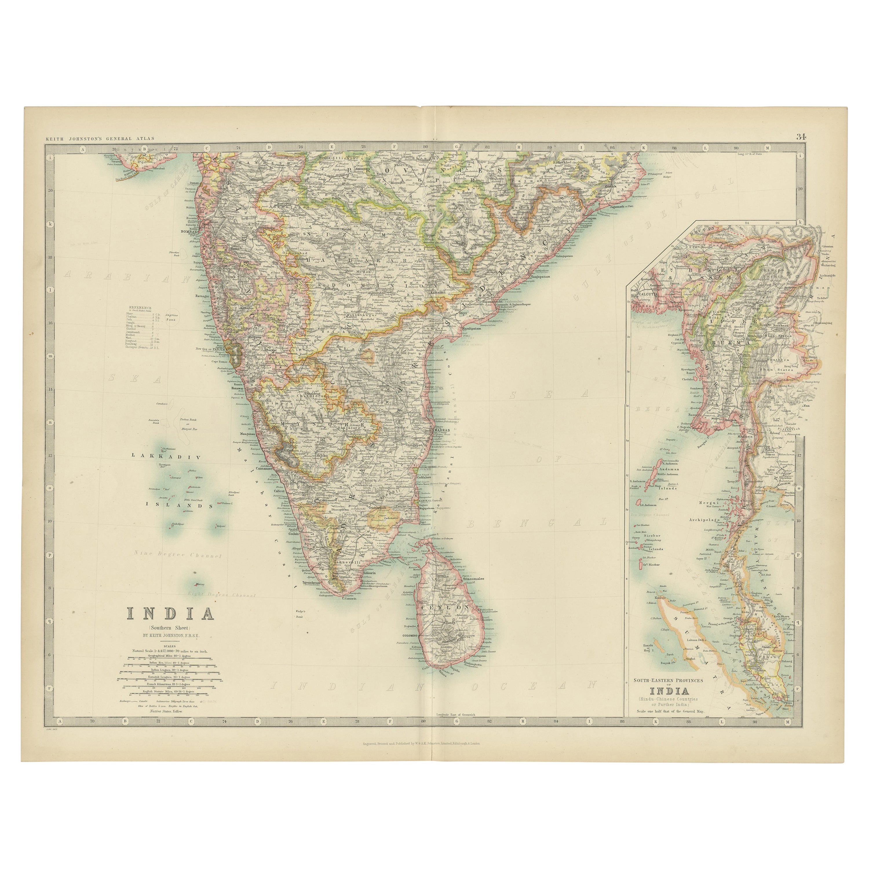
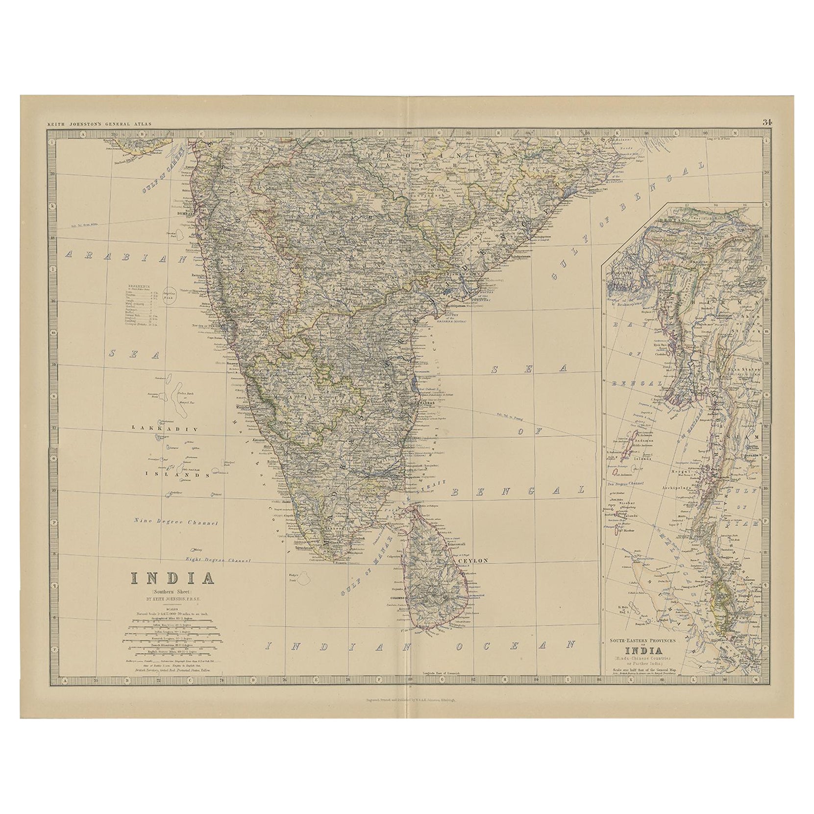
View AllAntique Map of India ( Southern ) by Johnston (1909)
Located in Langweer, NL
Antique map titled 'India'. Original antique map of India Southern sheet. With inset maps of south eastern provinces of India. This map originates from the ‘Royal Atlas of Modern Geo...
Category
Early 20th Century Maps
Materials
Paper

$236 Sale Price
20% Off
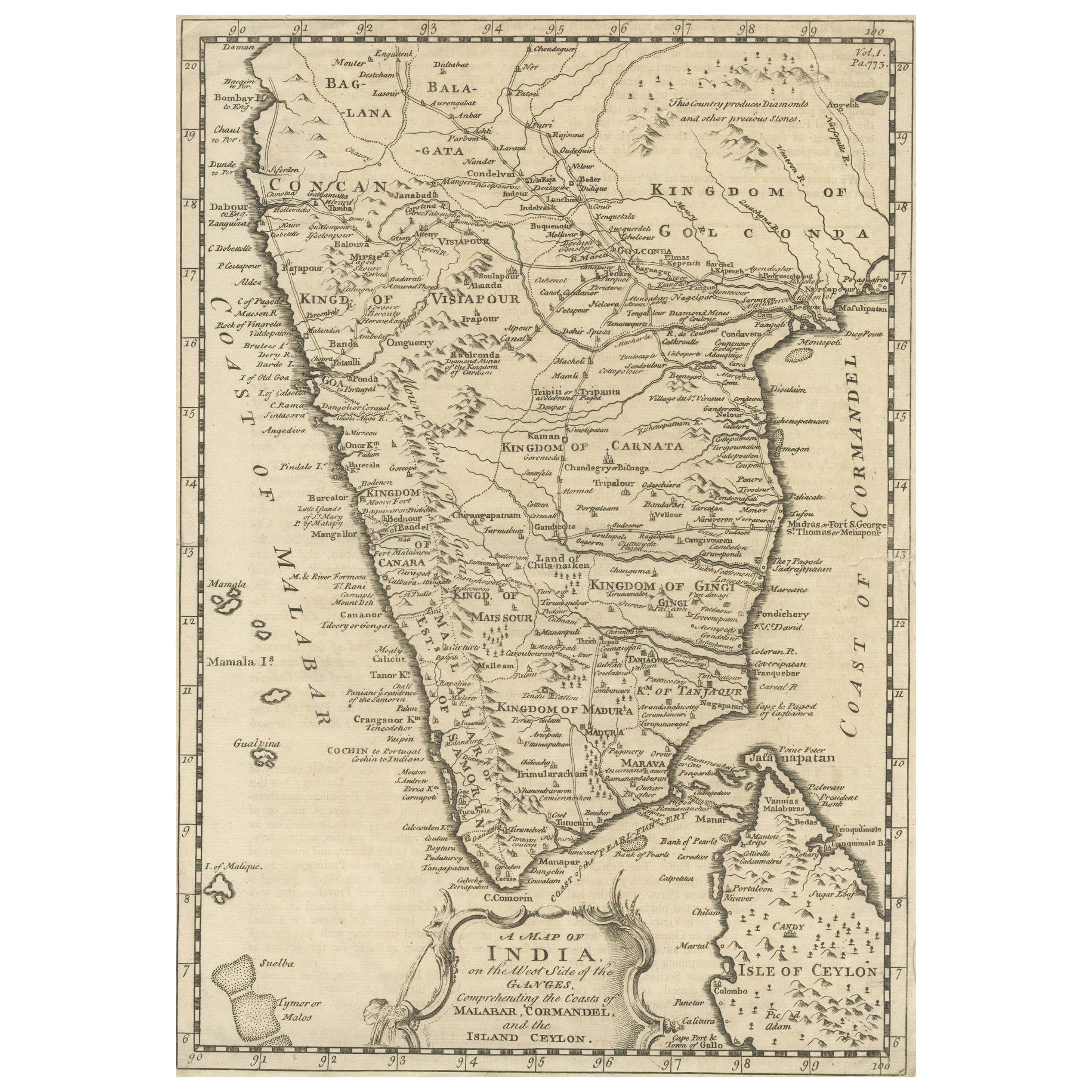
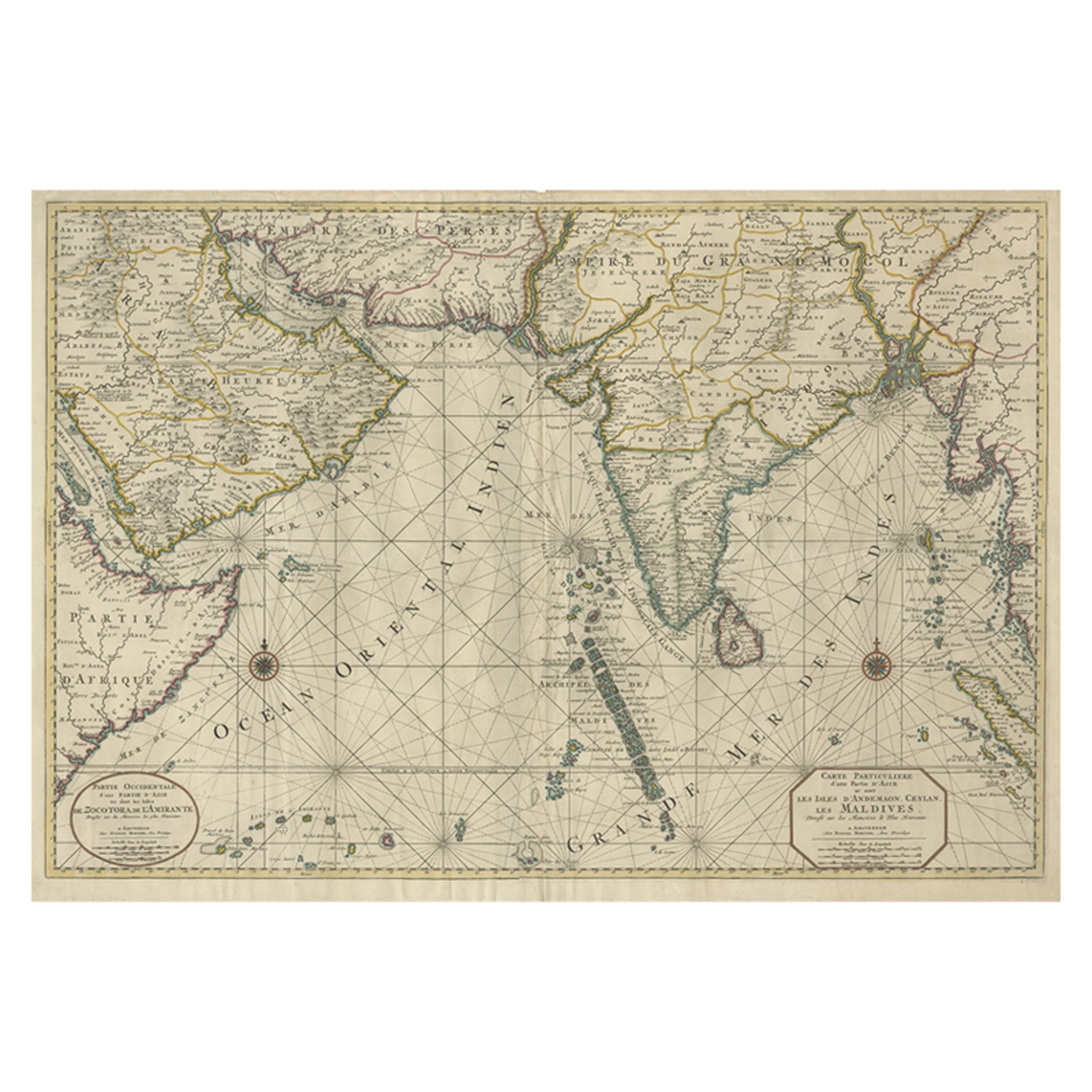
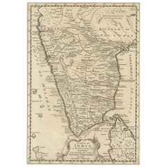
Original Detailed Antique Map of Southern India and Most of Ceylon, 1744
Located in Langweer, NL
Antique map titled 'A Map of India on the west Side of the Ganges, comprehending the coasts of Malabar, Coromandel and the Island Ceylon'.
Map of Southern India and most of Ceylo...
Category
Antique 1740s Maps
Materials
Paper
$415 Sale Price
20% Off
Detailed Original Old Map of the Southern Region of the Kingdom of Algiers 1773
Located in Langweer, NL
Antique map titled 'Kaart van het Zuidelyk Gedeelte van het Ryk Algiers'.
Old map of the southern region of the Kingdom of Algiers, Algeria. Originates from the first Dutch edito...
Category
Antique 18th Century Maps
Materials
Paper

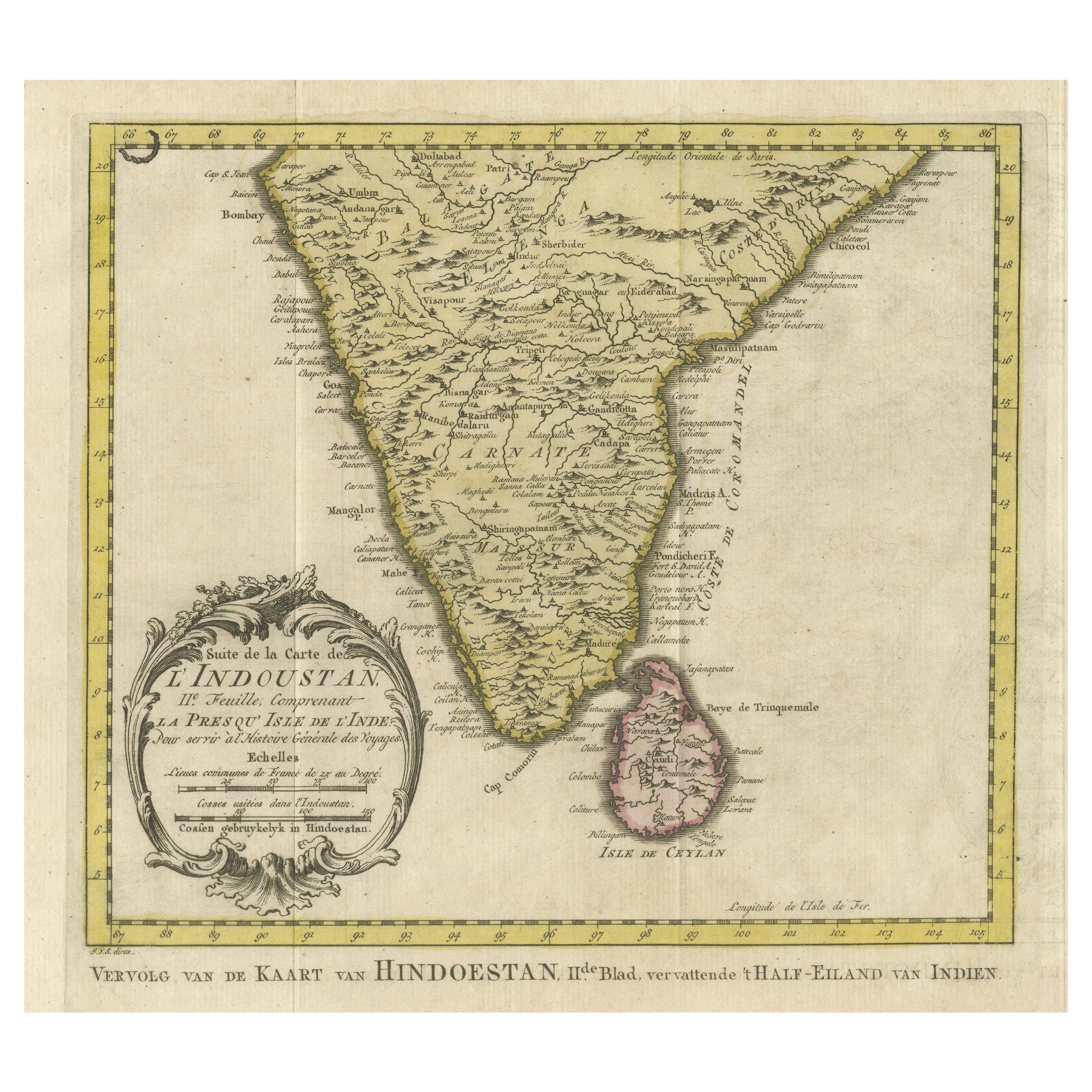
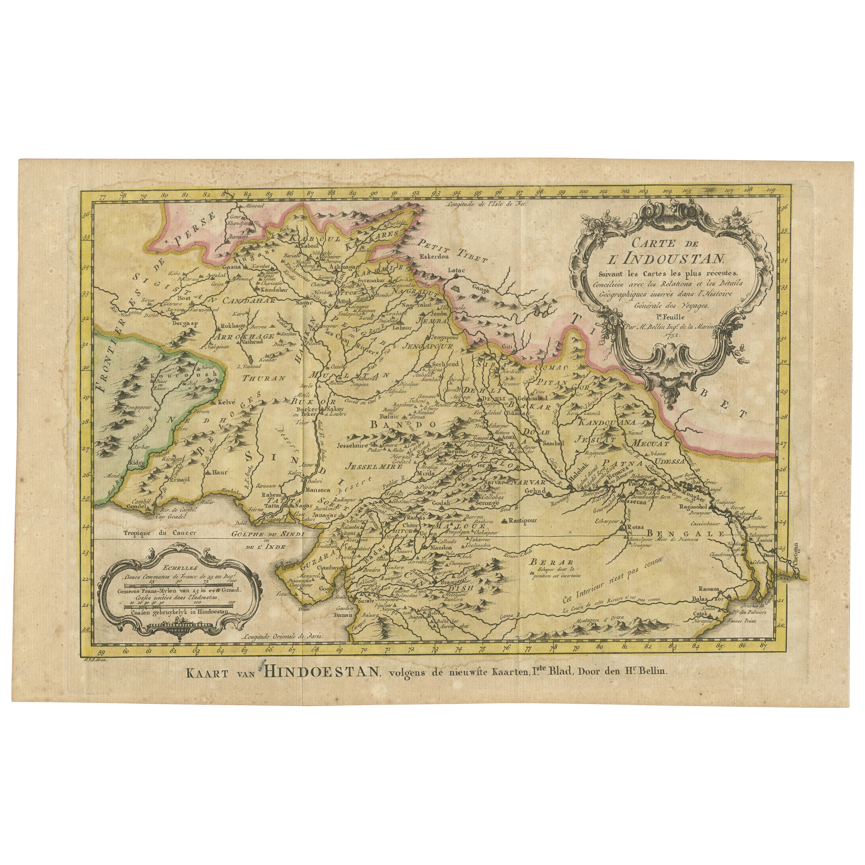
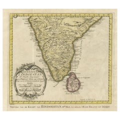
Original Antique Map of Southern India and Ceylon 'Present-Day Sri Lanka'
By Jakob van der Schley
Located in Langweer, NL
Antique map titled 'Suite de la Carte de l'Indoustan (..) - Vervolg van de Kaart van Hindoestan (..)'. Original antique map of Southern India and Ceylon (present-day Sri Lanka). This...
Category
Antique Mid-18th Century Maps
Materials
Paper
$793 Sale Price
20% Off
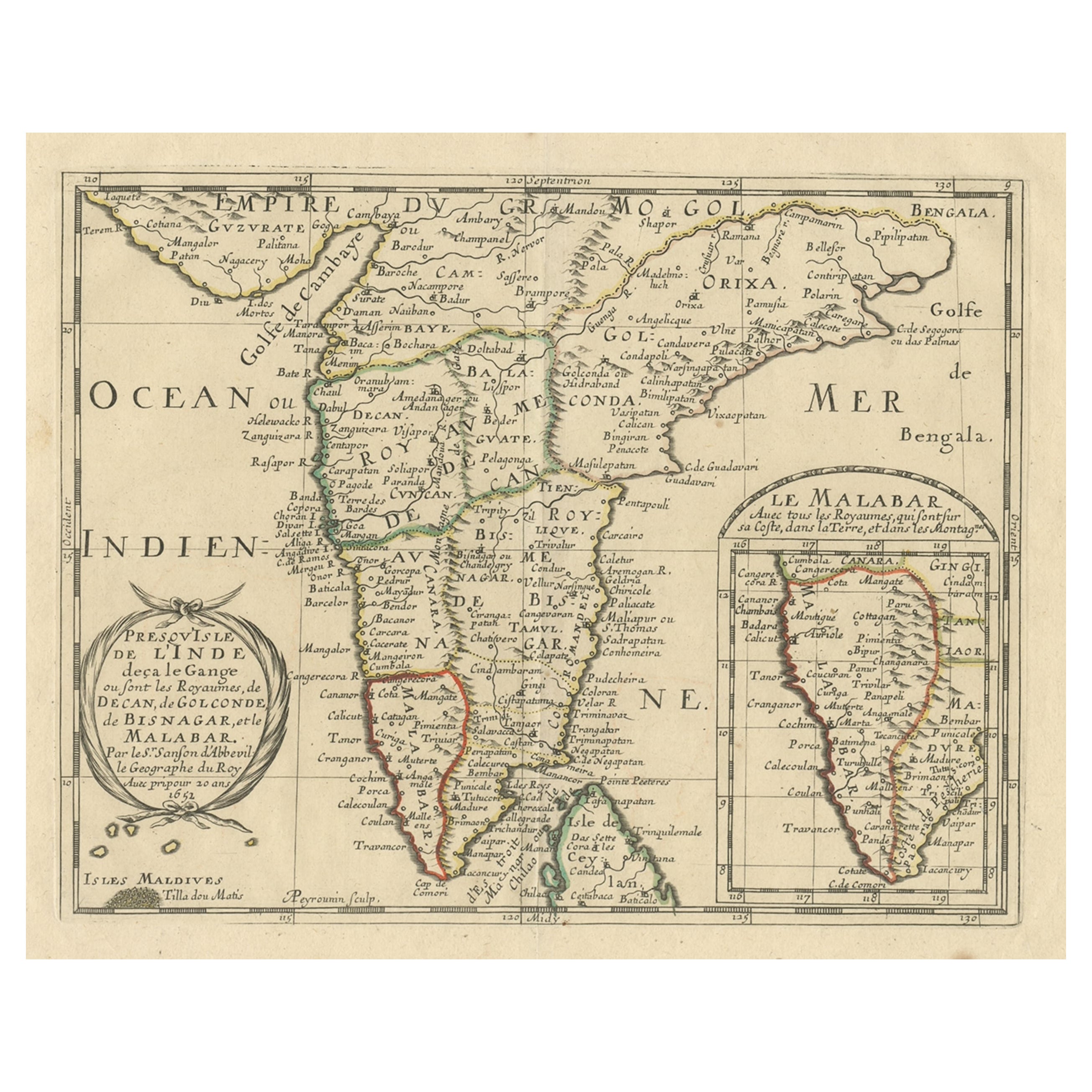
Original Antique Map showing Southern India, Northern Sri Lanka & Malabar, 1652
Located in Langweer, NL
Antique map titled 'Presqu'Isle de l'Inde deca le Gange (..)'.
Old map showing the southern part of India, including the northern part of Sri Lanka. With inset map of Southern India (Malabar). This map covers the subcontinent from the Bay of Bengal and the Gulf of Cambay to Ceylon. The Mogul Empire can be found in the north. Further south...
Category
Antique 1650s Maps
Materials
Paper

$623 Sale Price
20% Off
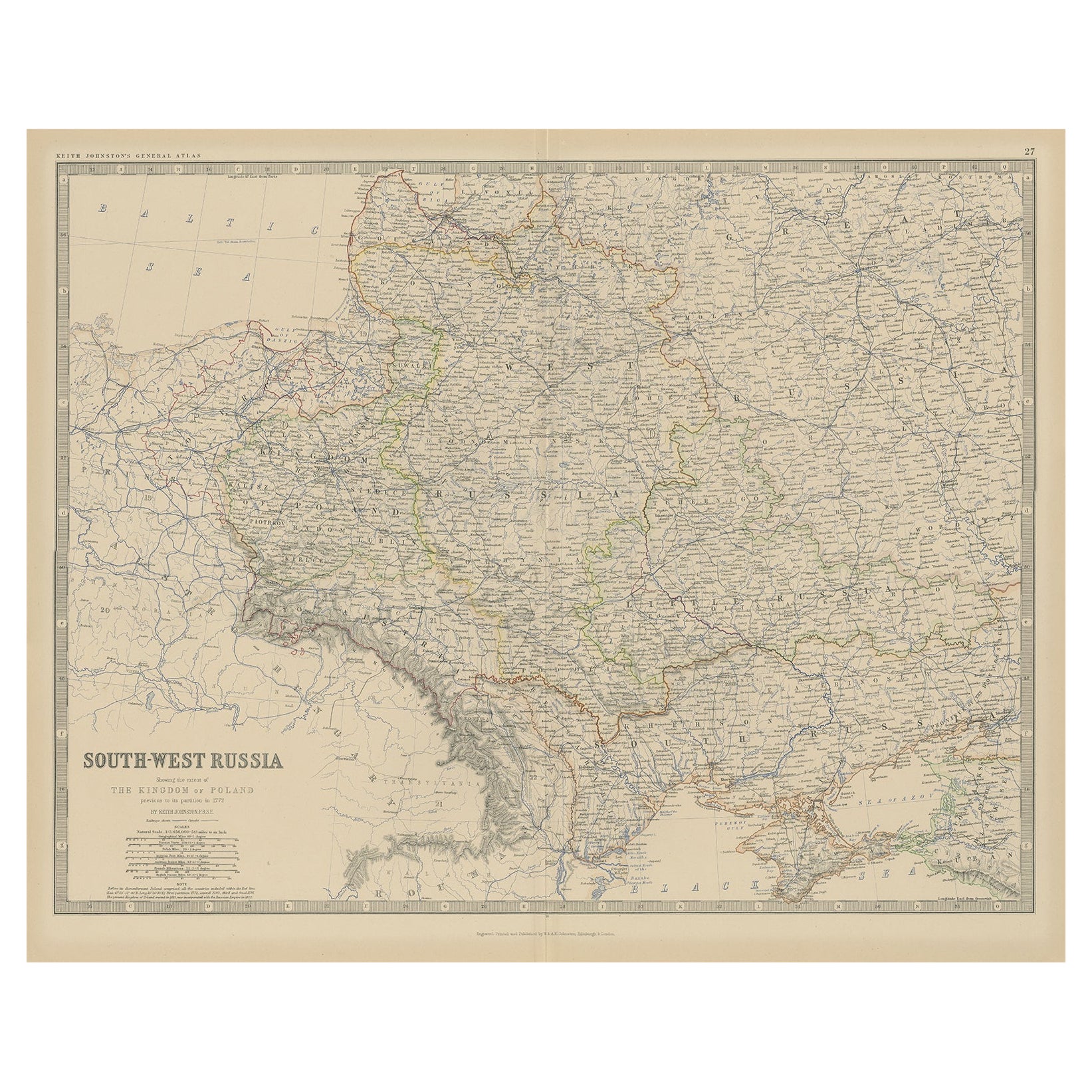
Old Map of Southern India and Ceylon 'Sri Lanka', 1882
Located in Langweer, NL
Antique map titled 'India (Southern Sheet)'.
Old map of Southern India and Ceylon (Sri Lanka). With an inset map of the South-Eastern Provinces of India. This map originates from...
Category
Antique 1880s Maps
Materials
Paper
$274 Sale Price
20% Off
You May Also Like
The Kingdom of Naples and Southern Italy: A Hand-Colored 18th Century Homann Map
By Johann Baptist Homann
Located in Alamo, CA
"Novissima & exactissimus Totius Regni Neapolis Tabula Presentis Belli Satui Accommo Data" is a hand colored map of southern Italy and the ancient Kingdom of Naples created by Johann...
Category
Antique Early 18th Century German Maps
Materials
Paper

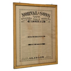
Antique Billiard Rules Pool Rules Pyramid Rules Victorian Framed Rules
Located in Radstock, GB
This framed and printed sheet Rule frame is very unusual because it actually
features the rules of three games Billiards, Life Pool and Pyramid pool.
Printed by the famous Glasgo...
Category
Antique Late 19th Century Scottish Victorian Sports Equipment and Memora...
Materials
Pine
Southern & Eastern Europe: A Large 17th C. Hand-colored Map by Sanson & Jaillot
By Nicolas Sanson
Located in Alamo, CA
This large hand-colored map entitled "Estats de L'Empire des Turqs en Europe, ou sont les Beglerbeglicz our Gouvernements" was originally created by Nicholas Sanson d'Abbeville and t...
Category
Antique 1690s French Maps
Materials
Paper

Southern Greece: A Large 17th C. Hand-colored Map by Sanson and Jaillot
By Nicolas Sanson
Located in Alamo, CA
This large original hand-colored copperplate engraved map of southern Greece and the Pelopponese Peninsula entitled "La Moree Et Les Isles De Zante, Cefalonie, Ste. Marie, Cerigo & C...
Category
Antique 1690s French Maps
Materials
Paper

Original Antique Map of Sweden, Engraved by Barlow, 1806
Located in St Annes, Lancashire
Great map of Sweden
Copper-plate engraving by Barlow
Published by Brightly & Kinnersly, Bungay, Suffolk. 1806
Unframed.
Category
Antique Early 1800s English Maps
Materials
Paper

Hand Colored 17th Century Visscher Map "Hollandiae" Southern Holland
By Nicolaes Visscher II
Located in Alamo, CA
A hand colored 17th century map of the southern portions of Holland by Nicolaus (Nicolas) Visscher II entitled "Hollandiae pars Meridionalis, vulgo Zuyd-Holland", published in Amsterdam in 1678. The map shows the region between Breda, Heusden, Gornichem, Gouda, Dordrecht, and Willemstad. It includes a decorative cartouche in the lower left corner.
The map is presented in an attractive maple colored wood frame with gold trim and a fabric mat.
The Visscher family were one of the great cartographic families of the 17th century. Begun by Claes Jansz Visscher...
Category
Antique Early 18th Century Dutch Maps
Materials
Paper

Recently Viewed
View AllMore Ways To Browse
Tipu Sultan
Persian Maps
Antique Map Of The Philippines
Large Map Of Italy
Used Marine Compass
West Indies Colonial
Antique Pamphlets
Sicily Map
Thailand Map
Antique Maps Of Russian Empire
Antique Navigational Tools
Australian Colonial
Antique German Compass
Key Trade Sign
Spanish Galleon
World Map Of Trade Routes
Antique Puerto Rico
Albanian Antique