1670s Maps
to
15
22
22
5
2,976
2,230
476
3
290
34
10
126
9
37
9
2
5
4
3
3
22
5
4
4
22
22
22
Period: 1670s
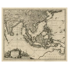
Antique Map of the Strait of Malacca, Malay Peninsula & Dutch Indies, c.1670
Located in Langweer, NL
Antique map titled 'Indiae Orientalis, nec non Insularum Adiacentium Nova Descriptio.'
Map of Southeast Asia. The map centers on the Strait of Malacca and Malay Peninsula. It ext...
Category
Antique 1670s Maps
Materials
Paper
$2,190 Sale Price
20% Off
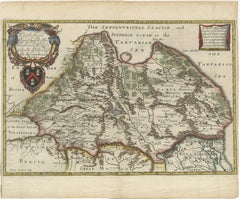
Rare 1670 Map of Tartary by Richard Blome after Sanson, Hand-colored Engraving
Located in Langweer, NL
Rare 1670 Map of Tartary by Richard Blome after Sanson, hand-colored engraving
This striking and highly decorative map, titled *A Generall Mapp of the Kingdome of Tartaria*, was pub...
Category
Antique 1670s Maps
Materials
Paper
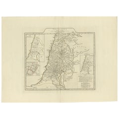
1767 D’Anville Map of the Holy Land: Ancient Divisions and Biblical Geography
Located in Langweer, NL
Ancient Map of Palestine or the Holy Land by D'Anville (1767)
This detailed map, created by the renowned French cartographer Jean Baptiste Bourguignon d'Anville in 1767, depicts the...
Category
Antique 1670s Maps
Materials
Paper
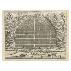
17th Century Cartographic Marvel: A Detailed Engraving of Guangzhou (Kanton)
Located in Langweer, NL
This engraving of Guangzhou ("Kanton") is from a French edition of Olfert Dapper's work. The French edition titled "Description de l’Empire de la Chine" was published in 1674. It is ...
Category
Antique 1670s Maps
Materials
Paper
$1,025 Sale Price
20% Off
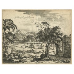
Old Engraving of The Catching of Horses on Jafnapatnam, Ceylon 'Sri Lanka', 1672
Located in Langweer, NL
Antique print, titled: 'Paardevangst op Jafnapatnam' - This plate shows the catching of horses on Jafnapatnam. The province of Jaffna , and specially the fort at Jaffnapatnam were th...
Category
Antique 1670s Maps
Materials
Paper
$494 Sale Price
20% Off
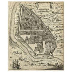
Antique Engraving of a Bird's-Eye Plan of Nagapattinam or Negapatam, India, 1672
Located in Langweer, NL
Antique map titled 'Negapatam.'
Bird's-eye plan of Nagapattinam or Negapatam, India. This map originates from 'Naauwkeurige Beschryvinge van Malabar en Choromandel…en het machtige ...
Category
Antique 1670s Maps
Materials
Paper
$316 Sale Price
20% Off
Original Antique Print of a Procession of Monks in Ceylon 'Sri Lanka', 1672
Located in Langweer, NL
Antique print, untitled. This original antique print shows a procession of monks in Ceylon. A group of dancing monks, beating drums, in front of the abbot, seated on an elephant. Dut...
Category
Antique 1670s Maps
Materials
Paper
$251 Sale Price
20% Off
Antique Map of the Cape Verde Islands, Africa, ca.1670
Located in Langweer, NL
Antique map titled 'Pascaert van de Soute Eylanden ofte Ilhas de Cabo Verde'.
This map depicts the Cape Verde Islands (Africa). Islands titled 'Ile de B...
Category
Antique 1670s Maps
Materials
Paper
$615 Sale Price
20% Off
Old Print of Farmers Harvesting Cinnamon on the Island Ceylon or Sri Lanka, 1672
Located in Langweer, NL
Antique print, titled: 'Hoe men de Caneel schilt opt Eyland Ceylon.'
This rare original plate shows a group of farmers harvesting cinnamon on the island of Ceylon / Sri Lanka. Du...
Category
Antique 1670s Maps
Materials
Paper
$354 Sale Price
20% Off
Antique Bird's-Eye Plan of Tutecoryn (Tuticorin or Thoothukudi), India, 1672
Located in Langweer, NL
Antique map, titled: 'Tutecoryn.'
Bird's-eye plan of map of Tutecoryn (Tuticorin or Thoothukudi), India. This map originates from 'Naauwkeurige Beschryvinge van Malabar en Choroman...
Category
Antique 1670s Maps
Materials
Paper
$335 Sale Price
20% Off
Large Copper Engraved Map of the Coastline of Friesland and Terschelling, c.1670
Located in Langweer, NL
Antique print, titled: 'Dominii Frisiae Tabula, inter Flevum et Lavicum (…)'
This large copper engraved map details the coastline of Friesland and Terschelling. At east is a part...
Category
Antique 1670s Maps
Materials
Paper
$829 Sale Price
20% Off
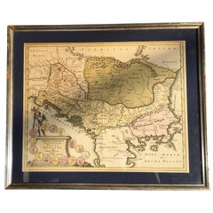
Map of Region Near the Baltic Sea, Present Day Bulgaria, Romania & Turkey, c1670
Located in Langweer, NL
Antique map titled 'Illyricum Orientis: In quo Partes II Moesia et Thracia'.
Engraved map of the area west of the Baltic Sea, present day Bulgaria, Romania, and Turkey. The map i...
Category
Antique 1670s Maps
Materials
Paper
$1,258 Sale Price
20% Off
Original Copper Engraving of the Indian City of Suratte 'Surat', 1672
Located in Langweer, NL
Antique print, titled: 'Suratte'
View of the Indian city of Suratte (Surat) showing a panoramic view of the city with figures, animals and a river wi...
Category
Antique 1670s Maps
Materials
Paper
$447 Sale Price
20% Off
Map of Friesland with Terschelling, Vlieland, Ameland En Schiermonnikoog, C.1670
Located in Langweer, NL
Antique print, titled: 'Tabula Comitatus Frisiae …'
Map of Friesland with the island Terschelling, Vlieland, Ameland en Schiermonnikoog. With a cartouche and a compass rose. Publ...
Category
Antique 1670s Maps
Materials
Paper
$510 Sale Price
40% Off
Antique Map of the Siege of Syracuse, Sicilia, Italy, 'ca.1675'
Located in Langweer, NL
Antique map titled 'Syracus beseeged by the Athenians.' This original uncommon antique map shows the siege of Syracuse, Italy, by the Athenians. Key top left.
The siege of Syracus...
Category
Antique 1670s Maps
Materials
Paper
$689 Sale Price
20% Off
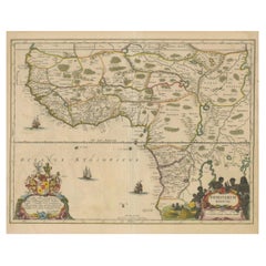
Antique Map of the Coast of Angola Up to Port Elizabeth in South Africa, 1675
Located in Langweer, NL
Antique map titled 'Cimbebas et Caffariae Littora a Catenbela ad Promontorium Bonae Spei'.
This map depicts the coast of Angola, South-West Africa and South Africa up to Port Elizabeth...
Category
Antique 1670s Maps
Materials
Paper
$885 Sale Price / set
20% Off
Antique Engraving of a Print Showing the Indian City of Suratte 'Surat', 1672
Located in Langweer, NL
Antique print, titled: 'Suratte' -
View of the Indian city of Suratte (Surat) showing a panoramic view of the city with figures, animals and a river ...
Category
Antique 1670s Maps
Materials
Paper
$335 Sale Price
20% Off
Map Road John Ogilby Britannia No 74 Ipswich to Norwich Cromer Framed
By John Ogilby
Located in BUNGAY, SUFFOLK
The Road from Ipswich com Suffolk to Norwich and thence to cromer on the sea coast com Norfolk. By John Ogilby, Esq, His Majesties Cosmographer. Containing...
Category
English Baroque Antique 1670s Maps
Materials
Paper
Road Map John Ogilby London St David's Britannia No 15 Abingdon Monmouth Framed
By John Ogilby
Located in BUNGAY, SUFFOLK
John Ogilby (British 1600-1676) Cosmographer and Geographick Printer to Charles II. A road map from Britannia, 1675/6. No 15.
The continuation of the r...
Category
English Baroque Antique 1670s Maps
Materials
Paper
Road Map John Ogilby No 75 Kings Lyn Harwich, Britannia Framed Wallhanging
By John Ogilby
Located in BUNGAY, SUFFOLK
The Road from Kings Lyn Co Norfolk to Harwich Co Essex. By John Ogilby His Majesties Cosmographer. Containing 76 miles, 1 furlong.
From Lyn to Swaffam, to Stanford, to Thetford, To Icksworth, to Stowmarket, to Ipswich and to Harwich including ye Ferry, No 75, inscribed in pencil 1698
Hand colored and floated in the original black and gold frame, c1961. Some creasing commensurate with age. The back of the frame inscribed May 1961.
Provenance : Private Collection, acquired c1961, along with No 74 Ipswich to Norwich & No 54 London to Yarmouth. All in the original black and gold frames.
Sheet width 45cm., 17 ¾”., height 34.5cm., 13 ½“
Frame width 50cm 19 ¾”., height 40cm., 15 ¾”
Literature: In a remarkable life John Ogilby pursued, several careers, each ending in misfortune, and yet he always emerged undeterred, to carry on. His modern reputation is based on his final career, started in his sixty-sixth year, as a publisher of maps and geographical accounts.
Ogilby was born outside Dundee, in 1600, the son of a Scottish gentleman. While he was still a child, the family moved to London. When the elder Ogilby was imprisoned for debt, the young John invested his savings in a lottery, won a minor prize, and settled his father's debts. Unfortunately, not enough money was left to secure John a good apprenticeship; instead, he was apprenticed to a dance master. Ogilby was soon dancing in masques at court but, one day, while executing a particularly ambitious leap, he landed badly. The accident left him with a permanent limp, and ended his dancing career. However, he had come to the attention of Thomas Wentworth, later Earl of Strafford, Charles I's most senior minister. Ever one to exploit his contacts, Ogilby became a dance instructor in Strafford's household.
When Strafford was sent to Ireland, Ogilby accompanied him as Deputy-Master of the Kings Revels, and then Master of Revels. In Dublin, he built the New Theatre, in St. Werburgh Street, which prospered at first, but the Irish Rebellion, in 1641, cost Ogilby his fortune, which he estimated at £2,000, and almost his life. After brief service as a soldier, he returned to England, survived shipwreck on the way, and arrived back penniless.
On his return, Ogilby turned his attention to the Latin classics, as a translator and publisher. His first faltering attempt, in 1649, was a translation of the works of Virgil, but after his marriage to a wealthy widow the same year, his publishing activities received a considerable boost. One means by which Ogilby financed these volumes was by subscription, securing advance payments from his patrons, in return for including their name and coats-of-arms on the plates of illustrations. Another approach was to secure a patron, preferably in the court circle. Ogilby's first patron was Strafford, who found out too late that all leading ministers are dispensable when Charles I assented to his execution in 1641. As he re-established himself, Ogilby sought a new patron, the King himself.
In 1661, Ogilby was approached to write poetry for Charles II's coronation procession; he later published 'The Relation of His Majesties Entertainment Passing Through the City of London', and a much enlarged edition the following year, which included a Fine set of plates depicting the procession. Royal favour was bestowed in 1674 when John Ogilby received the title of 'His Majesty's Cosmographer and Geographick Printer' with a salary of £13.6s.8d per annum.
In 1665, Ogilby left London to avoid the Plague then ravaging the capital. The following year, in the Great Fire of London, Ogilby claimed that he lost his entire stock of books valued at some £3,000, as well as his shop and house, leaving him worth just £5.
As he sought to restore his fortunes, Ogilby was already looking in new directions. The initial opportunity he seized on was the reconstruction of London's burnt-out centre. He secured appointment as a 'sworn viewer', whose duty was to establish the property boundaries as they existed before the Fire. Ogilby was assisted in the project by his step-grandson, William Morgan...
Category
European Baroque Antique 1670s Maps
Materials
Paper
Road Map, John Ogilby, No 54, London, Yarmouth, Britannia
By John Ogilby
Located in BUNGAY, SUFFOLK
The Road from London to Yarmouth com. Norfolk. By John Ogilby, His Majesties Cosmographer. Containing 122 miles, 5 furlongs. No 54.
From Standard in Co...
Category
English Baroque Antique 1670s Maps
Materials
Paper
Road Map, John Ogilby, London, Barwick, York, Chester, Darlington, Durham Framed
By John Ogilby
Located in BUNGAY, SUFFOLK
The continuation of the road from London to Barwick beginning at York and extending to Chester in ye Street. Plate ye 4th continuing 76 ½ miles. No 8.
York to Burrowbridge, to Top...
Category
English Baroque Antique 1670s Maps
Materials
Paper
Related Items
1864 Map of North America, Antique Hand-Colored Map, by Adolphe Hippolyte Dufour
Located in Colorado Springs, CO
Offered is a map of North America entitled Amerique du Nord from 1864. This rare, separately published wall map was produced by Adolphe Hippolyte Dufour. This map includes vibrant an...
Category
French Antique 1670s Maps
Materials
Paper
$4,500
H 44.5 in W 33 in D 1.5 in
Four 18th Century Engraved and Hand-Colored Maps by Weigel
By Christoph Weigel
Located in Copenhagen, K
Small collection of four engraved maps of Italy, Balkan and of Central Asia.
Two are of Italy, one Corsica and Northern Italy and the other of the Southern Italian boot...
Category
German Antique 1670s Maps
Materials
Paper
$450 / item
H 15.75 in W 18.12 in D 0.79 in
The Holy Bible, Containing the Old and New Testaments, 1887
Located in Colorado Springs, CO
The Holy Bible, Containing the Old and New Testaments, Translated out of the Original Tongues: And with the Former Translations Diligently Compared and Revised, by His Majesty’s Spec...
Category
English Late Victorian Antique 1670s Maps
Materials
Leather, Paper
Golf Inspired Chess Set in White Bird's-Eye Maple
By Agresti
Located in New York, NY
White bird’s-eye maple and green marble chess set. Hand painted Golf chessmen.
Category
Italian Modern 1670s Maps
Materials
Birdseye Maple
Cross of Caravaca 17th Century
Located in Madrid, ES
Cross of caravaca XVII century.
Very beautiful cross of caravaca made in bronze. 17th Century. Measurements: 14X6 cm.
Good condition.
Category
Italian Gothic Antique 1670s Maps
Materials
Bronze
Antique County Map, Shropshire, English, Atlas Engraving, Richard Blome, C.1673
Located in Hele, Devon, GB
This is an antique county map of Shropshire. An English, framed atlas engraving by Richard Blome, dating to the 17th century and later.
A treat for the collector or county native, ...
Category
British Restauration Antique 1670s Maps
Materials
Glass, Wood, Paper
$1,157
H 15.95 in W 15.16 in D 0.99 in
17th Century Brass Alms Plate
Located in San Francisco, CA
A 17th century or earlier brass alms dish or alms plate.
Category
European Antique 1670s Maps
Materials
Brass
Antique Golf Engraving, Henry Callender ESQ, Golf Mezzotint
Located in Oxfordshire, GB
Golf mezzotint of 'Henry Callender Esq' (Captain of the society of Golfers at Blackheath) after Lemuel Francis Abbott (1760-1803).
Henry Callend...
Category
British Sporting Art Antique 1670s Maps
Materials
Paper
The History of the Crusades for the Recovery and Possession of the Holy Land
Located in Middletown, NY
Charles Baudelaire: Souvenirs, Correspondances, Bibliographie, suivie de pièces inédites
Paris: René Pincebourde, 1872.
FIRST LIMITED EDITION - EXTRA ILLUSTRATED
Small 8vo 8 12 x 5...
Category
French Antique 1670s Maps
Materials
Gold Leaf
$275 / set
H 8.27 in W 5.4 in D 1.97 in
Mid-19th Century Bird's-Eye Maple Simulated Miniature Chest
Located in Bedfordshire, GB
A charming mid-19th century simulated bird's-eye
Maple miniature chest of three long drawers
With original turned wooden knobs raised
On original plinth
(There is often debate ...
Category
English Victorian Antique 1670s Maps
Materials
Birdseye Maple
$1,846 Sale Price
30% Off
H 10 in W 11 in D 7 in
Map of the Holy Land "Carte de la Syrie et de l'Egypte" by Pierre M. Lapie
Located in Alamo, CA
An early 19th century map of ancient Syria and Egypt entitled "Carte de la Syrie et de l'Egypte anciennes/dressée par M. Lapie, Colonel d'Etat Major, et...
Category
French Antique 1670s Maps
Materials
Paper
$775
H 27 in W 21.38 in D 0.75 in
Golf Inspired Chess Set in White Bird's-Eye Maple
By Agresti
Located in New York, NY
White bird's-eye maple and erable. Hand-painted golf chessmen.
Category
Italian Modern 1670s Maps
Materials
Birdseye Maple
Previously Available Items
1675 Map of the Kingdom of the Black People (Nigritarum Regnum) by Janssonius
Located in Langweer, NL
This original antique map, titled 'Nigritarum Regnum' (The Kingdom of the Black People), was produced by the renowned Dutch cartographer Johannes Janssonius and published in 'Joannis...
Category
Antique 1670s Maps
Materials
Paper
H 20.08 in W 23.43 in D 0 in
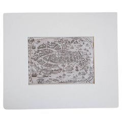
17th Century Miniature Map of Venice
Located in Florence, Tuscany
An extraordinary miniature map of the ancient city of Venice published in Padua by Matteo Cadorin in the 1670 edition of Francesco Scoto's 'Itinerary of Italy' guide.
This delightf...
Category
Italian Antique 1670s Maps
Materials
Parchment Paper
17th Century Miniature Map of Milan
Located in Florence, Tuscany
An extraordinary miniature map of the ancient city of Milan published in Padua by Matteo Cadorin in the 1670 edition of Francesco Scoto's 'Itinerary of Italy' guide.
This delightfu...
Category
Italian Antique 1670s Maps
Materials
Parchment Paper
17th Century Miniature Map of Florence
Located in Florence, Tuscany
An extraordinary miniature map of the ancient city of Florence. Published in Padua by Matteo Cadorin in the 1670 edition of Francesco Scoto's 'Itinerary of Italy' guide.
This delig...
Category
Italian Antique 1670s Maps
Materials
Parchment Paper
Antique Framed Hand Colored Map of the Americas by Frederick De Wit, circa 1675
Located in Morristown, NJ
Frederick De Wit (Dutch, 1629-1706), "Novissima et Accuratissima totius Americae Descriptio", hand-colored map engraving of North and South America with California depicted as an island, decorated with images of Native Americans and indigenous flora and fauna, framed under glass, 19.5"h x 23"l (sheet), 22.5"h x 1.75"d x 26"w (frame), From the collection of an NY corporation.
A fine example of De Wit’s map of the Americas, first published ca. 1675. This map is fascinating. It was the first Dutch map to include all five Great Lakes; Lac Superieur (Lake Superior), Lac des Puans (Lake Michigan), Mare Dulce (Lake Huron...
Category
Dutch Baroque Antique 1670s Maps
Materials
Glass, Wood, Giltwood, Paint, Paper
H 22.5 in W 26 in D 1.75 in
Original Map of Dutch Province Friesland, Incl the Island Terschelling, ca.1670
Located in Langweer, NL
Antique map titled 'Dominii Frisiae Tabula, inter Felvum et Lavicam.' -
A map of the Dutch province Friesland, also showing the island Terschelling. A small inset map shows the F...
Category
Antique 1670s Maps
Materials
Paper
H 20.91 in W 24.26 in D 0 in
Bird's-Eye Plan of Solomon's Temple to the West, Jerusalem in Israel, 1677
Located in Langweer, NL
Antique print religion titled 'Platte gront van Salomons Tempel ten tijden des Zalighmakers volgens Thomas Fuller'.
Bird's-eye plan of Solomon's Temple, oriented to the west (Jer...
Category
Antique 1670s Maps
Materials
Paper
H 12.21 in W 14.57 in D 0 in
Antique Bird's-Eye Plan of the Port City of Colombo, Sri Lanka (Ceylon), 1672
Located in Langweer, NL
Antique map titled 'Columbo.' Bird's-eye plan of the important port city of Colombo, Sri Lanka, during the period of Dutch occupation. The countryside is filled with elephants, cattl...
Category
Antique 1670s Maps
Materials
Paper
H 12.01 in W 14.77 in D 0 in
Roggeveen's Hand Colored Chart of Cape Cod and the Islands, 1675
By Arent Roggeveen
Located in Nantucket, MA
Pascaert van Nieu Nederland Van Hendrick Christiaens Eyland tot Staten hoeck of Cabo Cod, by Arent Roggeveen, published in circa 1675, an extremely rare first edition chart printed o...
Category
Dutch Other Antique 1670s Maps
Materials
Paper
