18th Century and Earlier Maps
to
2,336
2,869
64
2,936
26
12
1
1
2,936
2,283
475
3
290
34
10
126
10
37
9
2
5
4
3
3
2,922
30
20
3
3
307
111
81
53
52
2,936
2,936
2,936
59
21
13
12
12
Period: 18th Century and Earlier
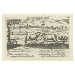
Rare Antique Print of the University City of Franeker, the Netherlands, 1678
Located in Langweer, NL
Antique print titled 'Franicker in Friesland, Academia' View of the city of Franeker, Friesland, the Netherlands. Edition: 1678. This delicate engraving originates from 'Thesauri Phi...
Category
Antique 18th Century and Earlier Maps
Materials
Paper
$371 Sale Price
20% Off
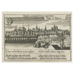
Rare Antique Engraving of the University City of Leiden, The Netherlands, c.1625
Located in Langweer, NL
Antique print titled 'Leijden in Hollandt'. Old print of the city of Leiden, the Netherlands. This print originates from 'Thesaurus philopoliticus oder Politisches Schatzkästlein'. T...
Category
Antique 18th Century and Earlier Maps
Materials
Paper
$361 Sale Price
20% Off
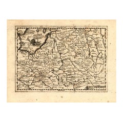
Antique Map of Gelderland and Overijssel by Guicciardini, 1613
Located in Langweer, NL
Antique map titled 'Geldria et Transisulania.' (Map of the provinces of Gelderland and Overijssel, the Netherlands.) This original old antique print / plate originates from the scars...
Category
Antique 18th Century and Earlier Maps
Materials
Paper
$266 Sale Price
20% Off
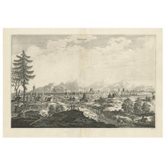
Original Copper Engraved Antique Print of the City of Bejing in China, 1668
Located in Langweer, NL
Antique print China titled 'Peking'. Old print depicting a view of Bejing in China with its ramparts. On the left a pagoda. This print originates from the Latin edition of Nieuhof's ...
Category
Antique 18th Century and Earlier Maps
Materials
Paper
$514 Sale Price
20% Off
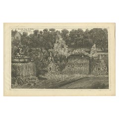
Antique Print of a Waterfall in Lincoln Province, C.1785
Located in Langweer, NL
Antique print titled 'Nouvelles Eaux de Belton au Lord Tyrconnel province de Lincoln'. Copper engraving showing a waterfall. This print originates from 'Jardins Anglo-Chinois à la Mo...
Category
Antique 18th Century and Earlier Maps
Materials
Paper
$266 Sale Price
20% Off
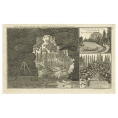
Original Antique Engraving of the Cave of Saint-Leu in France, C.1785
Located in Langweer, NL
Antique print titled 'Vue étant vers la droitte dans l'intérieur de la Grotte de St. Leu'. Copper engraving showing the cave, park and garden of Saint-Leu. This print originates from...
Category
Antique 18th Century and Earlier Maps
Materials
Paper
Antique Engraving of West Wycombe Park and Windsor Park in England, ca.1785
Located in Langweer, NL
Antique print titled 'Cascade de Westwycob au chevalier Dashwood - Grotte du Parc de Windsor'. Copper engraving showing the waterfall of West Wycombe park and the cabe of Windsor Par...
Category
Antique 18th Century and Earlier Maps
Materials
Paper
$333 Sale Price
8% Off
Antique Print of Amsterdam and St. Paul Island, 1753
Located in Langweer, NL
Antique print titled 'Isle d'Amsterdam, Isle St. Paul'. Two images on one sheet depicting Amsterdam and St. Paul island. The Dutch captain Anthonie van Diemen named it island Nieuw Amsterdam...
Category
Antique 18th Century and Earlier Maps
Materials
Paper
Original Rare Antique Print of the City of Ucienjen in China, 1665
Located in Langweer, NL
Antique print titled 'Ucienjen'. Old print depicting a view on the Chinese city of Ucienjen. Also depicted are many ships. This print originates from 'Het gezantschap der Nee^rlandts...
Category
Antique 18th Century and Earlier Maps
Materials
Paper
$209 Sale Price
20% Off
Antique Print of the Sang-Won-Hab Mountains in China, 1665
Located in Langweer, NL
Antique print titled 'Gebergte van Sang-Won-Hab'. Old print depicting the Sang-Won-Hab mountains (China) with many ships on the river between the mountains. This print originates fro...
Category
Antique 18th Century and Earlier Maps
Materials
Paper
$171 Sale Price
20% Off
Antique Print of the King of Barsalli & the Yamyamakunda Factory, Gambia, C1730
Located in Langweer, NL
Old Engraving with Title: Bumey Haman Seaka, King of Barsalli on the Gambia // plan of Yamyamakunda Factory on ye Gambia.
Artist/engraver/cartographer: ...
Category
Antique 18th Century and Earlier Maps
Materials
Paper
$228 Sale Price
20% Off
Antique Print of the Village of Tienhoven by Spilman, C.1750
Located in Langweer, NL
Antique print titled 'Het Huis te Herlaar en het Dorp Tienhoven langs de Lek te zien'. View of the village of Tienhoven, the Netherlands. This print originates from 'Het verheerlykt ...
Category
Antique 18th Century and Earlier Maps
Materials
Paper
Antique Print of the Town and Fortress of Ternate by Renneville, 1725
Located in Langweer, NL
Antique print Ternate titled 'La Ville et la Fort de Gamma lamma dans l'isle de Ternade lequel Fort apartient aux Espagnols'. Antique print of the town and fortress of the island of Ternate. Originates from 'Recueil des voyages qui ont servi à l’établissement et aux progrès de la compagnie des Indes orientales...
Category
Antique 18th Century and Earlier Maps
Materials
Paper
Original Copper Engraving of the Indian City of Suratte 'Surat', 1672
Located in Langweer, NL
Antique print, titled: 'Suratte'
View of the Indian city of Suratte (Surat) showing a panoramic view of the city with figures, animals and a river wi...
Category
Antique 18th Century and Earlier Maps
Materials
Paper
$457 Sale Price
20% Off
Antique Map of the Achtkarspelen township, Friesland, The Netherlands, 1718
Located in Langweer, NL
Antique map Friesland titled 'Achtkarspelen, de sesde Grietenije van Ooster-Goo (..)'. Old map of Friesland, the Netherlands. This map depicts the region of Achtkarspelen and include...
Category
Antique 18th Century and Earlier Maps
Materials
Paper
$361 Sale Price
20% Off
Antique Print of a Section of Stratton Park, Hampshire, England, c.1770
Located in Langweer, NL
Antique print titled 'Section of Stratton Park'. Section of Stratton Park, Hampshire.
This print originates from 'Vitruvius Britannicus' by Colen Campbell. Artists and Engravers:...
Category
Antique 18th Century and Earlier Maps
Materials
Paper
$342 Sale Price
20% Off
Antique Map of the Region of Kennemerland and Eems by Halma, 1718
Located in Langweer, NL
Antique map Friesland titled 'Descriptio Frisiae Liberae (..)'. Old map of Friesland, the Netherlands. This map depicts the region between Kennemerland and Eems. Originates from 'Uit...
Category
Antique 18th Century and Earlier Maps
Materials
Paper
$222 Sale Price
20% Off
Antique Map of the Region of Menaldumadeel by Schotanus, 1664
By B. Schotanus
Located in Langweer, NL
Antique map titled 'De Grietenie van Menaldema Deel (..)'. Very decorative regional map of the Grietenij of Menaldumadeel, west of Leeuwarden, Friesland, The Netherlands. Multiple ca...
Category
Antique 18th Century and Earlier Maps
Materials
Paper
$190 Sale Price
20% Off
Antique Map of the Region of Lyonnais by Nolin, 1697
Located in Langweer, NL
Untitled map of the French Province of Lyonnais, with its capital at Lyon, on the upper Loire and Rhone rivers. This map is a single sheet and part of a two sheet map titled 'The Gen...
Category
Antique 18th Century and Earlier Maps
Materials
Paper
$225 Sale Price
20% Off
Antique Map of the Region of Opsterland by Schotanus, 1664
By B. Schotanus
Located in Langweer, NL
Antique map titled 'De Grietenie van Opsterlandt : waer over d'e. heer Martinus Fockens altans grietman is, bysitters syn Wybe Sytjes, Boele Broers, secretaris Saco Fockens.' Detaile...
Category
Antique 18th Century and Earlier Maps
Materials
Paper
$257 Sale Price
20% Off
Antique Map of the Region of Kollumerland by Schotanus, 1664
By B. Schotanus
Located in Langweer, NL
Antique map titled 'De Grietenije van Kollumer Landt (..).' Map of the Grietenij of Kollumerland, Friesland, The Netherlands. Multiple cartouches, key and coat of arms. "Beschrijving...
Category
Antique 18th Century and Earlier Maps
Materials
Paper
Antique Map of the Region of Ooststellingwerf by Schotanus, 1664
By B. Schotanus
Located in Langweer, NL
Antique map titled 'De Grietenije van Stellingwerf oost eynde (..).' Map of the Grietenij of Ooststellingwerf, Friesland, The Netherlands. Multiple cartouches, key and coat of arms. ...
Category
Antique 18th Century and Earlier Maps
Materials
Paper
Antique Map of the Region of Oostergo by Colom, 1635
Located in Langweer, NL
Antique map titled 'Ooster-Goe'. Original antique map of the region of Oostergo, Friesland, the Netherlands. Includes the cities of Leeuwarden, Dokkum and others. This map originates...
Category
Antique 18th Century and Earlier Maps
Materials
Paper
$119 Sale Price
20% Off
Antique Map of the Region of Mühlberg by Schreiber, 1749
Located in Langweer, NL
Antique map titled 'Das Amt Muhlberg'. Map of the region of Mühlberg, Germany. This map originates from 'Atlas Selectus von allen Konigreichen und Landern de...
Category
Antique 18th Century and Earlier Maps
Materials
Paper
$88 Sale Price
20% Off
Antique Map of the Region of Périgord by Janssonius, 1657
Located in Langweer, NL
Antique map of France titled 'Le Comte de Perigort'. Decorative map of the Périgord region. Périgord is a natural region and former province of France, which corresponds roughly to t...
Category
Antique 18th Century and Earlier Maps
Materials
Paper
$337 Sale Price
20% Off
Antique Map of the Region of Roermond by Janssonius, c.1650
Located in Langweer, NL
Antique map titled 'Ducatus Gelriae'. Map of the region around Roermond, the Netherlands. This map includes the cities of Gennep, Goch, Venlo, Roermond, Maaseik, Weert, Wachtendonk a...
Category
Antique 18th Century and Earlier Maps
Materials
Paper
$404 Sale Price
20% Off
Antique Map of the Region of Meissen by Schreiber, 1749
Located in Langweer, NL
Antique map titled 'Der Ertz-Gebürgische Creis in Meissen (..)'. Map of the region of Meissen, Germany. This map originates from 'Atlas Selectus von allen Ko...
Category
Antique 18th Century and Earlier Maps
Materials
Paper
$88 Sale Price
20% Off
Antique Map of the Region of Mansfeld by Schreiber, 1749
Located in Langweer, NL
Antique map titled 'Die Grafschafft Mannsfeld (..)'. Map of the region of Mansfeld, Germany. This map originates from 'Atlas Selectus von allen Konigreichen und Landern der Welt' by ...
Category
Antique 18th Century and Earlier Maps
Materials
Paper
$88 Sale Price
20% Off
Antique Map of the Region of Wonseradeel by Schotanus, 1664
By B. Schotanus
Located in Langweer, NL
Antique map titled 'De Grietenije van Wonsera-deel (..).' Map of the Grietenij of Wonseradeel, Friesland, The Netherlands. Multiple cartouches, key and coat of arms. "Beschrijvinge e...
Category
Antique 18th Century and Earlier Maps
Materials
Paper
$85 Sale Price
20% Off
Antique Map of the Region of Rethel by Janssonius, 1657
Located in Langweer, NL
Antique map of France titled 'Carte du Pais de Retelois'. Detailed map of the region of Rethel in the north east of France. Showing the city of Rethel, Moncornet en Tirache, Beaumont...
Category
Antique 18th Century and Earlier Maps
Materials
Paper
$304 Sale Price
20% Off
Antique Map of the Region of Weißenfels by Schreiber, 1749
By Schreiber
Located in Langweer, NL
Antique map titled 'Das Amt Weissenfels (..)'. Map of the region of Weißenfels, Germany. This map originates from 'Atlas Selectus von allen Konigreichen und Landern der Welt' by Joha...
Category
Antique 18th Century and Earlier Maps
Materials
Paper
$88 Sale Price
20% Off
Antique Map of the Region of Rauwerderhem, Friesland, The Netherlands, '1664'
By B. Schotanus
Located in Langweer, NL
Antique map titled 'De Grietenije van Rauwerderhem (..).' Map of the Grietenij of Rauwerderhem, Friesland, The Netherlands. Multiple cartouches, key and coat of arms. This map orgini...
Category
Antique 18th Century and Earlier Maps
Materials
Paper
Antique Map of the Region of Picardy by Janssonius 'c.1650'
Located in Langweer, NL
Antique map of France titled 'Picardia vera et inferior'. Detailed map of the Picardy region of France. Shows the cities of Calais, Abbeville, St. Quentin, Rethel and others.
Ar...
Category
Antique 18th Century and Earlier Maps
Materials
Paper
$282 Sale Price
20% Off
Antique Map of the Schoterland Township, Friesland by Halma, 1718
Located in Langweer, NL
Antique map Friesland titled 'Schooterlandt de Vijfde Grietenije van de Sevenwolden (..)'. Old map of Friesland, the Netherlands. This map depicts the region of Schoterland and inclu...
Category
Antique 18th Century and Earlier Maps
Materials
Paper
$319 Sale Price
20% Off
Antique Map of the Region of Schwarzburg by Schreiber, 1749
By Schreiber
Located in Langweer, NL
Antique map titled 'Die Südliche Fürstenthum Schwartzburg (..)'. Map of the region of Schwarzburg, Germany. This map originates from 'Atlas Selectus von allen Konigreichen und Lander...
Category
Antique 18th Century and Earlier Maps
Materials
Paper
$88 Sale Price
20% Off
Antique Map of the Region of Plauen by Schreiber '1749'
By Schreiber
Located in Langweer, NL
Antique map titled 'Die Aemter Plauen und Pausa (..)'. Map of the region of Plauen, Germany. This map originates from 'Atlas Selectus von allen Konigreichen und Landern der Welt' by ...
Category
Antique 18th Century and Earlier Maps
Materials
Paper
$88 Sale Price
20% Off
Antique Map of the South-Western Coast of Sumatra by De la Haye, c.1780
Located in Langweer, NL
Antique map titled 'Carte de la Côte Occidentale de l'Isle Sumatra'. Sea chart of the part of the south-western coast of Sumatra with the Nassau (Nias) and Fortune isles.
Artists ...
Category
Antique 18th Century and Earlier Maps
Materials
Paper
$385 Sale Price
20% Off
Antique Map of the Region of Voigtsberg by Schreiber, 1749
By Schreiber
Located in Langweer, NL
Antique map titled 'Das Amt Voigtsberg (..)'. Map of the region of Voigtsberg, Germany. This map originates from 'Atlas Selectus von allen Konigreichen und Landern der Welt' by Johan...
Category
Antique 18th Century and Earlier Maps
Materials
Paper
$88 Sale Price
20% Off
Antique Map of the Region of Kennemerland and Eems by Halma, 1718
Located in Langweer, NL
Antique map Friesland titled 'Descriptio Frisiae Liberae (..)'. Old map of Friesland, the Netherlands. This map depicts the region between Kennemerland and Eems. Originates from 'Uit...
Category
Antique 18th Century and Earlier Maps
Materials
Paper
$242 Sale Price
20% Off
Antique Map of the Province of Overijssel by Janssonius, c.1650
Located in Langweer, NL
Antique map titled 'Ditio Trans-isulana'. Original antique map of the province of Overijssel, the Netherlands. With coat of arms and two decorative cartouches. Published by J. Jansso...
Category
Antique 18th Century and Earlier Maps
Materials
Paper
$495 Sale Price
20% Off
Antique Map of the Region of Haskerland by Schotanus, 1664
By B. Schotanus
Located in Langweer, NL
Antique map titled 'De Grietenije van Hasscher Landt (..)'. Map of the Grietenij of Haskerland, Friesland, The Netherlands. Multiple cartouches, key and coat of arms. Originates from...
Category
Antique 18th Century and Earlier Maps
Materials
Paper
Antique Map of the Region of Hainaut and Cambrésis by Reinhardt, c.1784
Located in Langweer, NL
Antique map titled 'Theatre de la Guerre ou Carte Topographique tres exacte des Pais-Bas (..)'. Detailed map showing the county of Hainaut and Cambrésis, France. Inludes the cities o...
Category
Antique 18th Century and Earlier Maps
Materials
Paper
$323 Sale Price
20% Off
Antique Map of the Region of Hennaarderadeel by Schotanus, 1664
By B. Schotanus
Located in Langweer, NL
Antique map titled 'De Grietenije van Hennaerdera deel (..)'. Map of the Grietenij of Hennaarderadeel, Friesland, The Netherlands. Multiple cartouches, key and coat of arms. Originat...
Category
Antique 18th Century and Earlier Maps
Materials
Paper
Antique Map of the Region of Beauvais by Janssonius, 1657
Located in Langweer, NL
Antique map of France titled 'Beauvaisis Comitatus Belovacium'. Detailed map of the region centered on Beauvais. This map originates from 'Atlas Novus, Sive Theatrum Orbis Orbis Terr...
Category
Antique 18th Century and Earlier Maps
Materials
Paper
$304 Sale Price
20% Off
Antique Map of the Region of Dongeradeel by Schotanus, 1664
Located in Langweer, NL
Antique map titled 'De Grietenije van Dongeradeel West-zyde der Pasens (..)'. Map of the Grietenij of Dongeradeel, Friesland, The Netherlands. Multiple cartouches, key and coat of ar...
Category
Antique 18th Century and Earlier Maps
Materials
Paper
$140 Sale Price
20% Off
Antique Map of the Region of Batavia by Conrade, 1782
Located in Langweer, NL
Antique map titled 'Carte des environs de Batavia.' (Map of Batavia and its surroundings.) Map of the Batavia area (Jakarta) in Indonesia. With cartouche, scale and compass rose. Thi...
Category
Antique 18th Century and Earlier Maps
Materials
Paper
$300 Sale Price
20% Off
Antique Map of the Region of Dauphiné by Zatta, 1779
Located in Langweer, NL
Antique map titled 'Li Governi del Delfinato e di Provenza la Contea Venaissin ed il Princie d'Orange'. Old map of France showing the province of Dauphiné. This map originates from '...
Category
Antique 18th Century and Earlier Maps
Materials
Paper
Antique Map of the Region of Bresse by Janssonius, 1657
Located in Langweer, NL
Antique map of France titled 'Bressia vulgo Bresse'. Decorative map of Bresse, including Lyon, Bourg and Geneva. This map originates from 'Atlas Novus, Sive Theatrum Orbis Orbis Terr...
Category
Antique 18th Century and Earlier Maps
Materials
Paper
$304 Sale Price
20% Off
Antique Map of the Ooststellingwerf Township Friesland by Halma, 1718
Located in Langweer, NL
Antique map titled 'Stellingwerf Oost-Eynde, de negende Grietenije van de Sevenwolden'. This regional map of the Oost Stellingwerf Grietenij, part of the Province of Friesland, The N...
Category
Antique 18th Century and Earlier Maps
Materials
Paper
$400 Sale Price
20% Off
Antique Map of the Region of Gaasterland, Friesland, The Netherlands, 1791
Located in Langweer, NL
Antique map titled 'Der Provinz Westergo zwey südliche Grietenyen mit dem Gaasterland und der Stadt Staveren, Sloten, Workum, Ylst und Hindelopen'. Map of the region of Gaasterland, ...
Category
Antique 18th Century and Earlier Maps
Materials
Paper
Antique Map of the German Empire by De Leth, 1749
Located in Langweer, NL
Antique map Germany titled 'L'Empire d'Allemagne divisé en ses dix cercles et Autres Estats'. Detailed map of the German Empire divided in the ten ...
Category
Antique 18th Century and Earlier Maps
Materials
Paper
$160 Sale Price
20% Off
Antique Map of the Region of Hohenstein by Schreiber, 1749
Located in Langweer, NL
Antique map titled 'Aemter Stolpen, Hohenstein mit Lohmen'. Map of the region of Hohenstein, Germany. This map originates from 'Atlas Selectus von allen Konigreichen und Landern der ...
Category
Antique 18th Century and Earlier Maps
Materials
Paper
$88 Sale Price
20% Off
Antique Map of the Region of Grossenhain by Schreiber, 1749
Located in Langweer, NL
Antique map titled 'Das Amt Grossen-Hayn mit Zabeltitz'. Map of the region of Großenhain, Germany. This map originates from 'Atlas Selectus von allen Konigre...
Category
Antique 18th Century and Earlier Maps
Materials
Paper
$88 Sale Price
20% Off
Antique Map of the Region of Ferwerderadeel by Schotanus, 1664
Located in Langweer, NL
Antique map titled 'De Grietenye van Ferwerdera-Deel (..)'. Map of the Grietenij of Ferwerderadeel, Friesland, The Netherlands. Originates from "Beschrijvinge ende nieuwe caerten van...
Category
Antique 18th Century and Earlier Maps
Materials
Paper
$104 Sale Price
20% Off
Antique Map of the Region of Franeker and Harlingen by Von Reilly, 1791
Located in Langweer, NL
Antique map titled 'Der Provinz Westergo vier nördliche Grietenyen mit der Stadt Franeker und Harlingen'. Map of the region of Franeker and Harlingen, Friesland, the Netherlands. Thi...
Category
Antique 18th Century and Earlier Maps
Materials
Paper
$150 Sale Price
20% Off
Antique Map of the Franekeradeel Township 'Friesland' by Halma, 1718
Located in Langweer, NL
Antique map Friesland titled 'De Grietenije van Franeker Deel (..) '. Old map of Friesland, the Netherlands. This map depicts the region of Franekeradeel and includes cities and vill...
Category
Antique 18th Century and Earlier Maps
Materials
Paper
$250 Sale Price
20% Off
Antique Map of the Region of Brie by Janssonius, 1657
Located in Langweer, NL
Antique map of France titled 'Le Pais de Brie'. Old map of the Brie Region, to the east of Paris, between the Marne and the Seine Rivers. This map originates from 'Atlas Novus, Sive ...
Category
Antique 18th Century and Earlier Maps
Materials
Paper
$326 Sale Price
20% Off
Antique Map of the Region of Beauvais in France, 1737
Located in Langweer, NL
Untitled map of the region of Beauvais, France. This map originates from 'Nieuw en beknopt Kaart-Boekje vertoonende de XVII. Nederlandse Provintien (..)'.
Artists and Engravers: Au...
Category
Antique 18th Century and Earlier Maps
Materials
Paper
Antique Map of the Huguang Province of China by Du Halde, 1738
Located in Langweer, NL
Antique map titled 'Province VI Hu-Quang'. Old map depicting the Huguang province of China. Originates from 'A description of the Empire of China and Chinese-Tartary' by by J.B. du H...
Category
Antique 18th Century and Earlier Maps
Materials
Paper
$221 Sale Price
20% Off
Antique Map of the Region of Annaburg by Schreiber, 1749
By Schreiber
Located in Langweer, NL
Antique map titled 'Die Aemter Annaburg, Schweinitz (..)'. Map of the region of Annaburg, Germany. This map originates from 'Atlas Selectus von allen Konigreichen und Landern der Wel...
Category
Antique 18th Century and Earlier Maps
Materials
Paper
$88 Sale Price
20% Off
