Items Similar to Rare Antique Engraving of the University City of Leiden, The Netherlands, c.1625
Want more images or videos?
Request additional images or videos from the seller
1 of 7
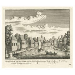
Rare Antique Engraving of the University City of Leiden, The Netherlands, c.1625
About the Item
Antique print titled 'Leijden in Hollandt'. Old print of the city of Leiden, the Netherlands. This print originates from 'Thesaurus philopoliticus oder Politisches Schatzkästlein'. This work was originally created in the period 1623-1632 and consisted of 16 parts, first published separately and then together in 2 books of 8 parts ea. Altogether it had 830 prints'. The primary objective was the poetry and accompanying emblems with a moralising symbolism. The city views were secondary and mainly published for decoration.
Artists and Engravers: The authors of this work are Daniel Meisner (1585-1625) and Eberhart Kieser (1583-1631). Meisner was a Bohemian / German poet. Kieser a German publisher and engraver. Kieser probably engraved some of the plates himself , but he also used other well known engravers: Sebastian Furck, Georg Keller, Johann Eckard Loffler and Matthias Merian the elder.
Condition: Very good, general age-related toning. Minor wear, please study image carefully.
Date: c.1625
Overall size: 16 x 13 cm.
Image size: 14 x 10 cm.
Antique prints have long been appreciated for both their aesthetic and investment value. They were the product of engraved, etched or lithographed plates. These plates were handmade out of wood or metal, which required an incredible level of skill, patience and craftsmanship. Whether you have a house with Victorian furniture or more contemporary decor an old engraving can enhance your living space. We offer a wide range of authentic antique prints for any budget.
- Dimensions:Height: 5.12 in (13 cm)Width: 6.3 in (16 cm)Depth: 0 in (0.01 mm)
- Materials and Techniques:
- Period:
- Date of Manufacture:c.1625
- Condition:Condition: Very good, general age-related toning. Minor wear, please study image carefully.
- Seller Location:Langweer, NL
- Reference Number:
About the Seller
5.0
Platinum Seller
These expertly vetted sellers are 1stDibs' most experienced sellers and are rated highest by our customers.
Established in 2009
1stDibs seller since 2017
1,916 sales on 1stDibs
Typical response time: <1 hour
- ShippingRetrieving quote...Ships From: Langweer, Netherlands
- Return PolicyA return for this item may be initiated within 14 days of delivery.
More From This SellerView All
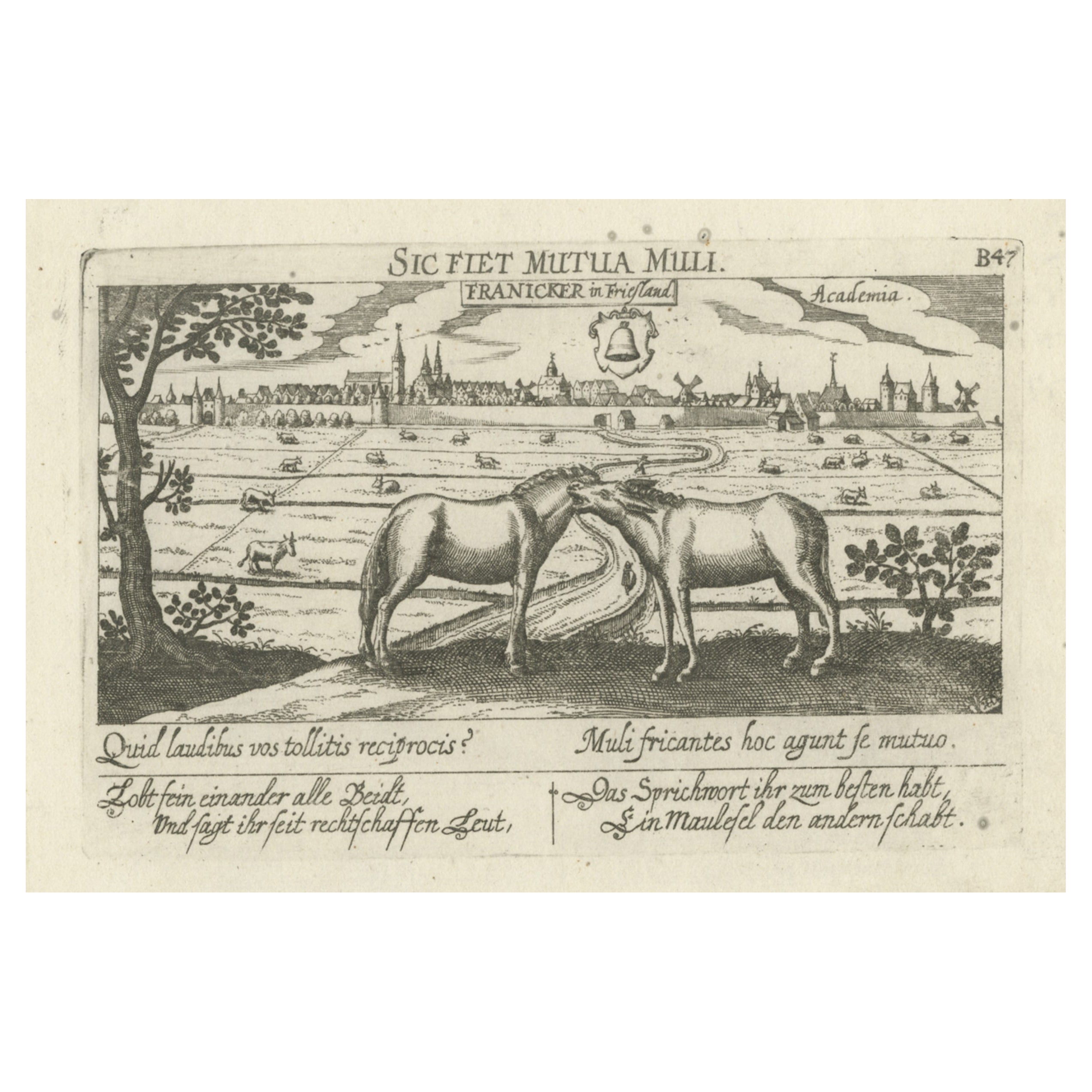
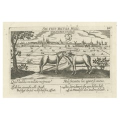
- Rare Antique Print of the University City of Franeker, the Netherlands, 1678Located in Langweer, NLAntique print titled 'Franicker in Friesland, Academia' View of the city of Franeker, Friesland, the Netherlands. Edition: 1678. This delicate engraving originates from 'Thesauri Phi...Category
Antique 17th Century Prints
MaterialsPaper
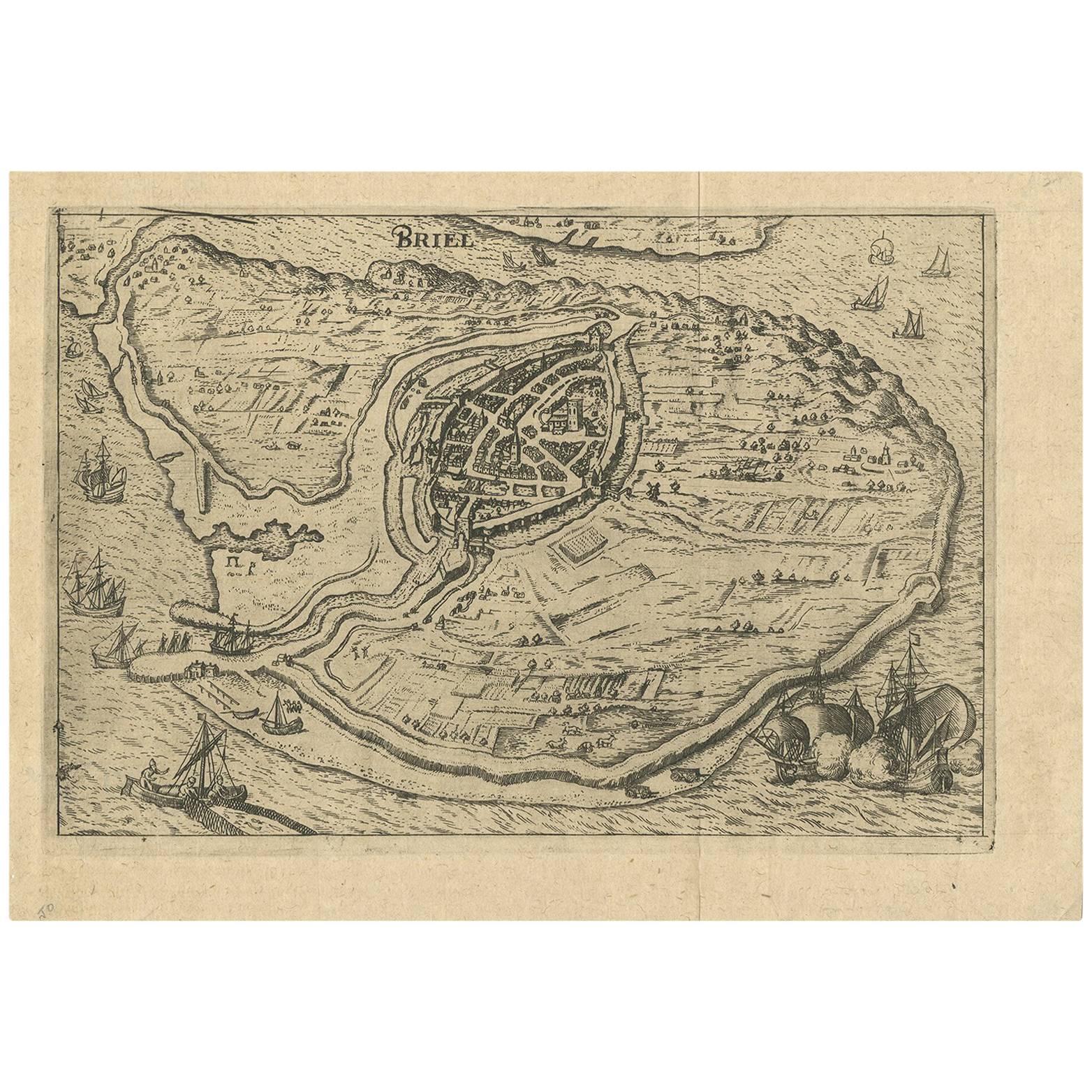
- Antique Map of the City of Brielle 'The Netherlands' by L. Guicciardini, 1625Located in Langweer, NLPlan of Brielle, Briel, Den Briel in the Province of Zuid-Holland, The Netherlands, Holland. This map originates from the 1625 edition of 'Discrittione di tutti i Paesi Bassi', by L....Category
Antique Early 17th Century Maps
MaterialsPaper
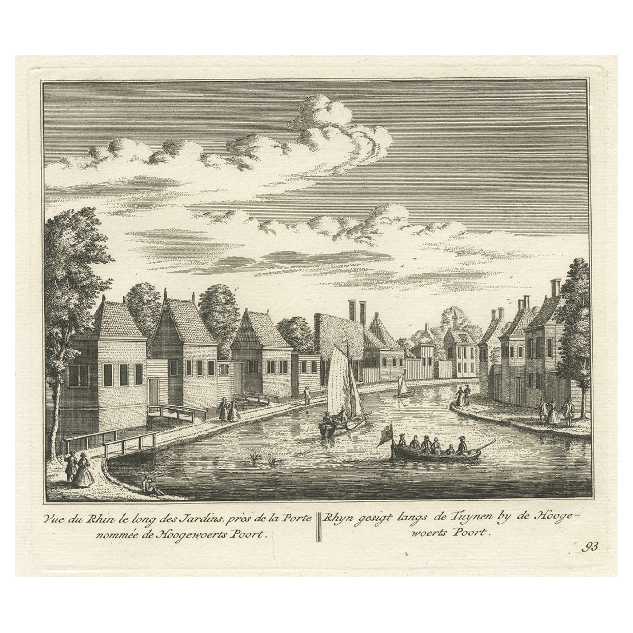
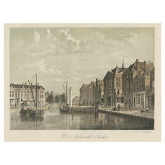
- Antique Print of the Rhine River, Leiden, The Netherlands, c.1800Located in Langweer, NLAntique print titled 'Rhyn gesigt langs de Tuynen by de Hoogewoerts Poort'. Old print depicting with a view on the Rhine river, the Netherlands. This print...Category
Antique 18th Century Prints
MaterialsPaper
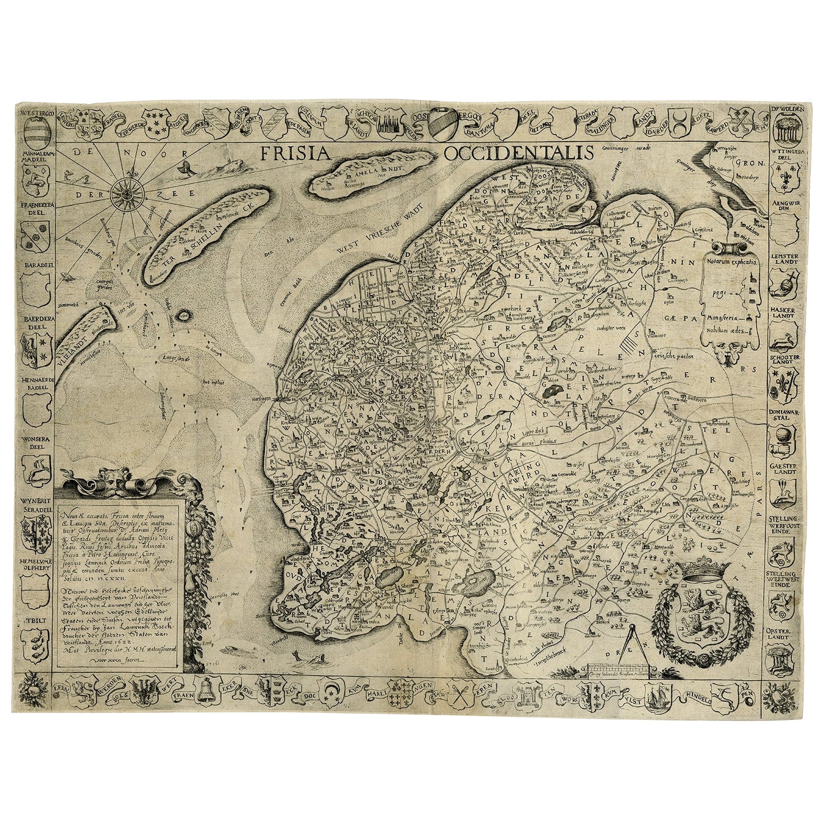
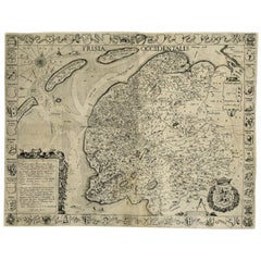
- Frisia Occidentalis, A Rare Antique Engraving of Friesland, The NetherlandsLocated in Langweer, NLAntique map titled 'Frisia Occidentalis.' - A very decorative map of the Dutch province Friesland, also showing the Wadden islands Terschelling and Ameland. With coats of arms of the...Category
Antique 1620s Maps
MaterialsPaper
- Old Print of the 'Aalmarkt' of Leiden, University City in the Netherlands, 1860Located in Langweer, NLAntique print titled 'De Aalmarkt te Leiden'. View of the 'Aalmarkt', a street in the city of Leiden, the Netherlands. Artists and Engravers: Published by C.W. Mieling. Condit...Category
Antique 19th Century Prints
MaterialsPaper
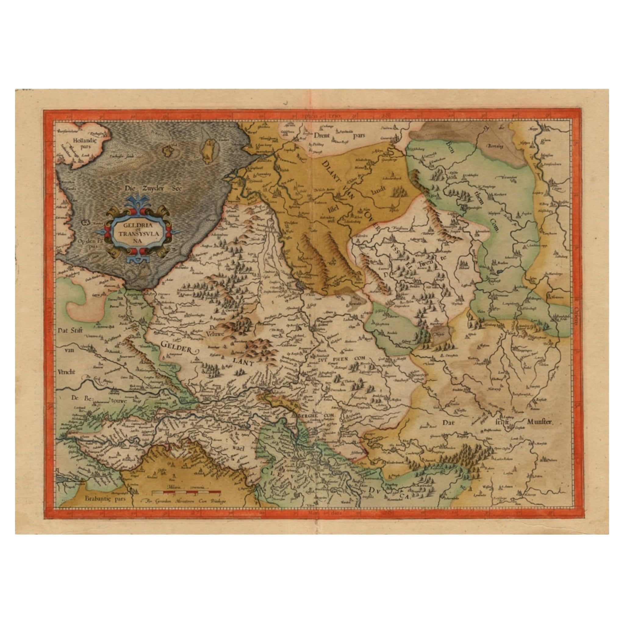
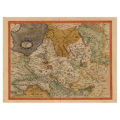
- Early Antique Map of Gelderland and Overijssel in the Netherlands, c.1625Located in Langweer, NLAntique map titled 'Geldria et Transysulana'. One of the earliest maps of Gelderland and Overijssel in the Netherlands, prepared by Gerard Mercator. Artists and Engravers: Gerard...Category
Antique 17th Century Maps
MaterialsPaper
You May Also Like
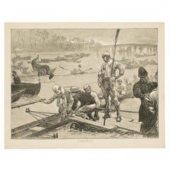
- Antique Rowing Print, Cambridge UniversityLocated in Oxfordshire, GBCambridge preparing for the boat race. A wonderful atmospheric rowing lithograph of the Cambridge crew getting into a rowing scull preparing for a race....Category
Antique 1890s British Sporting Art Prints
MaterialsPaper
- Original Antique Map of The Netherlands, Sherwood, Neely & Jones, Dated 1809Located in St Annes, LancashireGreat map of The Netherlands Copper-plate engraving by Cooper Published by Sherwood, Neely & Jones. Dated 1809 Unframed.Category
Antique Early 1800s English Maps
MaterialsPaper
- Original Antique Map of The Netherlands, Engraved by Barlow, Dated 1807Located in St Annes, LancashireGreat map of Netherlands Copper-plate engraving by Barlow Published by Brightly & Kinnersly, Bungay, Suffolk. Dated 1807 Unframed.Category
Antique Early 1800s English Maps
MaterialsPaper
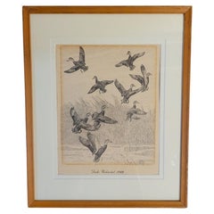
- Rare Lynn Bogue Hunt Engraving of Ducks Unlimited, 1940By Lynn Bogue HuntLocated in Dallas, TXPresenting a Rare Lynn Bogue Hunt engraving of ducks unlimited 1940. This piece cam from a wealthy estate in Dallas, TX with the mansion being built...Category
Mid-20th Century American Sporting Art Prints
MaterialsPaper
- “The Restaurant of the House of Representatives” Engraving by Harper's WeeklyLocated in Colorado Springs, COThis original wood engraving is titled “The Restaurant of the House of Representatives, Washington, DC.” It was published as a double-page image, in the August 12, 1893 issue of the famous 19th century newspaper Harper’s Weekly. The print was illustrated by Charles Stanley Reinhardt. The House Restaurant, a unique part of life in the Capitol, has been in the same location since the 1857 Capitol Expansion. Congressional members’ busy work schedule made the availability of food on site a necessity. But the restaurant also served as an informal meeting spot for members to continue conversations and deal making. This 1893 print illustrates the convivial atmosphere. Details including elegantly dressed tables...Category
Antique 1890s American Prints
MaterialsPaper
- 1876 "Gettysburg, The Repulse of Longstreet's Assault." EngravingLocated in Colorado Springs, COPresented here is an 1876 engraving of John B. Bachelder and James Walker’s Gettysburg. The Repulse of Longstreet’s Assault. The engraved scene depicts the decisive battle on the final day of the Battle of Gettysburg. Researched by the photographer and topographer John B. Bachelder and painted by James Walker, the original painting was created in 1870. This detailed engraving was done by H. B. Hall Jr. and published by James Drummond Ball. Otherwise called Pickett’s Charge, the battle occurred on July 3, 1863. Pickett’s corp commander, Lieutenant General James Longstreet was placed in charge of the attack despite his hesitations. Longstreet’s central role led to the title of the work, Repulse of Longstreet’s Assault. In an attempt to gain control of an important supply route, nine Confederate brigades charged across three-quarters of a mile of open ground against cannon fire to take Cemetery Ridge from the defending Union Army. Despite their overwhelming numbers, the Confederate forces were repelled with considerable casualties marking not only a decisive victory for the Union, but also the beginning of the slow defeat of Lee’s Army. The furthest the charging forces advanced before being repulsed would forever be known as the “High Water Mark of the Confederacy.” The Confederate army never recovered from the losses at Gettysburg and it effectively ended Lee’s campaign into Pennsylvania. The engraving gives the perspective from the Union rear, one that encompasses most of the battlefield, from Big Round Top on the left to the northern reaches of Cemetery Ridge on the right. The Confederate lines at Seminary Ridge are in the far distance, partially obscured by bursting shells. The image centers on the main Confederate assault, in the vicinity of what today are known as "The Copse" and "The Bloody Angle." The composition has elemen...Category
Antique 1870s American Prints
MaterialsPaper


Recently Viewed
View AllMore Ways To Browse
17th Century German Engravings
Antique Merian Prints
Merian Engraving
French Display Cabinet Carved
Large Walnut Chest Of Drawers
Antique Ivory Pieces
Mid Century Commode Black
Swedish Gustavian Commode
Painted Cabinet Mahogany
1960 Wood Small Cabinet
Art Deco Display Cabinets
Art Deco Display Cabinet
China Cabinet Display Cabinet
Chinese Display Cabinet
Double Chest Drawers
Victorian Bow
China Display Cabinet
Pair Carved Shelves