18th Century and Earlier Maps
to
2,341
2,861
110
2,974
26
12
1
1
2,974
2,230
473
3
288
34
9
126
8
36
9
2
5
4
3
2
2,960
30
20
3
3
322
123
77
62
48
2,974
2,974
2,974
63
24
16
13
13
Period: 18th Century and Earlier
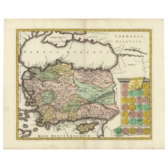
Decorative Antique Map of Cyprus and Asia Minor by Christoph Weigel, Circa 1720
Located in Langweer, NL
Title: Asiae Peninsula sive Asia Intra Taurum by Christoph Weigel, Circa 1720 – Decorative Antique Map of Cyprus and Asia Minor
Description: Thi...
Category
Antique 18th Century and Earlier Maps
Materials
Paper
$622 Sale Price
20% Off
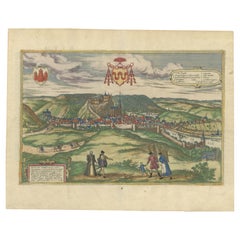
Huy (Huum) Cityscape 1574: Historical Copper Engraving by Braun & Hogenberg
Located in Langweer, NL
Title: Huum opp. condrusorum caput (...) Anno partae salutis 1574.
**Type:** Print (Colored Copper Engraving)
**Year:** Circa 1580
**Technique:** Colored Copper Engraving
**Medium:...
Category
Antique 18th Century and Earlier Maps
Materials
Paper
$603 Sale Price
20% Off
Original Antique Map of Ancient Greece- Boeotia, Thebes, 1787
Located in St Annes, Lancashire
Great map of Ancient Greece. Showing the region of Boeotia, including Thebes
Drawn by J.D. Barbie Du Bocage
Copper plate engraving by P.F T...
Category
French Other Antique 18th Century and Earlier Maps
Materials
Paper
Antique Map of Tartary and Northeast Asia, c.1750
Located in Langweer, NL
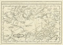
Antique map titled 'Carte de la tartarie occidentale'. An interesting map of Tartary and northeast Asia, from Lake Baykal, Partie du Siberia in the north, Pays des Kalkas at the cent...
Category
Antique 18th Century and Earlier Maps
Materials
Paper
$122 Sale Price
20% Off
Antique Map of the South Pole by Keizer & de Lat, 1788
Located in Langweer, NL
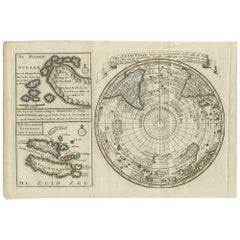
Antique map titled 'De Zuid Pool, waar in aangetoont werd alle de Nieuwe Landen (..)'. Original antique map of the South Pole including two small inset maps...
Category
Antique 18th Century and Earlier Maps
Materials
Paper
$471 Sale Price
20% Off
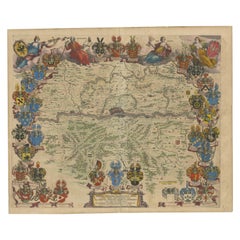
1663 Blaeu's Engraved Map of Frankfurt with Decorative Coats of Arms
Located in Langweer, NL
This map, titled "Novam Hanc Territorii Francofurtensis Tabulam," is an exquisite hand-colored engraved map from around 1663, created by the renowned cartographers J. and C. Blaeu of...
Category
Antique 18th Century and Earlier Maps
Materials
Paper
$934 Sale Price
20% Off
A General View of Jerusalem in the Early Part of the 18th Century" (circa 1752)
Located in Langweer, NL
The print is signed by the artist "S. Mynde sc." in the lower right corner. This suggests that the maker of the print is Samuel Mynde, a known engraver from the 18th century. His wor...
Category
Antique 18th Century and Earlier Maps
Materials
Paper
$415 Sale Price
20% Off
Map of Southern Spain Depicting Castile, Andalusia, Granada, Murcia and Valencia
Located in Langweer, NL
Antique map titled 'Partie Meridionale Des Etats de Castille (..)'. Decorative and highly detailed map of the southern part of Castile, Spain, including a decorative cartouche. Publi...
Category
Antique 18th Century and Earlier Maps
Materials
Paper
$623 Sale Price
20% Off
Orginal Antique Handcolored Map of the Turkish Empire, 1748
Located in Langweer, NL
Antique map titled 'L'Empire des Turcs'. Old map of the Turkish Empire with an inset of the North African regions. Originates from 'Atlas Nouveau Portatif' by G.L. le Rouge.
Artis...
Category
Antique 18th Century and Earlier Maps
Materials
Paper
$337 Sale Price
35% Off
Frisia Occidentalis, A Rare Antique Engraving of Friesland, The Netherlands
Located in Langweer, NL
Antique map titled 'Frisia Occidentalis.' - A very decorative map of the Dutch province Friesland, also showing the Wadden islands Terschelling and Ameland. With coats of arms of the...
Category
Antique 18th Century and Earlier Maps
Materials
Paper
$2,311 Sale Price
20% Off
Antique Map of the Burgundy Region by Mallet, c.1683
Located in Langweer, NL
Antique map titled 'Royaume de Bourgogne sous la seconde Race des Roys de France'. Detailed miniature map of the Burgundy region, France. Originates from Mallet's 'Description de l'U...
Category
Antique 18th Century and Earlier Maps
Materials
Paper
$72 Sale Price
20% Off
1773 Map of Persia, Gujarat & Malabar Coasts – Arabia to India, Hand-Colored
Located in Langweer, NL
1773 Bellin map of Persia, Gujarat and Malabar coasts with Arabia and Maldives
Description:
This finely engraved and delicately hand-colored 18th-century map titled Kaart van de Kusten van Persië, Guzaratte en Malabar was produced by the eminent French cartographer Jacques-Nicolas Bellin and engraved by Jakob van der Schley. It was published in 1773 in Amsterdam by E. van Harrevelt and D. Changuion, as part of a Dutch edition of Bellin’s maritime atlas focused on the East Indies and the Indian Ocean.
The map presents the coastline bordering the Arabian Sea, extending from the Persian Gulf and parts of the Arabian Peninsula to the shores of Gujarat and the Malabar Coast in southwestern India. It provides a detailed representation of the coastlines of Persia (modern-day Iran), the western coast of India, and a portion of southern Arabia including the Oman Peninsula. Coastal towns, rivers, ports, and geographical landmarks are clearly labeled, including prominent trading centers like Surat, Goa, Calicut, Cochin, and Cape Comorin (now Kanyakumari).
Additionally, the map shows the Laccadive Islands (Laka Dives) and the Maldives (Maldivische Eilanden), with attention to navigational details such as shoals, sandbanks, and anchor points. A large compass rose and clear latitude and longitude markings enhance its utility as a navigational aid.
A highly decorative title cartouche at lower left features maritime iconography such as sea creatures, a fountain, and shells. An inset legend beneath the map provides explanations in Dutch for the symbols used to indicate bays, capes, ports, forts, islands, and towns.
This is a copperplate engraving printed on laid paper with full original hand coloring. It retains its original fold lines as issued. The condition is generally good, with minor age toning and a few light spots in the margins. No repairs or restoration are visible. The paper is strong, and the impression remains crisp and clear.
This historical map is a significant and attractive example of 18th-century European cartography, especially valued for its depiction of maritime trade regions and coastal geography during the age of exploration and colonial expansion.
To frame this 1773 Bellin map attractively and safely:
- Use acid-free matting in a neutral tone like cream or antique white
- Consider double matting with a subtle inner color that complements the map
- Choose a simple wooden frame in walnut, cherry, or aged oak for a classic look
- Use UV-protective glass or acrylic to prevent fading
- For a full display, consider float mounting to show the edges and fold lines
- Allow 2 to 3 inch mat margins to balance the composition and enhance presentation
Keywords:
Bellin map 1773, van der Schley, Persia coast map, Gujarat map, Malabar map...
Category
Antique 18th Century and Earlier Maps
Materials
Paper
$320 Sale Price
20% Off
Antique Map of Persia by A. Zatta, circa 1785
Located in Langweer, NL
Antique map titled 'L'Impero della Persia diviso ne suoi Stati'. The Empire of Persia divided into its states. Originates from 'Atlante Novissimo, illustrato ed accresciuto sulle oss...
Category
Italian Antique 18th Century and Earlier Maps
Materials
Paper
Antique Map of the Coast of Roussillon, France
Located in Langweer, NL
Antique map titled 'Coste de Roussillon depuis Port Vendres, jusqu'au golphe de Rozes'. Original map of the coast of Roussillon, France. This map originates from 'Le Petit Atlas Mari...
Category
Antique 18th Century and Earlier Maps
Materials
Paper
$321 Sale Price
20% Off
Old Map of Ancient Spain and Portugal – Hispania Antiqua Featuring Roman Cities
Located in Langweer, NL
Title: "Hispania Antiqua in Tres Praecipuas Partes Divisa: Tarraconensem, Lusitaniam, et Bæticam" by Robert de Vaugondy, 18th Century
Description:
This beautifully detailed map titl...
Category
Antique 18th Century and Earlier Maps
Materials
Paper
$623 Sale Price
20% Off
Antique Map of Persia with Dedication Cartouche
Located in Langweer, NL
Antique map titled 'Persia sive Sophorum Regnum'. Original old map of Persia. The map extends from the Eastern Mediteranian to Tacalistan and the Indus River and the Dalanguer Mounta...
Category
Antique 18th Century and Earlier Maps
Materials
Paper
$1,320 Sale Price
20% Off
Map Holy Land La Terre Sainte Engraved van Loon Published N de Fer 1703 French
Located in BUNGAY, SUFFOLK
La Terre Sainte, The Holy Land, Tiree Des Memoires De M.De.La Rue. Par N. de Fer. Geographe de Sa Majeste Catoliq et de Monseigneur le Dauphin. Avec Privil du Roi 1703
Detailed map of the Holy Land from Nicholas de Fer's L'Atlas Curieux ou le Monde. East is oriented at the top.
MAKER Nicolas de Fer 1646-1720
The French cartographer and engraver, Nicolas de Fer, was a master at creating maps that were works of art. The maps that he published were printed during the Baroque period when the decorative arts were characterized by ornate detail. De Fer’s detailed maps and atlases were valued more for their decorative content than their geographical accuracy.
Nicolas de Fer was born in 1646. His father, Antoine de Fer, owned a mapmaking firm. At the age of twelve, Nicolas was apprenticed to a Parisian engraver named Louis Spirinx. The family business was starting to decline when his father died in 1673. Nicolas de Fer’s mother, Genevieve, took over the business after the death of her husband. In 1687 the business was passed on to Nicolas and the profits increased after he took over the firm. Nicolas de Fer was a prolific cartographer who produced atlases and hundreds of single maps. He eventually became the official geographer to King Louis XIV of France and King Philip V...
Category
French Louis XIV Antique 18th Century and Earlier Maps
Materials
Paper
Rare Hand-Colored Antique Map of Asia, 1788
Located in Langweer, NL
Antique map titled 'Kaartje van Asia'.
Original antique map of Asia. This map originates from 'Nieuwe Natuur- Geschied- en Handelkundige Zak- en Reisatlas' by N.T. Gravius, 1788....
Category
Antique 18th Century and Earlier Maps
Materials
Paper
$584 Sale Price
20% Off
Map of the British Isles with Historical Kings, 1719
Located in Langweer, NL
This antique map, titled "Les Royaumes d'Angleterre d'Escosse et d'Irlande," offers a detailed view of the British Isles, including England, Wales, Scotland, and Ireland. Additionall...
Category
Antique 18th Century and Earlier Maps
Materials
Paper
$415 Sale Price
20% Off
Antique Map of North Africa by Ortelius, c.1600
Located in Langweer, NL
Antique map titled 'Barbariae et Biledulgerid nova descriptio'.
Old map of coastal North Africa and the Mediterranean. The map extends from Morocco and the Sahara to Libya and sh...
Category
Antique 18th Century and Earlier Maps
Materials
Paper
$353 Sale Price
20% Off
Copper Engraving of Kamchadal Women from Kamchatka, Russia, 1770
Located in Langweer, NL
Description: Antique print titled 'Habillemens des Femmes du Kamtchatka'. Copper engraving of Kamchadal women. This print originates from volume 19 of 'Histoire generale des voyages (..)' by Antoine Francois Prevost d'Exile.
Artists and Engravers: Published by Panckoucke.
The Kamchadals inhabit Kamchatka, Russia. The name "Kamchadal" was applied to the descendants of the local Siberians and aboriginal peoples (the Itelmens, Ainu, Koryaks and Chuvans) who assimilated with the Russians. The descendants of the mixed-blood Russian settlers in 18th-19th century are called Kamchadals these days. The Kamchadals speak Russian with a touch of local dialects of the aboriginal languages of Kamchatka. The Kamchadals engage in fur trading...
Category
Antique 18th Century and Earlier Maps
Materials
Paper
$320 Sale Price
20% Off
Original Antique Map of the Island of Dominica in the West Indies, 1794
Located in Langweer, NL
MAP OF THE ISLAND OF DOMINICA for the History of the West Indies, by Bryan Edwards. Esq.
Dominica, an island renowned for its lucrative exports of sugar, cocoa, and coffee, operated...
Category
Antique 18th Century and Earlier Maps
Materials
Paper
$226 Sale Price
20% Off
Coast of Northumberland, England, Incl the Holy & Farne Islands, Etc, 1693
Located in Langweer, NL
Antique map titled 'Holy Island, Staples and Barwick.'
A map of the coast of Northumberland, England. This map includes Holy Island, Buckton, Sunderland and the Farne Islands. Th...
Category
Antique 18th Century and Earlier Maps
Materials
Paper
$358 Sale Price
20% Off
Map of the Vietnamese Coast, Centered on Turon Harbor 'Da Nang Area', 1796
Located in Langweer, NL
Antique map titled 'A chart of part of the coast of Cochin-China including Turon Harbour and the Island Callao'.
Detailed map of the Vietnamese Coast, centered on Turon Harbor (D...
Category
Antique 18th Century and Earlier Maps
Materials
Paper
$632 Sale Price
20% Off
Original Antique Map of the Peninsula of India with Part of Ceylon by Wyld, 1844
Located in Langweer, NL
This extensive map of India, spanning two sheets, draws from Reynell’s original map and incorporates data provided by Sir Archibald Campbell, as well as surveys conducted by Colonel ...
Category
Antique 18th Century and Earlier Maps
Materials
Paper
$1,134 Sale Price
20% Off
Original Antique Map of Friesland in Decorative Hand-Colouring, 1600
Located in Langweer, NL
Antique map titled 'Frisiae antiquissima trans rhenu provinc et adiacentium regionum nova et exacta descriptio'. Original antique map of the province of Friesland, the Netherlands. T...
Category
Antique 18th Century and Earlier Maps
Materials
Paper
$584 Sale Price
20% Off
Antique Print of the Dutch Trading Post Deshima in Japan, circa 1738
Located in Langweer, NL
Antique print titled 'Isoletta Desima abittata Dagli Olandesi nel Giappone secondo la delineazione del Sigr. Voogt'. Bird's-eye view of Deshima (or Dejima) copied from a manuscript b...
Category
Antique 18th Century and Earlier Maps
Materials
Paper
Antique Map of the City of Visby 'Sweden' by F. Hogenberg, 1598
Located in Langweer, NL
This is a wonderful bird's-eye plan/view of the oldest city in Sweden.
Visby, the largest city on the island of Gotland was an important Viking city and the main centre of the Hanseatic League...
Category
Antique 18th Century and Earlier Maps
Materials
Paper
$2,311 Sale Price
20% Off
Original Antique Map of Abyssinia, Sudan and the Red Sea, 1749
Located in Langweer, NL
Antique map titled 'Nubie, Abissinie et Cote d'Ajan'.
Map of Abyssinia, Sudan and the Red Sea by Robert Vaugondy. Covers from Arabia and Egypt south to M...
Category
Antique 18th Century and Earlier Maps
Materials
Paper
$320 Sale Price
20% Off
Old Map of the Mughal Empire, Persia in the West to Lake Chimay etc., ca.1685
Located in Langweer, NL
Antique map titled 'L'Empire du Grand Mogol'. Old map of India and Central Asia.
The map extends from Persia in the West to Lake Chimay and the Bay of Bengal...
Category
Antique 18th Century and Earlier Maps
Materials
Paper
$301 Sale Price
20% Off
Antique Map of Peru in South America by Blaeu, circa 1645
Located in Langweer, NL
Antique map titled 'Peru'. Original antique map of Peru. With cartouche, compass rose, ships and two sea-monsters. Published by W. Blaeu, circa 1645.
Category
Antique 18th Century and Earlier Maps
Materials
Paper
$665 Sale Price
24% Off
Antique plan of Ayutthaya, the capital of Siam, Thailand
Located in Langweer, NL
Antique map titled 'Judia, De Hoofd-Stad van Siam'. Antique plan of Ayutthaya, the capital of Siam (Thailand). This print originates from 'Oud en Nieuw Oost-...
Category
Antique 18th Century and Earlier Maps
Materials
Paper
$935 Sale Price
20% Off
Senex Map of Castile, Leon & La Mancha in The Spanish Heartland, 1714
Located in Langweer, NL
This antique map, titled "A Map of Old & New Castile from the Observations of Rodrigo Mendes Silva and others," depicts the regions of Old Castile and New Castile in Spain, along with the Kingdom of Leon, Estremadura, La Mancha, among others. The map dates back to the early 18th century, a period marked by significant political shifts and territorial changes in Europe, particularly illustrated by the War of the Spanish Succession (1701–1714) that reshaped Spain’s governance and regional boundaries.
The map itself was published in 1714 by John Senex, a prominent English mapmaker, surveyor, globemaker, and geographer of the early eighteenth century. He was apprenticed as a young man to bookseller Robert Clavell and collaborated with notable mapmakers such as Jeremiah Seller and Charles Price. In 1728, Senex's contributions to geography and mapping were recognized when he was elected a Fellow of the Royal Society, an exceptional honor for a mapmaker, underlining his significant role as the Society's engraver and a publisher of maps by Edmund Halley and other notable figures.
John Senex is renowned for his English Atlas, first published in the same year as this map, 1714, and continued to be printed until the 1760s. Following his death in 1740, his widow Mary Senex managed the business until 1755. Afterward, the stock passed to William Herbert and Robert Sayer for maps, and to James Ferguson for globes.
The map serves not just as a geographical record but also as a historical document, reflecting the territorial divisions significant to Spain's political and economic structure at the time. The focus on Old and New Castile underscores their importance during a transformative era in Spanish history.
Here are some potentially significant places and features of this map:
1. **Old Castile (Castilla la Vieja)**: Historically significant as part of the former Kingdom of Castile, this region includes major cities such as Burgos and Valladolid. These cities could be popular search...
Category
Antique 18th Century and Earlier Maps
Materials
Paper
$462 Sale Price
20% Off
Antique Map of the Saxony Region 'Germany' by F. de Wit, circa 1680
Located in Langweer, NL
A detailed map of a region in eastern Germany. Cartouches depict coat of arms surrounded by cherubs. The map is fully engraved with towns, political boundaries, rivers and forests. P...
Category
Dutch Antique 18th Century and Earlier Maps
Materials
Paper
Pl. 18 Antique Print of a Garden Design by Le Rouge, c.1785
Located in Langweer, NL
Antique print titled 'Bain de Cesar (..)'. Copper engraving showing a garden design. This print originates from 'Jardins Anglo-Chinois à la Mode' by Georg Louis le Rouge. Artists and...
Category
Antique 18th Century and Earlier Maps
Materials
Paper
Detailed 1729 Battle Map – Allied Army Camp at Denain France, 1712 Siege
Located in Langweer, NL
Map of Allied Camp at Denain, France, 1712 Attack – Published 1729
This engraved map depicts the army camp of the Allied forces at Denain, attacked by the French on July 24, 1712 du...
Category
Dutch Antique 18th Century and Earlier Maps
Materials
Paper
Antique Map of the Coast of France Between Brest and Bayonne
Located in Langweer, NL
Antique map titled 'Carte des Costes de France depuis Brest jusquá Bayone'. Original old map of the coast of France between Brest and Bayonne. This map originates from 'Le Petit Atla...
Category
Antique 18th Century and Earlier Maps
Materials
Paper
$301 Sale Price
20% Off
Rare and Early Map of the Seventeen Provinces, Published in circa 1640
Located in Langweer, NL
Antique map titled 'Carte Generale des Dixsept Provinces des Pais Bas'. Rare and Early map of the Seventeen Provinces. The Seventeen Provinces were the Imperial states of the Habsbur...
Category
Antique 18th Century and Earlier Maps
Materials
Paper
$2,075 Sale Price
20% Off
Detailed Antique Map of the Black Sea, Balkans and Asia Minor
Located in Langweer, NL
Antique map titled 'Nuova Carta del Europa Turchesca (..)'. This is an Italian version of Tirion's detailed map of the Black Sea, Balkans, and Asia Minor. It is embellished with a si...
Category
Antique 18th Century and Earlier Maps
Materials
Paper
$547 Sale Price
20% Off
Original Antique Sea Chart of the Northern Part of Hispaniola, Western Cuba
Located in Langweer, NL
Antique map titled 'Pas kaart van de Noord Kust van Espaniola (..)'. Beautiful sea chart of the northern part of Hispaniola, western Cuba. The map includes the Turks & Caicos Islands and southern part of the Bahamas. Shows Guanahami or S. Salvador. Guanahani is an island in the Bahamas that was the first land in the New World sighted and visited by Christopher Columbus' first voyage, on October 12, 1492. It is not known precisely which island it was, and several theories have been put forth by historians. Guanahani is the native Taíno name; Columbus called it San Salvador. Originates from 'De Nieuwe Groote Lightende Zee-Fakkel'. Published by J. van Keulen, circa 1684.
The Van Keulens were a family of chartmakers and publishers. The firm, In de Gekroonde Lootsman (In the Crowned Pilot), was founded in 1678 by Johannes van Keulen (1654-1715). Van Keulen originally registered his business as a vendor of books and instruments (specifically cross-staffs). In 1680, however, he gained a privilege from the States of Holland and West Friesland for the publication of pilot guides and sea atlases.
In that year, van Keulen released his Zee-Atlas (Sea Atlas), which secured him a name in the competitive maritime publishing market. In 1681, he published the first volume of Nieuwe Lichtende Zee-Fakkel (New Shining Sea Torch). This would be the first of an eventual five volumes originally published between 1680 and 1684. A sixth volume was added in 1753. The Zee-Fakkel won van Keulen lasting fame. The atlas had charts compiled by Claes Jansz Vooght and artwork from Jan Luyken...
Category
Antique 18th Century and Earlier Maps
Materials
Paper
$1,792 Sale Price
20% Off
Old 18th Century Composite Map of Key Caribbean Islands with Descriptive Texts
Located in Langweer, NL
Antique map titled 'Dominia Anglorum in praecipuis Insulis Americae ut sunt Insula S. Christophori, Antegoa, Iamaica, Barbados nec non Insulae Bermudes vel Sommers dictae. Die Englis...
Category
Antique 18th Century and Earlier Maps
Materials
Paper
$737 Sale Price
20% Off
Antique Map of the North Pole by V.M. Coronelli, circa 1692
Located in Langweer, NL
Globe gore by Vincenzo Maria Coronelli shows the North Pole with the coasts of Canada, Greenland, Scandinavia and Siberia, and is decorated with pictorial scenes of bear, seal and wh...
Category
Antique 18th Century and Earlier Maps
Materials
Paper
$1,323 Sale Price
20% Off
Antique Map of Virginia & the Chesapeake Bay by Jacques-Nicolas Bellin, c. 1750
Located in Philadelphia, PA
A fine antique 18th century French map of North America.
By Jacques-Nicolas Bellin.
On laid paper with polychrome highlights.
Depicting Virginia, the Chesapeake Bay, and the nearb...
Category
French Baroque Antique 18th Century and Earlier Maps
Materials
Paper
Excellent Antique Map of America with Unusual Northwest Coast of America, c.1754
Located in Langweer, NL
Description: Antique map titled 'Nieuwe Kaart Van het Westelykste Deel Der Weereld, dienende tot aanwyzing an de Scheepstogten der Nederlanderne Naar West Indie.' Excellent map of America, featuring an unusual northwest coast of America, which includes Martin d'Aguilar's strait which provides for a Northwest Passage via the Great Lakes. The rest of the NW coast...
Category
Antique 18th Century and Earlier Maps
Materials
Paper
$542 Sale Price
20% Off
Antique Print of London with St. Paul's Cathedral Before the Fire, ca.1725
Located in Langweer, NL
Antique print London titled 'Londres, capitale de l'Angleterre'.
Antique print of London with St. Paul's Cathedral (before the fire) in the...
Category
Antique 18th Century and Earlier Maps
Materials
Paper
$679 Sale Price
20% Off
Antique Plan of the City of Grave in Holland With Coats of Arms and Compass Rose
By Isaak Tirion
Located in Langweer, NL
Antique map titled 'Grondtekening der Stad Graave'. Plan of Grave, The Netherlands. With coats of arms, compass rose and key. From: Isaak Tirion's 'Hedendaagsche Historie, of Tegenwo...
Category
Antique 18th Century and Earlier Maps
Materials
Paper
$207 Sale Price
20% Off
Original Old Map of Present-Day Mongolia, Northeast China and Korea
Located in Langweer, NL
Antique map titled 'Carte de la Tartarie Chinoise. Projettee et assujettie aux observations astronomiques par M. Bonne, Hydrographe du Roi. A Paris, Chez Lattre Graveur, ordinaire de...
Category
Antique 18th Century and Earlier Maps
Materials
Paper
$1,122 Sale Price
20% Off
Antique Map Made After a Roman Papyrus Travel Map, Known as Peutinger Map, 1773
Located in Langweer, NL
Old Dutch engraving with title: 'Romeinsche Reis Kaart van K. Peutinger'.
Rare antique map based on the original 'Peutinger' map, the map has the shape of papyrus scrolls. Originat...
Category
Antique 18th Century and Earlier Maps
Materials
Paper
$424 Sale Price
20% Off
Pl. 4 Antique Print of Various Elements of the Kew Gardens by Le Rouge, c.1785
Located in Langweer, NL
Antique print titled 'Vue du Lac, de l'Orangerie et du Temple d'Eole à Kew (..)'. Copper engraving showing the lake, orangery, temple and pagoda of the Kew gardens. This print origin...
Category
Antique 18th Century and Earlier Maps
Materials
Paper
$132 Sale Price
20% Off
Rare Antique Engraving of the City of Stockholm, Norway, ca.1720
Located in Langweer, NL
Antique print titled 'Die Königl. Schwedische Haupt und Residenz Stadt Stockholm'. Panoramic view of the city of Stockholm, Sweden. This print originates from the series 'Europe Prac...
Category
Antique 18th Century and Earlier Maps
Materials
Paper
$433 Sale Price
20% Off
Antique Map of Italy by R. Bonne, circa 1780
Located in Langweer, NL
Beautiful map of Italy, Corsica, Sardinia and Sicily. Highly detailed, showing towns, rivers, some topographical features and political boundaries. Published by R. Bonne, circa 1780.
Category
French Antique 18th Century and Earlier Maps
Materials
Paper
$283 Sale Price
20% Off
Original Antique Map of Spain and Portugal, circa 1790
Located in St Annes, Lancashire
Super map of Spain and Portugal
Copper plate engraving by A. Bell
Published, circa 1790.
Unframed.
Category
English Other Antique 18th Century and Earlier Maps
Materials
Paper
Antique Map of Roermond & Duchy of Guelders by Sanson – Hand-Colored, c.1667
Located in Langweer, NL
Antique map of Roermond and the Duchy of Guelders with rich detail, c.1667
This beautifully hand-colored 17th-century map presents the region of Roermond and the broader Duchy of Gu...
Category
French Antique 18th Century and Earlier Maps
Materials
Paper
Antique Map of Southeast Asia from Persia to the Timor Island, 1712
Located in Langweer, NL
Antique map titled 'A New Map of the East Indies'.
Old map covering all of Southeast Asia from Persia to the Timor Island, inclusive of the modern day nations of India, Ceylon, T...
Category
Antique 18th Century and Earlier Maps
Materials
Paper
$746 Sale Price
20% Off
Antique Copper Engraving with a Panoramic View of Mexico City, ca.1760
Located in Langweer, NL
Description: Antique print titled 'Nouveau Mexico'.
Copper engraving with a panoramic view of Mexico city. Source unknown, to be determined.
Artists and Engravers: Engraved after ...
Category
Antique 18th Century and Earlier Maps
Materials
Paper
$273 Sale Price
20% Off
Rare Hand-Colored Antique Map of Tartary, China and Korea, ca.1741
Located in Langweer, NL
Antique map titled 'A General Map of Eastern and Western Tatary, commonly call'd Tartary; drawn from the Particular Maps of the Jesuit Missionaries'.
Rare antique map of Tartary, C...
Category
Antique 18th Century and Earlier Maps
Materials
Paper
$2,599 Sale Price
20% Off
Antique Map of Coevorden in the Netherlands, 1691
Located in Langweer, NL
Plate 'Covorden.' (Plan of the fortified city of Coevorden, The Netherlands.) This attractive original old antique print / plate originates from: 'Ausführliche und grundrichtige Besc...
Category
Antique 18th Century and Earlier Maps
Materials
Paper
$85 Sale Price
20% Off
Antique Map of the Languedoc Coast between Agde and Sète 'Cette', France
Located in Langweer, NL
Antique map titled 'Coste de Languedoc depuis Agde jusqu'a Cette'. Original map of the Languedoc coast between Agde and Sète (historically Cette), France. This map originates from 'L...
Category
Antique 18th Century and Earlier Maps
Materials
Paper
$320 Sale Price
20% Off
Print of Various Ceremonies 'Marriage, Funeral, Baptism, Magic' of Finland, 1726
Located in Langweer, NL
Antique print titled 'Mariage des Lapons (..)'.
Old print of various ceremonies (marriage, funeral, baptism, magic) of Finland. This print originates from 'Ceremonies et costumes...
Category
Antique 18th Century and Earlier Maps
Materials
Paper
$320 Sale Price
20% Off
Antique Map of the Northwestern Netherlands, incl Texel and Vlieland, ca.1741
Located in Langweer, NL
Antique print, titled: 'Tabula Comitatus Hollandiae in Praefecturas sua distributa; cui adjuncta est Provinc. Ultraiectina et maxima pars Geldriae summo studio delin. Et aeri incidit...
Category
Antique 18th Century and Earlier Maps
Materials
Paper
$886 Sale Price
20% Off
