18th Century and Earlier Maps
to
2,341
2,861
110
2,974
26
12
1
1
2,974
2,230
473
3
288
34
9
126
8
36
9
2
5
4
3
2
2,960
30
20
3
3
322
123
77
62
48
2,974
2,974
2,974
63
24
16
13
13
Period: 18th Century and Earlier
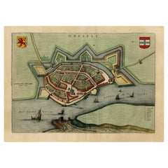
Stunning Bird's-Eye View Plan of Hasselt by Blaeu in The Netherlands, 1649
Located in Langweer, NL
Antique print, titled: 'Hasselt.'
Bird's-eye view plan of Hasselt in The Netherlands. With key to locations and coats of arms. Text in Dutch on verso. This plan originates from the famous city Atlas: 'Toneel der Steeden' published by Joan Blaeu...
Category
Antique 18th Century and Earlier Maps
Materials
Paper
$1,084 Sale Price
20% Off
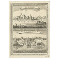
Antique Print of two Chinese Village Pau Ing Hyen with Windmills, China, 1748
Located in Langweer, NL
Antique print titled 'Village Flottant - Ville de Pau Ing Hyen avec ses Moulins a Vent'. View of two Chinese villages. This print originates from Prevo...
Category
Antique 18th Century and Earlier Maps
Materials
Paper
$169 Sale Price
20% Off
Antique Map of China, Korea, Japan and the Northern Philippines, circa 1780
Located in Langweer, NL
Antique map titled 'Carte de l'Empire de la Chine de la Tartarie Chinoise, et du Royaume de Corée'. Interesting and detailed map of China, Korea, Japan and the Northern Philippines. ...
Category
Antique 18th Century and Earlier Maps
Materials
Paper
$283 Sale Price
20% Off
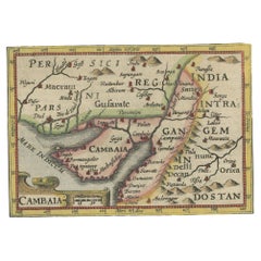
Rare Antique Miniature Map of Pakistan, India and Cambaia, ca.1618
Located in Langweer, NL
Old 17th century miniature antique map of 'Cambaia' , from the 1616 edition of Jadocus Hondius Atlas by Petrus Bertius.
Original copperplate engraving with hand coloring.
Carto...
Category
Antique 18th Century and Earlier Maps
Materials
Paper
$367 Sale Price
20% Off
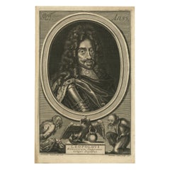
Print of Leopold I, Holy Roman Emperor, King of Hungary, Croatia & Bohemia, 1695
Located in Langweer, NL
Antique print, titled: 'Leopoldus Romanorum Imperator Semper Augustus.'
This original antique plate shows a portrait of Leopold I (9 June 1640 – 5 May 1705), he was Holy Roman Emperor...
Category
Antique 18th Century and Earlier Maps
Materials
Paper
$301 Sale Price
20% Off
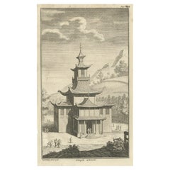
Original Antique Engraving of a Chinese Temple, 1736
Located in Langweer, NL
Antique print titled 'Temple Chinois'. Old print depicting a temple in China. Source unknown, to be determined.
Artists and Engravers: Made after J.C. Philips.
Condition: Very ...
Category
Antique 18th Century and Earlier Maps
Materials
Paper
Antique Map of Denmark with Schleswig-Holstein and the South of Sweden, c.1750
Located in Langweer, NL
Antique map titled 'General Charte von Konigreich Daenemark nebst dem Herzogthum Holstein.' Denmark with Schleswig-Holstein and the southern coast of Sweden. The large title cartouch...
Category
Antique 18th Century and Earlier Maps
Materials
Paper
$349 Sale Price
20% Off
Original Antique Engraving of the Mighty Imperial Osaka Castle in Japan, 1669
Located in Langweer, NL
Antique print, titled: 'Afbeeldinge vant Maghtich Keyserlyck Casteel Osacca geleegen int groot Ryck Jappan besuyden de Stadt Osacce inde provinsie Qioo.' - ('Image of the Mighty Imperial Castle Osaka').
A bird's eye view of Osaka Castle, Japan. Arnoldus Montanus' "Gedenkwaerdige Gesantschappen der Oost-Indische Maatschappy in 't Vereenigde Nederland aan de Kaisaren van Japan […]. Amsterdam: Jacob Meurs, 1669.
Artists and Engravers: Made by an anonymous engraver after 'Arnoldus Montanus'.
Condition: Very good, given age. Original middle fold, as issued. Some faint browning of the margin edges. A few small spots in the margins (from paper making...
Category
Antique 18th Century and Earlier Maps
Materials
Paper
$896 Sale Price
20% Off
Two Antique Genealogy Charts of the Royal House of France, Coats of Arms, 1732
Located in Langweer, NL
Antique print titled 'Nouvelle Carte Genealogique de la Maison Royale de France (..)'. Set of two prints depicting a genealogical chart of the Royal ...
Category
Antique 18th Century and Earlier Maps
Materials
Paper
$518 Sale Price / set
20% Off
Antique Map of the Region of Venice, Italy by F. De Wit, circa 1700
Located in Langweer, NL
Antique map of the Dominion of Venice, extending from Stato di Milano and Genoa to Istria. Including Lake Garda, Venice and Istria.
Category
Antique 18th Century and Earlier Maps
Materials
Paper
$556 Sale Price
20% Off
Very Rare Antique Print of the Valley of Terebinthus in Arabia, 1673
Located in Langweer, NL
Antique print titled 'Vallis Therebinthi'. Old print of the Valley of Terebinthus, below a decorative cartouche with lettered key and surrounded by 2 cherubins. This print originates...
Category
Antique 18th Century and Earlier Maps
Materials
Paper
Old Map of the Western Part of Central Europe, c.1680
Located in Langweer, NL
Antique map titled 'Carta nova accurate del Passagio et strada dalli Paesi Bassi'. Old map of the western portion of Central Europe. Oriented to the Northeast.
Artists and Engrav...
Category
Antique 18th Century and Earlier Maps
Materials
Paper
$354 Sale Price
20% Off
Antique Map of Martinique with Title Cartouche Garnished with Sugar Cane, c.1760
Located in Langweer, NL
Antique map titled 'Het Westindisch Eiland Martenique'. Decorative map of Martinique filled with good detail of roads, topography, soundings, villages, windmills, and plantations. Th...
Category
Antique 18th Century and Earlier Maps
Materials
Paper
$879 Sale Price
20% Off
Panoramic Engraved View of the Town of Longvek 'or Lavek' in Cambodia, ca.1726
Located in Langweer, NL
Description: Antique print titled 'Eauweck, Hooft Stad van Cambodia'. Decorative panoramic view of the town of Longvek (or Lavek) in Cambodia. It was the second capital city during t...
Category
Antique 18th Century and Earlier Maps
Materials
Paper
$801 Sale Price
20% Off
Antique Map of the Netherlands by Guicciardini, 1582
Located in Langweer, NL
Antique map titled 'Hollandiae Cattorum Regionis Typus'. Early copper engraving of the Netherlands in the 2nd state, numbered 30 bottom right. This map originates from 'Description d...
Category
Antique 18th Century and Earlier Maps
Materials
Paper
$561 Sale Price
20% Off
Colorful and Decorative Miniature Map of India, Ceylon by Bertius 1616
Located in Langweer, NL
Old 17th century miniature antique map of India - Ceylon from the 1616 edition of Jadocus Hondius Atlas by Petrus Bertius. Original copperplate engraving with hand coloring.
Carto...
Category
Antique 18th Century and Earlier Maps
Materials
Paper
$367 Sale Price
20% Off
New Map of North America from the Latest Discoveries, 1763
Located in Philadelphia, PA
A fine antique 18th century map of the North American seaboard.
Entitled "A New Map of North America from the Latest Discoveries 1763".
By the Cartographer/Engraver - John Spil...
Category
English Georgian Antique 18th Century and Earlier Maps
Materials
Paper
Pl. 10 Antique Print of various Garden Temples by Le Rouge, c.1785
Located in Langweer, NL
Untitled antique print showing various garden temples. This print originates from 'Jardins Anglo-Chinois à la Mode' by Georg Louis le Rouge. Artists and ...
Category
Antique 18th Century and Earlier Maps
Materials
Paper
Pl. 7 Antique Print of Moorish Garden Elements by Le Rouge, 1776
Located in Langweer, NL
Antique print titled 'Pavillon Moresque Temple - Temple Moresque'. Copper engraving showing Moorish garden elements including a pavilion and temple. This print originates from 'Jardi...
Category
Antique 18th Century and Earlier Maps
Materials
Paper
Antique Map of Artois in the North of France by Famous Mapmaker Blaeu, c.1640
Located in Langweer, NL
Antique map titled 'Artesia Comitatus Artois'. Map of Artois or Artesia, France. Artois is former province located in the northwestern part of France, boarding Belgium (Flanders) on ...
Category
Antique 18th Century and Earlier Maps
Materials
Paper
$452 Sale Price
20% Off
Unusual Benedictine Map of Italy, Showing Various States of the Church, C.1745
Located in Langweer, NL
Antique map titled 'Italia Benedictina Delineata A.P.R.C.P.W.' Unusual Benedictine map of Italy, showing the various states of the church, with an elaborate cartouche. Part of a seri...
Category
Antique 18th Century and Earlier Maps
Materials
Paper
$1,415 Sale Price
20% Off
Frederic de Wit Map of Palestine – Terra Sancta, Amsterdam c.1670
Located in Langweer, NL
Terra Sancta sive Promissionis, olim Palestina – hand-coloured copper-engraved map of the Holy Land by Frederic de Wit, Amsterdam, circa 1670
This impressive folio sheet, bearing th...
Category
Dutch Antique 18th Century and Earlier Maps
Materials
Paper
Antique Map of the Region of Poitou by Ortelius, circa 1600
Located in Langweer, NL
Antique map titled 'Poictou'. Original antique map of the region of Poitou, a former province of west-central France whose capital city was Poitiers. Published by A. Ortelius, circa ...
Category
Antique 18th Century and Earlier Maps
Materials
Paper
$566 Sale Price
20% Off
Large Antique Map of the Region of Berry, Nivernois & Bourbonnais, France, 1753
Located in Langweer, NL
Antique map titled 'Gouvernements généraux du Berry, du Nivernois et du Bourbonois'.
Large, original antique map of the region of Berry, Nivernois and Bourbonnais, France. Featur...
Category
Antique 18th Century and Earlier Maps
Materials
Paper
$528 Sale Price
20% Off
Original Old Map East of Stockholm, the Island Ljusterö and Värmdö, Sweden, 1720
Located in Langweer, NL
Antique map titled 'Accurate Carte der Upländischen Scheren mit der Situation und Gegend umb die Konigle Schwedisch Haupt und Residentz Stadt Stockholm.'
Map of the area east of ...
Category
Antique 18th Century and Earlier Maps
Materials
Paper
$1,084 Sale Price
20% Off
Antique Map of Denmark and Southern Sweden, c.1658
Located in Langweer, NL
Antique map titled 'Royaume de Danemarq.' Map centered on Sjaelland and covers all of Denmark and part of southern Sweden where a dramatic title cartouche obscures the interior. Sour...
Category
Antique 18th Century and Earlier Maps
Materials
Paper
$254 Sale Price
20% Off
Antique Map of Siberia and Chinese Tartary, Incl Nova Zembla, ca.1732
Located in Langweer, NL
Antique map of Tartary titled 'Nieuwe Kaart van Tartarie na de alderlaatste ondekking int ligt gebracht tot Amsterdam door Isaak Tirion'.
Map op Siberia and Chinese tartary. In t...
Category
Antique 18th Century and Earlier Maps
Materials
Paper
$812 Sale Price
20% Off
Antique Map of the Kingdom of Sweden and Norway by Keizer & de Lat, 1788
Located in Langweer, NL
Antique map titled 't Koninkryk van Zweden en Noorwegen'. Uncommon original antique map of the Kingdom of Sweden and Norway. This map originates from 'Nieuwe Natuur- Geschied- en Han...
Category
Antique 18th Century and Earlier Maps
Materials
Paper
$330 Sale Price
20% Off
Beautiful Large Scale Map of Spain and Portugal Published by Herman Moll in 1711
Located in Langweer, NL
Title: A New and Exact Map of Spain & Portugal
Author: Herman Moll
Date: 1711
Medium: Hand-colored copperplate engraving
Herman Moll (c. 1654-1732) was one of the most important London mapmakers in the first half of the eighteenth century. Moll was probably born in Bremen, Germany, around 1654. He moved to London to escape the Scanian Wars. His earliest work was as an engraver for Moses Pitt on the production of the English Atlas, a failed work which landed Pitt in debtor's prison. Moll also engraved for Sir Jonas Moore, Grenville Collins, John Adair, and the Seller & Price firm. He published his first original maps in the early 1680s and had set up his own shop by the 1690s.
Moll's work quickly helped him become a member of a group which congregated at Jonathan's Coffee House at Number 20 Exchange Alley, Cornhill, where speculators met to trade stock. Moll's circle included the scientist Robert Hooke...
Category
Antique 18th Century and Earlier Maps
Materials
Paper
$2,358 Sale Price
20% Off
Antique Genealogy Chart of the Landgraviate Hessen-Kassel, Germany, 1732
Located in Langweer, NL
Antique print titled 'Genealogie de la Maison de Hesse Cassel'. Chart of the genealogy of the Landgraviate Hessen-Kassel / Hesse-Cassel. This includes the coats of arms of both Hesse-Cassel and Hesse-Darmstadt. This print orginates from 'Atlas Historique'.
The Landgraviate of Hesse-Kassel (German: Landgrafschaft Hessen-Kassel), spelled Hesse-Cassel during its entire existence, was a state in the Holy Roman Empire that was directly subject to the Emperor. The state was created in 1567 when the Landgraviate of Hesse was divided upon the death of Philip I, Landgrave of Hesse. His eldest son William IV inherited the northern half of the Landgraviate and the capital of Kassel. The other sons received the Landgraviate of Hesse-Marburg, the Landgraviate of Hesse-Rheinfels and the Landgraviate of Hesse-Darmstadt.
During the Napoleonic reorganisation of the Empire in 1803, the Landgrave of Hesse-Kassel was elevated to an Electorate and Landgrave William IX became an Imperial Elector. Many members of the Hesse-Kassel House served in the Danish military gaining high ranks and power in the Oldenburg realm due to the fact that many Landgraves were married to Danish princesses...
Category
Antique 18th Century and Earlier Maps
Materials
Paper
$245 Sale Price
20% Off
Impressive Decorative Engraved Map of the Red Sea and Arabian Peninsula, 1787
Located in Langweer, NL
This map, titled "Karte des arabischen Meerbusens oder des Rothen Meeres," is an original engraving from 1787 created by F. A. Schraembl, based on the cartographic work of d'Anville.
It is a partially colored copper engraving.
Key features and notable details of the map include:
1. The title is prominently displayed within a large, ornate cartouche, enhancing the aesthetic appeal and indicating the map's subject as the Red Sea (Rothen Meeres).
2. The map covers the Red Sea and its surrounding regions, including significant portions of the Arabian Peninsula and northeastern Africa.
3. There are two detailed inset maps:
- The first inset map shows the roadstead of the port of Suez (Rheede des Hafen von Sues).
- The second inset map depicts Bahr el Kolsum, the northwestern arm of the Red Sea, based on a map by De la Rochette from 1785.
4. Geographical Features: The map meticulously details the coastline, islands, and notable port cities along the Red Sea. The cartography highlights both natural and man-made features, with elevations and mountains represented through hachures.
5. Condition and Preservation: The map has a horizontal centerfold and is partially backed to prevent tears. The edges of the map sheet show minor holes, tears, and faint brown spots, yet it remains in overall good condition considering its age.
6. Historical Importance: This map is a valuable historical document, reflecting the cartographic knowledge of the late 18th century. It serves as a significant piece for collectors interested in antique maps, particularly those focusing on the Arabian Peninsula and maritime navigation in the Red Sea region.
The map shows the coastline of the Red Sea and the Arabian Peninsula, detailing regions and places along the western coast of Saudi Arabia and Yemen, as well as the eastern coast of Egypt and Sudan. Here are some of the most important places identified on the map:
1. Jeddah (Gedda): A major city and port on the western coast of Saudi Arabia, significant for its role as a gateway for pilgrims traveling to Mecca.
2. Mecca (Mekka): A holy city in Islam, located inland from the Red Sea, important for being the site of pilgrimage (Hajj) for Muslims.
3. Medina (Medina): Another important Islamic city, known for the Prophet's Mosque and being a key pilgrimage site.
4. Suez (Suess): Located at the northern end of the Red Sea, near the Suez Canal, it's a crucial link between the Mediterranean Sea and the Red Sea.
5. Aden: A port city in Yemen, located at the southern tip of the Arabian Peninsula, historically significant as a trading hub.
6. Mocha (Mokka): A port city in Yemen, historically known for being a major marketplace for coffee.
7. Sana'a: The capital city of Yemen, noted for its historical and cultural significance.
8. Bab el Mandeb: The strait connecting the Red Sea to the Gulf of Aden, crucial for maritime navigation.
These locations are critical due to their historical, religious, and economic significance, especially in terms of trade routes and pilgrimage sites. The map also illustrates the mountainous terrain and coastal features of the region.
The condition and preservation status, which, despite minor imperfections, is considered well-preserved for its age.
Overall, this map is a rare and valuable artifact, offering both historical insights and aesthetic appeal for collectors and enthusiasts of antique cartography.
Category
Antique 18th Century and Earlier Maps
Materials
Paper
$1,594 Sale Price
20% Off
South Sweden Map with Inset of Halmstad – Antique Map by Frederik de Wit, c.1680
Located in Langweer, NL
South Sweden Map with Inset of Halmstad – Antique Map by Frederik de Wit, c.1680
This richly detailed antique map titled Accurata Scaniae, Blekingae et Hallandiae Descriptio present...
Category
Dutch Antique 18th Century and Earlier Maps
Materials
Paper
$798 Sale Price
20% Off
Antique Map of Scandinavia by Van der Aa 'circa 1710'
Located in Langweer, NL
Antique map titled 'Scandinavie Septentrionale' and 'Scandinavie Meridionale'. Copper engraving with two maps on one sheet. The upper map depicts Northern Scandinavia with Norway, Sw...
Category
Antique 18th Century and Earlier Maps
Materials
Paper
$660 Sale Price
20% Off
Antique Map of Prussia by Blaeu, circa 1635
By Willem Blaeu
Located in Langweer, NL
Antique map titled 'Prussiae Nova Tabula'. Rare early edition of Blaeu's map of Prussia, embellished with a gorgeous large format cartouche, compass ros...
Category
Antique 18th Century and Earlier Maps
Materials
Paper
$679 Sale Price
20% Off
Map of Choromandel & Malabar, Incl Kerala, Tamil Nadu & Part of Sri Lanka, 1726
Located in Langweer, NL
Antique map titled 'Nieuwe kaart van Choromandel ende Malabar.'
Original antique map of Southern India documenting the VOC's areas of influence. Included is Kerala, Tamil Nadu...
Category
Antique 18th Century and Earlier Maps
Materials
Paper
$809 Sale Price
30% Off
Southern Sweden Provinces Map – Homann’s ‘Nova Tabula Scaniae’, ca. 1730
Located in Langweer, NL
Southern Sweden Provinces Map – Homann’s ‘Nova Tabula Scaniae’, ca. 1730
Antique map titled 'Nova Tabula Scaniae in qua sunt Scania, Blekingia et Hallandia'. This decorative map sho...
Category
German Antique 18th Century and Earlier Maps
Materials
Paper
$519 Sale Price
20% Off
Antique Map of Mecklenburg-Vorpommern in Germany by J.B. Homann, c.1720
Located in Langweer, NL
Antique Map of Mecklenburg-Vorpommern by J.B. Homann, c.1720
Old colored antique map of Mecklenburg-Vorpommern by Johann Baptist Homann. This stunning map, titled "Ducatus Meklenbur...
Category
Antique 18th Century and Earlier Maps
Materials
Paper
$509 Sale Price
20% Off
1630 Pierre Petit map "Description du Gouvernement de la Capelle" Ric0010
Located in Norton, MA
1630 Pierre Petit map entitled
"Description du Gouvernement de la Capelle,"
Ric0010
Pierre Petit was the son of a minor provincial official in Montluçon. The town, in the Auver...
Category
Dutch Antique 18th Century and Earlier Maps
Materials
Paper
Persia, Armenia & Adjacent Regions: A 17th Century Hand-colored Map by De Wit
Located in Alamo, CA
A large 17th century hand colored copperplate engraved map entitled "Novissima nec non Perfectissima Scandinaviae Tabula comprehendens Regnorum Sueciae, Daniae et Norvegiae distincte...
Category
Dutch Antique 18th Century and Earlier Maps
Materials
Paper
Antique Map of the Middle East by Brion de la Tour '1772'
Located in Langweer, NL
Antique map titled 'Carte des Pays et Principaux Lieux (..)'. Original antique map of Middle East, extending to the Red Sea, Egypt, the Eastern Medi...
Category
Antique 18th Century and Earlier Maps
Materials
Paper
$613 Sale Price
20% Off
18th Century Original Dutch Map of Martinique in The West Indies by Isaak Tirion
Located in Langweer, NL
This is an 18th-century Dutch map of Martinique, titled *Het Westindisch Eiland Martinique*. The map was produced by Isaak Tirion, a renowned Dutch cartographer and publisher known for his precise and beautifully crafted maps. The cartouche in the lower left corner, adorned with decorative elements, adds to the aesthetic appeal of the map.
### Key Features:
- Martinique: The map offers detailed topographical information of the island, including mountains, rivers, and settlements.
- Geographical Details: Locations such as Fort Royal, Bay de St. Pierre, and Point de Cloche are marked, showcasing significant features of the island.
- Cartouche: The ornate cartouche, featuring tropical plants, reflects the importance of the island's agricultural production during the colonial period, particularly its sugar plantations.
This map captures Martinique during its time as a French colony and provides valuable insight into the island’s layout and strategic significance in the Caribbean. The attention to coastal detail highlights the importance of Martinique as a hub of maritime activity.
The map’s combination of aesthetic elegance and cartographic precision makes it a remarkable piece for collectors and those interested in Caribbean colonial...
Category
Antique 18th Century and Earlier Maps
Materials
Paper
$415 Sale Price
20% Off
Map of Comitatus Marchia et Ravensberg: Historical Counties in Germany, c.1660
Located in Langweer, NL
Antique map titled 'Comitatus Marchia et Ravensberg'. This map depicts two historical counties of the Holy Roman Empire: Marks and Ravensberg. Major cities, towns, mountains, and riv...
Category
Antique 18th Century and Earlier Maps
Materials
Paper
$415 Sale Price
20% Off
1756 Map of Brazil from Bahia to São Paulo by Bellin – French Colonial Engraving
Located in Langweer, NL
Antique Map of Brazil from Bahia to São Paulo – Bellin for L'Histoire des Voyages
This elegant 18th-century French map titled "Suite du Bresil, Depuis la Baie de Tous les Saints jus...
Category
Antique 18th Century and Earlier Maps
Materials
Paper
1616 Petrus Bertius Map of Arakan and Pegu in Southeast Asia
Located in Langweer, NL
Title: 1616 Petrus Bertius Map of Arakan and Pegu in Southeast Asia
Description: This early seventeenth-century map, titled Descriptio Arachan et Pegu, was published in 1616 by P...
Category
Antique 18th Century and Earlier Maps
Materials
Paper
Original Antique Map of Trier and Luxembourg by Joan Blaeu, Amsterdam circa 1640
Located in Langweer, NL
Map of Trier and Luxembourg by Joan Blaeu, Amsterdam circa 1640
This beautifully engraved and hand-colored map titled Trevirensis Archiepiscopatus, et Lutzenburgi Ducatus depicts th...
Category
Dutch Antique 18th Century and Earlier Maps
Materials
Paper
Rare Original Antique Ptolemy Map of Ceylon, Present Day Sri Lanka
Located in Langweer, NL
Original antique map titled 'Tab XII Asiae Taprobanam (..)'. For this map of Toprobana (Sri Lanka), Ptolemy drew on the accounts of travelers and sailors and though the information was secondhand and often inaccurate, it represented the most advanced account of the world's geography at that time. This map depicts the island with the typical misconceptions of the period with the enlarged island straddling the Equator and nearly divided by a ridge of mountains. A small part of India is incorrectly shown in the northeast corner of the map and a spurious coastline labeled Gangem fills the upper right corner. The stipple engraved sea contains an oriental ship...
Category
Antique 18th Century and Earlier Maps
Materials
Paper
$726 Sale Price
20% Off
Antique Map of the French Coast at Boulogne and Picardy
Located in Langweer, NL
Antique map titled 'Les Costes du Boulenois et de la Picardie'. Map of the French coast at Boulogne and Picardy. Left a large wind rose. Part of a bundled collection of plans of batt...
Category
Antique 18th Century and Earlier Maps
Materials
Paper
$462 Sale Price
20% Off
Antique Map of the British Isles by H. Chatelain, 1719
Located in Langweer, NL
Beautiful hand colored large format map of the British Isles, with large insets of the Eastern and Western Hemispheres and the coats of arms for Engl...
Category
Antique 18th Century and Earlier Maps
Materials
Paper
$708 Sale Price
20% Off
1723 Antique Map of Asia – Carte d’Asie by Guillaume Delisle, Paris
Located in Langweer, NL
Title: Carte d'Asie – Rare Hand-Colored Map of Asia by Guillaume Delisle, Paris 1723
Description:
This rare and highly decorative antique map titled 'Carte d'Asie', engraved and han...
Category
French Antique 18th Century and Earlier Maps
Materials
Paper
Original Antique Map of the Southern Coast of France by Janssonius, 1657
Located in Langweer, NL
Antique map of France titled 'Comté et Gouvernement de Provence'. Decorative map of the southern coast of France. This map originates from 'Atlas Novus,...
Category
Antique 18th Century and Earlier Maps
Materials
Paper
$679 Sale Price
20% Off
Antique Map of Lotharingia (Lorraine) by Danckerts, c. 1700 – Hand-Colored
Located in Langweer, NL
Antique Map of Lotharingia (Lorraine) by Theodorus Danckerts circa 1700 Hand-Colored
This beautifully detailed antique map of Lotharingia, now the Lorraine region in northeastern ...
Category
Antique 18th Century and Earlier Maps
Materials
Paper
Original Old Map of Northeastern Greece & Northwestern Turkey, Published in 1661
Located in Langweer, NL
This small map was engraved by Petrus Kaerius and is based on Ortelius' map of the same title. It covers the ancient region of Thrace, present-day European Turkey and part of Greece....
Category
Antique 18th Century and Earlier Maps
Materials
Paper
$396 Sale Price
20% Off
The Normandy Region of France: A 17th C. Hand-colored Map by Sanson and Jaillot
Located in Alamo, CA
This large hand-colored map entitled "Le Duché et Gouvernement de Normandie divisée en Haute et Basse Normandie en divers Pays; et par evêchez, avec le Gouvernement General du Havre ...
Category
French Antique 18th Century and Earlier Maps
Materials
Paper
Old Map of Arabian Peninsula and Canaan, Highlighting Biblical Territories, 1750
Located in Langweer, NL
This antique map, titled "Terre de Chanaan ou Terre Promise a Abraham," is a finely detailed copper-engraved map created around 1750 by Delamarche in Paris, based on earlier works by...
Category
French Antique 18th Century and Earlier Maps
Materials
Paper
Antique Print of the Chinese City of Anhing by Nieuhof, 1668
Located in Langweer, NL
Antique print China titled 'Anhing'. Old print depicting a view on the Chinese city of Anhing with its ramparts. This print originates from the Latin editio...
Category
Antique 18th Century and Earlier Maps
Materials
Paper
$321 Sale Price
20% Off
Large Antique Map of Delfland by Cruquius, 1712
Located in Langweer, NL
Map no. 20 of a large wall map of Delfland, The Netherlands. The map covers the region of Pijnacker with a large compass rose with allegorical figures a...
Category
Antique 18th Century and Earlier Maps
Materials
Paper
$698 Sale Price
20% Off
Scare Map of Canaan, with Portraits of the Apostles of Matheaus and Others
Located in Langweer, NL
Antique map titled 'Geographische Beschreibung des Belobten Landes Canaan (..)'. Scarce map of Canaan, with portraits of the Apostles of Matheaus, S. Marcus, S. Lucas, S. Johannes. With Christ in lower part. The map extends along the coast of the eastern Mediterranean. Published by Georg Andreas...
Category
Antique 18th Century and Earlier Maps
Materials
Paper
$415 Sale Price
20% Off
"Africa Vetus": a 17th Century Hand-Colored Map by Sanson
Located in Alamo, CA
This original hand-colored copperplate engraved map of Africa entitled "Africa Vetus, Nicolai Sanson Christianiss Galliar Regis Geographi" was originally created by Nicholas Sanson d...
Category
French Antique 18th Century and Earlier Maps
Materials
Paper
Comore Island Original Antique Engraving by Van Schley, 1749
Located in Langweer, NL
Antique map titled 'Carte des Isles de Comore Johanna ou Anouan Mohilla ou Moaly et Mayote (..) - Kaart van de Eilanden Komoro, Anjuan, Moelia, en Mayotta (..)'. Copper engraving of ...
Category
Antique 18th Century and Earlier Maps
Materials
Paper
Antique Map of the City of Batavia by Van der Aa 'c.1730'
Located in Langweer, NL
Antique map titled 'Plan de la Ville et du Chateau de Batavia en l'Isle de Iava - Ware affbeeldinge wegens het Casteel ende Stadt Batavia gelegen op groot Eylant Java'. Detailed plan...
Category
Antique 18th Century and Earlier Maps
Materials
Paper
$1,132 Sale Price
20% Off
