Items Similar to The Principality of Dombes: A 17th-Century Cartographic Jewel by Jan Jansson
Want more images or videos?
Request additional images or videos from the seller
1 of 7
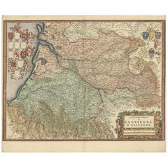
The Principality of Dombes: A 17th-Century Cartographic Jewel by Jan Jansson
$522.01
$652.5120% Off
£393.69
£492.1120% Off
€448
€56020% Off
CA$721.72
CA$902.1520% Off
A$808.45
A$1,010.5620% Off
CHF 424.63
CHF 530.7820% Off
MX$9,830.45
MX$12,288.0620% Off
NOK 5,377.14
NOK 6,721.4320% Off
SEK 5,104.36
SEK 6,380.4420% Off
DKK 3,410.47
DKK 4,263.0920% Off
About the Item
The text on the map "La principaute de Dombes; J. van den Eynde sculpit.; La Principavte de Dombes" indicates that it is a map of the principality of Dombes, engraved by J. van den Eynde (which is a Latinized name, standing for Jan van den Ende, a known engraver of the time). The map was published by Johannes Jansonius, more commonly known as Jan Jansson or Johann Jansson in Amsterdam. Jan Jansson was a famous Dutch cartographer and publisher active in the 17th century.
This original antique map has old hand-coloring on printed on strong hand pressed paper.
The Dombes region is located in what is now the eastern part of France, within the larger Auvergne-Rhône-Alpes administrative region. It is situated northeast of Lyon and is known historically for its unique form of government as a principality. Today, the area is recognized for its natural beauty, including the Dombes plateau, which is famous for its thousand ponds that have a significant ecological importance for birdlife, making it a popular spot for birdwatching.
Given that Jan Jansson lived from 1588 to 1664, the map would have been published sometime within his active years. Jansson's maps are often dated to the first half of the 17th century.
This region is also known for its historical significance. The Dombes had its own parliament and monetary system, and it was a sovereign principality until it was ceded to France in 1762.
- Dimensions:Height: 19.18 in (48.7 cm)Width: 22.05 in (56 cm)Depth: 0 in (0.02 mm)
- Materials and Techniques:Paper,Engraved
- Period:1630-1639
- Date of Manufacture:1636
- Condition:Condition: Good, given age, general age-related toning to the sheet edges, some small spots. Folding line as issued and some light offset. Dutch text on the reverse. Please study scan carefully.
- Seller Location:Langweer, NL
- Reference Number:Seller: BG-13704-11stDibs: LU3054338135382
About the Seller
5.0
Recognized Seller
These prestigious sellers are industry leaders and represent the highest echelon for item quality and design.
Platinum Seller
Premium sellers with a 4.7+ rating and 24-hour response times
Established in 2009
1stDibs seller since 2017
2,517 sales on 1stDibs
Typical response time: <1 hour
- ShippingRetrieving quote...Shipping from: Langweer, Netherlands
- Return Policy
Authenticity Guarantee
In the unlikely event there’s an issue with an item’s authenticity, contact us within 1 year for a full refund. DetailsMoney-Back Guarantee
If your item is not as described, is damaged in transit, or does not arrive, contact us within 7 days for a full refund. Details24-Hour Cancellation
You have a 24-hour grace period in which to reconsider your purchase, with no questions asked.Vetted Professional Sellers
Our world-class sellers must adhere to strict standards for service and quality, maintaining the integrity of our listings.Price-Match Guarantee
If you find that a seller listed the same item for a lower price elsewhere, we’ll match it.Trusted Global Delivery
Our best-in-class carrier network provides specialized shipping options worldwide, including custom delivery.More From This Seller
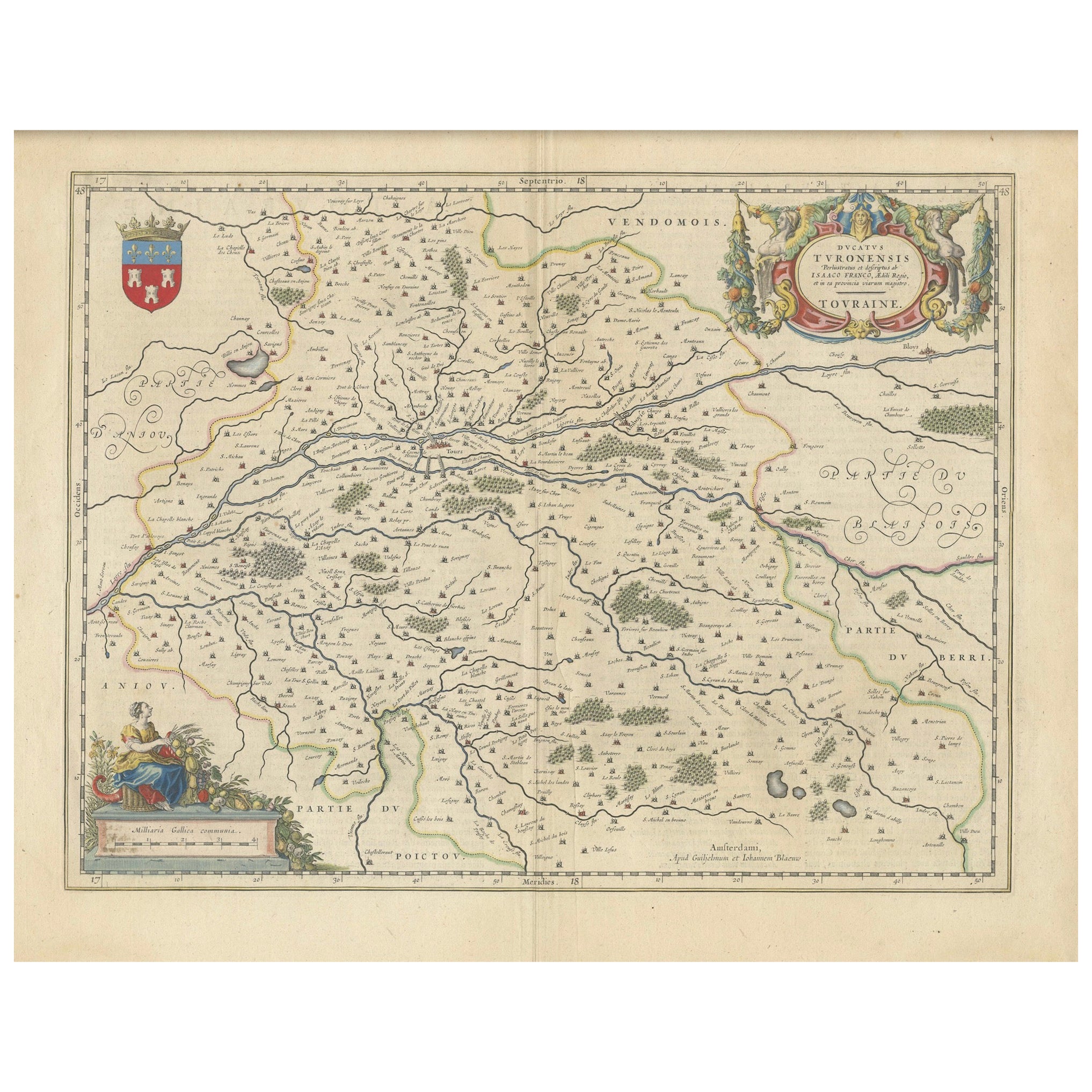
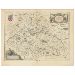
View AllCartographic Elegance of Touraine: A 17th-Century Map Showing French Heritage
Located in Langweer, NL
"Ducatus Turonensis - Touraine," is a original antique historical map of the Touraine region, which is located in the heart of France, centered...
Category
Antique 1630s Maps
Materials
Paper
$456 Sale Price
20% Off
Free Shipping
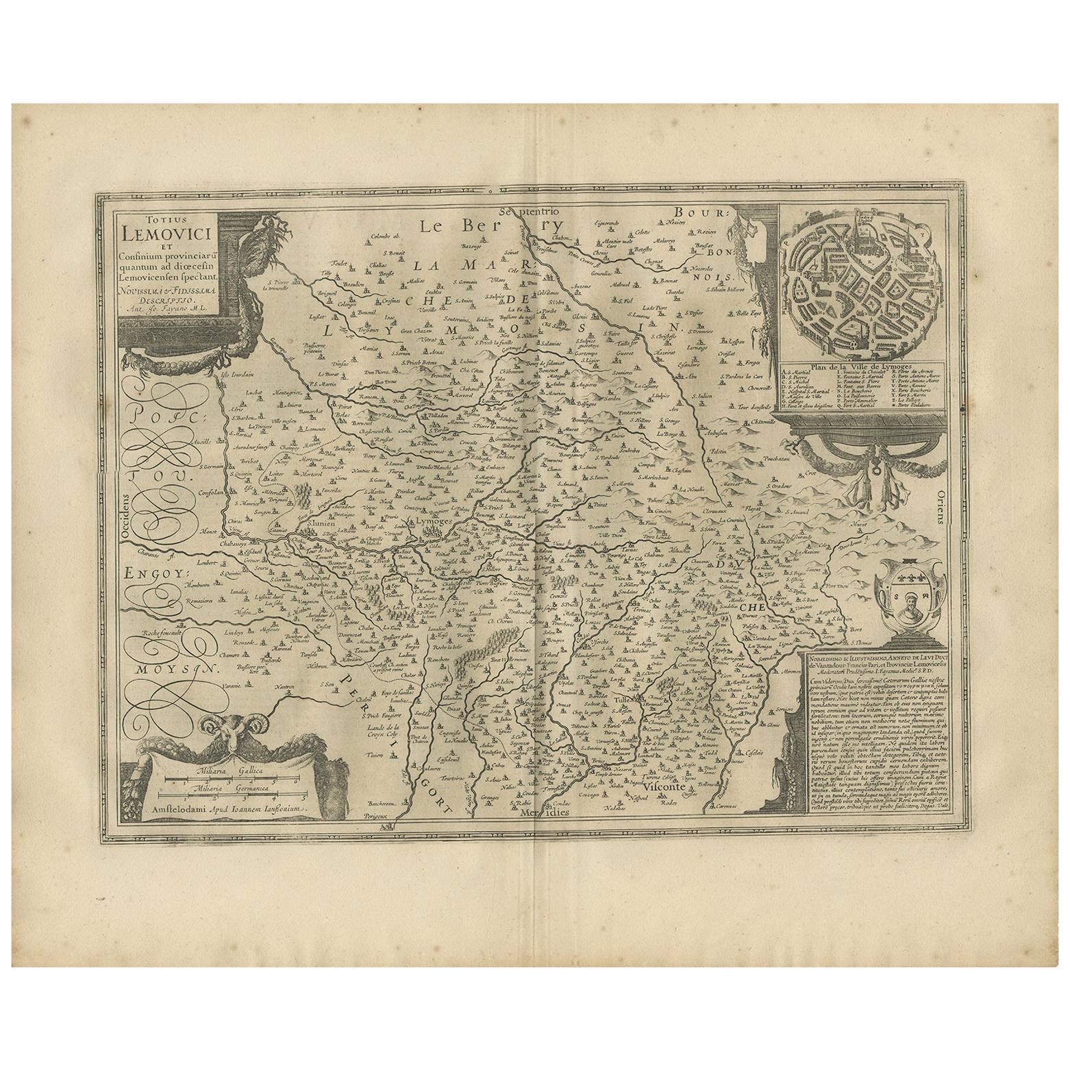
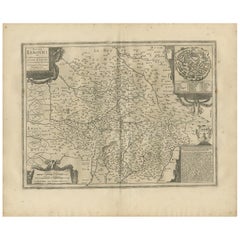
Antique Map of the Region of Limoge by Janssonius, '1657'
By Johannes Janssonius
Located in Langweer, NL
Antique map 'Totius Lemovici et consinium provinciaru quantum ad dioecesin Lemovicensen spectant'. Decorative map of the province of Limoge based on the important map of Antoin-Jean ...
Category
Antique Mid-17th Century Maps
Materials
Paper
$559 Sale Price
20% Off
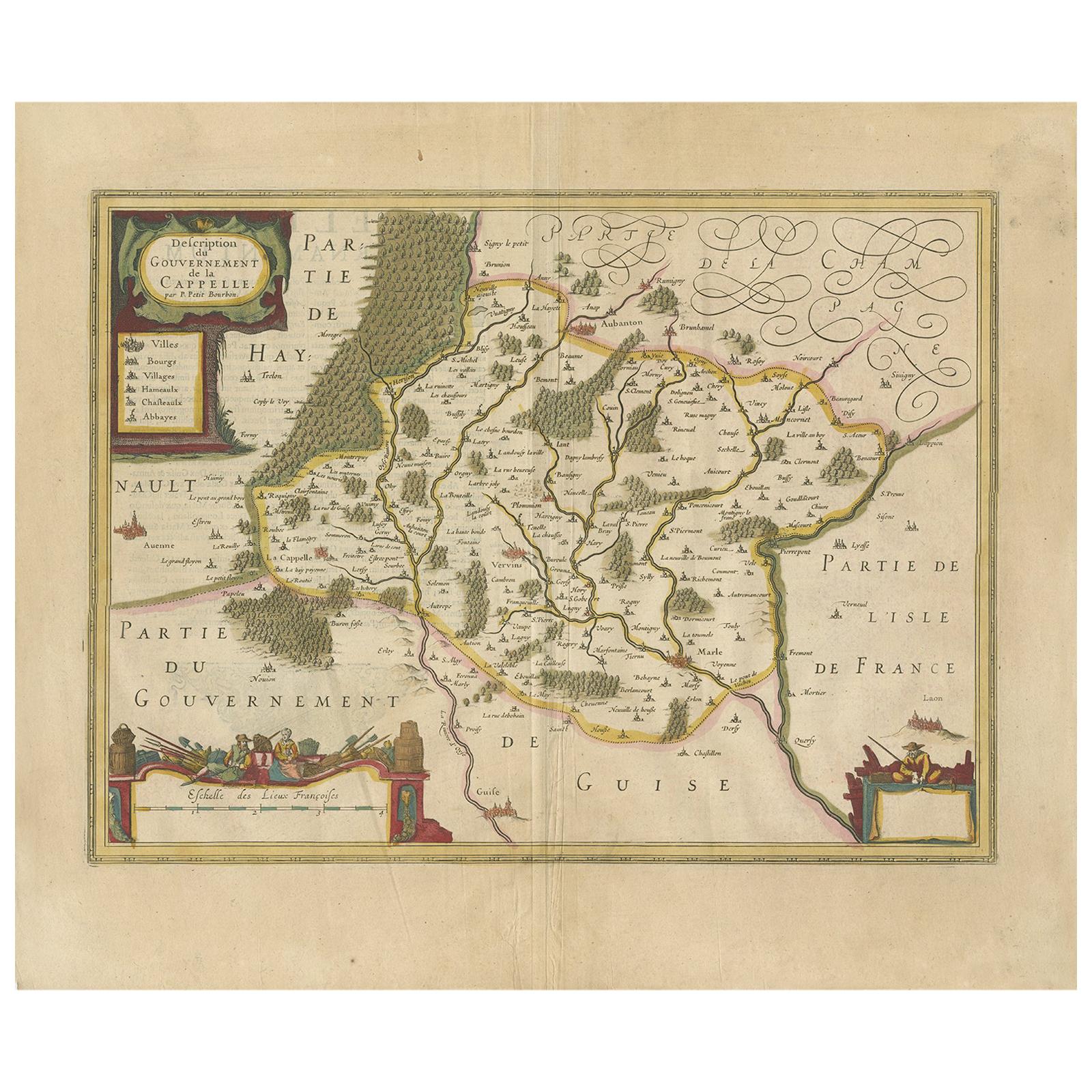
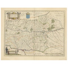
Antique Map of the Region of Hauts-de-France by Hondius, circa 1630
Located in Langweer, NL
Antique map titled 'Description du Gouvernement de la Cappelle'. Old map of the region of Hauts-de-France including the cities of Vervins, Marle, Cappelle and others. This map origin...
Category
Antique Mid-17th Century Maps
Materials
Paper

$466 Sale Price
20% Off
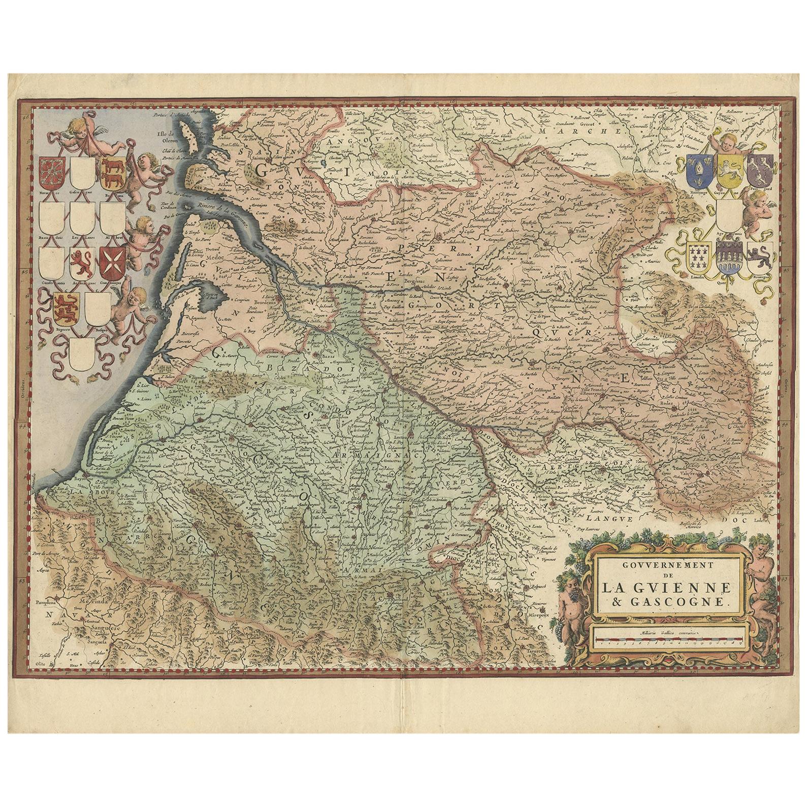
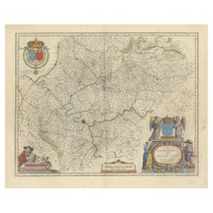
Cartographic Treasures: A Journey Through the Gascogne and Guyenne Regions, 1680
Located in Langweer, NL
The antique map titled "Gouvernement de La Guienne & Gascogne" depicts the region of Gascogne and Guyenne, known for their wine production, in France.
This map is a rare edition, u...
Category
Antique Late 17th Century Maps
Materials
Paper
$699 Sale Price
20% Off
Free Shipping
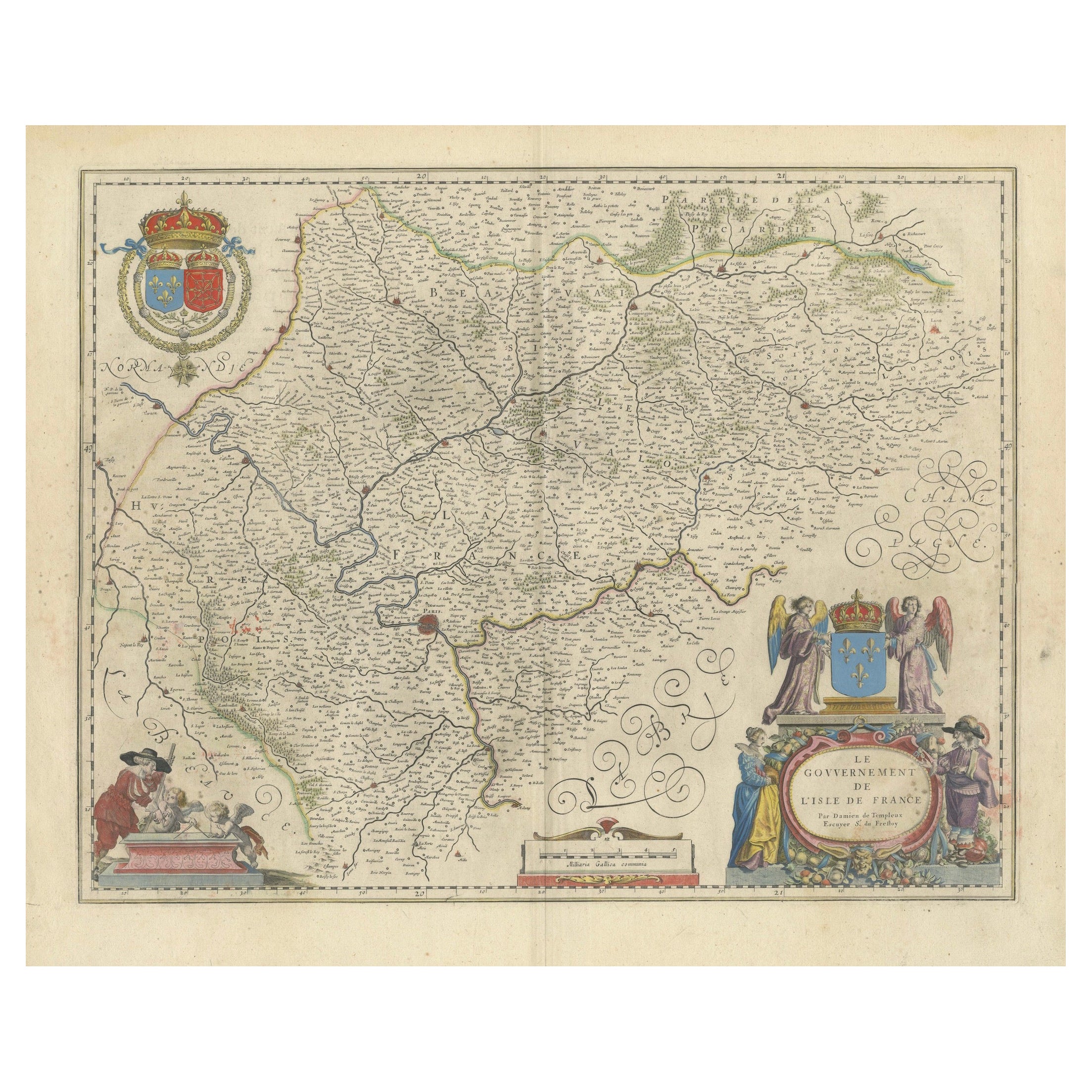
Mapping the Heart of France: Willem Blaeu's 17th Century Île-de-France, ca.1650
Located in Langweer, NL
This original antique map titled "Le Gouvernement de l'Isle de France" represents the Île-de-France region, which historically was one of the provinces of France and contained the ci...
Category
Antique 1650s Maps
Materials
Paper
$354 Sale Price
20% Off
Free Shipping
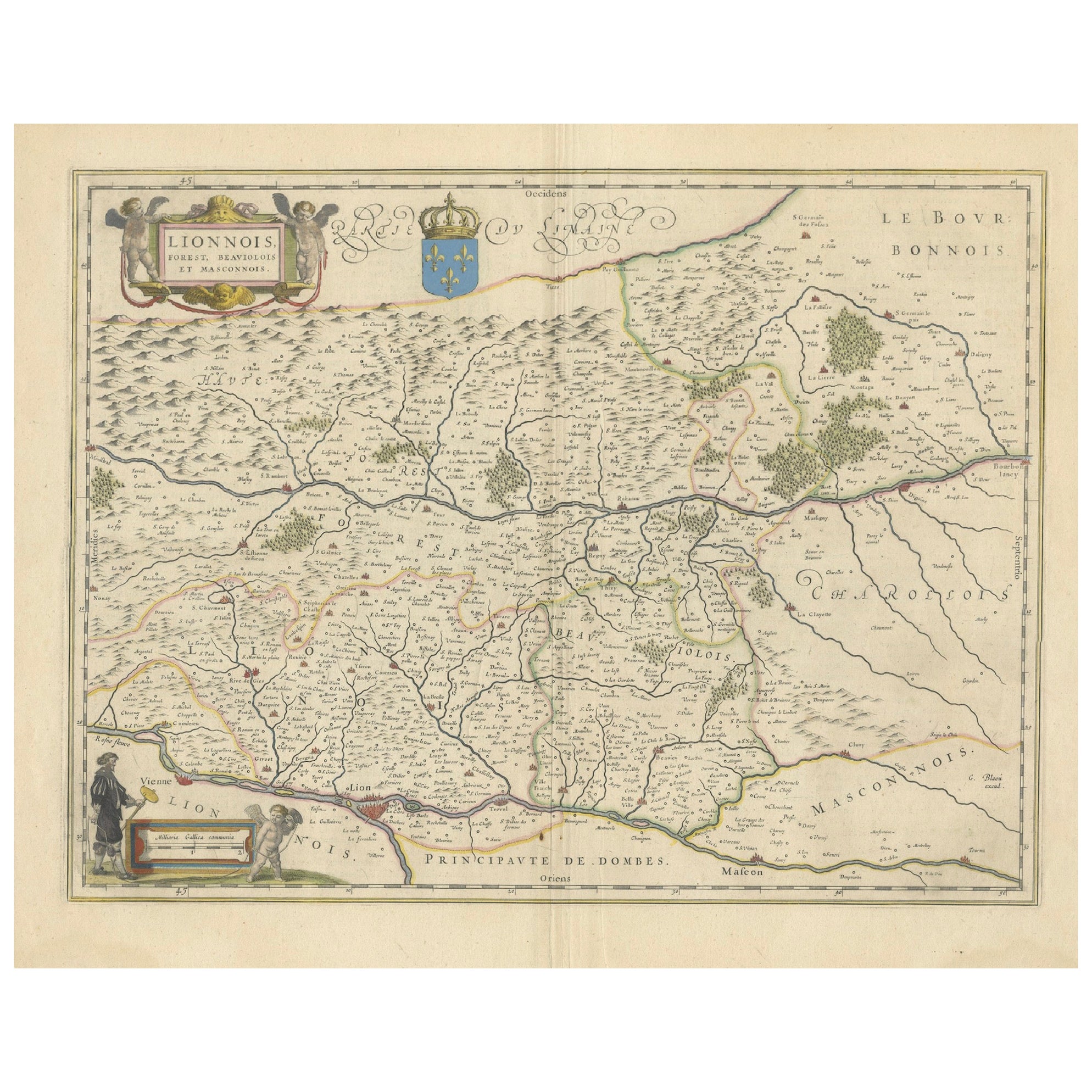
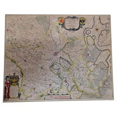
Lyonnais, Beaujolais, Forez, Mâconnais: A 1644 Depiction of France's Provinces
Located in Langweer, NL
An original antique map from 1644, depicting the French provinces of Lyonnais, Beaujolais, Forez, and Mâconnais. In this map, north is oriented to the right, which is a cartographic ...
Category
Antique 1640s Maps
Materials
Paper
$447 Sale Price
20% Off
Free Shipping
You May Also Like
1640 Flandriae Partes Duae Quarum Altera Proprietaria, Ric0016
Located in Norton, MA
1640 Willem and Joan Blaeu map entitled
"Flandriae Partes duae quarum altera Proprietaria, altera Imperialis vulgo dictur,"
Ric0016
(Mounted on Carboard)
Willem Janszoon Blaeu...
Category
Antique 17th Century Dutch Maps
Materials
Paper
1630 Pierre Petit map "Description du Gouvernement de la Capelle" Ric0010
Located in Norton, MA
1630 Pierre Petit map entitled
"Description du Gouvernement de la Capelle,"
Ric0010
Pierre Petit was the son of a minor provincial official in Montluçon. The town, in the Auver...
Category
Antique 17th Century Dutch Maps
Materials
Paper

1633 Map "La Souverainete De Sedan Et De Raucourt, Et La Prevoste Ric0011
Located in Norton, MA
1653 map entitled
"La Souverainete de Sedan et de Raucourt, et la Prevoste de Doncheri,"
Ric0011
Description:
Lovely map centered on Sedan and Doncheri and the Meuze River fr...
Category
Antique 17th Century Dutch Maps
Materials
Paper

1633 Map Entitled "Beauvaisis Comitatus Belova Cium, Ric.0002
Located in Norton, MA
1633 map entitled
"Beauvaisis Comitatus Belova Cium,"
Hand Colored
Ric.0002
Description: Cartographer : - Hondius, Henricus 1587-1638
Artists and Engravers:Jodocus Hondius, one of the most notable engravers of his time. He is known for his work in association with many of the cartographers and publishers prominent at the end of the sixteenth and the beginning of the seventeenth century. A native of Flanders, he grew up in Ghent, apprenticed as an instrument and globe maker and map engraver. In 1584, to escape the religious troubles sweeping the Low Countries at that time, he fled to London where he spent some years before finally settling in Amsterdam about 1593. In the London period he came into contact with the leading scientists and geographers of the day and engraved maps in The Mariner\\\\\\\\\\\\\\\'s Mirrour, the English edition of Waghenaer\\\\\\\\\\\\\\\'s Sea Atlas, as well as others with Pieter van den Keere, his brother-in-law. No doubt his temporary exile in London stood him in good stead, earning him an international reputation, for it could have been no accident that Speed chose Hondius to engrave the plates for the maps in The Theatre of the Empire of Great Britaine in the years between 1605 and 1610. In 1604 Hondius bought the plates of Mercator\\\\\\\\\\\\\\\'s Atlas which, in spite of its excellence, had not competed successfully with the continuing demand for the Ortelius Theatrum Orbis Terrarum. To meet this competition Hondius added about 40 maps to Mercator\\\\\\\\\\\\\\\'s original number and from 1606 published enlarged editions in many languages, still under Mercator\\\\\\\\\\\\\\\'s name but with his own name as publisher. These atlases have become known as the Mercator/Hondius series. The following year the maps were reengraved in miniature form and issued as a pocket Atlas Minor. After the death of Jodocus Hondius the Elder in 1612, work on the two atlases, folio and miniature, was carried on by his widow and sons, Jodocus II and Henricus, and eventually in conjunction with Jan Jansson in Amsterdam.
In all, from 1606 onwards, nearly 50 editions with increasing numbers of maps with texts in the main European languages were printed. Summaries of these issues are given under the entry for Gerard Mercator. Jodocus Hondius the Elder * 1588 Maps in The Mariner\\\\\\\\\\\\\\\'s Mirrour (Waghenaer/Ashley) * 1590 World Map...
Category
Antique 17th Century Dutch Maps
Materials
Paper

1590 Mercator Map Entitled "France Picardie Champaigne, Ric.0001
Located in Norton, MA
Description: Published in Amsterdam by Mercator/Hondius ca. 1590.
Ric.0001
Artists and Engravers: Map : 'France Picardie Champaigne cum regionibus adiacentibus'. (Map of the french provinces of Picardie and Champagne.) Copper engraved map of the french provinces of Picardie and Champagne, showing the cities of Caen, Paris, Melun, Auxerre, Verdun, etc. Copperplate engraving on verge type hand laid paper with watermark. Description: Published in Amsterdam by Mercator/Hondius ca. 1600.Artists and Engravers: Mercator was born in Rupelmonde in Flanders and studied in Louvain under Gemma Frisius, Dutch writer, astronomer and mathematician. The excellence of his work brought him the patronage of Charles V, but in spite of his favor with the Emperor he was caught up in the persecution of Lutheran protestants and charged with heresy, fortunately without serious consequences. No doubt the fear of further persecution influenced his move in 1552 to Duisburg, where he continued the production of maps, globes and instruments. Mercator's sons and grandsons, were all cartographers and made their contributions in various ways to his atlas. Rumold, in particular, was responsible for the complete edition in 1595. The map plates...
Category
Antique 16th Century Dutch Maps
Materials
Paper

1625 Mercator Map of the Provenience of Quercy, "Quercy Cadvrcivm Ric.0013
Located in Norton, MA
1625 Mercator map of the provenience of Quercy, entitled
"Quercy Cadvrcivm,"
Ric.0013
" Authentic" - Map of the provenience of Quercy Cadvrcivm
D...
Category
Antique 17th Century French Maps
Materials
Paper

More Ways To Browse
Jans Antiques
Antique Sovereigns
Early American Chairs
Hans Muller
Vintage Wood Table With Glass Top
19th Century Square Table
Antonio Bonet
Galle Chairs
Large Chinese Rug
1940s Vintage French Art Deco
20th Century Spanish Table
Antonio Bellini
Retro Fiberglass Furniture
Shipping Crate
Antique Oushak Carpets
Blue Coffee Tables
German Bauhaus Posters
1945 Chair Juhl