Items Similar to Rare Antique Map of Calcutta 'Kolkata' in India, 1893
Want more images or videos?
Request additional images or videos from the seller
1 of 6
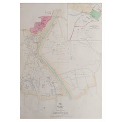
Rare Antique Map of Calcutta 'Kolkata' in India, 1893
$249.43
$311.7920% Off
£185.55
£231.9420% Off
€208
€26020% Off
CA$341.55
CA$426.9420% Off
A$379.76
A$474.7020% Off
CHF 198.29
CHF 247.8620% Off
MX$4,622.62
MX$5,778.2820% Off
NOK 2,530.10
NOK 3,162.6320% Off
SEK 2,370.58
SEK 2,963.2320% Off
DKK 1,583.39
DKK 1,979.2420% Off
Shipping
Retrieving quote...The 1stDibs Promise:
Authenticity Guarantee,
Money-Back Guarantee,
24-Hour Cancellation
About the Item
Antique map titled 'Calcutta (India)'. Old map of Calcutta/Kolkata, India. On verso, a map of Egypt, Arabia, Upper Nubia and Abyssinia. Originates from 'The Columbian World's Fair atlas'.
Artists and Engravers: The Columbian World's Fair atlas : containing complete illustrations of the World's Fair grounds and buildings, general illustrations of the public buildings, parks, monuments, street scenes, etc. of Chicago, and maps of every state and territory of the United States and Canada, and general maps of the world. Published for: Wood Brothers Cash Store.
Condition: Good, general age-related toning. Other map on verso, see item description. Please study image carefully.
Date: 1893
Overall size: 34 x 26 cm.
Image size: 31 x 22 cm.
We sell original antique maps to collectors, historians, educators and interior decorators all over the world. Our collection includes a wide range of authentic antique maps from the 16th to the 20th centuries. Buying and collecting antique maps is a tradition that goes back hundreds of years. Antique maps have proved a richly rewarding investment over the past decade, thanks to a growing appreciation of their unique historical appeal. Today the decorative qualities of antique maps are widely recognized by interior designers who appreciate their beauty and design flexibility. Depending on the individual map, presentation, and context, a rare or antique map can be modern, traditional, abstract, figurative, serious or whimsical. We offer a wide range of authentic antique maps for any budget.
- Dimensions:Height: 10.24 in (26 cm)Width: 13.39 in (34 cm)Depth: 0 in (0.01 mm)
- Materials and Techniques:
- Period:
- Date of Manufacture:1893
- Condition:
- Seller Location:Langweer, NL
- Reference Number:Seller: BGJC-002601stDibs: LU3054326084142
About the Seller
5.0
Recognized Seller
These prestigious sellers are industry leaders and represent the highest echelon for item quality and design.
Platinum Seller
Premium sellers with a 4.7+ rating and 24-hour response times
Established in 2009
1stDibs seller since 2017
2,511 sales on 1stDibs
Typical response time: <1 hour
- ShippingRetrieving quote...Shipping from: Langweer, Netherlands
- Return Policy
Authenticity Guarantee
In the unlikely event there’s an issue with an item’s authenticity, contact us within 1 year for a full refund. DetailsMoney-Back Guarantee
If your item is not as described, is damaged in transit, or does not arrive, contact us within 7 days for a full refund. Details24-Hour Cancellation
You have a 24-hour grace period in which to reconsider your purchase, with no questions asked.Vetted Professional Sellers
Our world-class sellers must adhere to strict standards for service and quality, maintaining the integrity of our listings.Price-Match Guarantee
If you find that a seller listed the same item for a lower price elsewhere, we’ll match it.Trusted Global Delivery
Our best-in-class carrier network provides specialized shipping options worldwide, including custom delivery.More From This Seller
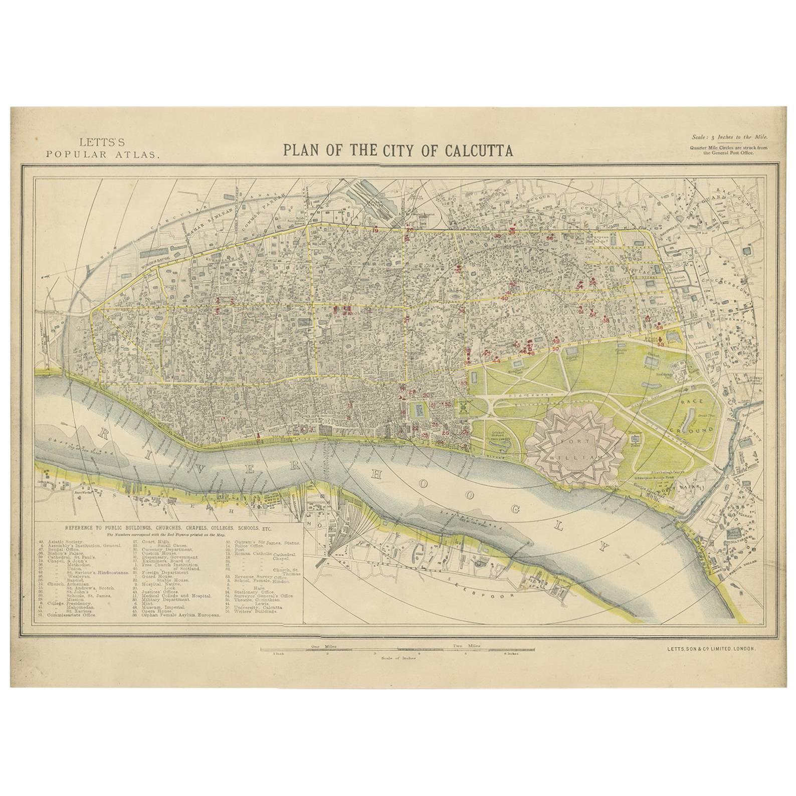
View AllAntique Plan of the City of Calcutta 'India' by Letts, 1883
Located in Langweer, NL
Beautiful colored plan showing buildings (with key), Fort William, race ground, canals, railroads, etc. This plan originates from Letts's Popular Atlas.
Category
Antique Late 19th Century Maps
Materials
Paper

$359 Sale Price
20% Off
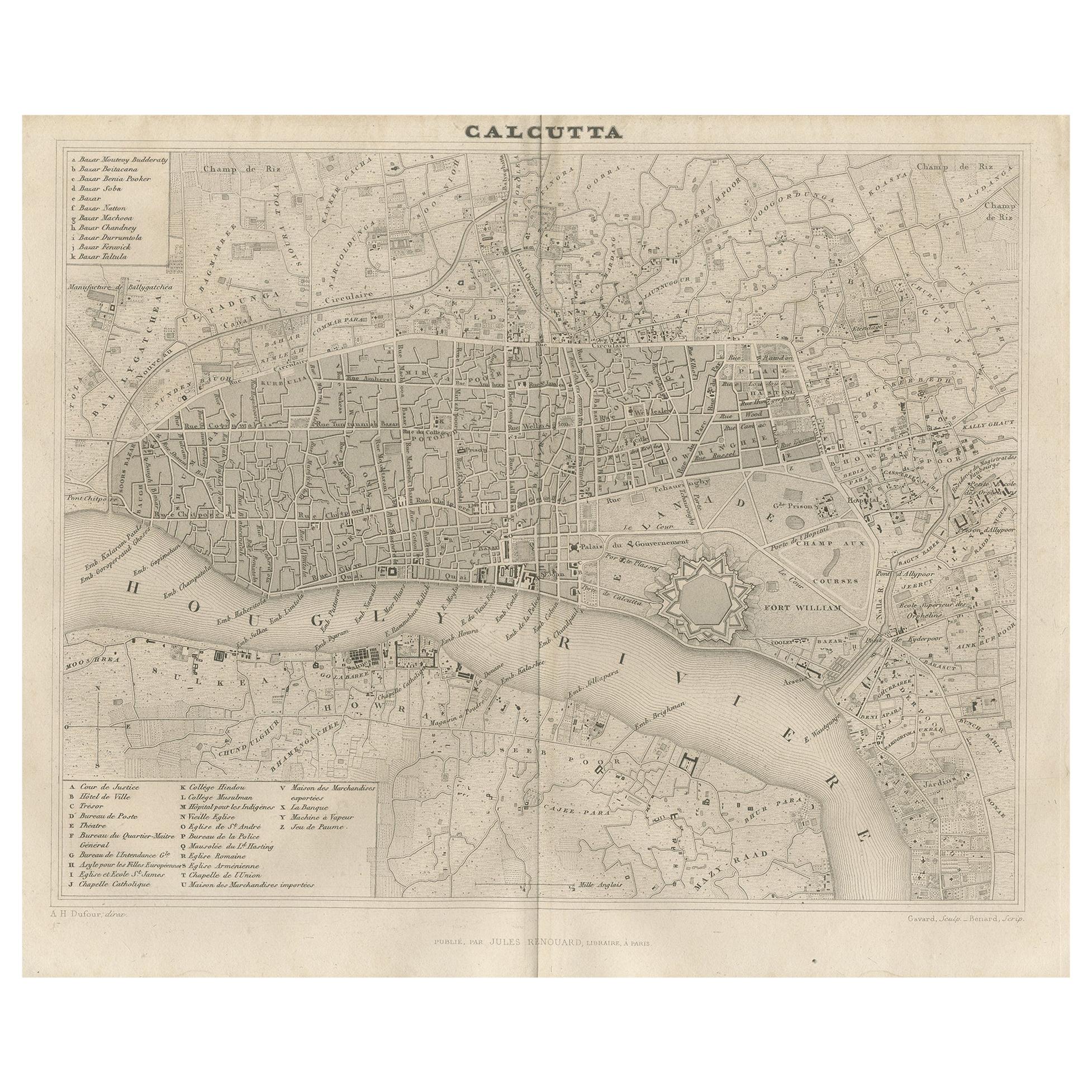
Antique Map of the City of Kolkata by Balbi '1847'
Located in Langweer, NL
Antique map titled 'Calcutta'. Original antique map of the city of Kolkata, India. This map originates from 'Abrégé de Géographie (..)' by Adrien Balbi. Published 1847.
Category
Antique Mid-19th Century Maps
Materials
Paper
$143 Sale Price
20% Off
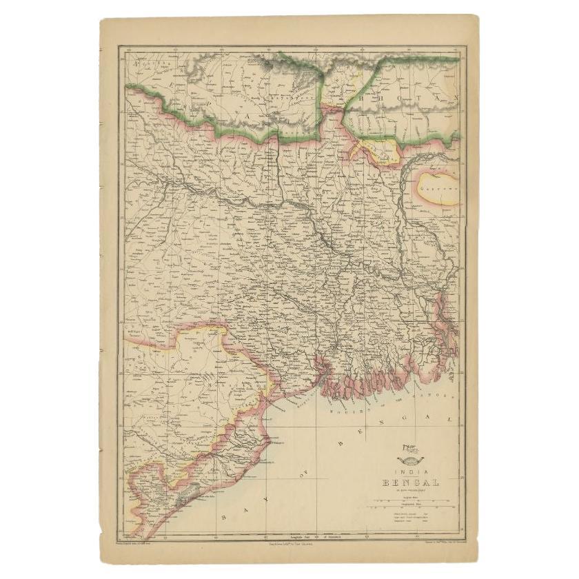
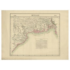
Antique Map of the Region of the Bay of Bengal, India, c.1863
By Edward Weller
Located in Langweer, NL
Antique map titled 'India Bengal'. Old map of India depicting the region near the Bay of Bengal. Originates from the 'Weekly Dispatch Atlas'.
Artist...
Category
Antique 19th Century Maps
Materials
Paper
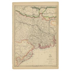
$182 Sale Price
20% Off
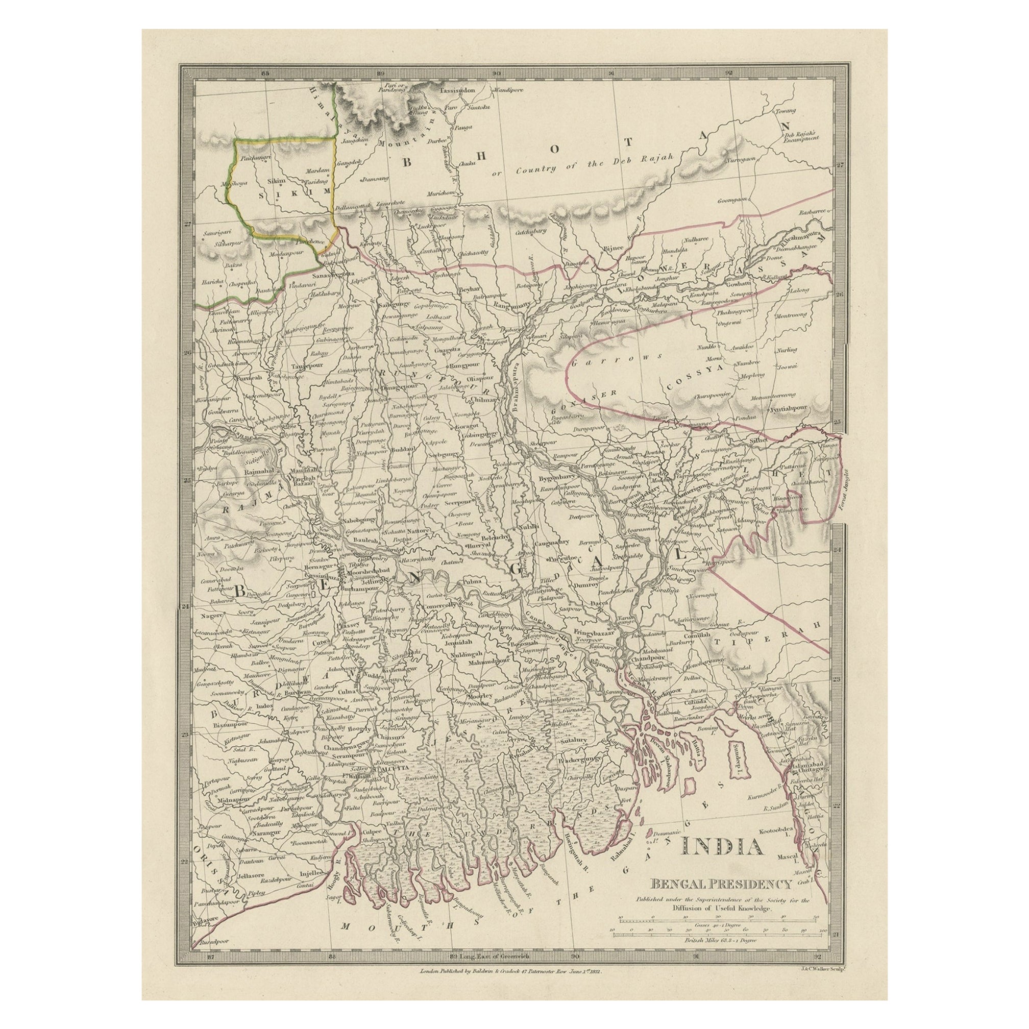
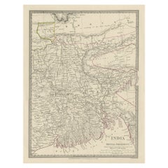
Steel Engraved Map of Part of the Bengal Presidency 'India & Bangladesh', 1831
Located in Langweer, NL
Antique map titled 'India Bengal Presidency'. Old steel engraved map of part of the Bengal Presidency. The Bengal Presidency (1757–1912), later reorganized as the Bengal Province (19...
Category
Antique 1830s Maps
Materials
Paper
$354 Sale Price
20% Off
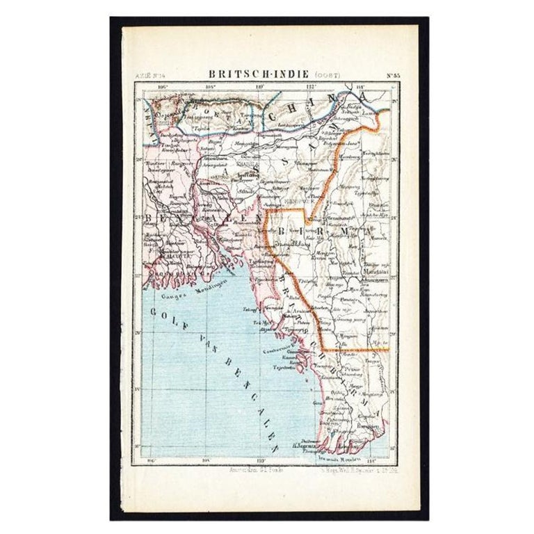
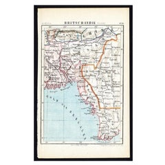
Antique Map of Eastern India by Kuyper, C.1880
Located in Langweer, NL
Plate 55 : 'Britsch-Indie, Oost.' (British Indies, East). This lithographed map originates from: 'Wereld-atlas voor Kantoor en Huiskamer' (transl: World Atlas for the office and livi...
Category
Antique 19th Century Maps
Materials
Paper
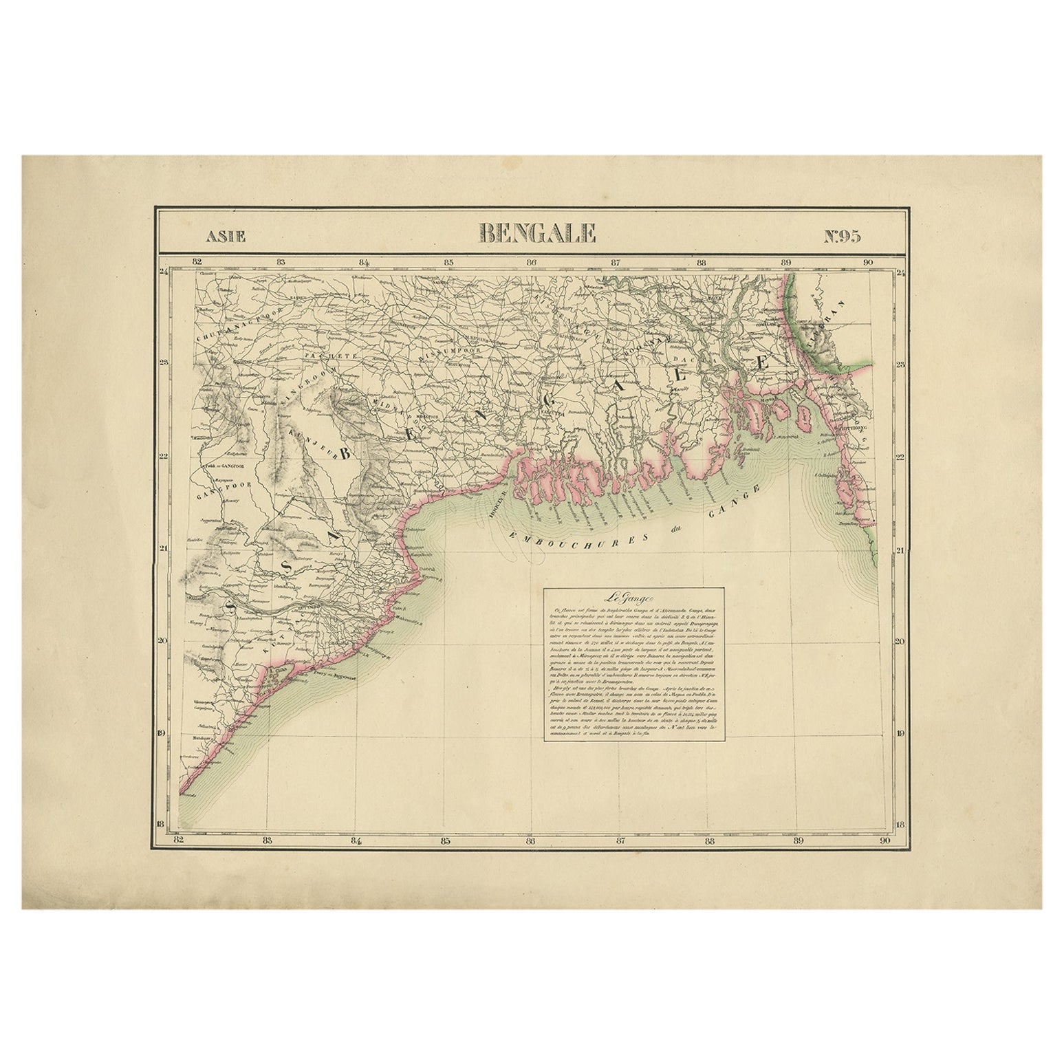
Detailed Orginal Antique Map of Bengal, India, c.1825
Located in Langweer, NL
Antique map titled 'No. 95 Bengale'. Detailed map of Bengal, Bangladesh. With text about the Ganges river. Originates from 'Atlas Universel' by P.M. Vand...
Category
Antique 19th Century Maps
Materials
Paper
$470 Sale Price
20% Off
You May Also Like
Original Antique Map of India by Dower, circa 1835
Located in St Annes, Lancashire
Nice map of India
Drawn and engraved by J.Dower
Published by Orr & Smith. C.1835
Unframed.
Free shipping
Category
Antique 1830s English Maps
Materials
Paper

Large Original Vintage Map of India, circa 1920
Located in St Annes, Lancashire
Great map of India
Original color.
Good condition / repair to some minor damage just above Sri Lanka. Shown in the last image.
Published by Alexander Gross
Unframed.
Category
Vintage 1920s English Maps
Materials
Paper

Original Antique Map of the American State of Louisiana, 1903
Located in St Annes, Lancashire
Antique map of Louisiana
Published By A & C Black. 1903
Original colour
Good condition
Unframed.
Free shipping
Category
Antique Early 1900s English Maps
Materials
Paper

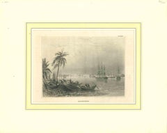
Ancient View of Calcutta - Original Lithograph - Half of the 19th Century
Located in Roma, IT
Calcutta is an original modern artwork realized in the first half of the 19th Century.
Original B/W Lithograph on Ivory Paper.
Inscripted on the lower margin in Capital Letters: ...
Category
Early 19th Century Modern Landscape Prints
Materials
Lithograph
India (Southern Sheet), English antique map by Alexander Keith Johnston, 1901
Located in Melbourne, Victoria
'India (Southern Sheet)', antique lithographic map by Keith Johnston.
Inset maps of 'Bombay Island & Town', 'Madras & Environs', and 'South-Eastern Provinces of India'.
Central vertical fold as issued.
495mm by 625mm (sheet)
Alexander Keith...
Category
Early 20th Century Victorian More Prints
Materials
Lithograph

Large Original Antique City Plan of Lucknow, India. Edward Weller, 1861
Located in St Annes, Lancashire
Great city plan of Lucknow
Lithograph engraving by Edward Weller
Original colour
Published, 1861
Unframed
Good condition / slight corner loss bottom right shown in last image
...
Category
Antique 1860s English Victorian Maps
Materials
Paper
More Ways To Browse
Antique Furniture In Chicago
Map Of Arabia
Antique Map Of Egypt
Antique Maps Of Canada
Canadian Atlas Furniture
Antique Chicago Maps
Kolkata Antique Furniture
Antique Navigator
Map Of Middle East
Antique Map Of Switzerland
World Map Copper
British Empire Map
Malaysian Antique Furniture
Birds Eye View Map
Map Of Arabia
Map Of Vienna
Old School Maps
Balinese Wood