Items Similar to Rare Engravings of Council of War in Bantam and Javanese Local Traders, 1614

Want more images or videos?
Request additional images or videos from the seller
1 of 8
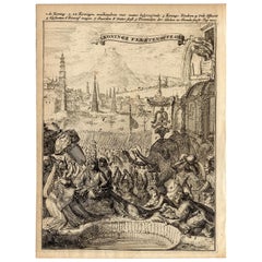
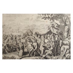
Rare Engravings of Council of War in Bantam and Javanese Local Traders, 1614
$426.81
$533.5220% Off
£319.42
£399.2820% Off
€360
€45020% Off
CA$588.83
CA$736.0320% Off
A$654.80
A$818.5020% Off
CHF 343.92
CHF 429.8920% Off
MX$8,005.60
MX$10,00720% Off
NOK 4,285.52
NOK 5,356.9020% Off
SEK 4,040.09
SEK 5,050.1120% Off
DKK 2,740.50
DKK 3,425.6220% Off
About the Item
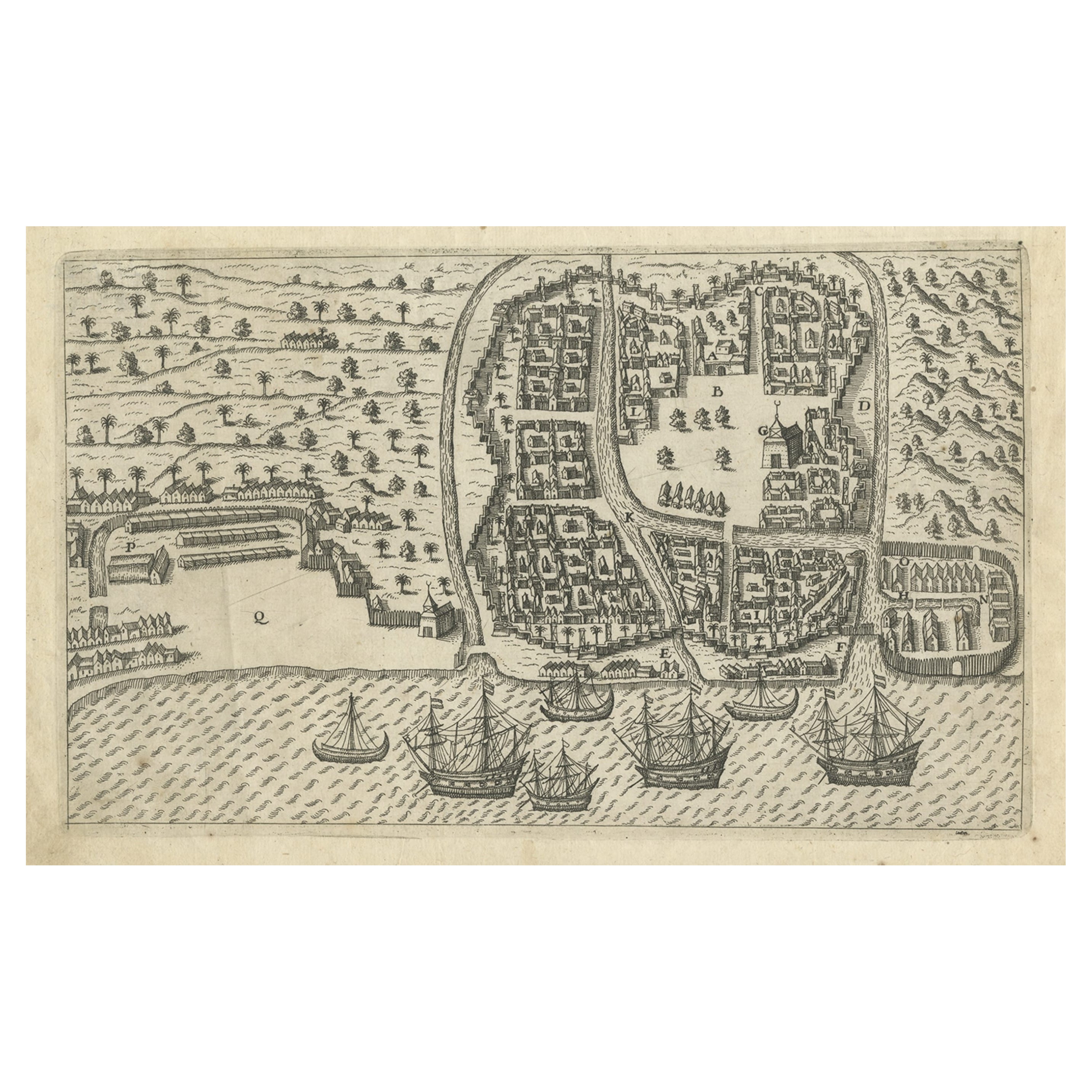
One leaf with an engraving on each site and text in old Dutch. One side shows the War Council of the locals in Bantam and the other side show some vegetables traders of Bantam.
Banten, also written as Bantam, is a port town near the western end of Java, Indonesia. It has a secure harbour at the mouth of Banten River, a navigable passage for light craft into the island's interior. The town is close to the Sunda Strait through which important ocean-going traffic passes between Java and Sumatra. Formerly Old Banten was the capital of a sultanate in the area, was strategically important and a major centre for trade. The English East India Company began to send ships to the East Indies around 1600 and established a permanent trading post at Bantam in 1603, as did the Dutch also. Aaron Baker (1610-1683) served for twenty years as President of Bantam, as is recorded on his mural monument in Dunchideock parish church, Devon. In the thirty years following 1603, the trading factories established by the English on the Coromandel Coast of India, such as those at Machilipatnam (estd. 1611) and Fort St. George (estd. 1639), reported to Bantam.
During the 17th century, the Portuguese and the Dutch fought for control of Bantam. Eventually, the fact that the Dutch found they could control their Batavia trading factory, established in 1611, more thoroughly than Bantam may have contributed to the decline of the English trading post. (Source: Wikipedia)
This leaf is from the rare Johan Isaac Pontanus & J. Hondius edition of 1614 - 'Historische beschrijvinghe der seer wijt beroemde coop-stadt Amsterdam'- which includes the text of the first voyage around the Cape to the East Indies (including a visit to Madagascar), the fight against the Portuguese on Bantam (West Java), description of Java, etc.
Creator: Anoniem / Anonymous(engraver / etcher), Lodewijcksz, Willem(copied after)
Period: 1614
Material: paper
Technique: copper engraving
Measurements sheet: 9.5 x 7 inch ( 24x18 cm)
Measurement engravings: 5.9 x 4.5 inch ( 15x11.5 cm ) each
The condition of the engravings is very good, Dutch text on verso of the leaf, but the paper is not strong. Water damage, but mostly outside the images. Study the image of the larger leaf carefully.
- Dimensions:Height: 7.09 in (18 cm)Width: 9.45 in (24 cm)Depth: 0 in (0.02 mm)
- Materials and Techniques:
- Period:Early 17th Century
- Date of Manufacture:1614
- Condition:
- Seller Location:Langweer, NL
- Reference Number:Seller: BG-13098-51stDibs: LU3054325981502
About the Seller
5.0
Recognized Seller
These prestigious sellers are industry leaders and represent the highest echelon for item quality and design.
Platinum Seller
Premium sellers with a 4.7+ rating and 24-hour response times
Established in 2009
1stDibs seller since 2017
2,609 sales on 1stDibs
Typical response time: <1 hour
- ShippingRetrieving quote...Shipping from: Langweer, Netherlands
- Return Policy
Authenticity Guarantee
In the unlikely event there’s an issue with an item’s authenticity, contact us within 1 year for a full refund. DetailsMoney-Back Guarantee
If your item is not as described, is damaged in transit, or does not arrive, contact us within 7 days for a full refund. Details24-Hour Cancellation
You have a 24-hour grace period in which to reconsider your purchase, with no questions asked.Vetted Professional Sellers
Our world-class sellers must adhere to strict standards for service and quality, maintaining the integrity of our listings.Price-Match Guarantee
If you find that a seller listed the same item for a lower price elsewhere, we’ll match it.Trusted Global Delivery
Our best-in-class carrier network provides specialized shipping options worldwide, including custom delivery.More From This Seller
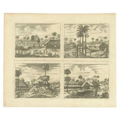
View AllAntique Engravings of Mauritius and Indonesia, incl de Banda Islands, c.1730
Located in Langweer, NL
Title on page: "Ins. de Cerno a. Nostatibus Mauritius Nominata [on sheet with] Gunnanappi Labetacq [and] Civitas Gammelamme [and] Rex Tubatus", Le Clerc, Jean
This sheet includes fo...
Category
Antique 1730s Maps
Materials
Paper
$521 Sale Price
20% Off
Antique Print of Bantam, Java, Indonesia by De Bry, c.1610
Located in Langweer, NL
Untitled print of Bantam, former city and sultanate of Java, Indonesia. It lay near the site of the present-day city of Banten, on Banten Bay, at the extreme northwest of the island....
Category
Antique 17th Century Prints
Materials
Paper
$360 Sale Price
20% Off
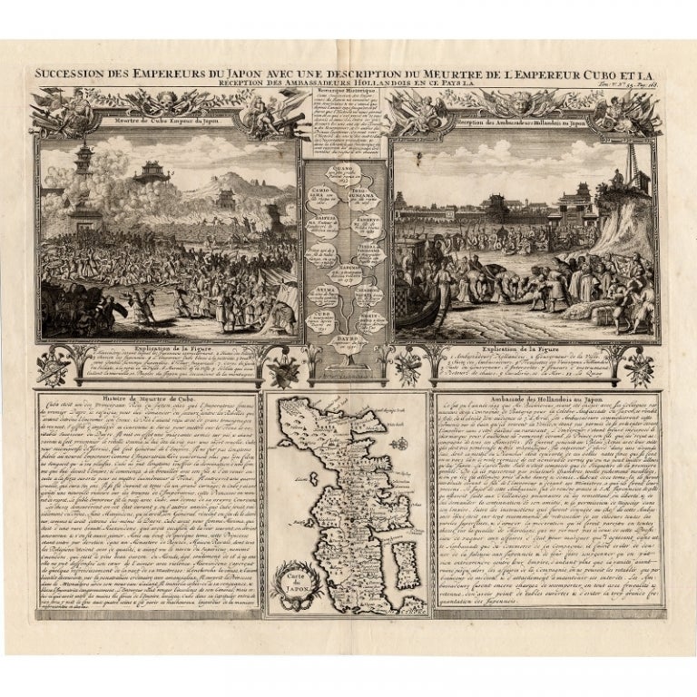
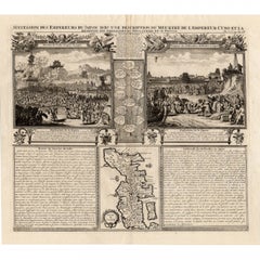
Antique Engravings of Japan incl a Map and the Arrival of the Dutch, 1732
Located in Langweer, NL
Original antique print titled 'Succession des Empereurs du Japon avec une Description de Meurtre de l'Empereur Cubo et la Reception des Ambassadeurs Hollandois en ce Pays la'. It sho...
Category
Antique 18th Century French Prints
Materials
Paper
$569 Sale Price
36% Off
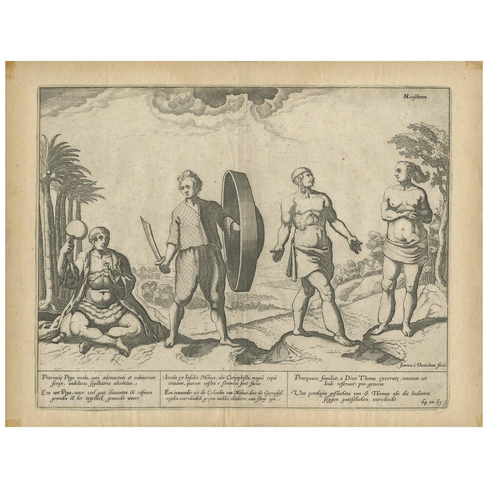
Antique Print of Natives of Southern Asia by Linschoten, circa 1605
By Jan Huygen van Linschoten
Located in Langweer, NL
Antique print titled 'Provincie Pegu incola (..) - Incola ex Insulis Moluco (..) - Penequais familiae (..)'. Old print showing various figures including a man from Pegu, a man from the Moluccan islands, Penequais Indians and inhabitants of S. Thomas. Illustration from an edition of Linschoten's Itinerario. This work informed Europeans of the 16th century Portuguese trade and navigation in southern Asia.
Category
Antique Early 17th Century Prints
Materials
Paper

$189 Sale Price
20% Off
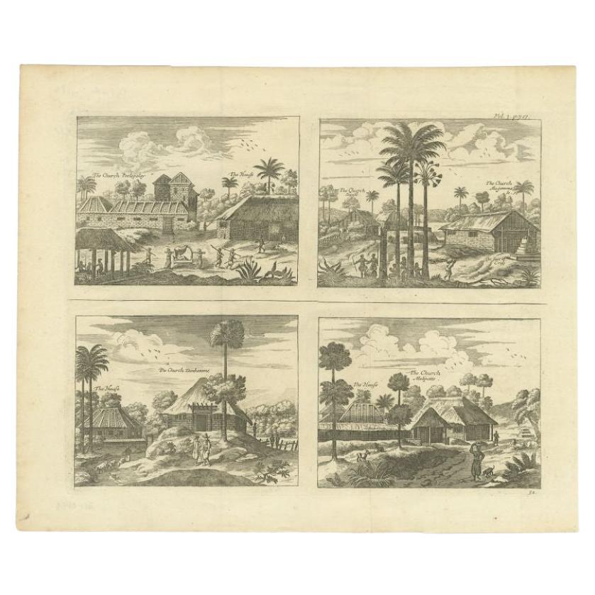
Original Antique Engravings of Various Churches on Ceylon 'Sri Lanka', 1732
Located in Langweer, NL
Antique print titled 'The Church Poelepolay, The Church Mogommate, The church Tambamme, the Church Mulipatto'. Antique print with four views of the churches of Poelepolay, Mogommate,...
Category
Antique 18th Century Prints
Materials
Paper
$284 Sale Price
20% Off
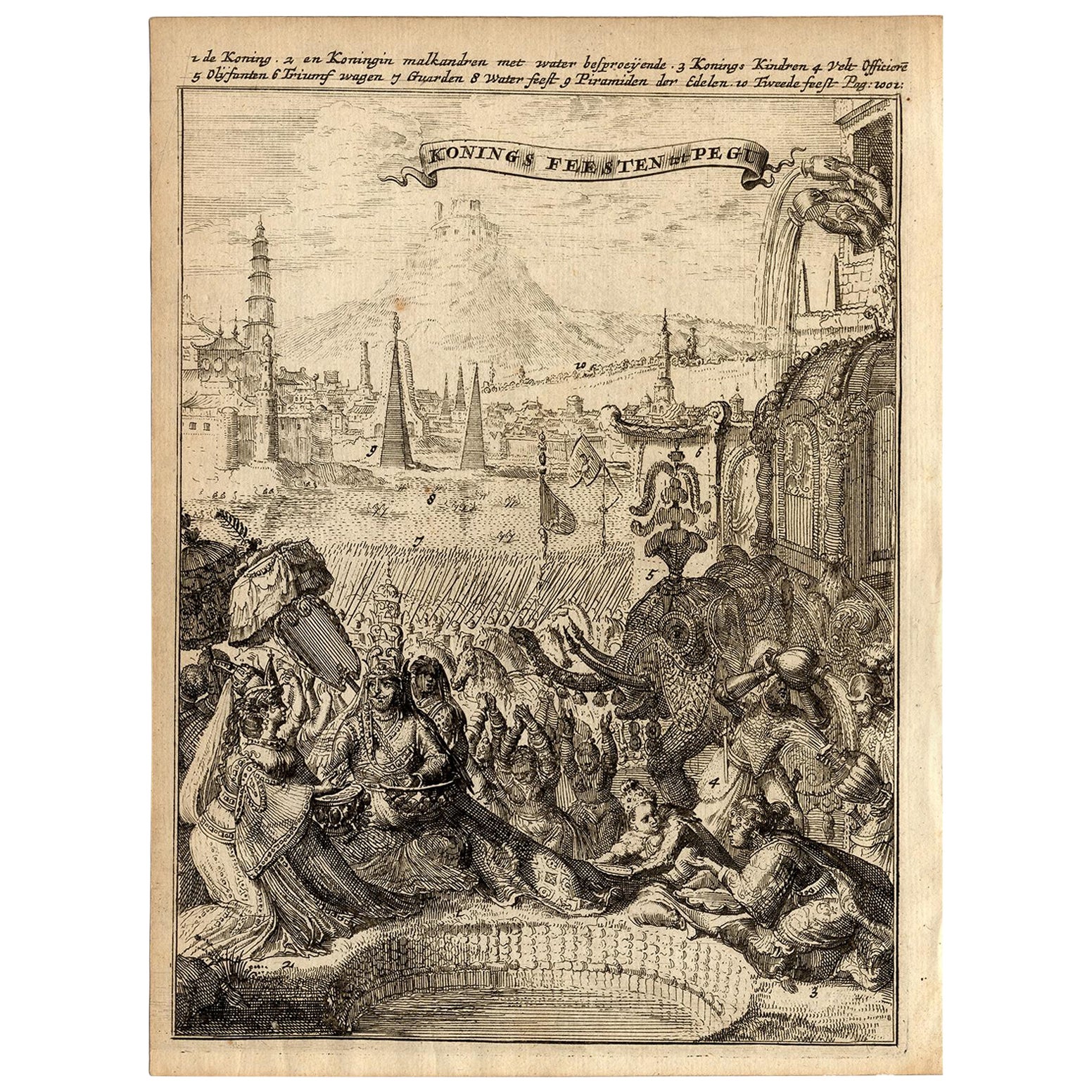
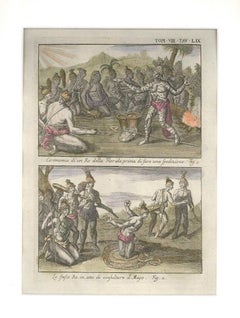
Very Rare Antique Print of the Kings Celebrations in Pegu, Myanmar, 1682
Located in Langweer, NL
Plate: 'Konings feesten tot Pegu.' (Kings celebrations in Pegu.)
On this plate: 1. The King. 2. And the Queen, sprinkling water on each other. 3. Their children. 4. Officers. 5. ...
Category
Antique 1680s Prints
Materials
Paper
$436 Sale Price
20% Off
You May Also Like
Antique Voc Print Holland Malaysia Old Map Melaka History, 1663
Located in Amsterdam, Noord Holland
From my own collection I offer this impressive Antique print of the city of Malakka
A very interesting piece for collectors . It is an museum piece from the Dutch Institute of Orien...
Category
Antique 17th Century European Paintings
Materials
Paper

$293 Sale Price
20% Off
Original Antique Print After Jan Luyken, Amsterdam, Genesis XXXI, 1724
Located in St Annes, Lancashire
Wonderful copper-plate engraving after Jan Luyken
Published by Marten Schagen, Amsterdam. 1724
Text on verso
The measurement given is the paper size.
Category
Antique 1720s Dutch Renaissance Prints
Materials
Paper
Tabula Indiae Orientalis - Etching by Frederick de Wit - 1680ca
By Frederick de Wit
Located in Roma, IT
This double-page etching with contemporary coloring, entitled Tabula Indiae orientalis, was realized by the cartographer Frederick de Wit for the famous Atlas published in Amsterdam ...
Category
1680s Modern Figurative Prints
Materials
Etching

Ceremonies of a Floridian King - Etching by G. Pivati - 1746-1751
By Gianfrancesco Pivati
Located in Roma, IT
Image dimensions: 25.5 x 18 cm.
Ceremonies of a Floridian King is a fine etching, hand-watercolored, realized by the engraver Gianfrancesco Pivati.
This original print, representi...
Category
1740s Old Masters Figurative Prints
Materials
Etching
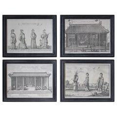
18th Century Ethnographic Interest Asian Natives & Temples Framed Engravings
Located in Lowestoft, GB
A collection of four late 18th century engravings of local tribes and temples from the Asian continent, printed by Nathaniel Parr and James Basire.
Later housed in 19th century ebon...
Category
Antique Late 18th Century English Prints
Materials
Glass, Pine, Paper
Collection of Colonial Drawings Depicting Indonesia by J.G. Sinia '1875-1948'
Located in Amsterdam, NL
A Collection of Thirteen Ink and Chalk Drawings by Johan Gerard Sinia (1875-1948)
All framed in gilt-metal or giltwood frames
Sinia started his professional career as an army off...
Category
Early 20th Century Indonesian Dutch Colonial Paintings and Screens
Materials
Other
$29,639 / set
Free Shipping
More Ways To Browse
East India Trading Company
Antique Maps West Indies
Dutch Church Interior
Cape Dutch Furniture
George Baker
Bakers Island
Map Of Madagascar
Framed Map Of Paris
Used Nautical Charts
Antique Navigator
Map Of Middle East
Antique Map Of Switzerland
World Map Copper
British Empire Map
Malaysian Antique Furniture
Birds Eye View Map
Map Of Arabia
Map Of Vienna