Items Similar to Antique Engravings of Japan incl a Map and the Arrival of the Dutch, 1732
Want more images or videos?
Request additional images or videos from the seller
1 of 7
Antique Engravings of Japan incl a Map and the Arrival of the Dutch, 1732
About the Item
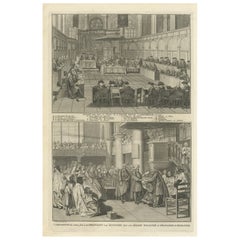
Original antique print titled 'Succession des Empereurs du Japon avec une Description de Meurtre de l'Empereur Cubo et la Reception des Ambassadeurs Hollandois en ce Pays la'. It shows: a central table of the succession of Japanese Emperors, a map of (part of modern-day) Japan, and two engravings: the death of Cubo, and the Dutch ambassador's arrival in Japan. The 2 engravings derived from Montanus: the murder of Emperor Cubo in a rebellion in 1564 and the arrival of Dutch Ambassadors in Japan 1644. This original old antique print / plate originates from the fifth volume of: 'Atlas Historique...' (Historic Atlas...), Published by Zacharie Chatelain, Amsterdam, 1732. The atlas was published in seven volumes between 1705 and 1720, with a second edition appearing in 1732. The maps were accompanied by information pertaining to cosmography, geography, history, chronology, genealogy, topography, heraldry, and costumes of the world. The maps in the Atlas Historique were mainly based on those of the French cartographer, Guillaume De L'Isle, but were presented by the Chatelains in an encyclopaedic form. We do not know the exact edition of this map.
When formal trade relations were established in 1609 by requests from Englishman William Adams, the Dutch were granted extensive trading rights and set up a Dutch East India Company trading outpost at Hirado. They traded exotic Asian goods such as spices, textiles, porcelain, and silk. When the Shimabara uprising of 1637 happened, in which Christian Japanese started a rebellion against the Tokugawa shogunate, it was crushed with the help of the Dutch. As a result, all Christian nations who gave aid to the rebels were expelled, leaving the Dutch the only commercial partner from the West. Among the expelled nations was Portugal who had a trading post in Nagasaki harbor on an artificial island called Dejima. In a move of the shogunate to take the Dutch trade away from the Hirado clan, the entire Dutch trading post was moved to Dejima. Dejima (Japanese: ??, "exit island") was a Portuguese and subsequently Dutch trading post at Nagasaki, Japan, from 1634 to 1854. Dejima was also the location for trade with the Chinese at the time, and thus the only place designated for foreign trade and exchange during the historical Japanese Edo period. (Source: Wikipedia)
Artists and Engravers: Henri Abraham Chatelain (1684-1743), his father Zacharie Chatelain (d.1723) and Zacharie Junior (1690-1754), worked as a partnership publishing the Atlas Historique, Ou Nouvelle Introduction A L'Histoire under several different Chatelain imprints, depending on the Chatelain family partnerships at the time of publication.
Condition: Very good, given age. Original folds from binding with some paper separation at lower fold all backed and restored. General age-related light toning and minimal staining from handling. Some creasing. Paper edges a bit irregular as issued and with ocassional chipping. Please study image carefully.
Date: 1732
Overall size: 47.5 x 42.5 cm.
Image size: 44.5 x 38.5 cm.
We sell original antique maps to collectors, historians, educators and interior decorators all over the world. Our collection includes a wide range of authentic antique maps from the 16th to the 20th centuries. Buying and collecting antique maps is a tradition that goes back hundreds of years. Antique maps have proved a richly rewarding investment over the past decade, thanks to a growing appreciation of their unique historical appeal. Today the decorative qualities of antique maps are widely recognized by interior designers who appreciate their beauty and design flexibility. Depending on the individual map, presentation, and context, a rare or antique map can be modern, traditional, abstract, figurative, serious or whimsical. We offer a wide range of authentic antique maps for any budget.
- Dimensions:Height: 16.74 in (42.5 cm)Width: 18.71 in (47.5 cm)Depth: 0 in (0.01 mm)
- Materials and Techniques:
- Period:
- Date of Manufacture:1732
- Condition:
- Seller Location:Langweer, NL
- Reference Number:
About the Seller
5.0
Platinum Seller
These expertly vetted sellers are 1stDibs' most experienced sellers and are rated highest by our customers.
Established in 2009
1stDibs seller since 2017
1,933 sales on 1stDibs
Typical response time: <1 hour
- ShippingRetrieving quote...Ships From: Langweer, Netherlands
- Return PolicyA return for this item may be initiated within 14 days of delivery.
More From This SellerView All
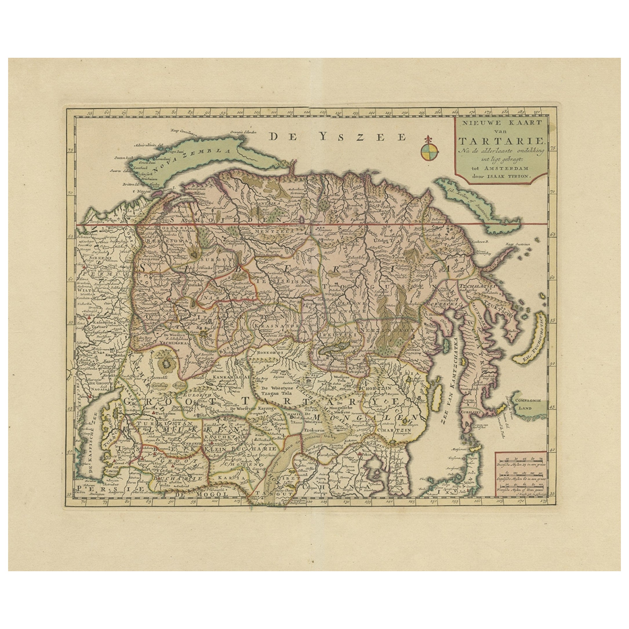
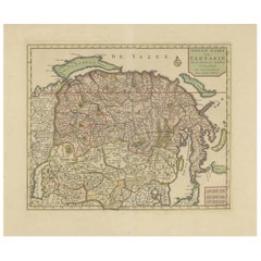
- Antique Map of Siberia and Chinese Tartary, Incl Nova Zembla, ca.1732Located in Langweer, NLAntique map of Tartary titled 'Nieuwe Kaart van Tartarie na de alderlaatste ondekking int ligt gebracht tot Amsterdam door Isaak Tirion'. Map op Siberia and Chinese tartary. In t...Category
Antique 1730s Maps
MaterialsPaper
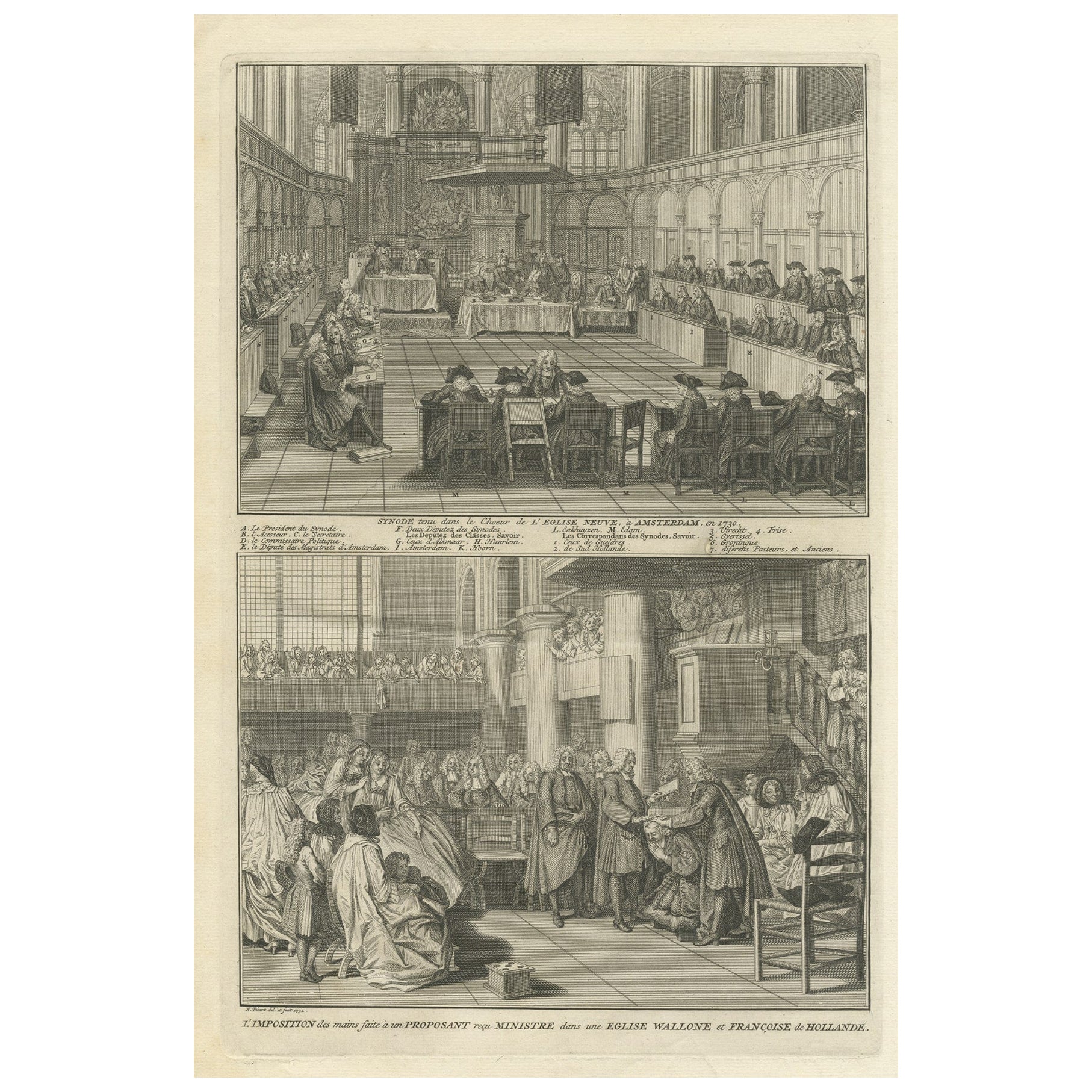
- Engraving of a Meeting of the Dutch Synode in Amsterdam, The Netherlands, 1732Located in Langweer, NLAntique print titled 'Synode tenu dans le Choeur (..)'. Old print of a meeting of the Dutch Synode in 'De Nieuwe Kerk' in Amsterdam, The Netherlands in 1730. Also depicted the accept...Category
Antique 18th Century Prints
MaterialsPaper
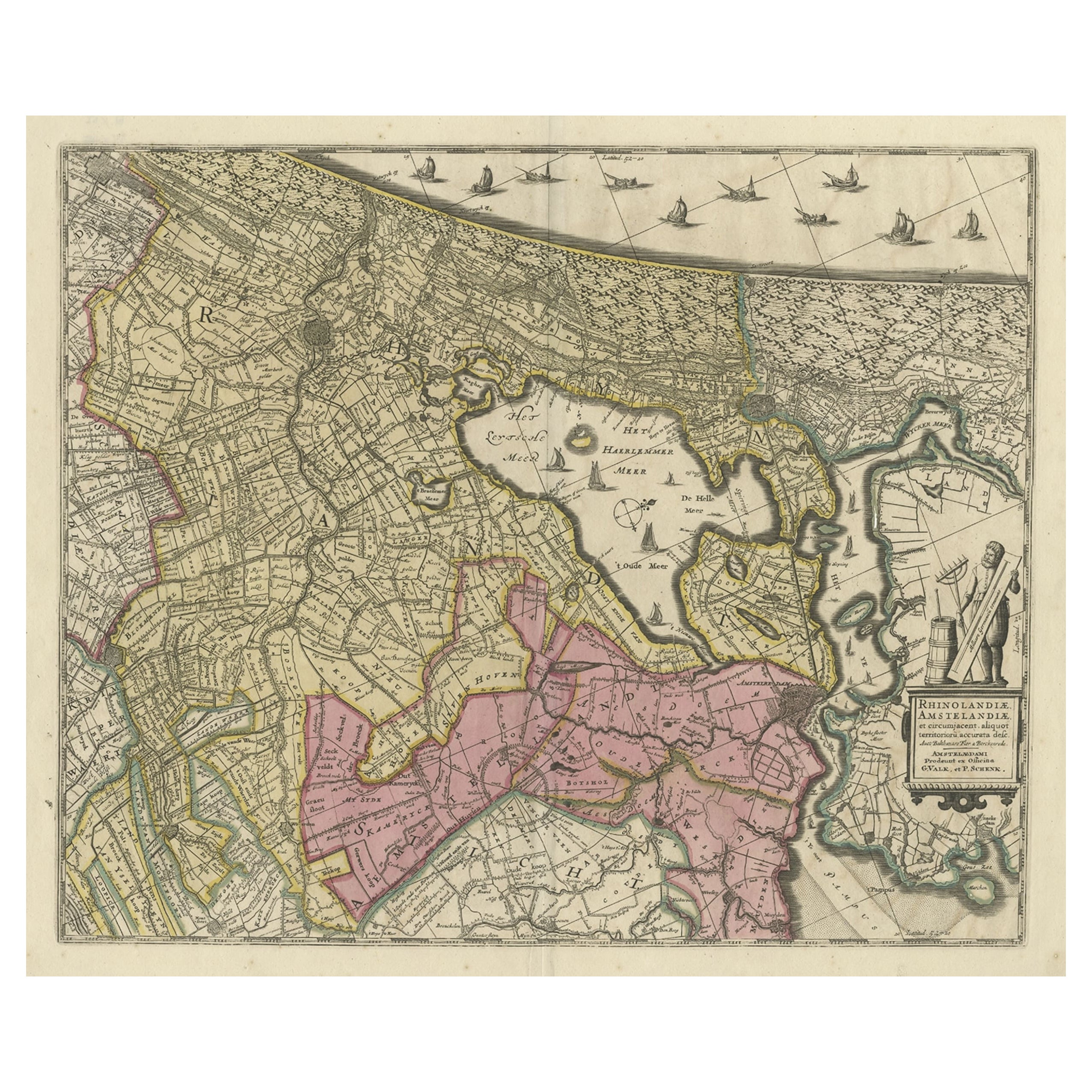
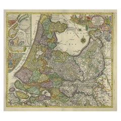
- Original Antique Map of the Netherlands Incl Amsterdam, Leiden and Haarlem, 1700Located in Langweer, NLAntique map titled ‘Rhinolandiae Amsterlandiae et circumjacent (..)’. Map of the regions of Rijnland and Amstelland in the Netherlands, including the cities of Amsterdam, Leiden ...Category
Antique Early 1700s Maps
MaterialsPaper
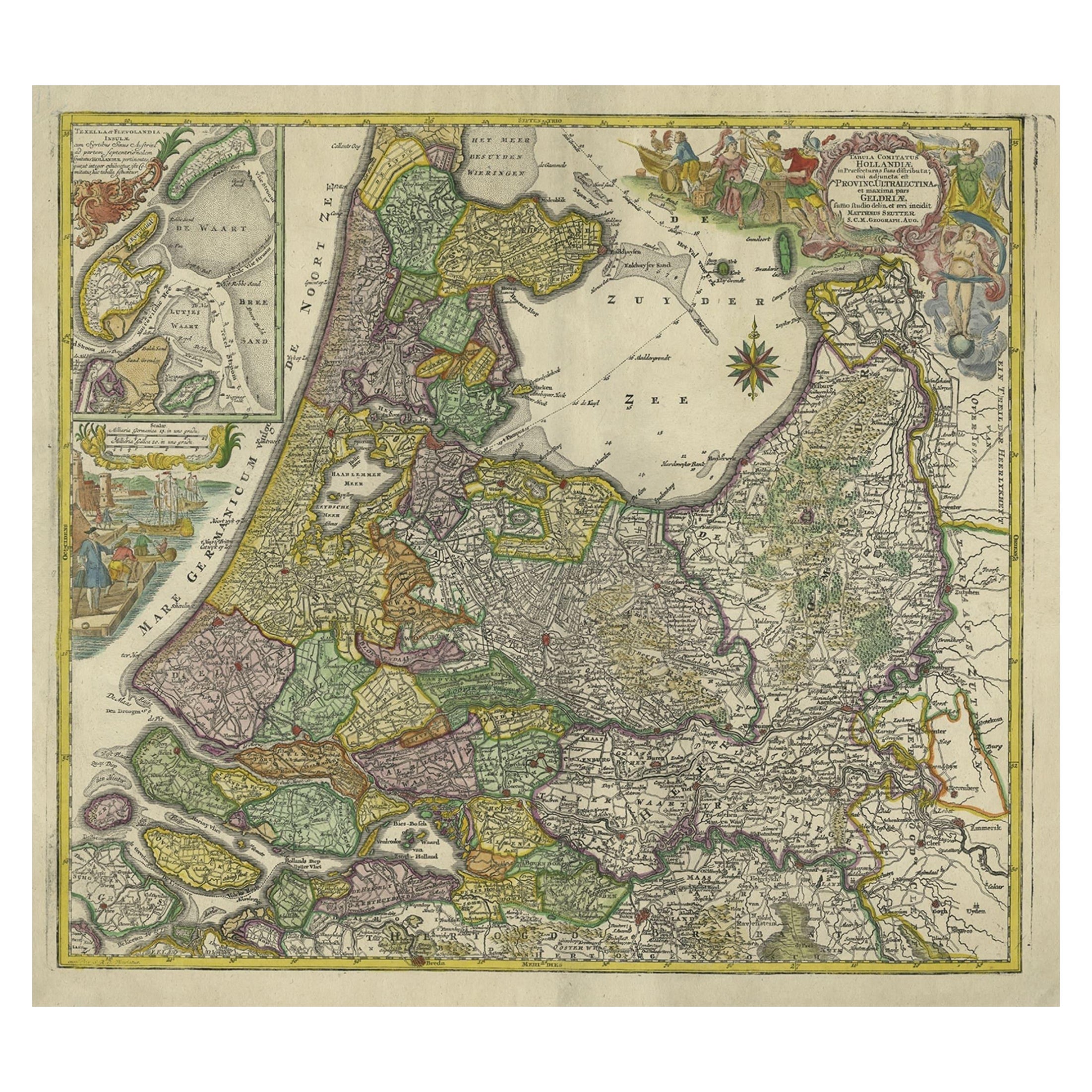
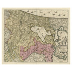
- Antique Map of the Northwestern Netherlands, incl Texel and Vlieland, ca.1741Located in Langweer, NLAntique print, titled: 'Tabula Comitatus Hollandiae in Praefecturas sua distributa; cui adjuncta est Provinc. Ultraiectina et maxima pars Geldriae summo studio delin. Et aeri incidit...Category
Antique 1740s Maps
MaterialsPaper
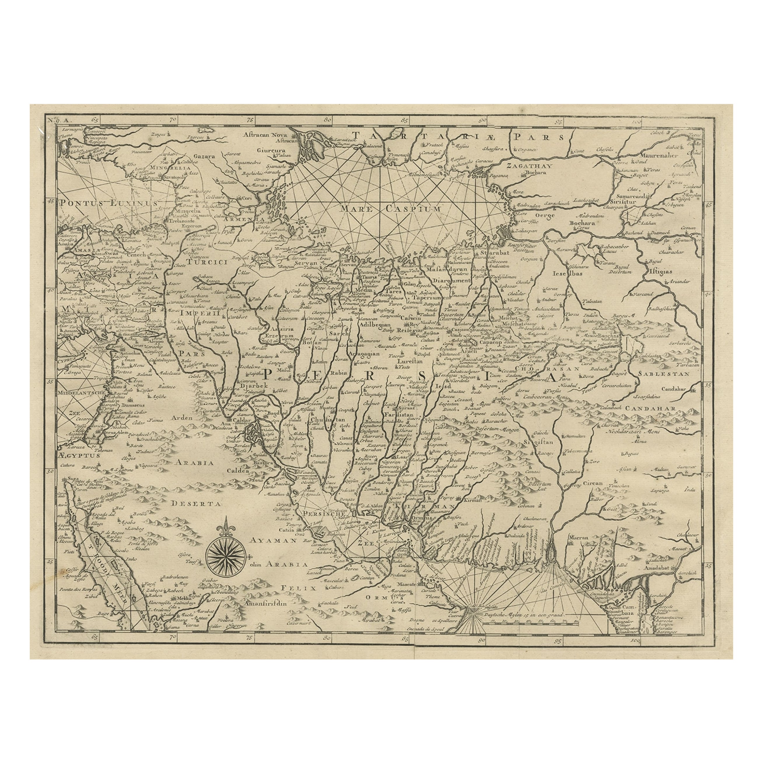
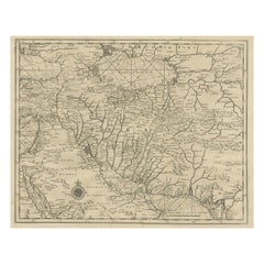
- Rare Antique Map of Persia, Incl the Caspian Sea and the Arabian Peninsula, 1726Located in Langweer, NLRare untitled antique map of Persia. It covers from the Gulf of Suez eastward to Ahmedabad (Amadabad) in modern day western India. This map, centered on Persia, includes the Caspian Sea and part of the Arabian Peninsula...Category
Antique 1720s Maps
MaterialsPaper
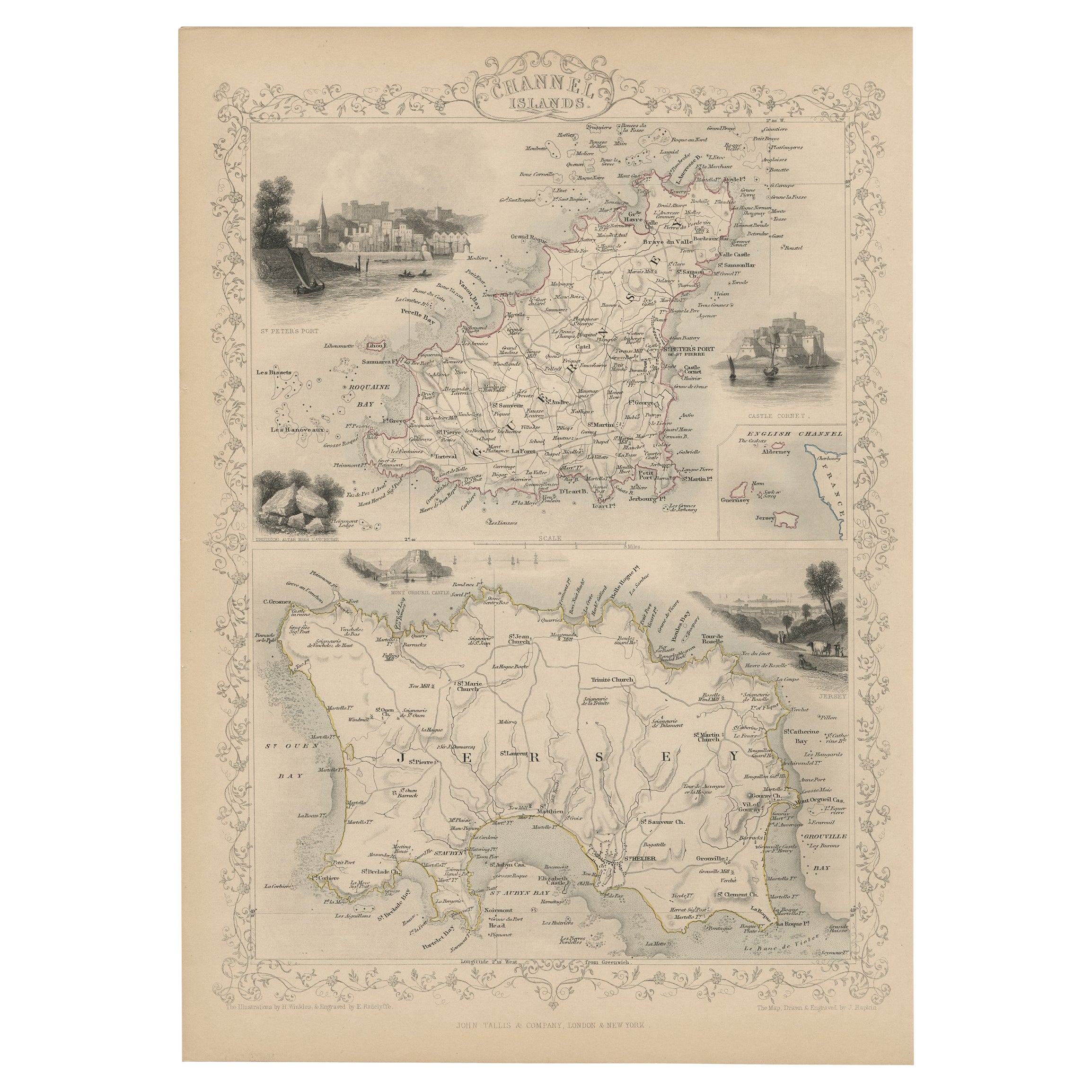
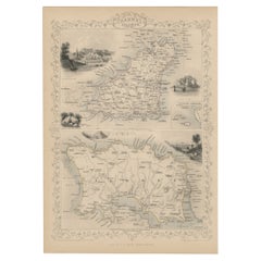
- Original Antique Map of the Channel Islands, Incl. Decorative Vignettes, 1851Located in Langweer, NLAntique map titled ‘Channel Islands’. Includes decorative vignettes titled St. Peters Port, Castle Cornet, Druidical altar near Lancresse, Mont Orgueil Castle and Jersey. Originates from 'The Illustrated Atlas, And Modern History Of The World Geographical, Political, Commercial & Statistical, Edited By R. Montgomery Martin'. Published; John Tallis London, New York, Edinburgh & Dublin. 1851. Drawn and Engraved by J. Rapkin. Artists and engravers: John Tallis (1817-1876) was a British map...Category
Antique 1850s Maps
MaterialsPaper
You May Also Like
- The Holy Land at the Time of Jesus: A 17th Century Dutch Map by VisscherBy Nicolaes Visscher IILocated in Alamo, CAThis detailed Dutch map entitled "Het Beloofe de Landt Canaan door wandelt van onsen Salichmaecker Iesu Christo, nessens syne Apostelen" by Nicolaes Visscher was published in Amsterd...Category
Antique Mid-17th Century Dutch Maps
MaterialsPaper
- Map of the Republic of GenoaLocated in New York, NYFramed antique hand-coloured map of the Republic of Genoa including the duchies of Mantua, Modena, and Parma. Europe, late 18th century. Dimension: 25...Category
Antique Late 18th Century European Maps
- Dutch Kolf Print, Winter, Golf EngravingLocated in Oxfordshire, GBDutch golf engraving by J. Boydell, Winter. Rare 18th century Dutch golf engraving by J. Boydell depicting Dutchman playing the early form of golf on the ice, titled 'Winter'. The s...Category
Antique 18th Century Dutch Prints
MaterialsPaper
- Antique Map of Principality of MonacoBy Antonio Vallardi EditoreLocated in Alessandria, PiemonteST/619 - "Old Geographical Atlas of Italy - Topographic map of ex-Principality of Monaco" - ediz Vallardi - Milano - A somewhat special edition ---Category
Antique Late 19th Century Italian Other Prints
MaterialsPaper
- Original Antique Map of The World by Thomas Clerk, 1817Located in St Annes, LancashireGreat map of The Eastern and Western Hemispheres On 2 sheets Copper-plate engraving Drawn and engraved by Thomas Clerk, Edinburgh. Published by Mackenzie And Dent, 1817 ...Category
Antique 1810s English Maps
MaterialsPaper
- Antique 18th Century Map of the Province of Pensilvania 'Pennsylvania State'Located in Philadelphia, PAA fine antique of the colony of Pennsylvania. Noted at the top of the sheet as a 'Map of the province of Pensilvania'. This undated and anonymous map is thought to be from the Gentleman's Magazine, London, circa 1775, although the general appearance could date it to the 1760's. The southern boundary reflects the Mason-Dixon survey (1768), the western boundary is placed just west of Pittsburgh, and the northern boundary is not marked. The map has a number of reference points that likely refer to companion text and appear to be connected to boundaries. The western and southern boundaries are marked Q, R, S, for example. A diagonal line runs from the Susquehanna R to the Lake Erie P. A broken line marked by many letters A, B, N, O, etc., appears in the east. There are no latitude or longitude markings, blank verso. Framed in a shaped contemporary gilt wooden frame and matted under a cream colored matte. Bearing an old Graham Arader Gallery...Category
Antique 18th Century British American Colonial Maps
MaterialsPaper


Recently Viewed
View AllMore Ways To Browse
Japanese Silk Prints
Dutch Japanned
Dutch Print Traditional
French Interior Engraving
Chinese Silk Prints
Antique Dutch Light
Wall Foldable Table
Antique Two Tone Light
French Table 16th Century
Dutch Plate Set
16th Century Japanese
Wall Folding Table
Antique Crusher
Antique Japanese China Set
Japanese Christian
Dutch 18th Century Table
Set Of Two 18th Century Tables
Dutch Table 18th