Items Similar to Scarce Antique Map of South America


Want more images or videos?
Request additional images or videos from the seller
1 of 6
Scarce Antique Map of South America
$326.18
$407.7220% Off
£242.64
£303.3020% Off
€272
€34020% Off
CA$446.65
CA$558.3120% Off
A$496.61
A$620.7620% Off
CHF 259.30
CHF 324.1320% Off
MX$6,044.97
MX$7,556.2120% Off
NOK 3,308.59
NOK 4,135.7420% Off
SEK 3,099.99
SEK 3,874.9920% Off
DKK 2,070.59
DKK 2,588.2320% Off
Shipping
Retrieving quote...The 1stDibs Promise:
Authenticity Guarantee,
Money-Back Guarantee,
24-Hour Cancellation
About the Item
Antique map titled 'Carte de l'Amérique Méridionale'. Scarce map of South America, published in Paris in 1821. The map shows the continent in the midst its of several decades of revolution, which reshaped the geopolitical landscape and boundaries for the next several decades. The names Spanish Guyana and San Juan de Los Llos appear in the southern parts of what would become Venezuela and Colombia. Published by Tardieu.
Pierre Antoine Tardieu (1784-1869), also known to sign his works as PF Tardieu, was a prolific French map engraver and geographer. The Tardieu family, based in Paris, was well known for their talent in engraving, cartography, and illustration. Pierre Antoine’s father, Antoine Francois Tardieu, was an established cartographer who published numerous atlases. His son is said to have collaborated with him for many years before establishing his own independent career.
- Dimensions:Height: 23.63 in (60 cm)Width: 17.45 in (44.3 cm)Depth: 0.02 in (0.5 mm)
- Materials and Techniques:
- Period:
- Date of Manufacture:1821
- Condition:Wear consistent with age and use. General age-related toning. Original folding line. Minor wear and foxing, blank verso. Please study images carefully.
- Seller Location:Langweer, NL
- Reference Number:Seller: BG-13193-41stDibs: LU3054331100292
About the Seller
5.0
Recognized Seller
These prestigious sellers are industry leaders and represent the highest echelon for item quality and design.
Platinum Seller
Premium sellers with a 4.7+ rating and 24-hour response times
Established in 2009
1stDibs seller since 2017
2,511 sales on 1stDibs
Typical response time: <1 hour
- ShippingRetrieving quote...Shipping from: Langweer, Netherlands
- Return Policy
Authenticity Guarantee
In the unlikely event there’s an issue with an item’s authenticity, contact us within 1 year for a full refund. DetailsMoney-Back Guarantee
If your item is not as described, is damaged in transit, or does not arrive, contact us within 7 days for a full refund. Details24-Hour Cancellation
You have a 24-hour grace period in which to reconsider your purchase, with no questions asked.Vetted Professional Sellers
Our world-class sellers must adhere to strict standards for service and quality, maintaining the integrity of our listings.Price-Match Guarantee
If you find that a seller listed the same item for a lower price elsewhere, we’ll match it.Trusted Global Delivery
Our best-in-class carrier network provides specialized shipping options worldwide, including custom delivery.More From This Seller
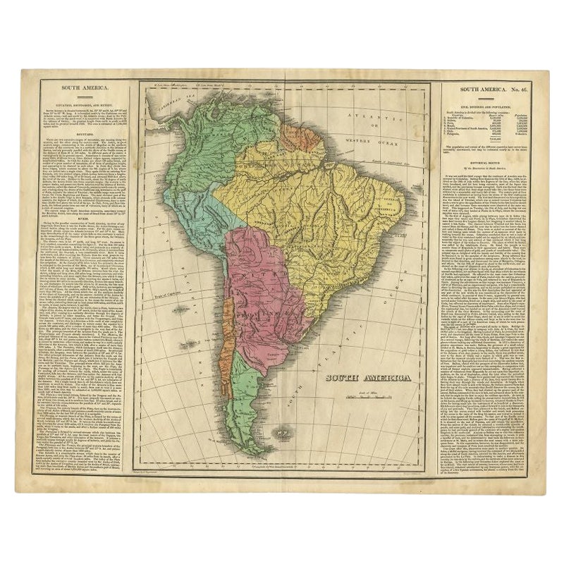
View AllInteresting Original Antique Map of South America, 1822
Located in Langweer, NL
Antique map titled 'South America'.
Map of South America with attractive topography, surrounded on three sides by text on the history, geography, and economy of the continent. Sh...
Category
Antique 19th Century Maps
Materials
Paper

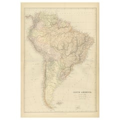
Antique Map of South America, c.1840
Located in Langweer, NL
Antique map titled 'South America'. Original, antique map depicting South America. With outline coloring. Source unknown, to be determined. Artists and Engravers: Anonymous.
Artist:...
Category
Antique 19th Century Maps
Materials
Paper

$70 Sale Price
20% Off
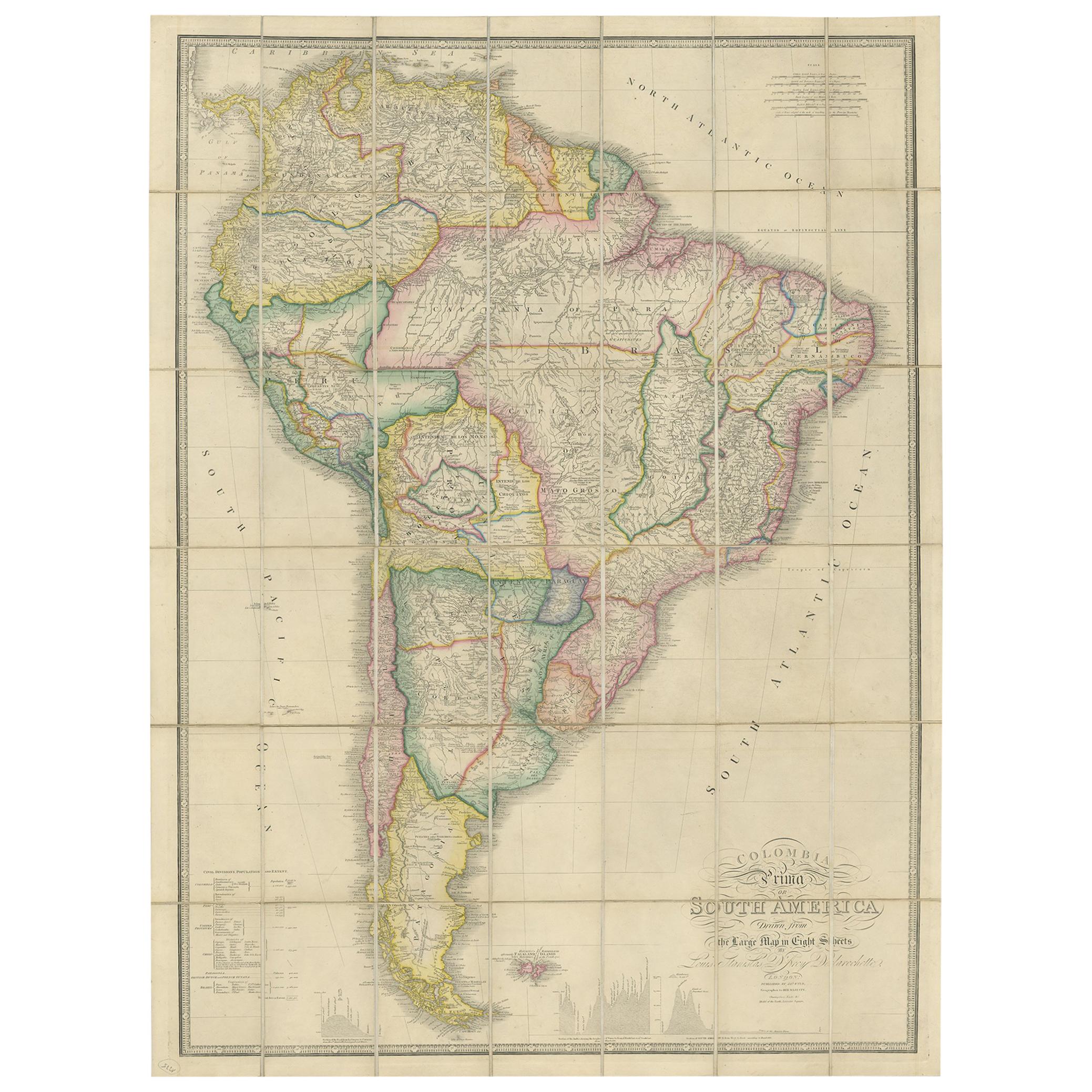
Antique Map of South America by Wyld, circa 1850
By J. Wyld
Located in Langweer, NL
Beautiful folding map of South America titled 'Colombia Prima or South America Drawn from the Large Map in Eight Sheets by Louis Stanislas D ' Arcy Delarochette'. Three insets in the...
Category
Antique Mid-19th Century British Maps
Materials
Paper

$1,391 Sale Price
20% Off
1882 Detailed Map of South America showing Political and Geographical Features
Located in Langweer, NL
This 1882 map of South America, published by Blackie and Son as part of the 'Comprehensive Atlas and Geography of the World,' showcases the continent in remarkable detail. It provide...
Category
Antique 1880s Maps
Materials
Paper
Antique Map of South America by Lapie '1842'
Located in Langweer, NL
Antique map titled 'Carte Générale de l'Amérique Meridionale'. Map of South America. This map originates from 'Atlas universel de géographie ancienne et moderne (..)' by Pierre M. La...
Category
Antique Mid-19th Century Maps
Materials
Paper

$575 Sale Price
20% Off
Antique Map of South America by Wyld, '1845'
Located in Langweer, NL
Antique map titled 'South America'. Original antique map of South America. This map originates from 'An Atlas of the World, Comprehending ...
Category
Antique Mid-19th Century Maps
Materials
Paper

$287 Sale Price
20% Off
You May Also Like
South America, Eastern Part. Century Atlas antique vintage map
Located in Melbourne, Victoria
'The Century Atlas. South America. Eastern Part'
Original antique map, 1903.
Inset map 'Rio de Janeiro and Vicinity'.
Central fold as issued. Map name and number printed on the rev...
Category
Early 20th Century Victorian More Prints
Materials
Lithograph

Original Antique Map of South America. C.1780
Located in St Annes, Lancashire
Great map of South America
Copper-plate engraving
Published C.1780
Two small worm holes to left side of map
Unframed.
Category
Antique Early 1800s English Georgian Maps
Materials
Paper

Antique Lithography Map, South America, English, Framed, Cartography, Victorian
Located in Hele, Devon, GB
This is an antique lithography map of South America. An English, framed atlas engraving of cartographic interest by John Rapkin , dating to the early Victorian period and later, circ...
Category
Antique Mid-19th Century British Early Victorian Maps
Materials
Wood

South America, North-West Part. Century Atlas antique vintage map
Located in Melbourne, Victoria
'The Century Atlas. South America, North-West Part'
Original antique map, 1903.
Central fold as issued. Map name and number printed on the reverse corners.
Sheet 40cm by 29.5cm.
Category
Early 20th Century Victorian More Prints
Materials
Lithograph

Original Antique Decorative Map of South America-West Coast, Fullarton, C.1870
Located in St Annes, Lancashire
Great map of Chili, Peru and part of Bolivia
Wonderful figural border
From the celebrated Royal Illustrated Atlas
Lithograph. Original color.
Published by Fullarton, Edi...
Category
Antique 1870s Scottish Maps
Materials
Paper

North & South America: A 17th Century Hand-colored Map by Jansson & Goos
By Johannes Janssonius
Located in Alamo, CA
A 17th century hand-colored map of North & South America entitled "Americae Descriptio" by the cartographer Johannes Jansson, published in Jansson's Atlas Minor in Amsterdam in 1628....
Category
Antique 1620s Dutch Maps
Materials
Paper

More Ways To Browse
Patagonia Map
Shepherd And Hedger
Vignola Furniture
Washington Dc Map
Antique Map Of Cornwall
Coronelli Globe
Vintage Bartholomew Maps
Antique Alabama Map
Cape Cod Map
Goa France
Antique Planisphere
Charlotte Reine
Dutch Malacca
Gabon Antique Map
J And C Bavaria
Map Of Barbados
Montreal Map
Antique Furniture Toledo Ohio