Engraved Maps
to
329
789
62
851
3
589
260
2
1
849
7
3
1
1
407
143
112
81
41
851
851
851
2
2
2
2
1
Technique: Engraved
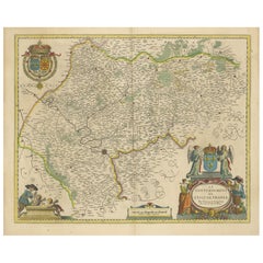
Beautiful 17th Century Map of Paris and Isle de France by Templeux, c.1650
Located in Langweer, NL
Map of Isle de France by D. de Templeux, ca. 1650, Hand-Colored and Decorative
This richly detailed antique map titled *Le Gouvernement de L'Isle de France* was engraved by Daniel d...
Category
1650s Antique Engraved Maps
Materials
Paper
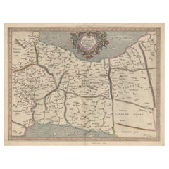
Antique Map of Northern Germany and the Netherlands – circa 1806
Located in Langweer, NL
Title: Antique Map of Northern Germany and the Netherlands – circa 1806
Description: This finely engraved antique map, titled L'Allemagne 1re Feuille, depicts the northern regions...
Category
Early 1800s Antique Engraved Maps
Materials
Paper
Exploring Ancient Persia: Ptolemaic Map of Iran and Iraq by Ptolemy and Mercator
Located in Langweer, NL
Claudius Ptolemy was a mathematician, astronomer and geographer who worked in Alexandria, then a part of the Roman Empire, in the 2nd century AD. One of the most learned and influent...
Category
1610s Antique Engraved Maps
Materials
Paper
$468 Sale Price
20% Off
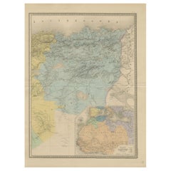
Antique Map of Algeria, Tunisia & Tripolitania – Andriveau-Goujon, Paris 1865
Located in Langweer, NL
Antique Map of Algeria, Tunisia & Tripolitania – Andriveau-Goujon, Paris 1865
This finely detailed and beautifully colored map was engraved and published in Paris in 1865 by the ren...
Category
Mid-19th Century French Antique Engraved Maps
Materials
Paper
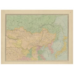
Antique Map of China, Japan & Korea – Eastern Asia by Andriveau-Goujon, 1860
Located in Langweer, NL
Antique Map of China, Japan & Korea – Eastern Asia by Andriveau-Goujon, 1860
This beautifully hand-colored antique map, titled “Carte de la Chine, de la Corée et du Japon,” was publ...
Category
Mid-19th Century French Antique Engraved Maps
Materials
Paper
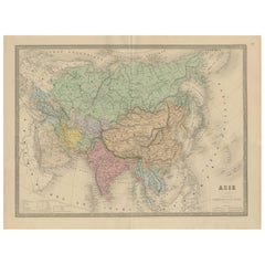
Antique Asia Map – Large 19th-Century Engraving with Political Boundaries, 1865
Located in Langweer, NL
Antique Map of Asia – Andriveau-Goujon, Paris 1865
This large and finely engraved antique map titled “Asie” was published in Paris in 1865 by the prominent French cartographer E. An...
Category
Mid-19th Century French Antique Engraved Maps
Materials
Paper
Antique Map of Eastern Europe – Russia, Ottoman Empire & Greece, 1868
Located in Langweer, NL
Antique Map of Eastern Europe – Russia, Ottoman Empire and Greece by Andriveau-Goujon, 1868
This detailed antique map titled “Carte de l’Europe Orientale, la Russie d’Europe, l’Empi...
Category
Mid-19th Century French Antique Engraved Maps
Materials
Paper
Antique Map of Scandinavia and the Baltic – Andriveau-Goujon, circa 1860s
Located in Langweer, NL
Antique Map of Scandinavia and the Baltic – Andriveau-Goujon, circa 1860s
This impressive antique map presents Northern Europe, focusing on the Scandinavian Peninsula, the Baltic re...
Category
Mid-19th Century French Antique Engraved Maps
Materials
Paper
Germany & Central Europe – Antique 1865 Map by Andriveau-Goujon, Paris
Located in Langweer, NL
Antique Map of Germany and Central Europe – “Allemagne et Europe Centrale” by Andriveau-Goujon, 1865
This large, finely engraved map titled “Allemagne et Europe Centrale” was publis...
Category
Mid-19th Century French Antique Engraved Maps
Materials
Paper
Spain & Portugal Map – Antique 1867 Engraving by Andriveau-Goujon, Paris
Located in Langweer, NL
Antique Map of Spain and Portugal – “Espagne et Portugal” by Andriveau-Goujon, 1867
This finely detailed antique map titled “Espagne et Portugal” was published in Paris in 1867 by t...
Category
Mid-19th Century French Antique Engraved Maps
Materials
Paper
Antique Map of France – Divided into 89 Departments by Andriveau-Goujon, 1861
Located in Langweer, NL
Antique Map of France – Divided into 89 Departments by Andriveau-Goujon, 1861
This finely engraved and beautifully hand-colored map titled “France divisée en 89 Départements” was pu...
Category
Mid-19th Century French Antique Engraved Maps
Materials
Paper
Antique Map of Europe – Political Divisions by Andriveau-Goujon, Paris 1861
Located in Langweer, NL
Antique Map of Europe – Political Divisions by Andriveau-Goujon, Paris 1861
This beautifully engraved and hand-colored antique map of Europe was published in 1861 by the Parisian ca...
Category
Mid-19th Century French Antique Engraved Maps
Materials
Paper
World Wind Currents Map – “Courants de l’Atmosphère” by Andriveau-Goujon, 1861
Located in Langweer, NL
World Wind Currents Map – “Courants de l’Atmosphère” by Andriveau-Goujon, 1861
This striking and educational antique chart titled “Courants de l’Atmosphère d’après le Lt. F. Maury” ...
Category
Mid-19th Century French Antique Engraved Maps
Materials
Paper
Roman Gaul & Northern Italy – Antique Map of La Gaule by Andriveau-Goujon, 1861
Located in Langweer, NL
Roman Gaul & Northern Italy – Antique Map of La Gaule by Andriveau-Goujon, 1861
This antique map titled "Carte Comparée de La Gaule" was published in Paris in 1861 by J. Andriveau-G...
Category
Mid-19th Century French Antique Engraved Maps
Materials
Paper
Antique Celestial Star Map – Northern & Southern Hemispheres, 1860
Located in Langweer, NL
Antique Celestial Star Map – Northern & Southern Hemispheres, Andriveau-Goujon 1860
This elegant antique celestial chart, published in Paris in 1860 by the noted French cartographer...
Category
Mid-19th Century French Antique Engraved Maps
Materials
Paper
Antique 1830 Map of Munster, Ireland with Limerick, Cork, Kerry and Tipperary
Located in Langweer, NL
Title: Antique 1830 Map of Munster, Ireland with Limerick, Cork, Kerry, and Tipperary
Description: This 1830 German-language map, titled Britisches Reich – C. Kon: Ireland, focu...
Category
1830s Antique Engraved Maps
Materials
Paper
Map of Haute-Garonne France with Toulouse and Garonne River by Vuillemin, c.1850
Located in Langweer, NL
Map of Haute-Garonne France with Toulouse and Garonne River by Vuillemin, 19th c
Description:
This finely engraved 19th-century map of the department of Haute-Garonne, located in so...
Category
Mid-19th Century French Antique Engraved Maps
Materials
Paper
Rare 1757 Jesuit Map of California and Baja, Dedicated to the King of Spain
Located in Langweer, NL
Title: Rare 1757 Jesuit Map of California and Baja, Dedicated to the King of Spain
This rare and detailed map, titled *Carte de la Californie Levee par la Société des Jésuites*, wa...
Category
1750s Antique Engraved Maps
Materials
Paper
Antique Map of Hungary and Transylvania by Isaak Tirion, Amsterdam c.1740
Located in Langweer, NL
Poland Map 1740s – Nieuwe Kaart van het Koninryk Poolen by Isaak Tirion
This finely engraved and attractively hand-colored map of the Kingdom of Poland was published by Isaak Tirion...
Category
Mid-18th Century Dutch Antique Engraved Maps
Materials
Paper
Original Antique Map of Muscovy or Russia by Isaak Tirion, Amsterdam circa 1740
Located in Langweer, NL
Map of Muscovy or Russia by Isaak Tirion, Amsterdam circa 1740
Description:
This beautifully engraved and delicately hand-colored map titled "Nieuwe Kaart van Muskovië of Rusland" w...
Category
Mid-18th Century Dutch Antique Engraved Maps
Materials
Paper
Original 17th-Century Antique Map of Fujian (Fokien) Province, China – by Blaeu
Located in Langweer, NL
17th-Century Antique Map of Fujian Province, China – "Fokien" by Blaeu, with Decorative Cartouches
Description: This stunning 17th-century map of Fujian Province, historically ref...
Category
1650s Antique Engraved Maps
Materials
Paper
1756 Map of Brazil from Bahia to São Paulo by Bellin – French Colonial Engraving
Located in Langweer, NL
Antique Map of Brazil from Bahia to São Paulo – Bellin for L'Histoire des Voyages
This elegant 18th-century French map titled "Suite du Bresil, Depuis la Baie de Tous les Saints jus...
Category
1750s Antique Engraved Maps
Materials
Paper
Large Antique Map of Franche-Comté – Divided into Three Historic Bailliages 1681
Located in Langweer, NL
Antique Map of Franche-Comté – “La Franche Comté divisée en Trois Grands Bailliages” by Jaillot, 1681
This richly detailed antique map, titled “La Franche Comté divisée en Trois Gra...
Category
Late 17th Century French Antique Engraved Maps
Materials
Paper
Antique Map of Kalmykia – Vandermaelen Lithograph of Central Asia, 1827
Located in Langweer, NL
Antique Map of Kalmykia – Vandermaelen Lithograph of Central Asia, 1827
This rare antique map titled “Partie de la Kalmoukie” (No. 56) is an original 1827 lithograph by Belgian cart...
Category
Early 19th Century Belgian Antique Engraved Maps
Materials
Paper
Antique Map of Turkestan – Vandermaelen Lithograph of Central Asia, 1827
Located in Langweer, NL
Antique Map of Turkestan – Vandermaelen Lithograph of Central Asia, 1827
This finely detailed antique map titled “Turkestan” (No. 34) is an original lithograph from the groundbreaki...
Category
Early 19th Century Belgian Antique Engraved Maps
Materials
Paper
Map of Corsica France with Ajaccio and Napoleon Portraits, 19th Century
Located in Langweer, NL
Map of Corsica France with Ajaccio and Napoleon Portraits, 19th Century
Description:
This finely engraved 19th-century map of Corsica, the Mediterranean island region of France, was...
Category
Mid-19th Century French Antique Engraved Maps
Materials
Paper
Map of Cher France with Bourges, Sancerre Vineyards and Engraved Vignettes, 1850
Located in Langweer, NL
Map of Charente-Inférieure France with La Rochelle and Coastal Vineyards, 19th c
Description:
This decorative 19th-century map of the former department of Charente-Inférieure, now k...
Category
Mid-19th Century French Antique Engraved Maps
Materials
Paper
Map of Persia, the Caspian & India – Isaak Tirion, c.1730
Located in Langweer, NL
Map of Persia and Surrounding Regions – “Nieuwe Kaart van 't Ryck van Persie” by Isaak Tirion, Amsterdam, c. 1730
This finely detailed copperplate map titled “Nieuwe Kaart van 't Ry...
Category
Mid-18th Century Dutch Antique Engraved Maps
Materials
Paper
Antique Map of the County of Burgundy by Johann Baptist Homann circa 1710
Located in Langweer, NL
Antique Map of the County of Burgundy by Johann Baptist Homann circa 1710 Hand-Colored
This finely detailed antique map titled Comitatus Burgundia depicts the historic region of t...
Category
1720s Antique Engraved Maps
Materials
Paper
Austria by Wolfgang Lazius – A Magnificent 16th-Century Map from Ortelius
Located in Langweer, NL
Title:
Avstriae Descrip – Wolfgang Lazius’ Map of Austria, 16th Century
Description:
This extraordinary map of Austria pays homage to the Austrian humanist and cartographer Wo...
Category
16th Century Antique Engraved Maps
Materials
Paper
Hand-Colored 1750 Plan of Batavia, Colonial Jakarta, Indonesia by Jacques Bellin
Located in Langweer, NL
Hand-Colored 1750 Plan of Batavia, Colonial Jakarta by Jacques Bellin
This finely detailed mid-18th century plan presents the fortified city of Batavia, now Jakarta, the capital of ...
Category
Mid-18th Century Antique Engraved Maps
Materials
Paper
Crete Map 1749 – Homann Heirs Engraving of Candia with Aegean Islands
Located in Langweer, NL
Crete Map 1749 – Homann Heirs Engraving of Candia with Aegean Islands
This fine 1749 map titled 'Insula Creta hodie Candia' presents an 18th-century cartographic portrait of the isl...
Category
1740s German Antique Engraved Maps
Materials
Paper
Map of Batavia’s Surroundings with Early Reference to Jakarta, Indonesia, c.1770
Located in Langweer, NL
Map of Batavia’s Surroundings with Early Reference to Jakarta, circa 1770
Description:
This finely engraved map titled "Carte des Environs de Batavia" offers a compelling and histor...
Category
Late 18th Century Dutch Antique Engraved Maps
Materials
Paper
British Island Group Map 1695 – Morden’s Smaller Islands of the British Ocean
Located in Langweer, NL
British Island Group Map 1695 – Morden’s Smaller Islands of the British Ocean
This rare and decorative late 17th-century map titled "The Smaller Islands in the British Ocean" was en...
Category
Late 17th Century English Antique Engraved Maps
Materials
Paper
Map of Drôme France with Valence and Rhône Valley Wine Region, 19th Century
Located in Langweer, NL
Map of Drôme France with Valence and Rhône Valley Wine Region, 19th Century
Description:
This beautifully engraved 19th-century map of the Drôme department in southeastern France wa...
Category
Mid-19th Century French Antique Engraved Maps
Materials
Paper
Historic Map of Poland and Lithuania – Tirion Edition c.1740
Located in Langweer, NL
Poland Map 1740s – Nieuwe Kaart van het Koninryk Poolen by Isaak Tirion
This finely engraved and attractively hand-colored map of the Kingdom of Poland was published by Isaak Tirion...
Category
Mid-18th Century Antique Engraved Maps
Materials
Paper
Italia Antiqua Philippo Cluvero – 1603 Hondius Map of Ancient Italy, Handcolored
Located in Langweer, NL
Italia Antiqua Philippo Cluvero – 1603 Hondius Map of Ancient Italy with Hand Color
This stunning early 17th-century map, *Italia Antiqua Philippo Cluvero Borusso Designatore*, wa...
Category
Early 1600s Antique Engraved Maps
Materials
Paper
Imperial map of Northern Russia with Archangel, Lapland and Permia, c.1730
Located in Langweer, NL
Imperial map of Northern Russia with Archangel, Lapland, and Permia, c.1730
Description:
This intricately engraved and hand-colored map presents the northern reaches of the Russian ...
Category
Early 18th Century German Antique Engraved Maps
Materials
Paper
Antique Map of the Location of the Garden of Eden and Travels of the Patriarchs
Located in Langweer, NL
Title: Map of the Location of the Garden of Eden and Travels of the Patriarchs
Cartographer/Publisher:
Pieter Mortier (1661–1711), published by Covens & Mortier (Amsterdam, 1725)...
Category
1720s Antique Engraved Maps
Materials
Paper
18th Century Antique Engraving of the Southern Hemisphere by G. de L'Isle
Located in Langweer, NL
Antique map titled 'Hemisphere Meridional pour voir plus distinctement Les Terres Australes'. Hemispherical map of the southern hemisphere centered on ...
Category
Late 18th Century Antique Engraved Maps
Materials
Paper
1857 Map of Northern South America – Brazil, Colombia, Peru by Stülpnagel
Located in Langweer, NL
1857 Map of Northern South America – Brazil, Colombia, Peru by Stülpnagel
Antique map titled “Süd-America in zwei Blättern” (South America in Two Sheets), newly edited by V. v. Stül...
Category
Mid-19th Century German Antique Engraved Maps
Materials
Paper
1858 Map of Hungary, Galicia & the Balkans – Justus Perthes Engraving
Located in Langweer, NL
1858 Map of Hungary, Galicia & the Balkans – Justus Perthes Engraving
Antique map titled "Galizien, Ungarn, Slavonien und Croatien, Siebenbürgen und Dalmatien," published by Justus ...
Category
Mid-19th Century German Antique Engraved Maps
Materials
Paper
Benelux Antique Map – Netherlands, Belgium & Luxembourg by Perthes, 1857
Located in Langweer, NL
1857 Map of Netherlands, Belgium & Luxembourg – Justus Perthes Engraving
Antique map titled "Niederlande, Belgien und Luxemburg," published by Justus Perthes in Gotha in 1857. This...
Category
Mid-19th Century German Antique Engraved Maps
Materials
Paper
Antique Habsburg Empire Map – Southeastern Germany to Venice, 1858
Located in Langweer, NL
Map of Southeastern Germany & Northern Italy – Antique Engraving, 1858
Antique map titled "Süd-Östliches Deutschland nebst einem Theil des nördlichen Italien," published by Justus P...
Category
Mid-19th Century German Antique Engraved Maps
Materials
Paper
Antique Map of Eastern Germany, Bohemia, Moravia & Silesia – 1858
Located in Langweer, NL
Antique Map of Eastern Germany, Bohemia, Moravia & Silesia – 1858
Detailed 19th-century engraved map titled "Östliches Deutschland mit Böhmen, Mähren und Schlesien" (Eastern German...
Category
Mid-19th Century German Antique Engraved Maps
Materials
Paper
Antique Map of Prussia & Posen – Insets of Berlin, Königsberg & Danzig, 1858
Located in Langweer, NL
Antique Map of Prussia & Posen – With Insets of Berlin, Königsberg & Danzig, 1858
Highly detailed and information-rich map titled "Die Preuss: Provinzen Preussen und Posen", publish...
Category
Mid-19th Century German Antique Engraved Maps
Materials
Paper
Antique Map of Northeastern Germany – Saxon & Prussian States, 1858
Located in Langweer, NL
Antique Map of Northeastern Germany – Saxon & Prussian States, 1858
Detailed and finely engraved map titled "Nord-Östliches Deutschland enthaltend die Sächsischen Länder und die Pre...
Category
Mid-19th Century German Antique Engraved Maps
Materials
Paper
Antique Map of Prussia, Hanover, Netherlands & Belgium – 1858
Located in Langweer, NL
Antique Map of Northwestern Germany, Netherlands & Belgium – 1858
Detailed 19th-century engraved map titled "Nordwestliches Deutschland, Kgr. der Niederlande, Kgr. Belgien" (Northwe...
Category
Mid-19th Century German Antique Engraved Maps
Materials
Paper
Antique Print of Alexandria in Egypt, 1698
Located in Langweer, NL
Antique print with two views of Alexandria, Egypt. This print originates from 'Reizen van Cornelis de Bruyn, door de vermaardste deelen van Klein Asia, de eylanden Scio, Rhodus, Cypr...
Category
17th Century Dutch Antique Engraved Maps
Materials
Paper
$229 Sale Price
20% Off
Historic 1690 Map of Lorraine in France by Allard - Cities of Toul, Nancy, Metz
Located in Langweer, NL
Exactissima Lotharingia - A Rare 17th Century Map of Lorraine by Carel Allard
This fascinating map of Lorraine, created by Carel Allard around 1690, is a stunning example of coppe...
Category
1690s Antique Engraved Maps
Materials
Paper
$660 Sale Price
20% Off
Thraciae Veteris Typus – 1618 Ortelius Map of Ancient Thrace with Hand Color
Located in Langweer, NL
Thraciae Veteris Typus – 1618 Ortelius Map of Ancient Thrace with Hand Color
This striking early 17th-century map, Thraciae Veteris Typus, was published in 1618 by Abraham Orteliu...
Category
Early 1600s Antique Engraved Maps
Materials
Paper
England & Wales in 1857 – Decorative Antique Map with Rail Routes
Located in Langweer, NL
Antique Map of England & Wales – Hand-Colored Engraving by Stülpnagel, 1857
Fine 19th-century map titled "England und Wales", drawn and engraved by Friedrich von Stülpnagel and publ...
Category
Mid-19th Century German Antique Engraved Maps
Materials
Paper
Hand-Colored Map of Northwest France – Brittany to Loire, 1858
Located in Langweer, NL
Antique Map of Northwestern France – Stülpnagel Engraving, Justus Perthes 1858
Impressively detailed mid-19th-century map of northwestern France titled "Frankreich in IV Blättern – ...
Category
Mid-19th Century German Antique Engraved Maps
Materials
Paper
1855 Relief Map of Germany and the Alps Showing Rivers and Terrain
Located in Langweer, NL
1855 Engraved Map of Switzerland with Cantonal Borders by Stülpnagel
This finely detailed antique map of Switzerland, titled "Die Schweiz," was published in 1855 by the renowned Ger...
Category
Mid-19th Century German Antique Engraved Maps
Materials
Paper
Original Spanish Brabant map with Brussels, Louvain and Antwerp quarters, c.1684
Located in Langweer, NL
Spanish Brabant map with Brussels, Louvain, and Antwerp quarters, c.1690
Description:
This richly detailed antique map depicts the historical region of Spanish Brabant, focusing on ...
Category
Late 17th Century French Antique Engraved Maps
Materials
Paper
Map of Calvados France with Caen and Cider-Brandy Region, 19th Century
Located in Langweer, NL
Map of Calvados France with Caen and Cider-Brandy Region, 19th Century
Description:
This finely engraved 19th-century map of the Calvados department in Normandy, northwestern France...
Category
Mid-19th Century French Antique Engraved Maps
Materials
Paper
Map of the Ottoman Empire in Europe, incl. the Balkans, Greece & Turkey, c.1760
Located in Langweer, NL
Antique map Turkey titled 'An Accurate Map of Turky in Europe drawn from the best Authorities'.
Map of the Ottoman Empire in Europe, the Balkans, Greece, and Turkey in Europe. Engr...
Category
1760s Antique Engraved Maps
Materials
Paper
$440 Sale Price
20% Off
1856 Engraved Map of Switzerland with Cantonal Borders by Stülpnagel
Located in Langweer, NL
1856 Engraved Map of Switzerland with Cantonal Borders by Stülpnagel
This finely detailed antique map of Switzerland, titled "Die Schweiz," was published in 1856 by the renowned Ger...
Category
Mid-19th Century German Antique Engraved Maps
Materials
Paper
1856 France and Switzerland Map with Mountain Profiles
Located in Langweer, NL
1856 Map of France and Switzerland with Paris Inset by Stülpnagel
This finely detailed antique map of France and Switzerland was published in 1856 by the esteemed German cartographe...
Category
Mid-19th Century German Antique Engraved Maps
Materials
Paper
Antique Map of Australia, New Zealand & Polynesia – Stülpnagel, 1857
Located in Langweer, NL
Antique Map of Australia, New Zealand & Polynesia – Stülpnagel, 1857
Description:
This finely engraved and delicately hand-colored map titled "Australien und Polynesien in Mercator'...
Category
Mid-19th Century German Antique Engraved Maps
Materials
Paper
Recently Viewed
View AllMore Ways To Browse
Bavarian Porcelain Vases
Beer Tankard
Bjorn L
Black Cabinet With Flowers And Birds
Black Tansu Chest
Blue Morpho
Blue Opaline Crystal Vases
Bow Front Buffet
Boy And Girl Statues
Brass Donkey
Brass Hound
Bread Oven
Bronze Atlas Sculpture
Bronze Door Stop
Bronze Shakespeare Sculpture
Buddha Bell
Bull Terrier
Butlers Chest
