Engraved Maps
to
329
789
62
851
3
589
260
2
1
849
7
3
1
1
407
143
112
81
41
851
851
851
2
2
2
2
1
Technique: Engraved
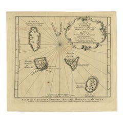
Comore Island Original Antique Engraving by Van Schley, 1749
Located in Langweer, NL
Antique map titled 'Carte des Isles de Comore Johanna ou Anouan Mohilla ou Moaly et Mayote (..) - Kaart van de Eilanden Komoro, Anjuan, Moelia, en Mayotta (..)'. Copper engraving of ...
Category
18th Century Antique Engraved Maps
Materials
Paper
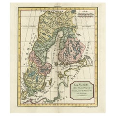
Decorative Antique Map of Sweden and Part of Finland, 1806
Located in Langweer, NL
Antique map titled 'La Suede.'
Decorative map of Sweden and part of Finland by Robert de Vaugondy, revised and published by Delamarche. Source unknown, to be determined.
Artists and Engravers: Made by 'Charles Francois Delamarche' after an anonymous artist. Charles Francois Delamarche (1740-1817) founded the important and prolific Paris based Maison Delamarche map publishing firm in the late 18th century. A lawyer by trade Delamarche entered the map business with the acquisition from Jean-Baptiste Fortin of Robert de Vaugondy's map plates...
Category
Early 1800s French Antique Engraved Maps
Materials
Paper
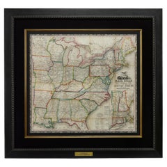
1866 Ensign & Bridgman's Rail Road Map of the United States
Located in Colorado Springs, CO
Presented is an 1866 issue of “Ensign & Bridgeman’s Rail Road Map of the United States, showing Depots & Stations.” First published in 1856, this is the third edition, following anot...
Category
1860s American Late Victorian Antique Engraved Maps
Materials
Paper
Cairo, Babylon & Heliopolis – Antique Map of Ancient Memphis Region, 1776
Located in Langweer, NL
Cairo, Babylon & Heliopolis – Antique Map of Ancient Memphis Region, 1776
This antique map is an 18th-century Dutch engraving showing the region around ancient Memphis, Egypt, inclu...
Category
Late 18th Century Dutch Antique Engraved Maps
Materials
Paper
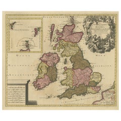
Rare Hand-colored Map of the British Isles by Gerard Valk, Published circa 1700
Located in Langweer, NL
Map of the British Isles by Gerard Valk circa 1700 – Hand-Colored Engraving
This elegant copperplate engraving titled *Les Isles Britanniques, qui contiennent les Royaumes d'Anglete...
Category
Early 1700s Dutch Antique Engraved Maps
Materials
Paper
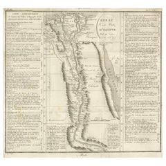
Antique Map of Egypt and the Nile Valley with City Index, 1715
Located in Langweer, NL
Antique map of Egypt, titled "Essay d'une Carte d'Égypte Fait au Caire en 1715".
This finely engraved map presents a detailed depiction of Egypt along the Nile River from the Medit...
Category
Early 18th Century French Antique Engraved Maps
Materials
Paper
Antique Map of Southern India – French Engraving by D’Anville, 18th Century
Located in Langweer, NL
This finely detailed antique map presents the southern portion of India, engraved in the 18th century by the renowned French cartographer Jean-Baptiste Bourguignon d’Anville.
It de...
Category
Late 18th Century French Antique Engraved Maps
Materials
Paper
Antique Map of Paraguay and Jesuit Missions by D’Anville, 1733
Located in Langweer, NL
Antique Map of Paraguay and Jesuit Missions by D’Anville, 1733
Antique map titled Le Paraguay. This finely detailed copperplate engraving depicts the region of Paraguay along with ...
Category
Mid-18th Century French Antique Engraved Maps
Materials
Paper
Public Execution Scene in Tonkin (Northern Vietnam) – Antique Engraving, 1787
Located in Langweer, NL
Public Execution Scene in Tonkin – Antique Engraving, 1787
Striking 18th-century copperplate engraving depicting a large-scale public execution in the Kingdom of Tonkin (present-day...
Category
Late 18th Century French Antique Engraved Maps
Materials
Paper
Antique Engraving – Layout of the King of Persia’s Field Camp, 18th Century
Located in Langweer, NL
Antique Engraving – Layout of the King of Persia’s Field Camp, 18th Century
Fascinating 18th-century engraved plan depicting the arrangement of the royal encampment of the King of P...
Category
Mid-18th Century French Antique Engraved Maps
Materials
Paper
Antique Map of the Jesuit Missions in Madurai and Surrounding Kingdoms, c.1760
Located in Langweer, NL
Antique Map of the Jesuit Missions in Madurai and Surrounding Kingdoms, c.1760
This 18th-century copperplate map, titled Carte des Missions du P.P. de la Compagnie de Jésus dans le ...
Category
Early 18th Century French Antique Engraved Maps
Materials
Paper
Chinese Calligraphy Inscription – Antique Engraving with Kangxi-era Text, c.1770
Located in Langweer, NL
Chinese Calligraphy Inscription – Antique Engraving with Kangxi-era Text, c.1770
This elegant 18th-century copperplate engraving reproduces a Chinese inscription, framed within thre...
Category
Late 18th Century French Antique Engraved Maps
Materials
Paper
Map of the Philippines and Palau Islands – Antique French Engraving, c.1790
Located in Langweer, NL
Map of the Philippines and Palau Islands – Antique French Engraving, c.1790
This antique French maritime chart depicts the western Pacific region between the Philippines and the Pal...
Category
Late 18th Century French Antique Engraved Maps
Materials
Paper
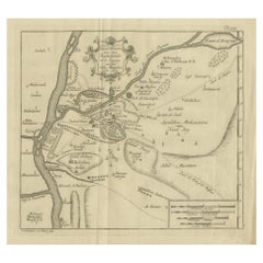
Detailed 1729 Battle Map – Allied Army Camp at Denain France, 1712 Siege
Located in Langweer, NL
Map of Allied Camp at Denain, France, 1712 Attack – Published 1729
This engraved map depicts the army camp of the Allied forces at Denain, attacked by the French on July 24, 1712 du...
Category
Early 18th Century Dutch Antique Engraved Maps
Materials
Paper
Plan of the Town and River of Ganjam, India – Antique French Map by Portier 1790
Located in Langweer, NL
Plan of the Town and River of Ganjam, India – Antique French Map by Portier, c.1790
This antique French engraving shows a detailed plan of the town and river of Ganjam, located on t...
Category
Late 18th Century French Antique Engraved Maps
Materials
Paper
Ornate 1850s Map of South America: A Masterpiece of Exploration & Art by Rapkin
Located in Langweer, NL
Decorative 19th-Century Map of South America by J. Rapkin, Published by J & F Tallis
Description: This beautifully detailed map of South America, drawn and engraved by J. Rapkin a...
Category
1850s Antique Engraved Maps
Materials
Paper
1616 Bertius Map of Sumatra, Singapore and the Straits of Malacca
Located in Langweer, NL
Title: "1616 Bertius Map of Sumatra and the Straits of Malacca"
Description: This is an exquisite 1616 original antique map by Petrus Bertius, titled "Sumatra Insula," showcasing Su...
Category
Early 17th Century Antique Engraved Maps
Materials
Paper
$803 Sale Price
20% Off
Ottoman Empire in Europe – Antique Map by Reilly, Vienna, 1796
Located in Langweer, NL
Map of the Ottoman Empire in Europe – Reilly, Vienna circa 1794-1796
This large original antique map, titled “Karte von dem Oschmanischen Reiche in Europa,” was published between 17...
Category
Late 18th Century Austrian Antique Engraved Maps
Materials
Paper
Mountain Elevation Profiles – Alps, Pyrenees, Andes & World Heights 1857
Located in Langweer, NL
Mountain Elevation Profiles – Alps, Pyrenees, Andes & World Heights 1857
This intriguing antique print shows comparative elevation profiles titled “Die bekannteren Höhen über der Me...
Category
Mid-19th Century German Antique Engraved Maps
Materials
Paper
Antique Map of Italy – Pre-Unification Italy by Andriveau-Goujon, Paris 1861
Located in Langweer, NL
Antique Map of Italy – Pre-Unification Italy by Andriveau-Goujon, Paris 1861
This antique map of Italy, titled simply “Italie,” was published in Paris in 1861 by E. Andriveau-Goujon...
Category
Mid-19th Century French Antique Engraved Maps
Materials
Paper
Constantinople – Panoramic Hand-Colored Engraving, Augsburg, circa 1720
Located in Langweer, NL
Constantinople – Panoramic Hand-Colored Engraving, Augsburg, circa 1720
This panoramic hand-colored engraving presents a sweeping bird’s-eye view of Constantinople (modern-day Istan...
Category
Early 18th Century German Antique Engraved Maps
Materials
Paper
Konstantinopel – Panoramic View of Istanbul by François Halma, 1705
Located in Langweer, NL
Konstantinopel – Panoramic View of Istanbul by François Halma, 1705
This engaging hand-colored engraving of “Konstantinopel” offers a sweeping panoramic view of 18th-century Istanbu...
Category
Early 18th Century Dutch Antique Engraved Maps
Materials
Paper
Constantinople – Panoramic Engraving by Matthäus Merian the Elder, 1635
Located in Langweer, NL
Constantinople – Panoramic Engraving by Matthäus Merian the Elder, Frankfurt, 1635
This finely detailed copperplate engraving presents a sweeping bird’s-eye view of Constantinople (...
Category
Early 17th Century German Antique Engraved Maps
Materials
Paper
Map of Turkish Dominions in Europe, Ottoman Balkan Territories 1813
Located in Langweer, NL
Map of Turkish Dominions in Europe, Ottoman Balkan Territories 1814
This antique map titled "Turkish Dominions in Europe" provides a detailed depiction of the Balkan Peninsula and a...
Category
1810s Antique Engraved Maps
Materials
Paper
Phoenician Trade Routes – Antique Map of Europe and the Mediterranean, 1748
Located in Langweer, NL
Phoenician Trade Routes – Antique Map of Europe and the Mediterranean, 1748
This antique German map titled Vorstellung von Europa zur Erläuterung der Schifffahrt der Phönicier auf d...
Category
Mid-18th Century Antique Engraved Maps
Materials
Paper
Antique Map of India & Southeast Asia – Chevalier Engraving, Malte-Brun, 1853
Located in Langweer, NL
Antique Map of India and Southeast Asia – Chevalier Engraving from Malte-Brun’s Atlas, 1853
This beautifully engraved map titled “Inde, comprenant les Empires de la Chine, de l’Indo...
Category
Mid-19th Century English Antique Engraved Maps
Materials
Paper
Antique Map of Tartary – Hand-Colored Lithograph of Central Asia, 1827
Located in Langweer, NL
Antique Map of Tartary – Hand-Colored Lithograph of Central Asia, 1827
This original antique map, titled "Partie de la Tartarie" (No. 42), is an exceptional example of early 19th-ce...
Category
Early 19th Century Belgian Antique Engraved Maps
Materials
Paper
Antique Map of Assam and Bhutan – Hand-Colored Lithograph by Vandermaelen, 1827
Located in Langweer, NL
Antique Map of Assam and Bhutan – Hand-Colored Lithograph by Vandermaelen, 1827
This original antique map titled “Assam et Boutan” (No. 84) is a finely detailed lithograph from the ...
Category
Early 19th Century Belgian Antique Engraved Maps
Materials
Paper
Antique Map of Tartary, Siberia & China – Tirion, Amsterdam c.1730
Located in Langweer, NL
Antique Map of Tartary – “Nieuwe Kaart van Tartarie” by Isaak Tirion, Amsterdam c.1730
This finely engraved 18th-century map titled “Nieuwe Kaart van Tartarie” (New Map of Tartary) ...
Category
Mid-18th Century Dutch Antique Engraved Maps
Materials
Paper
Pl. 8 Antique Plan of the House of Mr. Morel by Le Rouge, c.1785
Located in Langweer, NL
Antique print titled 'Plan de la Maison de Ville et de Campagne de Mr. Morel'. Copper engraving showing a plan of the house of Mr. Morel. This print originates from 'Jardins Anglo-Ch...
Category
18th Century French Antique Engraved Maps
Materials
Paper
Antique Map of Egypt with Detailed Inset of the Nile Delta, ca. 1799
Located in Langweer, NL
Antique Map of Egypt with Detailed Inset of the Nile Delta, ca. 1799
This finely engraved antique map titled Carte Physique et Politique de l’Égypte presents a detailed and scientif...
Category
Early 1800s French Antique Engraved Maps
Materials
Paper
Plan of Pondicherry Fortifications and Attacks, France, c.1750
Located in Langweer, NL
Plan of Pondicherry Fortifications and Attacks, France, c.1750
This finely engraved map depicts the fortified city of Pondicherry, titled "Plan de Pondichéry et de ses attaques." It...
Category
Mid-18th Century French Antique Engraved Maps
Materials
Paper
Hand-Colored Map of Delfland by Hendrik de Leth, 1740 – Delft & The Hague
Located in Langweer, NL
Hand-Colored Map of Delfland by Hendrik de Leth, 1740 – Delft & The Hague
This beautifully preserved antique map titled "Nieuwe Gemeete Kaert van Delfland" was engraved by Hendrik d...
Category
1740s Antique Engraved Maps
Materials
Paper
1858 Map of Southwestern Germany & Switzerland – Bavaria, Württemberg, Baden
Located in Langweer, NL
Antique Map of Southwestern Germany & Switzerland – Bavaria, Württemberg, Baden, 1858
Detailed antique map titled "Südwestliches Deutschland mit Bayern, Würtemberg, Baden, Hohenzoll...
Category
Mid-19th Century German Antique Engraved Maps
Materials
Paper
1858 Map of South France with Corsica – Marseille to Italian Border
Located in Langweer, NL
Antique Map of Southeastern France & Corsica – Stülpnagel Engraving, 1858
Highly detailed 19th-century map titled "Südöstliches Frankreich"(Southeastern France), engraved by Friedri...
Category
Mid-19th Century German Antique Engraved Maps
Materials
Paper
Historic 1858 Map of South America – Pre-Border Consolidation
Located in Langweer, NL
Antique Map of South America – Stülpnagel Engraving Published by Perthes, 1858
Detailed 19th-century engraved map titled "Süd-America", designed and drawn by F. von Stülpnagel and p...
Category
Mid-19th Century German Antique Engraved Maps
Materials
Paper
Antique Map of Germany & Railways – Transport Network Overview, 1857
Located in Langweer, NL
Antique Map of Germany & Railways – Transport Network Overview, 1857
Striking 19th-century map titled "Deutschland und angränzende Länder zur Übersicht der Eisenbahnen und Hauptstra...
Category
Mid-19th Century German Antique Engraved Maps
Materials
Paper
Antique Map of Spain and Portugal – Hand-Colored Engraving by Stülpnagel, 1857
Located in Langweer, NL
Antique Map of Spain and Portugal – Hand-Colored Engraving by Stülpnagel, 1857
Fine 19th-century engraved map of the Iberian Peninsula titled "Spanien und Portugal", designed by F. ...
Category
Mid-19th Century German Antique Engraved Maps
Materials
Paper
Antique Map of Southwestern France – With Insets of Paris & Lyon, 1858
Located in Langweer, NL
Antique Map of Southwestern France – With Insets of Paris & Lyon, 1858
Detailed copperplate map of "Südwestliches Frankreich" (Southwestern France), created by Friedrich von Stülpna...
Category
Mid-19th Century German Antique Engraved Maps
Materials
Paper
Antique Map of Northeastern France – Alsace, Lorraine & Champagne, 1858
Located in Langweer, NL
Antique Map of Northeastern France – Alsace, Lorraine & Champagne, 1858
Detailed 19th-century engraved map titled "Nordöstliches Frankreich", drawn by Friedrich von Stülpnagel and p...
Category
Mid-19th Century German Antique Engraved Maps
Materials
Paper
Antique Map of Britain & Ireland with North Sea Detail – 1856 Stülpnagel
Located in Langweer, NL
Antique Map of the British Isles & North Sea by Stülpnagel, 1856
This beautifully detailed 1856 map titled *"Die Britischen Inseln und die Nord-See"* was drawn by F. von Stülpnagel ...
Category
Mid-19th Century German Antique Engraved Maps
Materials
Paper
Antique Map of West and Central Africa – Stieler Atlas, Justus Perthes 1857
Located in Langweer, NL
Antique Map of West and Central Africa – Stieler Atlas, Justus Perthes 1857
This finely engraved map titled "Mittel- und Nord-Africa. Westl. Theil." was published in 1857 by Justus ...
Category
Mid-19th Century German Antique Engraved Maps
Materials
Paper
Pair of 19th Century English J & W Cary Celestial/Terrestrial Table Model Globes
Located in Milford, NH
A fine assembled pair of 12-inch English table model globes on stands manufactured by J & W. Cary, the left globe with cartouche labeled “The New Celestial Globe, on which are correc...
Category
Early 19th Century English Antique Engraved Maps
Materials
Brass
Mediterranean, Black Sea & Ottoman Empire Map 1853
Located in Langweer, NL
Mediterranean, Black Sea & Ottoman Empire Map 1853
This impressive antique print shows the Mediterranean and Black Sea regions with a focus on the Ottoman Empire, titled “Das Mittel...
Category
Mid-19th Century German Antique Engraved Maps
Materials
Paper
Southern Africa & Madagascar Antique Map – Beautiful 1857 Edition
Located in Langweer, NL
Southern Africa and Madagascar Map 1857
This detailed antique print shows “Süd-Africa mit Madagascar” meaning “Southern Africa with Madagascar,” published in 1857 by Justus Perthes ...
Category
Mid-19th Century German Antique Engraved Maps
Materials
Paper
Topographic Map of Mount Sinai Summit – Antique Engraving by Pococke, 1776
Located in Langweer, NL
Topographic Map of Mount Sinai Summit – Antique Engraving by Pococke, 1776
This antique engraving offers a rare and detailed view of the summit plateau of Mount Sinai, titled "Grond...
Category
Late 18th Century Dutch Antique Engraved Maps
Materials
Paper
1720 Maps of the Holy Land: Ancient and Modern by De Fer and Danet
Located in Langweer, NL
1720 Maps of the Holy Land: Ancient and Modern by De Fer and Danet
This set of two 1720 maps, published by Nicolas de Fer and Danet in Paris, presents a unique juxtaposition of t...
Category
1720s Antique Engraved Maps
Materials
Paper
Biblical Map and Family Trees of the Holy Land by Chatelain, ca. 1720
Located in Langweer, NL
Title: 1720 Chatelain Map of the Holy Land with Biblical Family Trees and Chronology
Description:
This fascinating 18th-century folio map by Henry Abraham Chatelain combines geo...
Category
1710s Antique Engraved Maps
Materials
Paper
Antique Map of Lotharingia (Lorraine) by Danckerts, c. 1700 – Hand-Colored
Located in Langweer, NL
Antique Map of Lotharingia (Lorraine) by Theodorus Danckerts circa 1700 Hand-Colored
This beautifully detailed antique map of Lotharingia, now the Lorraine region in northeastern ...
Category
Early 1700s Antique Engraved Maps
Materials
Paper
1573 Ortelius Map: First to Name California, Spanning Tartary to North America
Located in Langweer, NL
"1573 Abraham Ortelius Map of Tartary, Japan, and Western North America"
Description of the Map:
This is an outstanding example of Abraham Ortelius' map titled "Tartariae Sive Magn...
Category
16th Century Antique Engraved Maps
Materials
Paper
$2,295 Sale Price
20% Off
Western & Eastern Hemisphere Maps – World Double Hemisphere Engravings 1857
Located in Langweer, NL
Western & Eastern Hemisphere Maps – World Double Hemisphere Engravings 1857
These beautiful antique prints show two complementary hemispheric maps titled “Westliche Halbkugel” (West...
Category
Mid-19th Century German Antique Engraved Maps
Materials
Paper
1732 Henri Chatelain Map of the Holy Land Divided Among the Tribes of Israel
Located in Langweer, NL
Title: 1732 Henri Chatelain Map of the Holy Land Divided Among the Tribes of Israel
This exquisite 18th-century map by Henri Chatelain, published in 1732, offers a detailed depict...
Category
1710s Antique Engraved Maps
Materials
Paper
1685 Alain Manesson Mallet Map of Hokkaido (Lesso) in Northern Japan
Located in Langweer, NL
Title: 1685 Alain Manesson Mallet Map of Hokkaido, Iesso, and Company’s Land
Description: This engraved seventeenth-century map, titled Terre de Iesso, was published in 1685 as pa...
Category
1680s Antique Engraved Maps
Materials
Paper
Bordeaux City View – Braun & Hogenberg Original Woodcut, ca. 1575
Located in Langweer, NL
Bordeaux City View – Braun & Hogenberg Original Woodcut, ca. 1575
Description:
This detailed and highly decorative bird’s-eye view of Bordeaux, titled Bovrdeavx, originates from the...
Category
16th Century German Antique Engraved Maps
Materials
Paper
Huy (Huum) Cityscape 1574: Historical Copper Engraving by Braun & Hogenberg
Located in Langweer, NL
Title: Huum opp. condrusorum caput (...) Anno partae salutis 1574.
**Type:** Print (Colored Copper Engraving)
**Year:** Circa 1580
**Technique:** Colored Copper Engraving
**Medium:...
Category
16th Century Antique Engraved Maps
Materials
Paper
$612 Sale Price
20% Off
Impressive Decorative Engraved Map of the Red Sea and Arabian Peninsula, 1787
Located in Langweer, NL
This map, titled "Karte des arabischen Meerbusens oder des Rothen Meeres," is an original engraving from 1787 created by F. A. Schraembl, based on the cartographic work of d'Anville.
It is a partially colored copper engraving.
Key features and notable details of the map include:
1. The title is prominently displayed within a large, ornate cartouche, enhancing the aesthetic appeal and indicating the map's subject as the Red Sea (Rothen Meeres).
2. The map covers the Red Sea and its surrounding regions, including significant portions of the Arabian Peninsula and northeastern Africa.
3. There are two detailed inset maps:
- The first inset map shows the roadstead of the port of Suez (Rheede des Hafen von Sues).
- The second inset map depicts Bahr el Kolsum, the northwestern arm of the Red Sea, based on a map by De la Rochette from 1785.
4. Geographical Features: The map meticulously details the coastline, islands, and notable port cities along the Red Sea. The cartography highlights both natural and man-made features, with elevations and mountains represented through hachures.
5. Condition and Preservation: The map has a horizontal centerfold and is partially backed to prevent tears. The edges of the map sheet show minor holes, tears, and faint brown spots, yet it remains in overall good condition considering its age.
6. Historical Importance: This map is a valuable historical document, reflecting the cartographic knowledge of the late 18th century. It serves as a significant piece for collectors interested in antique maps, particularly those focusing on the Arabian Peninsula and maritime navigation in the Red Sea region.
The map shows the coastline of the Red Sea and the Arabian Peninsula, detailing regions and places along the western coast of Saudi Arabia and Yemen, as well as the eastern coast of Egypt and Sudan. Here are some of the most important places identified on the map:
1. Jeddah (Gedda): A major city and port on the western coast of Saudi Arabia, significant for its role as a gateway for pilgrims traveling to Mecca.
2. Mecca (Mekka): A holy city in Islam, located inland from the Red Sea, important for being the site of pilgrimage (Hajj) for Muslims.
3. Medina (Medina): Another important Islamic city, known for the Prophet's Mosque and being a key pilgrimage site.
4. Suez (Suess): Located at the northern end of the Red Sea, near the Suez Canal, it's a crucial link between the Mediterranean Sea and the Red Sea.
5. Aden: A port city in Yemen, located at the southern tip of the Arabian Peninsula, historically significant as a trading hub.
6. Mocha (Mokka): A port city in Yemen, historically known for being a major marketplace for coffee.
7. Sana'a: The capital city of Yemen, noted for its historical and cultural significance.
8. Bab el Mandeb: The strait connecting the Red Sea to the Gulf of Aden, crucial for maritime navigation.
These locations are critical due to their historical, religious, and economic significance, especially in terms of trade routes and pilgrimage sites. The map also illustrates the mountainous terrain and coastal features of the region.
The condition and preservation status, which, despite minor imperfections, is considered well-preserved for its age.
Overall, this map is a rare and valuable artifact, offering both historical insights and aesthetic appeal for collectors and enthusiasts of antique cartography.
Category
1780s Antique Engraved Maps
Materials
Paper
$1,212 Sale Price
40% Off
Frederic de Wit Map of Palestine – Terra Sancta, Amsterdam c.1670
Located in Langweer, NL
Terra Sancta sive Promissionis, olim Palestina – hand-coloured copper-engraved map of the Holy Land by Frederic de Wit, Amsterdam, circa 1670
This impressive folio sheet, bearing th...
Category
Late 17th Century Dutch Antique Engraved Maps
Materials
Paper
Antique Map of Jamaica and Hispaniola (Saint-Domingue and Santo Domingo), 1802
Located in Langweer, NL
This is an original antique map titled "Carte des Isles de la Jamaïque et de St. Domingue," depicting the islands of Jamaica and Saint-Domingue (modern-day Haiti and the Dominican Re...
Category
Early 1800s Antique Engraved Maps
Materials
Paper
$535 Sale Price
20% Off
Original Antique Map of Munich, Germany by J. Stockdale, 1800
Located in Langweer, NL
Title: Vintage Map of Munich, Germany by J. Stockdale, 1800
This vintage map, titled "A Plan of the City of Munich," was published by J. Stockdale in Piccadilly, London, in 1800. Th...
Category
Early 1800s Antique Engraved Maps
Materials
Paper
1723 Antique Map of Asia – Carte d’Asie by Guillaume Delisle, Paris
Located in Langweer, NL
Title: Carte d'Asie – Rare Hand-Colored Map of Asia by Guillaume Delisle, Paris 1723
Description:
This rare and highly decorative antique map titled 'Carte d'Asie', engraved and han...
Category
Early 18th Century French Antique Engraved Maps
Materials
Paper
Recently Viewed
View AllMore Ways To Browse
Bavarian Porcelain Vases
Beer Tankard
Bjorn L
Black Cabinet With Flowers And Birds
Black Tansu Chest
Blue Morpho
Blue Opaline Crystal Vases
Bow Front Buffet
Boy And Girl Statues
Brass Donkey
Brass Hound
Bread Oven
Bronze Atlas Sculpture
Bronze Door Stop
Bronze Shakespeare Sculpture
Buddha Bell
Bull Terrier
Butlers Chest
