Engraved Maps
to
329
789
62
851
3
589
260
2
1
849
7
3
1
1
407
143
112
81
41
851
851
851
2
2
2
2
1
Technique: Engraved
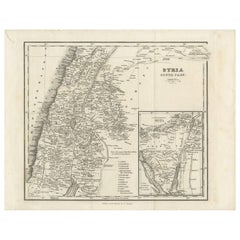
Antique Map of Southern Syria by Fullarton & Co, circa 1860
Located in Langweer, NL
Antique map titled 'Syria south part'. Published by Fullarton & Co, Glasgow, circa 1860.
- Title: Syria South Part
- Publisher: Fullarton & Co, Glasgow
- Date of Publication: Circa ...
Category
Mid-19th Century English Antique Engraved Maps
Materials
Paper
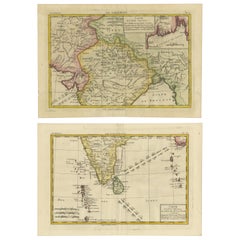
18th Century Cartographic Depiction of Upper India and Ceylon, 1835
Located in Langweer, NL
An exquisite set of two maps, 'Carte de la Partie Superieure De L'Inde en de Cadu Gange,' masterfully crafted by the renowned 18th-century French cartographer, Charles Marie Rigobert...
Category
1830s Antique Engraved Maps
Materials
Paper
$420 Sale Price
20% Off
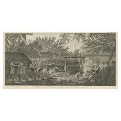
Human Sacrifice in a Morai, Tahiti – Cook Voyage Engraving c.1795
Located in Langweer, NL
Menschelijke Offerhande in eene Morai of Otahiti verrigt – Human Sacrifice in Tahiti c.1795
This antique print depicts a dramatic and solemn scene of a human sacrifice performed in ...
Category
Early 1800s European Antique Engraved Maps
Materials
Paper
$707 Sale Price
20% Off
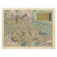
1584 Ortelius Map of Switzerland: A Cartographic Reversal
Located in Langweer, NL
This is a fine example of Ortelius' map of Switzerland from his *Theatrum Orbis Terrarum*, recognized as the first modern atlas of the world. The map is oriented with south at the top, which reverses the typical north-up orientation seen in most modern maps. It highlights significant geographical features such as Lake Geneva (Lemanus Lacus) to the right of the map and the Rhine river entering Switzerland near the center.
The *Theatrum Orbis Terrarum*, first published in 1570 by Abraham Ortelius in Antwerp, was groundbreaking as it compiled uniform maps with supporting text in a single volume, marking a departure from earlier collections of maps that were custom-assembled on demand. This atlas included a wealth of sixteenth-century cartographic knowledge, reflecting the extensive global explorations occurring after the discovery of America...
Category
16th Century Antique Engraved Maps
Materials
Paper
$920 Sale Price
30% Off
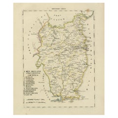
Antique 1830 Map of Leinster, Ireland with Dublin, Kilkenny, Wexford and Kildare
Located in Langweer, NL
Title: Antique 1830 Map of Leinster, Ireland with Dublin, Kilkenny, Wexford, and Kildare
Description: This 1830 German-language map, titled Britisches Reich – C. Kon: Ireland, f...
Category
1830s Antique Engraved Maps
Materials
Paper
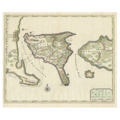
1726 Valentyn's Map of Bali and Lombok, Original Engraving
Located in Langweer, NL
This antique map is a detailed 18th-century chart of the island of Bali, one of the many islands of Indonesia, with an inset of the neighboring island Lombok, attributed to François ...
Category
Early 18th Century Antique Engraved Maps
Materials
Paper
$1,434 Sale Price
20% Off
1802 German Map of Kashmir and Surrounding Regions by Weimar, Based on Gentil
Located in Langweer, NL
Title: 1802 German Map of Kashmir and Surrounding Regions by Weimar, Based on Gentil
Description: This rare and finely detailed antique map, titled Charte von Kaschemir, was pub...
Category
Early 1800s Antique Engraved Maps
Materials
Paper
Antique Map of the Area Around Venice in Italy by H. Hondius, circa 1606
By Jodocus Hondius, Gerard Mercator
Located in Langweer, NL
Attractive and early map of the area around Venice, Italy. With South-Tirol in the North, areas of Krain (Slovenia), Croatia, Ferrara, Modena and Piacenza. In the east with areas aro...
Category
Early 17th Century Dutch Antique Engraved Maps
Materials
Paper
1750 Bellin Map of the Red River (Tonkin River) and Hanoi, Vietnam
Located in Langweer, NL
Title: 1750 Bellin Map of the Red River and Hanoi, Vietnam
Description: This finely engraved eighteenth-century French map, titled Carte du Cours de la Riviere de Tunquin, was created by the renowned cartographer Jacques-Nicolas Bellin and published in 1750. It depicts the course of the Red River, historically referred to as the Tonkin River, from Hanoi, labeled as Cacho, Ville Capitale du Tunquin, to the Gulf of Tonkin, labeled as Baye de Tunquin. Bellin’s work was based on navigational surveys by an English explorer, as stated in the title, reflecting the growing European interest in Southeast Asia during the early colonial period.
The Red River Delta was a crucial region for trade and agriculture, forming the backbone of Vietnam’s economic and cultural history. The river originates in China and flows through northern Vietnam, passing through Hanoi before emptying into the Gulf of Tonkin. This map captures the strategic importance of the river, as it served as a major trade route for goods and a point of interest for European navigators, merchants, and missionaries seeking access to Indochina.
The map includes numerous geographical details. Hanoi is prominently labeled as the capital of Tonkin, a historical term used by Europeans to describe northern Vietnam. The surrounding settlements, islands, and tributaries are carefully marked, illustrating the intricate network of waterways that characterized the region. Notable features include Île de la Potterie, referring to a location known for ceramic production, and various sandbanks and fortified locations along the river.
A decorative compass rose is placed in the upper left corner, reinforcing the map’s navigational purpose. The scale of measurement is provided in French leagues, labeled as Grandes Lieues...
Category
1750s Antique Engraved Maps
Materials
Paper
1718 Holy Land Map - Twelve Tribes, Six Provinces, Hand-Colored, Antique Map
Located in Langweer, NL
Title: Terra Sancta in XII olim Tribus nunc VI Provincias Dispertita
Cartographer: Christoph Weigel the Elder (1654–1725)
Publisher: Johann Ernst Adelbulner
Publication Locatio...
Category
1710s Antique Engraved Maps
Materials
Paper
Antique Map Eastern Mediterranean by D. Stoopendaal 'circa 1710'
Located in Langweer, NL
Antique map Middle East titled 'De Beschryving van de Reysen Pauli en van de Andere Apostelen'. Antique map of the Eastern Mediterranean with details of the travels by Apostle Paul...
Category
Early 18th Century Dutch Antique Engraved Maps
Materials
Paper
$334 Sale Price
20% Off
Old Map of Arabian Peninsula and Canaan, Highlighting Biblical Territories, 1750
Located in Langweer, NL
This antique map, titled "Terre de Chanaan ou Terre Promise a Abraham," is a finely detailed copper-engraved map created around 1750 by Delamarche in Paris, based on earlier works by...
Category
1750s French Antique Engraved Maps
Materials
Paper
Map of Saint Helena Island: Early 18th-Century Copper Engraving by F. Bernard
Located in Langweer, NL
Map of Saint Helena Island: Early 18th-Century Copper Engraving by F. Bernard
This rare and beautifully detailed copper engraving of Saint Helena Island dates from around 1722 and...
Category
1720s Antique Engraved Maps
Materials
Paper
$143 Sale Price
20% Off
Hibernia Regnum Map by Carel Allard, 1700: Hand-Colored Provinces of Ireland
Located in Langweer, NL
This is a historical map of Ireland created by Carel Allard around 1700, titled "Hibernia Regnum in Quatuor Provincias Ultoniam, Connaciam, Lageniam, et Momoniam". The map is hand-colored and engraved. It includes two large decorative cartouches. The map is part of an atlas by Carel Allard, an Amsterdam-based cartographer.
Here are the detailed points about the map:
Maker: Carel Allard - a prominent Dutch cartographer and publisher from Amsterdam.
Atlas: Source Atlas - Likely part of an atlas published by Carel Allard, but specific title of the atlas isn't mentioned.
Interesting Features
1. Decorative Cartouches: The map features two large, ornate cartouches. One in the upper left depicts a classical figure and British Royal arms...
Category
Early 1700s Antique Engraved Maps
Materials
Paper
$2,008 Sale Price
30% Off
Early Woodcut Map of Swabia and Bavaria in Germany, 1628
Located in Langweer, NL
Title: Early Woodcut Map of Swabia and Bavaria, 16th Century
This early woodcut map titled "Schwaben und Bayernlande / Darbey auch begreiffen der Oenwaldt / Nordgaw / etc." provides...
Category
1620s Antique Engraved Maps
Materials
Paper
1640 Map of North Africa Nova Barbariae Descriptio or The Barbarian Coast
Located in Langweer, NL
1640 Antique Map of North Africa 'Nova Barbariae Descriptio' by Johannes Janssonius
This antique map titled Nova Barbariae Descriptio*, published by Johannes Janssonius around 1640,...
Category
1640s Antique Engraved Maps
Materials
Paper
$459 Sale Price
20% Off
17th-Century Map of the Latin Patriarchate of Jerusalem by Melchior Tavernier
Located in Langweer, NL
Title: 17th-Century Map of the Latin Patriarchate of Jerusalem by Melchior Tavernier
Description: This rare 17th-century map by Melchior Tavernier illustrates the geographical ext...
Category
1640s Antique Engraved Maps
Materials
Paper
Bird’s-Eye View Map of Gallipoli: Fortified Ionian Gem by Mattheus Merian, 1688
Located in Langweer, NL
Bird’s-Eye View Map of Gallipoli: Fortified Ionian Gem by Mattheus Merian
Description:
This exquisitely detailed map of Gallipoli, crafted by the renowned engraver Mattheus Merian,...
Category
1680s German Antique Engraved Maps
Materials
Paper
Historical Map of Northern Europe and Russia - Engraved for I. Harrison, 1788
Located in Langweer, NL
Historical Map of Northern Europe and Russia - Engraved for I. Harrison, 1788
This impressive historical map titled A New Map of Europe Containing Denmark, Norway, Sweden and Russ...
Category
1780s Antique Engraved Maps
Materials
Paper
$803 Sale Price
20% Off
1698 Mercator Ptolemaic Map of Asia East of the Ganges
Located in Langweer, NL
**Catalogue Description:**
**Title:** Tab. XI. Asiae, comprehendens Indiam extra Gangem.
**Description:**
This is an exquisite Ptolemaic map depicting Asia east of the Ganges, ti...
Category
1680s Antique Engraved Maps
Materials
Paper
$899 Sale Price
20% Off
Historical Map of the Duchy of Lauenburg by Johann Baptist Homann - Circa 1720
Located in Langweer, NL
Historical Map of the Duchy of Lauenburg by Johann Baptist Homann - Circa 1720
This splendid historical map titled Ducatus Lauemburgicus is a highly detailed and beautifully engra...
Category
1720s Antique Engraved Maps
Materials
Paper
$516 Sale Price
20% Off
Hand-Colored 17th-Century Map of Orléanais in France by Frederik De Wit c. 1688
Located in Langweer, NL
Title: Hand-Colored 17th-Century Map of Orléanais by Frederik De Wit c. 1688
Description: This beautifully crafted map, "Gouvernement General du Pays Orléanois," illustrates the Orl...
Category
1680s Antique Engraved Maps
Materials
Paper
1633 Map, Entitled "La Douche De Berry, " Original Hand Colored Ric.0005
Located in Norton, MA
1633 map, entitled.
"La douche de Berry,"
Hand Colored
Ric.0005
Description:
1633 map, entitled "La douche de Berry,".
Dimension: Paper: 23.3" W x 20.3" H (59 cm W x 51.7...
Category
17th Century Unknown Antique Engraved Maps
Materials
Paper
Antique Map of the Persian Gulf and Caspian Sea Region by R. Bonne, 1780
Located in Langweer, NL
Antique print titled 'Carte de la Perse, de la Georgie, et de la Tartarie Independante'. Shows the region from the Persian Gulf and Caspian Sea in the wes...
Category
Late 18th Century French Antique Engraved Maps
Materials
Paper
Daniae Regni & Oldenburg – Antique Maps of Denmark and Saxony by Ortelius, 1598
Located in Langweer, NL
Daniae Regni & Oldenburg – Antique Maps of Denmark and Saxony by Ortelius, 1584
This elegant antique map sheet features two detailed regional maps side by side: Daniae Regni Typus (...
Category
16th Century European Antique Engraved Maps
Materials
Paper
$860 Sale Price
20% Off
Authentic Old Map of Sumatra, Malaysia and Singapore, 1745
Located in Langweer, NL
Title: "Kaartje van't Eiland Sumatra en de Maleidse Kust gelegen na de stelling van de G. de L'Isle"
Published by Jacob Keizer and by Jan de Lat
Creator: Keizer, Jacob, active 1706...
Category
1740s Antique Engraved Maps
Materials
Paper
$459 Sale Price
20% Off
Map of the Margraviate and Electorate of Brandenburg by de Beaurain - ca.1750
Located in Langweer, NL
Historical Map of the Margraviate and Electorate of Brandenburg by Chevalier de Beaurain - Circa 1750
This impressive historical map, titled "Carte du Marquisat et Electorat de Br...
Category
1750s Antique Engraved Maps
Materials
Paper
$516 Sale Price
20% Off
Tomb of King Edward IV – Engraving of Vault & Effigy, St George’s Chapel, 1790
Located in Langweer, NL
Tomb of King Edward IV – Engraving of Vault & Effigy, St George’s Chapel, 1790
This rare and atmospheric antique engraving captures the tomb and burial vaul...
Category
18th Century English Antique Engraved Maps
Materials
Paper
$186 Sale Price
20% Off
Old Map of the Margraviate of Brandenburg by Giacomo Cantelli da Vignola, 1687
Located in Langweer, NL
Historical Map of the Margraviate of Brandenburg by Giacomo Cantelli da Vignola - 1687
This magnificent map, titled Marchesato, et Elettorato di Brandeburgo con una gran Porzione ...
Category
1680s Antique Engraved Maps
Materials
Paper
$516 Sale Price
20% Off
Bay of Saint Helena: French Naval Chart by N.B. Ingénieur de la Marine, ca.1770
Located in Langweer, NL
Bay of Saint Helena: French Naval Chart by N.B. Ingénieur de la Marine, 18th Century
This meticulously detailed copper engraving, titled 'Carte de la Baye de Sainte Helene' (Map of the Bay of Saint Helena), was drawn by N.B., an engineer of the French Navy (*Ingénieur de la Marine*). The map was created based on the navigational observations of mariners and published in the 18th century, most likely in France. It offers a precise and practical representation of Saint Helena Bay, a crucial anchorage point in the South Atlantic Ocean.
Saint Helena Bay, located on the island of Saint Helena, was an important stopover for ships sailing between Europe and Asia, particularly for Dutch and British vessels during the Age of Exploration and the later colonial period. Its significance was further heightened when the island became the final exile location of Napoleon Bonaparte from 1815 to 1821.
The map shows the bay with impressive attention to detail, depicting the coastline with numerous soundings marked in French and English leagues (*Lieues Marines de France et d'Angleterre*), allowing navigators to gauge the water depth and avoid hazards. The bay’s natural topography, including hills and coastal elevations, is rendered in delicate engraving lines. A large central peak dominates the landscape, surrounded by rugged terrain, while a smaller inlet and river (*Riviere*) are also shown, highlighting the complex geography of the bay.
A decorative fleur-de-lis compass rose marks the left side of the chart, indicating orientation and providing a clear sense of direction for mariners. The map's clean and elegant design reflects the French cartographic tradition of combining functional navigation aids with aesthetic appeal.
The chart includes practical features such as scale indicators and coastal profiles that help sailors recognize the bay from a distance. The detailed soundings marked throughout the bay make this map an invaluable tool for understanding the navigational challenges of the area, particularly for large, heavily laden ships.
This rare chart belongs to a series of marine maps...
Category
1770s Antique Engraved Maps
Materials
Paper
$133 Sale Price
20% Off
Large Map of Russian Discoveries in Siberia, Alaska & the Bering Strait, 1784
Located in Langweer, NL
1784 Russian Discoveries in Siberia, Alaska & the Bering Strait - Gerhard Friedrich Muller
"Nouvelle Carte des Decouvertes Faites par des Vaisseaux Russiens Aux Cotes Inconnues de L'Amerique Septentrionale avec Les Pais Adiacents" is a seminal map by Gerhard Friedrich Muller, showcasing Russian discoveries in Siberia, Alaska, and the Bering Strait region. Originally published in 1754, this map served as a direct counter to Guillaume de L'Isle's speculative "fantasy" map of the same area, which prominently featured the fictitious Mer de l'Ouest (Sea of the West).
This edition, published in 1784 by the Imperial Academy of Sciences in St. Petersburg, reflects the substantial geographic knowledge gained through Russian explorations, particularly the voyages of Vitus Bering. It accurately depicts the northern Pacific coasts, focusing on Siberia, the Aleutian Islands, and the Alaskan coast. The hand-coloring remains vibrant, emphasizing key geographic details, and a richly decorated rococo cartouche adorns the upper right, indicating the map's origins.
This map is a significant artifact, illustrating the progression of cartographic accuracy and the influence of Russian expeditions in shaping the early knowledge of the North Pacific and Arctic regions.
The 1784 edition of Gerhard Friedrich Muller's map features the routes of key Russian voyages that explored the North Pacific, specifically those related to the exploration of Siberia, Alaska, and the Bering Strait. These include:
1. Vitus Bering's Voyages (1728 and 1741) - The map shows routes of Vitus Bering, a Danish explorer in the Russian Navy, who led two important expeditions:
- During his first Kamchatka Expedition (1728), Bering navigated through what is now known as the Bering Strait, proving that Siberia and Alaska were separated by a sea.
- His second Kamchatka Expedition (1741) extended further eastward to Alaska. This journey greatly expanded European knowledge of the northern Pacific and confirmed Alaska as part of the North American continent.
2. Aleksei Chirikov's Route (1741) - As part of the second Kamchatka Expedition, Aleksei Chirikov, who was Bering's second-in-command, led a separate ship and reached the Alaskan coast, discovering the southeastern parts of Alaska and providing further detailed knowledge of the area.
3. Russian Navigators in the Aleutian Islands - The map also shows the exploration routes in and around the Aleutian Islands, which were instrumental for Russian fur...
Category
1780s Antique Engraved Maps
Materials
Paper
European Turkey Map – Detailed Balkan Ottoman Provinces 1858
Located in Langweer, NL
European Turkey and Greece Map – Balkans and Ionian Islands 1857
This detailed antique print shows “Die Europäische Türkei, Griechenland und die Ionische...
Category
Mid-19th Century German Antique Engraved Maps
Materials
Paper
European Turkey and Greece Map – Balkans and Ionian Islands 1857
Located in Langweer, NL
European Turkey and Greece Map – Balkans and Ionian Islands 1857
This detailed antique print shows “Die Europäische Türkei, Griechenland und die Ionische...
Category
Mid-19th Century German Antique Engraved Maps
Materials
Paper
Greece Map – Kingdom of Greece and Ionian Islands 1847
Located in Langweer, NL
Greece Map – Kingdom of Greece and Ionian Islands 1847
This elegant antique print shows the Kingdom of Greece titled “Königreich Griechenland und die Ionischen Inseln” meaning “King...
Category
Mid-19th Century German Antique Engraved Maps
Materials
Paper
Europe Map – Political Divisions and Borders, Published in 1858
Located in Langweer, NL
Europe Map – Political Divisions and Borders 1858
This fine antique print shows Europe with its political divisions titled “Europa zur Übersicht der politischen Verhältnisse” meanin...
Category
Mid-19th Century German Antique Engraved Maps
Materials
Paper
Europe Map – Rivers, Watersheds and Elevation, Published in 1857
Located in Langweer, NL
Europe Map – Rivers, Watersheds and Elevation 1857
This beautiful antique print shows Europe with its river systems and watershed regions, titled “Europa zur Übersicht der Flussgebi...
Category
Mid-19th Century German Antique Engraved Maps
Materials
Paper
Arctic Polar Map – North Pole and Russian Empire Regions 1857
Located in Langweer, NL
Arctic Polar Map – North Pole and Russian Empire Regions 1857
This remarkable antique print shows the Arctic titled “Polar-Karte enthaltend die Länder und Meere am Nord-Pol” meaning...
Category
Mid-19th Century German Antique Engraved Maps
Materials
Paper
World Map – Mercator Projection with Global Sea Routes, Published in 1857
Located in Langweer, NL
World Map – Mercator Projection with Global Sea Routes 1857
This attractive antique print shows a world map titled “Planiglob in Mercators Projection zur Übersicht der Erdfläche und...
Category
Mid-19th Century German Antique Engraved Maps
Materials
Paper
Solar System Map – Planetary Orbits and Data Chart, Published in 1857
Located in Langweer, NL
Solar System Map – Planetary Orbits and Data Chart 1857
This antique print shows a detailed diagram of the solar system titled “Planeten-System der Sonne” meaning “Planetary System ...
Category
Mid-19th Century German Antique Engraved Maps
Materials
Paper
Visible Side of the Moon Map – Detailed Lunar Crater Chart, Published in 1858
Located in Langweer, NL
Visible Side of the Moon Map – Detailed Lunar Crater Chart 1858
This fascinating antique print shows the visible side of the moon with incredible precision and detail. It depicts th...
Category
Mid-19th Century German Antique Engraved Maps
Materials
Paper
Old Engraving of Longvek or Lavek (Eauweck), the 2nd Capital of Cambodia, 1761
Located in Langweer, NL
Antique print titled 'Eauweck, capitale de Camboye'. Decorative panoramic view of the town of Longvek (or Lavek) in Cambodia. It was the second capital city during the Cambodia's Mid...
Category
18th Century French Antique Engraved Maps
Materials
Paper
$286 Sale Price
20% Off
Rare Hand-Colored Map of Franche-Comté and Burgundy by Frederik De Wit c. 1688
Located in Langweer, NL
Title: Rare Hand-Colored Map of Franche-Comté and Burgundy by Frederik De Wit c. 1688
Description: This stunning 17th-century map, titled "Comitatus Burgundiae vulgo La Franche Comt...
Category
1680s Antique Engraved Maps
Materials
Paper
Large Rhine River Map, Moselle and Meuse, by Willem Blaeu, Hand-coloured - 1640
Located in Langweer, NL
Rhine River & Tributaries Antique Map by Willem Blaeu, c.1640
This spectacular mid-seventeenth-century copper-engraved map, titled in Latin “Rhenus Fluvio...
Category
Mid-17th Century Dutch Antique Engraved Maps
Materials
Paper
$1,434 Sale Price
20% Off
The Principality of Dombes: A 17th-Century Cartographic Jewel by Jan Jansson
Located in Langweer, NL
The text on the map "La principaute de Dombes; J. van den Eynde sculpit.; La Principavte de Dombes" indicates that it is a map of the principality of Dombes, engraved by J. van den E...
Category
1630s Antique Engraved Maps
Materials
Paper
$535 Sale Price
20% Off
Senex Map of Castile, Leon & La Mancha in The Spanish Heartland, 1714
Located in Langweer, NL
This antique map, titled "A Map of Old & New Castile from the Observations of Rodrigo Mendes Silva and others," depicts the regions of Old Castile and New Castile in Spain, along with the Kingdom of Leon, Estremadura, La Mancha, among others. The map dates back to the early 18th century, a period marked by significant political shifts and territorial changes in Europe, particularly illustrated by the War of the Spanish Succession (1701–1714) that reshaped Spain’s governance and regional boundaries.
The map itself was published in 1714 by John Senex, a prominent English mapmaker, surveyor, globemaker, and geographer of the early eighteenth century. He was apprenticed as a young man to bookseller Robert Clavell and collaborated with notable mapmakers such as Jeremiah Seller and Charles Price. In 1728, Senex's contributions to geography and mapping were recognized when he was elected a Fellow of the Royal Society, an exceptional honor for a mapmaker, underlining his significant role as the Society's engraver and a publisher of maps by Edmund Halley and other notable figures.
John Senex is renowned for his English Atlas, first published in the same year as this map, 1714, and continued to be printed until the 1760s. Following his death in 1740, his widow Mary Senex managed the business until 1755. Afterward, the stock passed to William Herbert and Robert Sayer for maps, and to James Ferguson for globes.
The map serves not just as a geographical record but also as a historical document, reflecting the territorial divisions significant to Spain's political and economic structure at the time. The focus on Old and New Castile underscores their importance during a transformative era in Spanish history.
Here are some potentially significant places and features of this map:
1. **Old Castile (Castilla la Vieja)**: Historically significant as part of the former Kingdom of Castile, this region includes major cities such as Burgos and Valladolid. These cities could be popular search...
Category
Early 18th Century Antique Engraved Maps
Materials
Paper
$468 Sale Price
20% Off
1601 Miniature Map of Southeast Asia & Nova Guinea by Ortelius, Vrients Edition
Located in Langweer, NL
This miniature map of the East Indies and Nova Guinea was created by Abraham Ortelius and published in 1601 as part of the "Epitome" by Giovanni Battista Vrients. It is a finely hand...
Category
Early 1600s Antique Engraved Maps
Materials
Paper
Original Antique Map of Martinique Island In The West Indies by Bonne, circa1780
Located in Langweer, NL
Antique map titled 'Carte de l'Isle de la Martinique Colonie Francoise dans les Isles Antilles'. Detailed map of the French Island of Martinique.
Many towns and harbours, anchor pl...
Category
18th Century Antique Engraved Maps
Materials
Paper
$353 Sale Price
20% Off
Antique Map of the Namen or Namur Region in Wallonia, Belgium
Located in Langweer, NL
Description: Antique map titled 'Namurcum Comitatus' A map of the Namen/Namur region in Wallonia, Belgium. It is the capital of the province Namur and hosts the Walloon Parliament. T...
Category
1610s Antique Engraved Maps
Materials
Paper
$420 Sale Price
20% Off
Antique Map of the Harbour of Praia, Santiago Island, Cape Verde, c.1750
Located in Langweer, NL
Antique map titled 'A Draught of ye Harbour of Praya in the Island St. Jago (..)'. Uncommon map showing the harbour of Praia on Santiago Island, Cape Verde. Source unknown, to be det...
Category
18th Century English Antique Engraved Maps
Materials
Paper
Map of Friesland (La Frise), from a French Atlas - circa 1756
Located in Langweer, NL
Title: Map of Friesland (La Frise), from "Atlas Nouveau Portatif" (1756)
This is an 18th-century map of Friesland (Frise), a northern province of the Netherlands, engraved by *Georg...
Category
1750s Antique Engraved Maps
Materials
Paper
A General View of Jerusalem in the Early Part of the 18th Century" (circa 1752)
Located in Langweer, NL
The print is signed by the artist "S. Mynde sc." in the lower right corner. This suggests that the maker of the print is Samuel Mynde, a known engraver from the 18th century. His wor...
Category
1750s Antique Engraved Maps
Materials
Paper
$420 Sale Price
20% Off
Antique Map of Granada Spain – Hand-Coloured Tassin Engraving 1651
Located in Langweer, NL
Antique Map of Granada Spain – Hand-Coloured Tassin Engraving 1651
This beautiful hand-coloured engraved map depicts the historic Kingdom of Granada in southern Spain, created by th...
Category
Mid-17th Century French Antique Engraved Maps
Materials
Paper
17th-Century Original Antique Map of Hunan and Hubei Provinces, China – by Blaeu
Located in Langweer, NL
Title: 17th-Century Antique Map of Hunan and Hubei Provinces, China – "Hvqvang" by Blaeu, Richly Detailed and Illustrated
Description: This beautiful 17th-century map of the regions that now comprise Hunan and Hubei Provinces, historically referred to as "Hvqvang," was created by Johannes Blaeu and published in 1655 as part of the *Novus Atlas Sinensis*. This map, drawn with input from Jesuit missionary Martino Martini, provides a meticulous representation of central China’s geography, capturing its rivers, towns, and mountainous terrain.
The Yangtze River (Changjiang) is prominently featured, emphasizing the region’s importance as a vital waterway for trade and transportation. Wuhan, now a modern metropolis, and Changsha, the capital of Hunan Province, were historically significant cities that appear on the map. The area is also notable for its fertile lands and contributions to China’s agricultural prosperity, particularly in rice and tea production.
The decorative cartouche in the lower-right corner features two figures in traditional Chinese attire standing amid bamboo, symbolizing the cultural and natural richness of the region. Blaeu’s map combines precision and artistry, with vibrant hand-coloring distinguishing boundaries and geographical features. The copperplate engraving ensures fine detail, making this map a remarkable historical artifact.
Condition: Near excellent. Clean impression with vivid hand-coloring. Wide margins with minor age-toning appropriate for its age.
Framing Tips: Use a neutral double mat and a gilt or dark wood frame to enhance the presentation. UV-protective glass is recommended to preserve the vivid hand-coloring and intricate engraving details.
Hunan and Hubei, historically referred to as "Hvqvang," are known for their strategic location along the Yangtze River and their cultural and economic significance in Chinese history. The region’s fertile lands have supported extensive rice cultivation, earning it the title of one of China’s "breadbaskets." Hubei, with Wuhan at its center, has long been a hub of transportation and trade, owing to the convergence of the Yangtze and Han Rivers. Hunan, with Changsha as its capital, is known for its rich cultural heritage and contributions to Chinese literature and art.
Important places in the region include Wuhan, an ancient trade center, and Changsha, known for its historical sites and cultural prominence. The Yangtze River, a key feature on the map, highlights the region’s historical importance as a major waterway for commerce and agriculture. Other notable features include Dongting Lake, a vital ecological and cultural landmark, and the surrounding mountainous areas that have shaped the region’s history and development.
Keywords: antique map of Hunan, Hubei map, Hvqvang map, Yangtze River map, 17th-century Chinese map...
Category
1650s Antique Engraved Maps
Materials
Paper
Antique Map of the City of Kampen by Guicciardini, 1613
Located in Langweer, NL
Antique map titled 'Urbis Campensis (..)'. Plan of the city of Kampen, the Netherlands. This map originates from the 1613 edition of 'Discrittione di tutti i Paesi Bassi', by L. Guic...
Category
17th Century Antique Engraved Maps
Materials
Paper
18th-Century Map of Holstein and Surrounding Duchies by Homann Heirs
Located in Langweer, NL
18th-Century Map of Holstein and Surrounding Duchies by Homann Heirs
Description: This finely detailed 18th-century map by the Homann Heirs (Homannische Erben) illustrates the Duc...
Category
1750s Antique Engraved Maps
Materials
Paper
Detailed Antique Map of Hungary and Transylvania by Tirion, 1753
Located in Langweer, NL
Title: Nieuwe Kaart van’t Koninkryk Hongaryen en Zevenbergen by Isaak Tirion, 1753 – Antique Map of Hungary and Transylvania
Description: This is an antique 1753 map titled *Nieuwe Kaart van’t Koninkryk Hongaryen en Zevenbergen*, created by the notable Dutch cartographer and publisher Isaak Tirion. The map showcases the Kingdom of Hungary and the region of Transylvania (referred to as "Zevenbergen") as they appeared in the mid-18th century. Tirion’s maps are well-known for their clarity, precision, and attention to geographic detail, making them highly sought after by collectors of antique maps.
This map provides a detailed view of Hungary and Transylvania, including borders, towns, cities, rivers, and mountain ranges. It was created using the latest discoveries and updates of the time and reflects the political landscape of the region, which was part of the Habsburg Empire during a period of territorial changes and consolidations. The map’s borders are highlighted with color to distinguish different regions, and significant cities such as Buda, Pest, and Debrecen are clearly labeled.
Isaak Tirion was one of the most prominent Dutch publishers of the 18th century, particularly known for his *Nieuwe en Beknopte Hand-Atlas* (New and Concise Hand Atlas) series, which included a wide range of maps of Europe and beyond. His works were appreciated for their cartographic accuracy and artistic quality.
This map is a valuable piece for collectors interested in 18th-century European maps, particularly those that highlight Central Europe, Hungary, Transylvania, and the Habsburg Empire. It is a fine example of the craftsmanship of Isaak Tirion and offers insight into the historical geography of the region.
Condition: Excellent for its age, with finely preserved hand-coloring and wide margins. Slight edge wear typical of maps from this period.
Effective keywords that may help attract collectors or enthusiasts interested in historical maps of Hungary, Transylvania, and Central Europe:
- Antique map of Hungary
- Historical map of Transylvania
- 18th-century map of Central Europe
- Habsburg Empire map
- Isaak Tirion map
- Nieuwe Kaart van’t Koninkryk Hongaryen en Zevenbergen
- Kingdom of Hungary map...
Category
1750s Antique Engraved Maps
Materials
Paper
$577 Sale Price
30% Off
Hand-Colored Map of West India Islands: St. Christopher's, St. Lucia and Nevis
Located in Langweer, NL
This map, titled "West India Islands," was published by John Thomson & Co. in 1821 as part of *Thomson's New General Atlas.* The map offers detailed depictions of three key islands i...
Category
1820s Antique Engraved Maps
Materials
Paper
$554 Sale Price
20% Off
Rare Engraved City Plan of Nuremberg, Bavaria by Christoph Weigel, 1718
Located in Langweer, NL
Title: Rare Engraved City Plan of Nuremberg, Bavaria by Christoph Weigel, 1718
Description:
This detailed city plan of Nuremberg, Bavaria was crafted by Christoph Weigel in 1718 an...
Category
1710s Antique Engraved Maps
Materials
Paper
Mapping the Heart of France: Willem Blaeu's 17th Century Île-de-France, ca.1650
Located in Langweer, NL
This original antique map titled "Le Gouvernement de l'Isle de France" represents the Île-de-France region, which historically was one of the provinces of France and contained the ci...
Category
1650s Antique Engraved Maps
Materials
Paper
$363 Sale Price
20% Off
Antique Map of South America by Scherer, c.1700
Located in Langweer, NL
Antique map of part of South America. Two maps on a single sheet, each depicting nearly the same area. On close examination there are slight differences in the rivers, lakes and moun...
Category
18th Century German Antique Engraved Maps
Materials
Paper
Recently Viewed
View AllMore Ways To Browse
Bavarian Porcelain Vases
Beer Tankard
Bjorn L
Black Cabinet With Flowers And Birds
Black Tansu Chest
Blue Morpho
Blue Opaline Crystal Vases
Bow Front Buffet
Boy And Girl Statues
Brass Donkey
Brass Hound
Bread Oven
Bronze Atlas Sculpture
Bronze Door Stop
Bronze Shakespeare Sculpture
Buddha Bell
Bull Terrier
Butlers Chest
