Items Similar to Toledo 1902: A Historical Cartographic Study of this Spanish Province


Want more images or videos?
Request additional images or videos from the seller
1 of 6
Toledo 1902: A Historical Cartographic Study of this Spanish Province
$316.58
$395.7320% Off
£235.51
£294.3820% Off
€264
€33020% Off
CA$433.51
CA$541.8920% Off
A$482
A$602.5120% Off
CHF 251.68
CHF 314.6020% Off
MX$5,867.17
MX$7,333.9720% Off
NOK 3,211.28
NOK 4,014.1020% Off
SEK 3,008.82
SEK 3,761.0220% Off
DKK 2,009.69
DKK 2,512.1120% Off
Shipping
Retrieving quote...The 1stDibs Promise:
Authenticity Guarantee,
Money-Back Guarantee,
24-Hour Cancellation
About the Item
The print is a historical map of the province of Toledo from 1902. It's a detailed, colored map, highlighting topographical features, such as mountain ranges and rivers, as well as infrastructural elements like roads and railways. The map includes symbols that represent cities, towns, and other points of interest, with a key explaining these symbols typically found on one side of the map.
The map uses contour lines to depict elevation, with different shades or colors often used to indicate various altitude ranges. Rivers and bodies of water are clearly marked, and the map likely shows the boundaries of the province with neighboring provinces and regions.
The prominence of certain elements, such as railways and roads, suggests the map's practical use for navigation and travel at the time of its creation. The presence of a coat of arms or heraldic shield usually indicates the importance and pride of the region, often containing symbols of local history and identity.
Such maps are valuable for historical research, providing insight into the geography, infrastructure, and administrative divisions of a region at a specific point in time. They can be used to study changes in the landscape, urban development, and the evolution of transportation networks over time.
Toledo is a province located in central Spain, part of the autonomous community of Castilla-La Mancha. It is particularly significant for its historical, cultural, and architectural heritage. The city of Toledo, the capital of the province, is often called the "Imperial City" for having been the main venue of the court of Charles V, Holy Roman Emperor in Spain, and the "City of the Three Cultures", having been influenced by a historical co-existence of Christians, Muslims, and Jews.
Toledo's old city is a UNESCO World Heritage Site, where you can find a rich array of monuments dating from the Roman, Visigothic, Moorish, and Renaissance periods. The Toledo Cathedral and the Alcázar of Toledo are two notable landmarks. Toledo is also famous for its production of steel and the manufacturing of swords, a craft that dates back to the Roman period.
The province is characterized by a varied landscape that includes the Montes de Toledo and part of the Tagus River, which provides a scenic backdrop to many of its towns and villages. It's a province that encapsulates much of Spain's rich and tumultuous history, with a wealth of stories to explore.
- Dimensions:Height: 14.77 in (37.5 cm)Width: 20.08 in (51 cm)Depth: 0 in (0.02 mm)
- Materials and Techniques:
- Period:1900-1909
- Date of Manufacture:1902
- Condition:Good condition. Central vertical folding lines as issued. Aged paper with typically warm, yellowish-brown hue, especially around the edges and folding lines. Top middle a wrinkle. Check the images carefully.
- Seller Location:Langweer, NL
- Reference Number:Seller: BG-13642-421stDibs: LU3054338033262
About the Seller
5.0
Recognized Seller
These prestigious sellers are industry leaders and represent the highest echelon for item quality and design.
Platinum Seller
Premium sellers with a 4.7+ rating and 24-hour response times
Established in 2009
1stDibs seller since 2017
2,511 sales on 1stDibs
Typical response time: <1 hour
- ShippingRetrieving quote...Shipping from: Langweer, Netherlands
- Return Policy
Authenticity Guarantee
In the unlikely event there’s an issue with an item’s authenticity, contact us within 1 year for a full refund. DetailsMoney-Back Guarantee
If your item is not as described, is damaged in transit, or does not arrive, contact us within 7 days for a full refund. Details24-Hour Cancellation
You have a 24-hour grace period in which to reconsider your purchase, with no questions asked.Vetted Professional Sellers
Our world-class sellers must adhere to strict standards for service and quality, maintaining the integrity of our listings.Price-Match Guarantee
If you find that a seller listed the same item for a lower price elsewhere, we’ll match it.Trusted Global Delivery
Our best-in-class carrier network provides specialized shipping options worldwide, including custom delivery.More From This Seller
View AllTeruel 1901: A Cartographic Depiction of Heritage and Natural Splendor in Spain
Located in Langweer, NL
Original antique map of Teruel in Spain, with highlighted gold. The province of Teruel, located in the region of Aragon in eastern Spain, is known for several unique features:
1. **Mudejar Architecture**: Teruel is famous for its well-preserved Mudejar architecture, which is a style that is a fusion of Christian and Islamic design. This includes notable examples like the Tower of El Salvador and the Teruel Cathedral, both of which are UNESCO World Heritage sites.
2. **Dinopolis**: It hosts Dinópolis, a paleontological park that is one of the largest of its kind in Europe, featuring dinosaur fossils and interactive...
Category
Antique Early 1900s Maps
Materials
Paper

$287 Sale Price
20% Off
Free Shipping
Navarra in Cartographic Detail: A 1902 Map of the Crossroads of Northern Spain
Located in Langweer, NL
The original antique map for sale shows the Spanish province of Navarra as it was in 1902. Here's a brief description and a potential title for the map:
Description:
- The map detai...
Category
Antique Early 1900s Maps
Materials
Paper

$326 Sale Price
20% Off
Free Shipping
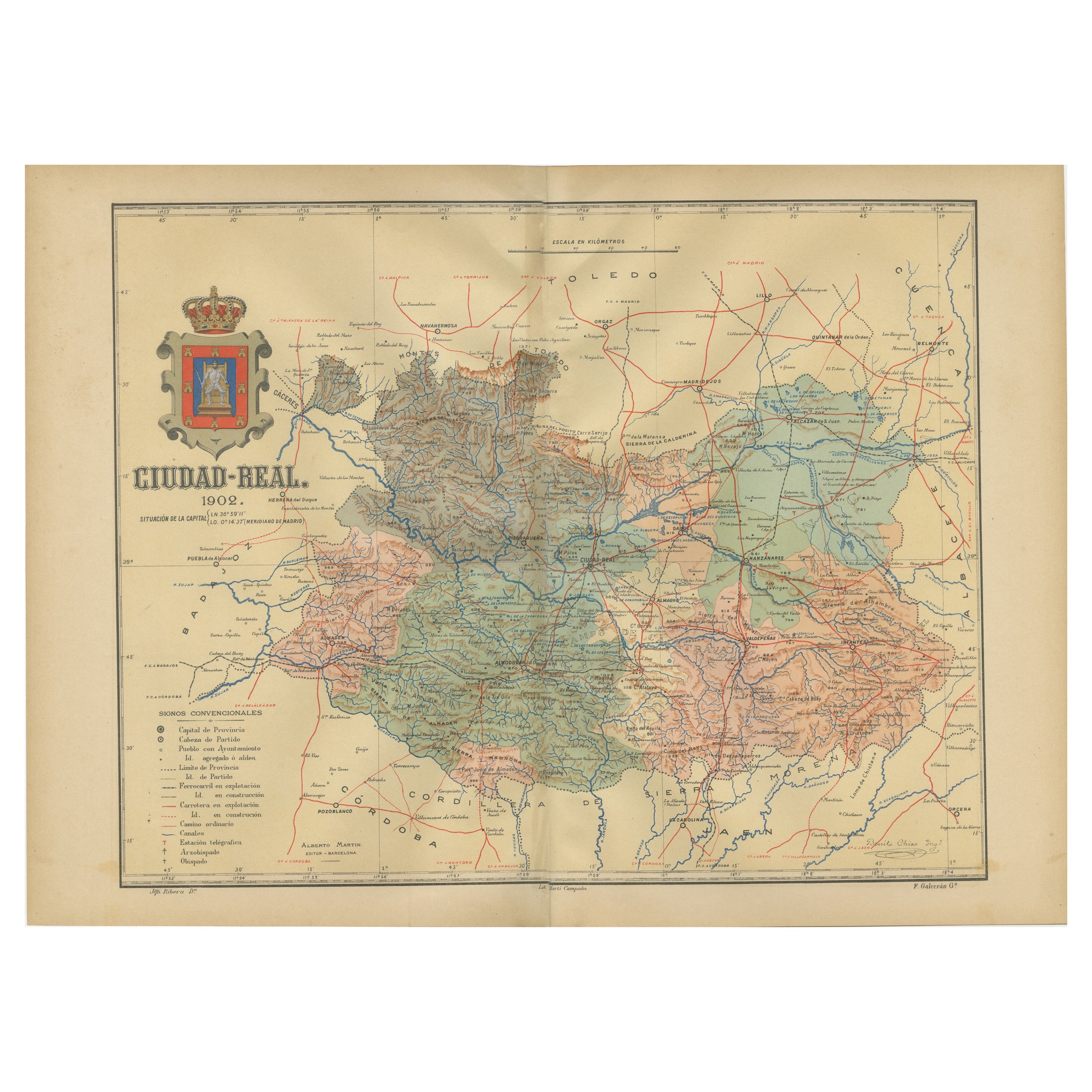
Ciudad Real 1902: A Detailed Cartographic Survey of La Mancha in Spain
Located in Langweer, NL
This original antitque map presents the province of Ciudad Real, located in the autonomous community of Castilla-La Mancha in central Spain, as of 1902. It includes several notable f...
Category
Antique Early 1900s Maps
Materials
Paper

$326 Sale Price
20% Off
Free Shipping
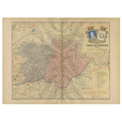
Trás-os-Montes: A Cartographic Exploration of Portugal's Hidden Province in 1903
Located in Langweer, NL
This print is an original historical map of the Trás-os-Montes region in the northeastern part of Portugal, dated 1903. Trás-os-Montes is often translated as "behind the mountains," ...
Category
Antique Early 1900s Maps
Materials
Paper
$297 Sale Price
20% Off
Free Shipping
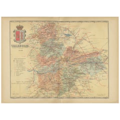
Anrtique Map of the Province of Valladolid, Central Spain, 1902
Located in Langweer, NL
A historical or archival map of the province of Valladolid, Spain, from the year 1902. Valladolid is a province located in the central part of Spain, within the autonomous community ...
Category
Antique Early 1900s Maps
Materials
Paper
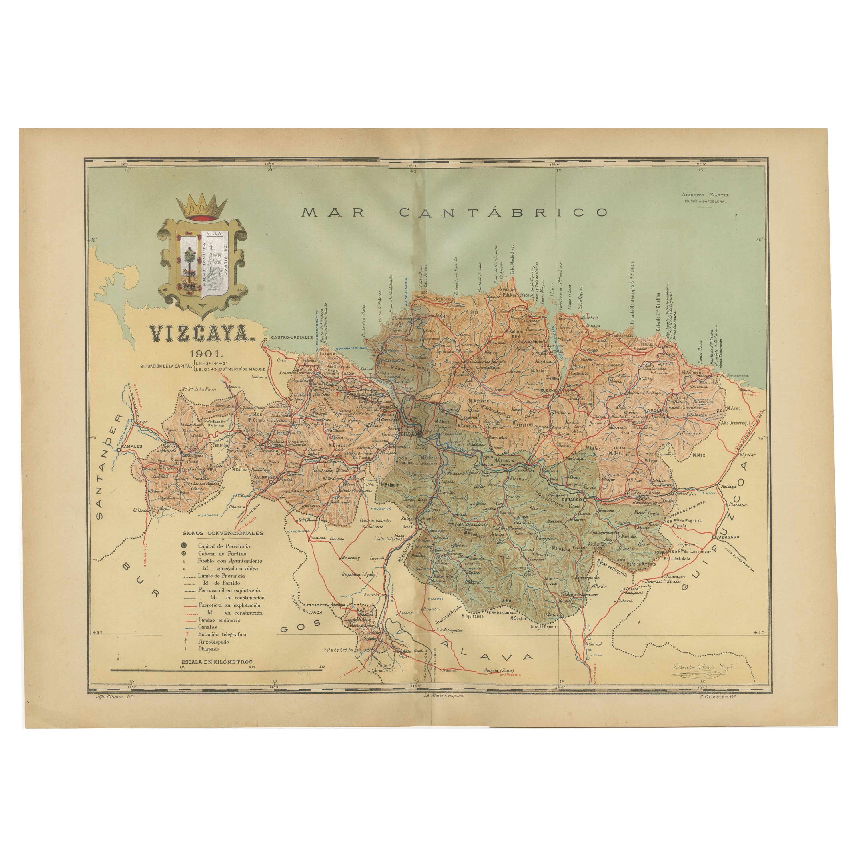
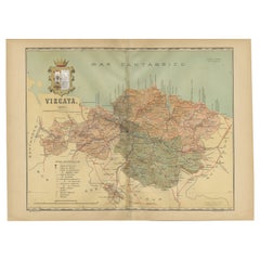
Cartographic Heritage: The 1901 Map of the Vizcaya Province in Spain
Located in Langweer, NL
This is a historical map of the province of Vizcaya (Biscay) in Spain, dated 1901. The title on the map is "VIZCAYA. 1901." It shows the topographical details of the region with cont...
Category
Antique Early 1900s Maps
Materials
Paper
$306 Sale Price
20% Off
Free Shipping
You May Also Like
Ancient National Atlas of France with Marengo
Located in Alessandria, Piemonte
Ancient National Atlas of France with the department of Marengo: a rare French etching dated 1806.
ST/178.
Category
Antique Early 19th Century French Other Prints
Materials
Paper

Large Original Vintage Map of Spain, circa 1920
Located in St Annes, Lancashire
Great map of Spain
Original color.
Good condition
Published by Alexander Gross
Unframed.
Category
Vintage 1920s English Maps
Materials
Paper

Original Antique Map of the American State of Ohio ( Southern Part ), 1903
Located in St Annes, Lancashire
Antique map of Ohio ( Southern part )
Published By A & C Black. 1903
Original colour
Good condition
Unframed.
Free shipping
Category
Antique Early 1900s English Maps
Materials
Paper

Austria-Hungary, Western Part. Century Atlas antique vintage map
Located in Melbourne, Victoria
'The Century Atlas. Austria-Hungary, Western Part'
Original antique map, 1903.
Central fold as issued. Map name and number printed on the reverse corners.
Sheet 40cm by 29.5cm.
Category
Early 20th Century Victorian More Prints
Materials
Lithograph

1832 Large Map "Russian & Poland" Ric. R0012
Located in Norton, MA
Large map 1832
"Russian & Poland"
Ric.r0012
Russia & Poland, by J. Arrowsmith. London, pubd. 15 Feby. 1832 by J. Arrowsmith, 35 Essex Street, Strand., ...
Category
Antique 19th Century Unknown Maps
Materials
Paper

1851 Map of "Independent Tartary", Ric. R018
Located in Norton, MA
1851 Map of
Independent Tartary
"Russia"
Ric.r018
A highly decorative 1851 map of Independent Tartary by John Tallis and John Rapkin. Covers the regions between the Caspian Sea and Lake Bakquash and between Russia and Afghanistan. These include the ancient Silk Route kingdoms of Khiva, Tartaria, Kokand, and Bokhara. Today this region roughly includes Kazakhstan, Uzbekistan, Turkmenistan, Kyrgyzstan, and Tajikistan. This wonderful map offers a wealth of detail for anyone with an interest in the Central Asian portion of the ancient Silk Road. Identifies various caravan routes, deserts, wells, and stopping points, including the cities of Bokhara and Samarkand. Three vignettes by W. Bragg decorate the map, these including an image of Tartars on a Journey, a horseback Bride Chase, and a tartar camp site. Surrounded by a vine motif border. Engraved by J. Rapkin for John Tallis's 1851 Illustrated Atlas .
Tartary Antique Map...
Category
Antique 19th Century Unknown Maps
Materials
Paper

More Ways To Browse
Heraldic Shield
Railway Map
Spanish Shield
Holy Water
Antique Holy Water
Court Sword
Spanish Sword
Antique Spanish Sword
Antique Spanish Swords
Toledo Sword
Antique Oushak
Mid Century Danish Directors Chairs
Moller 70
Argentina Travel Poster
Century Furniture Faux Bamboo
Early American Chairs
Hans Muller
Vintage Wood Table With Glass Top