Items Similar to Vintage World Map Mirror Based on the Original by Johnson 1882 Military Campaign

Want more images or videos?
Request additional images or videos from the seller
1 of 13
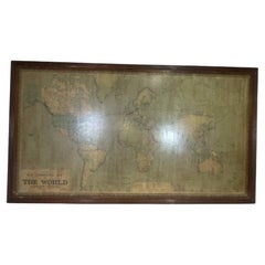
Vintage World Map Mirror Based on the Original by Johnson 1882 Military Campaign
$290.19
$414.5530% Off
£210
£30030% Off
€248.87
€355.5330% Off
CA$400.58
CA$572.2530% Off
A$446.27
A$637.5330% Off
CHF 234.12
CHF 334.4630% Off
MX$5,450.73
MX$7,786.7530% Off
NOK 2,964.40
NOK 4,234.8630% Off
SEK 2,777.89
SEK 3,968.4130% Off
DKK 1,857.63
DKK 2,653.7530% Off
About the Item
We are delighted to offer for sale this lovely Antique style pictorial plan map of the globe based on the original by Johnson in 1882
This is a very interesting and decorative piece, it looks good in any setting. It is an etching some was made by some kind of printing method
Condition wise the frame will have age related patina marks here and there, it is 30-40 years old
Dimensions:
Height:- 48cm
Width:- 61cm
Depth:- 2cm
Please note all measurements are taken at the widest point.
This item is available for collection from our Wimbledon warehouses.
Condition:
Please view the very detailed pictures as they form part of the description around condition
Please note vintage period and original items such as leather seating will always have natural patina in the form of cracking creasing and wear, we recommend regular waxing to ensure no moisture is lost, also hand dyed leather is not recommended to sit in direct sunlight for prolonged periods of time as it will dry out and fade.
- Dimensions:Height: 18.9 in (48 cm)Width: 24.02 in (61 cm)Depth: 0.79 in (2 cm)
- Style:Campaign (In the Style Of)
- Materials and Techniques:
- Place of Origin:
- Period:
- Date of Manufacture:20th Century
- Condition:Wear consistent with age and use. Minor fading.
- Seller Location:West Sussex, GB
- Reference Number:1stDibs: LU2823320334102
About the Seller
4.7
Platinum Seller
Premium sellers with a 4.7+ rating and 24-hour response times
Established in 2012
1stDibs seller since 2017
2,001 sales on 1stDibs
Typical response time: <1 hour
- ShippingRetrieving quote...Shipping from: West Sussex, United Kingdom
- Return Policy
Authenticity Guarantee
In the unlikely event there’s an issue with an item’s authenticity, contact us within 1 year for a full refund. DetailsMoney-Back Guarantee
If your item is not as described, is damaged in transit, or does not arrive, contact us within 7 days for a full refund. Details24-Hour Cancellation
You have a 24-hour grace period in which to reconsider your purchase, with no questions asked.Vetted Professional Sellers
Our world-class sellers must adhere to strict standards for service and quality, maintaining the integrity of our listings.Price-Match Guarantee
If you find that a seller listed the same item for a lower price elsewhere, we’ll match it.Trusted Global Delivery
Our best-in-class carrier network provides specialized shipping options worldwide, including custom delivery.More From This Seller
View AllSilver Leaf Foil Wall World Map Engraving Based on the Original Moses Pitt, 1681
Located in West Sussex, Pulborough
We are delighted to offer for sale this lovely antique style pictorial silver leaf foil world map taken from and original engraving my Moses Pitt, 1681
This is a very interesting ...
Category
20th Century English Modern Maps
Materials
Silver Leaf

$266 Sale Price
30% Off
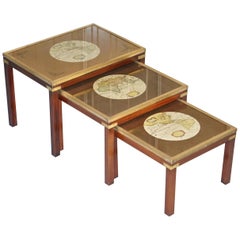
Rare Lovely Coffee & Side Table Nest of Tables Military Campaign with World Maps
Located in West Sussex, Pulborough
We are delighted to offer for sale this lovely nest of three side tables with world maps detailing
A nice decorative set, each one has a good quality print of a world map. They ar...
Category
20th Century English Campaign Nesting Tables and Stacking Tables
Materials
Brass
$1,402 Sale Price / set
30% Off
Gold Leaf Foil Pictorial Plan Map of the West Country of England Antique Style
Located in West Sussex, Pulborough
We are delighted to offer for sale this lovely Antique style pictorial plan map of the West Country of England etched in gold leaf foil
This is a very interesting and decorative p...
Category
20th Century English Adam Style Maps
Materials
Gold Leaf

$266 Sale Price
30% Off
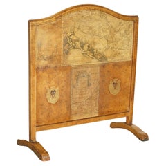
ANTIQUE EDWARDIAN LEATHER CLAD & EMBOSSED FiRE SCREEN WITH MAP DECORATION
Located in West Sussex, Pulborough
Royal House Antiques
Royal House Antiques is delighted to offer for sale this lovely Edwardian circa 1900 Leather clad and embossed fire screen
Please note the delivery fee listed ...
Category
Antique Early 1900s European Edwardian Screens and Room Dividers
Materials
Leather, Pine
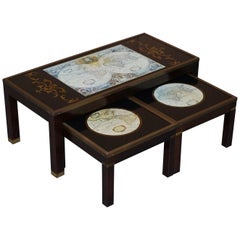
Stunning Coffee and Side Table Nest of Tables Military Campaign with World Maps
Located in West Sussex, Pulborough
We are delighted to offer for sale this stunning nest of vintage military campaign tables to include one large coffee table and two sm...
Category
20th Century English Campaign Coffee and Cocktail Tables
Materials
Hardwood
$1,308 Sale Price / set
30% Off
Vintage Coffee & Side Table Nest of Tables Military Campaign with World Maps
Located in West Sussex, Pulborough
We are delighted to offer for sale this lovely nest of three side tables with world maps detailing.
A nice decorative set, each one has a good quality print of a world map. They a...
Category
20th Century English Campaign Nesting Tables and Stacking Tables
Materials
Brass

You May Also Like
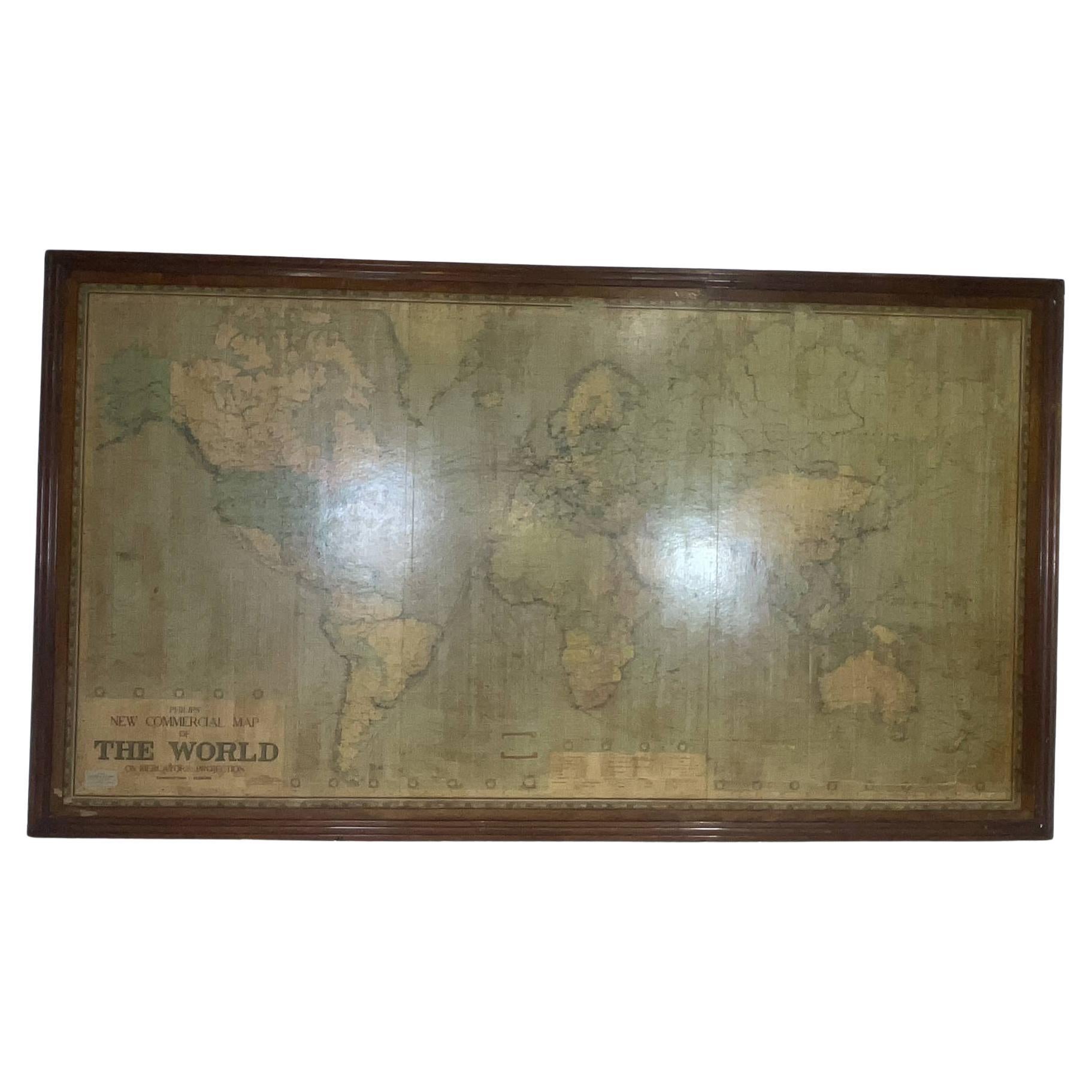
8 Foot Framed World Map by Philips
Located in Norwell, MA
1951 map of the world by George Philip and Son. Large beautiful map as it was in 1951. Nice patina mounted to a sturdy wood frame. Overall good condition. Very large in size. 90" W x...
Category
Vintage 1950s North American Maps
Materials
Paper
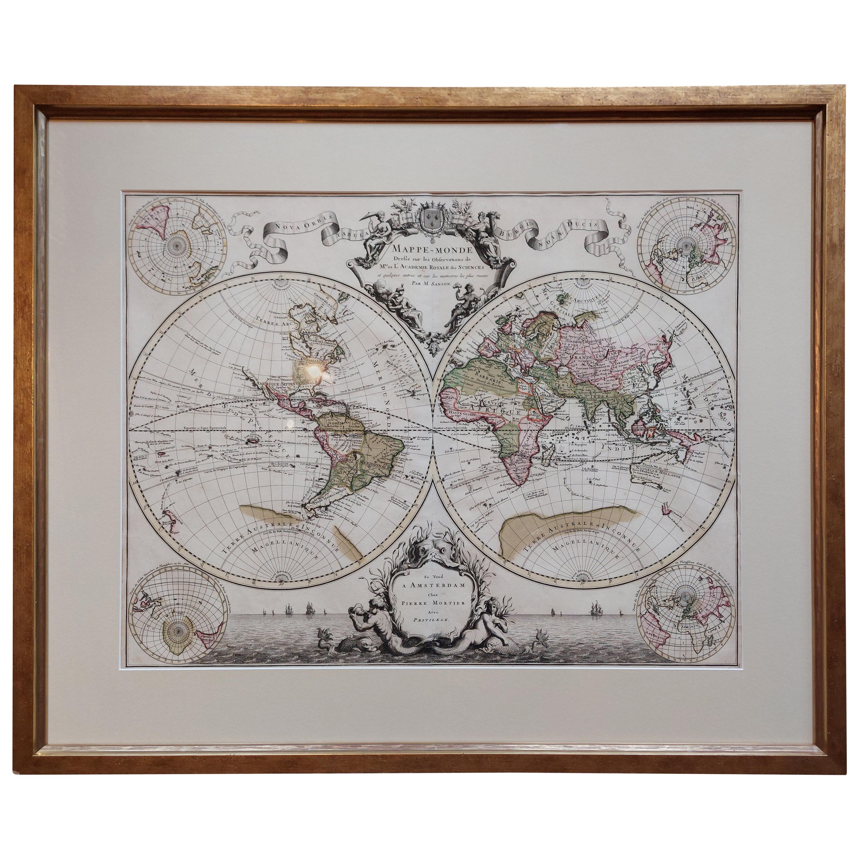
Original Antique Hand-colored World Map with or without Frame, '1696'
Located in Langweer, NL
Antique world map titled 'Mappe-Monde dressee sur les Observations de Mrs. de l'Academie Royale des Sciences (..)'. Beautiful original antique world map...
Category
Antique Late 17th Century French Maps
Materials
Paper

World Relief Map
Located in Antwerp, BE
Large world relief map.
Measures: Width 232 cm.
Height 158 cm.
Category
Mid-20th Century German Mid-Century Modern Maps
Materials
Acrylic

$2,140
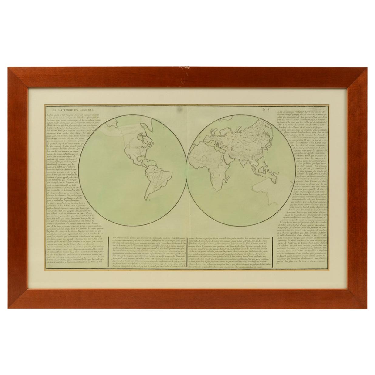
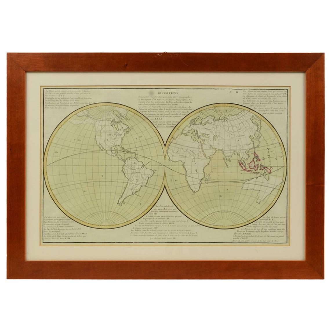
1850 Old French Map Depicting the Entire Earth's Surface Divided into Two Parts
Located in Milan, IT
Geographical map depicting the entire earth's surface divided into two parts that correspond to the two hemispheres or globes, the map deals with the earth in general. Detailed expla...
Category
Antique Mid-19th Century French Maps
Materials
Glass, Wood, Paper

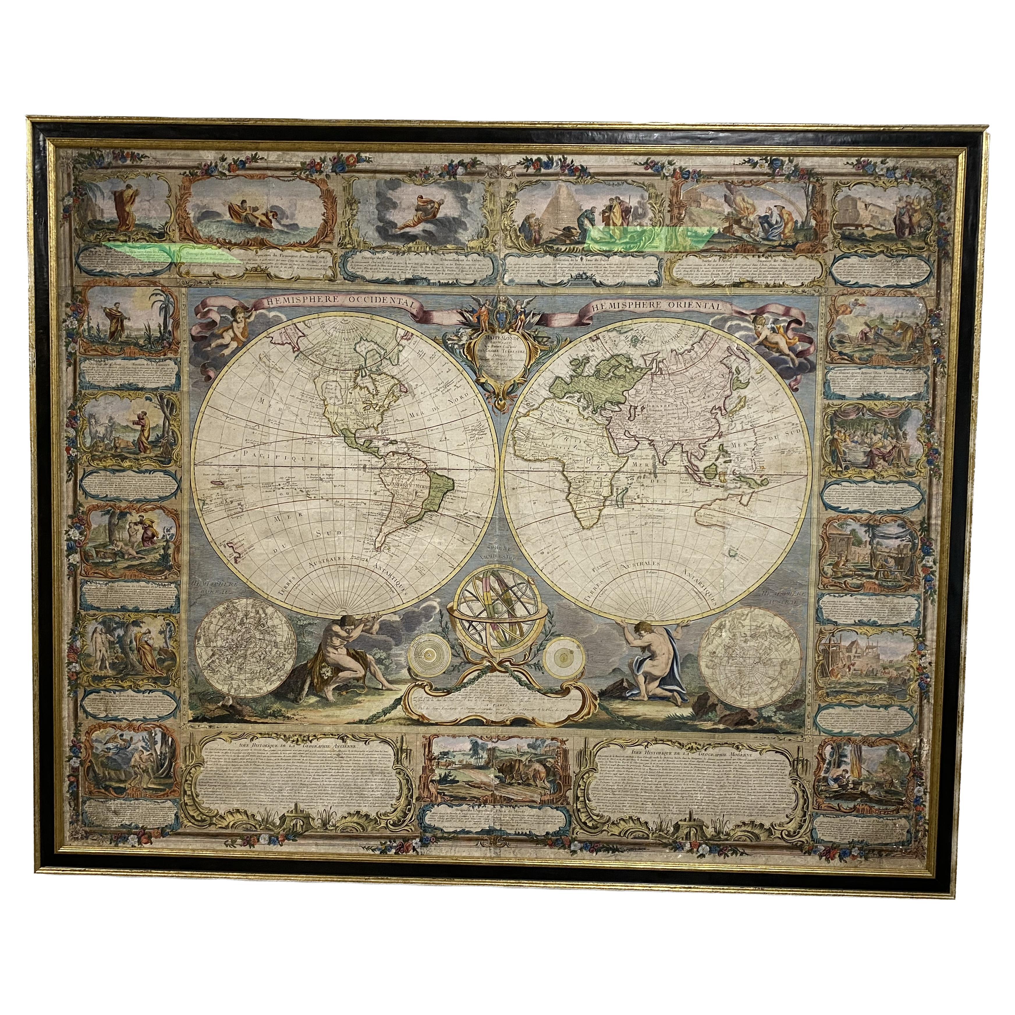
Colored wall map of the WORLD
By Chambon
Located in ZWIJNDRECHT, NL
“Mappe Monde, contenant les Parties Connues du Globe Terrestre”
CHAMBON, Gobert-Denis (France, 17.. - 1781)
Paris, Longchamps et Janvier, 1754
Size H. 115 x W. 145 cm.
Gobert-Denis Chambon made copper engraving after the work of Guillaume De L’Isle, published in 1754 by Jean Janvier and S.G. Longschamps.
A huge wall map of the world in two hemispheres printed on two sheets, depicting the Eastern and Western hemispheres supported by two male figures, decorated at the bottom right and left with two celestial hemispheres (boreal and southern) and at the bottom in the middle with an armillary sphere, in addition.
This map is most notable for its depiction of the Sea of Japan labeled "Mer de Corée" and of "Mer de L'Ouest" or Sea of the West - a great sea, easily the size of the Mediterranean, to flow from the then-known Strait of Juan de Fuca...
Category
Antique Mid-18th Century French French Provincial Maps
Materials
Wood, Paper

1850 Old French Map Depicting the Entire Earth's Surface Divided into Two Parts
Located in Milan, IT
Geographical map depicting the entire earth's surface divided into two parts that correspond to the two hemispheres where the emerged lands are depicted which have been classified wi...
Category
Antique Mid-19th Century French Maps
Materials
Glass, Wood, Paper

More Ways To Browse
The Vintage Map
Military Map
Framed World Map
Vintage World Map
Vintage World Globes
Military Globe
Johnson Wax
Antique Maps Indonesia
Compass Rose Antique
Swiss Antiques And Collectables
Antique Compass Map
Blaeu Maps
Coat Of Arms German
Antique Collectables Australia
Military Map
Spanish Empire
Antique Maps Scotland
Mississippi Antique