Late 17th Century Prints
to
218
250
3
253
Height
to
Width
to
3
5,275
9,779
5,515
874
1,209
1,729
1,683
199
80
206
257
248
311
414
704
366
226
253
1
1
1
1
44
24
6
5
3
253
253
253
3
3
2
2
1
Period: Late 17th Century
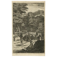
Old Print of Farmers Harvesting Cinnamon on the Island Ceylon or Sri Lanka, 1672
Located in Langweer, NL
Antique print, titled: 'Hoe men de Caneel schilt opt Eyland Ceylon.'
This rare original plate shows a group of farmers harvesting cinnamon on the island of Ceylon / Sri Lanka. Du...
Category
Antique Late 17th Century Prints
Materials
Paper
$363 Sale Price
20% Off
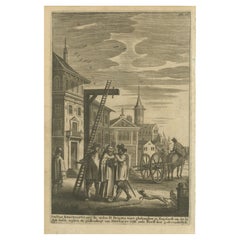
The Execution of Doctor Reginaldus for Opposing Henry VIII's Reformation, c.1680
Located in Langweer, NL
The engraving depicts a historical execution scene, likely related to religious persecution. Below is a detailed description and analysis of the image and text:
The text at the bott...
Category
Antique Late 17th Century Prints
Materials
Paper
$420 Sale Price
20% Off
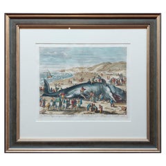
Antique Print of a Beached Whale by Van der Gouwen 'c.1680'
Located in Langweer, NL
Antique print titled 'Een Walvisch lang zo voeten, gestrandt op de Hollandtse zee-kust, tusschen Schevelingen en Katwyk, in Sprokkelmaandt, 1598'. Beautiful original antique print of...
Category
Antique Late 17th Century Prints
Materials
Paper
$1,435 Sale Price
20% Off
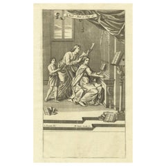
A Musical Gathering: Engraving from Richard Blome’s The Gentleman’s Recreation
Located in Langweer, NL
This print is an illustration from Richard Blome’s The Gentleman's Recreation, published in 1686, showing a group of people engaged in making music, with one person playing an organ....
Category
Antique Late 17th Century Prints
Materials
Paper
$306 Sale Price
20% Off
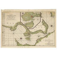
Antique Map: Carte du Détroit du Sond with Copenhagen Inset, 1693
Located in Langweer, NL
Antique Map: Carte du Détroit du Sond with Copenhagen Inset, Jaillot/Mortier, 1693
This rare and striking antique map, titled *Carte du détroit du Sond contenant les costes de l’Is...
Category
Antique Late 17th Century Prints
Materials
Paper
$2,152 Sale Price
20% Off
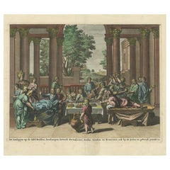
Old Print of Jews Eating on Beds like Assyrians, Persians, Romans, Greeks, 1690
Located in Langweer, NL
Description: Antique print religion titled 'Het aanliggen op de Tafel-Bedden; hoedanigen Eetwyse der Assyriers, Persen, Grieken en Romeinen, ook by de Joden in gebruyk geraakt is'.
...
Category
Antique Late 17th Century Prints
Materials
Paper
$526 Sale Price
20% Off
Baroque Grandeur: The Rosersberg Palace Gardens in Swidde's 1695 Engraving
Located in Langweer, NL
The image is an original antique copperplate engraving by Swidde, completed in 1695. The scene is a meticulous depiction of an elegant palace and its formal gardens, rendered in the ...
Category
Antique Late 17th Century Prints
Materials
Paper
$430 Sale Price
20% Off
The Spanish Armada’s Defeat: A 17th-Century German Chronicle Engraving
Located in Langweer, NL
The Spanish Armada’s Defeat: A 17th-Century German Chronicle Engraving
This impressive 17th-century engraving, titled *Historischer Chronicken*, vividly depicts the dramatic naval...
Category
Antique Late 17th Century Prints
Materials
Paper
Mecha in Arabia – Engraving by Gaspar Bouttats after Jan Peeters, Antwerp, 1680
Located in Langweer, NL
Title: Mecha in Arabia – Engraving by Gaspar Bouttats after Jan Peeters, Antwerp, circa 1680
Description: This copperplate engraving depicts a detailed view of Mecca in Arabia, h...
Category
Antique Late 17th Century Prints
Materials
Paper
17th Century Engraving of the Royal City of Arakan (Burma) by Arnoldus Montanus
Located in Langweer, NL
Lovely detailled engraving of the old city of Arakan in Myanmar, in good condition. This illustration is from "De Oost-Indische Voyagie van Wouter Schouten", published by Jacob Meurs...
Category
Antique Late 17th Century Prints
Materials
Paper
$287 Sale Price
20% Off
Old Map of the Province of Groningen, the Netherlands & inset of Islands, C.1680
Located in Langweer, NL
Antique map titled 'Tabulae dominii Groeningae quae et complecitur maximam partem Drentiae Emendata'.
Old map of the province of Groningen, the Netherlands. With an inset map of ...
Category
Antique Late 17th Century Prints
Materials
Paper
$1,195 Sale Price
20% Off
Engraving of Rituals and Cremation Ceremonies in New Spain by Montanus, 1673
Located in Langweer, NL
Title: "Rituals and Ceremonies in New Spain"
Description: This striking copper engraving is extracted from Arnoldus Montanus' seminal work, "Die Unbekannte Neue Welt oder Beschreibu...
Category
Antique Late 17th Century Prints
Materials
Paper
$430 Sale Price
20% Off
Original Antique Portrait of Charles XI of Sweden, Engraved in 1698
Located in Langweer, NL
This is an original antique print that features an intricate engraving from 1698, depicting Charles XI, the King of Sweden, titled "Carolus XI, Suecorum Gothorum Et Vandalorum Rex,"...
Category
Antique Late 17th Century Prints
Materials
Paper
$325 Sale Price
20% Off
Set of 2 Antique Mythology Prints after Bloemaert 'c.1680'
Located in Langweer, NL
Set of two antique mythology prints. These prints originate from 'Prima Pars: 't Eerste deel van de Teeken- Konst' by Abraham Bloemaert. Published by...
Category
Antique Late 17th Century Prints
Materials
Paper
$334 Sale Price / set
20% Off
Antique Map of the Eastern Hemisphere in Frame, 'circa 1683'
Located in Langweer, NL
Antique map titled 'Climats selon les Anciens'. Miniature map of the Eastern Hemisphere showing the climatic regions. This map originates from 'Description de l'Univers' by A.M. Mall...
Category
Antique Late 17th Century Prints
Materials
Paper
Antique Map of Bavaria with many details, Germany
Located in Langweer, NL
Antique map titled 'Bavariae Circulus atq Electoratus tam cum Adiacentibus quam insertis Regionibus (..)'. Dutch map of Bavaria, showing the many cities, towns, and other features of...
Category
Antique Late 17th Century Prints
Materials
Paper
$631 Sale Price
20% Off
Set of 10 Antique Horse Riding Prints
Located in Langweer, NL
Set of 10 antique horse riding prints. Published circa 1680.
Category
Antique Late 17th Century Prints
Materials
Paper
$1,148 Sale Price / set
20% Off
Charming Miniature Map of Thrace or Thrake in Southeast Europe, 1685
Located in Langweer, NL
Antique map titled 'Thraciae Descriptio.'
Charming miniature map of Thrace, from the pocket atlas 'Introductionis in Universam Geographiam tam Veterem quam novam .. Acessit P. Be...
Category
Antique Late 17th Century Prints
Materials
Paper
$315 Sale Price
20% Off
Botanical Illustration of Cardamom Plant (Cardamomum majus arborescens) , 1696
Located in Langweer, NL
This antique print, titled "Cardamomum majus arborescens," illustrates the Cardamom plant, known for its aromatic seeds, which are commonly used as a spice in both culinary and medic...
Category
Antique Late 17th Century Prints
Materials
Paper
$420 Sale Price
20% Off
Original Copper Engraving of Koroni 'or Corone', Greece, 1688
Located in Langweer, NL
Antique print titled 'Das Aussehen der Stadt und Vestung Coron von der Seit des Auffgang'.
Copper engraving of Koroni (or Corone), Greece. This print originates from 'Ruhm-belorb...
Category
Antique Late 17th Century Prints
Materials
Paper
$248 Sale Price
20% Off
Rare Original Antique Ptolemy Map of Ceylon, Present Day Sri Lanka
Located in Langweer, NL
Original antique map titled 'Tab XII Asiae Taprobanam (..)'. For this map of Toprobana (Sri Lanka), Ptolemy drew on the accounts of travelers and sailors and though the information was secondhand and often inaccurate, it represented the most advanced account of the world's geography at that time. This map depicts the island with the typical misconceptions of the period with the enlarged island straddling the Equator and nearly divided by a ridge of mountains. A small part of India is incorrectly shown in the northeast corner of the map and a spurious coastline labeled Gangem fills the upper right corner. The stipple engraved sea contains an oriental ship...
Category
Antique Late 17th Century Prints
Materials
Paper
$736 Sale Price
20% Off
Copper-Line Engraving by Cornelius de Bruyn of Alexandria in Egypt, c.1690
Located in Langweer, NL
Artist: Cornelis de Bruijn (or de Bruyn); 1652 – 1726/7 was a Dutch artist and traveler. He made two large tours and published illustrated books with his observations of people, buil...
Category
Antique Late 17th Century Prints
Materials
Paper
$277 Sale Price
20% Off
Antique Map of Western Africa and the Cape Verde Islands by Coronelli, 1691
Located in Langweer, NL
Antique map titled 'Bocche del Fiume Negro et Isole di Capo Verde'. Antique map of Western Africa with the Cape Verde Islands and an inset of Goree Island. Originates from 'Atlante V...
Category
Italian Antique Late 17th Century Prints
Materials
Paper
Rare Hand-Colored Antique Map of the Bassora 'Basra' Region in Iraq, 1680
Located in Langweer, NL
Description: Antique map titled 'Delineato Regionis Bassora cum Angis uminibus et Isulis.'
Map of the Bassora (Basra) region, Iraq.
Artists and Engravers: Made by 'Olfert Dapper' ...
Category
Antique Late 17th Century Prints
Materials
Paper
$1,100 Sale Price
20% Off
Coppeer Engraving of Henry Garnet (1555–1606), Jesuit Priest and Martyr, ca.1670
Located in Langweer, NL
Title: Portrait of Henry Garnet (1555–1606), Jesuit Priest and Martyr – 17th-Century Copper Engraving
This fine copper engraving from around 1670 depicts Henry Garnet, a Jesuit prie...
Category
Antique Late 17th Century Prints
Materials
Paper
$315 Sale Price
20% Off
Rare Antique Map of Southwestern Europe and West Africa by V.M. Coronelli, 1692
Located in Langweer, NL
Antique Globe Gore: Southwestern Europe and West Africa by Vincenzo Coronelli
This exquisite, hand-colored globe gore by Vincenzo Coronelli, one of the most renowned 17th-century cartographers, represents Southwestern Europe and West Africa. A segment of Coronelli's monumental 42-inch terrestrial globe, this gore is a remarkable example of the artistry and geographical knowledge of the late 1600s. Covering France, the Iberian Peninsula, and all of Africa west of a line extending from Algeria to the Bight of Benin, it also includes the Canary Islands and Madeira.
Coronelli’s globe gores are celebrated for their exceptional engraving and accuracy, and this piece is no exception. The coastline of Africa is depicted with remarkable precision for its time, reflecting the latest geographical knowledge of European explorers. In contrast, the interior of Africa—still a mystery to European mapmakers—features mythical elements such as fantastical mountain ranges and exotic fauna. Giraffes, elephants, lions, and mysterious giant birds populate the landscape, offering a glimpse into the imagination and curiosity of the era. One notable detail is the Gambia...
Category
Antique Late 17th Century Prints
Materials
Paper
$2,343 Sale Price
20% Off
Venngarn Castle, Uppland in Sweden: A Dahlbergh and Swidde Masterpiece, c. 1695
Located in Langweer, NL
Title: "Venngarn Castle, Uppland: A Dahlbergh and Swidde Masterpiece, c. 1695"
Description: This enchanting hand-colored copper engraving from circa 1695 captures the grand Venngarn...
Category
Antique Late 17th Century Prints
Materials
Paper
$459 Sale Price
20% Off
Allegorical Frontispiece of Rome's Ruins, Pieter van der Aa & F. Halma, 1696
Located in Langweer, NL
This engraving is an allegorical frontispiece featuring a depiction of the ruins of ancient Rome, emphasizing the enduring legacy of the city's grandeur through its remnants. The com...
Category
Antique Late 17th Century Prints
Materials
Paper
Old Original Miniature View of the Skyline of Miaco 'Kyoto, Japan', 1683
Located in Langweer, NL
Antique print titled 'De l'Asie Figure XXV, Miaco'.
Miniature view of the skyline of Miaco (Kyoto, Japan). This print originates from 'Description de l'Univers', published 1683.
...
Category
French Antique Late 17th Century Prints
Materials
Paper
$229 Sale Price
20% Off
His Majesty’s Arrival at Honselaarsdijk – Grand Procession Engraving c.1690
Located in Langweer, NL
Title: Arrival of His Majesty in Honselaarsdijk – Grand Procession Engraving, circa 1690
Description:
This impressive large-format antique engraving depicts the grand arrival proces...
Category
Dutch Antique Late 17th Century Prints
Materials
Paper
Cartographic Treasures: A Journey Through the Gascogne and Guyenne Regions, 1680
Located in Langweer, NL
The antique map titled "Gouvernement de La Guienne & Gascogne" depicts the region of Gascogne and Guyenne, known for their wine production, in France.
This map is a rare edition, u...
Category
Antique Late 17th Century Prints
Materials
Paper
$717 Sale Price
20% Off
View of Bartanico in the Aegean Archipelago with Fortifications and Ships, 1680
Located in Langweer, NL
Title: View of Bartanico in the Aegean Archipelago with Fortifications and Ships, ca. 1680
Description: This copperplate engraving depicts a striking view of Bartanico (possibly P...
Category
Antique Late 17th Century Prints
Materials
Paper
Set of 5 Antique Horse Riding Prints – Equestrian Training Scenes, c.1680
Located in Langweer, NL
Set of 5 Antique Horse Riding Prints – Equestrian Training Scenes, c.1680
This rare set of five copper engravings, published circa 1680, presents ...
Category
European Antique Late 17th Century Prints
Materials
Paper
$621 Sale Price / set
20% Off
Rare Portrait of Flemish Baroque Printmaker of Pieter de Jode the Younger, 1694
Located in Langweer, NL
Antique print, titled: 'Petrus de Jode' -
Portrait of Pieter de Jode II or Pieter de Jode the Younger (1606–1674), a Flemish Baroque printmaker, draughtsman, painter and art deal...
Category
Antique Late 17th Century Prints
Materials
Paper
$172 Sale Price
20% Off
Print of Leopold I, Holy Roman Emperor, King of Hungary, Croatia & Bohemia, 1695
Located in Langweer, NL
Antique print, titled: 'Leopoldus Romanorum Imperator Semper Augustus.'
This original antique plate shows a portrait of Leopold I (9 June 1640 – 5 May 1705), he was Holy Roman Emperor...
Category
Antique Late 17th Century Prints
Materials
Paper
$306 Sale Price
20% Off
Antique Map of Madagascar by N. Sanson, circa 1680
Located in Langweer, NL
Antique map titled 'Isle de Madagascar ou de St. Laurens. Tiree de Sanutu &c'. Antique map of Madagascar, first published by Sanson in 1657. Sanson n...
Category
Antique Late 17th Century Prints
Materials
Paper
$239 Sale Price
20% Off
Etching of Agostino Chigi's Coat of Arms and View of Rome, by C.Fantetti, c.1690
Located in Langweer, NL
Etching of Agostino Chigi's Coat of Arms and View of Rome, by Cesare Fantetti
This exquisite 17th-century etching, created by Italian printmaker Cesare Fantetti between 1653 and 169...
Category
Antique Late 17th Century Prints
Materials
Paper
The Ekolsund Castle and Gardens in Sweden in Swidde's 1695 Engraving
Located in Langweer, NL
The print is aan original detailed 1695 engraving of Ekolsund Castle in Sweden, crafted by Willem Swidde. The engraving is part of the collection from "Suecia Antiqua et Hodierna," which was a grand work showcasing the estates and landmarks of Sweden through elaborate illustrations.
The scene depicted in the engraving is a classic example of the baroque garden architecture style, with geometrically arranged gardens, symmetrical layouts, and an expansive approach leading up to the castle, emphasizing the grandeur and formality of the estate. The meticulous detail in the gardens and the inclusion of figures within the grounds suggest a vibrant and cultured estate life.
Ekolsund Castle, located in Enköping Municipality in Uppsala County, Sweden, is a manor house with a rich history dating back to the 14th century. By the 15th century, it was owned by the prominent Bengt Jönsson...
Category
Antique Late 17th Century Prints
Materials
Paper
$363 Sale Price
20% Off
Portrait of Fernando Alvarez de Toledo y Pimentel, Grand duke of Alba, c.1690
Located in Langweer, NL
Antique print, titled: 'Ferdinand de Tolede. Duc d'Albe.'
Portrait of Fernando Alvarez de Toledo y Pimentel, Grand duke of Alba (1507-1582). Source un...
Category
Antique Late 17th Century Prints
Materials
Paper
$497 Sale Price
20% Off
Historic View of Sugar Milling in 17th Century America, published in 1673
Located in Langweer, NL
The print titled "AMERIKENS ENTDECKER" is a striking antique copper engraving, crafted in 1673 during the 17th century as part of the German edition of Arnoldus Montanus' influential work, "Die Unbekante Neue Welt" ("The New and Unknown World"). The engraving was executed by Jacob van Meurs, a renowned Dutch engraver and publisher known for his detailed works on geography and history, and it was published in Amsterdam.
Description of the Print:
The engraving measures 17 x 13 cm (approximately 6.6 x 4.7 inches) and is set on a page that is 31 x 19.5 cm (about 12.2 x 7.4 inches). It depicts a vivid scene that illustrates the discovery of America...
Category
Dutch Antique Late 17th Century Prints
Materials
Paper
$363 Sale Price
20% Off
Antique Map of the Island of Djerba by Coronelli '1691'
Located in Langweer, NL
Antique map titled 'Isola e Castello di Gerbi'. Original antique map of the Island of Djerba, Tunisia, in Africa. Includes an inset of the Djerba Castle in upper right. This map orig...
Category
Antique Late 17th Century Prints
Materials
Paper
$334 Sale Price
20% Off
The Sjö Castle and Gardens in the Swedish Countryside, 1696
Located in Langweer, NL
The engraving depicts a grand manor house surrounded by formal gardens. It is titled "Facies Splendidissimi Ornatißimique Palatii," which suggests it is an illustration of an opulent and ornate palace. The year noted for the engraving is 1696, and it was engraved by Swidde, referring to Willem Swidde, a Dutch artist known for his work in Sweden and his significant contributions to the collection "Suecia Antiqua et Hodierna" by Erik Dahlbergh...
Category
Antique Late 17th Century Prints
Materials
Paper
$229 Sale Price
20% Off
Antique Hand-Colored Map of Western Russia and Ukraine, c.1680
Located in Langweer, NL
Description: Antique map titled 'Novissima et Accuratissima Totius Russiae vulgo Muscoviae Tabula'.
Antique map of Western Russia and Ukraine, published by Justus Danckerts. The ma...
Category
Antique Late 17th Century Prints
Materials
Paper
$717 Sale Price
20% Off
The Martyrdom of Secular Priests and One Benedictine Monk by Parlement, c.1680
Located in Langweer, NL
The engraving depicts a scene of execution involving multiple priests, likely reflecting religious persecution in England. Here is a detailed analysis, including a translated version...
Category
Antique Late 17th Century Prints
Materials
Paper
$420 Sale Price
20% Off
View of Fanar in the Aegean Archipelago with Bridge and Ships, ca. 1680
Located in Langweer, NL
Title: View of Fanar in the Aegean Archipelago with Bridge and Ships, ca. 1680
Description: This copperplate engraving showcases a detailed view of Fanar (possibly Fener or anothe...
Category
Antique Late 17th Century Prints
Materials
Paper
Baroque Allegorical Engraving with Noble Coat of Arms, circa 1690
Located in Langweer, NL
Title: "Allegorical Tribute to Cardinal Giovanni Francesco Negroni"
Description: This intricate engraving features an allegorical landscape dedicated to Cardinal Giovanni Francesco ...
Category
Antique Late 17th Century Prints
Materials
Paper
Botanical Illustration of Soursop (Annona muricata) from Munting’s 1696 Herbal
Located in Langweer, NL
This antique print, titled "Guanabanus Folio Ficulneo," illustrates the Soursop, or Annona muricata, a fruit native to tropical regions of the Americas, particularly valued for its s...
Category
Antique Late 17th Century Prints
Materials
Paper
$373 Sale Price
20% Off
Botanical Engraving of Arrowhead from Munting’s 1696 Herbal Collection
Located in Langweer, NL
This original old hand-coloured antique print depicts Sagittaria Sagittifolia, known as "arrowhead." It originates from the botanical work "Naauwkeurige Beschryving der Aardgewassen"...
Category
Antique Late 17th Century Prints
Materials
Paper
$325 Sale Price
20% Off
Port Scene at Ladimiti in the Aegean Archipelago with Fortifications, ca. 1680
Located in Langweer, NL
Title: Port Scene at Ladimiti in the Aegean Archipelago with Fortifications, ca. 1680
Description: This copperplate engraving depicts a bustling port scene at Ladimiti (likely Lem...
Category
Antique Late 17th Century Prints
Materials
Paper
Botanical Illustration of White Turmeric (Curcuma zedoaria) by Blackwell, 1696
Located in Langweer, NL
This antique print, titled "Zedoaria," depicts the Curcuma zedoaria, also known as zedoary, white turmeric, or kentjur. The plant is a member of the ginger family, known for its medi...
Category
Antique Late 17th Century Prints
Materials
Paper
$420 Sale Price
20% Off
Noble Abode: The la Gardie Estate in Stockholm as Envisioned by Jean Marot, 1670
Located in Langweer, NL
Makalös or De la Gardieska palace, from 1643. View from Jacob's church. Later function as an arsenal and armory chamber. Rebuilt as the Dramatic Theater in 1793. Destroyed by fire on November 24, 1825. Copper engraving in Suecia antiqua et hodierna, from about 1667.
This print is from "Suecia Antiqua et Hodierna," which is a significant work depicting Sweden during its era as a great power. The collection of engravings...
Category
Antique Late 17th Century Prints
Materials
Paper
$478 Sale Price
20% Off
Antique Miniature Map of the Old World and France by Mallet, circa 1683
Located in Langweer, NL
Antique map titled 'Planisphere du Monde - France'. Two miniature maps on one sheet. The upper map shows a hemisphere of the Old World. The lower map shows France. This map originate...
Category
Antique Late 17th Century Prints
Materials
Paper
$167 Sale Price
20% Off
Antique Sea Chart of Hudson Bay and Arctic Canada by Van Keulen, circa 1681
Located in Langweer, NL
Antique map titled 'Pascaarte vande Noorderzee Custen van America (..)'. Sea chart of Hudson Bay and Arctic Canada. Compass roses, loxodromic lines, and ships decorate the oceans and...
Category
Antique Late 17th Century Prints
Materials
Paper
Botanical Illustration of Sesame Plant (Sesamum indicum) - Munting’s 1696 Herbal
Located in Langweer, NL
This antique print, titled "Sesamum Persicum Trilobatum Foetidum," depicts the Sesame plant (Sesamum indicum), known for its seeds and oil. Sesame is one of the oldest oilseed crops,...
Category
Antique Late 17th Century Prints
Materials
Paper
$420 Sale Price
20% Off
Antique Bird's-Eye Plan of Tutecoryn (Tuticorin or Thoothukudi), India, 1672
Located in Langweer, NL
Antique map, titled: 'Tutecoryn.'
Bird's-eye plan of map of Tutecoryn (Tuticorin or Thoothukudi), India. This map originates from 'Naauwkeurige Beschryvinge van Malabar en Choroman...
Category
Antique Late 17th Century Prints
Materials
Paper
$344 Sale Price
20% Off
Antique Map of Friesland 'The Netherlands' by B. Schotanus, 1664
By B. Schotanus
Located in Langweer, NL
Hand-colored map of the Dutch province Friesland. Also shows the Wadden islands Vlieland, Terschelling and Ameland and a part of Schiermonnikoog. With a decorative cartouche with two...
Category
Antique Late 17th Century Prints
Materials
Paper
$1,602 Sale Price
9% Off
Old Engraving of The Catching of Horses on Jafnapatnam, Ceylon 'Sri Lanka', 1672
Located in Langweer, NL
Antique print, titled: 'Paardevangst op Jafnapatnam' - This plate shows the catching of horses on Jafnapatnam. The province of Jaffna , and specially the fort at Jaffnapatnam were th...
Category
Antique Late 17th Century Prints
Materials
Paper
$507 Sale Price
20% Off
Antique Hand-Coloured Engraving of Tarantula Spiders from Crete, 1688
Located in Langweer, NL
Antique print, titled: 'De Spinneweb Tarantula.' - This original antique print shows spiders of Crete. Dutch text on verso. Source unknown, to be determined.
Artists and Engravers...
Category
Antique Late 17th Century Prints
Materials
Paper
$229 Sale Price
20% Off
Godfried Schalcken "the Family Concert" 18th Century Engraving by Georg Wille
Located in Beuzevillette, FR
This is an engraving by Johann Georg Wille after the work of Godfried Schalcken.
This is a genre scene. Representing a family is sitting around...
Category
Dutch Baroque Antique Late 17th Century Prints
Materials
Paper
Antique Map of East Asia by Coronelli, circa 1690
Located in Langweer, NL
Antique map of East Asia showing New Holland and parts of Van Diemens Land and New Zealand. This map is the right hand part of a two sheet map, but is complete on its own. This map o...
Category
Antique Late 17th Century Prints
Materials
Paper
$2,254 Sale Price
35% Off
Recently Viewed
View AllMore Ways To Browse
Antique Japanese Satsuma Tea Sets
Antique Japanese Shibayama
Antique Military Saddles
Antique Nantucket Signs
Antique Oak Card Cabinet
Antique Pegasus
Antique Peugeot
Antique Red Transferware
Antique Salt Dishes
Antique Silver Grape Scissors
Antique Smiths Clocks
Antique Sterling Silver Toast Rack
Antique Stoneware Teapot
Antique Sun Dial
Antique Welsh Oak Cabinet
Antique Wine Server
Architect File Cabinet
Art Deco Bronze Antelope
