Late 17th Century Prints
to
218
250
3
253
Height
to
Width
to
3
5,275
9,779
5,515
874
1,209
1,729
1,683
199
80
206
257
248
311
414
704
366
226
253
1
1
1
1
44
24
6
5
3
253
253
253
3
3
2
2
1
Period: Late 17th Century
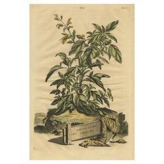
Botanical Illustration of Yellow Variegated Sage from Munting’s 1696 Herbal
Located in Langweer, NL
This antique print, titled "Salvia Lutea Variegata," originates from Abraham Munting's renowned botanical work published in 1696. The print features the Salvia plant against an imagi...
Category
Antique Late 17th Century Prints
Materials
Paper
$325 Sale Price
20% Off
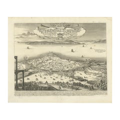
Prince Henry's Naval and Land Battle during the Seven Years' War Engraved, 1667
Located in Langweer, NL
The engraving depicts the assault and capture of the Danish fortress Friderichsodde (now known as Fredericia) located on the island of Fyn. The scene, captured on October 24, 1657, vividly illustrates the Swedish main army's takeover under the command of General Carl Gustaf Wrangel. This historical event is meticulously documented in the artwork, which showcases not only the military action but also the strategic landscape and fortifications characteristic of the time.
Erik Jönsson Graf von Dahlberg, the artist behind this work, was a prominent Swedish field marshal, architect, and fortress builder. Born in 1625 and passing in 1703, Dahlberg's contributions to military and architectural fields were significant. He was renowned for his detailed and artistically valuable drawings which served as the basis for large-scale copperplate engravings. These engravings are of substantial topographical and architectural historical importance as they provide a detailed visual account of Swedish territories during the era.
In 1661, Dahlberg began work on his magnum opus—a comprehensive geographical and historical depiction of Swedish territories, which received royal privileges. His journey in 1667-1668 to Paris for the engraving of the initial plates reflects the international scope and ambition of his project. However, the work was intermittently paused when Dahlberg was tasked in 1674 with overseeing all Swedish fortress constructions, a role that significantly impacted his career and works. The project resumed and was published in 1684, highlighting a significant period of Swedish history and military achievements under his visual documentation.
MORE ABOUT THE BATTLE:
The image is an intricate engraving depicting a battle scene. Based on the details and the text in the cartouche, the scene illustrates a significant historical battle involving Prussian forces. The presence of multiple ships and extensive fortifications suggests a combined land and naval engagement.
Key Features in the Engraving:
1. Land Battle: The forefront of the image shows numerous troops, artillery pieces, and cavalry in action, depicting the intensity and scale of the land combat.
2. Naval Elements: Ships in the background indicate that this battle had a naval component, which would have been crucial for controlling trade routes or strategic waterways.
3. Fortifications: Extensive fortifications, including bastions and protective walls, suggest a well-defended location, possibly a city or a significant stronghold.
Historical Context:
From the text, it appears the battle involves "Prinz Heinrich," referring to Prince Henry of Prussia, who was an influential military leader during the reign of his brother, Frederick the Great. Under Frederick’s rule, Prussia engaged in several key conflicts, including the Seven Years' War (1756-1763), which saw major battles across Europe and involved complex alliances.
Given the level of detail and the era suggested by the style of ships and fortifications, the battle was of the significant engagements during the Seven Years' War, where Prince Henry played a critical role. His campaigns often involved maneuvering to protect Prussia from multiple fronts, including naval engagements in the Baltic.
Interpretation:
This engraving serves not only as a historical document but also as a piece of propaganda, likely glorifying the prowess and strategic capabilities of the Prussian military...
Category
Antique Late 17th Century Prints
Materials
Paper
$440 Sale Price
20% Off
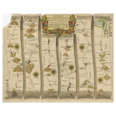
Original Antique Map of the Road from Bristol to Weymouth
Located in Langweer, NL
Antique map titled 'The Road from Bristol to Weymouth (..)'. Original antique map of the road from Bristol to Weymouth. Plate 60 from Ogilby's 'Britannia', the first road atlas of En...
Category
Antique Late 17th Century Prints
Materials
Paper
$210 Sale Price
20% Off
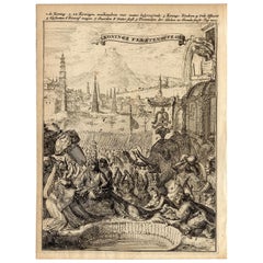
Very Rare Antique Print of the Kings Celebrations in Pegu, Myanmar, 1682
Located in Langweer, NL
Plate: 'Konings feesten tot Pegu.' (Kings celebrations in Pegu.)
On this plate: 1. The King. 2. And the Queen, sprinkling water on each other. 3. Their children. 4. Officers. 5. ...
Category
Antique Late 17th Century Prints
Materials
Paper
$440 Sale Price
20% Off
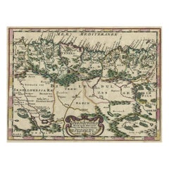
Copper-Engraved Map Showing the Algerian Coast of North Africa, Published 1683
Located in Langweer, NL
Antique map titled 'Partie de Barbarie, ou est le Royaume d'Alger (..)'.
Copper-engraved map showing the Algerian coast of North Africa. Published 1683.
Artists and Engravers:...
Category
Antique Late 17th Century Prints
Materials
Paper
$325 Sale Price
20% Off
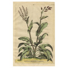
Botanical Illustration of Large Spanish Sorrel (Acetosa Hispanica Maxima), 1696
Located in Langweer, NL
This antique print, titled "Acetosa Hispanica Maxima," depicts the Acetosa plant, commonly known as Sorrel. It belongs to the Plantago or Rumex genus, known for their edible leaves w...
Category
Antique Late 17th Century Prints
Materials
Paper
$325 Sale Price
20% Off
Copper-Line Engraving by Cornelius de Bruyn of Alexandria in Egypt, c.1690
Located in Langweer, NL
Artist: Cornelis de Bruijn (or de Bruyn); 1652 – 1726/7 was a Dutch artist and traveler. He made two large tours and published illustrated books with his observations of people, buil...
Category
Antique Late 17th Century Prints
Materials
Paper
$325 Sale Price
20% Off
Beautiful View of Rhodes, Greece, depicting the Old Town with Fort, 1698
Located in Langweer, NL
Antique print Greece titled 'Rhodus'. Beautiful view of the Island of Rhodes, Greece, depicting the Old Town with fortifications beside a row of w...
Category
Dutch Antique Late 17th Century Prints
Materials
Paper
$535 Sale Price
20% Off
A Handsome & Detailed Map of the Duchy of Mecklenburg & Pomerania, Germany, 1680
Located in Langweer, NL
Antique map titled 'Ducatus Meklenburgicus in quo sunt Ducatus Vandaliae et Meklenburgi Ducatus et Comitatus Swerinensis.'
A handsome and detailed map of the Duchy of Mecklenburg...
Category
Antique Late 17th Century Prints
Materials
Paper
$707 Sale Price
20% Off
Antique Print of the Cells on the Island of Pharos, 1690
Located in Langweer, NL
Description: Antique religious print titled 'De LXXII Cellen (in welke d'Egiptische Koning Ptolomeus Philadelphus, op het eiland Pharos, de Hebreeuwse Bibel door de Jooden in het Gri...
Category
Antique Late 17th Century Prints
Materials
Paper
$277 Sale Price
20% Off
Antique Map of Southern Germany by F. de Wit, circa 1680
Located in Langweer, NL
This antique map depicts a portion of southern Germany that included the historic regions of Bavaria, the Palatinate, Prussia-Brandenburg, the Rhineland and Saxony. Regensberg, Freis...
Category
Antique Late 17th Century Prints
Materials
Paper
$664 Sale Price
20% Off
Rosersberg Castle and Gardens in the Swedish Baroque Era, 1690
Located in Langweer, NL
The engraving is a historical depiction of Rosersberg Castle, a baroque estate in Sweden. These engravings, often created in the 1690s as part of Erik Dahlberg's collection, typically showcase a bird's-eye view of the castle and its elaborate gardens. Such prints are valuable for their detailed representation of Swedish architectural heritage from the era of baroque grandeur. They usually feature notable age-related toning and wear, indicative of their antique status. These pieces of art are collectibles that capture the essence and grandiosity of Swedish noble...
Category
Antique Late 17th Century Prints
Materials
Paper
$516 Sale Price
20% Off
Antique Print with Ephesus, Greece, an ancient Greek city, now Turkish, CA.1698
Located in Langweer, NL
Description: Antique print with two views of Ephesus, Greece, an ancient Greek city, and later a major Roman city, on the west coast of Asia Minor, near present-day Selcuk, Izmir Pro...
Category
Dutch Antique Late 17th Century Prints
Materials
Paper
Baroque Majesty: A Vibrant Assembly at Svartsjö Castle in Sweden, 1693
Located in Langweer, NL
An handcolored original antique print of Svartsjö Castle, located on the island of Färingsö in Ekerö Municipality, Sweden. The castle has a rich history, with the current building da...
Category
Antique Late 17th Century Prints
Materials
Paper
$669 Sale Price
20% Off
Antique Print of Adam and Eve Eating the Apple from the Tree '1674'
Located in Langweer, NL
Description: Antique print, titled: 'Lussa dei sumpto violantur ab arbore pomo, Efficit hoc tacitis vipera saeua dolis.' - This original antique print shows a scene from Genesis in t...
Category
Antique Late 17th Century Prints
Materials
Paper
$526 Sale Price
20% Off
Antique Botany Print of a Limonium Flowering Plant, circa 1680
Located in Langweer, NL
Antique botany print titled 'Limonium minus Bellidis (..)'. Original antique print of a limonium flowering plant. This print originates from 'Me´moires pour servir a' l'histoire des ...
Category
Antique Late 17th Century Prints
Materials
Paper
$239 Sale Price
20% Off
Antique Map of Batavia 'Jakarta, Indonesia' by Montanus, 1679
Located in Langweer, NL
Fine early plan of Batavia (Jakarta), published by Arnoldus Montanus. This map has a vignette at the bottom showing Jakarta from the sea with the volcanoes Mount Gede, Mount Pangrnago and Mount Salak in the background. The plan is based on the earlier, much larger map of Batavia published by Clement de Jonghe...
Category
Unknown Antique Late 17th Century Prints
Materials
Paper
$1,018 Sale Price
20% Off
1658 Siege of Copenhagen by Swedish Forces: A Panoramic Perspective
Located in Langweer, NL
The engraving depicts the siege of Copenhagen, the capital of Denmark, by the King of Sweden in 1658. This historical event is captured in a detailed panoramic view, showcasing the s...
Category
Antique Late 17th Century Prints
Materials
Paper
$449 Sale Price
20% Off
Antique Map of Zeeland 'The Netherlands' by N. Visscher, circa 1690
Located in Langweer, NL
Antique map titled 'Comitatus Zelandiae (..)'. Detailed chart of the province Zeeland, The Netherlands, with details shown pictorially. Published by N. Visscher.
Category
Antique Late 17th Century Prints
Materials
Paper
$631 Sale Price
20% Off
Old Detailed Map of the Historical Regions of the Duchy of Saxony, Germany, 1680
Located in Langweer, NL
Antique map titled 'Circuli Saxoniae Superior Pars Meridionalis in qua sunt Ducatus Saxoniae, Comitatus Mansfeldiae, et Voitlandiae, Landgraviat Thuringiae, Marchionatus Misniae Prin...
Category
Antique Late 17th Century Prints
Materials
Paper
$688 Sale Price
20% Off
Banking on Prosperity: Södra Bancohuset of Stockholm in a 1691 Swidde Engraving
Located in Langweer, NL
This original antique image is a historical depiction from "Suecia Antiqua et Hodierna," which translates to "Ancient and Modern Sweden." This was a significant work of the mid-17th century, initiated by Count Erik Dahlbergh...
Category
Antique Late 17th Century Prints
Materials
Paper
$516 Sale Price
20% Off
Antique Print of a Greece Island, Most Likely Gavdopoula South of Crete, 1688
Located in Langweer, NL
Description: Untitled print of one of the islands of Greece, most likely Gavdopoula (located south of Crete).
Gavdopoula is an islet located north-west of its larger neighbour, G...
Category
Antique Late 17th Century Prints
Materials
Paper
$334 Sale Price
20% Off
Rosersberg Palace and Gardens near Stockholm in the Baroque Splendor of 1695
Located in Langweer, NL
This is a historical etching from "Suecia Antiqua et Hodierna", which translates to "Ancient and Modern Sweden", a large work that includes a collection of engravings...
Category
Antique Late 17th Century Prints
Materials
Paper
$172 Sale Price
20% Off
Rare Antique Map of the Middle East, ca.1690
Located in Langweer, NL
Description: Antique print, untitled.
Two decorative maps on one sheet of the middle east in biblical times. Source unknown, to be determined.
Artists and Engravers: Anonymous...
Category
Antique Late 17th Century Prints
Materials
Paper
$344 Sale Price
20% Off
Rare Antique Engraving of a Landscape with Two Horses and Horsemen, ca.1680
Located in Langweer, NL
Antique print of a landscape with two horses and horsemen.
Made after a painting by Philips Wouwerman. Source unknown, to be determined.
Artists and Engravers: Engraved by J....
Category
Antique Late 17th Century Prints
Materials
Paper
$564 Sale Price
20% Off
Original Antique Map of the Philippines, Malaysia, Indonesia, Singapore, c.1690
Located in Langweer, NL
Antique map titled 'Isole dell' Indie, diuise in Filippine, Molucche e della Sonda'.
Old map of the Philippines, Malaysia, Indonesia, Singapore, Northern Australia and contiguous i...
Category
Antique Late 17th Century Prints
Materials
Paper
$2,152 Sale Price
20% Off
Antique Engraving After a Self Portrait of Dutch Painter Abraham Bloemaert, 1694
Located in Langweer, NL
Antique print, titled: 'Abraham Blomaert'
Portrait of Abraham Bloemaert after a self-portrait by Bloemaert, engraved by Hendrik Snijers. Abraham ...
Category
Antique Late 17th Century Prints
Materials
Paper
$172 Sale Price
20% Off
Set of 2 Antique Horse Riding Prints
Located in Langweer, NL
Set of 2 antique horse riding prints. Published circa 1680.
Category
Antique Late 17th Century Prints
Materials
Paper
$325 Sale Price / set
20% Off
Original Antique Map of the Road from London to Bensington
Located in Langweer, NL
Antique map titled 'The Road from London to St. Davids in com: Pembroke (..)'. A strip map of the road from London to Bensington. The map is ornamented with numerous compass roses, a...
Category
Antique Late 17th Century Prints
Materials
Paper
$516 Sale Price
20% Off
Maritime Majesty: The 17th-Century Skyline of Kalmar in Sweden, 1693
Located in Langweer, NL
The engraving depicts the city of Kalmar, a historically significant city on the east coast of Sweden. This panoramic view captures the bustling port and the city's skyline during th...
Category
Antique Late 17th Century Prints
Materials
Paper
$430 Sale Price
20% Off
Antique Map of the German Empire, Johannes Janssonius van Waesbergen, circa 1670
Located in Langweer, NL
Antique map titled 'Nova Totius Germaniae Descriptio'. Uncommon map of the German Empire including the Netherlands, Germany, Switzerland, Austria, Bohemia,...
Category
Antique Late 17th Century Prints
Materials
Paper
$669 Sale Price
20% Off
Baroque Splendor: The Östanå Manor in Gränna, 1692 Swidde Engraving
Located in Langweer, NL
An original copper engraving from the renowned "Suecia Antiqua et Hodierna," an atlas of Sweden created under the direction of Erik Dahlberg in the late 17th century. This particular engraving, crafted by Willem Swidde in 1692, depicts the Östanå herrgård (manor house) in Gränna, located in the Jönköping county of Småland.
The engraving showcases the manor in a stately fashion, with a classical architectural design featuring symmetrical wings and a central structure adorned with a grand staircase. The scene is animated with figures in the foreground, indicating the manor's role as a hub of activity and societal life. The garden layout...
Category
Antique Late 17th Century Prints
Materials
Paper
$497 Sale Price
20% Off
Rosersberg Palace in Sweden: Dual Perspectives by Willem Swidde, circa 1695
Located in Langweer, NL
Title: "Rosersberg Palace: Dual Perspectives by Willem Swidde"
Description: The featured antique engravings portray Rosersberg Palace in Sweden, captured from two distinct vantage p...
Category
Antique Late 17th Century Prints
Materials
Paper
$430 Sale Price
20% Off
1687 Portrait of Assan Aga by E. Nessenthaler: A Glimpse into Ottoman Nobility
Located in Langweer, NL
This etching and engraving is a portrait of Assan Aga, created by Elias Nessenthaler, a German artist, in the year 1687.
The artwork features Assan Aga, identified as "Magnus Aleppo Bassa," which suggests he held a significant position in Aleppo, likely a high-ranking official or governor ("Bassa" being a variant of "Pasha", a high-ranking title). The text beneath the portrait indicates that he was a significant adversary ("Perniciem") to the emperor of the Turks, hinting at a historical narrative of conflict or betrayal ("Coniuratus hostis" suggesting a conspiratorial enemy).
The portrait shows Assan Aga adorned in elaborate attire with a turban, indicative of his status and cultural significance during that period. The detail in the etching, from the facial features to the clothing, reflects the artistic skill of Elias Nessenthaler and the styles of portraiture common in the late 17th century. The framing of the image with decorative borders adds to its formal presentation and would have likely been intended for an audience interested in the political and military figures of the time.
Assan Aga, also known as Magnus Aleppo Bassa, was likely a historical figure of significance in Aleppo, bearing the title of Pasha, which indicates a high-ranking official or governor in the Ottoman Empire. The detailed portrait by Elias Nessenthaler, housed in the Royal Collection, hints at his importance during his time. For further details on Assan Aga, you can visit the Royal Collection Trust...
Category
Antique Late 17th Century Prints
Materials
Paper
$636 Sale Price
30% Off
Antique Map of the Namur Region 'France' by F. de Wit, circa 1680
Located in Langweer, NL
Antique map titled 'Comitatus Namurci Tabula in Lucem Edita'. Large map of the Namur region, France. Published by F. de Wit, circa 1680.
Category
Antique Late 17th Century Prints
Materials
Paper
$550 Sale Price
20% Off
Baroque Splendor: Ericsberg Castle in Swidde's Suecia Antiqua et Hodierna, 1690
Located in Langweer, NL
The engraving depicts Ericsberg Castle (Erichsberg), a baroque castle located in Södermanland, Sweden. This hand-colored print is from "Suecia Antiqua et Hodierna" (Ancient and Moder...
Category
Antique Late 17th Century Prints
Materials
Paper
$459 Sale Price
20% Off
Original Antique Map of the Road from Marlborough to Huntspil
Located in Langweer, NL
Antique map titled 'The Continuation of the Road from London to Bristol (..)'. A strip map of the continuation of the road from London to Bristol, this particular sheet showing the r...
Category
Antique Late 17th Century Prints
Materials
Paper
$516 Sale Price
20% Off
Antique Map of Modern Day Ukraine and Russia Titled Moscovie 'Moscow', Ca.1683
Located in Langweer, NL
Antique map of modern day Ukraine and Russia titled ‚Moscovie‘. Miniature map of the Moscovia region by A.M. Mallet.
Artists and Engravers: Alain Manneson Mallet (1630-1706) spent...
Category
Antique Late 17th Century Prints
Materials
Paper
$440 Sale Price
20% Off
Coast of Northumberland, England, Incl the Holy & Farne Islands, Etc, 1693
Located in Langweer, NL
Antique map titled 'Holy Island, Staples and Barwick.'
A map of the coast of Northumberland, England. This map includes Holy Island, Buckton, Sunderland and the Farne Islands. Th...
Category
Antique Late 17th Century Prints
Materials
Paper
$363 Sale Price
20% Off
Detailed Antique Map of Southeast England, incl Warwickshire and Hampshire, 1690
Located in Langweer, NL
Antique map titled 'Orientalior districtus Regni Angliae (..)'.
Detailed map of southeast England encompassing the country from Lincolnshire and the Wash south and including Warw...
Category
Antique Late 17th Century Prints
Materials
Paper
$813 Sale Price
20% Off
The Pastoral Elegance of Ulriksdal Castle by Herman Padtbrugge, ca.1685
Located in Langweer, NL
This original print is a hand-colored engraving of Ulriksdal Castle, also historically known as "Jacobsdal" due to its location in the area of Solna near Stockholm, Sweden. The title...
Category
Antique Late 17th Century Prints
Materials
Paper
$468 Sale Price
20% Off
Baroque Opulence: The Eastern View of SIQVO Palace in Swidde's 1696 Engraving
Located in Langweer, NL
An engraving by Willem Swidde from 1696. The print features a palatial estate surrounded by formal gardens, a common representation of baroque architecture and landscaping. The centr...
Category
Antique Late 17th Century Prints
Materials
Paper
$420 Sale Price
20% Off
Large Panoramic View of Thonon-les-Bains near Lake Geneva, France
Located in Langweer, NL
Antique print titled 'Thonon'. Rare and large panoramic view of Thonon-les-Bains, or Thonon, France. Thonon-les-Bains is part of a transborder metropolitan area known as Grand Genève...
Category
Antique Late 17th Century Prints
Materials
Paper
$1,817 Sale Price
20% Off
Plan of Ancient Jerusalem – Cornelis de Bruijn’s Engraved City View c.1698
Located in Langweer, NL
Plan of Ancient Jerusalem – Cornelis de Bruijn’s Engraved City View c.1698
This antique map titled Jerusalem is an intricate plan of the ancient city, richly detailed and marked wit...
Category
Dutch Antique Late 17th Century Prints
Materials
Paper
$516 Sale Price
20% Off
Original Antique Print of a Procession of Monks in Ceylon 'Sri Lanka', 1672
Located in Langweer, NL
Antique print, untitled. This original antique print shows a procession of monks in Ceylon. A group of dancing monks, beating drums, in front of the abbot, seated on an elephant. Dut...
Category
Antique Late 17th Century Prints
Materials
Paper
$258 Sale Price
20% Off
Antique Map of Part of Flanders 'Belgium' by F. de Wit 'circa 1680'
Located in Langweer, NL
Antique map titled 'Marchionatus Sacri Imperii et Dominii Mechelini Tabula'. Large folio size map of the region around Mechelen, Leuven, Brussels, Dendermonde and Antwerp. Published ...
Category
Antique Late 17th Century Prints
Materials
Paper
$550 Sale Price
20% Off
Scare Map of Canaan, with Portraits of the Apostles of Matheaus and Others
Located in Langweer, NL
Antique map titled 'Geographische Beschreibung des Belobten Landes Canaan (..)'. Scarce map of Canaan, with portraits of the Apostles of Matheaus, S. Marcus, S. Lucas, S. Johannes. With Christ in lower part. The map extends along the coast of the eastern Mediterranean. Published by Georg Andreas...
Category
Antique Late 17th Century Prints
Materials
Paper
$420 Sale Price
20% Off
Rare Print of Genesis in the Old Testament; Adam and Eve Eating the Apple, 1674
Located in Langweer, NL
Antique print, titled: 'Lussa dei sumpto violantur ab arbore pomo, Efficit hoc tacitis vipera saeua dolis.'
This original antique print shows a scene from Genesis in the Old Test...
Category
Antique Late 17th Century Prints
Materials
Paper
$736 Sale Price
20% Off
Antique Map of Japan by A.M. Mallet, 1683
Located in Langweer, NL
A charming late 17th century French map with a very decorative title cartouche showing trumpet-blowing cherubs, by Allain Manneson Mallet (1630-1706), a well traveled military engine...
Category
French Antique Late 17th Century Prints
Materials
Paper
Original Old Engraving showing Cybele, the Anatolian Mother Goddess, 1686
Located in Langweer, NL
Description: Antique print, titled: 'Cybele, de Groote en Goede Moeder der Aarde' - This plate shows Cybele, the Anatolian mother goddess.
Source unknown, to be determined.
Artists...
Category
Antique Late 17th Century Prints
Materials
Paper
$267 Sale Price
20% Off
Original Antique Map of the Road from Andover to Crewkerne
Located in Langweer, NL
Antique map titled 'The Continuations of the Road from London to the Lands End'. Original antique map of the road from Andover to Crewkerne. Plate 26 from Ogilby's 'Britannia', the f...
Category
Antique Late 17th Century Prints
Materials
Paper
$736 Sale Price
20% Off
Original Italian Antique Map of Asia Minor and Cyprus and Neighboring Regions
Located in Langweer, NL
Antique map titled 'Natolia detta anticamente Asia Minor (..)'. Rare map of Asia Minor (Turkey) and Cyprus and neighboring regions. The map provides one of the most detailed and up t...
Category
Antique Late 17th Century Prints
Materials
Paper
$621 Sale Price
20% Off
Leicestershire – Antique Map of Leicester by Richard Blome, Britannia 1673
Located in Langweer, NL
Leicestershire – Antique Map of Leicester by Richard Blome, Britannia 1673
This original antique map titled A Mapp of the Country of Leicester presents a detailed and decorative dep...
Category
English Antique Late 17th Century Prints
Materials
Paper
$420 Sale Price
20% Off
Old Original Antique Engraved Portrait of Pope Bonifacius / Boniface, 1678
Located in Langweer, NL
Antique portrait titled 'XLIV S. Bonifacius'.
Old portrait of Pope Bonifacius / Boniface. Originates from 'Triomph der Pausen van Roomen over alle hare Benyders ende Bestryders met eene volkomen, ende overtuyghende wederlegginghe van alle de lasteringhen, en valscheden van de sectarisen (..)' published in Antwerpen.
Artists and Engravers: Cornelius Hazart (1617-1690) was a Dutch Jesuit controversialist, orator, and writer of polemical history.
Saint Boniface I, (born, Rome—died Sept. 4, 422, Rome; feast day September 4), pope from 418 to 422, whose reign was markedly disrupted by the faction of the antipope Eulalius.
Boniface was a priest, believed to have been ordained by Pope St. Damasus I and to have served Pope St. Innocent I at Constantinople.
When Boniface was chosen pope by a majority of the Roman electors, his rival Eulalius, a deacon, was simultaneously chosen by a clerical faction. The two claims and the fifth schism that resulted caused chaos in Rome. Eulalius lost the support of the West Roman emperor Flavius Honorius for violating an agreement that both claimants leave Rome pending a council’s decision.
Boniface’s reentry into Rome ended the 15-week schism. Thereafter his pontificate was noted for his peaceful, yet firm, diplomacy and for his zealous support of Bishop St. Augustine of Hippo...
Category
Antique Late 17th Century Prints
Materials
Paper
$181 Sale Price
20% Off
Antique Map of the Cape Verde Islands, Africa, ca.1670
Located in Langweer, NL
Antique map titled 'Pascaert van de Soute Eylanden ofte Ilhas de Cabo Verde'.
This map depicts the Cape Verde Islands (Africa). Islands titled 'Ile de B...
Category
Antique Late 17th Century Prints
Materials
Paper
$631 Sale Price
20% Off
Antique Map of Groningen with Contemporary Hand Coloring
Located in Langweer, NL
Antique map titled 'Tabulae dominii Groeningae quae et complecititur maximam partem Dreniae Emendata a F. de Wit'. Original antique map of the province of Groningen, the Netherlands....
Category
Antique Late 17th Century Prints
Materials
Paper
$631 Sale Price
20% Off
Original Antique County Map of Derbyshire, England
Located in Langweer, NL
Antique map titled 'Darbyshire'. Original antique map of the country of Derbyshire, England. Engraved by Robert Morden. Sold by Abel Swale, Awnsham and John Churchill...
Category
Antique Late 17th Century Prints
Materials
Paper
$526 Sale Price
20% Off
Old Map of Prussia, Embellished with a Large Cartouche and Compass Rose, ca.1680
Located in Langweer, NL
Antique map titled 'Prussiae nova Tabula'.
Later edition of Blaeu's map of Prussia, embellished with a large cartouche and compass rose. Prussia was a historically prominent Germ...
Category
Antique Late 17th Century Prints
Materials
Paper
$535 Sale Price
20% Off
Map of Languedoc-Roussillon and Provence in France and Piedmont in Italy, c1680
Located in Langweer, NL
Title: Antique map titled 'La basse Partie du Gouvernement de Languedoc, environne des Frontiers des Gouverns de Provence, de Dauphine de Lyonnais et de Guienne et Gascogne ; Les Fro...
Category
Antique Late 17th Century Prints
Materials
Paper
$2,630 Sale Price
20% Off
Rare & Old Panoramic Views of Stanchio, Greece and the Island of Rhodes, 1698
Located in Langweer, NL
Antique print titled Stanchio Rhodus.
Original antique print showing panoramic views of Stanchio, Greece and the Island of Rhodes, both with ships.
First edition in French, firs...
Category
Dutch Antique Late 17th Century Prints
Materials
Paper
Recently Viewed
View AllMore Ways To Browse
Antique Japanese Satsuma Tea Sets
Antique Japanese Shibayama
Antique Military Saddles
Antique Nantucket Signs
Antique Oak Card Cabinet
Antique Pegasus
Antique Peugeot
Antique Red Transferware
Antique Salt Dishes
Antique Silver Grape Scissors
Antique Smiths Clocks
Antique Sterling Silver Toast Rack
Antique Stoneware Teapot
Antique Sun Dial
Antique Welsh Oak Cabinet
Antique Wine Server
Architect File Cabinet
Art Deco Bronze Antelope
