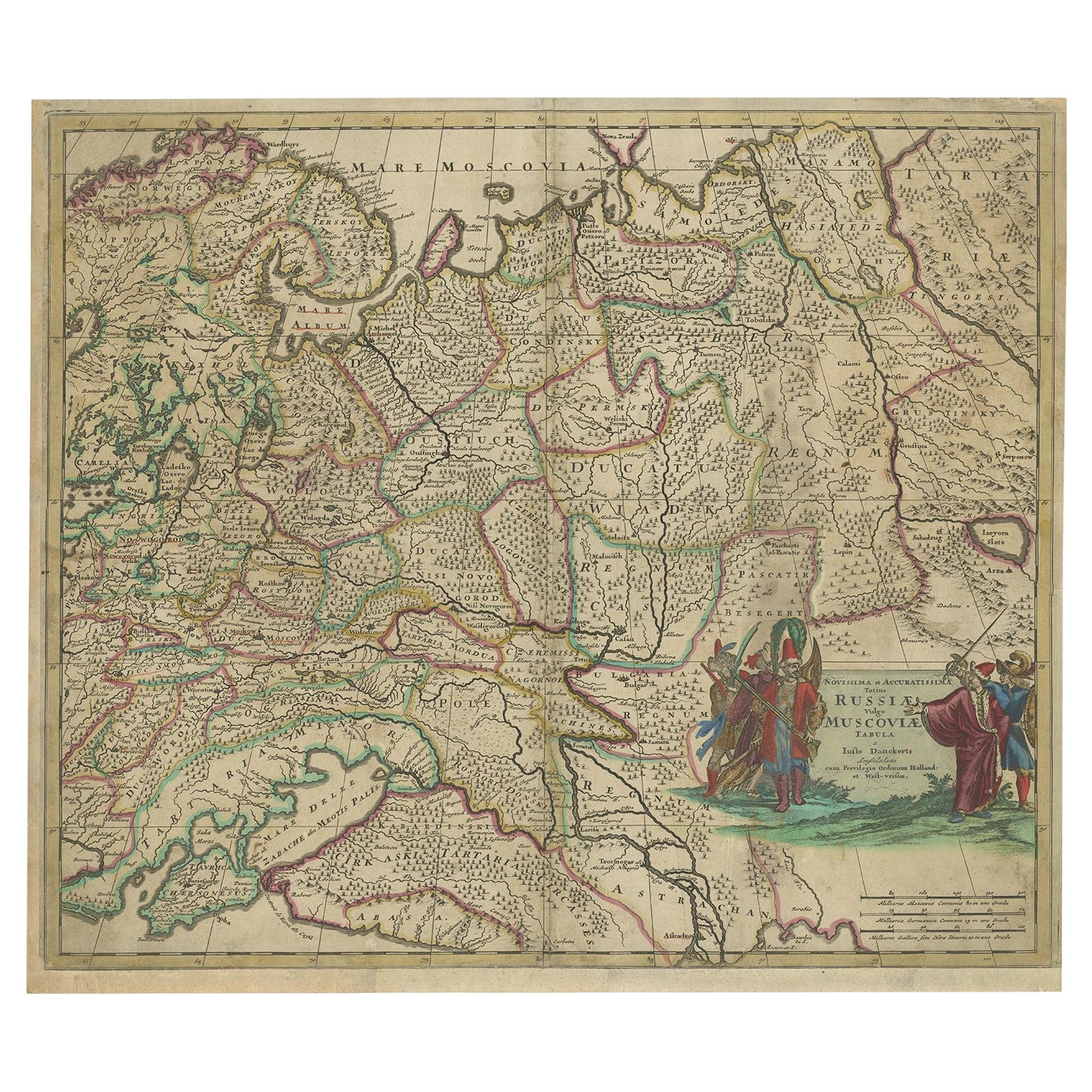
Items Similar to Antique Map of Modern Day Ukraine and Russia Titled Moscovie 'Moscow', Ca.1683


Want more images or videos?
Request additional images or videos from the seller
1 of 5
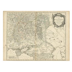
Antique Map of Modern Day Ukraine and Russia Titled Moscovie 'Moscow', Ca.1683
About the Item
Antique map of modern day Ukraine and Russia titled ‚Moscovie‘. Miniature map of the Moscovia region by A.M. Mallet.
Artists and Engravers: Alain Manneson Mallet (1630-1706) spent the first part of his career as a foot soldier in one the regiments of Louis XIV, becoming a sergeant-major of artillery and then an inspector of fortifications. After leaving the army he specialised in the publication of books describing both scientific and practical aspects of military engineering.
Condition: Good. General age-related toning. Small tear at the left. Please study image carefully.
- Dimensions:Height: 7.49 in (19 cm)Width: 5.12 in (13 cm)Depth: 0 in (0.02 mm)
- Materials and Techniques:
- Period:1680-1689
- Date of Manufacture:circa 1683
- Condition:Condition: Good. General age-related toning. Small tear at the left. Please study image carefully.
- Seller Location:Langweer, NL
- Reference Number:
About the Seller
5.0
Platinum Seller
These expertly vetted sellers are 1stDibs' most experienced sellers and are rated highest by our customers.
Established in 2009
1stDibs seller since 2017
1,947 sales on 1stDibs
Typical response time: <1 hour
- ShippingRetrieving quote...Ships From: Langweer, Netherlands
- Return PolicyA return for this item may be initiated within 14 days of delivery.
More From This SellerView All
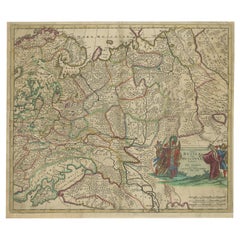
- Antique Hand-Colored Map of Western Russia and Ukraine, c.1680Located in Langweer, NLDescription: Antique map titled 'Novissima et Accuratissima Totius Russiae vulgo Muscoviae Tabula'. Antique map of Western Russia and Ukraine, published by Justus Danckerts. The ma...Category
Antique 1680s Maps
MaterialsPaper
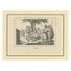
- Original Antique Print of Crimean Costumes, Russia & Ukraine, ca.1880Located in Langweer, NLAntique print titled 'Die Krim - Trachten'. Original antique print of Crimean costumes. Source unknown, to be determined. Artists and Engravers: Anonymous.Category
Antique 1880s Prints
MaterialsPaper
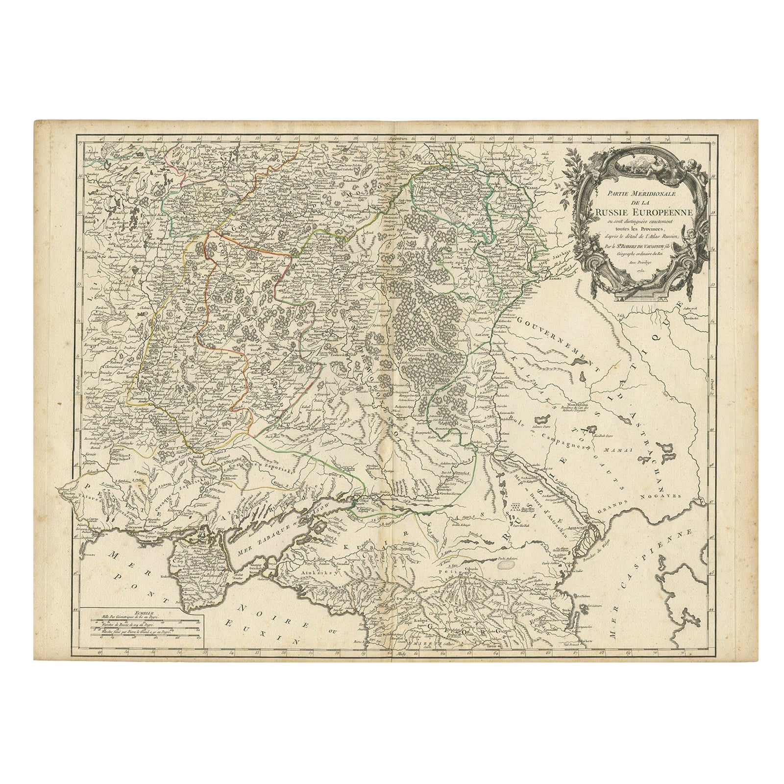
- Detailed Antique Map of the Southern Part of European Russia and Ukraine, 1752Located in Langweer, NLAntique map titled 'Partie meridionale de la Russie Européenne'. Detailed map of the southern part of European Russia by Robert de Vaugondy. It covers from Moscow south to Georgia and from Poland east to the Volga River, including Crimea and Ukraine. Artists and engravers: Gilles Robert de Vaugondy (1688-1766) was the head of a leading family of geographers in eighteenth century France. Gilles got his start when he jointly inherited the shop of Pierre-Moullart Sanson, grandson of the famous geographer Nicholas Sanson. The inheritance included the business, its stock of plates, and a roller press...Category
Antique 1750s Maps
MaterialsPaper
- Antique Map of Northern Europe and European Russia, ca.1780Located in Langweer, NLAntique map titled 'Le Nord de L'Europe, Contenant Le Danemark, La Norwege; La Suede et La Laponie avec la Majeure Partie de al Russie Europeenne.' Map of Northern Europe and Eur...Category
Antique 1780s Maps
MaterialsPaper
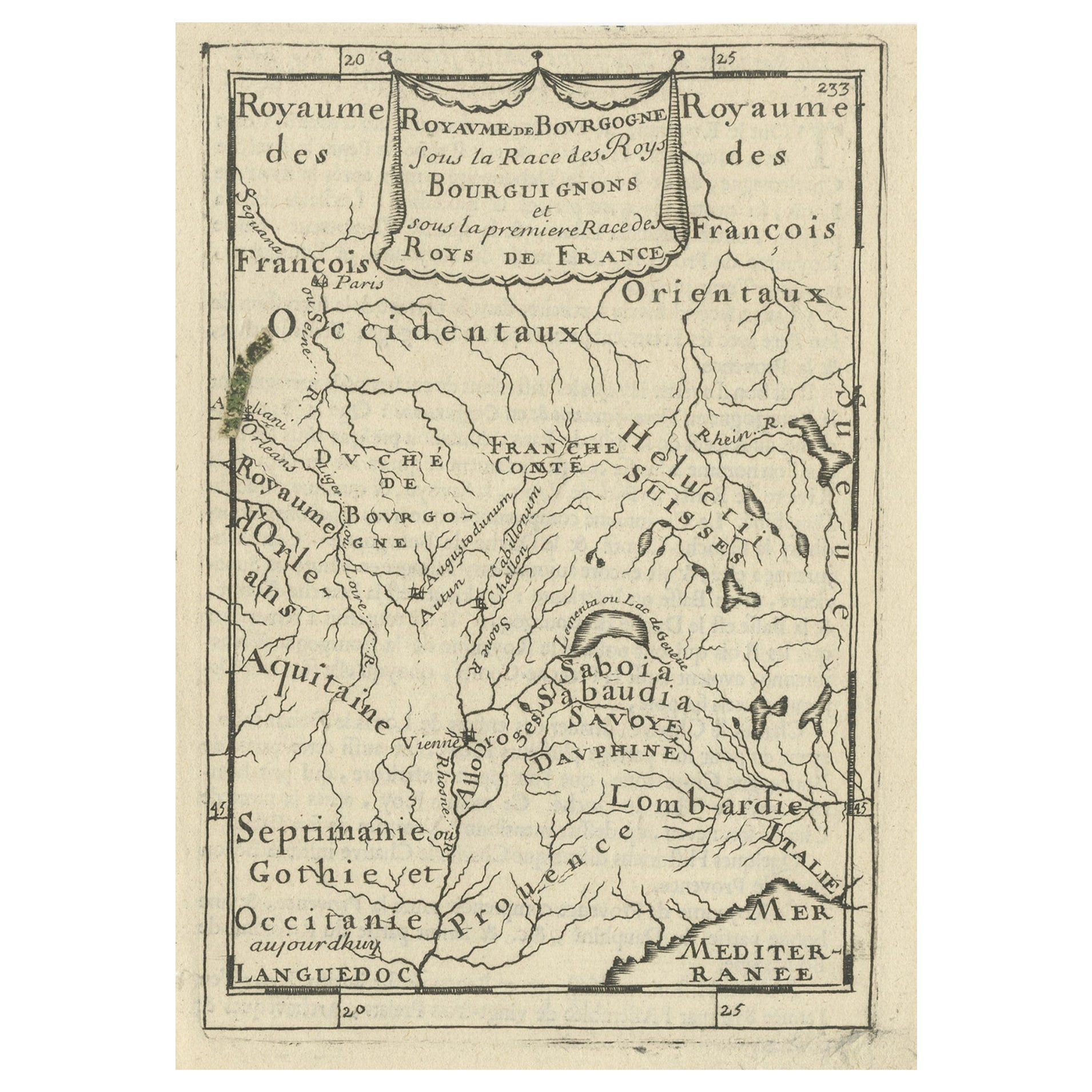
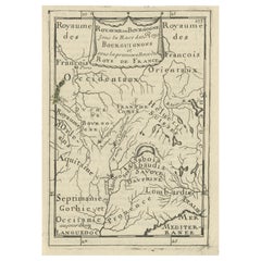
- Nice Detailed Antique Miniature Map of the Burgundy Wine Region, France, ca.1683Located in Langweer, NLAntique map titled 'Royaume de Bourgogne sous la Race des Roys Bourguignons (..)'. Detailed miniature map of the Burgundy region, France. Originates from Mallet's 'Description de...Category
Antique 1680s Maps
MaterialsPaper
- Antique Map of Japan by A.M. Mallet, 1683Located in Langweer, NLA charming late 17th century French map with a very decorative title cartouche showing trumpet-blowing cherubs, by Allain Manneson Mallet (1630-1706), a well traveled military engine...Category
Antique Late 17th Century Maps
MaterialsPaper

You May Also Like
- Original Antique Map of Russia By Arrowsmith. 1820Located in St Annes, LancashireGreat map of Russia Drawn under the direction of Arrowsmith Copper-plate engraving Published by Longman, Hurst, Rees, Orme and Brown, 1820 Unframed.Category
Antique 1820s English Maps
MaterialsPaper
- Antique Map of Principality of MonacoBy Antonio Vallardi EditoreLocated in Alessandria, PiemonteST/619 - "Old Geographical Atlas of Italy - Topographic map of ex-Principality of Monaco" - ediz Vallardi - Milano - A somewhat special edition ---Category
Antique Late 19th Century Italian Other Prints
MaterialsPaper
- Original Antique Map of Ireland- Tipperary and Waterford. C.1840Located in St Annes, LancashireGreat map of Tipperary and Waterford Steel engraving Drawn under the direction of A.Adlard Published by How and Parsons, C.1840 Unframed.Category
Antique 1840s English Maps
MaterialsPaper
- Original Antique Map of Spain and Portugal, circa 1790Located in St Annes, LancashireSuper map of Spain and Portugal Copper plate engraving by A. Bell Published, circa 1790. Unframed.Category
Antique 1790s English Other Maps
MaterialsPaper
- Original Antique Map of Italy. C.1780Located in St Annes, LancashireGreat map of Italy Copper-plate engraving Published C.1780 Unframed.Category
Antique Early 1800s English Georgian Maps
MaterialsPaper

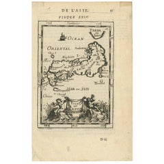
- Original Antique Map of Asia. C.1780Located in St Annes, LancashireGreat map of Asia Copper-plate engraving Published C.1780 Two small worm holes to right side of map Unframed.Category
Antique Early 1800s English Georgian Maps
MaterialsPaper


