Late 17th Century Prints
to
218
250
3
253
Height
to
Width
to
3
5,275
9,779
5,515
874
1,209
1,729
1,683
199
80
206
257
248
311
414
704
366
226
253
1
1
1
1
44
24
6
5
3
253
253
253
3
3
2
2
1
Period: Late 17th Century
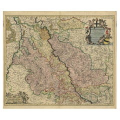
Rhine Splendor: Antique Map of the Lower Rhine Region, circa 1680
Located in Langweer, NL
The antique map titled 'Novissima et Accuratissima Archiepiscopatus et Electoratus Coloniensis Ducatuum Iuliancensis et Montensis et Meursiae Comitatus' is a handsome and detailed ma...
Category
Antique Late 17th Century Prints
Materials
Paper
$918 Sale Price
20% Off
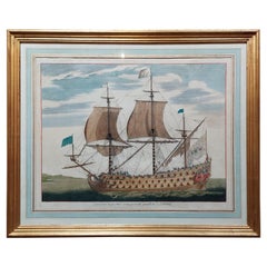
Antique Print of a Naval Vessel by Mortier '1695'
Located in Langweer, NL
Antique print titled 'Vaisseau du premier rang portant pavillon d'Admiral'. Beautiful copper engraving of a naval vessel. From Mortier's famous maritime Atlas "Neptune François". Eng...
Category
Antique Late 17th Century Prints
Materials
Paper
$1,674 Sale Price
20% Off
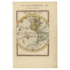
Antique Miniature Map of the Western Hemisphere, with California as an Island
Located in Langweer, NL
Antique miniature map titled 'Nouveau Continent avec plusieurs Isles et Mers'. Decorative map of the Western Hemisphere, published by Alain Manesson Mallet. The map shows California as an Island...
Category
Antique Late 17th Century Prints
Materials
Paper
$420 Sale Price
20% Off
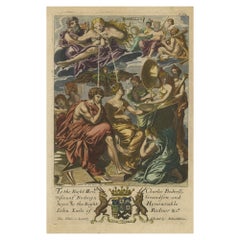
Rare Copper Engraving of Female with Five Breasts Lactating onto Others, 1686
Located in Langweer, NL
Antique print titled 'Painting'.
Rare antique print showing painters and various figures including: a female figure holding palette and brushes in centre, with another female figur...
Category
Antique Late 17th Century Prints
Materials
Paper
$813 Sale Price
20% Off
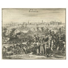
Antique Print of The Siege of Baghdad, Irag, 1680
Located in Langweer, NL
Antique print titled 'Beleg van Bagdad'.
Old print of a group of soldiers on high ground outside the walls of Baghdad. This print originates from 'Naukeurige Beschryving van Asie...
Category
Antique Late 17th Century Prints
Materials
Paper
$229 Sale Price
20% Off
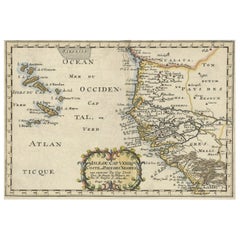
Antique Map of the Coast of Africa and the Cape Verde Islands, ca.1680
Located in Langweer, NL
Antique map Africa titled 'Isles du Cap Verd Coste et Pays des Negres'.
Antique map of the coast of Africa and the Cape Verde islands.
Artis...
Category
Antique Late 17th Century Prints
Materials
Paper
$334 Sale Price
20% Off
Old Antique Engraving of an Arab Sitting on a Carpet and Smoking a Pipe, 1698
Located in Langweer, NL
Untitled print of an Arab smoking a pipe, sitting on a carpet.
This print originates from 'Reizen van Cornelis de Bruyn, door de vermaardste deelen van Klein Asia, de eylanden Scio...
Category
Dutch Antique Late 17th Century Prints
Materials
Paper
$172 Sale Price
20% Off
Antique Print of Reba, The King of The Arab People, 1677
Located in Langweer, NL
Description: Antique print, titled: 'Reba, Koning der Arabieren (…)' -
This plate shows Reba, the King of Arab people.
Reba was one of five Midianite kings killed during the ...
Category
Antique Late 17th Century Prints
Materials
Paper
$344 Sale Price
20% Off
Antique Print of a Religious Calendar, Depicting the Month January, 1680
Located in Langweer, NL
Antique print of a religious calendar, depicting the month January. With Zodiac sign in upper left corner. Originates from 'Acta Sanctorum', an encyclopedic text in 68 folio volumes ...
Category
Antique Late 17th Century Prints
Materials
Paper
$650 Sale Price
20% Off
Syrian Oregano (Origanum Syriacum) – Antique Botanical Engraving c.1676
Located in Langweer, NL
Maiorana Syriaca sive Marum Syriacum – Origanum Syriacum Botanical Engraving c.1676
This antique botanical engraving features Origanum syriacum, also known as Bible hyssop, Lebanese...
Category
French Antique Late 17th Century Prints
Materials
Paper
$239 Sale Price
20% Off
Rare Anatomy Engraving – Skeleton and Flayed Figure, Blome, 17th Century
Located in Langweer, NL
Anatomy Display – Antique Engraving by Michael Vandergucht, 1686
This fascinating late 17th-century engraving depicts an anatomy display, showing a skeleton, an écorché (a flayed fi...
Category
European Antique Late 17th Century Prints
Materials
Paper
$583 Sale Price
25% Off
Antique Map of the Artois Region 'France' by F. de Wit, circa 1680
Located in Langweer, NL
Antique map titled 'Tabula Comitatus Artesiae emendata'. Large map of the Artois region, France. Published by F. de Wit, circa 1680.
Category
Antique Late 17th Century Prints
Materials
Paper
$515 Sale Price
25% Off
Two Antique Views of the Ruins of the Tower of Babel, Babylon, 1683
Located in Langweer, NL
Antique print titled 'Ruines De La Tour De Babel (Aspect Septentrional and Aspect Meridional)'.
Two views of the ruins of the Tower of Babel, Babylon. This print originates from Alain Manesson Mallet's 'Description de l 'Univers'.
Artists and Engravers: Alain Manesson Mallet (1630–1706) was a French cartographer and engineer. He started his career as a soldier in the army of Louis XIV, became a Sergeant-Major in the artillery and an Inspector of Fortifications. He also served under the King of Portugal, before returning to France, and his appointment to the court of Louis XIV. His military engineering and mathematical background led to his position teaching mathematics at court. His major publications were Description de L'Univers (1683) in 5 volumes, and Les Travaux de Mars ou l'Art de la Guerre (1684) in 3 volumes.
His Description de L'Universe contains a wide variety of information, including star maps...
Category
Antique Late 17th Century Prints
Materials
Paper
$162 Sale Price
20% Off
Antique Print of Royal Officials in Tunquin by Tavernier, '1682'
Located in Langweer, NL
Antique print titled 'Die grote Kancelier van 't Koninkryk Tunkin (..)'. Original antique print of royal officials in Tunquin, a historical region of southeast Asia on the Gulf of To...
Category
Antique Late 17th Century Prints
Materials
Paper
$239 Sale Price
20% Off
Large Copper Engraved Map of the Coastline of Friesland and Terschelling, c.1670
Located in Langweer, NL
Antique print, titled: 'Dominii Frisiae Tabula, inter Flevum et Lavicum (…)'
This large copper engraved map details the coastline of Friesland and Terschelling. At east is a part...
Category
Antique Late 17th Century Prints
Materials
Paper
$851 Sale Price
20% Off
The Iron Duke of Alva of Spain Planning the Atrocities Against the Dutch, c.1680
Located in Langweer, NL
Antique print titled ‘Afbeeldinge van de Spaansche Bloedraad in den Jaare 1567 door den Hartog van Alva aangestelt’.
The Duke of Alva and his entourage seated at a table planning...
Category
Antique Late 17th Century Prints
Materials
Paper
$535 Sale Price
20% Off
Antique Engraving of a Bird's-Eye Plan of Nagapattinam or Negapatam, India, 1672
Located in Langweer, NL
Antique map titled 'Negapatam.'
Bird's-eye plan of Nagapattinam or Negapatam, India. This map originates from 'Naauwkeurige Beschryvinge van Malabar en Choromandel…en het machtige ...
Category
Antique Late 17th Century Prints
Materials
Paper
$325 Sale Price
20% Off
Antique Print of a Perpetual Almanac of Staffordshire by Plot, 1686
Located in Langweer, NL
Antique print titled 'The Clog, or Stafford-Shire Perpetuall Almanack'. Engraving of a perpetual almanac (a type of calendar) devised for the English County of Staffordshire, and pre...
Category
Antique Late 17th Century Prints
Materials
Paper
$143 Sale Price
20% Off
Old Print of Vishnu and the Fifth Incarnation, 1672
Located in Langweer, NL
Antique print, untitled. This original antique print shows Vishnu in his fifth incarnation or avatar. Dutch text on verso. From: 'Naauwkeurige Beschryvinge van Malabar en Choromandel...
Category
Antique Late 17th Century Prints
Materials
Paper
$325 Sale Price
20% Off
Scandinavia & Baltic Map – Antique by G. & L. Valk, incl. Sweden, Finland, c1700
Located in Langweer, NL
Scandinavia & Baltic Map – Antique by G. & L. Valk, incl. Sweden, Finland, 1700
Antique map titled 'Sueciae Magnae, totius orbis regni antiquissimi (..)' by Gerard and Leonard Valk....
Category
Dutch Antique Late 17th Century Prints
Materials
Paper
$621 Sale Price
20% Off
Antique Map of Piedmonte and Savoie 'Italy' by N. Visscher, circa 1683
Located in Langweer, NL
Antique map titled 'Regiae Celsitudinis Sabaudicae Status consistens in Sabaudiae ac Montisferrati Ducatus, Pedemontii Principatum (..). This map originates from 'Atlas Minor Sive Ge...
Category
Dutch Antique Late 17th Century Prints
Materials
Paper
$593 Sale Price
20% Off
Old Portrait of Painter Gerard Seghers 'Segers', born in Antwerp, Belgium, 1694
Located in Langweer, NL
Antique print, titled: 'Gerard Segers' -
Portrait of the Flemish painter Gerard Seghers ( Segers ) 1591-1651, born in Antwerp, Belgium. Gerard Segher...
Category
Antique Late 17th Century Prints
Materials
Paper
$229 Sale Price
20% Off
Rare Engraving of The Opera about The Birth of The Archduchess of Austria, 1678
Located in Langweer, NL
Antique print titled 'Romanus Dictator coram populorem expediens'.
Engraving of a dictator who signs his orders. This engraving shows one of the stage sets for 'Il Fuoco Eterno C...
Category
Antique Late 17th Century Prints
Materials
Paper
$736 Sale Price
20% Off
Beautiful Map of Arnhem and the Veluwe Region, Gelderland, The Netherlands, 1690
Located in Langweer, NL
Antique map titled 'Ducatus Geldriae tetrachia Arnhemiensis sive Velavia'.
Beautiful map of the region of Arnhem and the Veluwe region, Gelderland, t...
Category
Antique Late 17th Century Prints
Materials
Paper
$937 Sale Price
20% Off
Striking Antique Map of Luxembourg and Northern France 'Lotharingen', c.1680
Located in Langweer, NL
Description: Antique map titled 'Exactissima Lotharingia tam Regis Gallorum quam Ducis.' -
Striking map of Luxembourg and Northern France. Includ...
Category
Antique Late 17th Century Prints
Materials
Paper
$621 Sale Price
20% Off
Antique Print of the Churches of Ilondi Matual, Ureputti, Catavelli and Paretitu
Located in Langweer, NL
Antique print titled 'Illondi Matual, Ureputti, Catavelli, Paretiture'. Antique print with four views of the churches of Ilondi Matual, Ureputti, Catavelli and Paretiture (Ceylon/Sri...
Category
Dutch Antique Late 17th Century Prints
Materials
Paper
$143 Sale Price
20% Off
Antique Print with a View of Magnesie in Turkey by O. Dapper, circa 1680
Located in Langweer, NL
An attractive view of the Turkish town of Magnesie with figures in local dress, camels and other animals in the foreground, all flocking to the town, with the city and its clearly id...
Category
Antique Late 17th Century Prints
Materials
Paper
$320 Sale Price
20% Off
Antique Map of Switzerland by N. Visscher, circa 1690
Located in Langweer, NL
Antique map titled 'Tabula Geogaphica qua Pars Meridionalis sive Superior Rheni, Mosae, et Mosellae (..)'. Published by N. Visscher, Amsterdam, circa 1690. Contemporary coloring.
Category
Antique Late 17th Century Prints
Materials
Paper
$636 Sale Price
20% Off
Map of Denmark Divided into Dioceses – G. & L. Valk, ca. 1690
Located in Langweer, NL
Map of Denmark Divided into Dioceses – G. & L. Valk, ca. 1700
Detailed antique map titled "Regnum Daniae, divisum in Dioeceses Arhusiam, Albergum, Viborgum, et Ripam," showing Denma...
Category
Antique Late 17th Century Prints
Materials
Paper
$526 Sale Price
20% Off
Antique Map of the Hainaut Region 'France' by F. de Wit, circa 1680
Located in Langweer, NL
Antique map titled 'Comitatus Hannoniae et Episcopatus Cambresis Descriptio'. Large map of the Hainaut region, France. Published by F. de Wit, circa 1680.
Category
Antique Late 17th Century Prints
Materials
Paper
$550 Sale Price
20% Off
Antique Print of the Churches of Mallagam, Achiavelli, Mayletti and Oudewil
Located in Langweer, NL
Antique print titled 'Mallagam / Achiavelli / Mayletti / Oudewil.' View of the churches of Mallagam, Achiavelli, Mayletti and Oudewil (Ceylon, Sri Lanka). This print originates from ...
Category
Antique Late 17th Century Prints
Materials
Paper
$248 Sale Price
20% Off
Antique Print of the Churches of Paneteripoum, Manipay, Changane and Vanarpone
Located in Langweer, NL
Antique print titled 'Paneteripou, Manipay, Changane, Vanarpone'. Antique print with four views of the churches of Paneteripoum, Manipay, Changane and Vanarpone (Ceylon/Sri Lanka). T...
Category
Dutch Antique Late 17th Century Prints
Materials
Paper
$191 Sale Price
20% Off
Antique Print of the Ancient Punishment by Crucifixion 'Constantine the Great'
Located in Langweer, NL
Plate page 714: 'd'Aal-oude Kruis-straffen der Romeinen: hoedanig door Constantyn de Groot ..'. (The ancient punishment by crucifixion which was abolished by Constantine the Great in deference to the cross of Jesus...
Category
Dutch Antique Late 17th Century Prints
Materials
Paper
$175 Sale Price
30% Off
Antique Map of Austria by N. Visscher, circa 1690
Located in Langweer, NL
Antique map titled 'Austriae Archiducatus pars superior in omnes ejusdem'. Spectacular large map of Upper and Lower Austria between Passau and Wien with figurative cartouche and armo...
Category
Antique Late 17th Century Prints
Materials
Paper
$889 Sale Price
20% Off
Germany & Bordering Kingdoms Map – N. Visscher, c.1680 Antique Engraving
Located in Langweer, NL
Antique map covering the central part of Europe with Germany in the centre and the Netherlands in west. With one cartouche containing cherubs and coat of arms. Published in Amsterdam...
Category
Dutch Antique Late 17th Century Prints
Materials
Paper
$621 Sale Price
20% Off
Antique Portrait of Quoveli by O. Dapper, 1688
Located in Langweer, NL
Antique print titled 'Quoveli', a Turkish Buddhist hermit. This print originates from ''Nauwkeurige Beschrijving van gansch Syrie, en Palenstijn of Heilige Lant'' by O. Dapper, Amste...
Category
Antique Late 17th Century Prints
Materials
Paper
$95 Sale Price
30% Off
Antique Map: Friesland and Terschelling with Inset Isles, by Visscher II, 1670
Located in Langweer, NL
Antique Map: Friesland and Terschelling with Inset Isles, by Nicolaas Visscher II, 1670
This large copper-engraved map provides a detailed and visually stunning depiction of the coastline of Friesland and the island of Terschelling, along with portions of Groningen to the east. Originating from Nicolaas Visscher II’s *Germania Inferiorsive XVII Provinciarum Geographicae Generalis* (Kaert-Boeck van de XVII Nederlandtsche Provincien), this map was published in Amsterdam circa 1670.
The map highlights the main cities of Friesland, beautifully accented in red, and includes a decorative inset in the lower-right corner, illustrating the smaller isles belonging to the province. The finely engraved details make this map a remarkable artifact of 17th-century cartography, with its coastline features rendered with precision and artistic flair.
Adding to its charm, the map is adorned with elaborate decorative cartouches featuring putti (cherubs) and a coat of arms, hallmark elements of Nicolaas Visscher II’s cartographic artistry. Visscher was one of the most prominent Dutch mapmakers of the Golden Age of Cartography, known for his dedication to both geographical accuracy and artistic embellishment. His maps were highly sought after during his lifetime and remain prized by collectors today.
Keywords: antique map Friesland, Terschelling map, Nicolaas Visscher II, 17th-century Dutch cartography, Groningen coastline map, decorative map cartouches, Germania Inferiorsive XVII Provinciarum, Kaert-Boeck Nederlandtsche Provincien, historical Dutch maps, rare collectible maps, Golden Age cartography.
This map is a treasure for collectors of antique cartography...
Category
Antique Late 17th Century Prints
Materials
Paper
$932 Sale Price
20% Off
Pair of 17th Century Engravings of Swedish Kings Karl X & Karl XI
Located in Miami, FL
A pair of fine engravings of two Swedish monarchs by Samuel Blessendorf for Puffendorf’s History of Sweden, in antique birch frames, 1663 and 1696.
Engravings of Swedish King Karl X Gustav (b. 1622 - d. 1660) dated 1663 and his successor, King Karl XI (b. 1655 - d. 1697) from 1696 by Samuel Blessendorf, a Prussian enamel painter and engraver, born in Berlin in 1670. He designed and engraved these portraits for Puffendorf’s History of Sweden by Freiherr Samuel von Pufendorf (1632-1694), Historiographer to King Karl X of Sweden.
Freiherr Samuel von Pufendorf (b 1632 – d 1694) was a German jurist, political philosopher, economist and historian. He was born Samuel Pufendorf and ennobled in 1684 when he was made a baron by Charles XI of Sweden a few months before his death at age 62. Among his achievements are his commentaries and revisions of the natural law theories of Thomas Hobbes...
Category
Swedish Baroque Antique Late 17th Century Prints
Materials
Paper
Engraved View of the Dardanelles with Fortifications and Ships, ca. 1680
Located in Langweer, NL
Title: View of the Dardanelles with Fortifications and Ships, ca. 1680
Description: This copperplate engraving offers a detailed view of the Dardanelles Strait, emphasizing its s...
Category
Antique Late 17th Century Prints
Materials
Paper
The Dardanelles with Fortified Towers and Maritime Activity, ca. 1680
Located in Langweer, NL
Title: The Dardanelles with Fortified Towers and Maritime Activity, ca. 1680
Description: This copperplate engraving portrays the Dardanelles Strait with its imposing fortified to...
Category
Antique Late 17th Century Prints
Materials
Paper
Fortified Island in the Aegean Archipelago with Ships at Sea, circa 1680
Located in Langweer, NL
Title: Fortified Island in the Aegean Archipelago with Ships at Sea, circa 1680
Description:
This copperplate engraving depicts a dramatic scene of a fortified island rising f...
Category
Antique Late 17th Century Prints
Materials
Paper
Stormy Scene in the Aegean Archipelago with Coastal Fortifications, circa 1680
Located in Langweer, NL
Title: Stormy Scene in the Aegean Archipelago with Coastal Fortifications, circa 1680
Description: This copperplate engraving illustrates a dramatic stormy maritime scene in the A...
Category
Antique Late 17th Century Prints
Materials
Paper
Title page from "Views of the Dardanelles", engraved by Jacob Peeters, ca. 1680
Located in Langweer, NL
Title:
Diverse viste delli Dardanelli del Strecio, come delle Città e Castelli nel Arcipelago – Title page of the series, engraved by Jacob Peeters after Jan Peeters, Antwerp, circ...
Category
Antique Late 17th Century Prints
Materials
Paper
Antique English Engraving on Architecture
Located in Alessandria, Piemonte
Antique English engraving on Architecture: rare and very interesting, especially for an Archituctural Study.
I can frame it upon request.
ref. ST/382.
Category
English Other Antique Late 17th Century Prints
Materials
Paper
An Allegorical Illustration from Anthony Le Grand's The Principles of Philosophy
Located in Langweer, NL
This is a fascinating print by Johannes Kip (1652/53–1722), an accomplished Dutch engraver known for his works illustrating various subjects in philosophy, architecture, and landscap...
Category
Antique Late 17th Century Prints
Materials
Paper
$306 Sale Price
20% Off
Botanical Illustration of Spanish Kidney Vetch, from Munting’s 1696 Herbal
Located in Langweer, NL
This antique print titled "Anthyllis Vesicaria Hispanica" features the Anthyllis plant, a member of the legume family often found in Mediterranean regions. It comes from Abraham Munt...
Category
Antique Late 17th Century Prints
Materials
Paper
$334 Sale Price
20% Off
The Manors of Kärsö and Malmvik near Stockholm in Sweden, by Erik Reitz, ca.1690
Located in Langweer, NL
The manors depicted in this original antique engraving, Kärsö and Malmvik, are located in Sweden.
The image is a copper engraving from the famous work "Suecia Antiqua et Hodierna," ...
Category
Antique Late 17th Century Prints
Materials
Paper
$468 Sale Price
20% Off
The Mälsåker Estate in Dahlberg's 'Suecia Antiqua et Hodierna', 1690
Located in Langweer, NL
The image is a hand-colored engraving depicting the Mälsåker manor, located near Strängnäs in Södermanland, Sweden. Above the image, two coats of arms are displayed, likely indicatin...
Category
Antique Late 17th Century Prints
Materials
Paper
$430 Sale Price
20% Off
The Southern Courthouse of Stockholm: An Engraving by Willem Swidde, 1691
Located in Langweer, NL
Title: "Cüria in Suburbio Australi Holmiae" - The Southern Courthouse, Now Stockholm City Museum
Description: This historical print, titled "Cüria in Suburbio Australi Holmiae," ill...
Category
Antique Late 17th Century Prints
Materials
Paper
$516 Sale Price
20% Off
Original Copper Engraving of the Indian City of Suratte 'Surat', 1672
Located in Langweer, NL
Antique print, titled: 'Suratte'
View of the Indian city of Suratte (Surat) showing a panoramic view of the city with figures, animals and a river wi...
Category
Antique Late 17th Century Prints
Materials
Paper
$459 Sale Price
20% Off
Decorative Original Antique Map of the North of Flanders, Belgium, 1697
Located in Langweer, NL
Antique map titled 'Fiandra Parte Occidentale (..)'.
Depicts northern part of Flanders, from North Sea, extends through the northern region of France to the cities of Douai and V...
Category
Antique Late 17th Century Prints
Materials
Paper
$880 Sale Price
20% Off
Map of Friesland with Terschelling, Vlieland, Ameland En Schiermonnikoog, C.1670
Located in Langweer, NL
Antique print, titled: 'Tabula Comitatus Frisiae …'
Map of Friesland with the island Terschelling, Vlieland, Ameland en Schiermonnikoog. With a cartouche and a compass rose. Publ...
Category
Antique Late 17th Century Prints
Materials
Paper
$523 Sale Price
40% Off
Splendid Detailed Map of the Province of Overijssel in the Netherlands, ca.1692
Located in Langweer, NL
Antique map titled 'Tran-siselana'. Splendid detailed and decorative map of the province of Overijssel in the Netherlands by Vincenzo Coronelli. An elaborate title cartouche garlande...
Category
Antique Late 17th Century Prints
Materials
Paper
$1,462 Sale Price
24% Off
Detailed Map of the South of the The Netherlands & The North of Belgium, ca.1680
Located in Langweer, NL
Antique map titled 'Tabula Ducatus Brabantiae.' - Detailed map of the southern part of The Netherlands and the northern part of Belgium with Antwerp and Brussels. In the corner top l...
Category
Antique Late 17th Century Prints
Materials
Paper
$641 Sale Price
20% Off
Original Copperplate Engraved Detailed Map of South Africa, ca.1680
Located in Langweer, NL
Antique map titled 'Pays et Coste des Caffres Empires de Monomotapa (..)'.
Detailed map of South Africa. Engraved by Antoine d'Winter for a Dutch edition of Sanson's pocket atlas...
Category
Antique Late 17th Century Prints
Materials
Paper
$344 Sale Price
20% Off
Antique Print with a View of the Temple of Daibuth, Japan, 1683
Located in Langweer, NL
Antique print titled 'Temple de Daibuth'.
View of the temple of Daibuth, Japan. Originates from 'Description de l'Univers'.
Artists and Engravers: Alain Manesson Mallet, a Fr...
Category
Antique Late 17th Century Prints
Materials
Paper
$172 Sale Price
20% Off
Original Colored Antique Map of Utrecht & Surroundings, The Netherlands, c1690
Located in Langweer, NL
Antique map titled 'Tabula nova Provinciae Ultrajectinae quam jussu Nob: hujus Dominij Ordinum Emensus est Bernardus du Roy'.
Map of the region of Utrecht, The Netherlands. This ...
Category
Antique Late 17th Century Prints
Materials
Paper
$851 Sale Price
20% Off
Old Original Print Showing Arab People with Weapons Receiving Gifts, Ca.1680
Located in Langweer, NL
Antique print, untitled. This original antique print shows Arabian people. Source unknown, to be determined.
Artists and Engravers: Olfert Dapper (c. 1635 - 1689) was a Dutch phys...
Category
Antique Late 17th Century Prints
Materials
Paper
$133 Sale Price
20% Off
Antique Map of Austria, Centered Around the Danube from Passau to Vienna, C.1690
Located in Langweer, NL
Antique map of Austria titled 'Circuli Austriaci pars septentrionalis in quia archiducatus Austriae et Ducatus Stiriae accuratissime divisi ostenduntur per F. de Wit'.
Detailed m...
Category
Antique Late 17th Century Prints
Materials
Paper
$1,291 Sale Price
20% Off
Antique Engraving of Dutch and German North Sea Coast of Friesland, ca.1680
Located in Langweer, NL
Antique map titled 'Tabula Nova In qua accuratè demonstratur tota Navigatio ab Amstelodami Statione per Vada vulgo de Watten Hamburgum usq.' -
Two maps with the Dutch and German North Sea coast of Friesland, with West Frisian Islands and below East Frisian Islands with inset map of the Elbe around Hamburg. With title and a scale cartouche. Map by Henricus Hondius...
Category
Antique Late 17th Century Prints
Materials
Paper
$1,100 Sale Price
20% Off
Recently Viewed
View AllMore Ways To Browse
Antique Japanese Satsuma Tea Sets
Antique Japanese Shibayama
Antique Military Saddles
Antique Nantucket Signs
Antique Oak Card Cabinet
Antique Pegasus
Antique Peugeot
Antique Red Transferware
Antique Salt Dishes
Antique Silver Grape Scissors
Antique Smiths Clocks
Antique Sterling Silver Toast Rack
Antique Stoneware Teapot
Antique Sun Dial
Antique Welsh Oak Cabinet
Antique Wine Server
Architect File Cabinet
Art Deco Bronze Antelope
