Items Similar to Antique Map of Friesland 'The Netherlands' by B. Schotanus, 1664

Want more images or videos?
Request additional images or videos from the seller
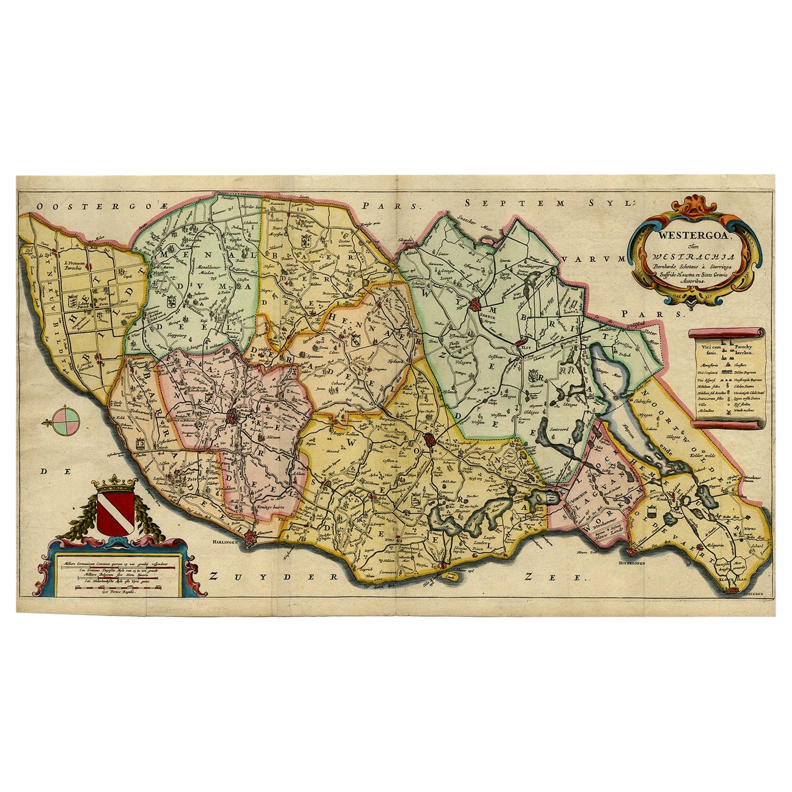
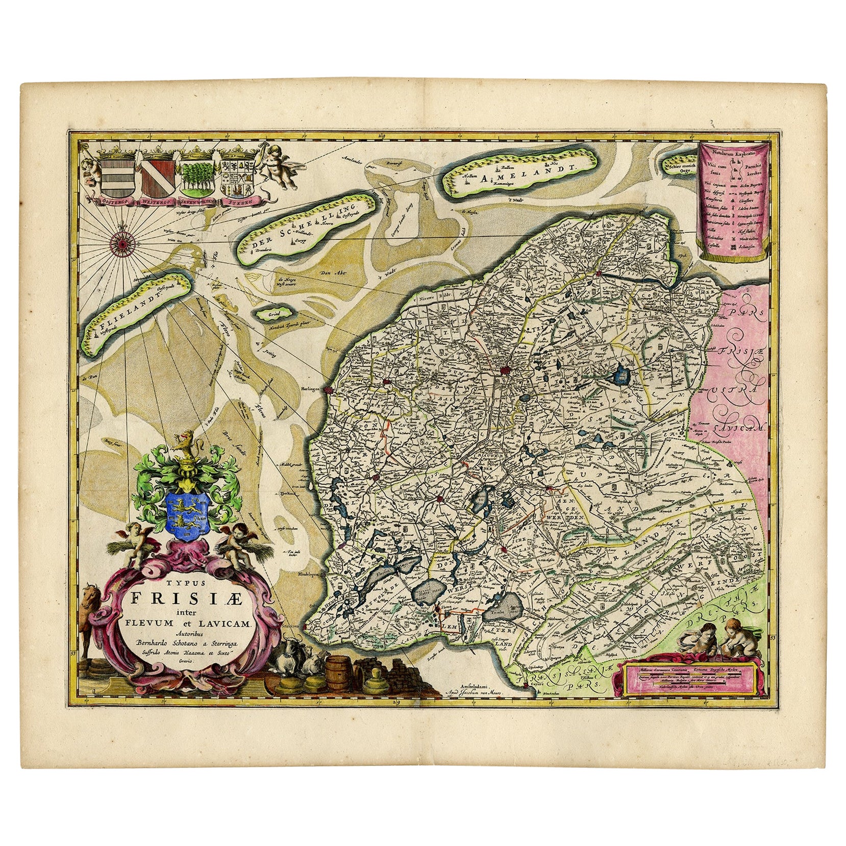
Antique Map of Friesland 'The Netherlands' by B. Schotanus, 1664
About the Item
Hand-colored map of the Dutch province Friesland. Also shows the Wadden islands Vlieland, Terschelling and Ameland and a part of Schiermonnikoog. With a decorative cartouche with two putti, livestock and cheese and milk barrels. Four coats of arms in the top left corner. This map originates from 'Beschrijvinge van de Heerlyckheydt van Frieslandt.', by Schotanus a Sterringa, published in Amsterdam: Jacob van Meurs, 1664.
- Creator:B. Schotanus (Artist)
- Dimensions:Height: 17.33 in (44 cm)Width: 21.66 in (55 cm)Depth: 0.02 in (0.5 mm)
- Materials and Techniques:
- Period:Late 17th Century
- Date of Manufacture:1664
- Condition:Please study image carefully.
- Seller Location:Langweer, NL
- Reference Number:
About the Seller
5.0
Platinum Seller
These expertly vetted sellers are 1stDibs' most experienced sellers and are rated highest by our customers.
Established in 2009
1stDibs seller since 2017
1,949 sales on 1stDibs
Typical response time: <1 hour
- ShippingRetrieving quote...Ships From: Langweer, Netherlands
- Return PolicyA return for this item may be initiated within 14 days of delivery.
More From This SellerView All
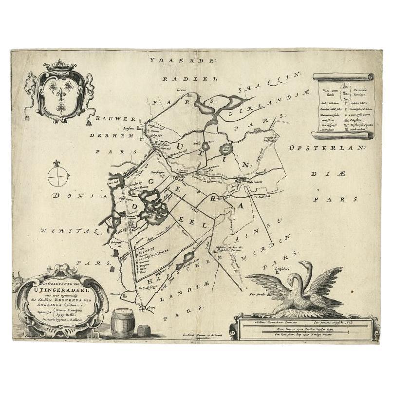
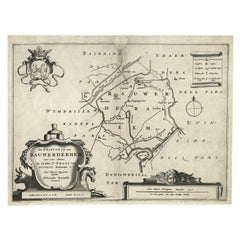
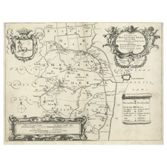
- Antique Map of the Region of Utingeradeel in Friesland, The Netherlands, 1664By B. SchotanusLocated in Langweer, NLAntique map titled 'De Grietenye van Utingeradeel (..)'. Map of the Grietenij of Utingeradeel, Friesland, The Netherlands. Multiple cartouches, key and coat of arms. "Beschrijvinge e...Category
Antique 17th Century Maps
MaterialsPaper
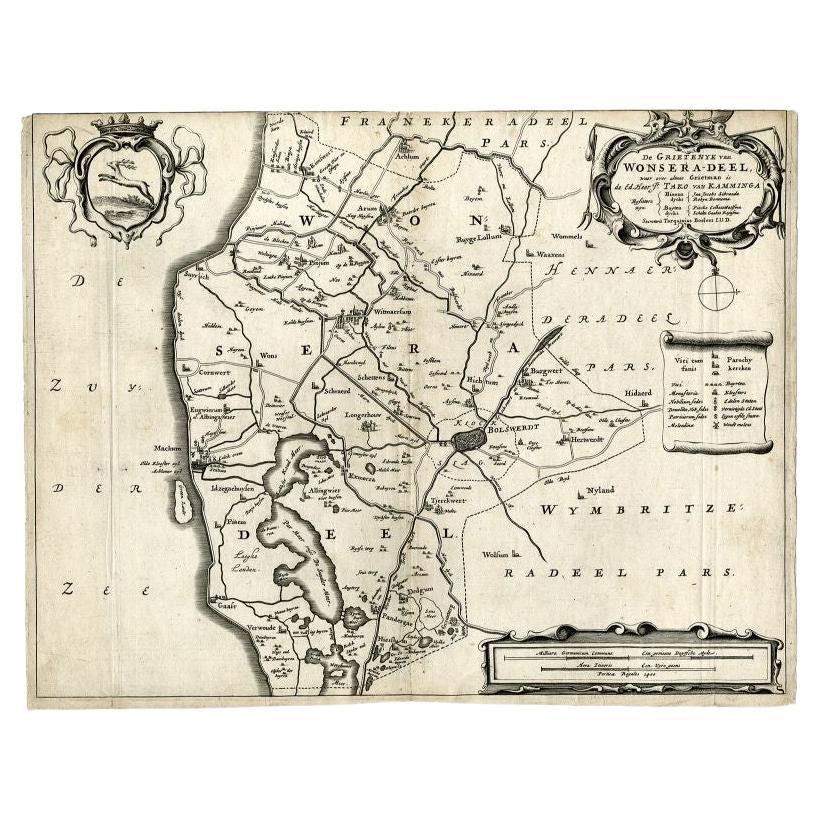
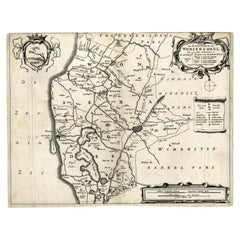
- Antique Map of the Region of Wonseradeel, Friesland in the Netherlands, 1664By B. SchotanusLocated in Langweer, NLAntique map titled 'De Grietenije van Wonsera-deel (..).' Map of the Grietenij of Wonseradeel, Friesland, The Netherlands. Multiple cartouches, key and coat of arms. "Beschrijvinge e...Category
Antique 17th Century Maps
MaterialsPaper
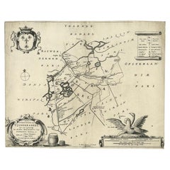
- Antique Map of the Region of Rauwerderhem, Friesland, The Netherlands, '1664'By B. SchotanusLocated in Langweer, NLAntique map titled 'De Grietenije van Rauwerderhem (..).' Map of the Grietenij of Rauwerderhem, Friesland, The Netherlands. Multiple cartouches, key and coat of arms. This map orgini...Category
Antique 17th Century Maps
MaterialsPaper
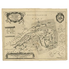
- Antique Map of the Region of Ooststellingwerf by Schotanus, 1664By B. SchotanusLocated in Langweer, NLAntique map titled 'De Grietenije van Stellingwerf oost eynde (..).' Map of the Grietenij of Ooststellingwerf, Friesland, The Netherlands. Multiple cartouches, key and coat of arms. ...Category
Antique 17th Century Maps
MaterialsPaper
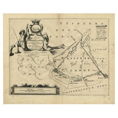
- Antique Map of the Region of Haskerland by Schotanus, 1664By B. SchotanusLocated in Langweer, NLAntique map titled 'De Grietenije van Hasscher Landt (..)'. Map of the Grietenij of Haskerland, Friesland, The Netherlands. Multiple cartouches, key and coat of arms. Originates from...Category
Antique 17th Century Maps
MaterialsPaper
- Antique Map of the Region of Menaldumadeel by Schotanus, 1664By B. SchotanusLocated in Langweer, NLAntique map titled 'De Grietenie van Menaldema Deel (..)'. Very decorative regional map of the Grietenij of Menaldumadeel, west of Leeuwarden, Friesland, The Netherlands. Multiple ca...Category
Antique 17th Century Maps
MaterialsPaper
You May Also Like
- Original Antique Map of The Netherlands, Engraved by Barlow, Dated 1807Located in St Annes, LancashireGreat map of Netherlands Copper-plate engraving by Barlow Published by Brightly & Kinnersly, Bungay, Suffolk. Dated 1807 Unframed.Category
Antique Early 1800s English Maps
MaterialsPaper
- Original Antique Map of The Netherlands, Sherwood, Neely & Jones, Dated 1809Located in St Annes, LancashireGreat map of The Netherlands Copper-plate engraving by Cooper Published by Sherwood, Neely & Jones. Dated 1809 Unframed.Category
Antique Early 1800s English Maps
MaterialsPaper
- Original Antique Map of The World by Thomas Clerk, 1817Located in St Annes, LancashireGreat map of The Eastern and Western Hemispheres On 2 sheets Copper-plate engraving Drawn and engraved by Thomas Clerk, Edinburgh. Published by Mackenzie And Dent, 1817 ...Category
Antique 1810s English Maps
MaterialsPaper
- Map of the Republic of GenoaLocated in New York, NYFramed antique hand-coloured map of the Republic of Genoa including the duchies of Mantua, Modena, and Parma. Europe, late 18th century. Dimension: 25...Category
Antique Late 18th Century European Maps
- Antique Map of Italy by Andriveau-Goujon, 1843By Andriveau-GoujonLocated in New York, NYAntique Map of Italy by Andriveau-Goujon, 1843. Map of Italy in two parts by Andriveau-Goujon for the Library of Prince Carini at Palazzo Carini i...Category
Antique 1840s French Maps
MaterialsLinen, Paper
- Antique Map of Principality of MonacoBy Antonio Vallardi EditoreLocated in Alessandria, PiemonteST/619 - "Old Geographical Atlas of Italy - Topographic map of ex-Principality of Monaco" - ediz Vallardi - Milano - A somewhat special edition ---Category
Antique Late 19th Century Italian Other Prints
MaterialsPaper


