Items Similar to Traversing the Volcanic Frontier: A South Australian Expedition of 1844

Want more images or videos?
Request additional images or videos from the seller
1 of 9
Traversing the Volcanic Frontier: A South Australian Expedition of 1844
$254.58
$318.2320% Off
£191.75
£239.6920% Off
€216
€27020% Off
CA$351.08
CA$438.8520% Off
A$394.42
A$493.0320% Off
CHF 206.09
CHF 257.6120% Off
MX$4,814.12
MX$6,017.6420% Off
NOK 2,616.70
NOK 3,270.8720% Off
SEK 2,463.07
SEK 3,078.8420% Off
DKK 1,644.11
DKK 2,055.1420% Off
About the Item
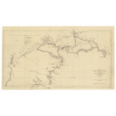
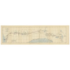
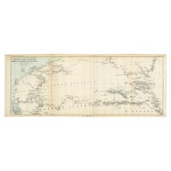
This is a historical document and part of a map and illustration from an expedition. The text indicates it is from South Australia to illustrate Governor G. Grey's Expedition in 1841. It includes detailed sketches of landscapes and geological formations, such as Mount Schank and Devil's Punchbowl near Mount Schank, based on sketches by G.F. Angas.
The map portion outlines a specific route with geographical names and landmarks, which are marked along the path of the expedition. On the right side of the document, there are detailed plans and sections of Mount Gambier and Mount Schank, showing their elevation and geological structure.
Such documents are valuable for understanding the history of exploration, geology, and cartography in Australia, particularly in the mid-19th century. Governor George Grey's expeditions were significant in the early European exploration of Australia, and the illustrations by George French Angas, a notable painter and lithographer, add a visual understanding of the terrain and significant natural landmarks they encountered.
Governor George Grey's expeditions, particularly the one illustrated here, were part of his broader exploratory work in Australia. Before his 1844 expedition in South Australia, Grey had undertaken significant explorations in Western Australia between 1837 and 1840. During these earlier expeditions, he traversed regions of Australia that were previously unexplored by Europeans, with the hope of discovering major rivers or inlets and assessing the land for its potential for colonization.
In the 1844 expedition in South Australia, Grey explored the southeastern extremity of the region, detailing his route along the coast from Encounter Bay to Discovery Bay, near Adelaide. The maps and illustrations created during this expedition, such as this one, included notations of significant geographical features, watering spots, and the routes taken. This particular expedition seemed to focus on areas with volcanic activity, as indicated by the detailed plans and elevations of Mount Schanck and Mount Gambier, as well as the sketches of the Devil's Punchbowl, which Grey described as filled with freshwater and nearly unfathomable.
Grey's expeditions contributed significantly to the understanding of the Australian landscape, especially in regions that were poorly documented at the time. His work helped to lay the groundwork for future settlement and development in these areas.
.
- Dimensions:Height: 8.39 in (21.3 cm)Width: 13.51 in (34.3 cm)Depth: 0 in (0.02 mm)
- Materials and Techniques:
- Period:
- Date of Manufacture:1844
- Condition:Good. Light paper with folds as issued. One fold supported by archival tape. Minor browning, especially around the edges and in the two images. Tight margin in the top and some creasing. Study the images carefully.
- Seller Location:Langweer, NL
- Reference Number:Seller: BG-13699-21stDibs: LU3054338355682
About the Seller
5.0
Recognized Seller
These prestigious sellers are industry leaders and represent the highest echelon for item quality and design.
Platinum Seller
Premium sellers with a 4.7+ rating and 24-hour response times
Established in 2009
1stDibs seller since 2017
2,533 sales on 1stDibs
Typical response time: <1 hour
- ShippingRetrieving quote...Shipping from: Langweer, Netherlands
- Return Policy
Authenticity Guarantee
In the unlikely event there’s an issue with an item’s authenticity, contact us within 1 year for a full refund. DetailsMoney-Back Guarantee
If your item is not as described, is damaged in transit, or does not arrive, contact us within 7 days for a full refund. Details24-Hour Cancellation
You have a 24-hour grace period in which to reconsider your purchase, with no questions asked.Vetted Professional Sellers
Our world-class sellers must adhere to strict standards for service and quality, maintaining the integrity of our listings.Price-Match Guarantee
If you find that a seller listed the same item for a lower price elsewhere, we’ll match it.Trusted Global Delivery
Our best-in-class carrier network provides specialized shipping options worldwide, including custom delivery.More From This Seller
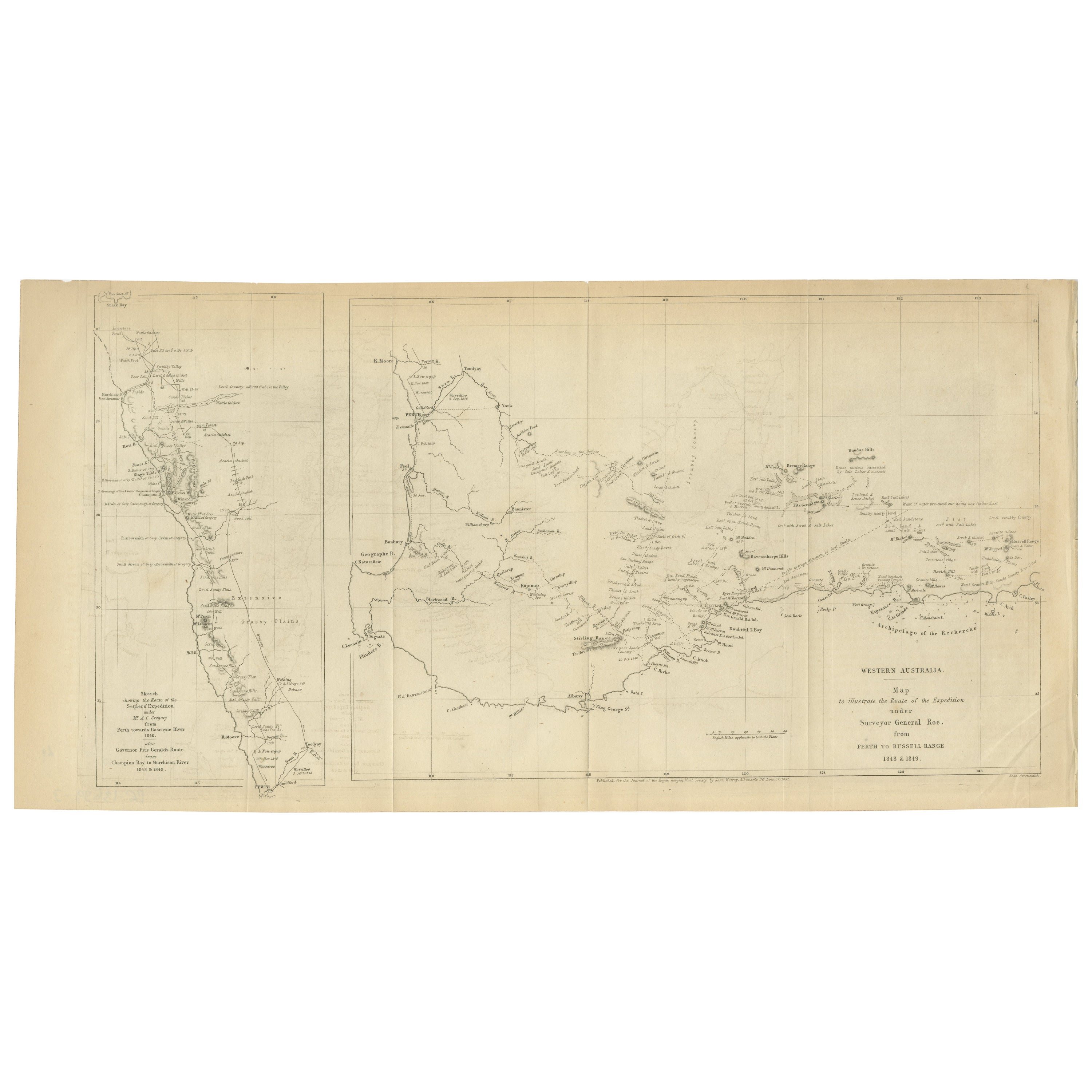
View AllCharting the West: Surveyor General Roe’s Western Australian Expedition , 1852
Located in Langweer, NL
This map is a historical document, focused on Western Australia. It illustrates the route of an expedition under Surveyor General Roe from Perth to Russell Range during 1848 and 1849...
Category
Antique 1850s Prints
Materials
Paper
$273 Sale Price
20% Off
Free Shipping
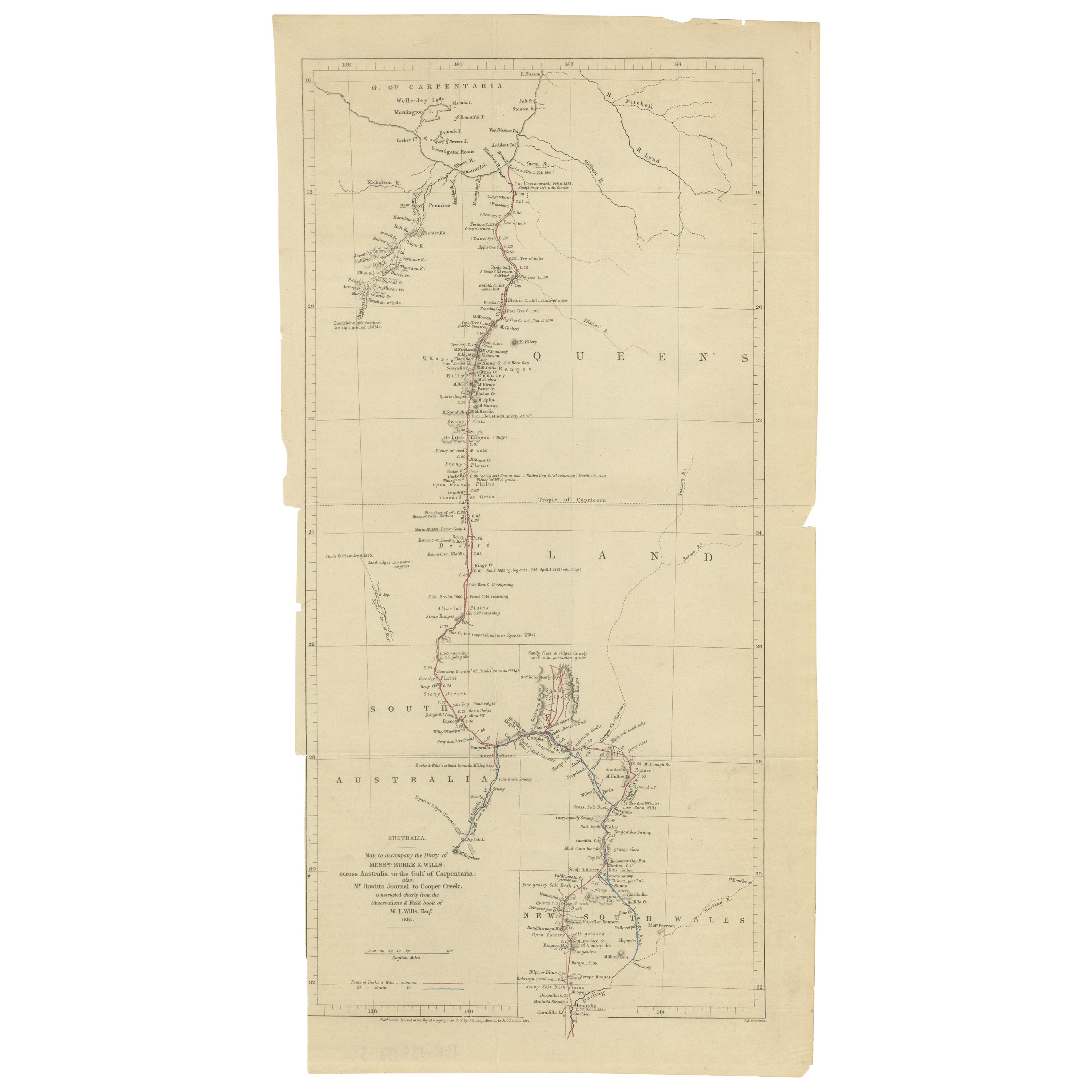
The Fateful Track of The Burke and Wills Expedition in Australia's Outback, 1862
Located in Langweer, NL
The map depicts the route of the Burke and Wills expedition, one of the most famous and tragic explorations in Australian history. This journey was the first to cross the Australian ...
Category
Antique 1860s Prints
Materials
Paper
$254 Sale Price
20% Off
Free Shipping
Gregory's 1861 Expedition into the North West of Australia, 1862
Located in Langweer, NL
The map represents the route taken during F.T. Gregory's 1861 North West Australian Expedition.
This exploration was a significant journey that took place over the Pilbara region, starting from the Ashburton River and extending to the Dampier Archipelago and the De Grey...
Category
Antique 1860s Prints
Materials
Paper
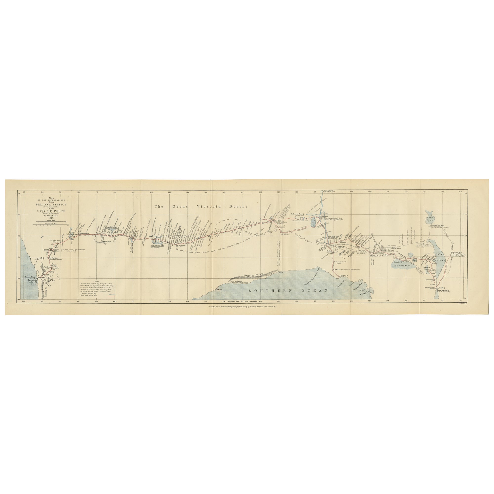
The 4000km Exploration of Ernest Giles from Beltena to Perth, Australia in 1875
Located in Langweer, NL
The map shows the route of the 1875 exploration led by Ernest Giles from Beltana Station in South Australia to the city of Perth in Western Australia. This was Giles' fourth and most...
Category
Antique 1870s Prints
Materials
Paper
$273 Sale Price
20% Off
Free Shipping
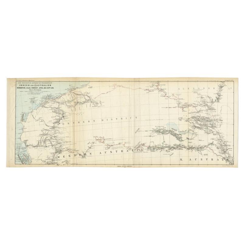
Antique Exploration Map of Australia from Sharks Bay to Alice Springs, 1876
Located in Langweer, NL
Antique map titled 'Die neuesten Entdeckungsreisen Innern von Australien von Warburton, Giles, Forrest (..)'. Old map of Australia from Sharks Bay to 90 Mile Beach over to Alice Springs...
Category
Antique 19th Century Maps
Materials
Paper
$235 Sale Price
20% Off
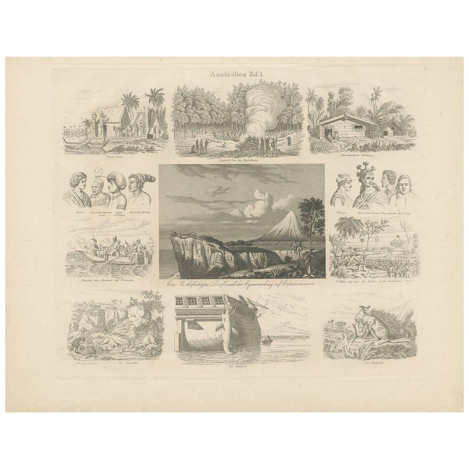
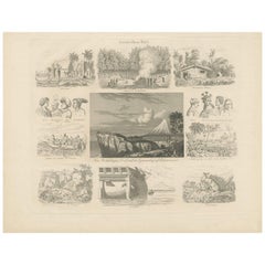
Antique Print with Views of Australia I by Rosmäsler, circa 1844
Located in Langweer, NL
Antique print with 11 scenes of Australia. Depicting for example a Kangaroo, a Temple various other animals and many more. This print originates from 'Album für Freunde der Länder un...
Category
Antique Mid-19th Century Prints
Materials
Paper
$150 Sale Price
20% Off
You May Also Like
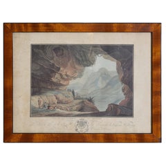
French Neoclassic Engraving, Vue de La Caverne du Dragon, early 19th century
Located in Atlanta, GA
The hand colored engraving by Descourtis depicting a true cave in the Orange region of France with curious admirers with a dog and a soldier, in a period walnut and ebonized frame
Category
Antique Early 1800s French Neoclassical Prints
Materials
Walnut
Ancient National Atlas of France with Marengo
Located in Alessandria, Piemonte
Ancient National Atlas of France with the department of Marengo: a rare French etching dated 1806.
ST/178.
Category
Antique Early 19th Century French Other Prints
Materials
Paper

Large Original Antique Map of Australia by Sidney Hall, 1847
Located in St Annes, Lancashire
Great map of Australia
Drawn and engraved by Sidney Hall
Steel engraving
Original colour outline
Published by A & C Black. 1847
Unframed
Free shipping.
Category
Antique 1840s Scottish Maps
Materials
Paper

Original Antique Map of Australia by Dower, circa 1835
Located in St Annes, Lancashire
Nice map of Australia
Drawn and engraved by J.Dower
Published by Orr & Smith. C.1835
Unframed.
Free shipping
Category
Antique 1830s English Maps
Materials
Paper

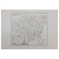
1762 Berri, Nivernois Bourbonois, Lyonois, Bourgogine, Bresse, et, Franche - Com
Located in Norton, MA
1762 Vaugondy map, entitled
"Berrl Nivernois Bourbonois Lyonois, Bourgone, Bresse, Et Franche-Comte,"
Ric.b003
About this Item
A fine Copperplate Engraving with original han...
Category
Antique 18th Century Unknown Maps
Materials
Paper
1851 Map of "Independent Tartary", Ric. R018
Located in Norton, MA
1851 Map of
Independent Tartary
"Russia"
Ric.r018
A highly decorative 1851 map of Independent Tartary by John Tallis and John Rapkin. Covers the regions between the Caspian Sea and Lake Bakquash and between Russia and Afghanistan. These include the ancient Silk Route kingdoms of Khiva, Tartaria, Kokand, and Bokhara. Today this region roughly includes Kazakhstan, Uzbekistan, Turkmenistan, Kyrgyzstan, and Tajikistan. This wonderful map offers a wealth of detail for anyone with an interest in the Central Asian portion of the ancient Silk Road. Identifies various caravan routes, deserts, wells, and stopping points, including the cities of Bokhara and Samarkand. Three vignettes by W. Bragg decorate the map, these including an image of Tartars on a Journey, a horseback Bride Chase, and a tartar camp site. Surrounded by a vine motif border. Engraved by J. Rapkin for John Tallis's 1851 Illustrated Atlas .
Tartary Antique Map...
Category
Antique 19th Century Unknown Maps
Materials
Paper

More Ways To Browse
In Australia
Paul Evans Cityscape Cabinet
Perfume Cabinet
Persian Side Table
Pheasant Figure
Pill Box 800 Silver
Plaster Cherub
Psyche Bronze 19th Century French
Qing Dynasty Teapot
Quail Decorative Object
Quilted Maple
Rattan Bamboo Headboard
Regency Table Kogl
Rococo Fire Basket
Rosewood Breakfront
Saddle Horse Stand
San Remo
Satsuma Plate