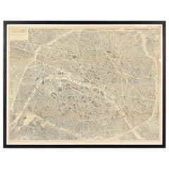
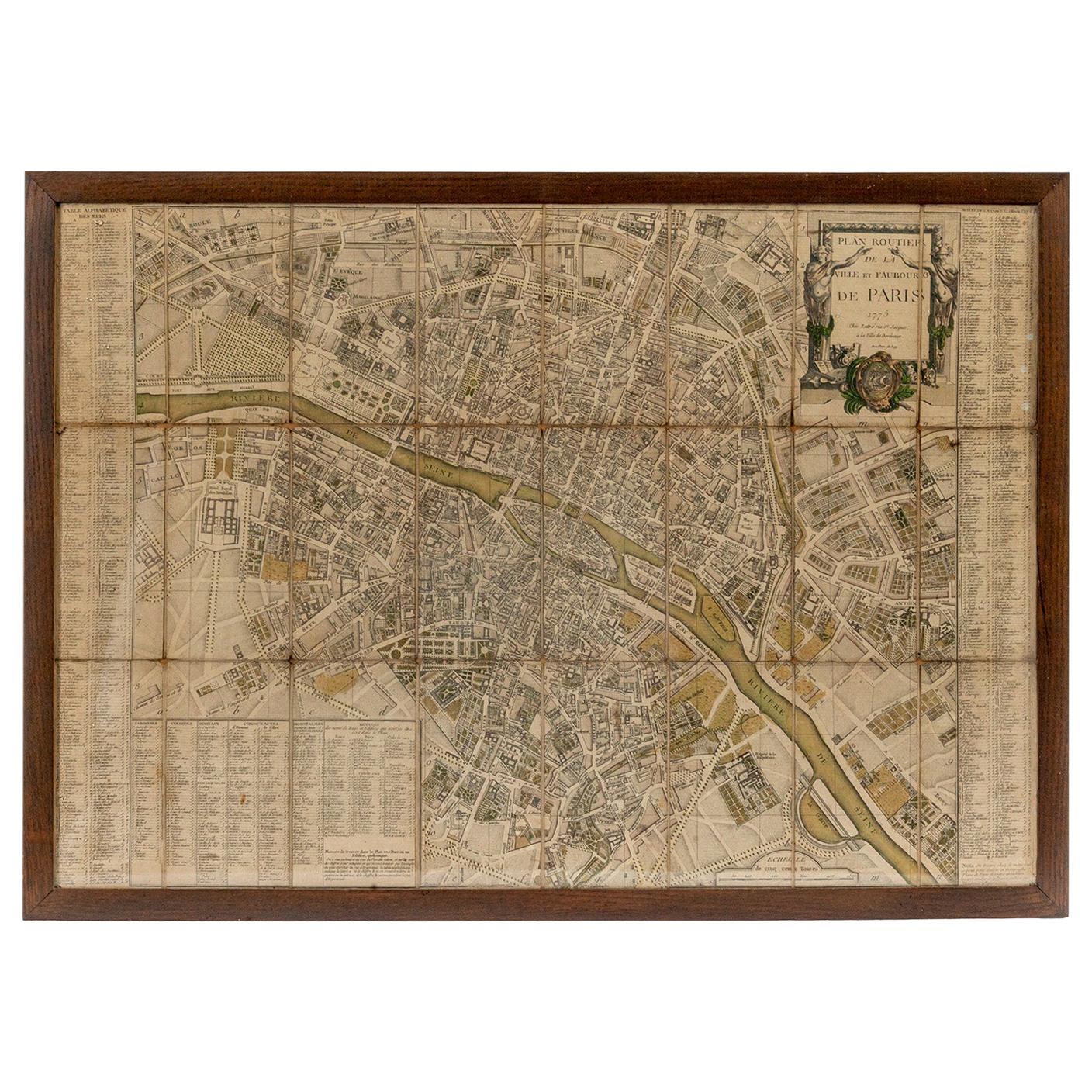
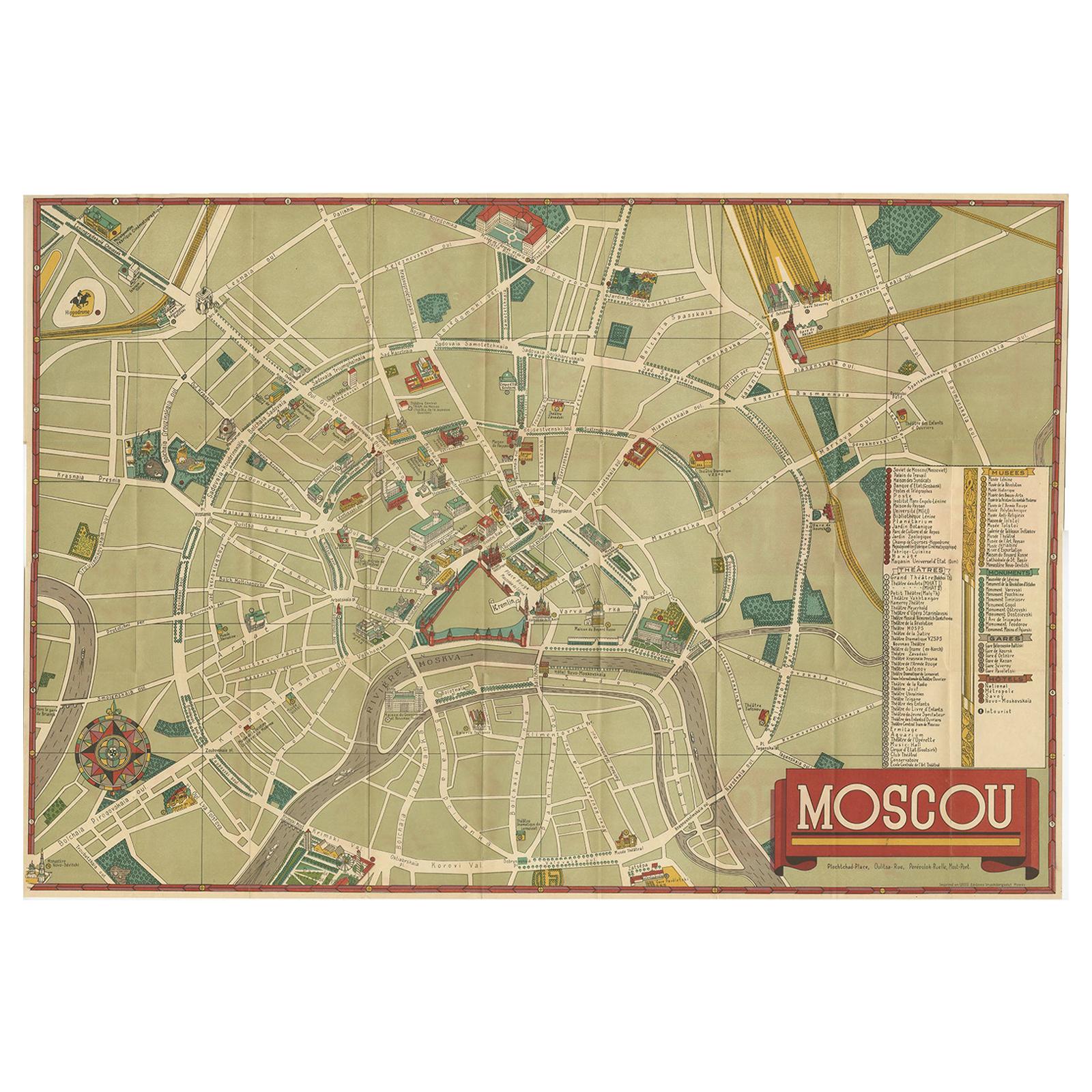
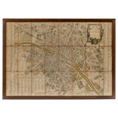
Vintage Map of Paris, ca. 1950s, "Plan de Paris à vol d'oiseau"
View Similar Items

Want more images or videos?
Request additional images or videos from the seller
1 of 10
Vintage Map of Paris, ca. 1950s, "Plan de Paris à vol d'oiseau"
$14,500List Price
About the Item
- Creator:G. Peltier (Designer)
- Dimensions:Height: 60 in (152.4 cm)Width: 72 in (182.88 cm)Depth: 1.5 in (3.81 cm)
- Materials and Techniques:
- Place of Origin:
- Period:
- Date of Manufacture:20th Century
- Condition:Wear consistent with age and use.
- Seller Location:New York, NY
- Reference Number:1stDibs: LU838713018852
About the Seller
4.8
Vetted Professional Seller
Every seller passes strict standards for authenticity and reliability
Established in 2007
1stDibs seller since 2007
231 sales on 1stDibs
Typical response time: 2 hours
Authenticity Guarantee
In the unlikely event there’s an issue with an item’s authenticity, contact us within 1 year for a full refund. DetailsMoney-Back Guarantee
If your item is not as described, is damaged in transit, or does not arrive, contact us within 7 days for a full refund. Details24-Hour Cancellation
You have a 24-hour grace period in which to reconsider your purchase, with no questions asked.Vetted Professional Sellers
Our world-class sellers must adhere to strict standards for service and quality, maintaining the integrity of our listings.Price-Match Guarantee
If you find that a seller listed the same item for a lower price elsewhere, we’ll match it.Trusted Global Delivery
Our best-in-class carrier network provides specialized shipping options worldwide, including custom delivery.More From This Seller
View AllA Series of Historical Maps of Italian Cities
Located in New York, NY
A Pair of vintage maps can add so much interest to a space and this group of Italian maps is particularly interesting. Each is a charming reinterpretation of historical city maps (R...
Category
20th Century Italian Prints
Materials
Paper
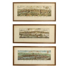
$1,260 / item
Prints from France in Faux Bamboo Frames
By Pierre-Joseph Redouté, Jean Louis Prévost
Located in New York, NY
French Botanical Prints of “Fleurs et Fruits” (Flowers and Fruits) created by Pierre-Joseph Redouté and Jean-Louis Prevost, two of the finest b...
Category
Antique Late 19th Century French Belle Époque Prints
Materials
Faux Bamboo

$565 / item
Interior Print
Located in New York, NY
A framed print of an elegant traditional bed chamber featuring a formal canopy bed; matted and finished in a gilt wood frame.
Category
20th Century French Louis XV Prints
Materials
Paper
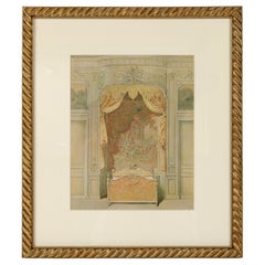
$1,200
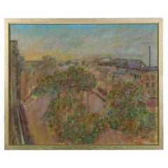
An Oil on Canvas Painting of Roof Tops in Paris
Located in New York, NY
A lovely painting in the impressionist style capturing a scene of Parisian rooftops and buildings, accented by blooming trees lining the street. The colors are in muted tones, creat...
Category
20th Century Unknown Paintings
Materials
Paint
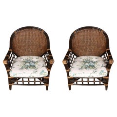
A Pair of Vintage Rattan Club Chairs
Located in New York, NY
This beautifully crafted pair of vintage rattan armchairs features a rich, dark finish and an airy open-weave lattice design. The arched back and gently sloped arms offer a comfortab...
Category
Mid-20th Century Unknown Club Chairs
Materials
Rattan
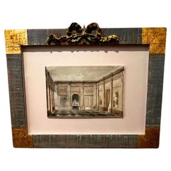
A Watercolor Painting of a Classical Interior
Located in New York, NY
French Neoclassical interior watercolor, c. 1800, rendered in elegant grisaille wash with crisp one-point perspective. Shows paneled boiserie, pilasters, and a chequerboard marble fl...
Category
Vintage 1960s French Louis XVI Paintings
Materials
Art Glass
You May Also Like
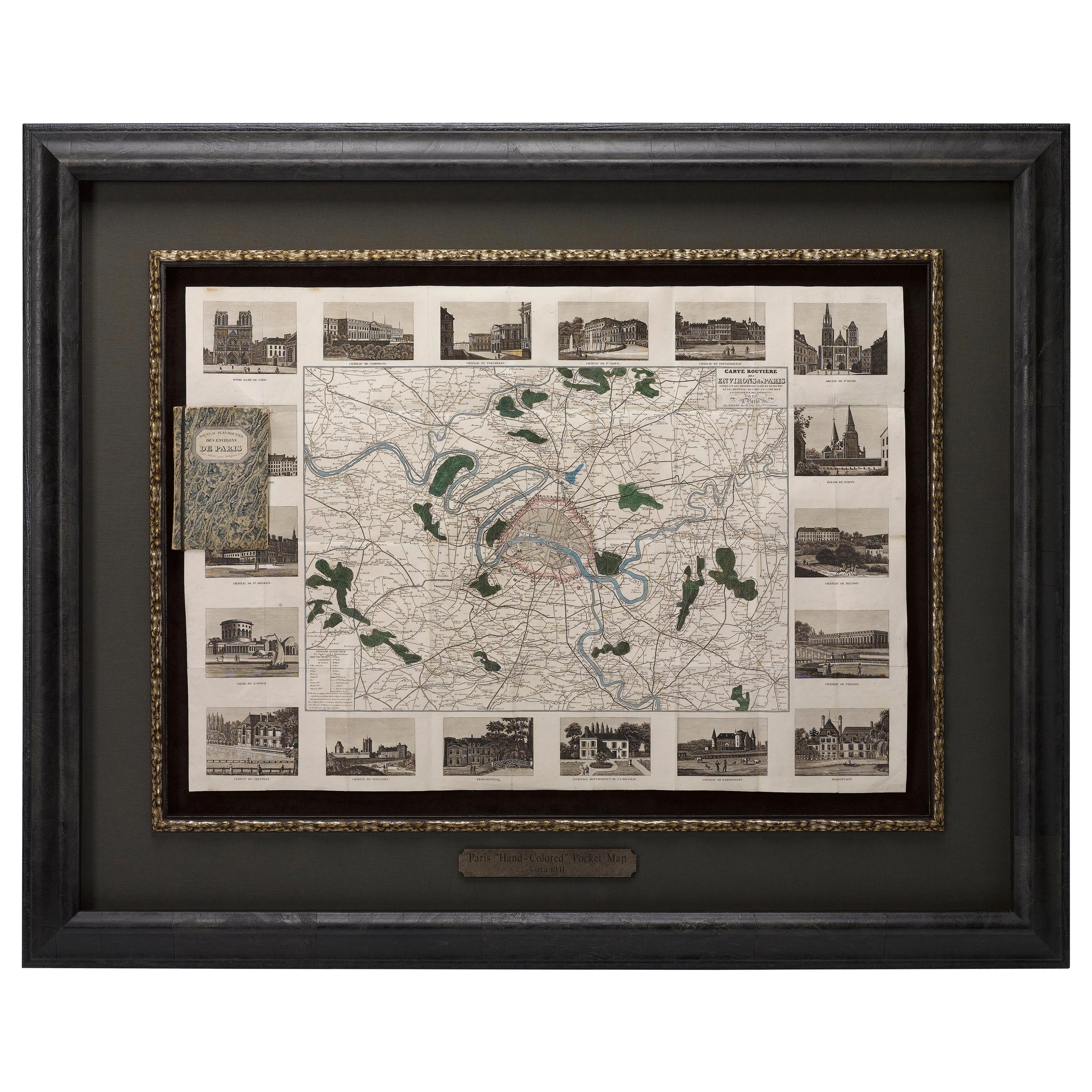
Antique Map of Paris, "Carte Routiere des Environs de Paris" 1841
Located in Colorado Springs, CO
This beautiful hand-colored road map of Paris was published in 1841. The map shows Paris and the surrounding area in a folding pocket map. Organized and detailed for travelers, this ...
Category
Antique 1840s French Maps
Materials
Paper

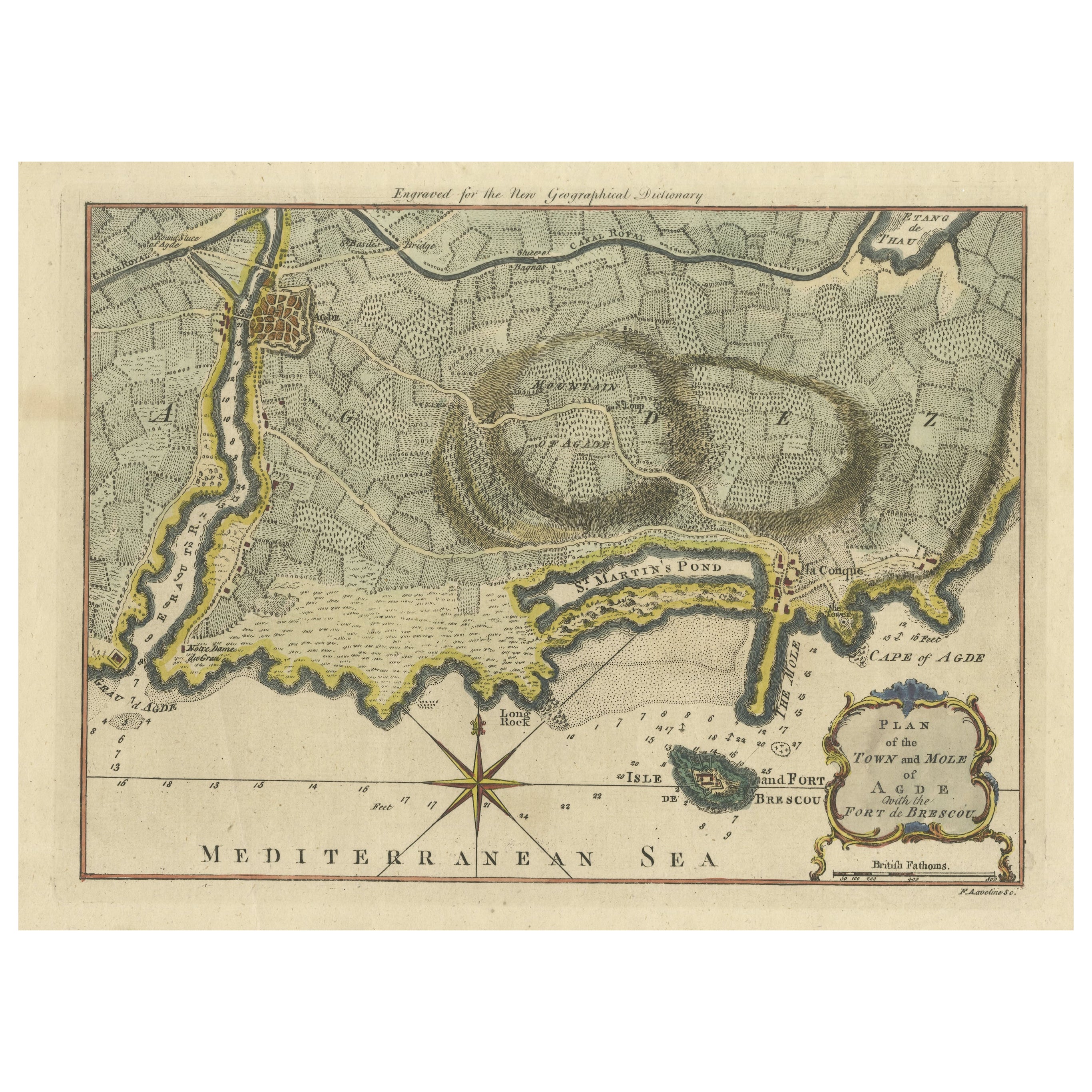
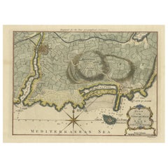
Antique Map Plan of Town and Mole of CAP D'agde & Fort De Brescou, France, 1759
Located in Langweer, NL
Antique Plan titled 'Plan of the Town and Mole of Agde with the Fort de Brescou'. Antique town plan of Agde, engraved for the Geographical Dictionary, by Rol...
Category
Antique Mid-18th Century Maps
Materials
Paper
$456 Sale Price
20% Off
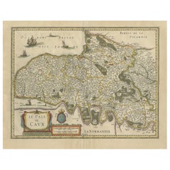
Old Handcolored Antique Map of Pays De Caux in Normandy, France, ca.1640
Located in Langweer, NL
Antique map titled 'Le Pais de Caux'.
Old map of Pays de Caux, France. Pays de Caux is an area in Normandy occupying the greater part of the French département of Seine Maritime ...
Category
Antique 1640s Maps
Materials
Paper
$1,257 Sale Price
20% Off
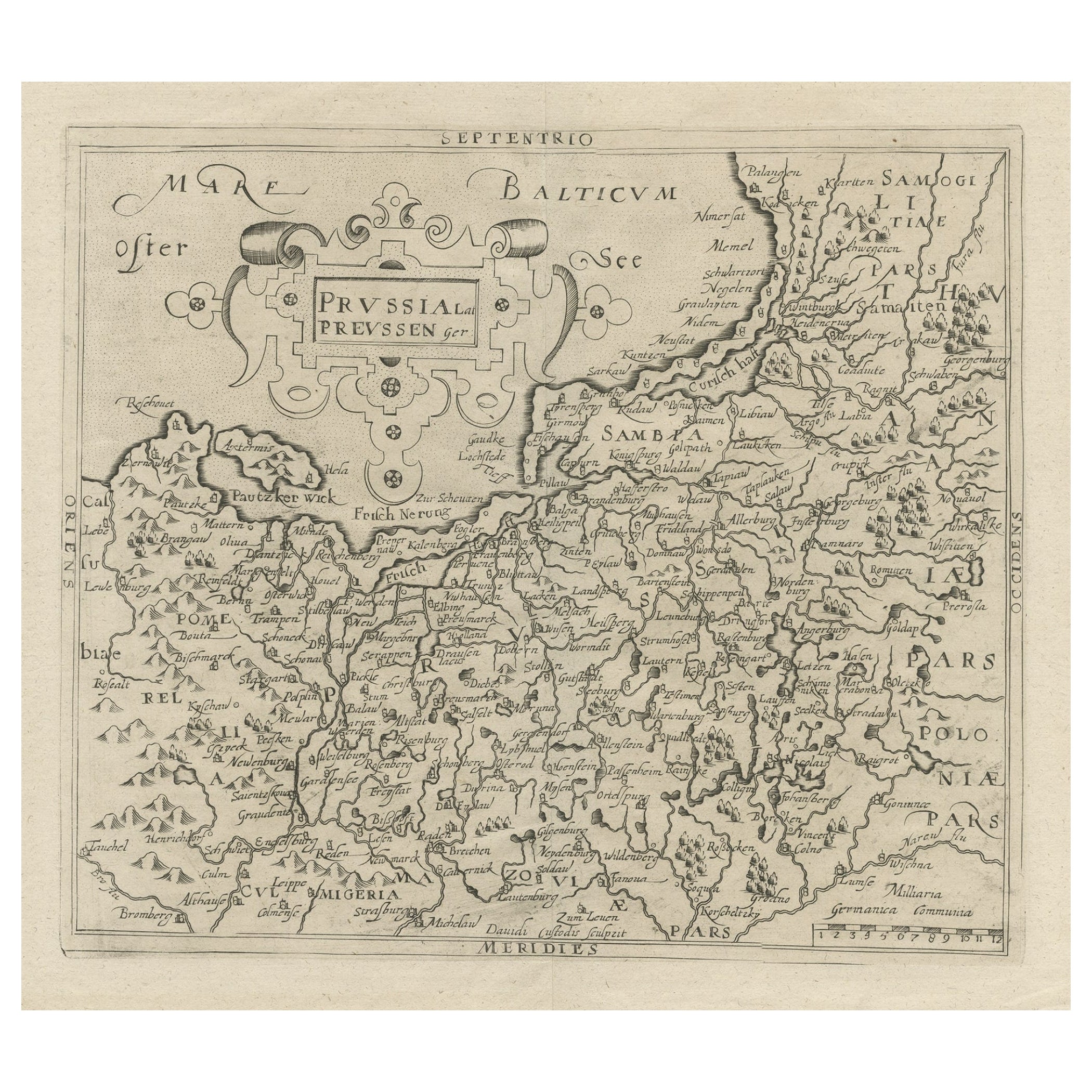
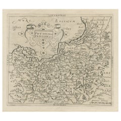
Original Antique Map of Prussia, ca.1630
Located in Langweer, NL
Antique map titled 'Prussia - Preussen'. Original map of Prussia, a historically prominent German state that originated in 1525 with a duchy centered on...
Category
Antique 1630s Maps
Materials
Paper
$633 Sale Price
20% Off
18th Century Map of Paris
Located in Washington, DC
18th century map of Paris.
Category
Antique Late 18th Century French Prints
Materials
Glass, Wood, Paper
Antique City Plan of Rotterdam in Frame, ca.1850
Located in Langweer, NL
Antique map titled 'Grondkaart der stad Rotterdam (..)'. Original antique city plan of Rotterdam, the Netherlands. Published circa 1850.
Artists...
Category
Antique 19th Century Prints
Materials
Paper

$605 Sale Price
20% Off
Recently Viewed
View AllMore Ways To Browse
Blondel La Rougery
Grouse Print
Antique Nursery Rhyme
Antique Rabbit Print
Engravings Hunt Scenes
Vintage Wall Registers
Will Sampson
Antique Furniture Lebanon
Joan Miro Glass
Antique Musket
Large Used Greenhouses
Botanical Prints 17th Century
Knights Of Malta
Maastricht Plate
Middle Eastern Plate
Set Of 4 Botanical Prints
Wall Plates Jesus
Antique Halberd